
“Dartmouth Parish”, noted once again.
“The Harbour of Halifax Nova Scotia”, William Smyth, 1824. https://archives.novascotia.ca/maps/archives/?ID=395

Amicitia Crescimus
“Dartmouth Parish”, noted once again.
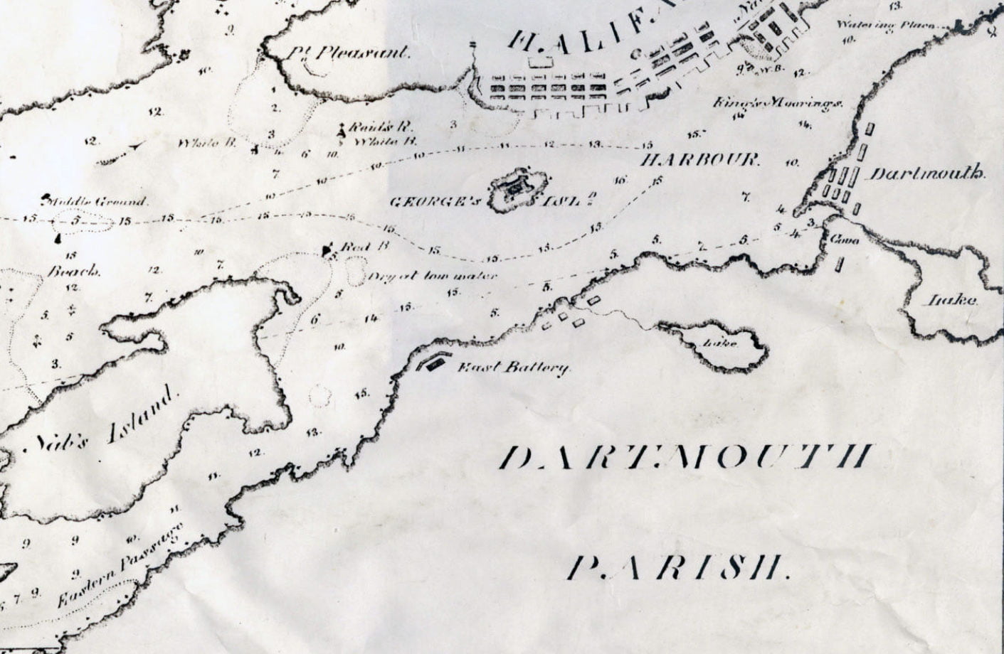
“The Harbour of Halifax Nova Scotia”, William Smyth, 1824. https://archives.novascotia.ca/maps/archives/?ID=395

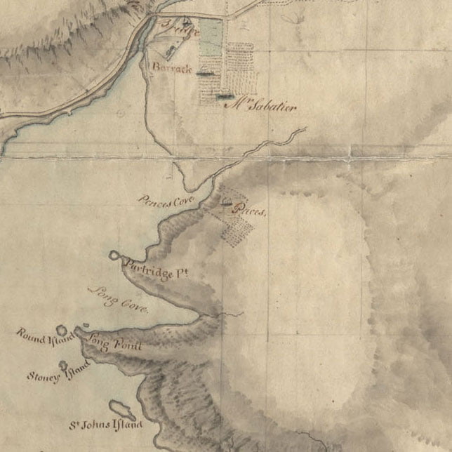
A noteable map for the fact that it shows the location of Pace’s Cove, used to determine the bounds of the Township of Dartmouth.
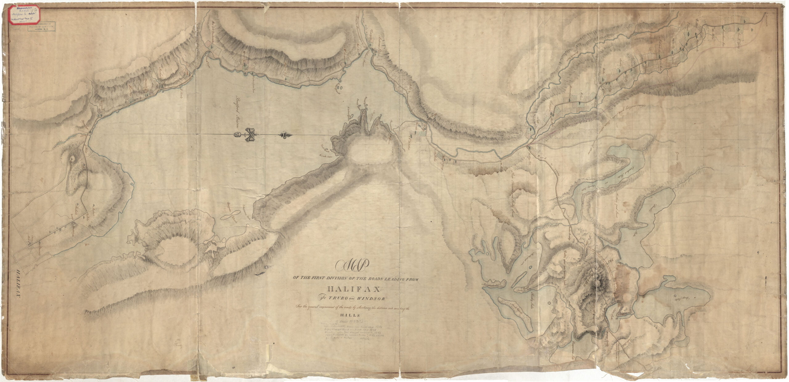
“Roads from Halifax to Truro & Windsor”, 1823. https://archives.novascotia.ca/maps/archives/?ID=392
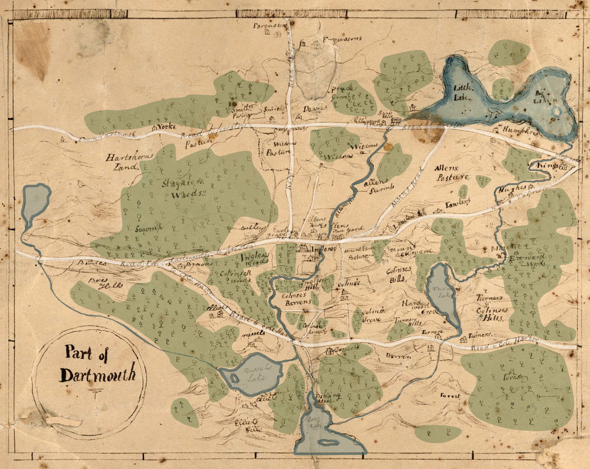
The Dartmouth they’re referring to here appears to be Dartmouth Township, since it wasn’t yet incorporated as a Town or City in 1820. Here’s a quick coloration in order to hopefully ease legibility: Penhorn Lake can be seen at far left, Russell and Morris Lake along the bottom, Bell Lake at middle right. What is now Main Street, then known as “Road to Preston”, travels from left to right at top. The “Road from Dartmouth to Preston” at middle is now Woodlawn Road and Mount Edward Road, “Road to Cole Harbor” at bottom, once the road to Lawrencetown is now Portland Street. Road to Farquharson’s, the vertical road at middle, is now Caledonia Road. I believe there’s still a very small piece of “Allen’s Road” extant, which connected what is now Mount Edward Road to Main Street, as seen here.
See also:
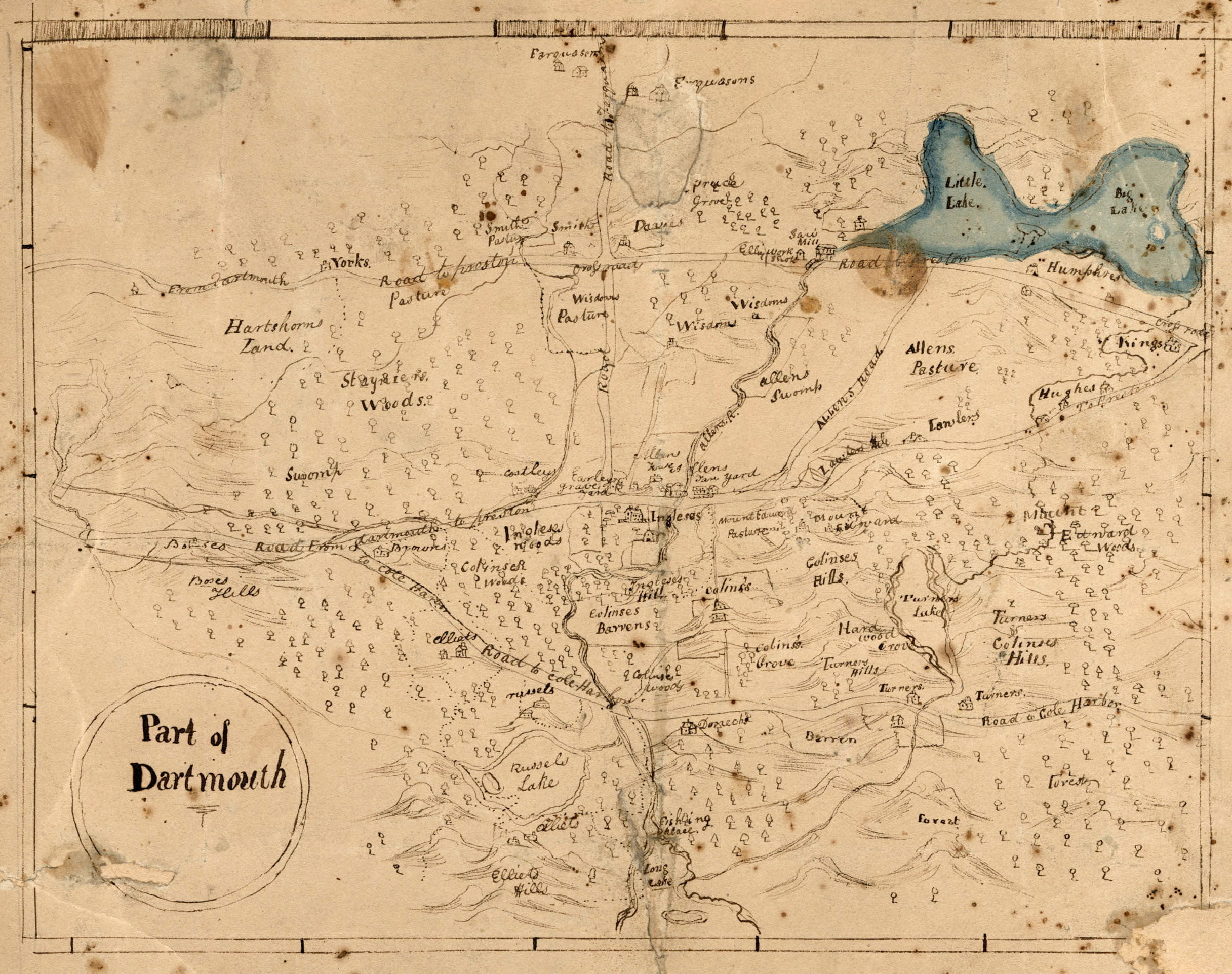
"Part of Dartmouth", 1820. https://archives.novascotia.ca/maps/archives/?ID=384
“East side of Bedford Basin: The winding shore above the narrows has many picturesque points and coves to recommend it to the lover of natural scenery. It has also historical associations, but not, perhaps, of such prominence as that of the western side. High hills, clad with pine and spruce, rise conspicuously above the sparkling waters, affording wide views of the city and harbor of Halifax.
Tuft’s Cove, which was named after Gerisham Tufts, who belonged to a family extensively known in the United States, was the first to obtain a grant of the land surrounding this cove. The impression prevailed that he belonged to New England and came to Halifax early in the settlement of the town. The land above the Tufts property was granted to Ezekiel Gilman. He was one of the two army majors, retired, that accompanied the first settlers to Halifax. Leonard Lochman, after whom Lockman street is named was the other. In Murdoch’s history of Nova Scotia the following tragedy, with which Gilman was connected, is thus related:
On Saturday, 10th Oct., 1749 (N.S.) the [Mi’kmaq] committed acts of hostility at a saw mill that had been erected in Chebucto bay. Six men without arms were sent out by Major Gilman to cut wood for the mill. Of these six, four were killed and one made prisoner by a party of [Mi’kmaq], who had lain in ambush. The sixth man made good his escape from them. The saw mill was near Dartmouth Cove. On the following day, Sunday, the governor and council met on board the Beaufort. They decided not to declare war against the [Mi’kmaq] as that would be in some sort to own them as a “free people” – that they ought to be looked upon as rebels to H.M. government, or as bandatti ruffians. War, however, was to be made on them; a reward offered for prisoners and for scalps; Major Gilman to raise another independent company of volunteers to scour all the country round the bay; a proclamation issued reciting the [indigenous] hostilities recently committed at Canso and Chebucto, and ordering all officers, civil and military, and all H.M. subjects to take and destroy the [Mi’kmaq], and offering ten guineas for each [indigenous person] living or dead, or his scalp, as was the custom of America. Major Gilman was now instructed to raise his company and get them hatchets, haversacks and snowshoes. Gilman went to Piscataqua to enlist his company of 100 men, engaging to return with them before December.
The Gilman lands were escheated, and re-granted in trust to Admiral Sir Isaac Coffin. Coffin was a son of an officer of the customs at Boston. He was born in that town on 16th May, 1750. He entered the Navy in 1773 under the patronage of Rear-Admiral Montague, the commander-in-chief on the North American station.”
“A steamboat on Bedford Basin for the first time: The first steam boat to make a trip on Bedford Basin – indeed, it could be said, the first ferry boat propelled by steam to appear on the harbor of old Chebucto – was the Sir Charles Ogle. She was built in the cove at Dartmouth by Mr. Lyle. It was in the closing days of 1829 that the steamer was completed – the machinery on board and in order. An attempt was made to launch her on the first day of the new year. She set off in fine style, but when about two-thirds in the water she stuck in the ways, and every exertion to complete the launch at that tide were unavailing. Her length of deck was 103 feet, width of beam 20 feet, width of deck over all 35 feet, 176 tons measurement, her engine was 30 horsepower.
It was understood that the fare would be four pence, and that the steamer would make four passages an hour. The team boat, which she displaced, frequently made but four trips a day, frequently less, and sometimes in winter would not cross at all. It was considered on all hands that an excellent exchange had been made. The steamboat had two commodious cabins. In the eyes of the inhabitants she brought Dartmouth as it were to the end of the steamboat wharf, and it was anticipated that the enterprise would have an admirable effect on the life and prosperity of the village. The hope was generally indulged in that the steamer would well repay the public-spirited gentlemen who had first given to Halifax one of the wonders of science. At full tide, near midnight, the steamer was got off, and in the words of an enthusiastic townsman, uttered at the time: “she now sits in water gracefully as a swan, an honor and an advantage to the community.” On the 12th of January teams and passengers crossed the harbor in the Sir Charles Ogle, and on the following day she circumnavigated George’s Island, to the satisfaction of numerous and most respectable passengers who had taken advantage of the trip.”
Mullane, George. “Footprints Around and About Bedford Basin : a district brimful of romantic associations: some interesting facts about its early history” [Nova Scotia] : publisher not identified, [19–] https://www.canadiana.ca/view/oocihm.78665
- When Halifax was first settled, this side of the harbor was the home and hunting ground of the [Mi’kmaq].
- Soon after the settlement of Halifax, Major Gillman built a saw mill in Dartmouth Cove on the stream flowing from the Dartmouth lakes.
- On September 30th 1749, [Mi’kmaq] attacked and killed four and captured one out of six unarmed men who were cutting wood near Gillman’s mill.
- In August 1750, the Alderney, of 504 tons, arrived at Halifax with 353 immigrants, a town was laid out on the eastern side of the harbor in the autumn, given the name of Dartmouth, and granted as the home of these new settlers.
- A guard house and military fort was established at what is still known as Blockhouse hill [—the hill on King Street, at North].
- In 1751 [Mi’kmaq] made a night attack on Dartmouth, surprising the inhabitants, scalping a number of the settlers and carrying off others as prisoners.
- In July 1751, some German emigrants were employed in picketing the back of the town as a protection against the [Mi’kmaq].
- In 1752, the first ferry was established, John Connor, of Dartmouth, being given the exclusive right for three years of carrying passengers between the two towns.
- Fort Clarence was built in 1754.
- In 1758 the first Charles Morris, the Surveyor General, made a return to Governor Lawrence giving a list of the lots in the town of Dartmouth.
- In 1762 the same Charles Morris wrote: “The Town of Dartmouth, situate on the opposite side of the harbour, has at present two families residing there, who subsist by cutting wood.”
- In 1785 three brigantines and one schooner with their crews and everything necessary for the whale fishery arrived, and twenty families from Nantucket were, on the invitation of Governor Parr, settled in Dartmouth. These whalers from Nantucket were Quakers in religion. Their fishing was principally in the Gulf of St. Lawrence which then abounded with black whales.
- In 1788 a common of 150 acres [—200 acres, in keeping with with the New England tradition of “200 acres for a common, sixty acres for a Town Site“, (1808 Toler map overlay) and certain tracts for a meeting house, cemetery, school”] was granted Thomas Cochran, Timothy Folger and Samuel Starbuck in trust for the town of Dartmouth. When these good Quakers left, Michael Wallace, Lawrence Hartshorne, Jonathon Tremaine, all subsequently members of Christ Church, were made trustees [in 1798]. Acts relating to this common were passed in 1841, 1868 and 1872, and the present Dartmouth Park Commission was appointed in 1888.
- In 1791 the idea of building a canal between the Shubenacadie river and Dartmouth by utilizing the lakes, a plan which originated with Sir John Wentworth, was brought before the legislature. The Shubenacadie Canal company was incorporated in 1826.
- In 1792 most of the Quakers left Dartmouth. One at least, Seth Coleman, ancestor of the Colemans of today, remained.
- In early days Lawrence Hartshorne, Johnathon Tremain and William Wilson all Churchmen, carried on grist-mills at Dartmouth Cove. At a ball given by Governor Wentworth on December 20th, 1792, one of the ornaments on the supper table was a reproduction of Messrs. Hartshorne and Tremain’s new flour mill.
- Many French prisoners of war were brought here off the prizes brought to the port of Halifax. Some were confined in a building near the cove, which now forms part of one of the Mott factories.
- In 1797 “Skipper” John Skerry began running a public ferry between Halifax and Dartmouth.
- In 1809 Dartmouth contained 19 houses, a tannery, a bakery and a grist-mill.
- In 1814 Murdoch relates that “Sir John Wentworth induced Mr. Seth Coleman to vaccinate the poor persons in Dartmouth, and throughout the township of Preston adjoining. He treated over 400 cases with great success.”
- The team boat Sherbrooke made her first trip across the harbor on November 8th, 1816.
- As already related the first schools in the town were established by the Church of England, the teachers getting salaries, small it is true, from the Society for the Propagation of the Gospel. Mary Munn (appointed 1821) was the first teacher of the girls at a salary of £5 a year. William Walker (appointed 1824), father of E.M. Walker, and grandfather of H.R. Walker, now superintendent of Christ Church Sunday School, at £15 year of the boys. Mr. Walker held school in a little half stone house on the site of the present Central School. The S.P.G. was specially anxious for the religion instruction of the children, and the following “Prayers for the use of the Charity Schools in America”, issued by the society were doubtless regularly used by these early teachers.
- A fire engine company was formed in 1822, a Axe and Ladder Company in 1865, and a Union Protection Company in 1876.
- Lyle & Chapel opened a shipyard about 1823.
- In 1828 a steam ferry boat of 30 tons, the Sir Charles Ogle, was built at the shipyard of Alexander Lyle. In 1832 a second steamer, the Boxer, was built; and in 1844 a third, the Micmac.
- In 1836 the ice business was commenced. William Foster erecting an ice house near the Canal Bridge on Portland Street. The ice was taken in a wheel-barrow to Mr. Foster’s shop in Bedford Row, Halifax, and sold for a penny a pound.
- In the thirties the industries of Dartmouth included besides the grist mill, of which William Wilson was chief miller, a foundry run by James Gregg on the hill back of the railway station; the manufacture of putty and oils by William Stairs; a tannery kept by Robert Stanford; a tobacco factory; the making of silk hats or “beavers” by Robinson Bros.; a soap chandlery run by Benjamin Elliott opposite Central School, and several ship building plants.
- It is estimated that altogether $359,951.98 was spent on this canal. The stone locks and parts of the canal are all that remain today.
- Edward H. Lowe, a leading member of Christ Church, was for many years secretary and manager of the Dartmouth Steamboat Company. At his death he was succeeded by another good Churchman, Captain George Mackenzie, whose wife was a daughter of Rev. James Stewart.
- The first vessel built in Dartmouth was called the “Maid of the Mill”, and was used in carrying flour from the mill then in full operation.
- In 1843 Adam Laidlaw, well known as driver of the stage coach between Windsor and Halifax, commenced cutting and storing the ice on a large scale, making this his only business.
- In 1845 a Mechanics Institute, the first of the kind in Nova Scotia, was formed in Dartmouth.
- The first regatta ever held on Dartmouth Lake is said to have been that on October 5th, 1846.
- About 1853 the late John P. Mott commenced his chocolate, spice and soap works.
- In 1853 the inland Navigation company took over the property and in 1861 a steam vessel of 60 tons, the Avery, went by way of the canal to Maitland and returned to Halifax.
- In 1856 George Gordon Dustan Esq., purchased “Woodside.” He was much interested in the refining of sugar, and the Halifax Sugar Refinery company was organized with head offices in England, and Mr. Dustan was one of the directions. The first refinery was begun in 1883, and sugar produced in 1884. In 1893 the refinery was transferred to the Acadia Sugar Refinery Company, then just founded.
- Mount Hope, the Hospital for the insane, was erected between 1856 and 1858, the first physician being in charge being Dr. James R. DeWolfe.
- About 1860 the Chebucto Marine Railway Company was found by Albert Pilsbury, American Consul at Halifax, who then resided at “Woodside,” four large ships being built by H. Crandall, civil engineer.
- In 1860 the Dartmouth rifles were organized with David Falconer as captain, and J.W. Johnstone (afterwards Judge) and Joseph Austen as lieutenants.
- A month later the Dartmouth Engineers with Richard Hartshorne as captain and Thomas A. Hyde and Thomas Synott lieutenants were found.
- Gold was discovered at Waverly in 1861.
- In 1862 the whole property and works were sold by the sheriff to a company which was styled “The Lake & River Navigation Company,” which worked the canal for a little time at a small profit. Thousands of pounds were spent on the enterprise.
- The works of the Starr Manufacturing Company were commenced by John Starr in 1864, associated with John Forbes. At first they made iron nails as their staple products. Mr. Forbes invented a new skate, the Acme, which gained a world-wide reputation, and in 1868 a joint company was formed.
- In 1869 the Boxer was sold and the old Checbucto also built there, put in her place.
- In 1868 the firm of Stairs, Son & Morrow decided to commence the manufacture of rope, selected Dartmouth for the site of the industry, erected the necessary buildings and apparatus in the north end of the town, and began the manufacture of cordage in 1869.
- Dartmouth was incorporated by an act of the Provincial Assembly in 1873 with a warden and six councillors. The first warden was W.S. Symonds, the first councillors, Ward 1 J.W. Johnstone, Joseph W. Allen; Ward 2, John Forbes, William F. Murray; Ward 3, Thomas A. Hyde, Francis Mumford.
- In 1885 a railway was constructed from Richmond to Woodside Sugar Refinery, with a bridge across the Narrows 650 feet long, which was swept away during a terrific wind and rain storm on Sept. 7th, 1891. A second bridge at the same place was carried away on July 23rd, 1893.
- In 1886 the railway station was built.
- In 1888 the Dartmouth (ferry) was built.
- The present Ferry Commission was appointed on April 17th 1890. It purchased the Arcadia from the citizens committee, and also the Annex 2 of the Brooklyn Annex Line, which was renamed the Halifax. The Steam Ferry Company finally sold out to the Commission, thus terminating an exciting contest between town and company.
- In 1890 the Halifax and Dartmouth Steam Ferry Company withdrew the commutation rates, and the indignant citizens purchased the Arcadia which carried foot passengers across for a cent, but at a loss.
- Until 1890 most of the water was obtained from public wells and pumps.
- In 1891 a Water Commission was formed. E.E. Dodwell, C.E. was appointed engineer, and on November 2nd 1892, our splendid water supply was turned on for the first time.
- In 1891 a public reading room, believed “to be the only free reading room in the province” at the time, was established near the ferry docks.
- The old brick post office near the ferry was erected in 1891, the present fine building quite recently.
- On July 13th 1892, the Dartmouth Electric Light and Power Company began its service.
- Woodside once had a brickyard and lime kilns, first owned by the late Samuel Prescott. They then passed by purchase to Henry Yeomans Mott, father of John Prescott Mott and Thomas Mott.
- Mount Amelia was built by the late Judge James William Johnstone.
- Among the early settlers in Dartmouth was Nathaniel Russell, an American loyalist, who settled near the Cole Harbor Road near Russell Lake. He was the father of Nathaniel Russell, who took so great an interest in the Mechanics Institute, grandfather of Mr. Justice Benjamin Russell, great grandfather of H.A. Russell, one of our progressive citizens of today.
- The Rev. J.H.D. Browne, now of Santa Monica, California, and editor of the Los Angeles Churchman, who was with the Late Archdeacon Pentreath, one of the founders of Church Work, was born and spent his boyhood in Dartmouth.
- Captain Ben Tufts was the first settler at Tuft’s Cove.
- John Gaston, who lived near Maynard’s Lake, drove a horse and milk wagon into Halifax, a two-wheeled conveyance known as “Perpetual Motion”. He is said to have been the first to extend his milk route from this side to Halifax.

See also:
Vernon, C. W. "The story of Christ Church, Dartmouth" [Halifax, N.S.] : publisher not identified , 1917 https://www.canadiana.ca/view/oocihm.80672
“Township of Dartmouth
Opposite the Town of Halifax, the Town called Dartmouth was laid out in the Year 1749; but in the war of 1756, the [Mi’kmaq] collected in great force on the basin of Minas, ascended the Shubenacadie in their canoes, and in the night surprised the guard, and killed, scalped, or carried away the most of the settlers; from which period the settlement went to decline, and was almost derelict until the year 1784, when a number of families were encouraged to settle there from Nantucket, to carry on the whale fishery. The town was then laid out in a new form, and cultivation and business revived with spirit and activity, and very encouraging expectations were formed of success in the whale fishery by all concerned in it, until these enterprising people were persuaded, by liberal encouragement, to quit this Country, and remove to Whitehaven in England, where they settled, and became connected with merchants of great capital.
N.B. – The Town of Dartmouth took its name from the Earl of Dartmouth, the Secretary of State for the Colonial Department of that day.
The remaining townships within the County of Halifax are Lawrencetown, Preston, Truro, Onslow, and Londonderry.”
Wilmot Horton, Robert. Cockburn, Francis. “Instructions under the direction of the Secretary of State for the Colonial Department : communicated to Lieut. Col. Cockburn by the Rt. Honorable R.W. Horton in a letter dated 26th January 1827, with a letter and appendix addressed to the Rt. Honorable R.W. Horton by Lieut. Col. Cockburn, detailing the execution of these instructions.” Great Britain. Colonial Office. [S.l. : s.n., 1827?] https://www.canadiana.ca/view/oocihm.59329
Nova Scotia’s governance evolved from a single governor to a structured system by 1719, with an advisory council. The pivotal year of 1758 saw a shift towards self-government, limiting the Crown’s direct legislative authority with the grant of an assembly. Despite the theoretical right of the Crown to appoint council members at pleasure, practical considerations led to a de facto life tenure by 1867. This framework persisted until Nova Scotia’s entry into the Dominion of Canada in 1867, with the lieutenant governor retaining the authority to suspend or dismiss individual council members, but unable to unilaterally alter the council’s constitution.
The Legislative Council, established in 1719, underwent reform in 1838, splitting into separate Executive and Legislative Councils. Over time, the Legislative Council became viewed as antiquated, especially after Confederation transferred significant concerns to the Dominion Parliament. While other provinces abolished their Legislative Councils relatively easily, Nova Scotia struggled for decades from 1879 to 1928. Premier William Stevens Fielding even petitioned the Queen and Westminster for abolition but was met with refusal.
However, in 1911, the passage of the imperial Parliament Act shattered the temporary ceasefire regarding the Legislative Council’s existence. Despite the lieutenant governor’s inability to unilaterally abolish the council, individual dismissals were used to effectively dismantle it. This action disrupted the constitutional machinery, demonstrating how the lieutenant governor’s power to suspend or dismiss council members could be strategically wielded to circumvent the council’s constitutional protections and achieve its abolition.
For a few years the government of Nova Scotia was vested solely in a governor, who had command of the garrison stationed at the fort of Annapolis, known as Port Royal in the days of the French regime. In 1719 a commission was issued to Governor Phillips, who was authorized to appoint a council of not less than twelve persons, all of whom held office during pleasure. The governor, in his instructions, was ordered neither to augment nor diminish the number of the said council, nor suspend any of the members thereof, without good and sufficient cause… This council had advisory and judicial functions, but its legislative authority was of a very limited scope.
Consequently the year 1758 is the commencement of a new epoch in the constitutional history of Nova Scotia. We find then from that time a civil government duly organized as in other English colonies of America, generally known as provincial governments. We find (1) a governor the head of the executive authority and a branch of the legislature, having a negative or affirmative voice in all legislation, appointed by the King and acting under the royal commission and instructions. (2) A council, appointed during the pleasure of the Crown, to act as an advisory body and also as an upper house of the legislature. (3) A house of assembly elected by the inhabitants of the province in accordance with law. As in all other colonies of the Crown of North America, these three branches, governor, council and assembly, passed such statutes and laws as were necessary for their internal regulation and were subject to the general control of the Queen-In-Council and the Parliament of Great Britain as the supreme executive and legislature of the whole British Empire.
Previous to 1758 the Sovereign-In-Council exercised all powers of government through the exercise of the royal prerogative, as in the case of all ceded or conquered countries. The constitution of Nova Scotia has always been considered previous to 1867 as derived from the terms of the royal commissions to the governors and lieutenant-governors, and from the instructions which accompanied the same, from imperial orders-in-council, from dispatches from the imperial secretary of state conveying the will and wishes of the imperial government, from acts of the imperial parliament immediately applicable to the colony, and from acts of the local legislature approved by the Crown, and “the whole to some extent interpreted by uniform usage and custom in the colony.
Previous to 1758 the governor and council, acting under royal instructions, were practically supreme in the exercise of powers of local government. From that day, however, Nova Scotia was vested with large powers of self-government. It is a fundamental principle that although a sovereign has the right to legislate for a conquered country by virtue of his royal prerogative, yet he ceases to have that power after he has authorized and directed the summoning of a representative legislative assembly. By granting an assembly to Nova Scotia in 1758, he precluded himself from legislating directly for the colony by virtue of his royal prerogative and irrevocably granted to the people the constitutional right of exercising all subordinate legislation over the province by an assembly with the consent of the governor and council. In this system of government the Crown continued to exercise large powers of control since it was represented by a governor having the right to negative all acts of the other two branches, and having in addition the appointment and supervision of the men constituting the upper house of the legislative power. With all its inherent defects which were to show themselves in the course of the ensuing eighty years, the change in the system of government, however, was very much in advance of the previous condition of things. From that time forward, there was an organized constitution solemnly granted by the Crown for legislative purposes. A governor, legislative council and an elected assembly represented collectively a complete legislature.
For nearly ninety years this system of government continued in force. Parliamentary government, in the modern sense of the term, never obtained, but the government of the country was virtually under the control of the council exercising executive, legislative and judicial powers. In the course of time a contest grew up between the irresponsible council and the people’s house for the management of all the public taxes and finances, for the separation of the executive and legislative functions of the council, and “for the responsibility of the members of government to the assembly.” As a remedy for existing grievances, an address to the Queen, passed by the house of assembly in 1837, prayed that “Her majesty should grant an elective legislative council,” or “should separate the executive from the legislative council;” provide “for a just representation of all the great interests of the province in both”; introduce the executive “some members of the popular branch,” and otherwise secure “responsibility to the Commons, and in that way confer upon the people of the province what they value above all other possessions, the blessings of the British constitution.”
Writing in 1829, Judge Haliburton observes: “By making the members of the council independent of the governor for their existence (for at present he has not only the power of nomination, but of suspension) and investing them with no other powers than those necessary to a branch of the legislature much weight would be added to the administration, on the confidence and extent of interest that it would thereby obtain, a much more perfect and political distribution of power would be given to the legislature, and the strange anomaly avoided of the same persons passing a law and then sitting in judgement on their own acts, and advising the governor to assent to it.”
In 1845 the legislative council of Nova Scotia passed an address to Her Majesty complaining of certain difficulties that had arisen since the remodeling of the council on account of gentlemen residing in the rural districts being unwilling to accept the position of legislative councillor “either from the want of a defined constitution or of a pecuniary provision for the expense of the attendance of the country members.”
All that they asked for was a “defined constitution.”
The colonial secretary of the day, Lord Stanley…assigned reasons why it was not possible to make pecuniary provision for the payment of the members, and then proceeded to discuss “the second proposal, that the tenure of office of a legislative councillor should be during his life, and not during His Majesty’s pleasure.” No such second proposal in exact words, it is well to note, was made in the address of the legislative council, as may be seen by reference to the preceding paragraph No. 17. All that they asked for was a “defined constitution.”
I have now reviewed the constitutional history of the legislative council of Nova Scotia, from its origin in the early part of the eighteenth century down to the first day of July, 1867, when, in accordance with the British North America Act of 1867, Nova Scotia became a province of the federal union known as the Dominion of Canada. This imperial act provides that the lieutenant governor shall be appointed by the governor general of the Dominion; that the constitution of the executive authority of Nova Scotia “shall, subject to the provisions of this act, continue as it exists at the union, until altered under the authority of this act;” that the constitution of the legislative council of Nova Scotia, shall, “subject to the provisions of this act, continue as it exists at the union until altered under the authority of this act.” In the ninety-second section, setting forth the subjects of exclusive provincial legislation, it is enacted that “in each province the legislature may exclusively make laws in relation to matters coming within the classes of subjects hereinafter enumerated;” and the first subject so enumerated is “the amendment from time to time, notwithstanding anything in this act, of the constitution of the province, except as regards the office of lieutenant governor” -the governor-general in council alone having the power to appoint, dismiss, and instruct that functionary as respects his relations with the Dominion government. In the exercise of this power of amendment, the legislature of Nova Scotia is supreme.
One thing is clear, that from 1719 to 1861 – from Governor Phillips until Governor-General Monck, whose commission and instructions held good until 1867 – the legislative councillors, as well as executive councillors, held office during pleasure of the Crown. But while this is no doubt the strictly legal and technical interpretation to be given to the commission and instructions, it is necessary to consider that the constitution of England and of all her dependencies is largely governed by conventions, understandings and usages which may not be law in an exact technical sense, but which, nevertheless, have the force of law in operation of the system we possess. In coming to any conclusion with respect to the tenure of office of legislative Councillor, these usages and understandings must have weight, and therefore, I shall endeavor to deduce the principles that seem well established.
From 1719 until 1867 there were three well defined periods in the constitutional history of the province.
Briefly summed up, the constitution of Nova Scotia in this particular was in 1867 as follows, in my opinion:
Bourinot, John George. The constitution of the Legislative Council of Nova Scotia [S.l. : s.n., 1896?] https://archive.org/details/cihm_10453/page/141, https://www.canadiana.ca/view/oocihm.10453/14?r=0&s=1
Between 1746 and 1894, Dartmouth’s history unfolds with significant events including the arrival of settlers, establishment of saw-mills, and conflicts with the Mi’kmaq people. Dartmouth saw fluctuations in population, the building of churches and other infrastructure, and incorporation as a town in 1873. Economic activities like shipbuilding, ferry services, and the discovery of gold at Waverley mark periods of prosperity. However, tragedies such as fires, mysterious disappearances, and drowning incidents also punctuate Dartmouth’s timeline.
The town experienced advancements such as the introduction of steamboats, electricity, and the establishment of amenities like bathing houses and public reading rooms. Infrastructure projects like railway construction, water supply, and sewerage systems reflect efforts to modernize Dartmouth. Despite setbacks like bridge collapses and refinery closures, the town continued to evolve and grow, reaching a population of over 6,000 by 1891.
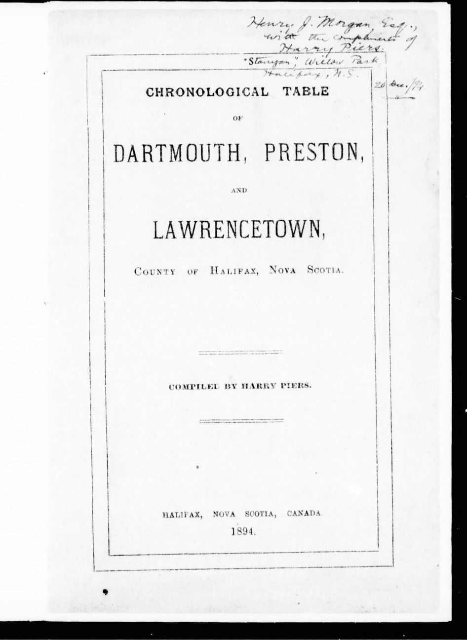
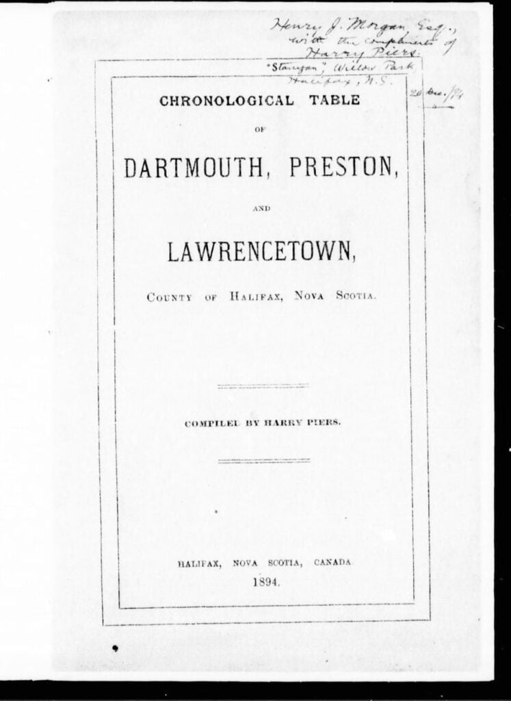
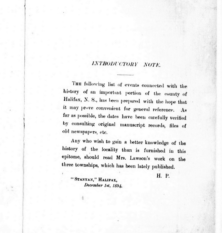
Piers, Harry, 1870-1940. Chronological Table of Dartmouth, Preston, And Lawrencetown, County of Halifax, Nova Scotia. Halifax, N.S.: [s.n.], 1894. https://www.canadiana.ca/view/oocihm.12013/12?r=0&s=1, https://hdl.handle.net/2027/aeu.ark:/13960/t8pc3fx9z

Another instance of Nova Scotia mentioned along with the other colonies in reference to the oppressions of the crown, recognized as kindred with regard to a collective state of affairs, its fate connected to that of the others.
“Soon after the first unfriendly attempt upon our chartered privileges, a congress of delegates from nine colonies was assembled at New-York in October, 1765, at the recommendation of Massachusetts, and they digested a bill of rights, in which the sole power of taxation was declared to reside in their own colonial legislatures. This was preparatory to a more extensive and general association of the colonies, which took place in September, 1774, and laid the foundations of our independence and permanent glory. The more serious claims of the British parliament, and the impending oppressions of the British Crown at this last critical period, induced the twelve colonies, which were spread over this vast continent from Nova Scotia to Georgia, to an interchange of opinions and views, and to unite in sending delegates to Philadelphia, “with authority and direction to meet and consult together for the common welfare.” In pursuance of their authority, this first continental congress, whose names and proceedings are still familiar to the present age, and will live in the gratitude of a distant posterity, took into consideration the afflicted state of their country; asserted, by a number of declaratory resolutions, what they deemed to be the unalienable rights of English freemen; pointed out to their constituents the system of violence which was preparing against those rights; and bound them by the most sacred of all ties, the ties of honor and of their country, to renounce commerce with Great Britain, as being the most salutary means to avert the one, and to secure the blessings of the other. These resolutions received prompt and universal obedience; and the Union being thus auspiciously formed, it was continued by a succession of delegates in congress; and through every period of the war, and through every revolution of our government, this union has been revered and cherished as the guardian of our peace, and the only solid foundation of national independence.”
Kent, James, 1763-1847. Commentaries On American Law. New York: O. Halsted, 1826. https://babel.hathitrust.org/cgi/pt?id=nyp.33433008580494&view=1up&seq=208, https://books.google.ca/books?id=cgY9AAAAIAAJ
See also:


After piecing together several Crown land grant maps, you can see the path of the Old Annapolis Road much more clearly. Open the image in a new tab, to see it in more detail.
Below you’ll find a few representations of the road as a contiguous route, as opposed to what is left recorded on the Crown Land Grant maps. (You can find find the individual Crown Land Grant maps here: https://novascotia.ca/natr/land/grantmap.asp)

One of the earliest road maps, from 1755, the Bay of Fundy still going by the name of Argal’s Bay. “A New map of Nova Scotia and Cape Britain”, https://gallica.bnf.fr/ark:/12148/btv1b53089581f

“Map of Nova Scotia, or Acadia, with the islands of Cape Breton and St. John’s, from actual surveys” https://gallica.bnf.fr/ark:/12148/btv1b53209890m

Previous to the construction of the more direct route to Annapolis, this map from 1776 shows a road (from Dartmouth, certainly an error, likely from Fort Sackville at the head of the harbor) to Annapolis. “A general Map of the northern British Colonies in America which comprehends the province of Quebec, the government of Newfoundland, Nova Scotia, New England and New-York” https://gallica.bnf.fr/ark:/12148/btv1b8443126p
One of the first representations of the Old Annapolis Road, “Road markt out by Gov. Parr’s orders in 1784”
“A map of Nova Scotia showing the post roads”, 1787. https://collections.leventhalmap.org/search/commonwealth:hx11z4938

“A Map of the United States and Canada, New Scotland, New Brunswick and New Foundland”, 1806. https://gallica.bnf.fr/ark:/12148/btv1b53100560v

“Map of the Province of Nova Scotia Including Cape Breton, Prince Edwards Island and Part of New Brunswick”, 1819. https://nscc.cairnrepo.org/islandora/object/nscc%3A112, https://collections.leventhalmap.org/search/commonwealth:8049g892q

“Map of the Provinces Of New Brunswick, and Nova Scotia”, 1825. https://nscc.cairnrepo.org/islandora/object/nscc%3A715
“Map of the United States; and the Provinces of Upper & Lower Canada, New Brunswick, and Nova Scotia”, 1827: https://www.davidrumsey.com/luna/servlet/detail/RUMSEY~8~1~4239~340032:Map-of-the-United-States-

“The Provinces of Lower & Upper Canada, Nova Scotia, New Brunswick, Newfoundland & Prince Edward Island with a large section of the United States”, 1831. https://gallica.bnf.fr/ark:/12148/btv1b530987207

“Maps of the Society for the Diffusion of Useful Knowledge”, 1832: https://www.davidrumsey.com/luna/servlet/detail/RUMSEY~8~1~20966~530058:Nova-Scotia,-N-B-,-Lower-Canada

“North America : sheet I. Nova-Scotia with part of New Brunswick and Lower Canada”, 1832: https://digitalarchive.mcmaster.ca/islandora/object/macrepo%3A26988

“Nouvelle carte des Etats-Unis, du Haut et Bas-Canada : de la Nouv[el]le-Écosse, du Nouv[e]au-Brunswick, de Terre-Neuve”, 1832
https://gallica.bnf.fr/ark:/12148/btv1b530354369

“Map of the United States; and the Provinces of Upper & Lower Canada, New Brunswick, and Nova Scotia”, 1835: https://www.davidrumsey.com/luna/servlet/detail/RUMSEY~8~1~316476~90085094:Composite–Map-of-the-United-States

From: “The London atlas of universal geography”, 1837: https://www.davidrumsey.com/luna/servlet/detail/RUMSEY~8~1~33890~1170042:Lower-Canada–

From: “British Possessions in North America, with part of the United States”, 1840: https://hdl.huntington.org/digital/collection/p15150coll4/id/9901

From: “Nelson’s new map of the British provinces in North America”, 1840–1849: https://collections.leventhalmap.org/search/commonwealth:0z709278h

From: “Lower Canada, New Brunswick, Nova Scotia, Prince Edwards Id. Newfoundland, and a large portion of the United States”, 1846. https://digitalarchive.mcmaster.ca/islandora/object/macrepo%3A31427

“Map of the provinces of Canada, New Brunswick, Nova Scotia, Newfoundland and Prince Edward Island”, 1846. https://digitalarchive.mcmaster.ca/islandora/object/macrepo%3A81413

“Lower Canada, New Brunswick, Nova Scotia, Prince Edwards Id. Newfoundland, and a large portion of the United States.”, 1853. https://hdl.huntington.org/digital/collection/p15150coll4/id/100

“Belcher’s map of the Province of Nova Scotia”, 1855: https://www.davidrumsey.com/luna/servlet/detail/RUMSEY~8~1~3016~290077:Belcher-s-map-of-the-Province-of-

“Map of the British Province of New Brunswick”, 1858: https://www.davidrumsey.com/luna/servlet/detail/RUMSEY~8~1~325278~90094243:Map-of-the-British-Province-of-New-

“The royal atlas of modern geography”, 1861: https://www.davidrumsey.com/luna/servlet/workspace/handleMediaPlayer?qvq=&trs=&mi=&lunaMediaId=RUMSEY~8~1~21338~620038

“Mackinlay’s map of the Province of Nova Scotia, including the island of Cape Breton”, 1862: https://www.davidrumsey.com/luna/servlet/detail/RUMSEY~8~1~2372~220044:Mackinlay-s-map-of-the-Province-of-

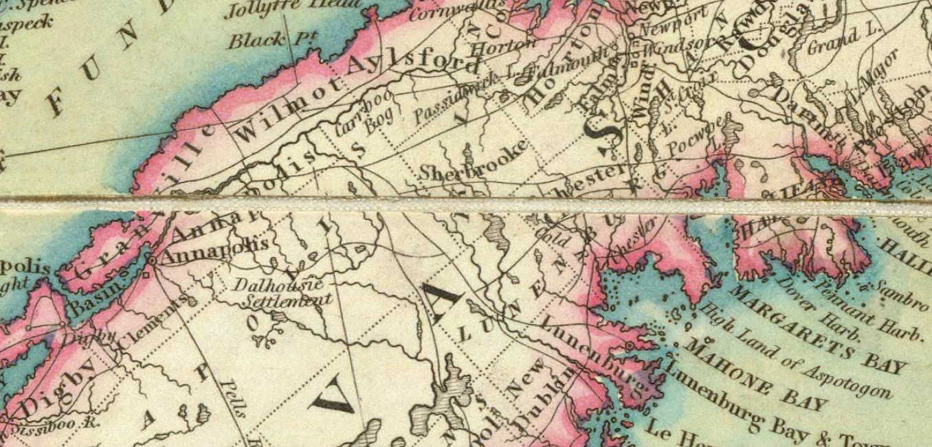
The portion of the Annapolis road that traverses Halifax County, as seen in the “Topographical township map of Halifax County” from A.F. Church and Co, 1864. https://collections.lib.uwm.edu/digital/collection/agdm/id/14722/rec/1

“Mackinlay’s map of the Province of Nova Scotia”, 1865: https://www.davidrumsey.com/luna/servlet/detail/RUMSEY~8~1~2374~220046:Mackinlay-s-map-of-the-Province-of-

“Colton’s… Nova Scotia”, 1865: https://www.davidrumsey.com/luna/servlet/detail/RUMSEY~8~1~208606~5003402:New-Brunswick,-Nova-Scotia–Prince-

“Colton’s Dominion of Canada”, 1869: https://www.davidrumsey.com/luna/servlet/detail/RUMSEY~8~1~208947~5003938:Dominion-of-Canada–Provinces-of-Ne

Annapolis Road seen here at Stoddards as it made its way through to what is now Dalhousie East. “Annapolis County part of A.F. Church Map”, 1876. https://archives.novascotia.ca/maps/archives/?ID=942

Annapolis Road pieced together from several pages of the “Atlas of the Maritime Provinces of the Dominion of Canada”, Roe Brothers, St. John, NB 1878. https://www.islandimagined.ca/roe_atlas

“Statistical & general map of Canada”, 1883: https://www.davidrumsey.com/luna/servlet/detail/RUMSEY~8~1~31463~1150419:Canada-1-

“Canada : the provinces of Quebec, Nova Scotia, New Brunswick, Prince Edward Island and Newfoundland”, 1886. https://digitalarchive.mcmaster.ca/islandora/object/macrepo%3A27057

“Mackinlay’s map of the Province of Nova Scotia”, 1890: https://www.davidrumsey.com/luna/servlet/detail/RUMSEY~8~1~3012~220131:Mackinlay-s-map-of-the-Province-of-

“Stanford’s London atlas of universal geography”, 1904: https://www.davidrumsey.com/luna/servlet/detail/RUMSEY~8~1~314730~90083550:Quebec,-New-Brunswick,-Nova-Scotia
“Dominion of Canada : E. Quebec, New Brunswick, Nova Scotia, Prince Edward Id. and Newfoundland”, 1910. https://collections.library.yale.edu/catalog/15827305
One of the last representations of the Old Annapolis Road:

Mackinlay’s map of the Province of Nova Scotia Compiled from Actual & Recent Surveys, 1912: https://nscc.cairnrepo.org/islandora/object/nscc%3A534
Fifteen years later, by 1927, the Old Annapolis Road disappears from the maps. Perhaps it wasn’t fit for automobile travel, though it’s hard not to notice the change (back?) to “Annapolis Royal” from “Annapolis” occurred at the same time.

From: “Rand McNally auto road atlas of the United States and Ontario, Quebec, and the Maritime Provinces of Canada”, 1927: https://www.davidrumsey.com/luna/servlet/detail/RUMSEY~8~1~33775~1171491:Maritime-Provinces-
Much of the road is now incorporated into other routes. It’s the #8 from Annapolis through Lequille, it’s the West Dalhousie Road through to Lake La Rose and from West Dalhousie to Albany Cross on to Stoddard’s where it once continued straight at what is now a turn (see above at 1876). It then crossed over the brook that empties into Upper Thirty Lake, from there it continued across another bridge, this time over the LaHave River to connect to what is now Camel Hill Road. The route proceeded to where it now meets Cherryfield Road and becomes Dalhousie Road, and on eastwards from there, through to Franey Corner and on to New Ross. At this point the route seems to have been reclaimed by the woods somewhat but it continued south and east near Sherwood, and then north of Canaan and Timber Lake, to the south of Panuke Lake (once called “Carrying Place”, see above at 1864) near Simms Settlement, through the country between Sandy and Rafter lake then terminating at Pockwock Road, north of Wrights Lake in Upper Hammonds Plains.
From: “Halifax & Dartmouth City & Maritimes map”, 1976. https://archives.novascotia.ca/maps/archives/?ID=948&Page=202012493
See also: