
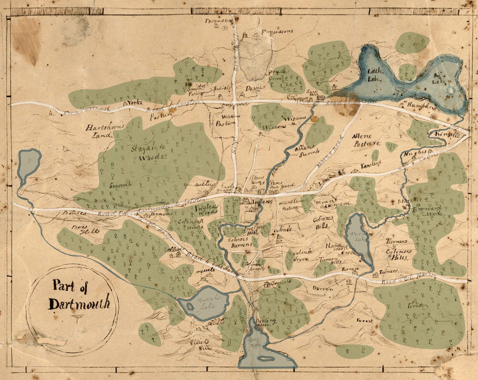
Here’s a quick coloration in order to hopefully ease legibility: Penhorn Lake can be seen at far left, Russell and Morris Lake along the bottom, Bell Lake at middle right. What is now Main Street, then known as “Road to Preston”, travels from left to right at top. The “Road from Dartmouth to Preston” at middle is now Woodlawn Road and Mount Edward Road, “Road to Cole Harbor” at bottom, once the road to Lawrencetown is now Portland Street. Road to Farquharson’s, the vertical road at middle, is now Caledonia Road. I believe there’s still a very small piece of “Allen’s Road” extant, which connected what is now Mount Edward Road to Main Street, as seen here.
See also:
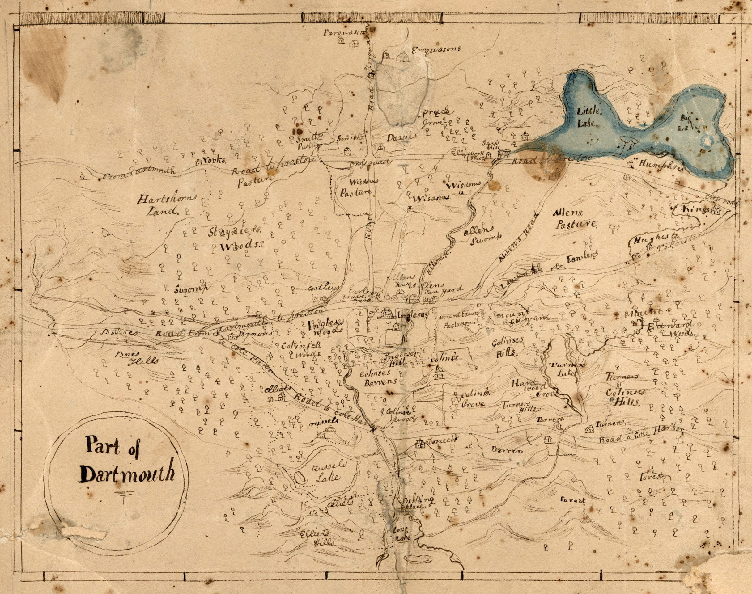
"Part of Dartmouth", 1820. https://archives.novascotia.ca/maps/archives/?ID=384