Carte de la coste de l’Acadie

dartmouth logo

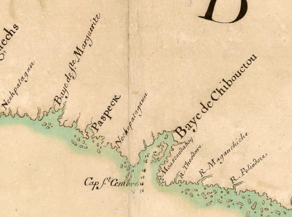
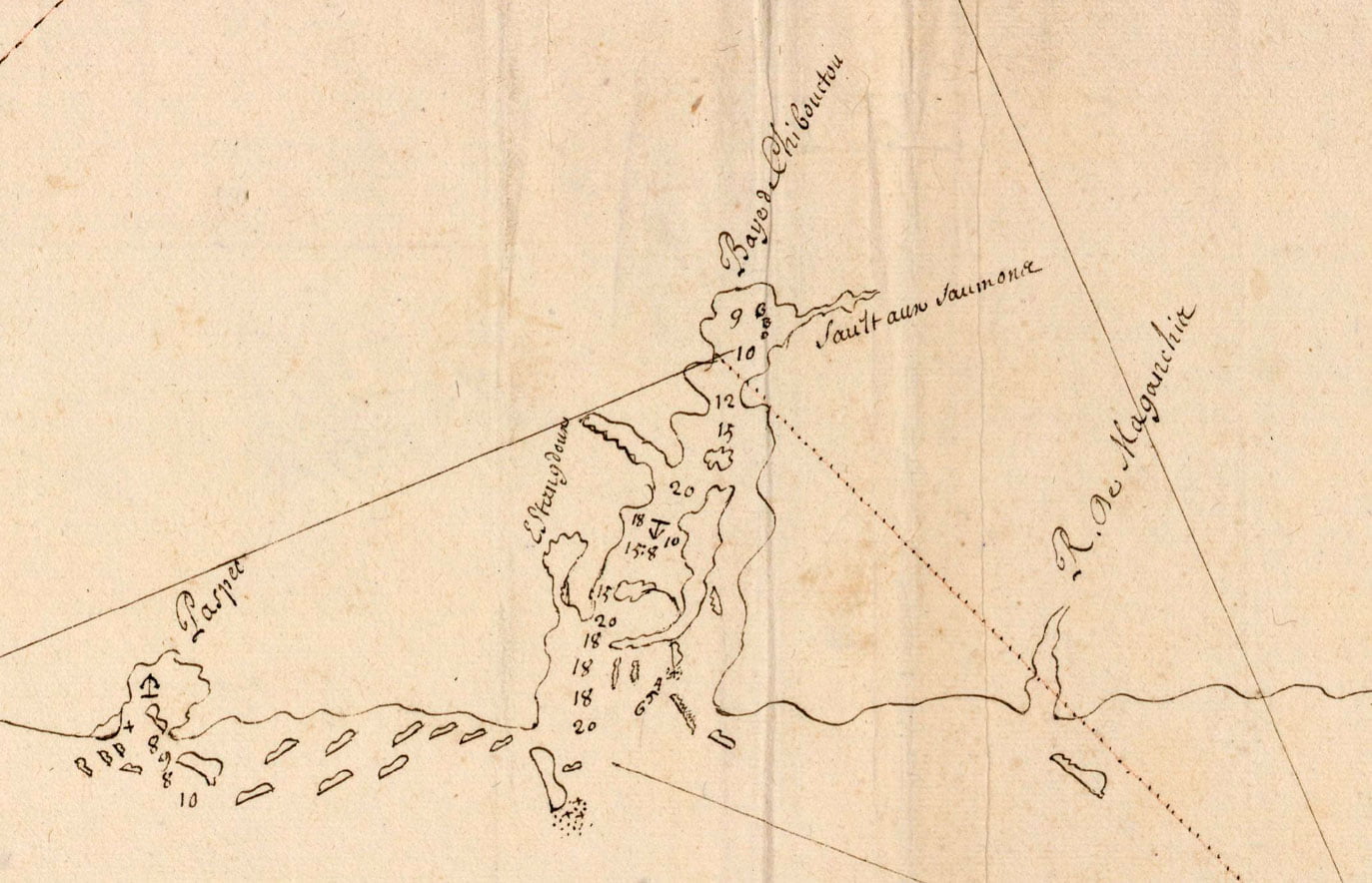
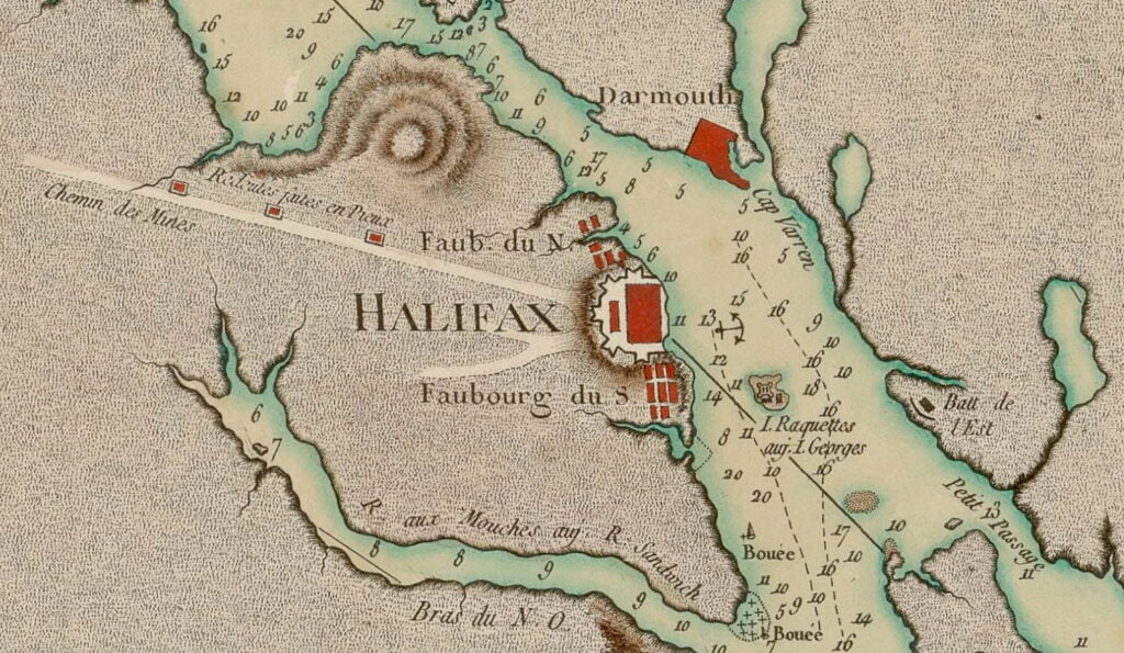
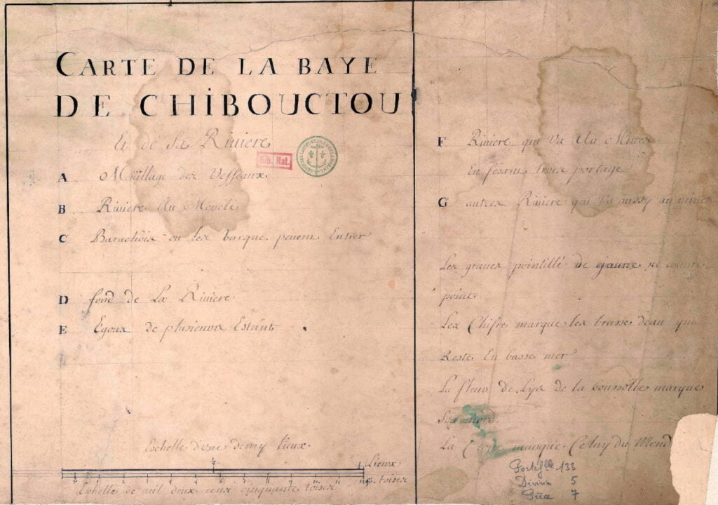
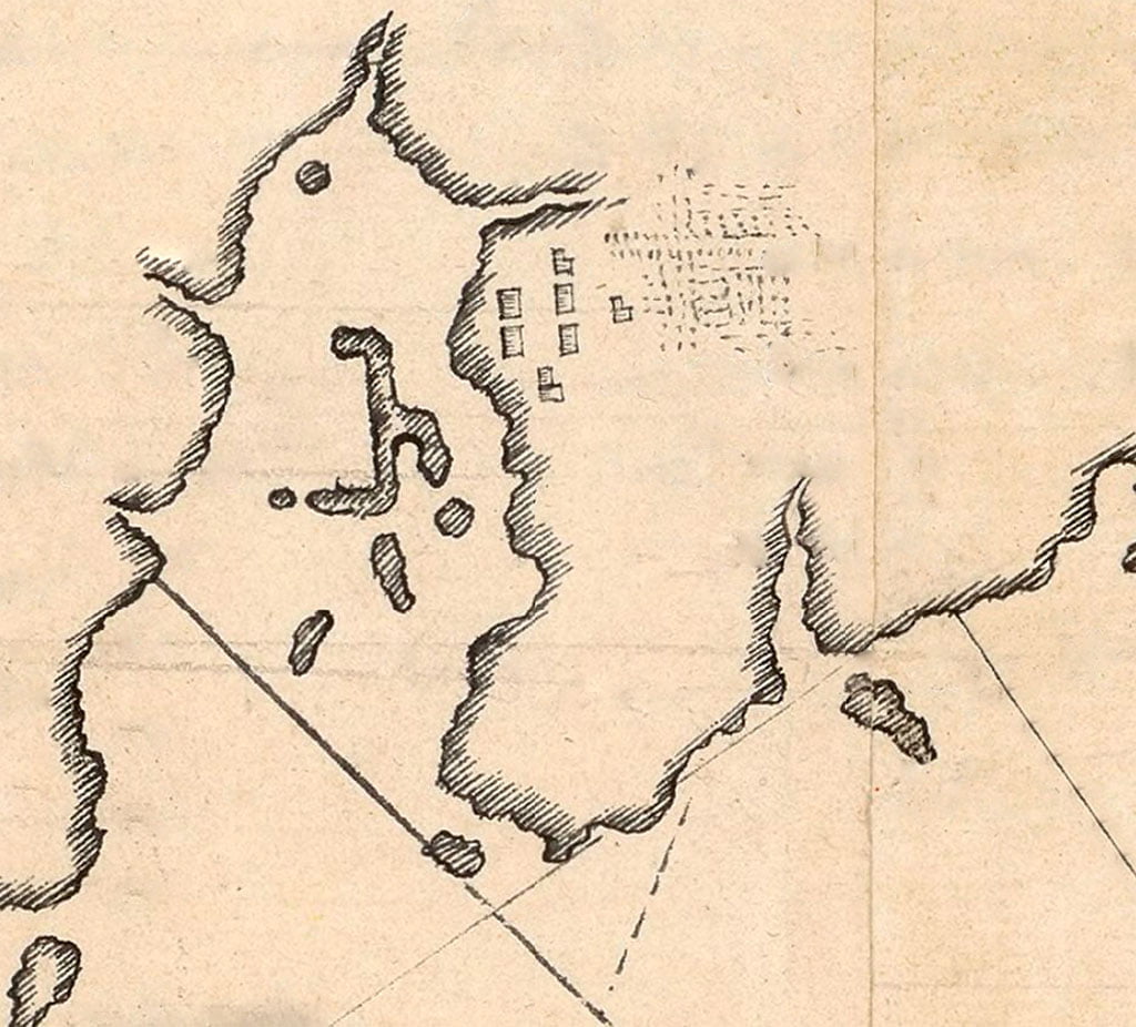
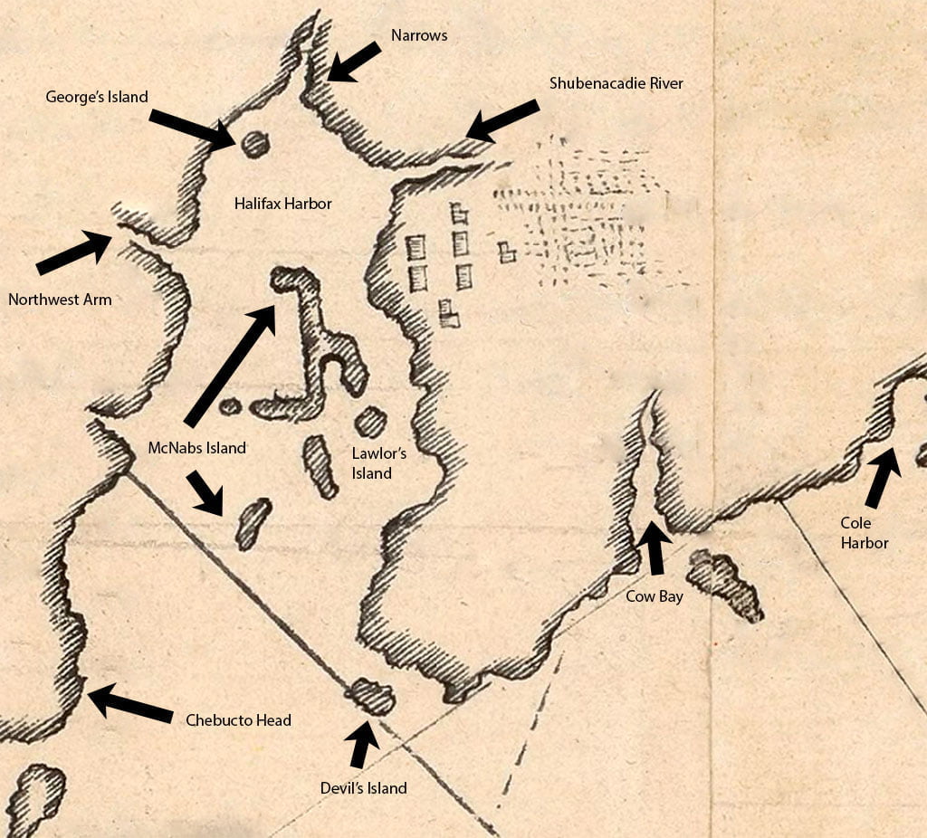
An incredibly detailed map, again showing Chibouctou on the Dartmouth side. Mcnabs Island and George’s are fairly easy to spot for those who’ve seen them on a map before. Perhaps the hatchings next to the seven buildings is meant to represent the “1/2 acre of improved land” that de Gargas notes in his 1687-1688 census of Acadie (including Chibouctou).

I have attempted to transcribe it as best as I can, being mostly unfamiliar with French, certainly the 17th/18th century variety. Following that is my attempt at a translation, thanks to Google Translate along with the ARTFL project at the University of Chicago.

My reading of a word or words I’m not familiar with will be in brackets, with what I think it means in context located previous to the brackets in italics. Example (as seen below): closely to (extremely tidy). I wasn’t sure at first if the text spanned both sides of the harbor but I’m assuming it does since it seems to make more sense. If anyone has a better read of this, please let me know.

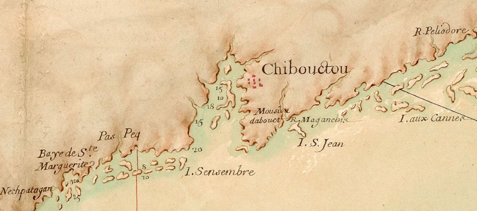
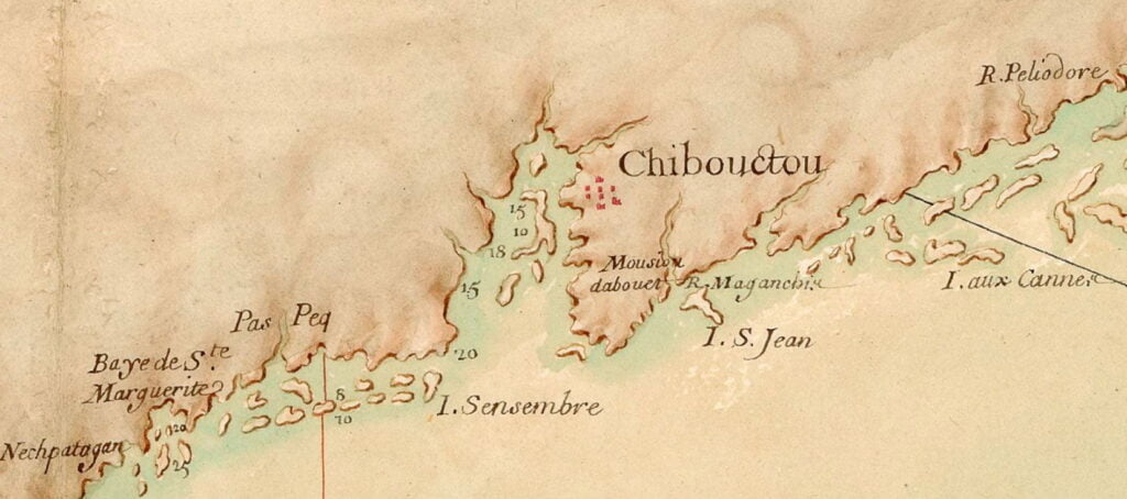
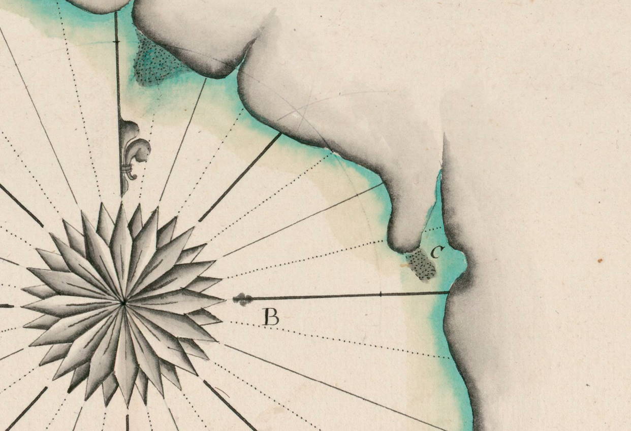
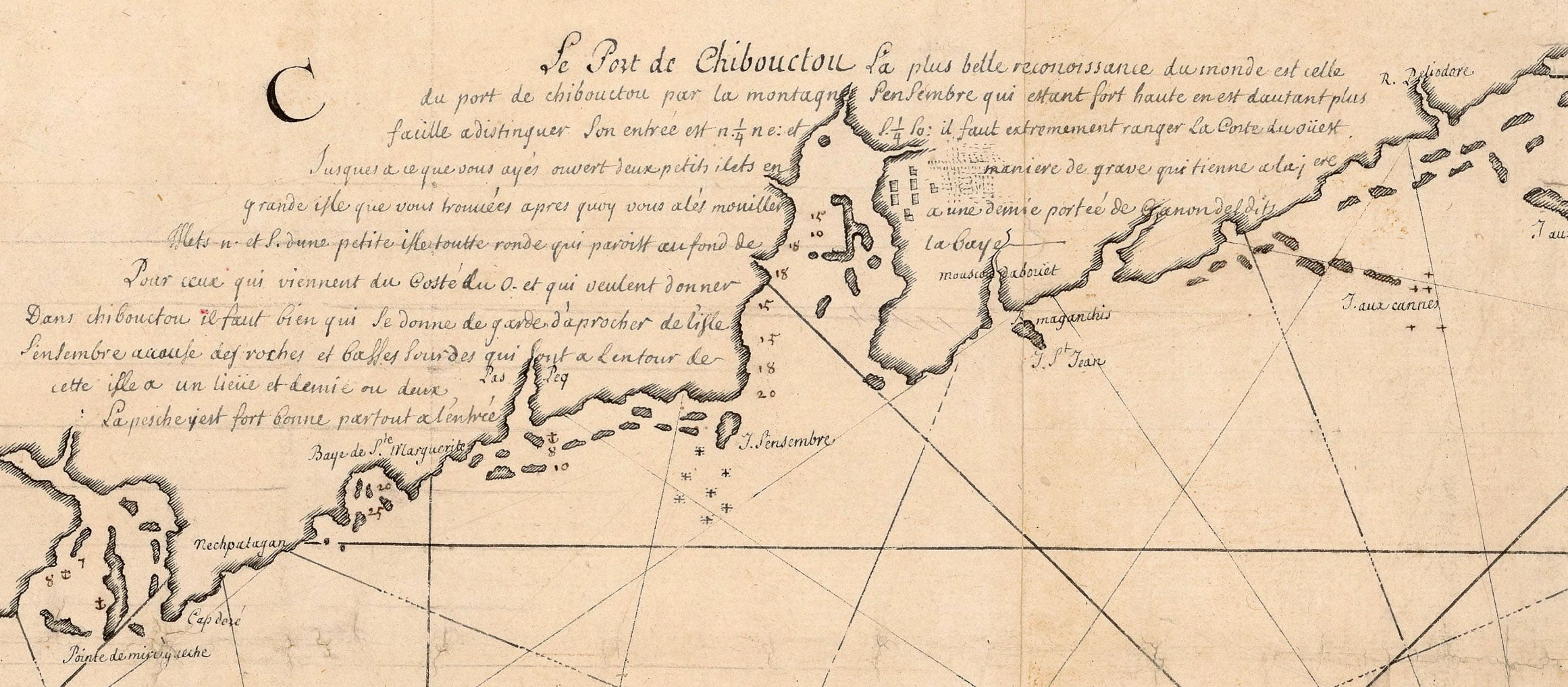
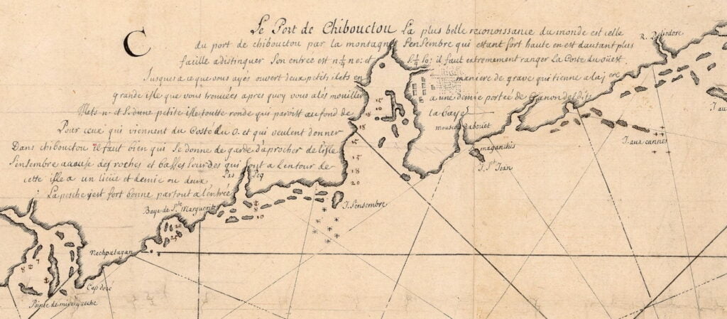
“Le Port de Chibouctou la plus belle recoinissance du monde est celle du port de chibouctou par la montagne SenSembre qui estant fort haute en est dautant plus facille adistinquer. Son entree est nord 1/4 nord est et sud 1/4 ouest. Il faut extrement ranger la coste du ouest. Jusques a ce que vous ayes ouvert deux petits islets en maniere de grave qui tienne arajere grand isle que vous howees apres quoy vous ales moniller a une demie portee de canondeldits. Islets nord et sud d’une petite isle toute ronde qui pariott au found de la baye. Pour ceux qui viennent du coste du ouest et qui veulenyt donner. Dans Chibouctou il fait bien qui le donne de garde d’aproacher de l’isle SenSembre accouse des roches et basses soundres qui sont a lentour de cette isle a un lieue et demie ou deux , la pesche est fort bonne partout a l’entree”

“The Port of Chibouctou

The most beautiful view (recognition) in the world is that of the port of Chibouctou from (by) the Sambro (SenSembre) mountain which, being very high, is all the more easy to distinguish.

Its entrance is north 1/4 north east and south 1/4 west.

You must adhere closely to (extremely tidy) the western coast until you see (have opened) two small islets in a grave manner which hold a large isle which you ?? (howees?) after which you go up to them at half a reach of ?? (cannondeldits?) islets north and south of a small isle all round which ?? (pariott?) at the bottom of the bay.

For those who come from the west coast and who want to enter (give in) Chibouctou it is good who gives him the guard to approach from the island Sambro (SenSembre). Watch out for (accommodate) rocks and low soundings (soundres) which are around this island at a league and a half or two. The fishing is very good everywhere at the entrance”

“Carte de la coste de l’Acadie” La Borde, Jean-Benjamin de. 17?? https://gallica.bnf.fr/ark:/12148/btv1b53089980h

See also:

Carte particulière de la coste d’Accadie

carteacadie6 map

A very detailed early map of Nova Scotia from some time previous to the founding of Halifax. Chibouctou is shown on the Dartmouth side of the harbor, opposite McNabs Island and Geroge’s Island. Shubenacadie River is seen to the north of the settlement. I haven’t found any substantial confirmation that the Dartmouth side is where the settlement known as Chibouctou was actually located, but there are a number of maps (many, but not all, seem to be derivative).

More about Chibouctou:

“Carte particulière de la coste d'Accadie” 16?? (<1700) https://gallica.bnf.fr/ark:/12148/btv1b53089778x

Carte réduite des costes de l’Acadie

dartmouth map

A (probably very) rough translation:

“The English took possession of Chibouctou on the 19th of August 1749 and named it Halifax.

It is one of the most beautiful ports in all parts of Acadia and England. It should provide great income, by the different advantages that it contains. It is located at 44 degrees 3 minutes latitude.”

This map is an inset from a broader map of Nova Scotia (Acadia), interestingly it shows the picketed part of Dartmouth as being near the bottom of what would be Old Ferry Road today, what appears to be the Eastern battery is seen further down the harbor, closer to Eastern Passage.

dartmouth map

“Carte réduite des costes de l’Acadie” 17?? (>1749) https://gallica.bnf.fr/ark:/12148/btv1b53089777g

Plan de la baye et des ports de Chibouctou

dartmouth map
A notation of “F” given to Dartmouth, though Dartmouth is located near the Eastern Battery.

“F: Village Dartmouth ou monte un bivac de 60 homes

Bivac“: “Term borrowed from German. Extraordinary guard which is made at night in the open air for the safety of a camp, a detachment, a post. Sleep at the bivac.”

Rough translation: Dartmouth village, a camp made up of 60 men.

“Plan de la baye et des ports de Chibouctou” 1751. https://gallica.bnf.fr/ark:/12148/btv1b53089566v

Carte de la baye de Chibouctou

dartmouth map
Dartmouth Cove and the Shubenacadie River with a notation of “G”.

One of the only representations I’ve seen of an island that supposedly existed in Dartmouth Cove, that is mentioned by Martin in the Story of Dartmouth on page 31:

“There is an old tradition that in this part of Mill Cove, a small island used to exist. It is mentioned in a footnote to the History of Dartmouth by Harry Piers, who got the particulars from George Shiels, a lifelong resident who died about 1900. The latter stated that until the island had been washed away by the sea in the early part of the last century, it had been situated north of Mott’s Wharf. (Mott’s wharf ran out from the middle of the present Hazelhurst railway trestle, or about halfway between Evergreen point and Parker’s wharf).

As the island disappeared under the action of the sea, according to Mr. Shiels, numerous wooden coffins containing skeletons could be seen. He thought that these were graves of the early French, either prisoners from the Hazelhurst barracks, or a fraction of the one thousand victims of an epidemic which had swept through the fleet of Duke D’Anville in this harbor during the autumn of 1746. More are said to be buried under St. James Church.”

“G: Autrer riviere qui va aussy au mines” Another river that goes to Minas (basin)

“Carte de la baye de Chibouctou” <1750. https://gallica.bnf.fr/ark:/12148/btv1b53089987n

Page 1 of 2
1 2