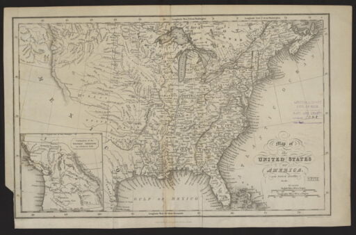
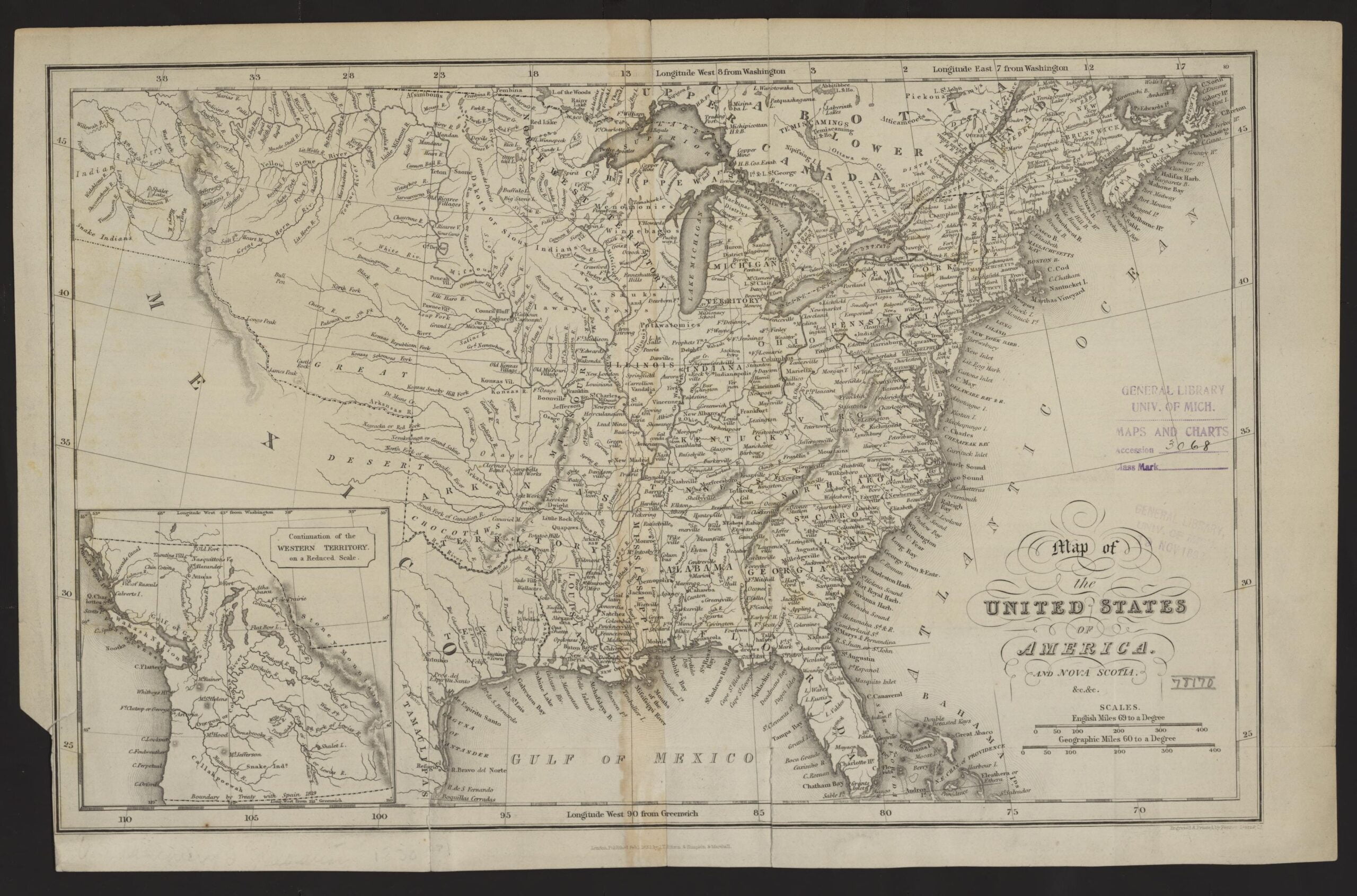
“Map of the United States of America and Nova Scotia, &c. &c.” https://quod.lib.umich.edu/c/clark1ic/x-002879918/39015091195050. University of Michigan Library Digital Collections. Accessed: June 02, 2021.

Amicitia Crescimus
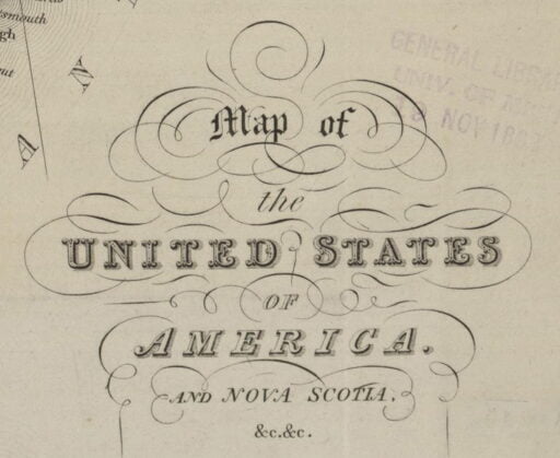
“Map of the United States of America and Nova Scotia, &c. &c.” https://quod.lib.umich.edu/c/clark1ic/x-002879918/39015091195050. University of Michigan Library Digital Collections. Accessed: June 02, 2021.
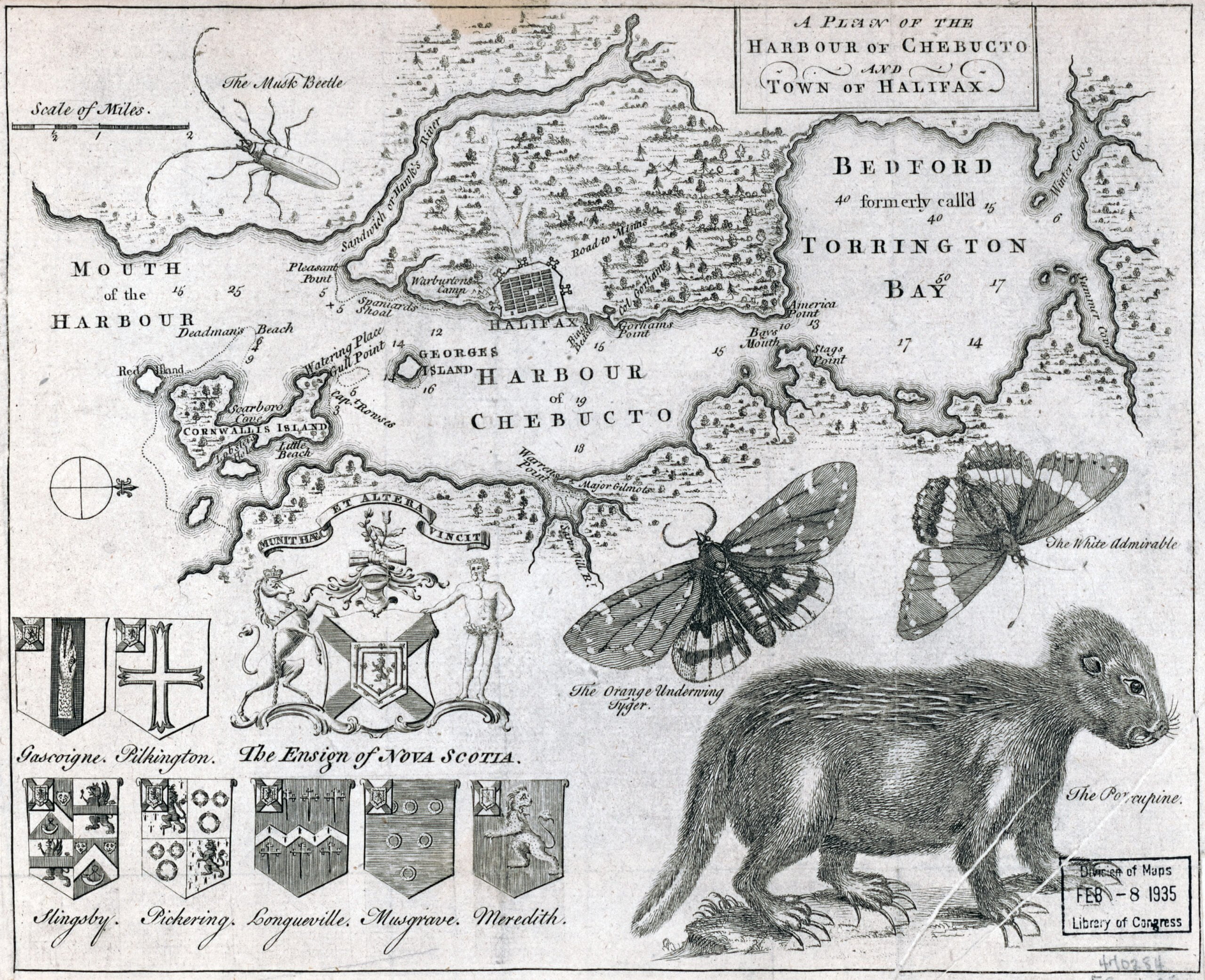
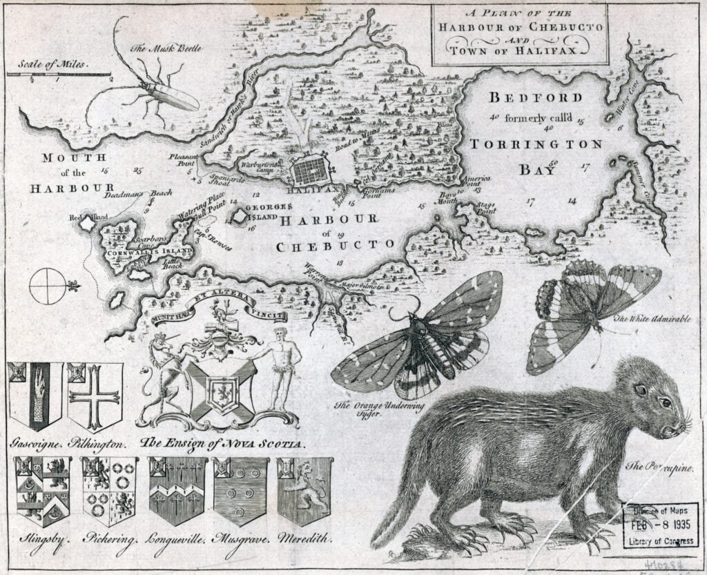
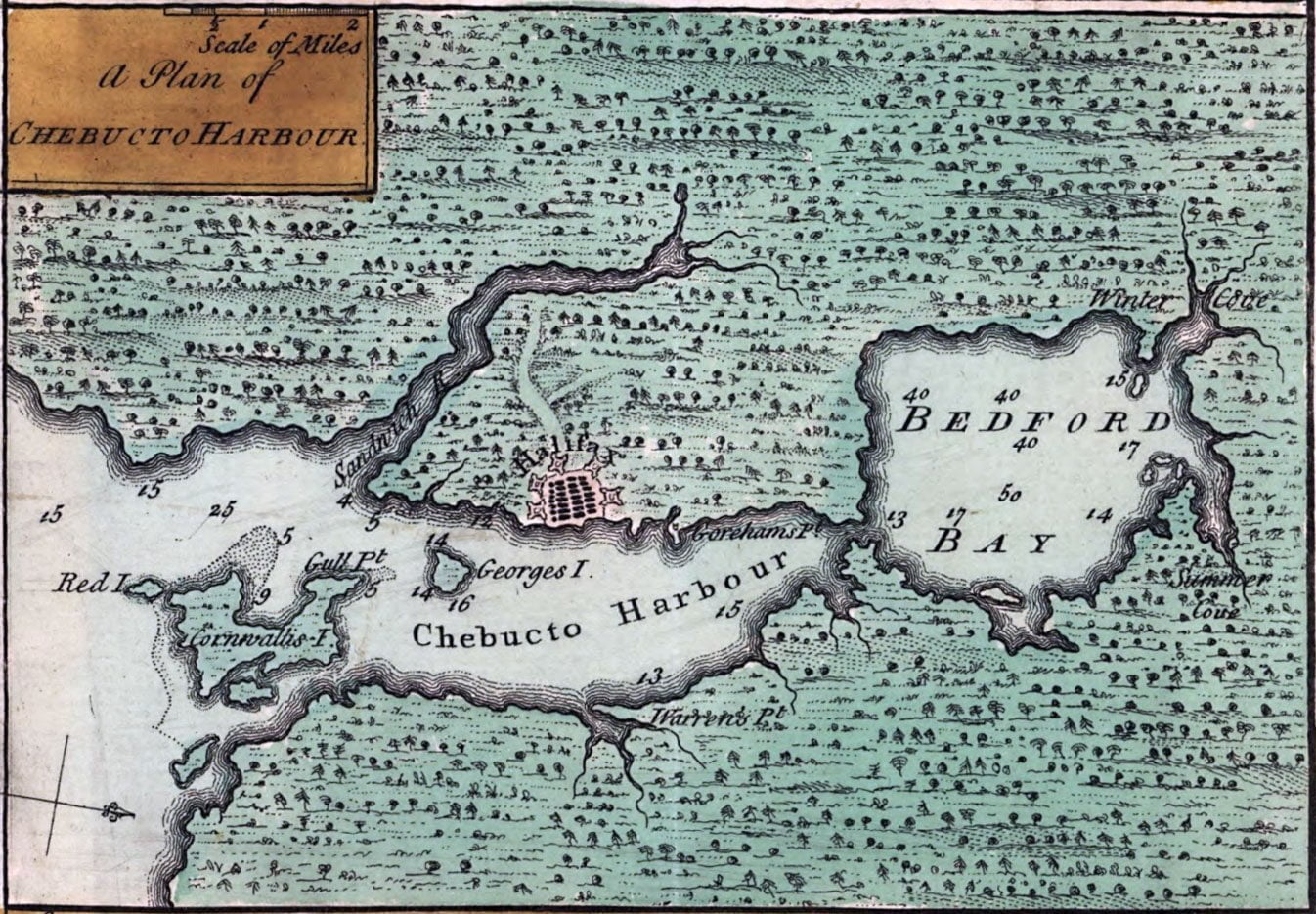
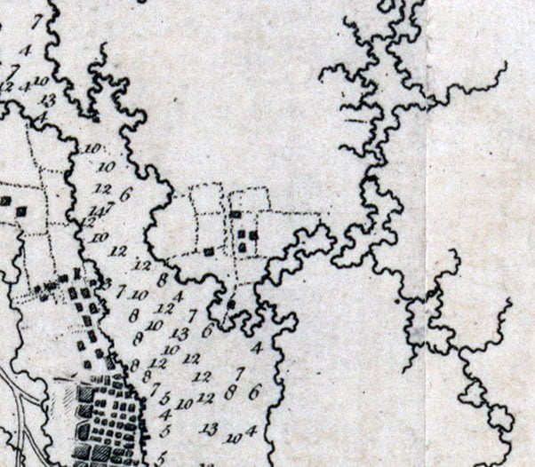
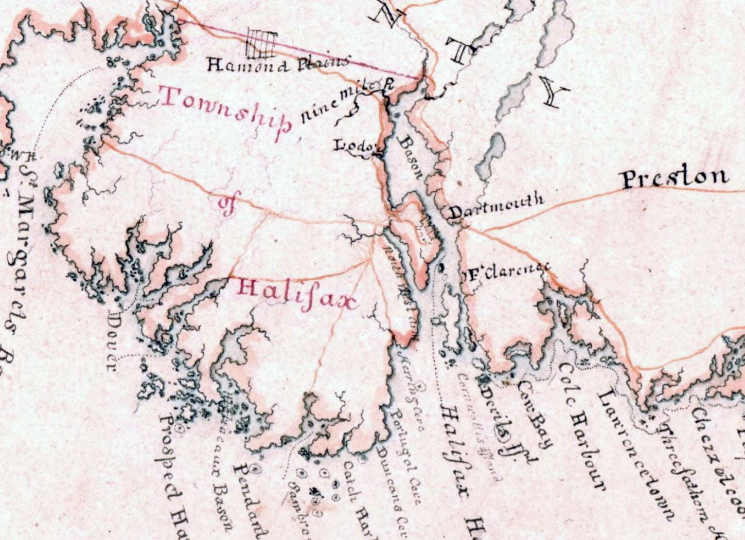
One structure is noted at “Warrens point” near where the Marine Slips were located, what is now King’s Wharf in downtown Dartmouth. “Major Gilmots”, is listed, which should be Major (Ezekiel) Gilman, whose saw mill was erected not long after Halifax’s initial settlement in 1749. Martin notes where its original location was thought to be here.
Saw Mill Brook (or river) shown as one of three streams entering Dartmouth Cove. One stream is located where the Canal stands today, perhaps the next is meant to represent the steam that used to flow down where Old Ferry Road is now, from Maynard’s lake, while the other could represent the brook that used to be near Sandy Cove. There are also reports of a stream that at one time used to traverse Maitland Street from a branch of the Shubenacadie River that split somewhere around where Elliot Street and Eaton Avenue sit today, though that would make it the Saw Mill Brook, if that’s what’s represented here.
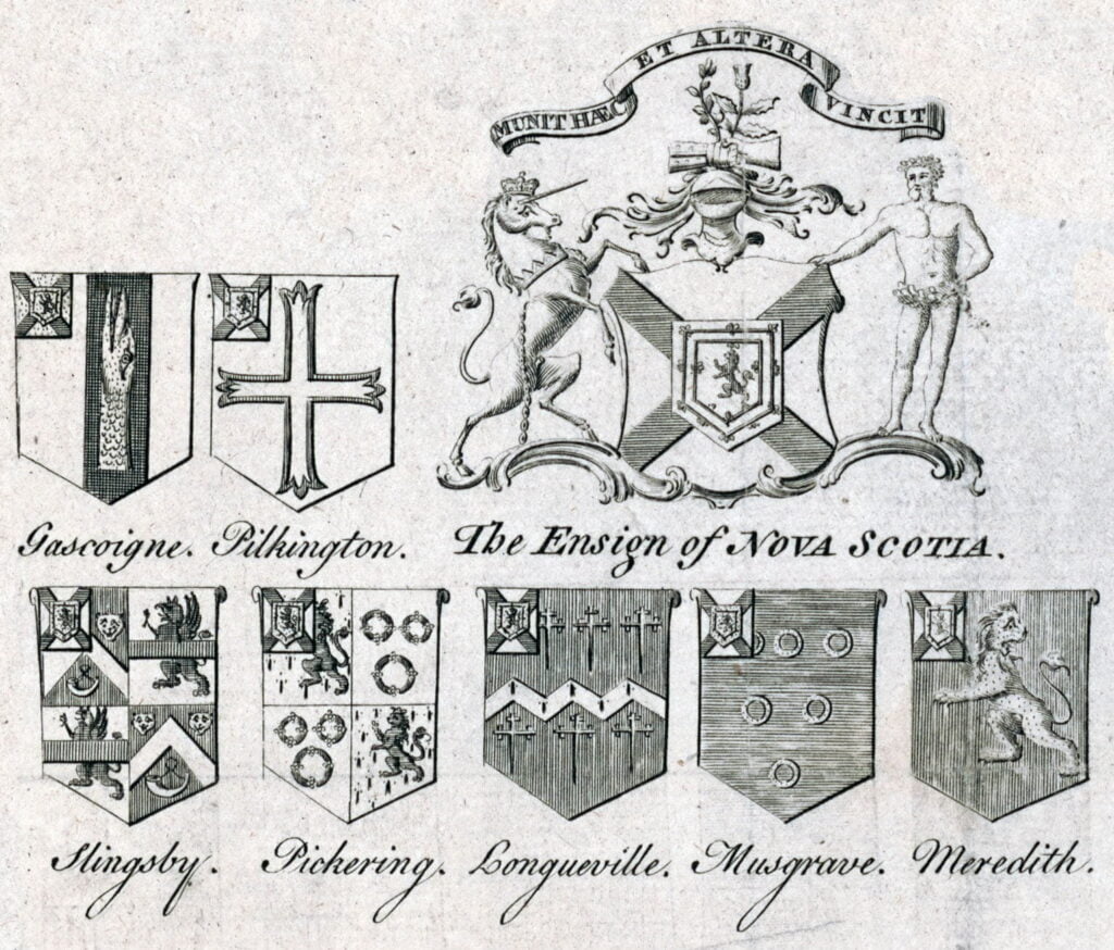
“Gascoine, Pilkington, Slingsby, Pickering, Longueville, Musgrave, Meredith”, what I assume are several of the Nova Scotian Baronets listed, or proprietors in some other fashion.
A plan of the harbour of Chebucto and town of Halifax. [London: Gentleman’s Magazine, 1750] Map. Retrieved from the Library of Congress, <www.loc.gov/item/2017585994/>, https://gallica.bnf.fr/ark:/12148/btv1b8595940z, https://archive.org/details/McGillLibrary-rbsc-maps_G3422_H3_1750_H3-17130/mode/1up

Morris, Charles. A chart of the peninsula of Nova Scotia. [1761] Map. Retrieved from the Library of Congress, <www.loc.gov/item/74691224/>
See also:
Stirling, William Alexander, Earl Of, 1567 Or , Cartographer, and William Alexander Stirling. New England, Nova Scotia, and Newfoundland. [London: Publisher not indicated, ?, 1624] Map. Retrieved from the Library of Congress, <www.loc.gov/item/2018590035/>

Society Of Anti-Gallicans, William Herbert, and Robert Sayer. A new and accurate map of the English empire in North America; Representing their rightful claim as confirmed by charters and the formal surrender of their Indian friends; likewise the encroachments of the French, with the several forts they have unjustly erected therein. London, Sold by Wm. Herbert, 1755. Map. Retrieved from the Library of Congress, <www.loc.gov/item/74696120/>
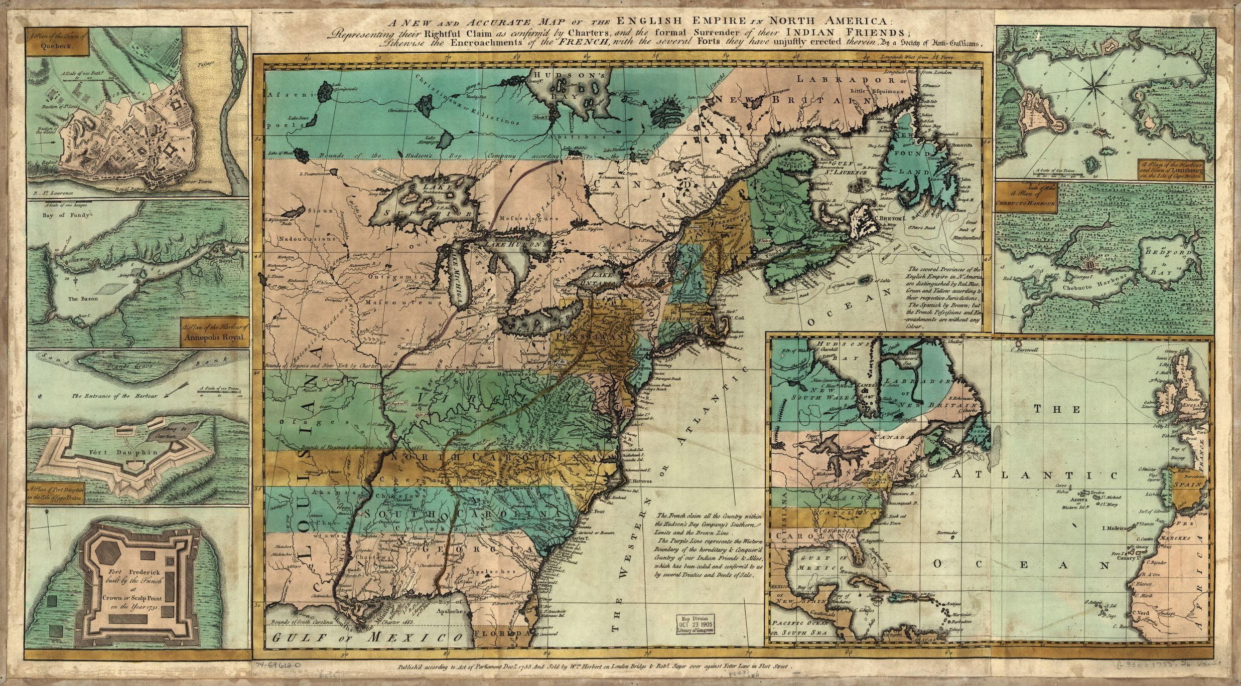
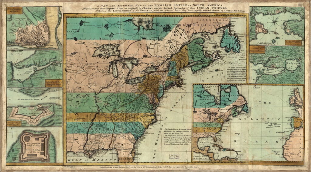
“The French claim all the country within the Hudson’s Bay Company’s southern limits and the brown line”, an entity just recently privatized.
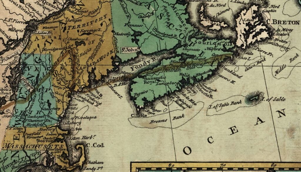
Perhaps this border shown here as the 45° latitude explains the location of the Old Annapolis Road which it seems to straddle somewhat, beyond the fact that it connected Nova Scotia’s old capital of Annapolis to the new capital of Halifax. Perhaps it explains much more, considering the placement of Greenwood (CFB), Halifax Airport (YHZ) and Windsor, all just below 45°.
It would be amazing to be able to preserve the Old Annapolis Road ROW as much as possible for future generations, perhaps some kind of restoration as a hiking trail especially the parts that lie hidden before it’s completely lost to the woods.
“A new and accurate map of the English empire in North America; Representing their rightful claim as confirmed by charters and the formal surrender of their Indian friends; likewise the encroachments of the French, with the several Society Of Anti-Gallicans, William Herbert, and Robert Sayer. London, Sold by Wm. Herbert, 1755. Map. Retrieved from the Library of Congress, <www.loc.gov/item/74696120/>.
Des Barres, Joseph F. W. The sea coast of Nova Scotia; exhibiting the diversities of the coast, and the face of the country near it: the banks, rocks, shoals, soundings, &c. Together with remarks and directions for the conveniency of navigation and pilotage. [London, -78?, 1777] Map. Retrieved from the Library of Congress, <www.loc.gov/item/75332514/>.
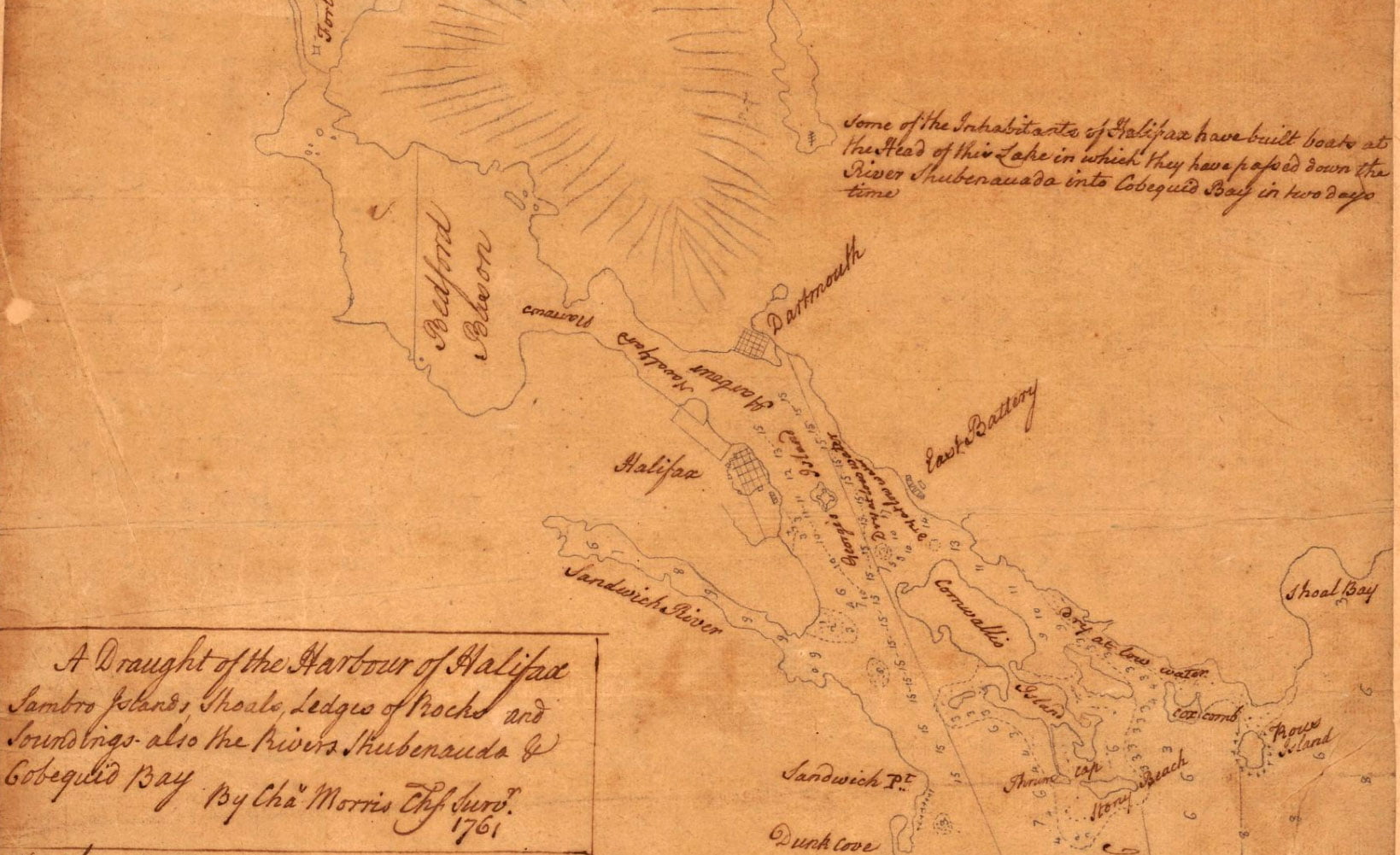
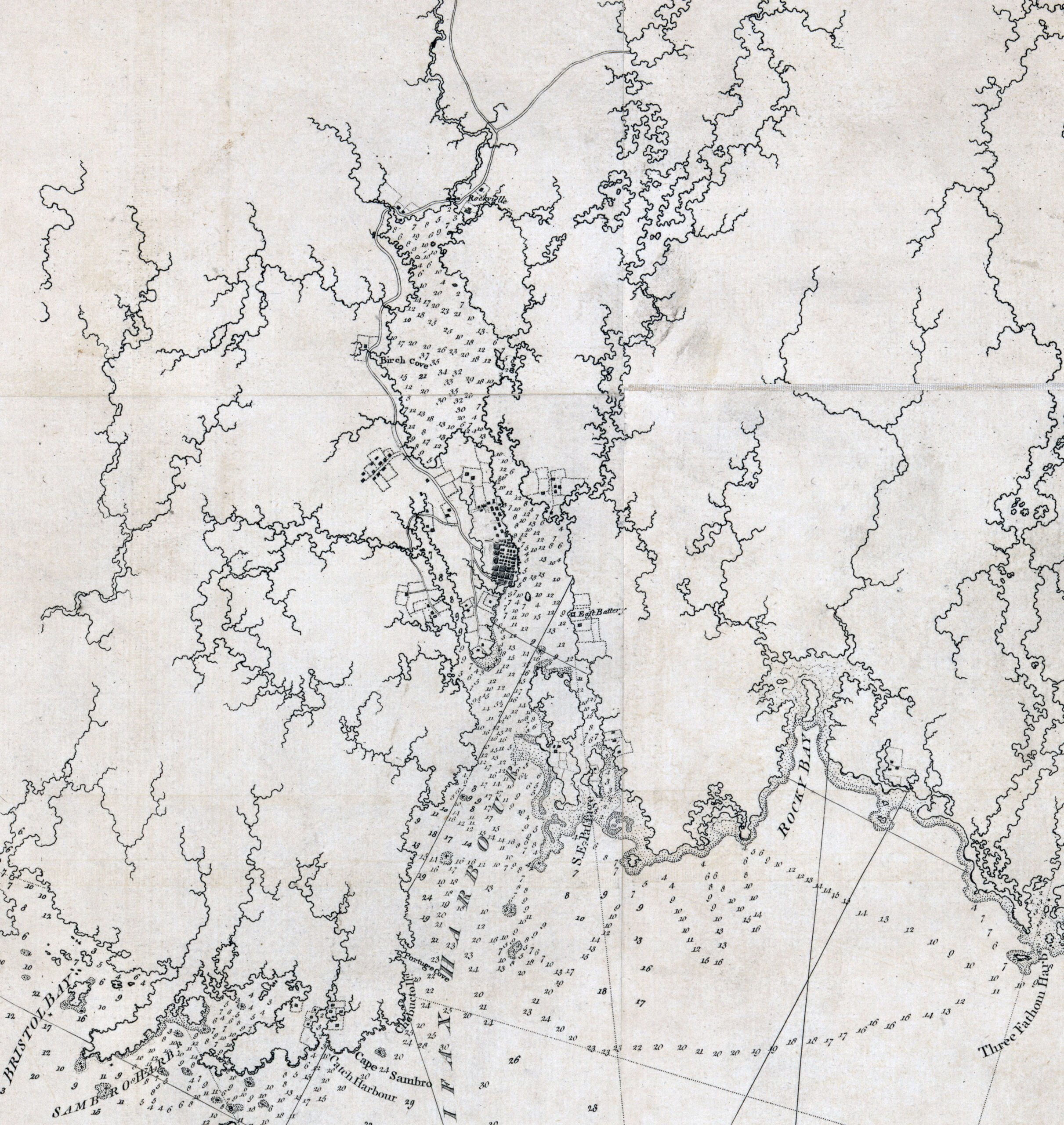
Morris, Charles. A draught of the harbour of Halifax, Sambro Islands, shoals, ledges of rocks, and soundings, also the rivers Shubenauda & Cobequid Bay. [1761] Map. Retrieved from the Library of Congress, <www.loc.gov/item/74691494/>
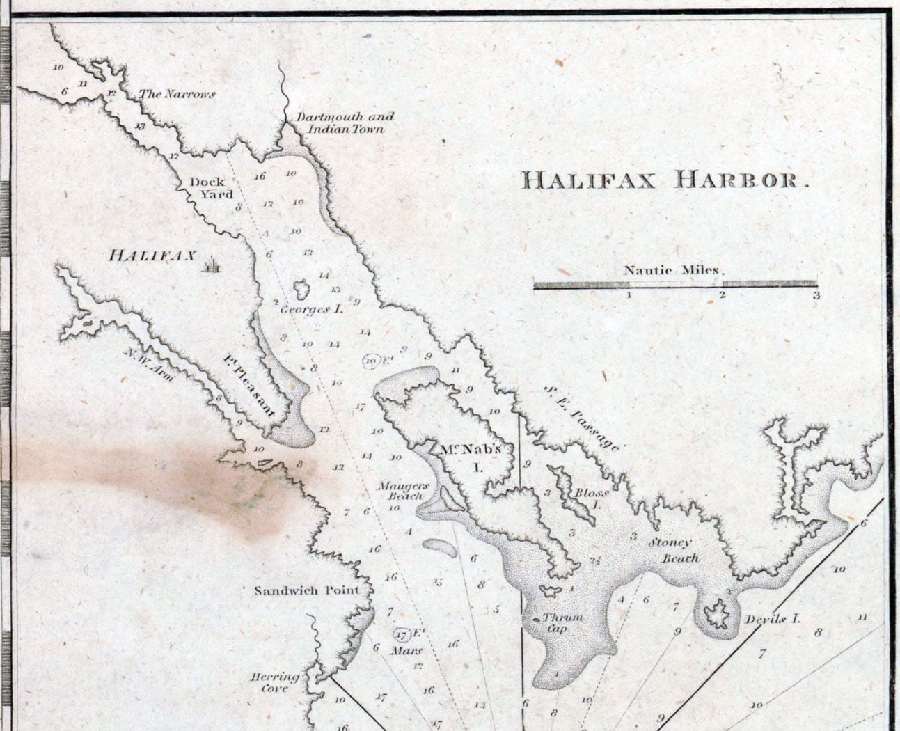
Dartmouth and Indian Town! 😎 If only there was more detail of the settlements themselves. Fascinating to me that the only inset on this map is Halifax Harbor. To me it represents Jefferson’s viewport to 45°N, reflective of his notes on the State of Virginia that traces the constitutional history of Nova Scotia too, from its time as proprietary colony through to various cessions and treaties thereafter, from the earliest instances of European exploration by Cabot and Gilbert to the Treaty of Aix-la-Chapelle and Paris. More on Notes on the State of Virginia as it relates to Nova Scotia here.
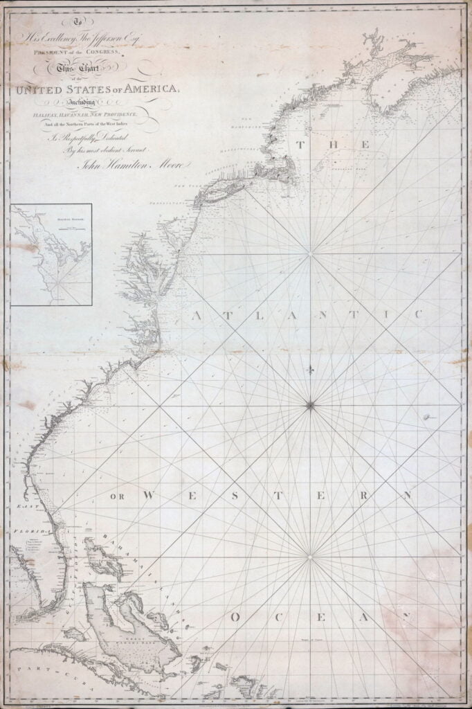
Moore, John Hamilton, -1807, et al. To his excellency Thos. Jefferson, esqr., president of the Congress, this chart of the United States of America: including Halifax, Havannah Havana, New Providence, and all the northern parts of the West Indies. London: R. Penny, sculp, 1805. Map. Retrieved from the Library of Congress, <www.loc.gov/item/2003620053/>

Maps of Nova Scotia and Halifax harbor and view of lighthouse. [Nova Scotia?: Producer not indicated, ?, 1840] Map. Retrieved from the Library of Congress, <www.loc.gov/item/2017585984/>