
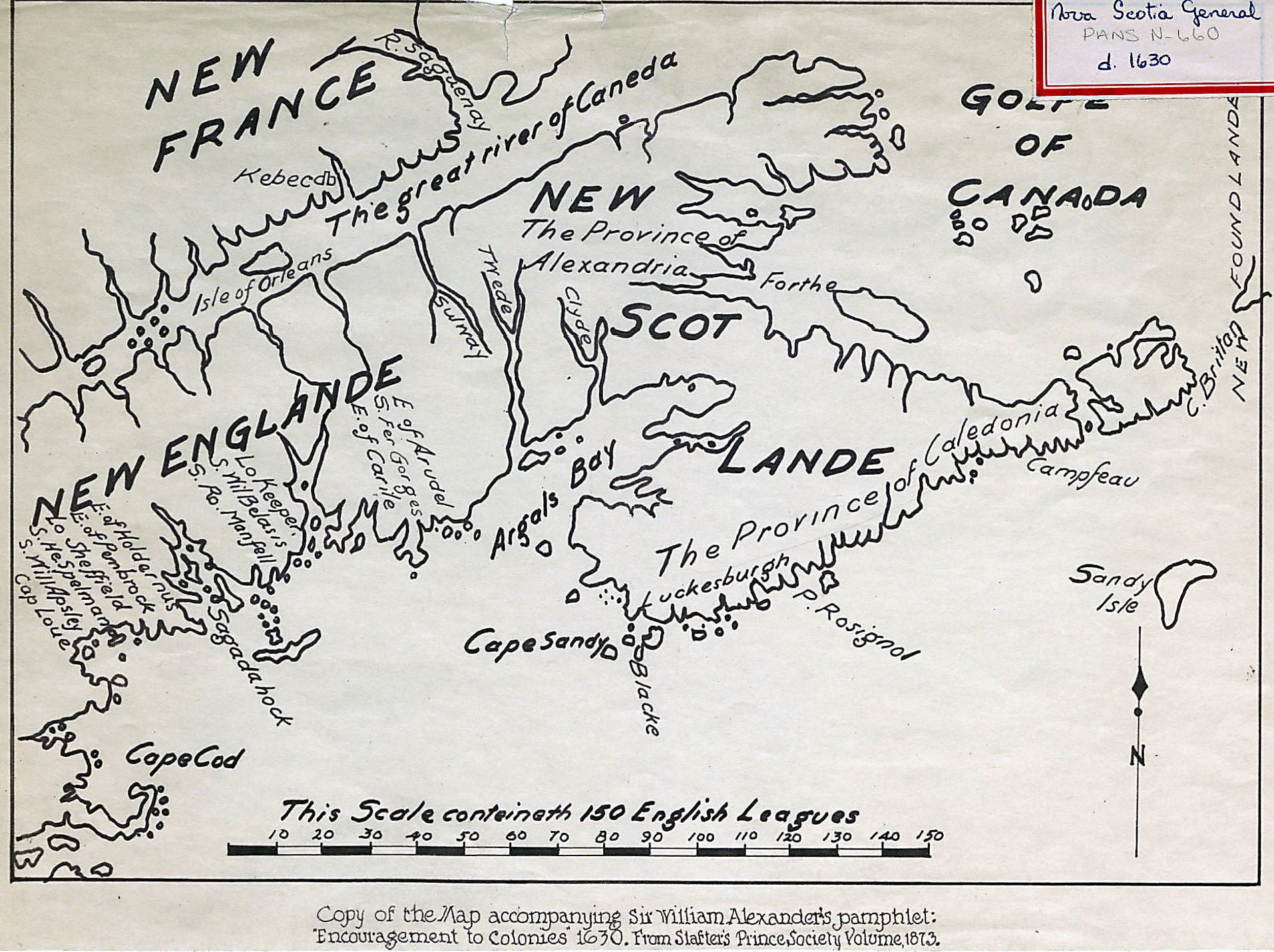
Argals Bay, now the Bay of Fundy, must be a reference to Samuel Argall. Interesting that “The province of Alexandria” as well as “The Province of Caledonia” seem to align with the general jurisdictions of New Brunswick and Nova Scotia today.
Other features include “Cape Brittan” as well as Canso (Campseau), “Blacke” at Nova Scotia’s southern tip, perhaps an earlier derivation and the source of “Cape Negro”, “Cape Sandy” appears to be Cape Sable Island, “Sandy Isle” being Sable Island, “P. Rosignol” perhaps is reference to Western Head, at the mouth of the Mersey River whose source is Lake Rosignol. “Luckesburgh” is also noted, in reference to what, I’m not sure.
See Also:
Copy of the map accompanying Sir William Alexander's pamphlet: "Encouragement to Colonies" 1630. https://archives.novascotia.ca/maps/archives/?ID=6