The Constitution of the Legislative Council of Nova Scotia

nova scotia constitution
Treatise on the Constitution of the Legislative Council of Nova Scotia

Nova Scotia’s governance evolved from a single governor to a structured system by 1719, with an advisory council. The pivotal year of 1758 saw a shift towards self-government, limiting the Crown’s direct legislative authority with the grant of an assembly. Despite the theoretical right of the Crown to appoint council members at pleasure, practical considerations led to a de facto life tenure by 1867. This framework persisted until Nova Scotia’s entry into the Dominion of Canada in 1867, with the lieutenant governor retaining the authority to suspend or dismiss individual council members, but unable to unilaterally alter the council’s constitution.

The Legislative Council, established in 1719, underwent reform in 1838, splitting into separate Executive and Legislative Councils. Over time, the Legislative Council became viewed as antiquated, especially after Confederation transferred significant concerns to the Dominion Parliament. While other provinces abolished their Legislative Councils relatively easily, Nova Scotia struggled for decades from 1879 to 1928. Premier William Stevens Fielding even petitioned the Queen and Westminster for abolition but was met with refusal.

However, in 1911, the passage of the imperial Parliament Act shattered the temporary ceasefire regarding the Legislative Council’s existence. Despite the lieutenant governor’s inability to unilaterally abolish the council, individual dismissals were used to effectively dismantle it. This action disrupted the constitutional machinery, demonstrating how the lieutenant governor’s power to suspend or dismiss council members could be strategically wielded to circumvent the council’s constitutional protections and achieve its abolition.


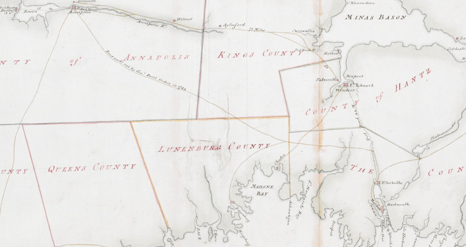
For a few years the government of Nova Scotia was vested solely in a governor, who had command of the garrison stationed at the fort of Annapolis, known as Port Royal in the days of the French regime. In 1719 a commission was issued to Governor Phillips, who was authorized to appoint a council of not less than twelve persons, all of whom held office during pleasure. The governor, in his instructions, was ordered neither to augment nor diminish the number of the said council, nor suspend any of the members thereof, without good and sufficient cause… This council had advisory and judicial functions, but its legislative authority was of a very limited scope.

Consequently the year 1758 is the commencement of a new epoch in the constitutional history of Nova Scotia. We find then from that time a civil government duly organized as in other English colonies of America, generally known as provincial governments. We find (1) a governor the head of the executive authority and a branch of the legislature, having a negative or affirmative voice in all legislation, appointed by the King and acting under the royal commission and instructions. (2) A council, appointed during the pleasure of the Crown, to act as an advisory body and also as an upper house of the legislature. (3) A house of assembly elected by the inhabitants of the province in accordance with law. As in all other colonies of the Crown of North America, these three branches, governor, council and assembly, passed such statutes and laws as were necessary for their internal regulation and were subject to the general control of the Queen-In-Council and the Parliament of Great Britain as the supreme executive and legislature of the whole British Empire.

Previous to 1758 the Sovereign-In-Council exercised all powers of government through the exercise of the royal prerogative, as in the case of all ceded or conquered countries. The constitution of Nova Scotia has always been considered previous to 1867 as derived from the terms of the royal commissions to the governors and lieutenant-governors, and from the instructions which accompanied the same, from imperial orders-in-council, from dispatches from the imperial secretary of state conveying the will and wishes of the imperial government, from acts of the imperial parliament immediately applicable to the colony, and from acts of the local legislature approved by the Crown, and “the whole to some extent interpreted by uniform usage and custom in the colony.

Previous to 1758 the governor and council, acting under royal instructions, were practically supreme in the exercise of powers of local government. From that day, however, Nova Scotia was vested with large powers of self-government. It is a fundamental principle that although a sovereign has the right to legislate for a conquered country by virtue of his royal prerogative, yet he ceases to have that power after he has authorized and directed the summoning of a representative legislative assembly. By granting an assembly to Nova Scotia in 1758, he precluded himself from legislating directly for the colony by virtue of his royal prerogative and irrevocably granted to the people the constitutional right of exercising all subordinate legislation over the province by an assembly with the consent of the governor and council. In this system of government the Crown continued to exercise large powers of control since it was represented by a governor having the right to negative all acts of the other two branches, and having in addition the appointment and supervision of the men constituting the upper house of the legislative power. With all its inherent defects which were to show themselves in the course of the ensuing eighty years, the change in the system of government, however, was very much in advance of the previous condition of things. From that time forward, there was an organized constitution solemnly granted by the Crown for legislative purposes. A governor, legislative council and an elected assembly represented collectively a complete legislature.

For nearly ninety years this system of government continued in force. Parliamentary government, in the modern sense of the term, never obtained, but the government of the country was virtually under the control of the council exercising executive, legislative and judicial powers. In the course of time a contest grew up between the irresponsible council and the people’s house for the management of all the public taxes and finances, for the separation of the executive and legislative functions of the council, and “for the responsibility of the members of government to the assembly.” As a remedy for existing grievances, an address to the Queen, passed by the house of assembly in 1837, prayed that “Her majesty should grant an elective legislative council,” or “should separate the executive from the legislative council;” provide “for a just representation of all the great interests of the province in both”; introduce the executive “some members of the popular branch,” and otherwise secure “responsibility to the Commons, and in that way confer upon the people of the province what they value above all other possessions, the blessings of the British constitution.”

Writing in 1829, Judge Haliburton observes: “By making the members of the council independent of the governor for their existence (for at present he has not only the power of nomination, but of suspension) and investing them with no other powers than those necessary to a branch of the legislature much weight would be added to the administration, on the confidence and extent of interest that it would thereby obtain, a much more perfect and political distribution of power would be given to the legislature, and the strange anomaly avoided of the same persons passing a law and then sitting in judgement on their own acts, and advising the governor to assent to it.”

In 1845 the legislative council of Nova Scotia passed an address to Her Majesty complaining of certain difficulties that had arisen since the remodeling of the council on account of gentlemen residing in the rural districts being unwilling to accept the position of legislative councillor “either from the want of a defined constitution or of a pecuniary provision for the expense of the attendance of the country members.”

All that they asked for was a “defined constitution.”

The colonial secretary of the day, Lord Stanley…assigned reasons why it was not possible to make pecuniary provision for the payment of the members, and then proceeded to discuss “the second proposal, that the tenure of office of a legislative councillor should be during his life, and not during His Majesty’s pleasure.” No such second proposal in exact words, it is well to note, was made in the address of the legislative council, as may be seen by reference to the preceding paragraph No. 17. All that they asked for was a “defined constitution.”

I have now reviewed the constitutional history of the legislative council of Nova Scotia, from its origin in the early part of the eighteenth century down to the first day of July, 1867, when, in accordance with the British North America Act of 1867, Nova Scotia became a province of the federal union known as the Dominion of Canada. This imperial act provides that the lieutenant governor shall be appointed by the governor general of the Dominion; that the constitution of the executive authority of Nova Scotia “shall, subject to the provisions of this act, continue as it exists at the union, until altered under the authority of this act;” that the constitution of the legislative council of Nova Scotia, shall, “subject to the provisions of this act, continue as it exists at the union until altered under the authority of this act.” In the ninety-second section, setting forth the subjects of exclusive provincial legislation, it is enacted that “in each province the legislature may exclusively make laws in relation to matters coming within the classes of subjects hereinafter enumerated;” and the first subject so enumerated is “the amendment from time to time, notwithstanding anything in this act, of the constitution of the province, except as regards the office of lieutenant governor” -the governor-general in council alone having the power to appoint, dismiss, and instruct that functionary as respects his relations with the Dominion government. In the exercise of this power of amendment, the legislature of Nova Scotia is supreme.

One thing is clear, that from 1719 to 1861 – from Governor Phillips until Governor-General Monck, whose commission and instructions held good until 1867 – the legislative councillors, as well as executive councillors, held office during pleasure of the Crown. But while this is no doubt the strictly legal and technical interpretation to be given to the commission and instructions, it is necessary to consider that the constitution of England and of all her dependencies is largely governed by conventions, understandings and usages which may not be law in an exact technical sense, but which, nevertheless, have the force of law in operation of the system we possess. In coming to any conclusion with respect to the tenure of office of legislative Councillor, these usages and understandings must have weight, and therefore, I shall endeavor to deduce the principles that seem well established.

From 1719 until 1867 there were three well defined periods in the constitutional history of the province.

  1. From 1719 until 1758, when the governor and council, with executive and legislative powers, alone carried on the government.
  2. From 1758 until 1838, when the government was in the hands of a governor, a council with legislative and executive functions, and assembly elected by the people.
  3. From 1838 until 1867, when the government was entrusted to a governor, an executive council, a legislative council, an assembly, and the province obtained the concession of responsible government.

Briefly summed up, the constitution of Nova Scotia in this particular was in 1867 as follows, in my opinion:

  1. The legislative council formed a nominated or upper house of a legislative body, the other branches of which were a lieutenant governor representing the Crown, and an assembly representing directly the people.
  2. The council formed part of a system of legislative and constitutional government sanctioned by the sovereign in 1758. This house had legislative functions co-ordinate with those of the assembly except as respects bills of revenue, expenditure, and taxation, which it could not initiate or amend though it might reject them.
  3. That in granting that constitution, and in conceding legislative rights to the people in 1758, the Sovereign gave up his rights to legislate directly by prerogative, and the Crown in parliament, as the supreme legislative authority of the Empire, could alone legislate for the province as for other dependencies of the Empire, in matters of imperial concern and necessity.
  4. That the rights of legislation conceded to Nova Scotia were given to three branches, and not to one alone, and that the legislative council as a whole had absolute rights and responsibilities as part of the legislative framework, and its place in that structure should not be disturbed by an arbitrary exercise of the royal prerogative. It is a question whether at any time after 1758 the Crown could constitutionally legislate it away as a whole body by the mere exercise of the royal prerogative, though it might increase and limit its membership and regulate the tenure of office, since a total abolition would seem to be an infringement of the constitution conceded to Canada in 1758. The crown in parliament could alone suspend or legislate away the constitution of the province, after the Crown had conceded the right of legislation and self-government by three branches, as was done in Lower Canada in 1838 and proposed by Lord Melbourne in the case of Jamaica in 1839.
  5. That while the Crown had not given up its theoretical right to appoint members of the council only during pleasure, it had be agreement and usage for many years previous to 1867 practically yielded its right, and conceded a tenure for life, subject to certain rules and conditions as set forth in the dispatch of 20th August, 1845.
  6. That consequently, in the opinion of the writer, the constitution of the council up to 1867 was unalterable except by the authority of the Crown in parliament, and its individual members were subject to certain conditions accompanying a tenure during good behavior for life.
  7. That since 1867 the constitution of the council remains as just set forth, subject to such amendments and alterations as have been made by the statutory authority vested by the British North America Act of 1867 in the legislature of the province.
  8. That the lieutenant governor of the province, as representing the Crown, may suspend or dismiss a legislative councillor, who falls within the conditions of the dispatch of August 20th, 1845, but he has no power to interfere with the constitution of the legislative council as a whole, or by the cancelling of the commissions and consequent dismissal of members, one by one, to abolish the body, as that would be as important a part in the operation of the constitutional machinery as any statutes, which give at once flexibility and stability to the framework and enable it to work as a rule with remarkable effectiveness, and which cannot be rudely touched and broken without doing undeniable injury to the whole fabric of government in the Dominion and its provinces.

Bourinot, John George. The constitution of the Legislative Council of Nova Scotia [S.l. : s.n., 1896?] https://archive.org/details/cihm_10453/page/141, https://www.canadiana.ca/view/oocihm.10453/14?r=0&s=1

History of the townships of Dartmouth, Preston and Lawrencetown, Halifax county, N.S.

“The annals of Dartmouth and its sister townships contain several tales of a by-gone era, whose recital has often brought tears to humble eyes and which may yet have a charm for a more general and critical audience.”

“Shortly after the settlement of Halifax, Major Gilman erected a saw-mill in Dartmouth Cove. It was doubtless situated on the stream which flows from the Dartmouth Lakes, but the exact site I have been unable to ascertain. The land laid out for the sawmili appears under the name of Ezekiel Gilman, on an old plan in the Department of Crown Lands, Halifax.

The boundary of the plot began on the above stream, at a spot close to the present Presbyterian Church, or about thirty chains from Collin’s Point, near the Chebucto Marine Railway. From thence it ran north 55° east, about sixty chains; thence north 35° west for about forty-two chains; thence south 55° west, for seventy-two and a half chains; thence south 35° east, for about fifty chains, or until it reached the stream before-mentioned. This embraced half of the First Lake, and land to the south eat and south-west of it. A plan of the Harbour of Chebucto and Town of Halifax, which appeared in The Gentleman’s Magazine for July, 1750 (page 295), shows three streams falling into Dartmouth Cove. The middle one of these is called ‘Saw Mill River’.

3streams gilmot

This name was probably intended to have been applied to the most northern of the three, and the transposition may have benn an error of the draughtsman. A building marked “Major Gilmot’s” (Gilman’s?) appears near the point named Warren’s Point on the plan, but since known as Collins’s Point. On Saturday, 30th September, O. S., 1749, six men, without arms, were cutting wood near Gilman’s mill. Theý Indians attacked them, killing four and carrying off one. The sixth man escaped. On 30th April, 1750, Cornwallis writes, that he never had one board from the saw-mill.

“It has been,” he says, “my constant plague from the beginting; thirty men have been constantly kept there ever since the affair of the Indians.” Between April and July, 1750, Gilman gave up the mill, and it was let to Capt. William Clapham. In June, 1752, the government mills at Dartmouth were sold at auction, for £310, to Major Ezekiel Gilman.

During the winter of 1749-50, the storeship Duke of Bedford and an armed sloop, were anchored in Dartmouth Cove, and the ice was broken around them every night in order to prevent the approach of the Indians. They were also within “Gun Shot of the Fort at the Sawmill.” (See MS. Minutes of Council, Sunday, 7th January, 1750).. According to Dr. Akins, the ships were under cover of a gun wbich was iounted on a point near the saw-mill. This, I suppose, was Collins’s Point.”

(Katzmann) Lawson, William Mrs. “History of the townships of Dartmouth, Preston and Lawrencetown, Halifax county, N.S. : (Akins historical prize essay)” Halifax, N.S. : Morton, 1893. https://www.canadiana.ca/view/oocihm.09015/3?r=0&s=1

Chronological Table of Dartmouth, Preston, and Lawrencetown

dartmouth township

Between 1746 and 1894, Dartmouth’s history unfolds with significant events including the arrival of settlers, establishment of saw-mills, and conflicts with the Mi’kmaq people. Dartmouth saw fluctuations in population, the building of churches and other infrastructure, and incorporation as a town in 1873. Economic activities like shipbuilding, ferry services, and the discovery of gold at Waverley mark periods of prosperity. However, tragedies such as fires, mysterious disappearances, and drowning incidents also punctuate Dartmouth’s timeline.

The town experienced advancements such as the introduction of steamboats, electricity, and the establishment of amenities like bathing houses and public reading rooms. Infrastructure projects like railway construction, water supply, and sewerage systems reflect efforts to modernize Dartmouth. Despite setbacks like bridge collapses and refinery closures, the town continued to evolve and grow, reaching a population of over 6,000 by 1891.


1746-1799

  • Duc d’Anville arrived at Chebucto, 10 Sept 1746
  • Halifax founded, 21 June 1749
  • [Mi’kmaq] attacked 6 men at Maj. Gilman’s saw-mill, Dartmouth Cove, killing 4, 30 Sept 1749
  • Saw-mill let to Capt. Wm. Clapham, 1750
  • Alderney arrived from Europe with 353 settlers, Aug. 1750
  • Town of Dartmouth laid out for the Alderney emigrants, Autumn 1750
  • Order issued relative to guard at Dartmouth, 31 Dec. 1750
  • Sergeant and 10 or 12 men ordered to mount guard during the nights at the Blockhouse, Dartmouth, 23 Feb. 1751
  • [Mi’kmaq] attacked Dartmouth, killing a number of the inhabitants, 13 May, 1751
  • German emigrants arrived at Halifax and were employed in picketing the back of Dartmouth, July 1751
  • Ferry established between Dartmouth and Halifax, John Connor, ferryman, 3 Feb. 1752
  • Mill at Dartmouth sold to Maj. Ezekiel Gilman, June 1752
  • Population of Dartmouth 193, or 53 families, July 1752
  • Advertisement ordered for the alteration of the style [Introduction of the Gregorian calendar], 31 Aug. 1752
  • Permission given Connor to assign ferry to Henry Wynne and William Manthorne, 22 Dec 1752
  • Township of Lawrencetown granted to 20 proprietors, 10 June 1754
  • Fort Clarence built, 1754
  • John Rock appointed ferryman in place of Wynne and Manthorne, 26 Jan. 1756
  • Troops withdrawn from Lawrencetown by order dated, 25 Aug, 1757
  • Dartmouth contained only 2 families, 9 Jan 1762
  • Phillip Westphal (afterwards Admiral), born, 1782
  • Preston Township granted to Theophilus Chamberlain and 163 others, chiefly loyalists, 15 Oct, 1784
  • Free [black people] arrived at Halifax and afterwards settled at Preston, Apr., 1785
  • George Augustus Westphal (afterwards Sir) born, 1785
  • Whalers from Nantucket arrived at Halifax, 1785
  • Town lots of Dartmouth escheated [See also] in order to grant them to the Nantucket whalers (Quakers), 2 Mar, 1786
  • Grant of land at Preston to T. Young and 34 others, 20 Dec. 1787
  • Common granted to inhabitants of Dartmouth [District, aka Township], 4 Sept. 1788 [Oct 2, 1758?] [–see also: “For regulating the Dartmouth Common, 1841 c52“]
  • First church at Preston consecrated (on “Church Hill”), 1791
  • Free [black people] departed for Sierra Leone, 15 Jan, 1792
  • Nantucket Whalers left Dartmouth, 1792
  • Francis Green built house (afterwards “Maroon Hall”) near Preston, 1792
  • Dartmouth, Preston, Lawrencetown and Cole Harbour erected into parish of St. John, Nov. 22, 1792
  • M. Danesville, governor of St. Pierre, arrived at Halifax (afterwards lived at “Brook House”), 20 June 1793
  • Act passed to build bridge of boats across the Harbour (1796, c7), 1796
  • Maroons arrived at Halifax (afterwards settled at Preston), 22 or 23 July, 1796
  • Subject of a canal between Minas Basin and Halifax Harbour brought before the legislature, 1797
  • Col. W.D. Quarrell returned to Jamaica, Spring 1797
  • Capt. A. Howe took charge of Maroons, Ochterloney having been removed, 1797
  • John Skerry began running ferry, about 1797
  • Howe removed and T. Chamberlain appointed to superintend Maroons, 9 July, 1798
  • Heavy storm did much damage, 25 Sept, 1798
  • Mary Russell killed by her lover, Thomas Bembridge, at her father’s house, Russell’s Lake, 27 Sept. 1798
  • Bembridge executed at Halifax, 18 Oct, 1798

1800-1849

  • Maroons left Halifax, Aug 1800
  • “Maroon Hall” sold to Samuel Hart, 8 Oct, 1801
  • Town of Dartmouth said to have contained only 19 dwellings, 1809
  • S. Hart died at “Maroon Hall” (property afterwards sold to John Prescott), 1810
  • United States prisoners of war on parole at Dartmouth, Preston, etc. About 1812-1814
  • Terrible gale, much damage to shipping 12 Nov 1813
  • Gov Danseville left “Brook House”, 1814
  • [Black people] arrived from Chesapeake Bay, 1 Sept 1814
  • Smallpox appeared in Dartmouth, Preston, etc., Autumn, 1814
  • Margaret Floyer died at “Brook House”, 9 Dec 1814
  • Act passed to incorporate Halifax Steamboat Co., 1815
  • Act passed allowing substitution of team-boats for steamboats by the company just mentioned, 1816
  • Team-boat Sherbrooke launched, 30 Sept, 1816
  • The team-boat made its first trip, 8 Nov., 1816
  • Foundation stone of Christ Church laid, 9 July, 1817
  • John Prescott died at “Maroon Hall” (property afterwards sold to Lieut. Katzmann), 1821
  • Ninety Chesapeake Bay [black people] sent to Trinidad, 1821
  • Dartmouth Fire Engine Co. established, 1822
  • Lyle’s and Chapel’s shipyards opened, About 1823
  • Act passed to authorize incorporation of a canal company, 1824
  • Theophilus Chamberlain died, 20 July, 1824
  • Joseph Findlay became lessee of Creighton’s ferry, About 1824
  • Shubenacadie Canal Co. incorporated by letters patent, 1 June, 1826
  • Ground first broken on canal, at Port Wallace, 25 July, 1826
  • Consecration of church at Preston which had been built to replace the one consecrated in 1791, 1828
  • Congregation of Church of St. James (Presbyterian) formed, Jan (?), 1829
  • St. Peter’s Chapel commenced at Dartmouth, 26 Oct. 1829
  • J. Findlay succeeded by Thos. Brewer at Creighton’s Ferry, About 1829-30
  • Sir C. Ogle launched (first steamboat on ferry), 1 Jan, 1830
  • Sixteen persons drowned by the upsetting of one of the small ferry boats, 14 Aug, 1831
  • Ferry steamboat Boxer launched, 1832
  • Brewer retired, and Creighton’s or the lower ferry ceased to exist, About 1832-33
  • A. Shiels started Ellenvale Carding Mill, July, 1834
  • Cholera in Halifax, Aug to Oct 1834
  • William Foster built an ice-house near the lakes, 1836
  • “Mount Amelia” built by Hon. J.W. Johnston, About, 1840
  • Death of Meagher children, Jane Elizabeth, and Margaret, in woods near Preston (bodies found 17 April), April 1842
  • Adam Laidlaw began ice-cutting on a large scale, 1843
  • Dartmouth Baptist Church organized, 29 Oct, 1843
  • Death of Lieut. C. C. Katzmann at “Maroon Hall”, 15 Dec, 1843
  • Ferry steamboat Micmac build, 1844
  • Dartmouth Baptist meeting-house opened, Sept, 1844
  • Cole Harbour Dyke Co. incorporated, 28 Mar., 1845
  • Incorporation of Richmond Bridge Co. (J.E. Starr, A.W. Godfrey, etc.) for purpose of erecting bridge of boards across Harbour, 14 April, 1845
  • Mechanics’ Institute building erected, 1845
  • Col. G. F. Thompson’s wife, said to have been a cousin of the Empress Eugenie, died under suspicious circumstances at “Lake Loon”, 20 Sept., 1846
  • First regatta on Dartmouth Lake, 5 Oct, 1846
  • Dr. MacDonald mysteriously disappeared, 30 Nov, 1846
  • Mechanic’s Institute building opened, 7 Dec, 1846
  • Second church at Preston (in the “Long swamp”) destroyed by fire, June (?), 1849

1850-1894

  • Third C. of E. church built at Preston, near Salmon River, About 1850-1851
  • Subenacadie Canal sold to government of N.S. (McNab, trustee), 1851-52
  • Inland Navigation Co. incorporated, 4 April, 1853
  • Methodist Church dedicated at Dartmouth, 1853
  • Canal purchased by Inland Navigation Co., 10 June, 1854
  • Mount Hope Insane Asylum cornerstone laid, 9 June, 1856
  • “Maroon Hall” burnt, June, 1856
  • Dartmouth Rifles and Engineers organized, Spring 1860
  • Checbucto Marine Railway Co. formed by A. Pillsbury, 1860
  • Gold discovered at Waverley, 1861
  • Lake and River Navigation Co. purchased Canal, 18 June, 1862
  • Dartmouth Rifles disbanded, 1 July, 1864
  • Dartmouth Axe and Ladder Co,. formed, 1865
  • Dartmouth Ropewalk began manufacturing, Spring, 1869
  • Ferry steamboat Chebucto built, About 1869
  • Prince Arthur’s Park Co. incorporated, 1870
  • New St. James’s Church (Presbyterian) built, 1870
  • Lewis P. Fairbanks purchased the canal from the Lake and River Navigation Co., Feb, 1870
  • Population of town of Dartmouth, 3,786, 1871
  • Dartmouth incorporated, 30 April, 1873
  • Union Protection Co. organized, 1876
  • Andrew Shiels, “Albyn”, died, 5 Nov, 1879
  • New Baptist Church opened, 4 Jan, 1880
  • Sandy Cove bathing houses opened at Dartmouth, 7 Aug, 1880
  • Foundation-stone of Woodside Refinery laid, 3 July, 1883
  • Railway to Dartmouth commenced, 1885
  • Railway opened for business, 6 Jan, 1886
  • Halifax and Dartmouth Steam Ferry Co. formed, in place of old company, 1886
  • Woodside Refinery closed, Dec, 1886
  • Ferry steamboat Dartmouth built, 1888
  • Public Reading-Room opened, 1 Jan, 1889
  • Dartmouth Ferry Commission formed, 17 April, 1890
  • Ferry Co. sells its property to the commission, 1 July, 1890
  • Several persons drowned on the arrival of the ferry-boat Annex 2 (Halifax), 11 July, 1890
  • New St. Peter’s Chapel begun, Autumn, 1890
  • Act passed to provide for supplying Dartmouth with water and sewerage, 19 May, 1891
  • Narrows railway bridge carried away, 7 Sept., 1891
  • Trenching and laying the main water pipe begun, 3 Oct., 1891
  • Woodside Refinery again opened, 1891
  • Population of town of Dartmouth, 6,252, 1891
  • St. Peter’s chapel opened, 7 Feb., 1892
  • Dartmouth first lighted by electricity, 13 July, 1892
  • Water turned on the town from Topsail and Lamont’s Lakes, 2 Nov, 1892
  • Narrows bridge destroyed for second time, 23 July, 1893
  • Woodside Refinery transferred to Acadia Sugar Refining Co., Aug, 1893
  • New Post Office opened, 1 May, 1894

Piers, Harry, 1870-1940. Chronological Table of Dartmouth, Preston, And Lawrencetown, County of Halifax, Nova Scotia. Halifax, N.S.: [s.n.], 1894. https://www.canadiana.ca/view/oocihm.12013/12?r=0&s=1, https://hdl.handle.net/2027/aeu.ark:/13960/t8pc3fx9z

Old Annapolis Road

old-annapolis-road2

After piecing together several Crown land grant maps, you can see the path of the Old Annapolis Road much more clearly. Open the image in a new tab, to see it in more detail.

Below you’ll find a few representations of the road as a contiguous route, as opposed to what is left recorded on the Crown Land Grant maps. (You can find find the individual Crown Land Grant maps here: https://novascotia.ca/natr/land/grantmap.asp)

One of the earliest road maps, from 1755, the Bay of Fundy still going by the name of Argal’s Bay. “A New map of Nova Scotia and Cape Britain”, https://gallica.bnf.fr/ark:/12148/btv1b53089581f

“Map of Nova Scotia, or Acadia, with the islands of Cape Breton and St. John’s, from actual surveys” https://gallica.bnf.fr/ark:/12148/btv1b53209890m

Previous to the construction of the more direct route to Annapolis, this map from 1776 shows a road (from Dartmouth, certainly an error, likely from Fort Sackville at the head of the harbor) to Annapolis. “A general Map of the northern British Colonies in America which comprehends the province of Quebec, the government of Newfoundland, Nova Scotia, New England and New-York” https://gallica.bnf.fr/ark:/12148/btv1b8443126p

One of the first representations of the Old Annapolis Road, “Road markt out by Gov. Parr’s orders in 1784”

nova scotia map Annapolis road

“A map of Nova Scotia showing the post roads”, 1787. https://collections.leventhalmap.org/search/commonwealth:hx11z4938

“A Map of the United States and Canada, New Scotland, New Brunswick and New Foundland”, 1806. https://gallica.bnf.fr/ark:/12148/btv1b53100560v

“Map of the Province of Nova Scotia Including Cape Breton, Prince Edwards Island and Part of New Brunswick”, 1819. https://nscc.cairnrepo.org/islandora/object/nscc%3A112, https://collections.leventhalmap.org/search/commonwealth:8049g892q

“Map of the Provinces Of New Brunswick, and Nova Scotia”, 1825. https://nscc.cairnrepo.org/islandora/object/nscc%3A715

annapolis road map 1827

“Map of the United States; and the Provinces of Upper & Lower Canada, New Brunswick, and Nova Scotia”, 1827: https://www.davidrumsey.com/luna/servlet/detail/RUMSEY~8~1~4239~340032:Map-of-the-United-States-

“The Provinces of Lower & Upper Canada, Nova Scotia, New Brunswick, Newfoundland & Prince Edward Island with a large section of the United States”, 1831. https://gallica.bnf.fr/ark:/12148/btv1b530987207

“Maps of the Society for the Diffusion of Useful Knowledge”, 1832: https://www.davidrumsey.com/luna/servlet/detail/RUMSEY~8~1~20966~530058:Nova-Scotia,-N-B-,-Lower-Canada

“North America : sheet I. Nova-Scotia with part of New Brunswick and Lower Canada”, 1832: https://digitalarchive.mcmaster.ca/islandora/object/macrepo%3A26988

“Nouvelle carte des Etats-Unis, du Haut et Bas-Canada : de la Nouv[el]le-Écosse, du Nouv[e]au-Brunswick, de Terre-Neuve”, 1832
https://gallica.bnf.fr/ark:/12148/btv1b530354369

“Map of the United States; and the Provinces of Upper & Lower Canada, New Brunswick, and Nova Scotia”, 1835: https://www.davidrumsey.com/luna/servlet/detail/RUMSEY~8~1~316476~90085094:Composite–Map-of-the-United-States

From: “The London atlas of universal geography”, 1837: https://www.davidrumsey.com/luna/servlet/detail/RUMSEY~8~1~33890~1170042:Lower-Canada

From: “British Possessions in North America, with part of the United States”, 1840: https://hdl.huntington.org/digital/collection/p15150coll4/id/9901

From: “Nelson’s new map of the British provinces in North America”, 1840–1849: https://collections.leventhalmap.org/search/commonwealth:0z709278h

From: “Lower Canada, New Brunswick, Nova Scotia, Prince Edwards Id. Newfoundland, and a large portion of the United States”, 1846. https://digitalarchive.mcmaster.ca/islandora/object/macrepo%3A31427

“Map of the provinces of Canada, New Brunswick, Nova Scotia, Newfoundland and Prince Edward Island”, 1846. https://digitalarchive.mcmaster.ca/islandora/object/macrepo%3A81413

“Lower Canada, New Brunswick, Nova Scotia, Prince Edwards Id. Newfoundland, and a large portion of the United States.”, 1853. https://hdl.huntington.org/digital/collection/p15150coll4/id/100

“Belcher’s map of the Province of Nova Scotia”, 1855: https://www.davidrumsey.com/luna/servlet/detail/RUMSEY~8~1~3016~290077:Belcher-s-map-of-the-Province-of-

“Map of the British Province of New Brunswick”, 1858: https://www.davidrumsey.com/luna/servlet/detail/RUMSEY~8~1~325278~90094243:Map-of-the-British-Province-of-New-

“The royal atlas of modern geography”, 1861: https://www.davidrumsey.com/luna/servlet/workspace/handleMediaPlayer?qvq=&trs=&mi=&lunaMediaId=RUMSEY~8~1~21338~620038

“Mackinlay’s map of the Province of Nova Scotia, including the island of Cape Breton”, 1862: https://www.davidrumsey.com/luna/servlet/detail/RUMSEY~8~1~2372~220044:Mackinlay-s-map-of-the-Province-of-

The portion of the Annapolis road that traverses Halifax County, as seen in the “Topographical township map of Halifax County” from A.F. Church and Co, 1864. https://collections.lib.uwm.edu/digital/collection/agdm/id/14722/rec/1

“Mackinlay’s map of the Province of Nova Scotia”, 1865: https://www.davidrumsey.com/luna/servlet/detail/RUMSEY~8~1~2374~220046:Mackinlay-s-map-of-the-Province-of-

“Colton’s… Nova Scotia”, 1865: https://www.davidrumsey.com/luna/servlet/detail/RUMSEY~8~1~208606~5003402:New-Brunswick,-Nova-Scotia–Prince-

“Colton’s Dominion of Canada”, 1869: https://www.davidrumsey.com/luna/servlet/detail/RUMSEY~8~1~208947~5003938:Dominion-of-Canada–Provinces-of-Ne

Annapolis Road seen here at Stoddards as it made its way through to what is now Dalhousie East. “Annapolis County part of A.F. Church Map”, 1876. https://archives.novascotia.ca/maps/archives/?ID=942

Annapolis Road pieced together from several pages of the “Atlas of the Maritime Provinces of the Dominion of Canada”, Roe Brothers, St. John, NB 1878. https://www.islandimagined.ca/roe_atlas

“Statistical & general map of Canada”, 1883: https://www.davidrumsey.com/luna/servlet/detail/RUMSEY~8~1~31463~1150419:Canada-1-

“Canada : the provinces of Quebec, Nova Scotia, New Brunswick, Prince Edward Island and Newfoundland”, 1886. https://digitalarchive.mcmaster.ca/islandora/object/macrepo%3A27057

“Mackinlay’s map of the Province of Nova Scotia”, 1890: https://www.davidrumsey.com/luna/servlet/detail/RUMSEY~8~1~3012~220131:Mackinlay-s-map-of-the-Province-of-

“Stanford’s London atlas of universal geography”, 1904: https://www.davidrumsey.com/luna/servlet/detail/RUMSEY~8~1~314730~90083550:Quebec,-New-Brunswick,-Nova-Scotia

“Dominion of Canada : E. Quebec, New Brunswick, Nova Scotia, Prince Edward Id. and Newfoundland”, 1910. https://collections.library.yale.edu/catalog/15827305

One of the last representations of the Old Annapolis Road:

Mackinlay’s map of the Province of Nova Scotia Compiled from Actual & Recent Surveys, 1912: https://nscc.cairnrepo.org/islandora/object/nscc%3A534

Fifteen years later, by 1927, the Old Annapolis Road disappears from the maps. Perhaps it wasn’t fit for automobile travel, though it’s hard not to notice the change (back?) to “Annapolis Royal” from “Annapolis” occurred at the same time.

From: “Rand McNally auto road atlas of the United States and Ontario, Quebec, and the Maritime Provinces of Canada”, 1927: https://www.davidrumsey.com/luna/servlet/detail/RUMSEY~8~1~33775~1171491:Maritime-Provinces-

Much of the road is now incorporated into other routes. It’s the #8 from Annapolis through Lequille, it’s the West Dalhousie Road through to Lake La Rose and from West Dalhousie to Albany Cross on to Stoddard’s where it once continued straight at what is now a turn (see above at 1876). It then crossed over the brook that empties into Upper Thirty Lake, from there it continued across another bridge, this time over the LaHave River to connect to what is now Camel Hill Road. The route proceeded to where it now meets Cherryfield Road and becomes Dalhousie Road, and on eastwards from there, through to Franey Corner and on to New Ross. At this point the route seems to have been reclaimed by the woods somewhat but it continued south and east near Sherwood, and then north of Canaan and Timber Lake, to the south of Panuke Lake (once called “Carrying Place”, see above at 1864) near Simms Settlement, through the country between Sandy and Rafter lake then terminating at Pockwock Road, north of Wrights Lake in Upper Hammonds Plains.

From: “Halifax & Dartmouth City & Maritimes map”, 1976. https://archives.novascotia.ca/maps/archives/?ID=948&Page=202012493

See also:

A new and accurate map of the English empire in North America

Body politic, Body corporate ⁠— City limits

dartmouth city limits

An examination of the legislated spatial dimensions of Dartmouth – from its initial definition as a township care of the Royal instructions that accompanied Cornwallis in 1749 to its dissolution in one of Nova Scotia’s city county mergers by fiat (aka a “municipal coup”) in 1996.

“And whereas for the better security, regulation and government of our said settlement, it will be necessary that such persons as we shall judge proper to send to our said province should be settled in townships; you are therefore hereby authorized and required to appoint such proper persons as you shall find there fully qualified to carry along with you forthwith to survey and mark out the said townships in such manner and at such places as is herein directed, that is to say, two townships containing 100,000 acres of land each be marked out at or near our harbor of Chebucto, as also one township of the like extent at each of the aforementioned places or such others as you shall judge most proper; and you are to take particular care in laying out such townships that they do include the best and most profitable land and also that they do include the best and most profitable rivers as may be at or near the said settlements and that the said townships do extend as far up into the country as conveniently may be, taking in a necessary part of the seacoast”.

769: Laying out townships in Nova Scotia (I). 1749-1752; (§§ 770, 766).
Labaree, Leonard Woods. “Royal Instructions To British Colonial Governors”, Volume II. New York, Octagon Books, 1967.
https://archive.org/details/royalinstruction028364mbp/page/n93/mode/2up

 “the Town and Suburbs of Dartmouth”

An Act for Establishing and Regulating a Militia, Law by Proclamation, by Command of his Excellency the Governor and his Majesty’s Council, May 10, 1753.

“That the Township of Dartmouth comprehend all the Lands lying on the East Side of the Harbour of Halifax and Bedford Basin, and extending and bounded Easterly by the Grant to the Proprietors of Lawrence-Town, and extending from the North-easterly Head of Bedford Basin into the Country, until One Hundred Thousand Acres be comprehended.”

Proclamation of His Excellency Charles Lawrence, with the Advice and Consent of His Majesty’s Council, January 3rd 1757. Journals of the Board of Trade and Plantations; Townships, Elections, 1757. Proclamation, Governor Charles Lawrence – official announcement and details about the election of representatives to the new General Assembly. The National Archives of the UK (TNA) . Colonial Office and Predecessors: Nova Scotia and Cape Breton Original Correspondence. CO 21/16 ff. 154

“the inhabitants of the town plot of Dartmouth…in said town…the district of Dartmouth”

Chapter 6 of the Acts of 1789, “An act to enable the Inhabitants of the Town Plot of Dartmouth to use and occupy the Common Field, granted them by his excellency the Lieutenant-Governor, in such way as they may think most beneficial to them”
http://0-nsleg–edeposit.gov.ns.ca.legcat.gov.ns.ca/deposit/Statutes/at_large/volume1/1789.pdf

“Common of the town of Dartmouth…the common of the township of Dartmouth; situate on the eastern side of the harbour of Halifax, in special trust, for the use of the inhabitants settled and resident in the town plot, or that might thereafter settle, and actually reside, within the township of Dartmouth… Within the township of Dartmouth”

Chapter 2 of the Acts of 1797, “An act to enable the Governor, Lieutenant Governor, or Commander in chief for the time being, to appoint Trustees, for the Common of the Town of Dartmouth, on the death, or removal, of the Trustees holding the same, and to vacate that part of the grant of the Common aforesaid, which vests trust in the heirs, executors or administrators, of the Trustees, named in the said grant, on the death of such Trustees”
http://0-nsleg–edeposit.gov.ns.ca.legcat.gov.ns.ca/deposit/Statutes/at_large/volume1/1797.pdf

“Town plot of Dartmouth… The said town… The town plot of Dartmouth, bounded on the North by the Common, on the South and West by the Halifax Harbour, and on the east by Mill Brook… Of the said towns respectively, within the said limits.”

Chapter 23 of the Acts of 1818, “An act to extend the provisions of c15 of 1761 relating to Trespasses, to the Town of Pictou and the Town Plot of Dartmouth”
https://0-nsleg–edeposit-gov-ns-ca.legcat.gov.ns.ca/deposit/Statutes/at_large/volume3/1818.pdf

“The town of Dartmouth”

Chapter 32 of the Acts of 1820-21 “To extend the Act for appointing Firewards to the Town of Dartmouth”
https://0-nsleg–edeposit-gov-ns-ca.legcat.gov.ns.ca/deposit/Statutes/at_large/volume3/1820-21.pdf

“the Town of Dartmouth… inhabitants of the said town… the jurisdiction, powers and authority, of the commissioners so to be appointed for the said Town of Dartmouth, shall be confined and restricted to the bounds and limits following, that is to say:⁠— to the direction or space of one Mile, measured in a southwardly, Easterly, and Northerly direction, from the Public Landing, or Steam Boat Company Wharf, in the said Town.”

Chapter 27 of the Acts of 1828 “To extend the Act relating to Commissioners of Highways to the Town of Dartmouth” https://0-nsleg–edeposit-gov-ns-ca.legcat.gov.ns.ca/deposit/Statutes/at_large/volume3/1828.pdf
A rough idea of what a 1 mile radius from the Ferry terminal wharf looks like.

“Inhabitants resident in the Town Plot of Dartmouth, at a meeting to be called for that purpose… Annual Meeting of the said Inhabitants”

Chapter 52 of the Acts of 1841, “An Act for regulating the Dartmouth Common” http://0-nsleg–edeposit.gov.ns.ca.legcat.gov.ns.ca/deposit/Statutes/1841.pdf

“the Town of Dartmouth, in the County of Halifax… the said Town of Dartmouth”

Chapter 48 of the Acts of 1843, “An Act to extend to the Town of Dartmouth the Act to amend the Act to regulate the Assize of Bread” http://0-nsleg–edeposit.gov.ns.ca.legcat.gov.ns.ca/deposit/Statutes/1843.pdf

“Whereas some uncertainty exists as regards the limits of the Township of Dartmouth… Be it therefore enacted by the Lieutenant Governor, Council and Assembly, that the lines of the Township of Dartmouth shall be established and settled as follows, beginning on the Eastern side of Bedford Basin at the head of Pace’s cove at low water mark, and thence to run north seventy four degrees east until it meets the main stream running Into Lake Major, thence southerly through the center of Lake Major and West Salmon River to the waters of Cole Harbor and thence Southwestwardly along the shore the several courses of the shore to Roaring Point, thence northerly following the course of the shore of the Main Land at low water mark to the place of beginning, so as not to include any Islands lying on or near said shore.

Chapter 17 of the Acts of 1846, “An Act to define and establish the Lines of the Township of Dartmouth”
https://0-nsleg–edeposit-gov-ns-ca.legcat.gov.ns.ca/deposit/Statutes/1846.pdf

“…the inhabitants of the said town of Dartmouth …within the space of one mile, measured in a southwardly, easterly and northerly direction from the public landing or Steamboat Company’s wharf in said town”

Chapter 29 of the Acts of 1847, “In relation to Assessment for a Fire Engine at Dartmouth”
https://0-nsleg–edeposit-gov-ns-ca.legcat.gov.ns.ca/deposit/Statutes/1847.pdf

For Dartmouth…one mile, measured in a southwardly, easterly and northerly direction from the public landing or Steamboat Company’s wharf in the said Town”

Chapter 46 of the Acts of 1847, “An act relating to Streets and Highways … in the Town of Dartmouth”
https://0-nsleg–edeposit-gov-ns-ca.legcat.gov.ns.ca/deposit/Statutes/1847.pdf

“After the first Annual Town Meeting in the Township of Dartmouth, Three Trustees of Public Property shall be chosen, in whom shall be vested the legal possession of the several Water Lots that have been reserved for the use of the Public along the shores of the Town Plot of Dartmouth, and of a certain Lot of Land and School House now known and distinguished as the School Lot, lying in the Town Plot, to be recovered, held and preserved by the Trustees for the uses to which the same respectively have been reserved and applied, but the School House and School Lot shall be preserved exclusively to the use of Schools and Education, and nothing herein shall excuse the possession and control of the Trustees to be appointed under the Act passed in the present Session for the support of Schools if the School House and Lot might otherwise come under control of such Trustees. Any other Public Property in the Township of Dartmouth not legally possessed by or under the charge and supervision of any person, shall also be legally vested in the Trustees appointed under this act… three trustees shall be annually thereafter appointed at each Annual Town Meeting of the Township… The Inhabitants, in Town Meeting, at any time may declare the purposes to which the Town Property shall be applied by the Trustees, provided those purposes shall not be inconsistent with the uses to which the property has been granted, reserved or legally appropriated… the next Annual Town Meeting of Dartmouth”

Chapter 53 of the Acts of 1850, “An Act Concerning Town Property in Dartmouth” http://0-nsleg–edeposit.gov.ns.ca.legcat.gov.ns.ca/deposit/Statutes/1850.pdf

“The rateable inhabitants residing within the town plot of the township of Dartmouth, in the county of Halifax, may assess themselves, at any public meeting… for the purpose of obtaining a good and sufficient plan of said town plot… the inhabitants of the said town plot… The Commissioner of Streets for the said township…”

Chapter 56 of the Acts of 1866, “To authorize an assessment on the inhabitants of the Town Plot of Dartmouth”
https://0-nsleg–edeposit-gov-ns-ca.legcat.gov.ns.ca/deposit/Statutes/1866.pdf

“The Trustees of the Dartmouth Common shall be a Body politic and corporate… the Commissioner of Streets for the Town of Dartmouth… A requisition signed by two thirds at least of the rate payers residing within the limits of the town plot of Dartmouth… Which town plot shall be construed to embrace an area within a distance of one mile measured in a southwardly, easterly and northerly direction from the public landing or Steamboat Company’s wharf in said town”

Chapter 31 of the Acts of 1868, “To amend the several Acts relating to the Dartmouth Common”
https://0-nsleg–edeposit-gov-ns-ca.legcat.gov.ns.ca/deposit/Statutes/1868.pdf

‘A municipality shall be erected within the County of Halifax, to be bounded as follows, that is to say: Beginning on the eastern side of the Harbor of Halifax, at a point in such Harbor distant three hundred feet Westerly from the South Western corner of a lot of land formerly owned by Judge Johnston and by him conveyed to John Esdaile; thence to run Eastwardly till it strikes the road leading to the property of the late John Esson; thence by the Southern side of such road and following the course thereof Eastwardly to such Esson property; thence along the Western boundary of such property, Southwardly to the South-Western corner thereof; thence Eastwardly to Gaston’s Road, and crossing such road to a point at right angles with the extension of a new road laid out by J.W. Watt through manor Hill Farm; thence Northwardly to such road and by such road for the length thereof; thence Northwardly to the causeway at Hurley’s on the First Lake; thence Northwardly to the North East boundary of Stair’s Ropewalk property; thence Westwardly to a point three hundred feet into the Harbor of Halifax; and thence Southwardly to then place of beginning; to be called and known as “The Town of Dartmouth”‘.

Chapter 17 of the Acts of 1873, “An Act to Incorporate the Town of Dartmouth” https://0-nsleg–edeposit-gov-ns-ca.legcat.gov.ns.ca/deposit/Statutes/1873.pdf

The inhabitants of the town of Dartmouth are constituted and declared to be a body corporate and politic by the name of the Town of Dartmouth. They shall as a corporation have perpetual succession and a Common Seal, changeable at pleasure, and shall be capable of suing and being sued in all Courts of Justice, and of acquiring, holding and conveying any description of property, real, personal or mixed, and shall have all the other rights usually had and enjoyed by corporations.

The Town of Dartmouth shall be bounded as follows:⁠—

Beginning on the eastern side of the Harbor of Halifax, at a point in such Harbor distant three hundred feet Westerly from the South Western corner of a lot of land formerly owned by Judge Johnston and by him conveyed to John Esdaile; thence to run Eastwardly till it strikes the road leading to the property of the late John Esson; thence by centre of such road and following the course thereof Eastwardly to such Esson property; thence along the Western boundary of such property, Southwardly to the South-Western corner thereof; thence Eastwardly to Gaston’s Road, and crossing such road to a point at right angles with the extension of a new road laid out by J.W. Watt through manor Hill Farm; thence Northwardly to such road and by such road for the length thereof; thence Northwardly to the western extremity of the causeway at Hurley’s on the First Lake; thence Northwestardly through Taylor’s barn on the opposite side of the lake until it strikes the Southern side line of the road which connects with the new road laid out by G. A. S Chichton, thence following the southern line of said road until it reaches the main road leading from Dartmouth to Bedford; and from thence crossing said road in a straight line following the said line of the said new road until it extends three hundred feet into the harbor of Halifax, and thence Southwardly to the place of beginning to be called and known as “The Town of Dartmouth”.

Chapter 40 of the Acts of 1877, “An Act to amend the Act entitled, “An Act to Incorporate the Town of Dartmouth” https://0-nsleg–edeposit-gov-ns-ca.legcat.gov.ns.ca/deposit/Statutes/1873.pdf

“The inhabitants of the town of Dartmouth are constituted and declared to be a body corporate and politic by the name of the Town of Dartmouth, and the boundaries of the town of Dartmouth, the division of the same into wards, and the boundaries of the several wards thereof, shall continue as at the passing of this Act.”

Chapter 86 of the acts of 1886, “An Act to Amend the Acts relating to the Town of Dartmouth”

[Included is a copy of the 1886 Statues from archive.org, since the copy supplied by the Government of Nova Scotia is missing page 253, which just so happens to be paragraph 1-3 of this Act to Amend the Acts relating to the Town of Dartmouth, which contains the above quoted passage, along with an explicit mention of male or female ratepayers, residents and nonresidents as qualified to vote.]

https://archive.org/embed/statutesnovasco01scotgoog
http://0-nsleg–edeposit.gov.ns.ca.legcat.gov.ns.ca/deposit/Statutes/1886.pdf

‘The body so constituted shall be a body corporate, under the name of “The Dartmouth Ferry Commission…”‘

Chapter 83 of the Acts of 1890, “An Act to provide for the establishment and operation of a Public Ferry between Dartmouth and Halifax”
https://0-nsleg–edeposit-gov-ns-ca.legcat.gov.ns.ca/deposit/Statutes/1890.pdf

“The Dartmouth Ferry Commission shall continue to be a body politic and corporate, as constituted under chapter 83 of the Acts of 1890 and amending Acts.”

Chapter 37 of the Acts of 1894, “An Act to Consolidate the Acts relating to the establishment and operation of a Public Ferry between Dartmouth and Halifax”, https://0-nsleg–edeposit-gov-ns-ca.legcat.gov.ns.ca/deposit/Statutes/1894.pdf

“The assessors shall also insert on the roll the names of all yearly tenants in occupation of real property assessed.”

Chapter 65 of the Acts of 1901, “Act to amend Chapter 50 of the Acts 1897, amending Towns’ Incorporation Act so far as relates to Dartmouth”
https://0-nsleg–edeposit-gov-ns-ca.legcat.gov.ns.ca/deposit/Statutes/1901.pdf

The town of Dartmouth is bounded as follows:

Beginning at a point in the harbor of Halifax distant three hundred feet westerly from the southwestern corner of a lot of land formerly owned by the late Judge Johnstone, and by him conveyed to John Esdaile; thence eastwardly to the road leading to the property of the late John Esson; thence by the centre of such road and following the course thereof eastwardly to such Esson property; thence along the Western boundary of such property southwardly to the southwestern corner thereof; thence eastwardly to the eastern side of Gaston’s Road; thence in a straight line to the point of intersection of the eastern side line of a new road laid out by J. W. Watt through Manor Hill farm, and the northern side line of Cole Harbor Road; thence northwardly by the said new road for the length thereof; thence northwardly to the western extremity of the causeway at Hurley’s on the first lake; thence northwestwardly through Taylor’s born on the opposite side of the lake until it strikes the southern line of the road which connects with the new road laid out by G. A. S. Chrichton; thence following the southern side of said road until it reaches the main road leading from Dartmouth to Bedford, and from thence crossing said road in a straight line following the said line of the said new road until it extends three hundred feet into the harbor of Halifax; thence southwardly in a line parallel to the shore of the harbor, and distant three hundred feet therefrom to the place of beginning. (1873, c. 17, s. 1; 1877, c. 40; 1897, c. 50, s. 3)

Chapter 56 of the Acts of 1902, “An Act to Consolidate the Acts Relating to the Town of Dartmouth
https://0-nsleg–edeposit-gov-ns-ca.legcat.gov.ns.ca/deposit/Statutes/1902.pdf

The Town of Dartmouth is bounded as follows:

Beginning at the point of intersection of ordinary high water mark on the eastern shore of Halifax Harbor with the prolongation south-westerly of the centre line of a stone wall defining the south-eastern boundary of a lot of land formerly owned by the late Judge Johnstone and by him conveyed to John Esdaile; thence north-easterly along said prolongation and the centre line of said stone wall 1084 feet to a monument on the eastern line of Pleasant Street; thence 52 degrees 22 minutes right, 880.9 feet to a monument; thence 38 degrees 24 minutes left, 826.8 feet to a monument on the south western boundary of the Esson farm; thence 76 degrees 48 minutes right along the southwestern boundary of said Esson Farm 1097.5 feet to a monument; thence 89 degrees 49 minutes left 1799 feet to a monument on the southeastern boundary of the Dartmouth Rod and Gun club; thence 86 degrees 50 minutes left along the rear line of properties situated on the southern side of Gaston Road, and crossing Gaston Road 1322.4 feet to a monument in rear of Atwood’s house on Gaston Road; thence 10 degrees 22 minutes right crossing Cole Harbor Road and along the eastern side of Watt Street 2411.2 feet to a monument on the southern line of Maynard Street; thence 11 degrees 7 minutes right crossing Oat Hill Lake, 2628 feet to a monument on the southwestern corner of the causeway on the Preston or Lake Road near Robert Carter’s; thence 13 degrees 32 minutes left, crossing Banook Lake 4757 feet to a monument on the southwestern corner of Crichton Avenue and Albro Lake Road; thence 10 degrees 19 minutes left along the southwestern side of Albro Lake Road 1085.8 feet to a monument; thence 88 degrees 25 minutes left along the south-eastern side of Albro Lake Road 2061.6 feet to a monument; thence 42 degrees 40 minutes right along the southern side of Albro Lake Road 400 feet to a monument; thence 19 degrees along the south side of Albro Lake Road 841 feet to a monument; thence 26 degrees 27 minutes left along the southeastern side of Albro Lake Road 1328.5 feet to a monument on the eastern line of Wyse Road at the point of intersection with the prolongation easterly of the northern side of the stone wall on the southern side of Albro Lake Road; thence 19 degrees 50 minutes right along the northern side of the stone wall on the southern side of Albro Lake Road 877.9 feet to a monument on the eastern side of Windmill Road; thence 6 degrees 30 minutes left, 1030 feet more or less to ordinary high water mark; thence in a general southerly direction along the shore of Halifax Harbor, as defined by ordinary high water mark, to the place of beginning, together will all water grants, docks, quays, slips and erections connected with the shores of the town which shall be deemed to be included in the boundaries and form part of the town.

Chapter 97 of the Acts of 1925, “An Act Relating to the Town of Dartmouth”
https://0-nsleg–edeposit-gov-ns-ca.legcat.gov.ns.ca/deposit/Statutes/1925.pdf

The Town of Dartmouth is bounded as follows:

Beginning at the point of intersection of ordinary high water mark on the eastern shore of Halifax Harbor with the prolongation south-westerly of the centre line of a stone wall defining the south-eastern boundary of a lot of land formerly owned by the late Judge Johnstone and by him conveyed to John Esdaile;

Thence north-easterly along said prolongation and the centre line of said stone wall 1084 feet to a monument on the eastern line of Pleasant Street;

Thence southerly along the eastern line of Pleasant Street to the northern line of Johnstone avenue and northern line of Esson Road to the south western boundary of the “Esson farm”;

Thence southeasterly along the southwestern boundary of the “Esson Farm” 100 feet (one hundred) more or less to a monument;

Thence continuing southeasterly along the southwestern boundary of the “Esson Farm” 1097.5 feet to a monument;

Thence 89 degrees 49 minutes left 1799 feet to a monument on the southeastern boundary of the Dartmouth Rod and Gun club;

Thence 86 degrees fifty minutes left along the rear line of properties situated on the southern side of Gaston Road, and crossing Gaston Road 1322.4 feet to a monument in rear of Atwood’s house on Gaston Road;

Thence 10 degrees 22 minutes right crossing Cole Harbor Road and along the eastern side of Watt Street 2411.2 feet to a monument on the southern line of Maynard Street;

Thence 11 degrees 7 minutes right crossing Oat Hill Lake, 2628 feet to a monument on the southwestern corner of the causeway on the Preston or Lake Road near Robert Carter’s;

Thence 13 degrees 32 minutes left, crossing Banook Lake 4757 feet to a monument on the southwestern corner of Crichton Avenue and Albro Lake Road;

Thence 10 degrees 19 minutes left along the southwestern side of Albro Lake Road 1085.8 feet to a monument;

Thence 88 degrees 25 minutes left along the south-eastern side of Albro Lake Road 2061.6 feet to a monument;

Thence 42 degrees 40 minutes right along the southern side of Albro Lake Road 400 feet to a monument;

Thence 19 degrees along the south side of Albro Lake Road 841 feet to a monument;

Thence 26 degrees 27 minutes left along the southeastern side of Albro Lake Road 2700 feet to a monument;

Thence 3 degrees 43 minutes right along the southern side of Albro Lake Road 1328.5 feet to a monument on the eastern line of Wyse Road at the point of intersection with the prolongation easterly of the northern side of the stone wall on the southern side of Albro Lake Road;

Thence 19 degrees 50 minutes right along the northern side of the stone wall on the southern side of Albro Lake Road 877.9 feet to a monument on the eastern side of Windmill Road;

thence 6 degrees 30 minutes left, 1030 feet more or less to ordinary high water mark;

thence in a general southerly direction along the shore of Halifax Harbor, as defined by ordinary high water mark, to the place of beginning, together will all water grants, docks, quays, slips and erections connected with the shores of the town which shall be deemed to be included in the boundaries and form part of the town.

Chapter 60 of the Acts of 1938, “An Act Relating to the Town of Dartmouth”
https://0-nsleg–edeposit-gov-ns-ca.legcat.gov.ns.ca/deposit/Statutes/1938.pdf

The Town of Dartmouth shall continue to be a body corporate under the name “City of Dartmouth” .

The boundaries of the City are as follows:-

Beginning at a point defined by the intersection of the centre line of Wright Brook (at its mouth) with the shoreline of Wright Cove on the north-eastern shore of Bedford Basin;

Thence generally north-easterly along the centre line of Wright Brook to its intersection with the north-western boundary of the Canadian National Railways Right-of-way;

Thence generally north-easterly along the north-western boundary of the said Canadian National Railways Right-of-way to its first intersection with the centre line of McGregor Brook;

Thence generally south-easterly crossing the Canadian National Railways Right-of-way and along the centre line of McGregor Brook to its origin approximately at grid point 52.4 by east 54.7 (Department of Mines and Surveys Map, Bedford Basin, Scale 1 to 25,000) which aforesaid water course flows generally south-easterly into Lake Charles;

Thence generally south-easterly along the centre line of aforesaid Water Course to its mouth on the western shore oof Lake Charles;

Thence easterly along a straight line to the general centre of Lake Charles easterly from the mouth of the aforesaid water course;

Thence northerly along the general centre line of Lake Charles to the northern shore of Lake Charles at its junction with the centre line of the mouth of the northerly water course leading from Lake Charles to Lake William;

Thence generally northerly along the centre line of the aforesaid water course to its intersection with the southern boundary of the Nova Scotia Light and Power Company limited transmission line right-of-way;

Thence easterly along the aforesaid water course to its intersection with the southern boundary of the Nova Scotia Light and Power Company Limited transmission line right-of-way;

Thence easterly along the aforesaid southern boundary of the Nova Scotia Light and Power Company Limited transmission line right-of-way to a point on said southern boundary, which point is at the intersection of this boundary with straight line measured 1,000 feet at right angles from the north-eastern boundary of No. 18 Highway;

Thence generally south-easterly along a line parallel to and distant 1,000 feet easterly from the north-eastern boundary of No. 18 Highway to the centre line of Mitchell Brook;

Thence generally south-easterly along the centre line of said Mitchell Brook to its junction with the shore line of Loon Lake;

Thence south-easterly along the general centre line of Loon Lake to a point northerly from the centre line of the mouth of Cranberry Lake Brook at its mouth on the shore of Loon Lake;

Thence southerly to the centre line of the mouth of said Cranberry Lake Brook at the shore of Loon Lake;

Thence generally south easterly along the centre line of said Cranberry Lake Brook to its junction with the shore line of Cranberry Lake;

Thence south easterly along the general centre line of Cranberry Lake to its southern tip;

Thence south-westerly along a straight line to the northern tip of Settle Lake;

Thence southerly along the general centre line of Settle Lake to its southern shore at tis junction with the centre line of the water course flowing out of the southern tip of Settle Lake;

Thence south-easterly along the centre line of said water course to its intersection with the centre line of the Cole Harbour Road;

Thence south-westerly along a straight line to the north-western tip of Morris Lake;

Thence south-easterly along the general centre line of Morris Lake to a point north easterly from the intersection of the north western boundary of the Department of National Defense property (R.C.N.A.S., H.M.C.S. Shearwater) with the western shore of Morris Lake;

Thence south-westerly along a straight line to the said point of intersection;

Thence south-westerly by the several courses of the aforesaid north-western boundary to the shore of Eastern Passage in Halifax Harbour;

Thence south-westerly across the waters of Eastern Passage of Halifax Harbour to a point 2,000 feet off the general shoreline of the north-eastern shoreline of Halifax Harbour;

Thence north-westerly along a straight line to a point 2,000 feet south-westerly from the most south-western point of lands of the Imperial Oil Refinery property; Thence north-westerly along a straight line to a point on the westerly prolongation of the centre line of Lyle Street 1,300 feet from the intersection of said prolongation with the shoreline of Halifax Harbour;

Thence north-westerly along a straight line to the most northern point of the line marking the headline of Halifax Harbour as laid down on a plan entitled “Plan of the Port of Halifax, Nova Scotia – National Harbours Board, 1931”, said point being on the eastern boundary line of the City of Halifax;

Thence north 60° 44′ west (astronomical bearing) following said eastern boundary line a distance of 6,950 feet to the most northerly angle of the City of Halifax boundary;

Thence northerly along a straight line to a point 1,000 feet due north-west from the most north-western point of Navy Island;

Thence along a straight line in a north-easterly direction to the center of the mouth of the small cove into which Wright Brook empties;

Thence north easterly along the general center line of said cove to the centre line of Wright Brook at its mouth, or to the place of beginning.

Chapter 64 of the Acts of 1961, “The City of Dartmouth Act”
https://0-nsleg–edeposit-gov-ns-ca.legcat.gov.ns.ca/deposit/Statutes/1961.pdf

“The City of Dartmouth shall continue, subject to change in accordance with the provisions thereof to be a body corporate…”

Chapter 67 of the Acts of 1962, “Dartmouth City Charter”
https://0-nsleg–edeposit-gov-ns-ca.legcat.gov.ns.ca/deposit/Statutes/1962-2.pdf

“…all persons of the full age of twenty-one years; whose names appear upon the last revised list of electors; whose names do not appear upon the last revised list of electors but who are Canadian citizens or British subjects and who have continuously resided in the City or in an area annexed to the City since the first day of May immediately preceding the date of election and who continue to reside therein on the date of election and who take the oath or affirmation in Form 14 of the schedule”

Chapter 86 of the Acts of 1966, “An Act to amend Chapter 67 of the Acts of 1962, the Dartmouth City Charter”
https://0-nsleg–edeposit-gov-ns-ca.legcat.gov.ns.ca/deposit/Statutes/1966.pdf

“the City of Dartmouth shall continue… to be a body corporate…”

Chapter 43A of the Acts of 1978, “Dartmouth City Charter”
https://0-nsleg–edeposit-gov-ns-ca.legcat.gov.ns.ca/deposit/Statutes/1978.pdf

And then: by fiat, without a plebiscite, without any measure of support from the body politic as composed of the citizens of any of the municipalities involved:

“On and after April 1, 1996, the inhabitants of the County of Halifax are a body corporate under the name “Halifax Regional Municipality”

“Chapter 3 of the Acts of 1995, An Act to Incorporate the Halifax Regional Municipality”
http://0-nsleg–edeposit-gov-ns-ca.legcat.gov.ns.ca/deposit/Statutes/1995.pdf

The Development of Public Health in Nova Scotia

Throughout the history of Nova Scotia, epidemics and infectious diseases have been recurring challenges, shaping legislation and public health measures. From as early as Champlain’s account of scurvy in 1606 to the smallpox outbreaks in the 18th and 19th centuries, diseases like smallpox, cholera, and typhus have had significant impacts on the region’s population.

Similarities can be drawn between past responses to epidemics and the modern approach to managing COVID-19. Social distancing measures, such as quarantine and isolation, were enforced through legislation dating back to the 18th century. Centralized decision-making, often led by governmental bodies or health officials, played a crucial role in implementing and enforcing these measures. For instance, laws were passed to regulate the entry of infected vessels into ports, mandate quarantine procedures, and appoint health officers to oversee public health initiatives.

Over time, legislation evolved to address specific diseases and public health challenges. Measures included the establishment of quarantine stations, vaccination programs, and the creation of boards of health to oversee public health initiatives at the local and provincial levels.


“Disaster is frequently the parent of legislation. In surveying the long history of Nova Scotia, we find this saying particularly true.”

“The first recorded instance of illness in Nova Scotia is the account of Champlain of an outbreak of scurvy at Port Royal in 1606. His group of settlers had spent the winter of 1605 at St. Croix Island, where, of a group of seventy-nine, forty-four died of scurvy. In Port Royal in the following year twelve of forty-five died.”

“Of all the epidemics, that of smallpox carried with it the greatest destruction and terror. In 1694 an epidemic was present among the [Mi’kmaq] of Acadia, but we have no knowledge of the number dying as a result. We may be sure it was large, however…”

“There was again an outbreak in Acadia in 1709 where there is evidence to suggest that the disease was of the hemorrhagic type. It was present in Louisburg in 1749. In October of the same year, a few months after the founding of Halifax, it broke out in this settlement. It was particularly destructive in type and during the autumn and winter months about one thousand persons died.”

“In 1801 we find it again in Nova Scotia and there is definite evidence that it was present the previous year. The total number of deaths in 1800 was one hundred and eighty-two, of which one hundred and thirty-eight contracted the disease in the ordinary manner and fourty-four by direct inoculation. In the epidemic of 1801, there were over 8,500 cases in and about Halifax of which accounts are scanty.

The early records indicate that a large number of persons were immunized by inoculation. Vaccination with cowpox was first used in Nova Scotia in the early spring of 1802 by Dr. Joseph Norman Bond of Yarmouth, Nova Scotia.”

“A terrible epidemic, that was in all probability typhus, prevented a successful French invasion in the summer of 1746. A fleet of seventy sailing vessels, having on board 3,150 disciplined troops under the command of the Duc D’Anville, was sent from France to join a force of 1,700 French troops in Nova Scotia. The expedition was to first take Annapolis Royal and then Boston, proceeding thereafter to the West Indies. The fleet arrived in Halifax Harbor, or as it was then known, Chebucto Harbor, ninety days after leaving France. During the voyage, 1,270 men had died and the remainder were ill. The Canadian force had, in the meantime, grown tired of waiting and had retraced its steps to Quebec. After landing the troops an additional number, probably about 1,200, died. The [Mi’kmaq] who approached the camp on the shore of Bedford Basin contracted the disease and in the months following, it is estimated that at least one third of the whole [Mi’kmaq] tribe in the province died.”

“On September 7, 1827, the brig “Fame” arrived in Halifax with 130 persons on board ill with typhus. Smallpox was prevalent in the city at the same time. There was a great loss of life from the two diseases. A large number of deaths were amongst the poor. Some 800 persons of the 11,000 inhabitants died. From Halifax the disease spread to other parts of the province. The first mention of cholera in Nova Scotia is in 1834. It continued for two or three months, particularly in Halifax and about twenty persons died daily.”

“In 1854 a severe epidemic of cholera broke out in Saint John, New Brunswick. It fortunately did not reach Halifax, but its proximity brought such anxiety to the minds of the legislators of that day that as a direct result a City Hospital was built. This afterwards became in turn the City and Provincial Hospital, and the Victoria General Hospital.”

“A ship arrived at Halifax with cholera on board in 1866. Dr. Slater of Halifax, one of those who went on board to care for the victims, died as a result of the disease. It does not appear that an outbreak followed. In 1871 the steamship “Franklyn” came to Halifax with cholera on board. The disease was carried ashore to Chezzetcook, on the coast east of Halifax, where two deaths occurred. So far as is known this was the extent of its spread.”

“Since 1749 various outbreaks of the infectious fevers, particularly scarlet fever and diphtheria, have occurred throughout the province. Diphtheria was particularly fatal amongst children. As these diseases were almost endemic, the public grew used to them and they did not strike the same terror into the populace as those brought by ships. It was the old story of an evil that became tolerated and as a result, public records contain little reference to the ordinary infectious diseases.”

“As previously mentioned, legislation, often temporary, was enacted from time to time following the appearance of epidemic diseases. While there is little doubt that the medical profession from time to time played a part, a great deal Of credit must be given the official bodies of Government for their efforts to meet the recurring dangers.

A perusal of the Uniacke Edition of the Statutes (1758 to 1804) of Nova Scotia, reveals that in the year 1761 an Act was passed which provided that vessels entering the port of Halifax with an infected person or infected persons on board, must anchor at least two miles from town, having an ensign with the Union down at her mast head; no persons were to land and the master was to give notice to the Governor and conform to his orders. Before infected persons were landed, the master was required to give security to pay attending charges; masters violating this Act were to forfeit 100 pounds, to be recovered in a court of record. In other towns one or more of the nearest justices were charged with the responsibility of preventing persons landing from or going on board infected vessels and of transmitting intelligence to the Governor for instructions.

In 1775 authority was given to two justices and the overseers of the poor to make provision for the care of persons coming from infected places and of local persons infected. If such persons were unable to pay the incidental expenses, the town of residence was made liable; if strangers, the charge was to be recovered from the Provincial Treasury.

Provision was made for “inoculating” such persons as desired it against smallpox in houses 160 rods from any dwelling. During the period of resulting illness they were not allowed to go farther than 80 rods from the inoculation houses and flags were to be flown on the premises in order that others might avoid the places.

In 1779 reference is made to the neighboring States of America having been, for several years, visited by yellow fever or “Putrid Fever” or other “Infectious Distempers” and as a consequence, the desirability of requiring persons coming from infected places to “perform” quarantine in such manner as may be ordered by the Governor, Lieutenant Governor or Commander in Chief for the time being and “for punishing offenders in a more expeditious manner than can be done by the ordinary course of law”. The Governor, Lieutenant Governor or Commander in Chief was given authority and was obliged to appoint during pleasure, health officers in all counties and districts of the province ; such officers, duly sworn, were to be paid out of the provincial treasury a reasonable sum for services rendered upon presentation of the accounts to the General Assembly. The 1799 legislation was quite drastic and gave wide powers to the Governor, Lieutenant Governor or Commander in Chief and health officers, to compel quarantine, to punish offenders, to use force if necessary, and to burn or purify goods, wearing apparel, beds, etc. It was provided that “two justices, with the overseers of the poor, where authorized by Governor’s proclamation and after consulting skillful persons, might make provision for treating persons, storing and airing goods on vessels, for removing persons and goods to houses, tents or lazarets appointed for the purpose”. “Skillful persons” as defined in the Act, meant “one or more physicians, surgeons, apothecaries or other skillful persons living in or near the place.” Persons refusing to conform were liable to imprisonment for 6 months or a fine of 50 pounds. “Persons concealing from health officers or emerging letters or goods from a vessel, shall be guilty of a felony, without benefit of clergy”. “Governor’s orders respecting quarantine to be published by proclamation and read the first Sunday in every month in places of public worship.”

In 1809 legislation was enacted which obliged persons within the “town” of Halifax, to keep gutters and streets before their houses, buildings or lots, clear of dirt, filth and nuisances of all kinds. A fine of 20 shillings was imposed on anyone permitting such nuisances and the expenses incurred in removing them.

On the 14th day of April, 1832, two important pieces of public health legislation were placed upon the Statute books of the province. Both appear to demonstrate how apprehensive the authorities of that time were respecting the spread of communicable diseases and particularly their desire to prevent the entry of these from without. By their introduction all previous legislation on the same subject was repealed. One was termed “An Act to prevent the spreading of contagious diseases and for the performance of quarantine” and the other “An Act more effectually to provide against the introduction of infectious or contagious diseases and the spreading thereof in the province”.

The first Act provided for quarantine at definite anchorage points of all vessels coming from ports declared to be infected by the Governor-in-Council. Plague, smallpox, yellow fever, typhus and cholera morbus were mentioned. Power was given the chief officers of the crown to make orders dealing with any health emergency which might arise. Masters of infected vessels were required to report their state and to hoist signals when meeting other vessels, or when within two leagues of land; the day signal—”a large yellow flag of six breadths of bunting at the main top mast head”, and the night large signal lantern, with a light therein at the same mast head”. Penalties up to 200 pounds could be imposed for disobedience or refractory behavior. Provision was made for appointing health officers, superintendents of quarantine and assistants at the several ports, by the Governor.

In the second Act reference is made to a highly dangerous disease called “Cholera” or “Spasmodia” or “Indian Cholera”, which had prevailed on the continent of Europe and in Great Britain. Power was given the Governor to appoint, when expedient, at the several ports of the province, not only health officers, but boards of health for “carrying out and enforcing regulations made by the Governor-in-Council and generally to preserve the public health.” Sweeping powers were given the chief officers of the Crown to make regulations in emergencies.

All ships entering port were required to anchor at quarantine and remain there until boarded by a health officer and given a permit, which permit had to be shown the customs officer. Fees for the health officer’s services in this particular were collected from the masters by the customs officers and paid to the health officers; such fees were fixed by the Governor-in-Council.

This Act also gave the Governor power to appoint “Health Wardens” in Halifax and Justices of the Peace authority to appoint such wardens in any county or district of the province, the wardens to act gratuitously and to be sworn to the due performance of their duties. Wardens were required to examine in day time, as often as they deemed necessary, all houses, buildings, lots, stores, wharves, yards, enclosures and other places and all vessels and boats lying at any place in the province and to ascertain and report to the Governor, or such other persons as might be appointed to receive such reports, “the state and condition of all such buildings, places and vessels in regard to any substances, articles or animals there or therein being, or any trade or business, matter or thing there or therein used, followed or transacted, whereby or by means whereof any nuisance might be occasioned or the public health might be endangered or affected”. The wardens were given power to order the removal of all nuisances and to order any premises “lime washed”, disinfected or “purified”. Penalties of 5 to 100 pounds could be imposed for any infringement of the act.

The two Acts just referred to were to be in force for one year. From this time on and for many years both Acts were, at each session of the legislature. continued for another year.

Chapter 71 of the Acts of 1833 made provision for the destroying. by any constable, of dogs by whose bite the disease “Canine Madness” might be occasioned. Two Justices of the Peace were empowered to make and put into execution such rules and regulations as they thought proper to prevent dogs or other animals, by whose bite the disease “Canine Madness” might be caused, going at large and to destroy them if necessary.

In the year 1850 authority was vested in general sessions of the Peace, or special sessions, consisting of not less than seven magistrates on requisition of the Board of Health, or whenever they considered such measures necessary to prevent the spread of smallpox, to order a general vaccination of persons in a county or district, or any portion thereof ; persons unable to pay to be vaccinated at the expense of the county or district concerned.

On April 8, 1852, a statute was passed empowering the Governor-in-Council to select a site and erect a building for a lunatic asylum.

On the 28th day of March, 1861, legislative enactment was given for the incorporation of the Medical Society of Nova Scotia. In the act of incorporation, the following were named : Rufus S, Black, James C. Hume, Edward Jennings, Daniel McNeil Parker and William B. Webster.

In the year 1862 legal provision was made for the appointment of a medical officer for the City of Halifax by the Board of Health of the City. This medical officer was not to interfere with the health officer for the port of Halifax, appointed by the Provincial Government. The city medical officer was to be under the control and subject to the orders of the Board of Health. He was given power to remove from dwellings in the city, or from boats at wharves within the city, persons having infectious diseases. If the sick persons should not, in his opinion be taken out, then the other occupants could, by him, be removed. He was also authorized to call in consultants; such consultants to be paid out of city funds. In the following year (1863) it was enacted that hereafter the mayor and aldermen of the City of Halifax should constitute the Board of Health of the city and any Acts previously passed and inconsistent with this ruling were thereby repealed.

Three years later (1866) provision was made for the establishment of a quarantine station at the port of Halifax. That Act empowered the Governor to expend $30,000.00 for the purchase of a site and the erection of a hospital, the City of Halifax having agreed to bear one-third of the expenses of the site and the building. Persons within the city having infectious diseases were to be eligible for treatment in and subject to removal to this station. All vessels over 100 tons burden entering the port were made liable to a fee of one cent per ton towards the expenses of maintaining such quarantine station and hospital. Mail steamers were required to pay this fee once a year. Vessels sent into quarantine with infectious diseases were held responsible for all expenses on account of crew or passengers aboard suffering from such diseases.

On the 7th day of May, 1866, an Act to provide against the introduction of diseases amongst horses and cattle was passed. The Governor-in-Council was given the power to make regulations respecting the introduction of such diseases in horses, cattle, sheep and swine and for the destruction of the animals should these diseases be introduced.

In the same year the mayor and all aldermen in the City of Halifax were made “Health Wardens” with power to expend money in sums found necessary to cleanse, purify and keep clean all sewers, drains, yards and places, or to carry into effect all sanitary orders of the Board of Health or health wardens in the interests of the public health.

Legislative authority in the year 1875 more clearly defined the duties of the city medical officer and the office of surgeon to the city prison was abolished. The following duties were imposed upon the city medical officer:

  • 1. “To perform services heretofore performed by the City Medical Offcer and prison surgeon”.
  • 2. “Act as medical advisor to the Board of Health, the City Council and the Health Inspectors,”
  • 3. ‘Visit City Policemen and other city offcials absent from duty on the plea of ill health and report to proper authority”.
  • 4. “To attend policemen, firemen or other city officials gratuitously, also persons brought to the police station”.
  • 5. “Vaccinate free of charge such persons as the Board of Health may determine”.
  • 6. ‘Visit and report upon cases of contagious disease brought to his notice”.
  • 7. “Generally to perform all such duties as may be reasonably required or prescribed by the Board of Health or City Council”.

In 1832 a Central Board of Health was established for the province. The President was the Honourable Henry H. Cogswell. Vice-Presidents were Doctors Allan and Johnston. Members were the Attorney-General; the Solicitor- General James Foreman, Esq., Doctors Shoreland, Hume, Sterling and Gregor and William Cogswell, Esq. The last named was the Secretary of the Board. This Central Board was given power to make and enforce regulations, to prevent spread of disease and to regulate the observance of quarantine. At the same time, local Boards were established in various places throughout the province, each having the same authority as the Central Board and each required to report its proceedings to the Central authority. At this time, Boards were named at Digby, Arichat, Lunenburg, Liverpool, Yarmouth, Windsor and Annapolis. There was some indication also that County Boards for Pictou, Hants, Kings, Cumberland and Antigonish were established.

A quarantine hospital was opened in Halifax and Dr. James C. Hume was appointed Health Officer with a “salary of twenty pounds a month while employed, with reasonable allowances for expenses.”

In 1851 all previous legislation relating to public health was consolidated. The Central Board apparently ceased to exist about this time and enforcements of quarantine and the administration of public health were vested in the Governor-in-Council, who had authority to “make quarantine orders applicable to vessels, goods, persons and things being within the province or expected hither from abroad ; to make sanitary orders to cover any special conditions that might arise; to appoint persons at the several ports of the province to act as health officers therefor; to establish at any place a Board of Health for carrying such sanitary orders into effect ; and to prescribe the duties of health officers and Boards of Health”. Health inspectors were to be appointed at general or special court sessions and in Halifax and other parts of the province health wardens were appointed.

The legislation of 1851 remained almost without change until 1873. At this time, some change was made with reference to executive officials and the requirements added that a yellow flag should be displayed on the premises where small-pox or “malignant cholera” prevailed. After 1884 the appointment of health wardens was made by the municipal councils instead of by the courts. In 1893 a Central Board of Health was established as a central organization.”

CAMPBELL, P. S., and H. L. SCAMMELL. “The Development of Public Health in Nova Scotia.” Canadian Public Health Journal, vol. 30, no. 5, 1939, pp. 226–238. JSTOR, www.jstor.org/stable/41977931. Accessed 27 Jan. 2021. https://www.jstor.org/stable/41977931?seq=1

Page 3 of 9
1 2 3 4 5 6 9