Chronological Table of Dartmouth, Preston, and Lawrencetown

dartmouth township

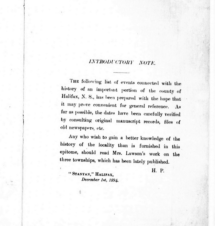
Between 1746 and 1894, Dartmouth’s history unfolds with significant events including the arrival of settlers, establishment of saw-mills, and conflicts with the Mi’kmaq people. Dartmouth saw fluctuations in population, the building of churches and other infrastructure, and incorporation as a town in 1873. Economic activities like shipbuilding, ferry services, and the discovery of gold at Waverley mark periods of prosperity. However, tragedies such as fires, mysterious disappearances, and drowning incidents also punctuate Dartmouth’s timeline.

The town experienced advancements such as the introduction of steamboats, electricity, and the establishment of amenities like bathing houses and public reading rooms. Infrastructure projects like railway construction, water supply, and sewerage systems reflect efforts to modernize Dartmouth. Despite setbacks like bridge collapses and refinery closures, the town continued to evolve and grow, reaching a population of over 6,000 by 1891.


1746-1799

  • Duc d’Anville arrived at Chebucto, 10 Sept 1746
  • Halifax founded, 21 June 1749
  • [Mi’kmaq] attacked 6 men at Maj. Gilman’s saw-mill, Dartmouth Cove, killing 4, 30 Sept 1749
  • Saw-mill let to Capt. Wm. Clapham, 1750
  • Alderney arrived from Europe with 353 settlers, Aug. 1750
  • Town of Dartmouth laid out for the Alderney emigrants, Autumn 1750
  • Order issued relative to guard at Dartmouth, 31 Dec. 1750
  • Sergeant and 10 or 12 men ordered to mount guard during the nights at the Blockhouse, Dartmouth, 23 Feb. 1751
  • [Mi’kmaq] attacked Dartmouth, killing a number of the inhabitants, 13 May, 1751
  • German emigrants arrived at Halifax and were employed in picketing the back of Dartmouth, July 1751
  • Ferry established between Dartmouth and Halifax, John Connor, ferryman, 3 Feb. 1752
  • Mill at Dartmouth sold to Maj. Ezekiel Gilman, June 1752
  • Population of Dartmouth 193, or 53 families, July 1752
  • Advertisement ordered for the alteration of the style [Introduction of the Gregorian calendar], 31 Aug. 1752
  • Permission given Connor to assign ferry to Henry Wynne and William Manthorne, 22 Dec 1752
  • Township of Lawrencetown granted to 20 proprietors, 10 June 1754
  • Fort Clarence built, 1754
  • John Rock appointed ferryman in place of Wynne and Manthorne, 26 Jan. 1756
  • Troops withdrawn from Lawrencetown by order dated, 25 Aug, 1757
  • Dartmouth contained only 2 families, 9 Jan 1762
  • Phillip Westphal (afterwards Admiral), born, 1782
  • Preston Township granted to Theophilus Chamberlain and 163 others, chiefly loyalists, 15 Oct, 1784
  • Free [black people] arrived at Halifax and afterwards settled at Preston, Apr., 1785
  • George Augustus Westphal (afterwards Sir) born, 1785
  • Whalers from Nantucket arrived at Halifax, 1785
  • Town lots of Dartmouth escheated [See also] in order to grant them to the Nantucket whalers (Quakers), 2 Mar, 1786
  • Grant of land at Preston to T. Young and 34 others, 20 Dec. 1787
  • Common granted to inhabitants of Dartmouth [District, aka Township], 4 Sept. 1788 [Oct 2, 1758?] [–see also: “For regulating the Dartmouth Common, 1841 c52“]
  • First church at Preston consecrated (on “Church Hill”), 1791
  • Free [black people] departed for Sierra Leone, 15 Jan, 1792
  • Nantucket Whalers left Dartmouth, 1792
  • Francis Green built house (afterwards “Maroon Hall”) near Preston, 1792
  • Dartmouth, Preston, Lawrencetown and Cole Harbour erected into parish of St. John, Nov. 22, 1792
  • M. Danesville, governor of St. Pierre, arrived at Halifax (afterwards lived at “Brook House”), 20 June 1793
  • Act passed to build bridge of boats across the Harbour (1796, c7), 1796
  • Maroons arrived at Halifax (afterwards settled at Preston), 22 or 23 July, 1796
  • Subject of a canal between Minas Basin and Halifax Harbour brought before the legislature, 1797
  • Col. W.D. Quarrell returned to Jamaica, Spring 1797
  • Capt. A. Howe took charge of Maroons, Ochterloney having been removed, 1797
  • John Skerry began running ferry, about 1797
  • Howe removed and T. Chamberlain appointed to superintend Maroons, 9 July, 1798
  • Heavy storm did much damage, 25 Sept, 1798
  • Mary Russell killed by her lover, Thomas Bembridge, at her father’s house, Russell’s Lake, 27 Sept. 1798
  • Bembridge executed at Halifax, 18 Oct, 1798

1800-1849

  • Maroons left Halifax, Aug 1800
  • “Maroon Hall” sold to Samuel Hart, 8 Oct, 1801
  • Town of Dartmouth said to have contained only 19 dwellings, 1809
  • S. Hart died at “Maroon Hall” (property afterwards sold to John Prescott), 1810
  • United States prisoners of war on parole at Dartmouth, Preston, etc. About 1812-1814
  • Terrible gale, much damage to shipping 12 Nov 1813
  • Gov Danseville left “Brook House”, 1814
  • [Black people] arrived from Chesapeake Bay, 1 Sept 1814
  • Smallpox appeared in Dartmouth, Preston, etc., Autumn, 1814
  • Margaret Floyer died at “Brook House”, 9 Dec 1814
  • Act passed to incorporate Halifax Steamboat Co., 1815
  • Act passed allowing substitution of team-boats for steamboats by the company just mentioned, 1816
  • Team-boat Sherbrooke launched, 30 Sept, 1816
  • The team-boat made its first trip, 8 Nov., 1816
  • Foundation stone of Christ Church laid, 9 July, 1817
  • John Prescott died at “Maroon Hall” (property afterwards sold to Lieut. Katzmann), 1821
  • Ninety Chesapeake Bay [black people] sent to Trinidad, 1821
  • Dartmouth Fire Engine Co. established, 1822
  • Lyle’s and Chapel’s shipyards opened, About 1823
  • Act passed to authorize incorporation of a canal company, 1824
  • Theophilus Chamberlain died, 20 July, 1824
  • Joseph Findlay became lessee of Creighton’s ferry, About 1824
  • Shubenacadie Canal Co. incorporated by letters patent, 1 June, 1826
  • Ground first broken on canal, at Port Wallace, 25 July, 1826
  • Consecration of church at Preston which had been built to replace the one consecrated in 1791, 1828
  • Congregation of Church of St. James (Presbyterian) formed, Jan (?), 1829
  • St. Peter’s Chapel commenced at Dartmouth, 26 Oct. 1829
  • J. Findlay succeeded by Thos. Brewer at Creighton’s Ferry, About 1829-30
  • Sir C. Ogle launched (first steamboat on ferry), 1 Jan, 1830
  • Sixteen persons drowned by the upsetting of one of the small ferry boats, 14 Aug, 1831
  • Ferry steamboat Boxer launched, 1832
  • Brewer retired, and Creighton’s or the lower ferry ceased to exist, About 1832-33
  • A. Shiels started Ellenvale Carding Mill, July, 1834
  • Cholera in Halifax, Aug to Oct 1834
  • William Foster built an ice-house near the lakes, 1836
  • “Mount Amelia” built by Hon. J.W. Johnston, About, 1840
  • Death of Meagher children, Jane Elizabeth, and Margaret, in woods near Preston (bodies found 17 April), April 1842
  • Adam Laidlaw began ice-cutting on a large scale, 1843
  • Dartmouth Baptist Church organized, 29 Oct, 1843
  • Death of Lieut. C. C. Katzmann at “Maroon Hall”, 15 Dec, 1843
  • Ferry steamboat Micmac build, 1844
  • Dartmouth Baptist meeting-house opened, Sept, 1844
  • Cole Harbour Dyke Co. incorporated, 28 Mar., 1845
  • Incorporation of Richmond Bridge Co. (J.E. Starr, A.W. Godfrey, etc.) for purpose of erecting bridge of boards across Harbour, 14 April, 1845
  • Mechanics’ Institute building erected, 1845
  • Col. G. F. Thompson’s wife, said to have been a cousin of the Empress Eugenie, died under suspicious circumstances at “Lake Loon”, 20 Sept., 1846
  • First regatta on Dartmouth Lake, 5 Oct, 1846
  • Dr. MacDonald mysteriously disappeared, 30 Nov, 1846
  • Mechanic’s Institute building opened, 7 Dec, 1846
  • Second church at Preston (in the “Long swamp”) destroyed by fire, June (?), 1849

1850-1894

  • Third C. of E. church built at Preston, near Salmon River, About 1850-1851
  • Subenacadie Canal sold to government of N.S. (McNab, trustee), 1851-52
  • Inland Navigation Co. incorporated, 4 April, 1853
  • Methodist Church dedicated at Dartmouth, 1853
  • Canal purchased by Inland Navigation Co., 10 June, 1854
  • Mount Hope Insane Asylum cornerstone laid, 9 June, 1856
  • “Maroon Hall” burnt, June, 1856
  • Dartmouth Rifles and Engineers organized, Spring 1860
  • Checbucto Marine Railway Co. formed by A. Pillsbury, 1860
  • Gold discovered at Waverley, 1861
  • Lake and River Navigation Co. purchased Canal, 18 June, 1862
  • Dartmouth Rifles disbanded, 1 July, 1864
  • Dartmouth Axe and Ladder Co,. formed, 1865
  • Dartmouth Ropewalk began manufacturing, Spring, 1869
  • Ferry steamboat Chebucto built, About 1869
  • Prince Arthur’s Park Co. incorporated, 1870
  • New St. James’s Church (Presbyterian) built, 1870
  • Lewis P. Fairbanks purchased the canal from the Lake and River Navigation Co., Feb, 1870
  • Population of town of Dartmouth, 3,786, 1871
  • Dartmouth incorporated, 30 April, 1873
  • Union Protection Co. organized, 1876
  • Andrew Shiels, “Albyn”, died, 5 Nov, 1879
  • New Baptist Church opened, 4 Jan, 1880
  • Sandy Cove bathing houses opened at Dartmouth, 7 Aug, 1880
  • Foundation-stone of Woodside Refinery laid, 3 July, 1883
  • Railway to Dartmouth commenced, 1885
  • Railway opened for business, 6 Jan, 1886
  • Halifax and Dartmouth Steam Ferry Co. formed, in place of old company, 1886
  • Woodside Refinery closed, Dec, 1886
  • Ferry steamboat Dartmouth built, 1888
  • Public Reading-Room opened, 1 Jan, 1889
  • Dartmouth Ferry Commission formed, 17 April, 1890
  • Ferry Co. sells its property to the commission, 1 July, 1890
  • Several persons drowned on the arrival of the ferry-boat Annex 2 (Halifax), 11 July, 1890
  • New St. Peter’s Chapel begun, Autumn, 1890
  • Act passed to provide for supplying Dartmouth with water and sewerage, 19 May, 1891
  • Narrows railway bridge carried away, 7 Sept., 1891
  • Trenching and laying the main water pipe begun, 3 Oct., 1891
  • Woodside Refinery again opened, 1891
  • Population of town of Dartmouth, 6,252, 1891
  • St. Peter’s chapel opened, 7 Feb., 1892
  • Dartmouth first lighted by electricity, 13 July, 1892
  • Water turned on the town from Topsail and Lamont’s Lakes, 2 Nov, 1892
  • Narrows bridge destroyed for second time, 23 July, 1893
  • Woodside Refinery transferred to Acadia Sugar Refining Co., Aug, 1893
  • New Post Office opened, 1 May, 1894

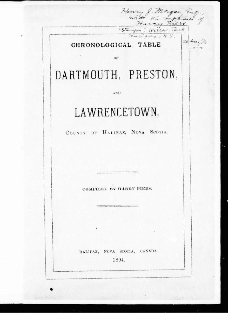
Piers, Harry, 1870-1940. Chronological Table of Dartmouth, Preston, And Lawrencetown, County of Halifax, Nova Scotia. Halifax, N.S.: [s.n.], 1894. https://www.canadiana.ca/view/oocihm.12013/12?r=0&s=1, https://hdl.handle.net/2027/aeu.ark:/13960/t8pc3fx9z

Old Annapolis Road

old-annapolis-road2

After piecing together several Crown land grant maps, you can see the path of the Old Annapolis Road much more clearly. Open the image in a new tab, to see it in more detail.

Below you’ll find a few representations of the road as a contiguous route, as opposed to what is left recorded on the Crown Land Grant maps. (You can find find the individual Crown Land Grant maps here: https://novascotia.ca/natr/land/grantmap.asp)

One of the earliest road maps, from 1755, the Bay of Fundy still going by the name of Argal’s Bay. “A New map of Nova Scotia and Cape Britain”, https://gallica.bnf.fr/ark:/12148/btv1b53089581f

“Map of Nova Scotia, or Acadia, with the islands of Cape Breton and St. John’s, from actual surveys” https://gallica.bnf.fr/ark:/12148/btv1b53209890m

Previous to the construction of the more direct route to Annapolis, this map from 1776 shows a road (from Dartmouth, certainly an error, likely from Fort Sackville at the head of the harbor) to Annapolis. “A general Map of the northern British Colonies in America which comprehends the province of Quebec, the government of Newfoundland, Nova Scotia, New England and New-York” https://gallica.bnf.fr/ark:/12148/btv1b8443126p

One of the first representations of the Old Annapolis Road, “Road markt out by Gov. Parr’s orders in 1784”

nova scotia map Annapolis road

“A map of Nova Scotia showing the post roads”, 1787. https://collections.leventhalmap.org/search/commonwealth:hx11z4938

“A Map of the United States and Canada, New Scotland, New Brunswick and New Foundland”, 1806. https://gallica.bnf.fr/ark:/12148/btv1b53100560v

“Map of the Province of Nova Scotia Including Cape Breton, Prince Edwards Island and Part of New Brunswick”, 1819. https://nscc.cairnrepo.org/islandora/object/nscc%3A112, https://collections.leventhalmap.org/search/commonwealth:8049g892q

“Map of the Provinces Of New Brunswick, and Nova Scotia”, 1825. https://nscc.cairnrepo.org/islandora/object/nscc%3A715

annapolis road map 1827

“Map of the United States; and the Provinces of Upper & Lower Canada, New Brunswick, and Nova Scotia”, 1827: https://www.davidrumsey.com/luna/servlet/detail/RUMSEY~8~1~4239~340032:Map-of-the-United-States-

“The Provinces of Lower & Upper Canada, Nova Scotia, New Brunswick, Newfoundland & Prince Edward Island with a large section of the United States”, 1831. https://gallica.bnf.fr/ark:/12148/btv1b530987207

“Maps of the Society for the Diffusion of Useful Knowledge”, 1832: https://www.davidrumsey.com/luna/servlet/detail/RUMSEY~8~1~20966~530058:Nova-Scotia,-N-B-,-Lower-Canada

“North America : sheet I. Nova-Scotia with part of New Brunswick and Lower Canada”, 1832: https://digitalarchive.mcmaster.ca/islandora/object/macrepo%3A26988

“Nouvelle carte des Etats-Unis, du Haut et Bas-Canada : de la Nouv[el]le-Écosse, du Nouv[e]au-Brunswick, de Terre-Neuve”, 1832
https://gallica.bnf.fr/ark:/12148/btv1b530354369

“Map of the United States; and the Provinces of Upper & Lower Canada, New Brunswick, and Nova Scotia”, 1835: https://www.davidrumsey.com/luna/servlet/detail/RUMSEY~8~1~316476~90085094:Composite–Map-of-the-United-States

From: “The London atlas of universal geography”, 1837: https://www.davidrumsey.com/luna/servlet/detail/RUMSEY~8~1~33890~1170042:Lower-Canada

From: “British Possessions in North America, with part of the United States”, 1840: https://hdl.huntington.org/digital/collection/p15150coll4/id/9901

From: “Nelson’s new map of the British provinces in North America”, 1840–1849: https://collections.leventhalmap.org/search/commonwealth:0z709278h

From: “Lower Canada, New Brunswick, Nova Scotia, Prince Edwards Id. Newfoundland, and a large portion of the United States”, 1846. https://digitalarchive.mcmaster.ca/islandora/object/macrepo%3A31427

“Map of the provinces of Canada, New Brunswick, Nova Scotia, Newfoundland and Prince Edward Island”, 1846. https://digitalarchive.mcmaster.ca/islandora/object/macrepo%3A81413

“Lower Canada, New Brunswick, Nova Scotia, Prince Edwards Id. Newfoundland, and a large portion of the United States.”, 1853. https://hdl.huntington.org/digital/collection/p15150coll4/id/100

“Belcher’s map of the Province of Nova Scotia”, 1855: https://www.davidrumsey.com/luna/servlet/detail/RUMSEY~8~1~3016~290077:Belcher-s-map-of-the-Province-of-

“Map of the British Province of New Brunswick”, 1858: https://www.davidrumsey.com/luna/servlet/detail/RUMSEY~8~1~325278~90094243:Map-of-the-British-Province-of-New-

“The royal atlas of modern geography”, 1861: https://www.davidrumsey.com/luna/servlet/workspace/handleMediaPlayer?qvq=&trs=&mi=&lunaMediaId=RUMSEY~8~1~21338~620038

“Mackinlay’s map of the Province of Nova Scotia, including the island of Cape Breton”, 1862: https://www.davidrumsey.com/luna/servlet/detail/RUMSEY~8~1~2372~220044:Mackinlay-s-map-of-the-Province-of-

The portion of the Annapolis road that traverses Halifax County, as seen in the “Topographical township map of Halifax County” from A.F. Church and Co, 1864. https://collections.lib.uwm.edu/digital/collection/agdm/id/14722/rec/1

“Mackinlay’s map of the Province of Nova Scotia”, 1865: https://www.davidrumsey.com/luna/servlet/detail/RUMSEY~8~1~2374~220046:Mackinlay-s-map-of-the-Province-of-

“Colton’s… Nova Scotia”, 1865: https://www.davidrumsey.com/luna/servlet/detail/RUMSEY~8~1~208606~5003402:New-Brunswick,-Nova-Scotia–Prince-

“Colton’s Dominion of Canada”, 1869: https://www.davidrumsey.com/luna/servlet/detail/RUMSEY~8~1~208947~5003938:Dominion-of-Canada–Provinces-of-Ne

Annapolis Road seen here at Stoddards as it made its way through to what is now Dalhousie East. “Annapolis County part of A.F. Church Map”, 1876. https://archives.novascotia.ca/maps/archives/?ID=942

Annapolis Road pieced together from several pages of the “Atlas of the Maritime Provinces of the Dominion of Canada”, Roe Brothers, St. John, NB 1878. https://www.islandimagined.ca/roe_atlas

“Statistical & general map of Canada”, 1883: https://www.davidrumsey.com/luna/servlet/detail/RUMSEY~8~1~31463~1150419:Canada-1-

“Canada : the provinces of Quebec, Nova Scotia, New Brunswick, Prince Edward Island and Newfoundland”, 1886. https://digitalarchive.mcmaster.ca/islandora/object/macrepo%3A27057

“Mackinlay’s map of the Province of Nova Scotia”, 1890: https://www.davidrumsey.com/luna/servlet/detail/RUMSEY~8~1~3012~220131:Mackinlay-s-map-of-the-Province-of-

“Stanford’s London atlas of universal geography”, 1904: https://www.davidrumsey.com/luna/servlet/detail/RUMSEY~8~1~314730~90083550:Quebec,-New-Brunswick,-Nova-Scotia

“Dominion of Canada : E. Quebec, New Brunswick, Nova Scotia, Prince Edward Id. and Newfoundland”, 1910. https://collections.library.yale.edu/catalog/15827305

One of the last representations of the Old Annapolis Road:

Mackinlay’s map of the Province of Nova Scotia Compiled from Actual & Recent Surveys, 1912: https://nscc.cairnrepo.org/islandora/object/nscc%3A534

Fifteen years later, by 1927, the Old Annapolis Road disappears from the maps. Perhaps it wasn’t fit for automobile travel, though it’s hard not to notice the change (back?) to “Annapolis Royal” from “Annapolis” occurred at the same time.

From: “Rand McNally auto road atlas of the United States and Ontario, Quebec, and the Maritime Provinces of Canada”, 1927: https://www.davidrumsey.com/luna/servlet/detail/RUMSEY~8~1~33775~1171491:Maritime-Provinces-

Much of the road is now incorporated into other routes. It’s the #8 from Annapolis through Lequille, it’s the West Dalhousie Road through to Lake La Rose and from West Dalhousie to Albany Cross on to Stoddard’s where it once continued straight at what is now a turn (see above at 1876). It then crossed over the brook that empties into Upper Thirty Lake, from there it continued across another bridge, this time over the LaHave River to connect to what is now Camel Hill Road. The route proceeded to where it now meets Cherryfield Road and becomes Dalhousie Road, and on eastwards from there, through to Franey Corner and on to New Ross. At this point the route seems to have been reclaimed by the woods somewhat but it continued south and east near Sherwood, and then north of Canaan and Timber Lake, to the south of Panuke Lake (once called “Carrying Place”, see above at 1864) near Simms Settlement, through the country between Sandy and Rafter lake then terminating at Pockwock Road, north of Wrights Lake in Upper Hammonds Plains.

From: “Halifax & Dartmouth City & Maritimes map”, 1976. https://archives.novascotia.ca/maps/archives/?ID=948&Page=202012493

See also:

A new and accurate map of the English empire in North America

Body politic, Body corporate ⁠— City limits

dartmouth city limits

An examination of the legislated spatial dimensions of Dartmouth – from its initial definition as a township care of the Royal instructions that accompanied Cornwallis in 1749 to its dissolution in one of Nova Scotia’s city county mergers by fiat (aka a “municipal coup”) in 1996.

“And whereas for the better security, regulation and government of our said settlement, it will be necessary that such persons as we shall judge proper to send to our said province should be settled in townships; you are therefore hereby authorized and required to appoint such proper persons as you shall find there fully qualified to carry along with you forthwith to survey and mark out the said townships in such manner and at such places as is herein directed, that is to say, two townships containing 100,000 acres of land each be marked out at or near our harbor of Chebucto, as also one township of the like extent at each of the aforementioned places or such others as you shall judge most proper; and you are to take particular care in laying out such townships that they do include the best and most profitable land and also that they do include the best and most profitable rivers as may be at or near the said settlements and that the said townships do extend as far up into the country as conveniently may be, taking in a necessary part of the seacoast”.

769: Laying out townships in Nova Scotia (I). 1749-1752; (§§ 770, 766).
Labaree, Leonard Woods. “Royal Instructions To British Colonial Governors”, Volume II. New York, Octagon Books, 1967.
https://archive.org/details/royalinstruction028364mbp/page/n93/mode/2up

 “the Town and Suburbs of Dartmouth”

An Act for Establishing and Regulating a Militia, Law by Proclamation, by Command of his Excellency the Governor and his Majesty’s Council, May 10, 1753.

“That the Township of Dartmouth comprehend all the Lands lying on the East Side of the Harbour of Halifax and Bedford Basin, and extending and bounded Easterly by the Grant to the Proprietors of Lawrence-Town, and extending from the North-easterly Head of Bedford Basin into the Country, until One Hundred Thousand Acres be comprehended.”

Proclamation of His Excellency Charles Lawrence, with the Advice and Consent of His Majesty’s Council, January 3rd 1757. Journals of the Board of Trade and Plantations; Townships, Elections, 1757. Proclamation, Governor Charles Lawrence – official announcement and details about the election of representatives to the new General Assembly. The National Archives of the UK (TNA) . Colonial Office and Predecessors: Nova Scotia and Cape Breton Original Correspondence. CO 21/16 ff. 154

“the inhabitants of the town plot of Dartmouth…in said town…the district of Dartmouth”

Chapter 6 of the Acts of 1789, “An act to enable the Inhabitants of the Town Plot of Dartmouth to use and occupy the Common Field, granted them by his excellency the Lieutenant-Governor, in such way as they may think most beneficial to them”
http://0-nsleg–edeposit.gov.ns.ca.legcat.gov.ns.ca/deposit/Statutes/at_large/volume1/1789.pdf

“Common of the town of Dartmouth…the common of the township of Dartmouth; situate on the eastern side of the harbour of Halifax, in special trust, for the use of the inhabitants settled and resident in the town plot, or that might thereafter settle, and actually reside, within the township of Dartmouth… Within the township of Dartmouth”

Chapter 2 of the Acts of 1797, “An act to enable the Governor, Lieutenant Governor, or Commander in chief for the time being, to appoint Trustees, for the Common of the Town of Dartmouth, on the death, or removal, of the Trustees holding the same, and to vacate that part of the grant of the Common aforesaid, which vests trust in the heirs, executors or administrators, of the Trustees, named in the said grant, on the death of such Trustees”
http://0-nsleg–edeposit.gov.ns.ca.legcat.gov.ns.ca/deposit/Statutes/at_large/volume1/1797.pdf

“Town plot of Dartmouth… The said town… The town plot of Dartmouth, bounded on the North by the Common, on the South and West by the Halifax Harbour, and on the east by Mill Brook… Of the said towns respectively, within the said limits.”

Chapter 23 of the Acts of 1818, “An act to extend the provisions of c15 of 1761 relating to Trespasses, to the Town of Pictou and the Town Plot of Dartmouth”
https://0-nsleg–edeposit-gov-ns-ca.legcat.gov.ns.ca/deposit/Statutes/at_large/volume3/1818.pdf

“The town of Dartmouth”

Chapter 32 of the Acts of 1820-21 “To extend the Act for appointing Firewards to the Town of Dartmouth”
https://0-nsleg–edeposit-gov-ns-ca.legcat.gov.ns.ca/deposit/Statutes/at_large/volume3/1820-21.pdf

“the Town of Dartmouth… inhabitants of the said town… the jurisdiction, powers and authority, of the commissioners so to be appointed for the said Town of Dartmouth, shall be confined and restricted to the bounds and limits following, that is to say:⁠— to the direction or space of one Mile, measured in a southwardly, Easterly, and Northerly direction, from the Public Landing, or Steam Boat Company Wharf, in the said Town.”

Chapter 27 of the Acts of 1828 “To extend the Act relating to Commissioners of Highways to the Town of Dartmouth” https://0-nsleg–edeposit-gov-ns-ca.legcat.gov.ns.ca/deposit/Statutes/at_large/volume3/1828.pdf
A rough idea of what a 1 mile radius from the Ferry terminal wharf looks like.

“Inhabitants resident in the Town Plot of Dartmouth, at a meeting to be called for that purpose… Annual Meeting of the said Inhabitants”

Chapter 52 of the Acts of 1841, “An Act for regulating the Dartmouth Common” http://0-nsleg–edeposit.gov.ns.ca.legcat.gov.ns.ca/deposit/Statutes/1841.pdf

“the Town of Dartmouth, in the County of Halifax… the said Town of Dartmouth”

Chapter 48 of the Acts of 1843, “An Act to extend to the Town of Dartmouth the Act to amend the Act to regulate the Assize of Bread” http://0-nsleg–edeposit.gov.ns.ca.legcat.gov.ns.ca/deposit/Statutes/1843.pdf

“Whereas some uncertainty exists as regards the limits of the Township of Dartmouth… Be it therefore enacted by the Lieutenant Governor, Council and Assembly, that the lines of the Township of Dartmouth shall be established and settled as follows, beginning on the Eastern side of Bedford Basin at the head of Pace’s cove at low water mark, and thence to run north seventy four degrees east until it meets the main stream running Into Lake Major, thence southerly through the center of Lake Major and West Salmon River to the waters of Cole Harbor and thence Southwestwardly along the shore the several courses of the shore to Roaring Point, thence northerly following the course of the shore of the Main Land at low water mark to the place of beginning, so as not to include any Islands lying on or near said shore.

Chapter 17 of the Acts of 1846, “An Act to define and establish the Lines of the Township of Dartmouth”
https://0-nsleg–edeposit-gov-ns-ca.legcat.gov.ns.ca/deposit/Statutes/1846.pdf

“…the inhabitants of the said town of Dartmouth …within the space of one mile, measured in a southwardly, easterly and northerly direction from the public landing or Steamboat Company’s wharf in said town”

Chapter 29 of the Acts of 1847, “In relation to Assessment for a Fire Engine at Dartmouth”
https://0-nsleg–edeposit-gov-ns-ca.legcat.gov.ns.ca/deposit/Statutes/1847.pdf

For Dartmouth…one mile, measured in a southwardly, easterly and northerly direction from the public landing or Steamboat Company’s wharf in the said Town”

Chapter 46 of the Acts of 1847, “An act relating to Streets and Highways … in the Town of Dartmouth”
https://0-nsleg–edeposit-gov-ns-ca.legcat.gov.ns.ca/deposit/Statutes/1847.pdf

“After the first Annual Town Meeting in the Township of Dartmouth, Three Trustees of Public Property shall be chosen, in whom shall be vested the legal possession of the several Water Lots that have been reserved for the use of the Public along the shores of the Town Plot of Dartmouth, and of a certain Lot of Land and School House now known and distinguished as the School Lot, lying in the Town Plot, to be recovered, held and preserved by the Trustees for the uses to which the same respectively have been reserved and applied, but the School House and School Lot shall be preserved exclusively to the use of Schools and Education, and nothing herein shall excuse the possession and control of the Trustees to be appointed under the Act passed in the present Session for the support of Schools if the School House and Lot might otherwise come under control of such Trustees. Any other Public Property in the Township of Dartmouth not legally possessed by or under the charge and supervision of any person, shall also be legally vested in the Trustees appointed under this act… three trustees shall be annually thereafter appointed at each Annual Town Meeting of the Township… The Inhabitants, in Town Meeting, at any time may declare the purposes to which the Town Property shall be applied by the Trustees, provided those purposes shall not be inconsistent with the uses to which the property has been granted, reserved or legally appropriated… the next Annual Town Meeting of Dartmouth”

Chapter 53 of the Acts of 1850, “An Act Concerning Town Property in Dartmouth” http://0-nsleg–edeposit.gov.ns.ca.legcat.gov.ns.ca/deposit/Statutes/1850.pdf

“The rateable inhabitants residing within the town plot of the township of Dartmouth, in the county of Halifax, may assess themselves, at any public meeting… for the purpose of obtaining a good and sufficient plan of said town plot… the inhabitants of the said town plot… The Commissioner of Streets for the said township…”

Chapter 56 of the Acts of 1866, “To authorize an assessment on the inhabitants of the Town Plot of Dartmouth”
https://0-nsleg–edeposit-gov-ns-ca.legcat.gov.ns.ca/deposit/Statutes/1866.pdf

“The Trustees of the Dartmouth Common shall be a Body politic and corporate… the Commissioner of Streets for the Town of Dartmouth… A requisition signed by two thirds at least of the rate payers residing within the limits of the town plot of Dartmouth… Which town plot shall be construed to embrace an area within a distance of one mile measured in a southwardly, easterly and northerly direction from the public landing or Steamboat Company’s wharf in said town”

Chapter 31 of the Acts of 1868, “To amend the several Acts relating to the Dartmouth Common”
https://0-nsleg–edeposit-gov-ns-ca.legcat.gov.ns.ca/deposit/Statutes/1868.pdf

‘A municipality shall be erected within the County of Halifax, to be bounded as follows, that is to say: Beginning on the eastern side of the Harbor of Halifax, at a point in such Harbor distant three hundred feet Westerly from the South Western corner of a lot of land formerly owned by Judge Johnston and by him conveyed to John Esdaile; thence to run Eastwardly till it strikes the road leading to the property of the late John Esson; thence by the Southern side of such road and following the course thereof Eastwardly to such Esson property; thence along the Western boundary of such property, Southwardly to the South-Western corner thereof; thence Eastwardly to Gaston’s Road, and crossing such road to a point at right angles with the extension of a new road laid out by J.W. Watt through manor Hill Farm; thence Northwardly to such road and by such road for the length thereof; thence Northwardly to the causeway at Hurley’s on the First Lake; thence Northwardly to the North East boundary of Stair’s Ropewalk property; thence Westwardly to a point three hundred feet into the Harbor of Halifax; and thence Southwardly to then place of beginning; to be called and known as “The Town of Dartmouth”‘.

Chapter 17 of the Acts of 1873, “An Act to Incorporate the Town of Dartmouth” https://0-nsleg–edeposit-gov-ns-ca.legcat.gov.ns.ca/deposit/Statutes/1873.pdf

The inhabitants of the town of Dartmouth are constituted and declared to be a body corporate and politic by the name of the Town of Dartmouth. They shall as a corporation have perpetual succession and a Common Seal, changeable at pleasure, and shall be capable of suing and being sued in all Courts of Justice, and of acquiring, holding and conveying any description of property, real, personal or mixed, and shall have all the other rights usually had and enjoyed by corporations.

The Town of Dartmouth shall be bounded as follows:⁠—

Beginning on the eastern side of the Harbor of Halifax, at a point in such Harbor distant three hundred feet Westerly from the South Western corner of a lot of land formerly owned by Judge Johnston and by him conveyed to John Esdaile; thence to run Eastwardly till it strikes the road leading to the property of the late John Esson; thence by centre of such road and following the course thereof Eastwardly to such Esson property; thence along the Western boundary of such property, Southwardly to the South-Western corner thereof; thence Eastwardly to Gaston’s Road, and crossing such road to a point at right angles with the extension of a new road laid out by J.W. Watt through manor Hill Farm; thence Northwardly to such road and by such road for the length thereof; thence Northwardly to the western extremity of the causeway at Hurley’s on the First Lake; thence Northwestardly through Taylor’s barn on the opposite side of the lake until it strikes the Southern side line of the road which connects with the new road laid out by G. A. S Chichton, thence following the southern line of said road until it reaches the main road leading from Dartmouth to Bedford; and from thence crossing said road in a straight line following the said line of the said new road until it extends three hundred feet into the harbor of Halifax, and thence Southwardly to the place of beginning to be called and known as “The Town of Dartmouth”.

Chapter 40 of the Acts of 1877, “An Act to amend the Act entitled, “An Act to Incorporate the Town of Dartmouth” https://0-nsleg–edeposit-gov-ns-ca.legcat.gov.ns.ca/deposit/Statutes/1873.pdf

“The inhabitants of the town of Dartmouth are constituted and declared to be a body corporate and politic by the name of the Town of Dartmouth, and the boundaries of the town of Dartmouth, the division of the same into wards, and the boundaries of the several wards thereof, shall continue as at the passing of this Act.”

Chapter 86 of the acts of 1886, “An Act to Amend the Acts relating to the Town of Dartmouth”

[Included is a copy of the 1886 Statues from archive.org, since the copy supplied by the Government of Nova Scotia is missing page 253, which just so happens to be paragraph 1-3 of this Act to Amend the Acts relating to the Town of Dartmouth, which contains the above quoted passage, along with an explicit mention of male or female ratepayers, residents and nonresidents as qualified to vote.]

https://archive.org/embed/statutesnovasco01scotgoog
http://0-nsleg–edeposit.gov.ns.ca.legcat.gov.ns.ca/deposit/Statutes/1886.pdf

‘The body so constituted shall be a body corporate, under the name of “The Dartmouth Ferry Commission…”‘

Chapter 83 of the Acts of 1890, “An Act to provide for the establishment and operation of a Public Ferry between Dartmouth and Halifax”
https://0-nsleg–edeposit-gov-ns-ca.legcat.gov.ns.ca/deposit/Statutes/1890.pdf

“The Dartmouth Ferry Commission shall continue to be a body politic and corporate, as constituted under chapter 83 of the Acts of 1890 and amending Acts.”

Chapter 37 of the Acts of 1894, “An Act to Consolidate the Acts relating to the establishment and operation of a Public Ferry between Dartmouth and Halifax”, https://0-nsleg–edeposit-gov-ns-ca.legcat.gov.ns.ca/deposit/Statutes/1894.pdf

“The assessors shall also insert on the roll the names of all yearly tenants in occupation of real property assessed.”

Chapter 65 of the Acts of 1901, “Act to amend Chapter 50 of the Acts 1897, amending Towns’ Incorporation Act so far as relates to Dartmouth”
https://0-nsleg–edeposit-gov-ns-ca.legcat.gov.ns.ca/deposit/Statutes/1901.pdf

The town of Dartmouth is bounded as follows:

Beginning at a point in the harbor of Halifax distant three hundred feet westerly from the southwestern corner of a lot of land formerly owned by the late Judge Johnstone, and by him conveyed to John Esdaile; thence eastwardly to the road leading to the property of the late John Esson; thence by the centre of such road and following the course thereof eastwardly to such Esson property; thence along the Western boundary of such property southwardly to the southwestern corner thereof; thence eastwardly to the eastern side of Gaston’s Road; thence in a straight line to the point of intersection of the eastern side line of a new road laid out by J. W. Watt through Manor Hill farm, and the northern side line of Cole Harbor Road; thence northwardly by the said new road for the length thereof; thence northwardly to the western extremity of the causeway at Hurley’s on the first lake; thence northwestwardly through Taylor’s born on the opposite side of the lake until it strikes the southern line of the road which connects with the new road laid out by G. A. S. Chrichton; thence following the southern side of said road until it reaches the main road leading from Dartmouth to Bedford, and from thence crossing said road in a straight line following the said line of the said new road until it extends three hundred feet into the harbor of Halifax; thence southwardly in a line parallel to the shore of the harbor, and distant three hundred feet therefrom to the place of beginning. (1873, c. 17, s. 1; 1877, c. 40; 1897, c. 50, s. 3)

Chapter 56 of the Acts of 1902, “An Act to Consolidate the Acts Relating to the Town of Dartmouth
https://0-nsleg–edeposit-gov-ns-ca.legcat.gov.ns.ca/deposit/Statutes/1902.pdf

The Town of Dartmouth is bounded as follows:

Beginning at the point of intersection of ordinary high water mark on the eastern shore of Halifax Harbor with the prolongation south-westerly of the centre line of a stone wall defining the south-eastern boundary of a lot of land formerly owned by the late Judge Johnstone and by him conveyed to John Esdaile; thence north-easterly along said prolongation and the centre line of said stone wall 1084 feet to a monument on the eastern line of Pleasant Street; thence 52 degrees 22 minutes right, 880.9 feet to a monument; thence 38 degrees 24 minutes left, 826.8 feet to a monument on the south western boundary of the Esson farm; thence 76 degrees 48 minutes right along the southwestern boundary of said Esson Farm 1097.5 feet to a monument; thence 89 degrees 49 minutes left 1799 feet to a monument on the southeastern boundary of the Dartmouth Rod and Gun club; thence 86 degrees 50 minutes left along the rear line of properties situated on the southern side of Gaston Road, and crossing Gaston Road 1322.4 feet to a monument in rear of Atwood’s house on Gaston Road; thence 10 degrees 22 minutes right crossing Cole Harbor Road and along the eastern side of Watt Street 2411.2 feet to a monument on the southern line of Maynard Street; thence 11 degrees 7 minutes right crossing Oat Hill Lake, 2628 feet to a monument on the southwestern corner of the causeway on the Preston or Lake Road near Robert Carter’s; thence 13 degrees 32 minutes left, crossing Banook Lake 4757 feet to a monument on the southwestern corner of Crichton Avenue and Albro Lake Road; thence 10 degrees 19 minutes left along the southwestern side of Albro Lake Road 1085.8 feet to a monument; thence 88 degrees 25 minutes left along the south-eastern side of Albro Lake Road 2061.6 feet to a monument; thence 42 degrees 40 minutes right along the southern side of Albro Lake Road 400 feet to a monument; thence 19 degrees along the south side of Albro Lake Road 841 feet to a monument; thence 26 degrees 27 minutes left along the southeastern side of Albro Lake Road 1328.5 feet to a monument on the eastern line of Wyse Road at the point of intersection with the prolongation easterly of the northern side of the stone wall on the southern side of Albro Lake Road; thence 19 degrees 50 minutes right along the northern side of the stone wall on the southern side of Albro Lake Road 877.9 feet to a monument on the eastern side of Windmill Road; thence 6 degrees 30 minutes left, 1030 feet more or less to ordinary high water mark; thence in a general southerly direction along the shore of Halifax Harbor, as defined by ordinary high water mark, to the place of beginning, together will all water grants, docks, quays, slips and erections connected with the shores of the town which shall be deemed to be included in the boundaries and form part of the town.

Chapter 97 of the Acts of 1925, “An Act Relating to the Town of Dartmouth”
https://0-nsleg–edeposit-gov-ns-ca.legcat.gov.ns.ca/deposit/Statutes/1925.pdf

The Town of Dartmouth is bounded as follows:

Beginning at the point of intersection of ordinary high water mark on the eastern shore of Halifax Harbor with the prolongation south-westerly of the centre line of a stone wall defining the south-eastern boundary of a lot of land formerly owned by the late Judge Johnstone and by him conveyed to John Esdaile;

Thence north-easterly along said prolongation and the centre line of said stone wall 1084 feet to a monument on the eastern line of Pleasant Street;

Thence southerly along the eastern line of Pleasant Street to the northern line of Johnstone avenue and northern line of Esson Road to the south western boundary of the “Esson farm”;

Thence southeasterly along the southwestern boundary of the “Esson Farm” 100 feet (one hundred) more or less to a monument;

Thence continuing southeasterly along the southwestern boundary of the “Esson Farm” 1097.5 feet to a monument;

Thence 89 degrees 49 minutes left 1799 feet to a monument on the southeastern boundary of the Dartmouth Rod and Gun club;

Thence 86 degrees fifty minutes left along the rear line of properties situated on the southern side of Gaston Road, and crossing Gaston Road 1322.4 feet to a monument in rear of Atwood’s house on Gaston Road;

Thence 10 degrees 22 minutes right crossing Cole Harbor Road and along the eastern side of Watt Street 2411.2 feet to a monument on the southern line of Maynard Street;

Thence 11 degrees 7 minutes right crossing Oat Hill Lake, 2628 feet to a monument on the southwestern corner of the causeway on the Preston or Lake Road near Robert Carter’s;

Thence 13 degrees 32 minutes left, crossing Banook Lake 4757 feet to a monument on the southwestern corner of Crichton Avenue and Albro Lake Road;

Thence 10 degrees 19 minutes left along the southwestern side of Albro Lake Road 1085.8 feet to a monument;

Thence 88 degrees 25 minutes left along the south-eastern side of Albro Lake Road 2061.6 feet to a monument;

Thence 42 degrees 40 minutes right along the southern side of Albro Lake Road 400 feet to a monument;

Thence 19 degrees along the south side of Albro Lake Road 841 feet to a monument;

Thence 26 degrees 27 minutes left along the southeastern side of Albro Lake Road 2700 feet to a monument;

Thence 3 degrees 43 minutes right along the southern side of Albro Lake Road 1328.5 feet to a monument on the eastern line of Wyse Road at the point of intersection with the prolongation easterly of the northern side of the stone wall on the southern side of Albro Lake Road;

Thence 19 degrees 50 minutes right along the northern side of the stone wall on the southern side of Albro Lake Road 877.9 feet to a monument on the eastern side of Windmill Road;

thence 6 degrees 30 minutes left, 1030 feet more or less to ordinary high water mark;

thence in a general southerly direction along the shore of Halifax Harbor, as defined by ordinary high water mark, to the place of beginning, together will all water grants, docks, quays, slips and erections connected with the shores of the town which shall be deemed to be included in the boundaries and form part of the town.

Chapter 60 of the Acts of 1938, “An Act Relating to the Town of Dartmouth”
https://0-nsleg–edeposit-gov-ns-ca.legcat.gov.ns.ca/deposit/Statutes/1938.pdf

The Town of Dartmouth shall continue to be a body corporate under the name “City of Dartmouth” .

The boundaries of the City are as follows:-

Beginning at a point defined by the intersection of the centre line of Wright Brook (at its mouth) with the shoreline of Wright Cove on the north-eastern shore of Bedford Basin;

Thence generally north-easterly along the centre line of Wright Brook to its intersection with the north-western boundary of the Canadian National Railways Right-of-way;

Thence generally north-easterly along the north-western boundary of the said Canadian National Railways Right-of-way to its first intersection with the centre line of McGregor Brook;

Thence generally south-easterly crossing the Canadian National Railways Right-of-way and along the centre line of McGregor Brook to its origin approximately at grid point 52.4 by east 54.7 (Department of Mines and Surveys Map, Bedford Basin, Scale 1 to 25,000) which aforesaid water course flows generally south-easterly into Lake Charles;

Thence generally south-easterly along the centre line of aforesaid Water Course to its mouth on the western shore oof Lake Charles;

Thence easterly along a straight line to the general centre of Lake Charles easterly from the mouth of the aforesaid water course;

Thence northerly along the general centre line of Lake Charles to the northern shore of Lake Charles at its junction with the centre line of the mouth of the northerly water course leading from Lake Charles to Lake William;

Thence generally northerly along the centre line of the aforesaid water course to its intersection with the southern boundary of the Nova Scotia Light and Power Company limited transmission line right-of-way;

Thence easterly along the aforesaid water course to its intersection with the southern boundary of the Nova Scotia Light and Power Company Limited transmission line right-of-way;

Thence easterly along the aforesaid southern boundary of the Nova Scotia Light and Power Company Limited transmission line right-of-way to a point on said southern boundary, which point is at the intersection of this boundary with straight line measured 1,000 feet at right angles from the north-eastern boundary of No. 18 Highway;

Thence generally south-easterly along a line parallel to and distant 1,000 feet easterly from the north-eastern boundary of No. 18 Highway to the centre line of Mitchell Brook;

Thence generally south-easterly along the centre line of said Mitchell Brook to its junction with the shore line of Loon Lake;

Thence south-easterly along the general centre line of Loon Lake to a point northerly from the centre line of the mouth of Cranberry Lake Brook at its mouth on the shore of Loon Lake;

Thence southerly to the centre line of the mouth of said Cranberry Lake Brook at the shore of Loon Lake;

Thence generally south easterly along the centre line of said Cranberry Lake Brook to its junction with the shore line of Cranberry Lake;

Thence south easterly along the general centre line of Cranberry Lake to its southern tip;

Thence south-westerly along a straight line to the northern tip of Settle Lake;

Thence southerly along the general centre line of Settle Lake to its southern shore at tis junction with the centre line of the water course flowing out of the southern tip of Settle Lake;

Thence south-easterly along the centre line of said water course to its intersection with the centre line of the Cole Harbour Road;

Thence south-westerly along a straight line to the north-western tip of Morris Lake;

Thence south-easterly along the general centre line of Morris Lake to a point north easterly from the intersection of the north western boundary of the Department of National Defense property (R.C.N.A.S., H.M.C.S. Shearwater) with the western shore of Morris Lake;

Thence south-westerly along a straight line to the said point of intersection;

Thence south-westerly by the several courses of the aforesaid north-western boundary to the shore of Eastern Passage in Halifax Harbour;

Thence south-westerly across the waters of Eastern Passage of Halifax Harbour to a point 2,000 feet off the general shoreline of the north-eastern shoreline of Halifax Harbour;

Thence north-westerly along a straight line to a point 2,000 feet south-westerly from the most south-western point of lands of the Imperial Oil Refinery property; Thence north-westerly along a straight line to a point on the westerly prolongation of the centre line of Lyle Street 1,300 feet from the intersection of said prolongation with the shoreline of Halifax Harbour;

Thence north-westerly along a straight line to the most northern point of the line marking the headline of Halifax Harbour as laid down on a plan entitled “Plan of the Port of Halifax, Nova Scotia – National Harbours Board, 1931”, said point being on the eastern boundary line of the City of Halifax;

Thence north 60° 44′ west (astronomical bearing) following said eastern boundary line a distance of 6,950 feet to the most northerly angle of the City of Halifax boundary;

Thence northerly along a straight line to a point 1,000 feet due north-west from the most north-western point of Navy Island;

Thence along a straight line in a north-easterly direction to the center of the mouth of the small cove into which Wright Brook empties;

Thence north easterly along the general center line of said cove to the centre line of Wright Brook at its mouth, or to the place of beginning.

Chapter 64 of the Acts of 1961, “The City of Dartmouth Act”
https://0-nsleg–edeposit-gov-ns-ca.legcat.gov.ns.ca/deposit/Statutes/1961.pdf

“The City of Dartmouth shall continue, subject to change in accordance with the provisions thereof to be a body corporate…”

Chapter 67 of the Acts of 1962, “Dartmouth City Charter”
https://0-nsleg–edeposit-gov-ns-ca.legcat.gov.ns.ca/deposit/Statutes/1962-2.pdf

“…all persons of the full age of twenty-one years; whose names appear upon the last revised list of electors; whose names do not appear upon the last revised list of electors but who are Canadian citizens or British subjects and who have continuously resided in the City or in an area annexed to the City since the first day of May immediately preceding the date of election and who continue to reside therein on the date of election and who take the oath or affirmation in Form 14 of the schedule”

Chapter 86 of the Acts of 1966, “An Act to amend Chapter 67 of the Acts of 1962, the Dartmouth City Charter”
https://0-nsleg–edeposit-gov-ns-ca.legcat.gov.ns.ca/deposit/Statutes/1966.pdf

“the City of Dartmouth shall continue… to be a body corporate…”

Chapter 43A of the Acts of 1978, “Dartmouth City Charter”
https://0-nsleg–edeposit-gov-ns-ca.legcat.gov.ns.ca/deposit/Statutes/1978.pdf

And then: by fiat, without a plebiscite, without any measure of support from the body politic as composed of the citizens of any of the municipalities involved:

“On and after April 1, 1996, the inhabitants of the County of Halifax are a body corporate under the name “Halifax Regional Municipality”

“Chapter 3 of the Acts of 1995, An Act to Incorporate the Halifax Regional Municipality”
http://0-nsleg–edeposit-gov-ns-ca.legcat.gov.ns.ca/deposit/Statutes/1995.pdf

The Geography of Haliburton’s Nova Scotia

“Across the harbour from Halifax were the settlements of Dartmouth and Preston, already economically dominated by the capital. Dartmouth had been settled in 1784 by twenty families from Nantucket. The men had been engaged in whaling, as had the men of Barrington, but the enterprise had suffered a financial disaster in 1792, and most of the original inhabitants had moved to Milford in South Wales. Preston had been settled in 1784 by Loyalists, disbanded soldiers, and freed [black] slaves. Only the Loyalists had remained. The [black people] were industrious, gaining a living by supplying butter, eggs, and poultry to Halifax, but most of them had taken advantage of the offer in 1791, extended by the British government, to resettle them in the newly purchased Colony of Sierra Leone. Of the other group of settlers Haliburton notes that “the disbanded soldiers were prone to idleness and intemperance, and when they had exhausted his Majesty’s bounty of provisions, they sold their lands and quitted the settlement.”

Rimmington, Gerald T. “The Geography of Haliburton’s Nova Scotia” Dalhousie Review, Volume 48, Number 4, 1969 https://dalspace.library.dal.ca/bitstream/handle/10222/59262/dalrev_vol48_iss4_pp488_499.pdf?sequence=1&isAllowed=y

The Dartmouth Whalers

“THERE can be few incidents in Nova Scotian history which, on the surface, present a greater enigma than that of the Dartmouth whale fishery. In 1785 a fleet of thirteen whalers, with fishermen and their families, came to Dartmouth. They put up houses, and settled, and in three years built up a successful and lucrative industry. But four years later, in the full enjoyment of it, suddenly, and for no apparent reason, they packed up their belongings, left their homes to tumble down or rot, and sailed away. This strange interlude has attracted scant attention from contemporary or subsequent writers. The loyalist and romantic town of Shelburne, whose dramatic rise and fall after the loyalists’ coming has evoked prolonged comment from nearly everyone who has written on that period of Nova Scotian history, presented no stranger phenomenon than contemporary Dartmouth. Yet no Haliburton has arisen to grieve over her deserted wharves and vacant houses. For more than half a century they bore mute witness to the few years of frenzied work that comprised the life of Dartmouth’s lost enterprise.”

Ells, Margaret, “The Dartmouth Whalers” Dalhousie Review, Volume 15, Number 1, 1935 https://dalspace.library.dal.ca/bitstream/handle/10222/57316/dalrev_vol15_iss1_pp85_95.pdf?sequence=1&isAllowed=y

The Impeachment of the Judges of the Nova Scotia Supreme Court, 1787-1793: Colonial Judges, Loyalist Lawyers, and the Colonial Assembly

In 1790, the Nova Scotia Assembly passed impeachment articles against two puisne judges, Isaac Deschamps and James Brenton, accusing them of illegal and corrupt acts. The charges stemmed from alleged incompetence, partiality, and dishonesty, including lying during an earlier inquiry. The trial before the Committee of the Privy Council in London resulted in the judges’ exoneration. Despite the failure, the impeachment attempt sheds light on colonial legal systems, judicial professionalization, and the relationship between judges and local power structures. In particular, it highlights the lack of separation of powers between the executive and judiciary in colonial governance.

The judges received staunch support from the executive, revealing the limited control the elected branch had over judicial appointments and dismissals. One of the impeachment articles, focusing on a criminal case involving Christian Bartling, criticized Judge Brenton’s handling of the bail process and re-committal following the failure to secure an indictment. However, the criticisms were largely unfounded, with the Privy Council finding no fault in Brenton’s actions. The Bartling case, marked by political tensions and racial prejudice, exemplified the complexities of colonial justice and the influence of local politics on legal proceedings. Despite attempts to discredit the judges, the impeachment proceedings failed to tarnish their reputations or undermine their authority.


“Isaac Deschamps and James Brenton, puisne judges of the Nova Scotia Supreme Court [NSSC], had, charged the colonial Assembly in April 1790, committed “divers illegal, partial, and corrupt acts” such as to justify “Impeachment” for “High Crimes and Misdemeanors.”‘ These words come from the preamble to a list of seven “articles of impeachment” passed by the Nova Scotia Assembly on 5-7 April 1790. The seven articles, distilled from thirteen draft articles which had been introduced on 10 March, listed ten cases in which the judges were alleged to have acted incompetently or partially, or both, and also included accusations that they had lied to the Lieutenant-Governor’s Council of Twelve when it had conducted an inquiry into some of the allegations two and a half years earlier. The “trial” of the judges on these articles of impeachment took place before the Committee of the Privy Council for Trade and Plantations in London, and resulted in their complete exoneration. This was one of only two occasions on which pre-confederation Canadian colonial assemblies passed “impeachment” articles against superior court judges, and both failed. Judges were removed, but by executive power, for they did not hold their commissions on “good behavior” and, thus, enjoy independence. The best known Canadian examples of executive removal are Robert Thorpe and John Willis in Upper Canada, but three other British North American judges were removed by colonial executives-Caesar Colclough and Thomas Tremlett in Prince Edward Island, and Richard Gibbons in Cape Breton.’

The Nova Scotia Assembly’s failure matters much less than the attempt; the long, drawn out saga of the efforts to censure and remove the NSSC judges is of interest to historians of colonial legal systems. It represents a chapter in the history of judicial professionalization, for much of the rhetoric aimed at the judges, especially Deschamps, concerned their basic competence. The event also reveals the role played by colonial judges within local power structures. The modern notion of a separation of powers between executive and judiciary was no part of the British system of colonial governance, with judges expected to be firm supporters, indeed active members, of government and receive in turn the backing of the executive. Hence, the Nova Scotia judges received unqualified support from the Lieutenant-Governor and his Council. Conversely, the failed impeachment shows that the elected branch of the constitution had as little control over the dismissal of judges as it did over their appointment. While the impeachment crisis is a significant event in Canadian legal history, and while that is the focus of the article, the events of the late 1780s and early 1790s also contribute to our understanding of the province’s general history, in particular of the transformations that took place after the American revolution.”

Article 2: R v Bartling (and R v Small)

Article 2 principally concerned R v Bartling, one of only two criminal cases among the allegations, the other being R v Small, which was used not so much as a ground of complaint but as a contrast to the Bartling case. Bartling and Small were the two cases from 1789 that, I suggest above, provided part of the catalyst for a successful re-raising of the judges’ question early in 1790, at a time when Parr believed the crisis was long over.

Christian Bartling was a very early settler in Halifax/Dartmouth and, by the 1780s, a substantial landowner on the Dartmouth side of the harbour. In May 1789 he got into boundary disputes with Jonathan Foster, Nathaniel Macy, and Barnabas Swain, all recent arrivals and all members of a group-some 40 families-of Nantucket Quaker whalers who had moved to the area in 1785. Although encouraged and indeed subsidized by Parr and his Council, the move was controversial both in London and Halifax in part because a considerable amount of land had been expropriated for them from absentee proprietors and in part because this particular economic development project was seen as aiding Americans and evading the imperial Navigation Acts.”‘ Bartling, apparently convinced that Swain et al were trespassing, defended his turf with a shotgun, and a considerable amount of shot ended up in Swain. He lost an eye to the assault.

Bartling was remanded for trial by a JP, and an application for release through a writ of habeas corpus in mid-June was denied. He went to trial a month or so later in Trinity Term. Although, as was common, the indictment was prosecuted by Attorney-General Blowers, the grand jury rejected it. When the judges were told this Brenton asked Blowers if he had another charge to prefer, but he did not. In Bartling’s lawyer Martin Wilkins’ words, he “turned his Back upon the Court and remarked that he washed his hands Clear of it and their Honors must decide for themselves.” Solicitor-General Uniacke, also in court, then declared “with some degree of heat” that “he would prefer Bills to.. .Grand Jury after Grand Jury, against Bartling so long as there was a Grand Jury in the Country, until a Bill was found… or until the Prisoner had a Public Trial.” Brenton remanded Bartling, although his further confinement lasted only one day; he was discharged when the court met the following morning. According to lawyer Daniel Wood, Deschamps gave no reasons but told Bartling “that in consideration of his long confinement and Large family they would then release him, without his giving Security, notwithstanding the Grand Jury had tho[ugh]t proper to acquit him, his Crimes appeared to be very enormous, and hoped the indulgence they then gave him would have some good effect upon him.”‘

The second article of impeachment criticized two aspects of Brenton’s handling of this case; Deschamps was not involved in the charges. It complained that Bartling had not been given bail when habeas corpus was applied for, as he should have been for committing a trespass. It was here that a contrast was drawn to R v Small. 4′ William Small was one of a group of black men and women who became involved in an altercation with three young, and drunk, white men returning home from a night of carousing in late November 1788. The whites had assaulted a fiddle player, George Warner, and Warner ran for refuge to Small’s house. When the whites tried to follow Warner in, Small came out armed with a spade. In the melee William Lloyd was struck with the spade and he died almost two months later. A coroner’s jury found that Lloyd had died from the blow inflicted by Small and he was arrested. A week later Small was bailed, by Brenton, with the sureties being William Brenton, the judge’s half-brother, and loyalist merchant Samuel Hart. Article 2 made the contrast between the two cases: Brenton had refused bail to Bartling but he had earlier “bailed a certain William Small, a [black] man, positively charged by, and committed on the Coroner’s Inquest, for [a]… felonious murder.”

The Privy Council made short work of the bail complaint, not even adverting to the contrast with Small. The evidence before the Assembly had made a lot of the fact that Brenton waited a day to hear the habeas corpus application, and the committee simply, and rightly, held that a Judge was not required to hear the application “the moment it is presented to him,” as “[i]t may be often material to enquire for what… crime” a person had committed “before he is brought up in order to be prepared in some sort to judge how it would be either legal or proper to Bail him.” When Brenton did hear the application, he was prepared to grant bail, but no sureties could be found, always a requirement for bail. In the Assembly the prosecution had alleged that Bartling had lost his sureties by the delay, but the evidence also showed, and the committee accepted this, that the reason he could find no sureties was that the men willing to do so were only prepared to stand bail for his appearance in court, not to be answerable for his keeping the peace, because Bartling “was apt to be in liquor.” The committee also adverted to evidence from Halifax sheriff James Clarke that he had summonsed possible sureties to court but they had refused to come.

The committee also noted that the statement in Article 2 that Bartling had been arrested for trespass was inaccurate, that he had been arrested for a felony, a serious assault leading to a wounding. As the indictment put it, Bartling had inflicted “several grievous wounds” and “the sight of one of [Swain’s] eyes” had been “ruined and destroyed.”‘ The committee made nothing more of this mis-statement in the charge, perhaps because if Brenton could have been criticized for anything in this stage of the proceedings it was that he was prepared to bail Bartling at all. The Marian bail laws were in force in Nova Scotia and they made remand the default option in the vast majority of felonies. It was extremely rare for anybody charged with a felony to receive bail-only ten of the more than 700 defendants who appeared in the NSSC at Halifax between 1754 and 1803 were bailed.'” Evidence given before the Assembly suggested that it was known that Parr favoured remand, and thus Brenton had somehow been improperly influenced by the Lieutenant-Governor. But since Brenton granted bail that complaint amounted to naught and did not find its way into the article of impeachment.

All in all the Assembly’s complaint about the bail process was worthless; ironically, as noted, they would have had a stronger case if they had attacked Brenton for not remanding Bartling. There was not even any validity to the contrast with the Small case-the latter was a highly exceptional but nonetheless explicable exercise of discretion, and, given contemporary attitudes towards blacks, criticisms of Brenton were surely a product of racism as much as anything else.

The second principal cause for complaint over the Bartling case was the re-committal following the failure to get an indictment. Certainly it was an unusual proceeding-normally a defendant not indicted or found not guilty was immediately released from custody. Yet there were other cases in which defendants were recommitted and another indictment drawn up, and in this instance Solicitor-General Uniacke declared that he would do so. Questioning of witnesses before the Assembly tried to elucidate testimony to the effect that Brenton remanded Bartling before Uniacke made his declaration, but witnesses were either contradictory or unsure on the point. The committee asserted that a recommittal pending another indictment was “the common practice at the Old Bailey,” and criticized the grand jury’s decision in any event. It was clearly a felony and there seemed to be enough evidence to proceed to trial. The committee could have made more of this point. A marginal note in the proceedings states that if the English “Black Act” was in force in the colony it certainly was a felony. What it did not say was that it was not just a felony, but a capital offence, and it seems surprising that the committee did not pursue this question further, for malicious shooting at somebody was indeed a capital offence in the colony. That they did not do so is perhaps attributable to the problem raised above: Brenton was very much at fault for bailing a person accused of so serious a crime.

It seems likely that the Bartling case became something of a cause celebre because of its political overtones. Neither the loyalists who supported Bartling out of resentment at the American whalers nor the elements in government and the city who sided with the whalers behaved particularly creditably. The JP who initially took down the parties’ depositions, loyalist James Gautier, does not appear to have committed Bartling or issued recognizances to prosecute, as he should have done. It was only later that another JP, William Folger, one of the whalers, did so. Parr, a supporter of the whalers, might well have had an opinion, along with many other people in the city, but as we have seen that opinion cannot have influenced Brenton. The fact that the contrast with Small included the statement that he was “a [black] man” suggests that racism played a role; the contrast of Bartling’s treatment with somebody else’s would not have mattered had not that other person been a black resident.

As already noted, the really questionable decision was the grand jury’s turning back of the indictment. Attorney-General Blowers probably should have had another indictment to put forward, but seems from the evidence given above to have been too peeved, and perhaps surprised, to bother. Solicitor-General Uniacke had to intervene on the spur of the moment; he was a vigorous supporter of the whalers’ move to Dartmouth and obviously wished the law to be used against those who resisted their integration into the community. Initially exasperated at a form of “grand jury nullification,” we can only suppose that he thought better of the politics of preferring another indictment on reflection. But the principal point for our purposes is that the Assembly’s criticisms of Brenton in this case were misplaced. It was a case riven with politics and prejudice, which may have inflamed local passions on all sides, but not one which showed the court in the bad light the Assembly tried to cast on it.

Jim Phillips, “The Impeachment of the Judges of the Nova Scotia Supreme Court, 1787-1793: Colonial Judges, Loyalist Lawyers, and the Colonial Assembly” (2011) 34:2 Dal LJ 265.

https://digitalcommons.schulichlaw.dal.ca/dlj/vol34/iss2/1/

The American Revolution and Nova Scotia Reconsidered

“The New Englanders, moreover, were greatly dissatisfied with the Halifax government. Had not Francklin encouraged the Yorkshiremen to settle in the Isthmus? Furthermore, the New Englanders reacted violently to the fact that a small clique of Halifax merchants controlled the legislative and executive functions of government stubbornly refusing to grant to the New Englanders the right of ”township form of government” which Governor Lawrence had promised them in 1758 and 1759″

“What real impact did the Revolution have upon the inhabitants of Nova Scotia? Of course most of them resolved to adopt a policy of neutrality; many suffered because of the depredations of the American privateers; while a few, especially the Halifax merchants, grew rich from the usual profits of war. But was there nothing else? M. W. Armstrong has convincingly argued that probably the most important impact of the Revolution upon Nova Scotia was in precipitating the “Great Awakening of Nova Scotia.” In addition, Armstrong has emphasized that the “Great Awakening” encouraged the development of neutrality:

Indeed, the Great Awakening itself may be considered to have been a retreat from the grim realities of the world to the safety and pleasantly exciting warmth of the revival meeting, and to profits and rewards of another character … an escape from fear and divided loyalties … an assertion of democratic ideals and a determination to maintain them, the Great Awakening gave self respect and satisfaction to people whose economic and political position was both humiliating and distressing.

The prophet and evangelist of the spiritual awakening was Henry Alline who, when he was twelve, had moved from Rhode Island to Falmouth, Nova Scotia. An uneducated farmer, Alline had experienced an unusual “Conversion”, and in 1776 he began to preach an emotional Christian message that has been described as being a combination of “Calvinism, Antinomianism, and Enthusiasm.” The flames of religious revival swept up the Minas Basin in 1777, across the Bay of Fundy in 1779, and to the South Shore in 1781. All Protestant Churches in Nova Scotia were in one way or another affected by the “Great Awakening”, and largely as a direct result the evangelical wing of the various Protestant Churches was able to dominate Maritime religious life throughout the nineteenth century”

Rawlyk, George A. “The American Revolution and Nova Scotia Reconsidered”, Dalhousie Review, Volume 43, Number 3, 1963 https://dalspace.library.dal.ca/bitstream/handle/10222/62718/dalrev_vol43_iss3_pp379_394.pdf

An act to enable the Inhabitants of the Town Plot of Dartmouth to use and occupy the Common Field…in such way as they may think most beneficial to them, 1789 c6

“The statutes at large passed in the several general assemblies held in His Majesty’s province of Nova-Scotia: from the first assembly which met at Halifax the second day of October, in the thirty-second year of His late Majesty Geo. II. A.D. 1758, to the forty-fourth year of His present Majesty Geo. III. A.D. 1804, inclusive; with a complete index and abridgement of the whole” Uniacke, Richard John. 1805. https://www.canadiana.ca/view/oocihm.9_01616/509?r=0&s=3


An ACT to enable the Inhabitants of the Town Plot of Dartmouth to use and occupy the Common Field, granted them by his Excellency the Lieutenant-Governor, in such way as they may think most beneficial to them.

For Acts respecting Commons see note on 34th Geo. 2d.

Preamble:
WHEREAS his Excellency the Lieutenant Governor hath granted a certain tract of land adjoining to the town plot of Dartmouth, to the inhabitants thereof for the time being, for the purpose of a common field, for feeding cattle, &c. and as the intention of said grant cannot be carried into effect, without the aid of a law for that purpose :

Proprietors to meet once a quarter, on the order of the Trustees, Empowered to chuse a Clerk to enter and record all votes and orders relative to the Common:
I. Be it therefore enacted, by the Lieutenant Governor, Council and Assembly, That it shall and may be lawful for the proprietors and persons interested in said common field, to assemble in such place in said town, as the Trustees named in said grant shall appoint, once in every quarter of a year, and one or more of said Trustees are hereby impowered to grant an order for such meeting directed to one of the Constables for the district of Dartmouth, requiring him to notify the proprietors, and others interested in said common field, of the meeting, and the time and place for the same, which notification shall be given in writing posted up in some public place within the town aforesaid, five days before the day appointed for the meeting, and such and so many of the proprietors and persons interested in said common field, who shall be assembled and meet accordingly, shall have power by a majority of votes, to chuse a Clerk to enter and record to enter and record all votes and orders that from time to time shall be made and passed in said meeting, respecting the said field and the management thereof, who shall be sworn to the faithful discharge of his office, and also to pass orders for the managing and improving said common field.

And for the better enabling the said proprietors and persons interested in said common field, to fence and improve the fame :

Trustees to sue, or defend suits for proprietors, respecting the Common. Mode of raising money for defraying expence of Law Suits, &c:
II. Be it further enacted, by the authority aforesaid, That the proprietors and persons interested in said common field, that by either of the trustees for the time being may sue, commence and prosecute any suits or actions (respecting the management of said common field) in any Court proper to try the fame, and in like manner to defend all such suits and actions that shall be commenced against them, and the said proprietors and persons interested in said common field are hereby impowered at their quarterly meetings to order the raising of any suitable sum or sums of money, that shall be by: them thought sufficient to carry on and prosecute, or de-fend any actions or suits that may be brought by or against them, or for the carrying on or managing any affairs relating to the said common field, and to appoint three of the proprietors aforesaid, to proportion such fun or sums, as shall be thought necessary to be raised for the ends and uses aforesaid, upon the proprietors and persons interested therein, and to appoint a collector or collectors to gather in, and collect the fame, which collector or collectors shall be and are hereby fully authorized and empowered to levy and collect the sum or sums set, and apportioned for such proprietors, to pay, in the same manner as the collector or collectors in the town of Halifax are impowered to collect the public taxes; and to pay in the same to the clerk of said meeting, (who is hereby impowered to grant warrants for levying and collecting such assessments) at such times as shall be by them appointed for the payment thereof; and such clerk shall be accountable to said proprietors therefor, and the person so assesing, and the collector or collectors that shall be appointed, shall be under oath for the faithful performance of their services respectively.

Fencing of Common, Rules and orders relative to the fence of the said Common, not to be repugnant to the Laws of the Province. Proprietors or Trustees not to alienate the common, or to levy taxes on such proprietors as do not use the common:
III. And be it further enacted, by the authority aforesaid, That the proprietors and persons interested in said common field at a meeting warned (as by this Act directed) and assembled, shall and may have power by a majority of votes of the persons then assembled, to make and pass such orders for fencing and improving of said common field as by them shall be thought proper and convenient, and to annex penalties on the breach and non-observance of such orders ; provided such penalties do not exceed fifteen shillings for one offence. Provided also, That such orders so made are not repugnant to the general laws of the Province ; said penalties to be recovered before any of His Majesty’s Justices of the Peace for the county of Halifax, and to be disposed of as said proprietors shall order or direct, any law, usage or custom, to the contrary notwithstanding. Provided always, That this Act, nor any thing therein contained, shall be construed to impower said proprietors, or the trustees, to alienate said common field, or any part thereof, or to assess or levy any money on any commoner, who shall not use his right of common, or on any commoner, except in proportion to the beasts he may depasture there, and the benefit he may derive from said common field.


“An act to enable the Inhabitants of the Town Plot of Dartmouth to use and occupy the Common Field, granted them by his excellency the Lieutenant-Governor, in such way as they may think most beneficial to them”, 1789 c6

Catalogue of ancient masonic documents in possession of Grand Lodge of Nova Scotia, A.F. and A.M.

“For many years past Grand Lodge has been endeavoring to collect together the many ancient and venerable Masonic documents known to be in the Province in the possession of brethren of the craft and others, for the purpose of ensuring the safe keeping of the same. Much time and labor have been devoted to the subject, and the following report, made to Grand Lodge in 1884, gives the final result of the committee appointed for that purpose:

(Among many documents listed within that I haven’t included, a few that do stand out in importance are listed here; communication with those in the States and Bermuda as well as those relating to J.W. Weeks who was the first Rector of St. John’s Parish in 1792.)

From The Story of Dartmouth, by John P. Martin:

“At Preston, the Rev. Joshua Wingate Weeks, who resided in Halifax, served as the first Rector of the St. John’s Parish from 1792. His report of 1794 states that, “The mission consists of four towns. Dartmouth is the principal, which consists of 50 families. Preston has 15, Cole Harbor 12 and Lawrencetown 23″. When Rev. Benjamin Gerrish Gray took over the parish in 1796, he had the additional duty of being chaplain and teacher to the Maroons.”

As an aside, it seems the Weeks family continued to be important players in Dartmouth for many years after. W.H. Weeks was listed as a Physician and surgeon living at King Street in an 1864 Dartmouth business directory, Jos. H. Weeks, Esq was listed as Secretary in regard to meetings held on the repeal of the British North America Act in 1867, J. M. Weeks is noted as having purchased a grocery concern at 22 Ochterloney Street from Frank M. Elliot in 1891, perhaps it was the same J. M. Weeks who purchased “The Atlantic Weekly” newspaper in 1901 from S. Harris Congdon, who then changed its name to the “Dartmouth Patriot“.

  • Bye-Laws of St. Johns lodge, 21, Auburn, North Carolina, 1772 (the earliest document on record).
  • Letter from Bro. Weeks acknowledging vote of thanks for his son, July 23 1782.
  • Letter from Grand Chaplain J. Weeks, acknowledging vote of thanks for sermon, September 3rd, 1783.
  • Letter to introduce G. Chaplain Rev. J. Weeks to Grand Secretary, London, No date.
  • Copy of letter to Bro. Weeks, with warrant, March 12th 1785.
  • Copy of letter to Grand Lodge in States warning of an expelled brother, December 2nd, 1790.
  • Letter from Grand Lodge of Virginia, January 15th, 1791.
  • Letter from Rev J.W. Weeks, Chaplain, Dartmouth, 1794.
  • Memorial to hold a Lodge at Bermuda, May 20th, 1796.
  • Letter from John Van Norden, St. George’s, Bermuda. October 13th, 1797.
  • Deed from King George III, signed by Duke of Kent, square piece of land, heretofore occupied by the main guard, lying between Pleasant and Granville Streets, Halifax, Nova Scotia. July 28th, 1798.

Freemasons. “Catalogue of ancient masonic documents in possession of Grand Lodge of Nova Scotia, A.F. and A.M. Report of Special Committee on Arrangement of Masonic Documents, classed as Grand Lodge and Subordinate Lodges.” [Halifax, N.S.? : s.n.], 1890 https://hdl.handle.net/2027/aeu.ark:/13960/t9475cw5f

1780s

From The Story of Dartmouth, by John P. Martin:

Most of the material In the Halifax weekly newspaper comprises advertisements and clippings from Old Country journals. Local items are largely limited to movements of ships. Incidents hereabouts had to be very exceptional to be published. A death or a marriage notice would often appear, but never a birth. Even to report that a person was ill, or had broken a leg, was regarded as a trespass on privacy. As a consequence, news from Dartmouth is very scant.

In winter of 1780, however, there was printed an unusually long account of a misfortune to William Cooper whose location would be near the lower end of the present Queen Street. The following is a transcript from the Nova Scotia Gazette:

“On Monday the 17th January, a direful fire broke out at the house of Mr. Wm. Cowper at Dartmouth, owing to the insufficiency of the chimney, it being built with clay, wood and straw, and notwithstanding his utmost efforts to put a stop to the conflagration, it communicated itself to the building in all parts and consumed his furniture, wearing apparel and such provisions that he had laid in for the comfort of life at the beginning of winter; but now by the melancholy accident, himself and family are reduced to the utmost extremity of getting immediate support and thereby are become real objects of charity worthy of the benevolence of all good people”.

Among the pre-Loyalists who came to Dartmouth at this period were Edward Foster, master blacksmith of Boston, and his son Edward. When the British cavalry were defending Boston, the Fosters were credited with making a number of horseshoes with erect prongs, fitted over the neck of horses to wound the attacking rebels. For this, they were proscribed and banished.

The Fosters settled at northend Mill Cove, where they established a large iron-works. In 1783 along with Samuel Greenwood, they were granted 1,000 acres adjoining the land of Gerisham Tufts. With it went another 200 acres, formerly laid out for Captain George Forthingham, of the 40th Regt., and also a 350 acre lot which had been originally assigned to William Magee.

A large tract was acquired by James Creighton when the farm of the late Major Ezekiel Gilman was put up at auction in 1784. This land included the present Austenville section, and north of it beyond School Street, then from the Common easterly to Lake Banook. It comprised 210 acres, and was sold for £90.

Page 4 of 5
1 2 3 4 5