
“Canada et Acadie e” 17?? (>1750) https://gallica.bnf.fr/ark:/12148/btv1b53089761c

Amicitia Crescimus

McNabs Island and George’s Island, recognizable elements within Halifax Harbor, (Baye de Chibouctou)
“Carte particulière de la coste d’Acadie” 1702. https://gallica.bnf.fr/ark:/12148/btv1b53089906w

This map shows the Shubenacadie River as the Chibouctou River, a few other features are discernible, including McNabs Island and George’s Island.

A rough idea of the different features represented, as they are known today.
“Carte de l’Acadie” 1708. https://gallica.bnf.fr/ark:/12148/btv1b530900430
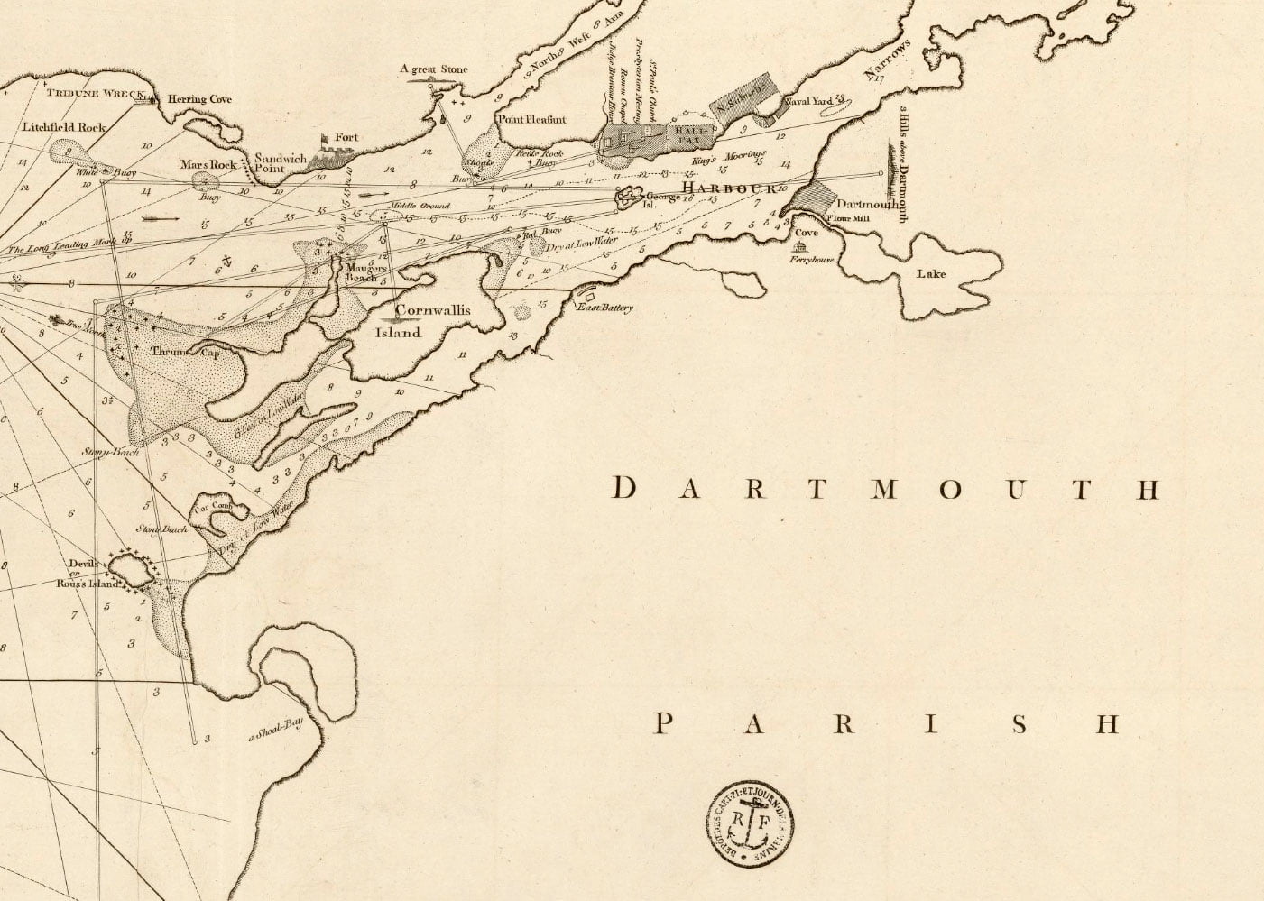
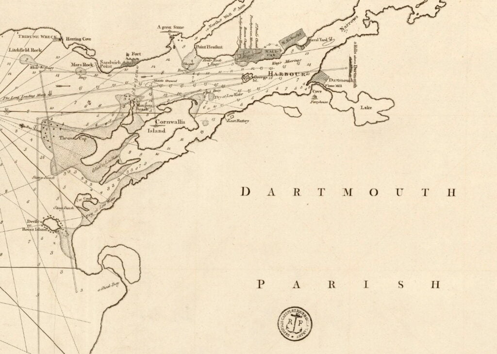
One of the only maps I’ve seen that shows what is a political division, “Dartmouth Parish”, I believe this is a reference to it being a bishopric. From Coke Upon Littleton:
“…the ancient towns called boroughs are the most ancient towns in England; and from these towns come the burgesses of parliament, when the king has summoned his parliament. Every borough incorporate that had a bishop within time of memory, is a city, albeit the bishopric be dissolved…It is not necessary that a city be a county of itself; as Cambridge, Ely, Westminster &c. are cities, but are no counties of themselves, but are part of the counties where they are.”
This ancient constitutional precept can be seen in Nova Scotian municipalities, at least, it was more easily seen while they were still legitimate municipal corporations, previous to the 1996 municipal coup when they had separate jurisdiction from the Counties in which they resided. That the establishment of Dartmouth Township (among others) predated Halifax County, that the incorporated Town of Dartmouth inherited the constitutional machinery of Dartmouth Township and itself preceded the incorporation of a municipalized “Halifax County” is a further example as to the constitutional order as it relates to “local government”.
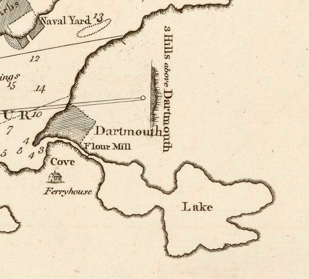
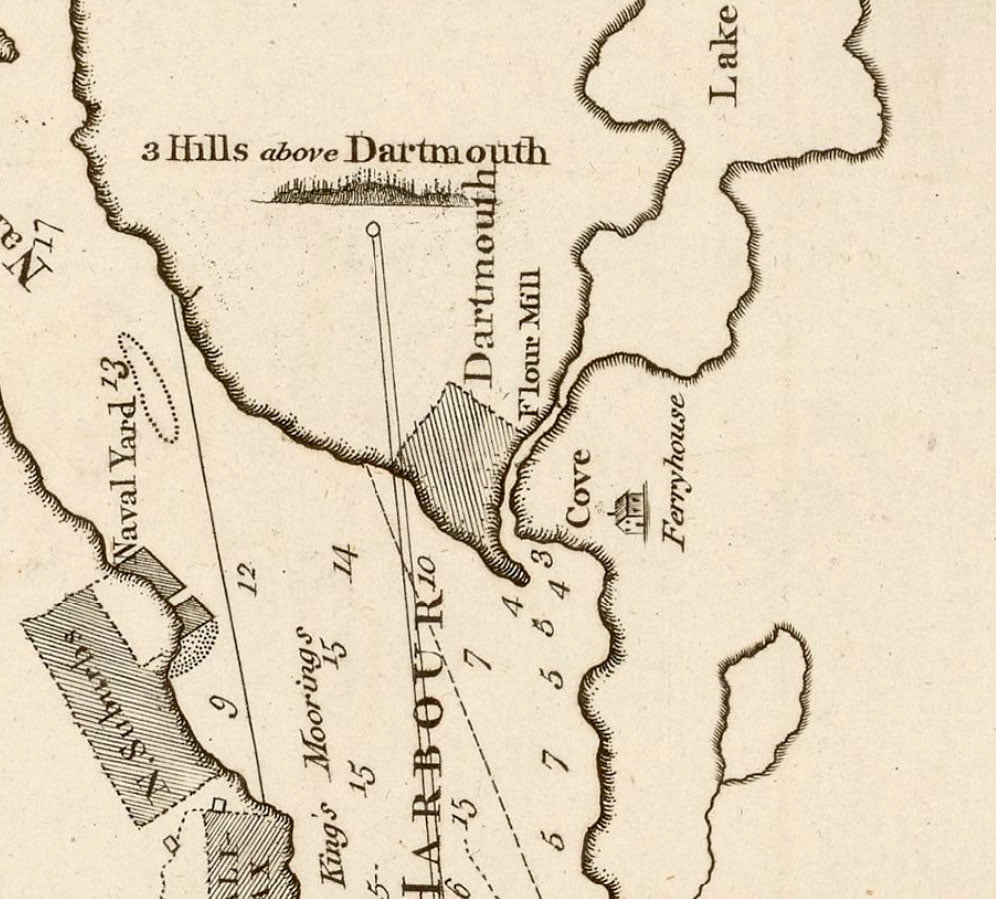
Some interesting features are included, including the Ferryhouse located at the bottom of Old Ferry Road, the flour mill just outside of the town plot, as well as the “three hills above Dartmouth”, (which I believe is in reference to “Mt. Amelia” at the top of Old Ferry Road, “Silver’s Hill” in the Sinclair neighborhood and “Mt. Thom” aka Brightwood).
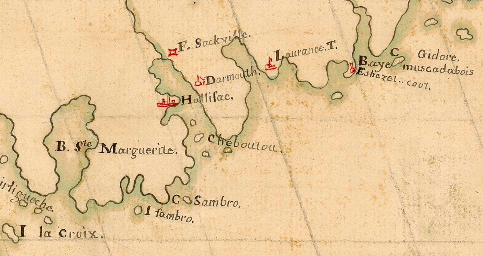
“The Harbour of Halifax”, Backhouse, Th. 1798. https://gallica.bnf.fr/ark:/12148/btv1b53090052z, https://archives.novascotia.ca/maps/archives/?ID=226
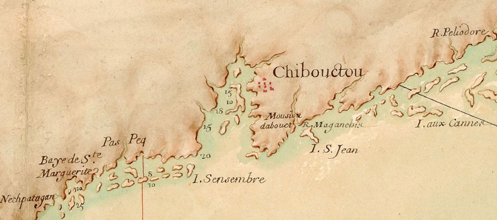
A very detailed early map of Nova Scotia from some time previous to the founding of Halifax. Chibouctou is shown on the Dartmouth side of the harbor, opposite McNabs Island and Geroge’s Island. Shubenacadie River is seen to the north of the settlement. I haven’t found any substantial confirmation that the Dartmouth side is where the settlement known as Chibouctou was actually located, but there are a number of maps (many, but not all, seem to be derivative).
More about Chibouctou:
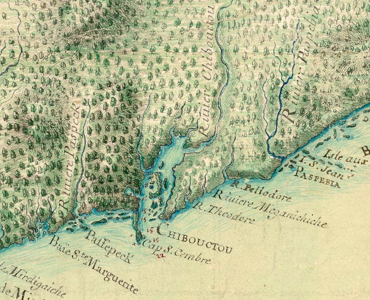
“Carte particulière de la coste d'Accadie” 16?? (<1700) https://gallica.bnf.fr/ark:/12148/btv1b53089778x
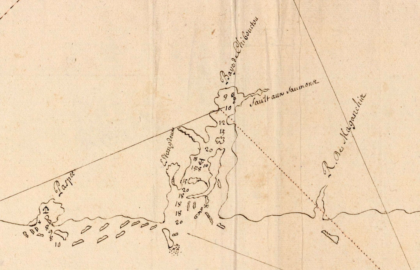
Baye d Chibouctou, later Halifax Harbor. McNabs Island can be seen in the middle of the harbor with George’s Island north, and to the north east is Sault aux saumone, or salmon jump – which could be the Sackville River.
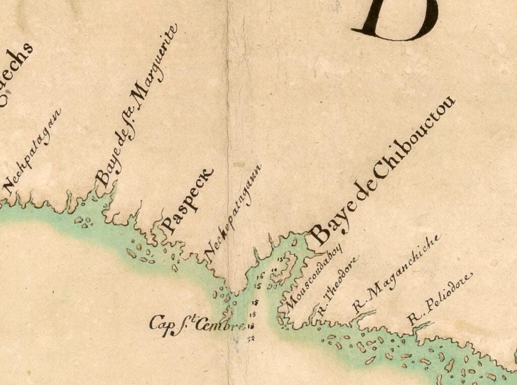
“Carte de la côte Sud de l’Acadie” 16?? (<1700) https://gallica.bnf.fr/ark:/12148/btv1b53089646d
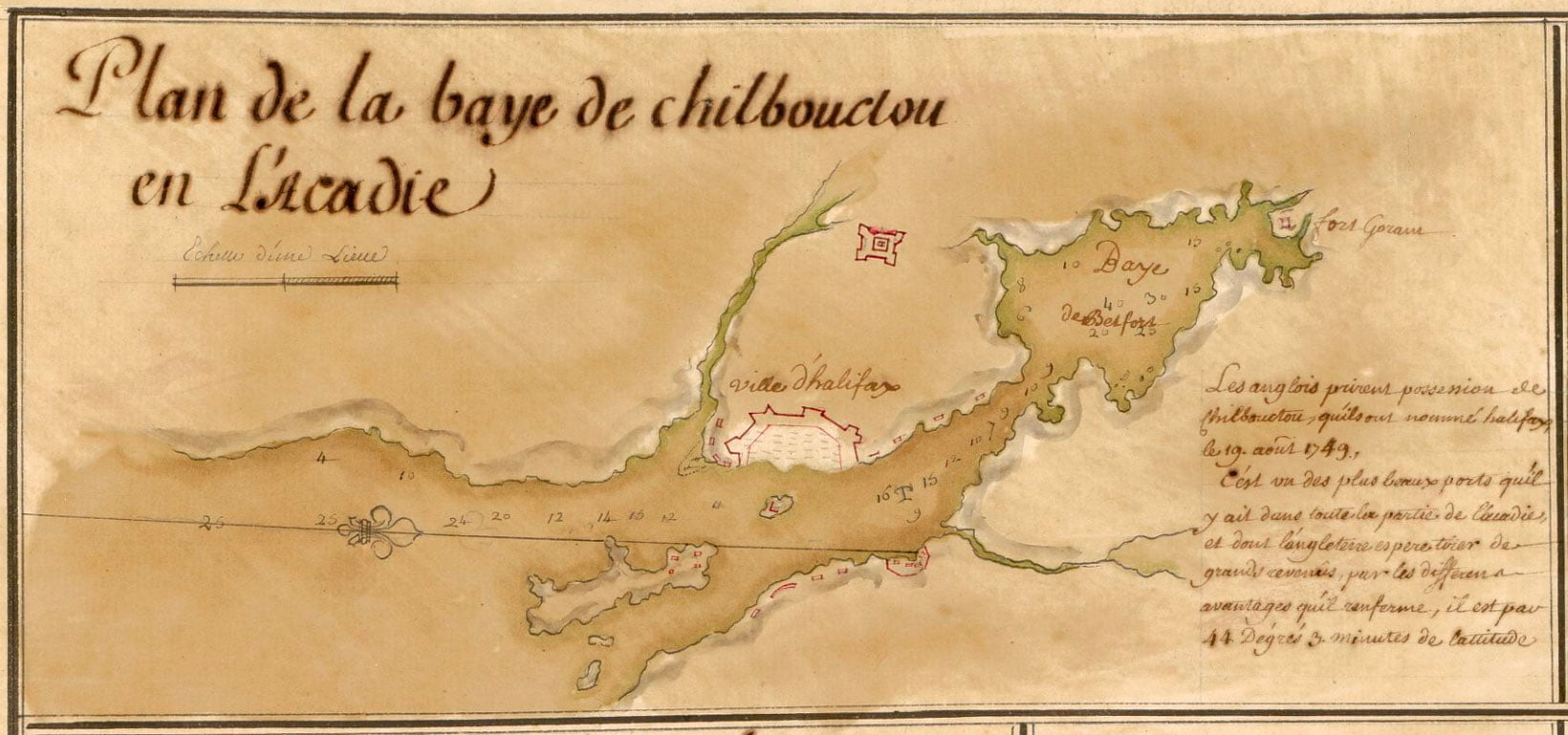

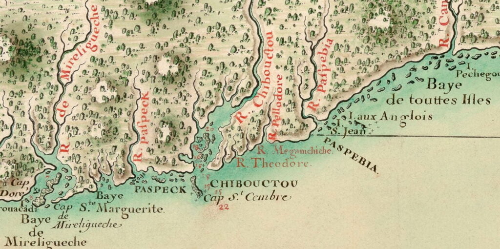
A (probably very) rough translation:
“The English took possession of Chibouctou on the 19th of August 1749 and named it Halifax.
It is one of the most beautiful ports in all parts of Acadia and England. It should provide great income, by the different advantages that it contains. It is located at 44 degrees 3 minutes latitude.”
This map is an inset from a broader map of Nova Scotia (Acadia), interestingly it shows the picketed part of Dartmouth as being near the bottom of what would be Old Ferry Road today, what appears to be the Eastern battery is seen further down the harbor, closer to Eastern Passage.

“Carte réduite des costes de l’Acadie” 17?? (>1749) https://gallica.bnf.fr/ark:/12148/btv1b53089777g
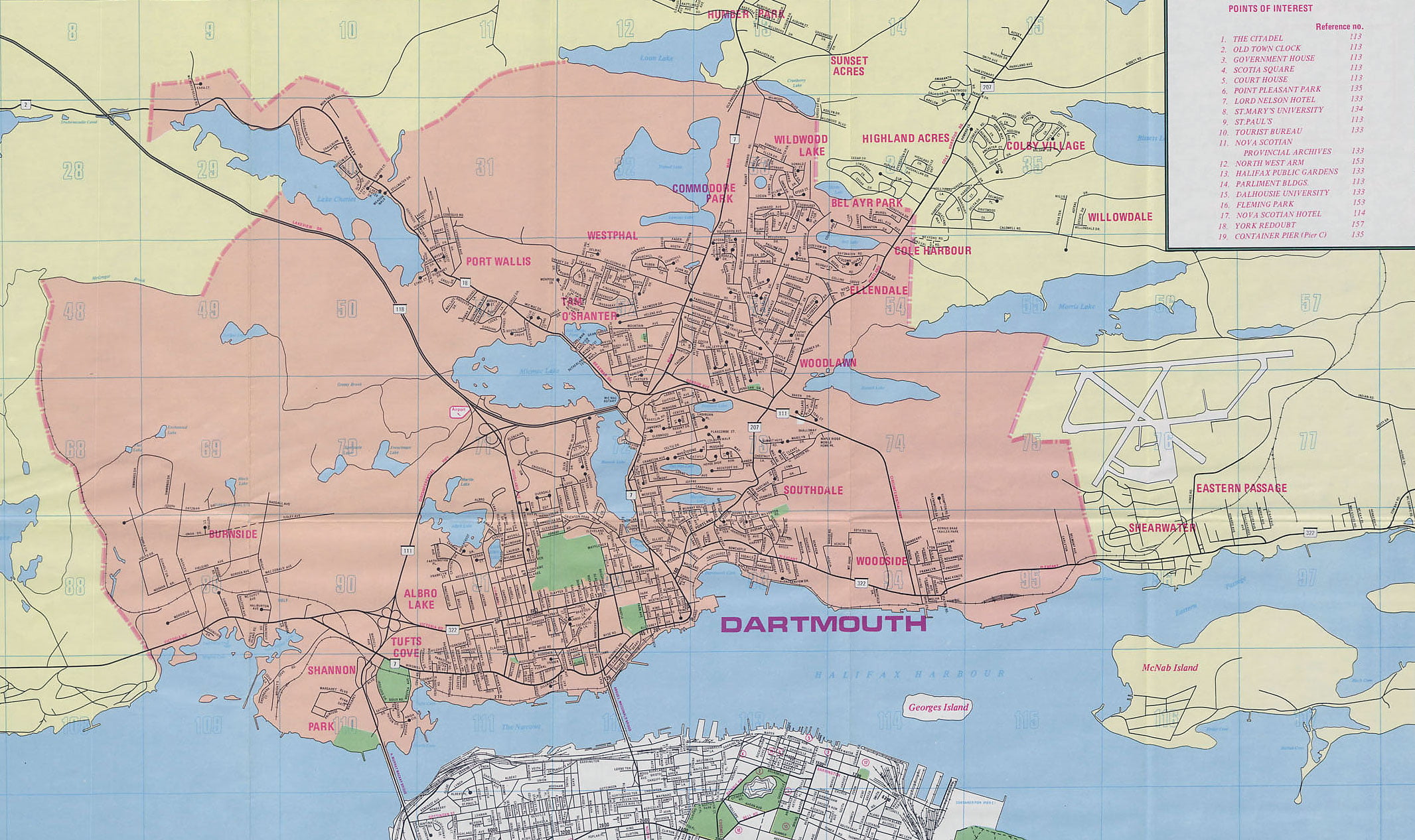
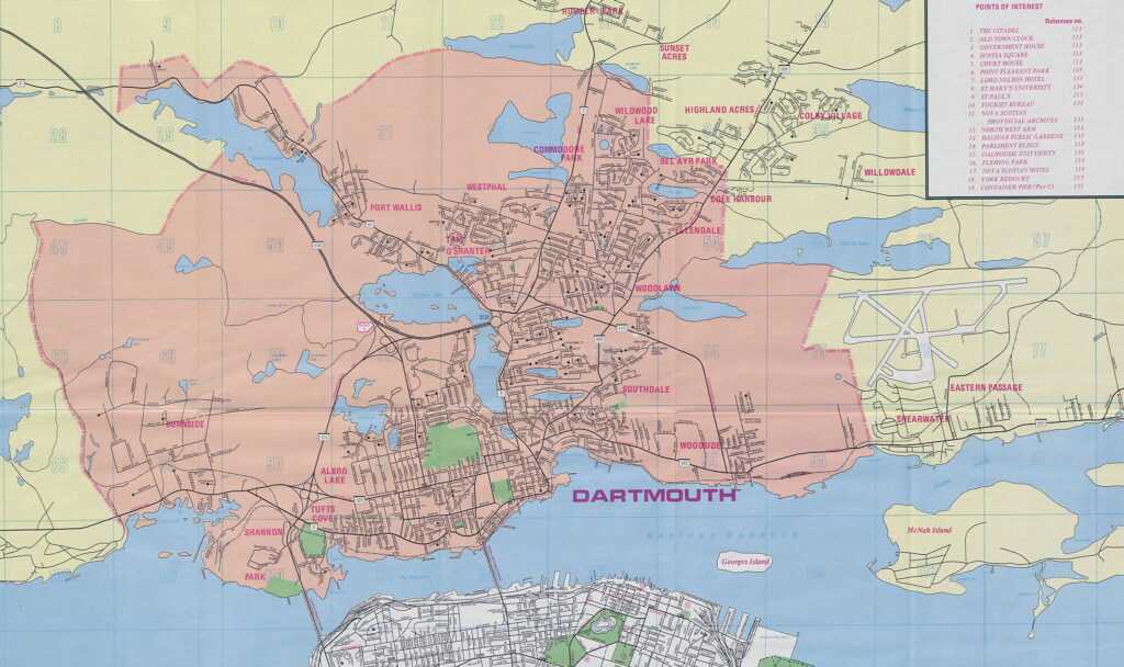
“Halifax & Dartmouth City & Maritimes map”, 1976. https://archives.novascotia.ca/maps/archives/?ID=948
Many communities noted on this map: Burnside, Shannon Park, Tufts Cove, Albro Lake, Port Wallis, Tam O’Shanter, Westphal, Graham Corner, Commodore Park, Southdale, Woodlawn Woodside, Ellendale, Bel Ayr Park and Wildwood Lake within the City of Dartmouth.
A few peripheral communities are also noted: Shearwater, Eastern Passage, Cole Harbour, Willowdale, Highland Acres, Sunset Acres and Humber Park.
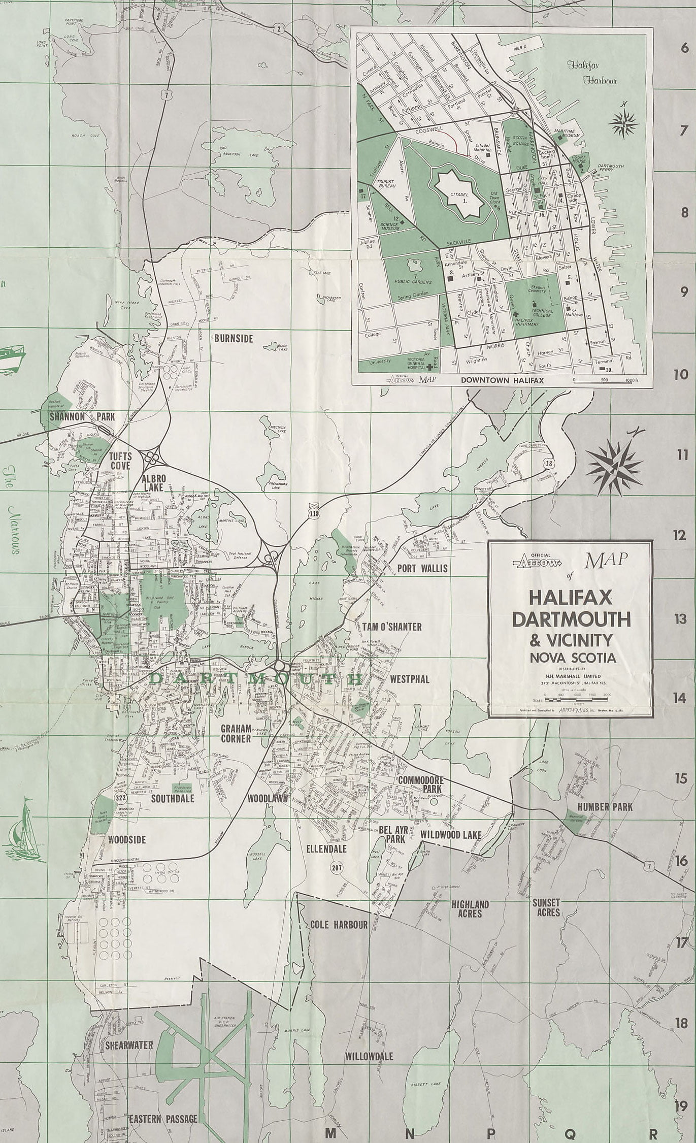
“Twin Cities Map Metropolitan Halifax-Dartmouth”, 1977. https://archives.novascotia.ca/maps/archives/?ID=1941