

“Carte de l’Acadie” 1702. https://gallica.bnf.fr/ark:/12148/btv1b53089759j
Related posts:
- Carte de la côte Sud de l’Acadie Baye d Chibouctou, later Halifax Harbor. McNabs Island can be seen in the middle of the harbor with George’s Island north, and to the north east is Sault aux saumone, or salmon jump – which could be the Sackville River....
- Carte de l’Acadie “Chebouquetou”, with McNabs Island relatively easy to pick out. “Carte de l’Acadie ” 16?? (<1700) https://gallica.bnf.fr/ark:/12148/btv1b53089760x...
- Carte particulière de la coste d’Acadie McNabs Island and George’s Island, recognizable elements within Halifax Harbor, (Baye de Chibouctou) “Carte particulière de la coste d’Acadie” 1702. https://gallica.bnf.fr/ark:/12148/btv1b53089906w...
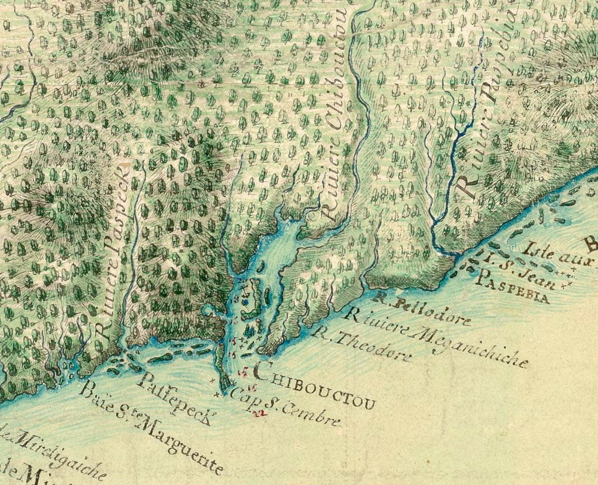
- Carte de l’Acadie This map shows the Shubenacadie River as the Chibouctou River, a few other features are discernible, including McNabs Island and George’s Island. A rough idea of the different features represented, as they are known today. “Carte de l’Acadie” 1708. https://gallica.bnf.fr/ark:/12148/btv1b530900430...
- Carte des costes de l’Acadie depuis le passage de Fronsac jusqu’à la rivière St Jean The salmon jump (Santau saumon, at the Shubenacadie River) makes another appearance “Carte des costes de l’Acadie depuis le passage de Fronsac jusqu’à la rivière St Jeanccadie” 16?? (<1700) https://gallica.bnf.fr/ark:/12148/btv1b53090042j...
- Carte réduite des costes de l’Acadie A (probably very) rough translation: “The English took possession of Chibouctou on the 19th of August 1749 and named it Halifax. It is one of the most beautiful ports in all parts of Acadia and England. It should provide great...
- Carte de l’Accadie A recognizable Halifax peninsula on this map, McNabs, George’s Lawlors and Devil’s island all properly represented, as well as a portage to Windsor. “Carte de l’Accadie”, Chabert, Joseph-Bernard de. 1746. https://gallica.bnf.fr/ark:/12148/btv1b53089771s...
- Carte particulière de la coste d’Accadie A very detailed early map of Nova Scotia from some time previous to the founding of Halifax. Chibouctou is shown on the Dartmouth side of the harbor, opposite McNabs Island and Geroge’s Island. Shubenacadie River is seen to the north...
- Carte de la coste de l’Acadie An incredibly detailed map, again showing Chibouctou on the Dartmouth side. Mcnabs Island and George’s are fairly easy to spot for those who’ve seen them on a map before. Perhaps the hatchings next to the seven buildings is meant to...
- “Carte de l’Acadie et pays voisins” “Darmont” Interesting interpretation of what is “Part of Canada” and what is Acadie here. “Carte de l’Acadie et pays voisins.”, Bellin, Jacques Nicolas. [Paris] 1764. https://www.loc.gov/resource/g3420.ct008129/?r=0.34,0.308,0.306,0.166,0...