
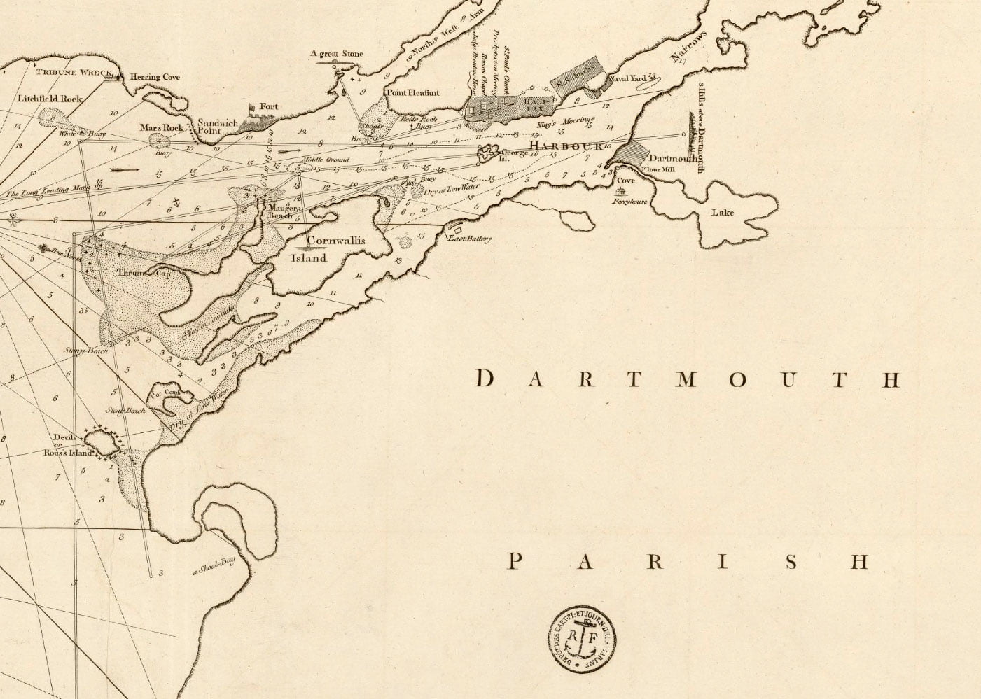
One of the only maps I’ve seen that shows what is a political division, “Dartmouth Parish”, I believe this is a reference to it being a bishopric. From Coke Upon Littleton:
“…the ancient towns called boroughs are the most ancient towns in England; and from these towns come the burgesses of parliament, when the king has summoned his parliament. Every borough incorporate that had a bishop within time of memory, is a city, albeit the bishopric be dissolved…It is not necessary that a city be a county of itself; as Cambridge, Ely, Westminster &c. are cities, but are no counties of themselves, but are part of the counties where they are.”
This ancient constitutional precept can be seen in Nova Scotian municipalities, at least, it was more easily seen while they were still legitimate municipal corporations, previous to the 1996 municipal coup when they had separate jurisdiction from the Counties in which they resided. That the establishment of Dartmouth Township (among others) predated Halifax County, that the incorporated Town of Dartmouth inherited the constitutional machinery of Dartmouth Township and itself preceded the incorporation of a municipalized “Halifax County” is a further example as to the constitutional order as it relates to “local government”.
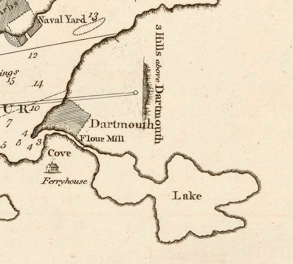
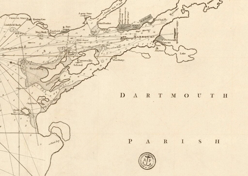
Some interesting features are included, including the Ferryhouse located at the bottom of Old Ferry Road, the flour mill just outside of the town plot, as well as the “three hills above Dartmouth”, (which I believe is in reference to “Mt. Amelia” at the top of Old Ferry Road, “Silver’s Hill” in the Sinclair neighborhood and “Mt. Thom” aka Brightwood).
“The Harbour of Halifax”, Backhouse, Th. 1798. https://gallica.bnf.fr/ark:/12148/btv1b53090052z, https://archives.novascotia.ca/maps/archives/?ID=226