At least one distinct record from the year of 1759 survives:
“Mrs. Mary Clark, whose house and garden stood at the southeast corner of the present Portland and King Streets, advised Secretary Richard Bulkeley that her “three lots have been improved, cleared and fenced-in twice but all the improvements, fences, etc., have been taken away and burnt by the Army and Navy”.
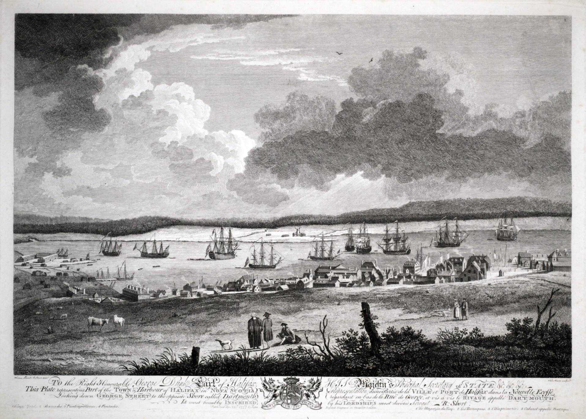
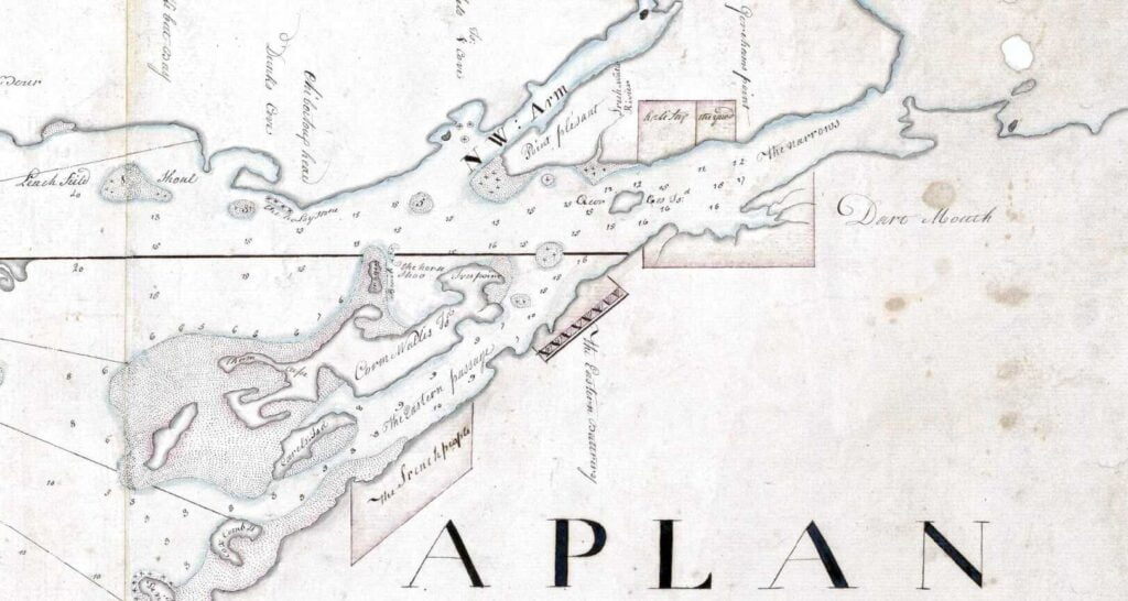
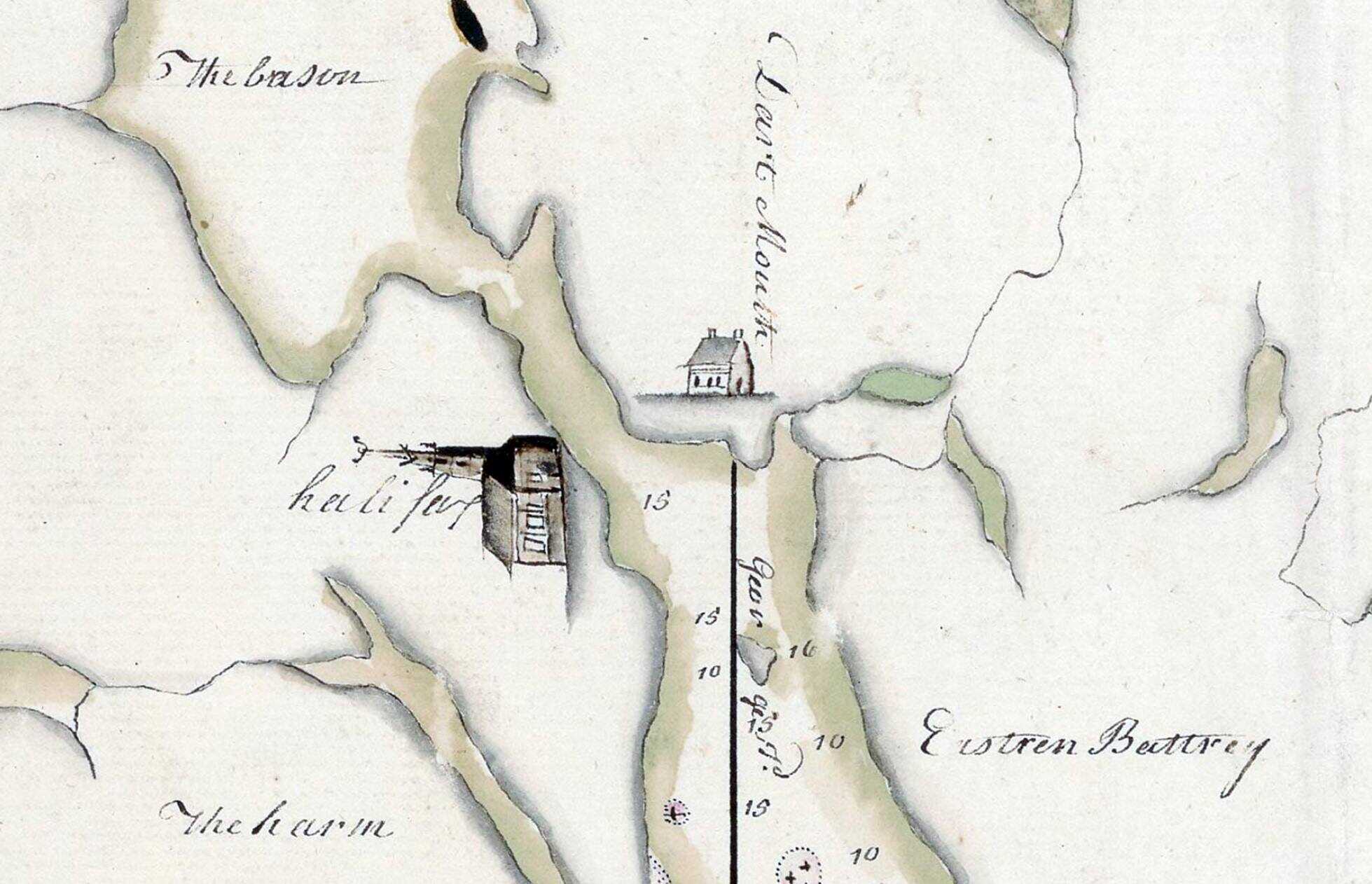
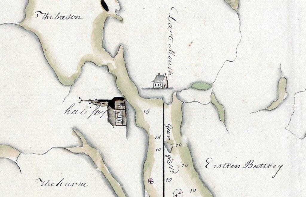
Part of the Town & Harbour of Halifax in Nova Scotia, Looking down George Street to the Opposite Shore Called Dartmouth (1759, Mason, James, 1710-c.1783) https://digitalarchive.tpl.ca/objects/341056
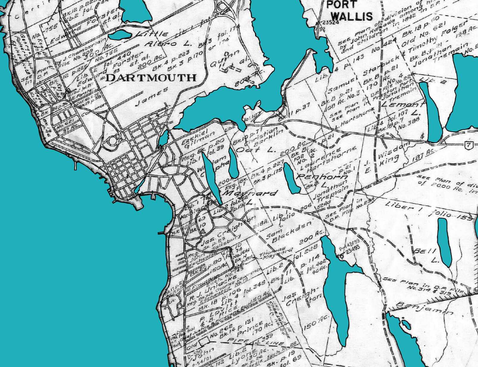
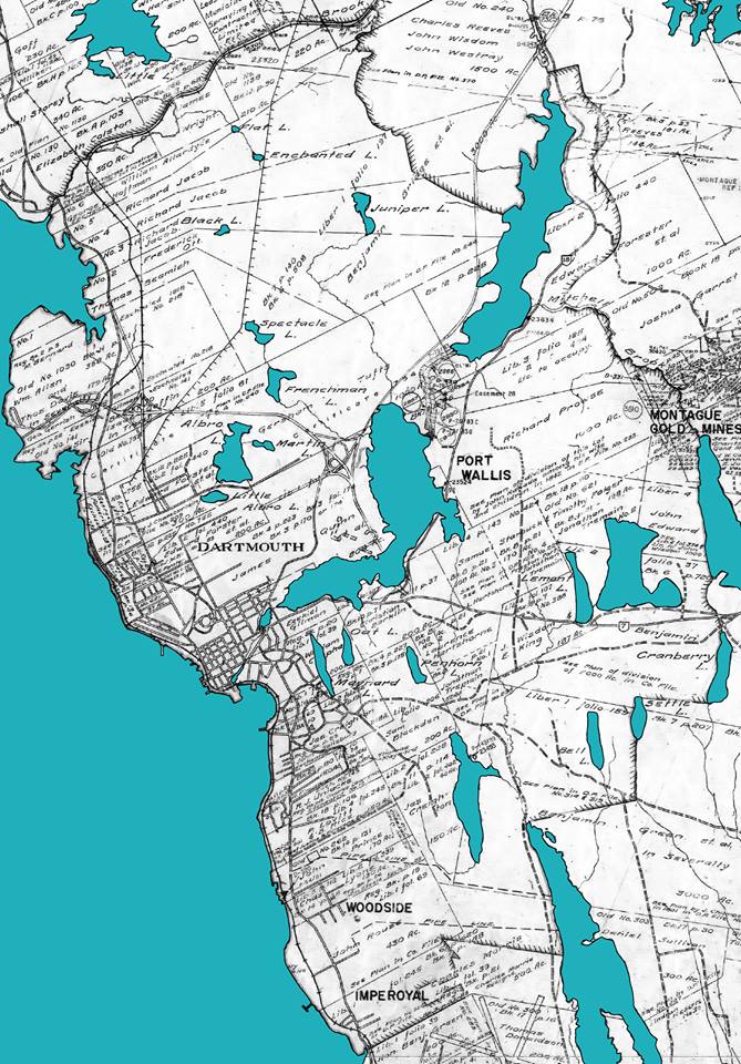
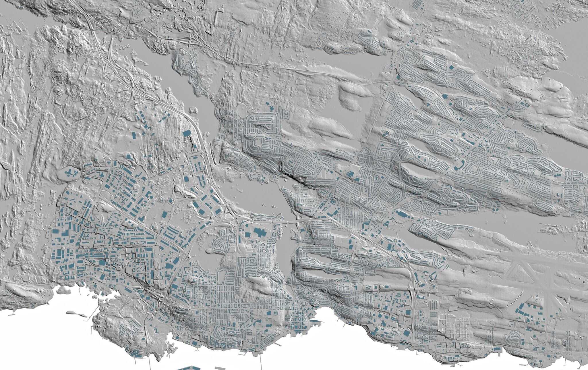
Crown Land Grants are an invaluable historical resource, especially considering how little is made freely available in terms of property records, a system which seems to exist in some kind of quasi-privatized state: https://novascotia.ca/natr/land/grantmap.aspThe map itself is a 1940s era base-map and so you’ll see the original configuration of many once rural now suburban roads.
Beyond the Land Grant Map Index, individual grants also have records of their own, and sometimes maps to go along with them.
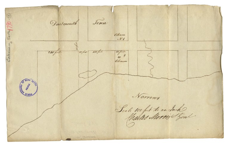
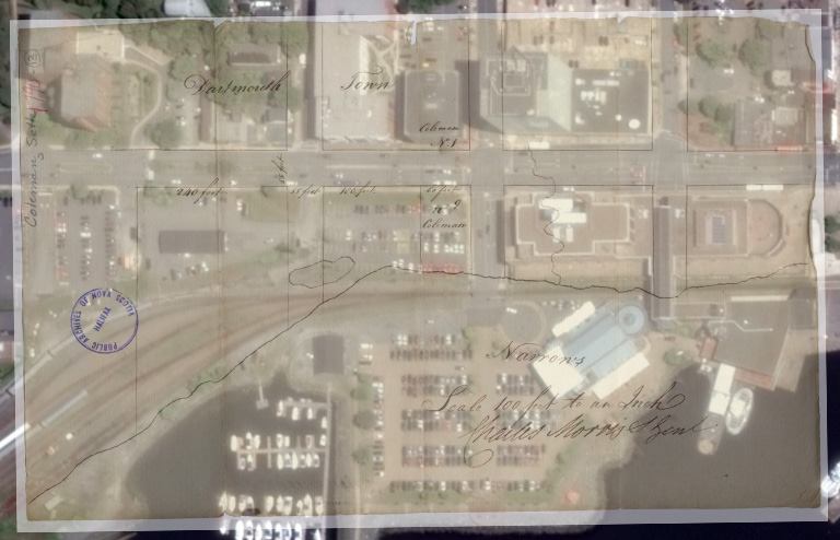
Included here is a map from Seth Coleman in 1790 – who was Clerk of the Dartmouth Meeting of Friends (The Quaker Fellowship). He owned the land that today stretches from Ochterloney Street to Church Street along the Dartmouth shore. This area was once littered with shipyards and later served as the terminus for one of our early ferries.
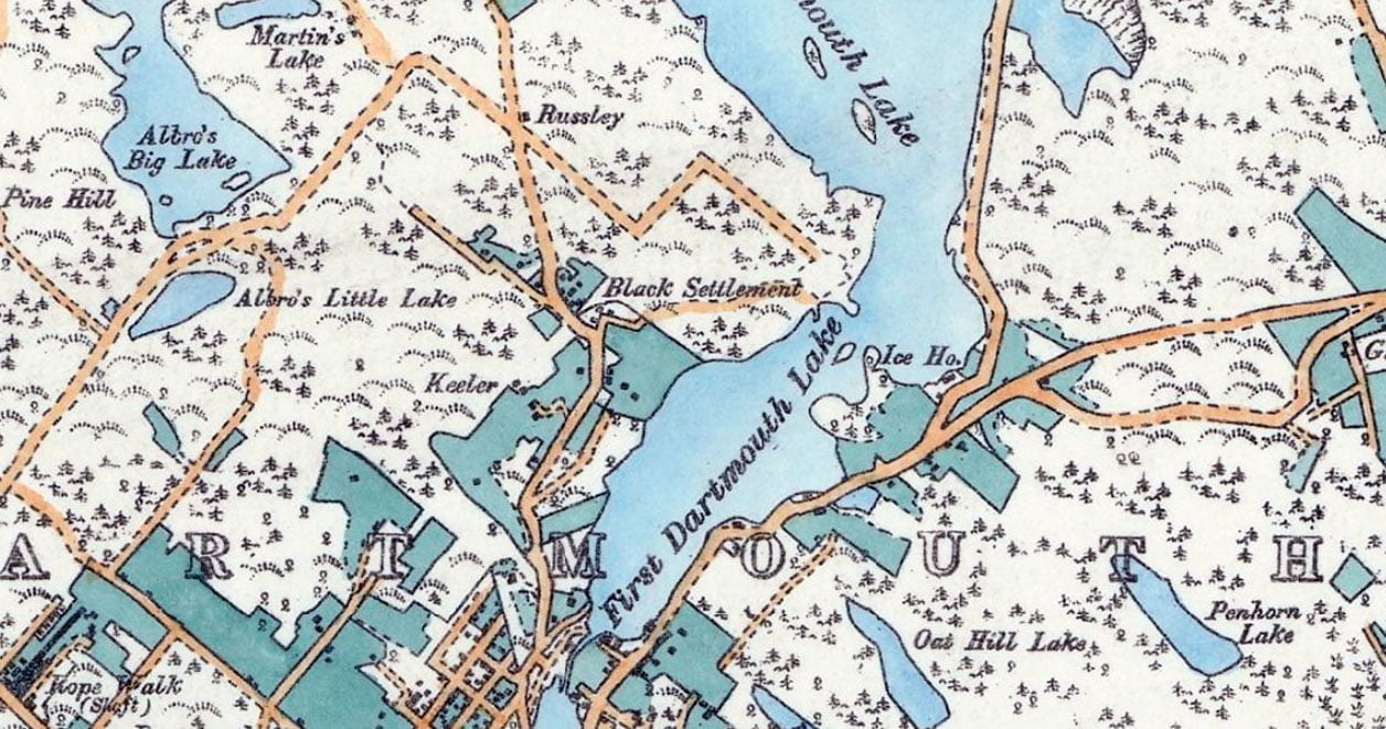
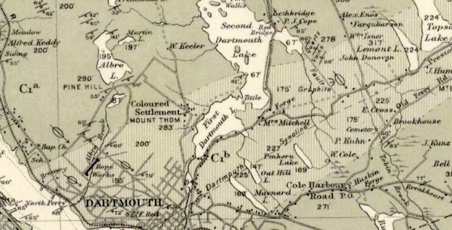
The “Black Settlement”, aka “The Avenue”, as seen on the outskirts of the Town of Dartmouth in 1886
The following excerpts are from “Survival of an African Nova Scotian Community: Up the Avenue, Revisited” by Adrienne Lucas Sehatzadeh, 1998. An incredible resource of some of the Black history of Dartmouth that is certainly worth your time to read.
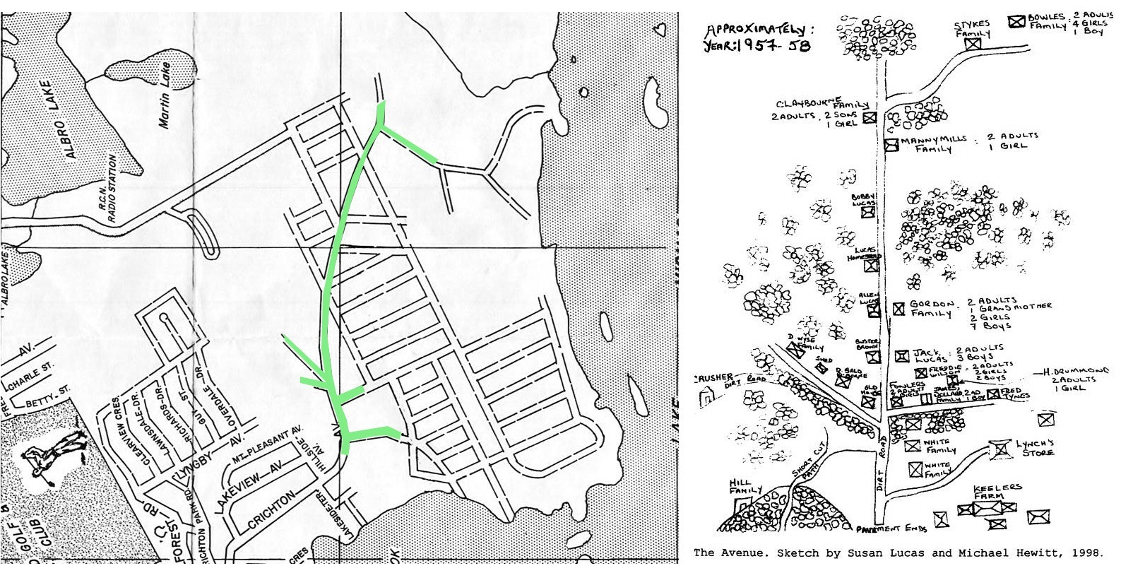
“The part of Crichton Avenue above Lyngby Avenue is the area where the Black settlement started. Crichton Avenue winds its way north/south from the downtown area, along the western shore of Sullivan’s Pond and Lake Banook.”
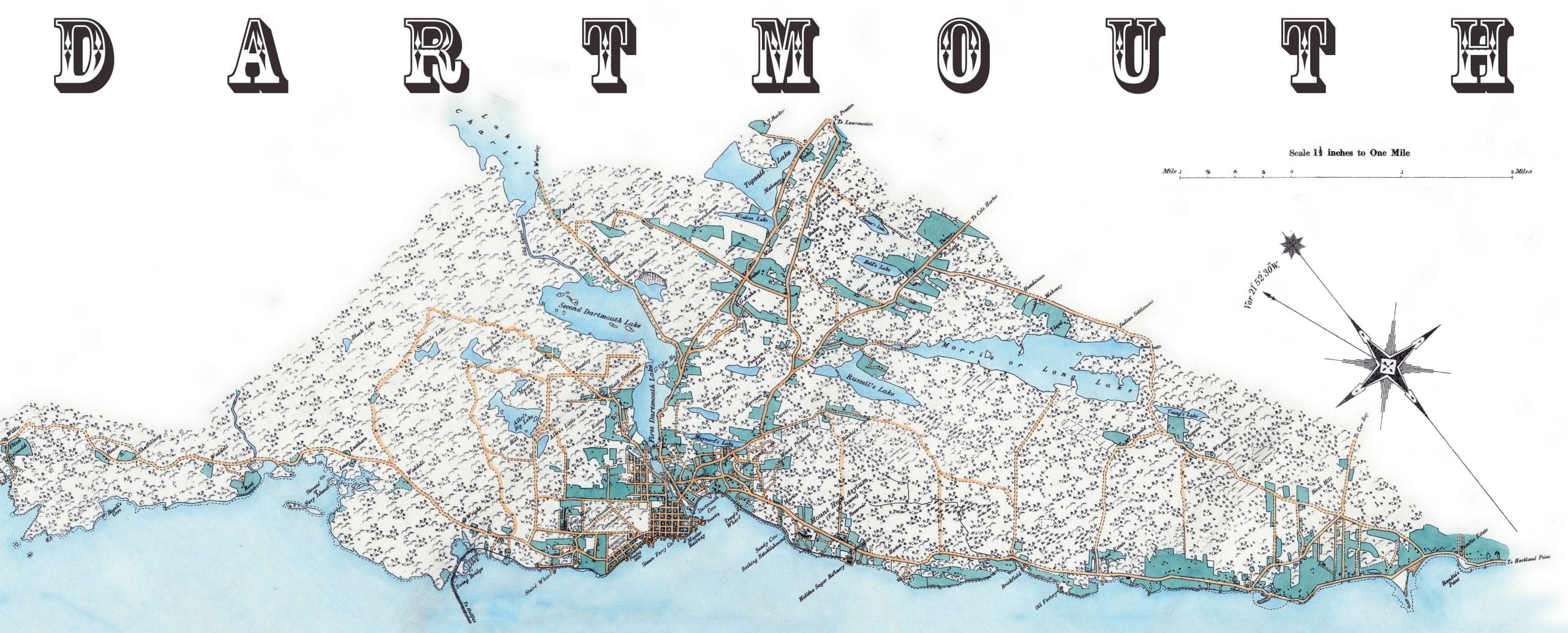
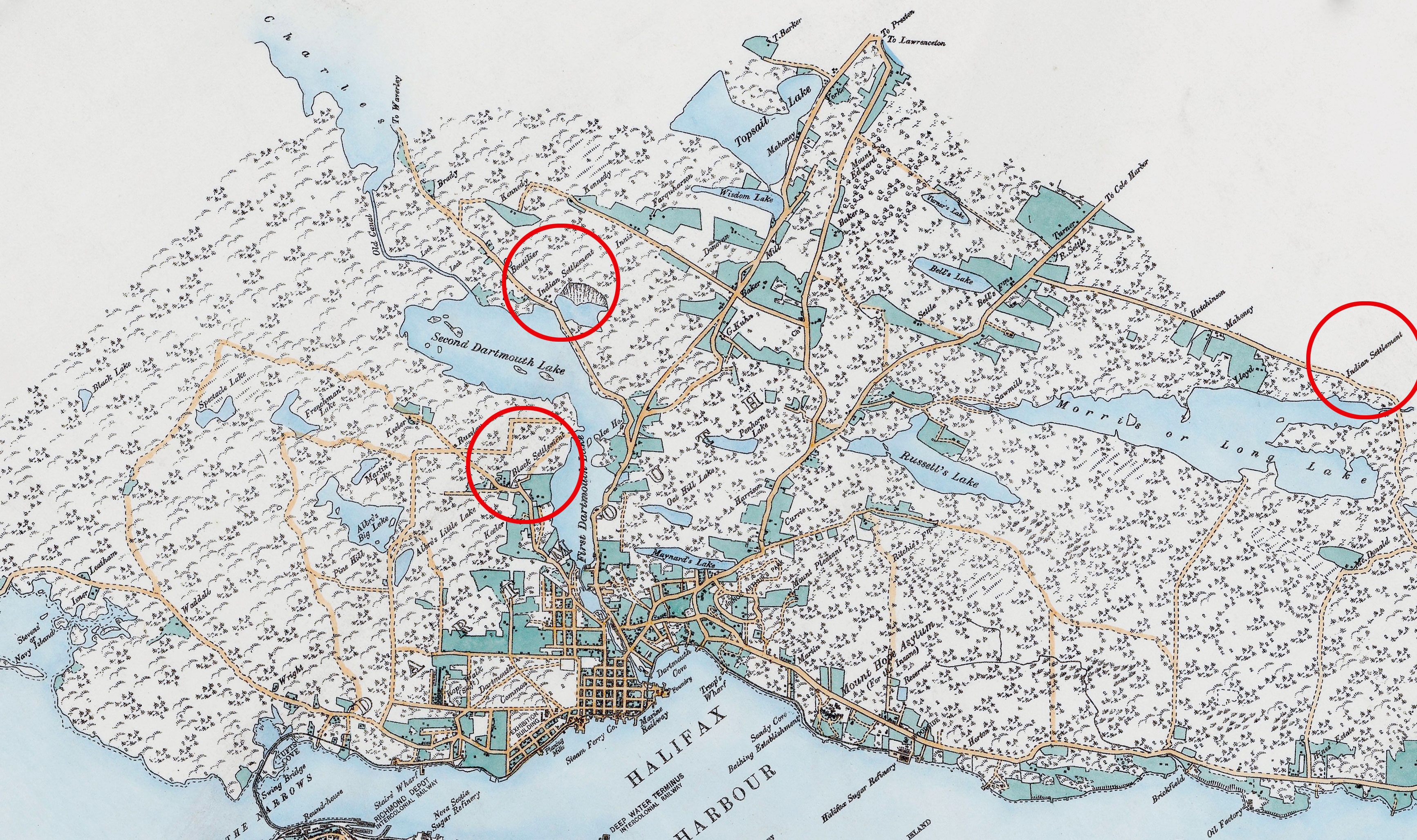
The Avenue as it was in context within the broader Dartmouth area, note also two Mi’kmaq Settlements. There aren’t many maps as excellent as this one by E. Hopkins and Chas S. Akers from the period. Many later maps omitted the Avenue and other peripheral Dartmouth communities entirely. (https://gallica.bnf.fr/ark:/12148/btv1b53029049m)
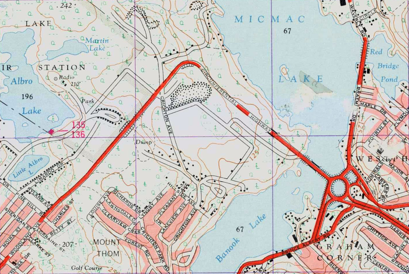
“Crichton Avenue has been a major roadway in Dartmouth for over 100 years and intersects Ochterloney Street in the downtown area, about one kilometre from Halifax Harbour. The Avenue portion of Crichton Avenue extended across the circumferential highway to The Extension, where the Black community ended.”
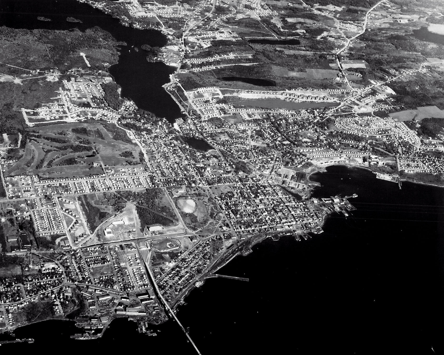
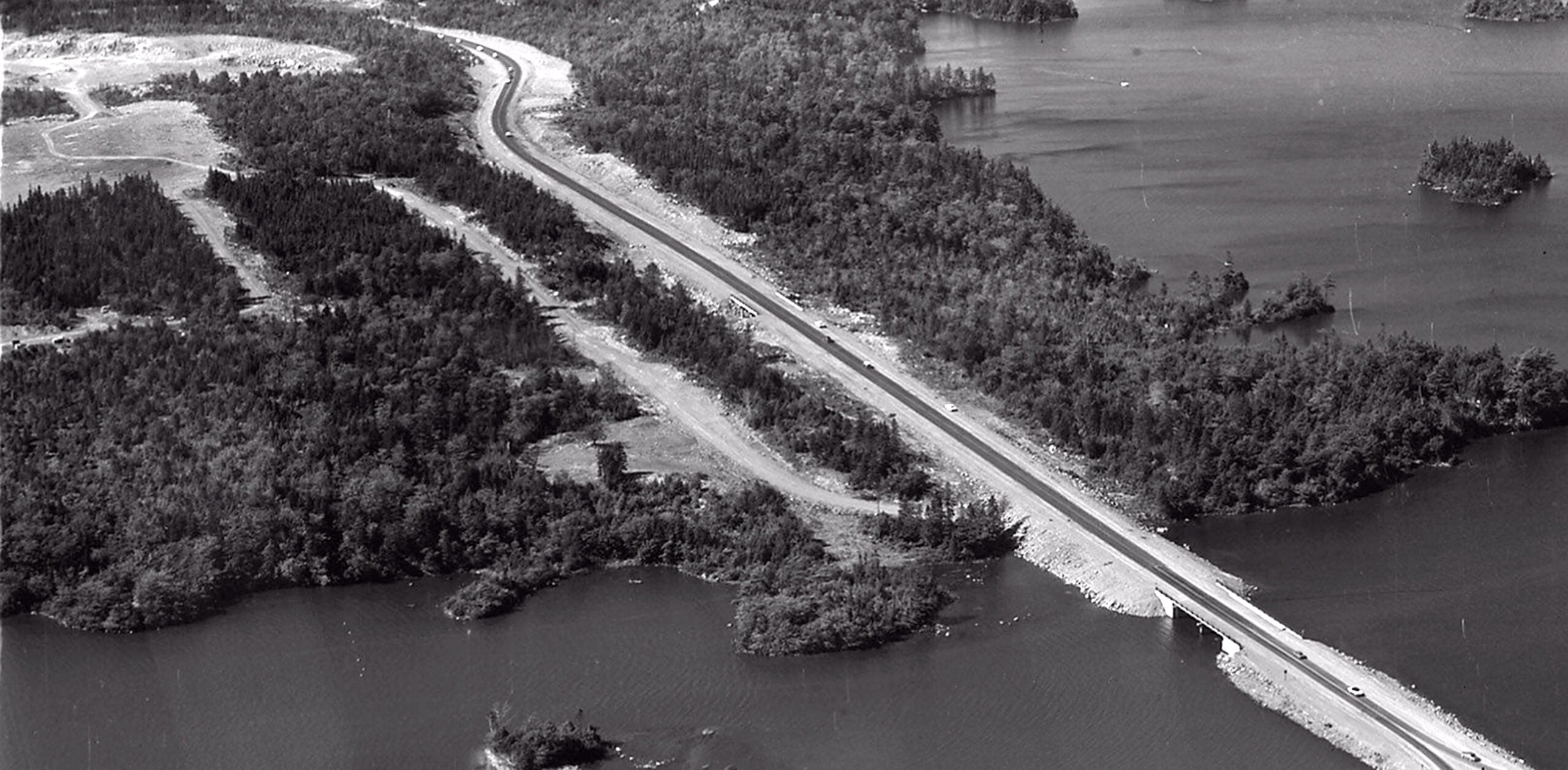
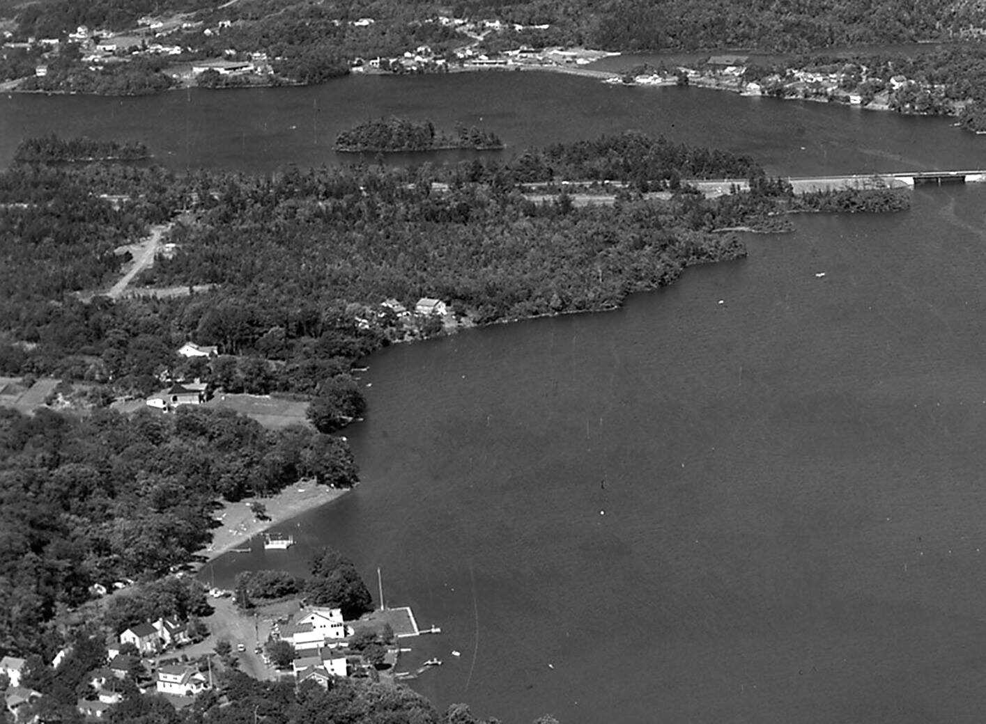
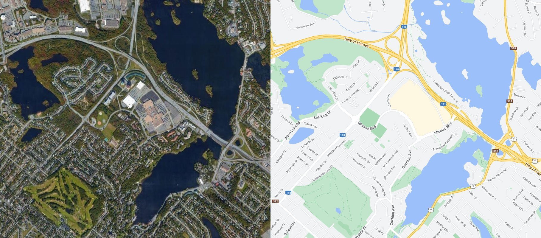
The encroachment of suburbia into “The Avenue” is well underway by the time these aerial shots were taken in the mid-late 1960s.
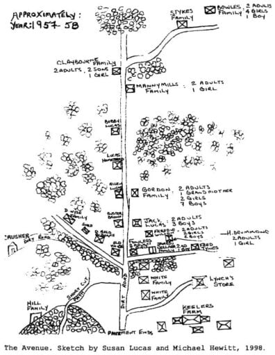
“Crichton Avenue Extension was expropriated in the late 1960s because of the expansion of the circumferential highway. The circumferential highway (not shown on the sketch) runs east less than one-half kilometre north of the last Lucas house on Crichton Avenue.”
“The Extension was the continuation of Crichton Avenue just north of the highway. The few references to this Black community in the literature refer to the area as ‘Colored Meeting House Road’ until the Legislature passed a bill in 1892 to name the roadway Crichton Avenue. Street signs bearing the name Crichton Avenue were erected in 1894 (Martin, 1957). However, the Black settlement at the top of Crichton Avenue was never officially named.”
“Although the Black settlement did not have a formal name, my experience has been that people always talked about going up The Avenue to spend time and socialize. The Avenue is a familiar referent for this community. The phrase evokes powerful imagery for individuals who are familiar with the life and times of the people from this area. I have, therefore, arbitrarily named the area ‘The Avenue’.”
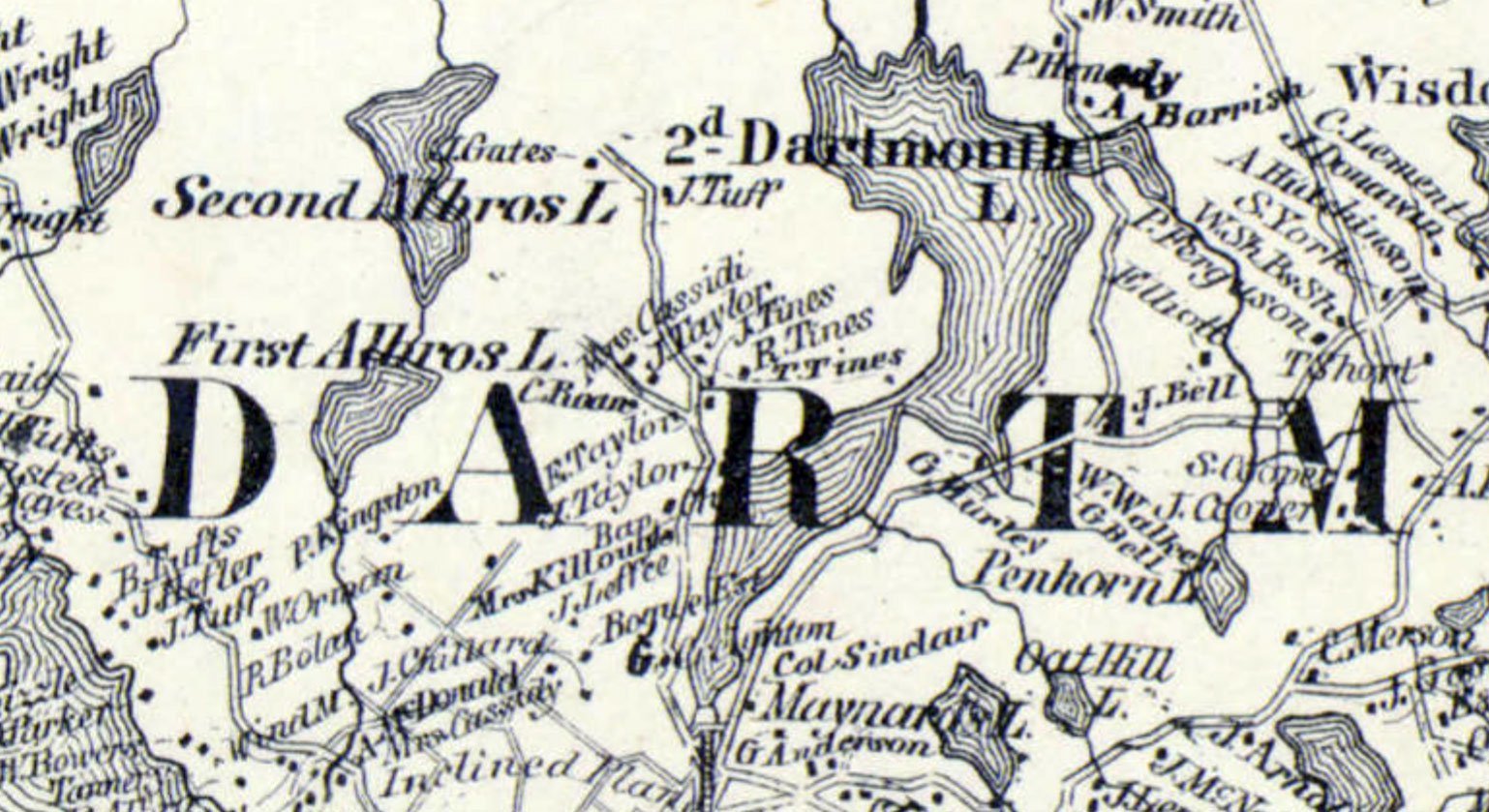
Tines families are seen in this extremely detailed map c.1864 from A.F. Church and Co. (https://collections.lib.uwm.edu/digital/collection/agdm/id/14722/rec/1) along with the Baptist Church, once located near the intersection of what would be Crichton Ave and Glen Manor Drive today.