1780s

From The Story of Dartmouth, by John P. Martin:

Most of the material In the Halifax weekly newspaper comprises advertisements and clippings from Old Country journals. Local items are largely limited to movements of ships. Incidents hereabouts had to be very exceptional to be published. A death or a marriage notice would often appear, but never a birth. Even to report that a person was ill, or had broken a leg, was regarded as a trespass on privacy. As a consequence, news from Dartmouth is very scant.

In winter of 1780, however, there was printed an unusually long account of a misfortune to William Cooper whose location would be near the lower end of the present Queen Street. The following is a transcript from the Nova Scotia Gazette:

“On Monday the 17th January, a direful fire broke out at the house of Mr. Wm. Cowper at Dartmouth, owing to the insufficiency of the chimney, it being built with clay, wood and straw, and notwithstanding his utmost efforts to put a stop to the conflagration, it communicated itself to the building in all parts and consumed his furniture, wearing apparel and such provisions that he had laid in for the comfort of life at the beginning of winter; but now by the melancholy accident, himself and family are reduced to the utmost extremity of getting immediate support and thereby are become real objects of charity worthy of the benevolence of all good people”.

Among the pre-Loyalists who came to Dartmouth at this period were Edward Foster, master blacksmith of Boston, and his son Edward. When the British cavalry were defending Boston, the Fosters were credited with making a number of horseshoes with erect prongs, fitted over the neck of horses to wound the attacking rebels. For this, they were proscribed and banished.

The Fosters settled at northend Mill Cove, where they established a large iron-works. In 1783 along with Samuel Greenwood, they were granted 1,000 acres adjoining the land of Gerisham Tufts. With it went another 200 acres, formerly laid out for Captain George Forthingham, of the 40th Regt., and also a 350 acre lot which had been originally assigned to William Magee.

A large tract was acquired by James Creighton when the farm of the late Major Ezekiel Gilman was put up at auction in 1784. This land included the present Austenville section, and north of it beyond School Street, then from the Common easterly to Lake Banook. It comprised 210 acres, and was sold for £90.

1770s

From The Story of Dartmouth, by John P. Martin:

During the 1770s, the weekly newspaper of Halifax kept Dartmouthians informed of the growing discontent in the American colonies leading up to the Revolution. Captain Preston, involved in the so-called Boston massacre of 1770, was soon to have his name applied to a new township here. Another connection is, that one of the East Indian Company ships, raided by the “Boston Tea-Party” of 1773, was called the “Dartmouth”.

When the British army under Lord Howe abandoned Boston, and sailed to Halifax with hundreds of refugees in 1776, there were more troopships on our side of the harbor. Records of the 65th Regiment in April of that year contain orders that, “Soldiers are not to go on shore on the Dartmouth side with their arms, unless under the command of a Captain. Whenever weather permits, officers will air their men on the Dartmouth side, taking care that the soldiers do not commit depredations”.

Many 1750 grantees evidently were neglecting their Dartmouth holdings, because in 1779 the Government issued a proclamation threatening prosecution “to plunderers, particularly French-Acadians, who have cut down and carried away timber and grass growing on granted lands on the east side of the harbor without any leave from the proprietors”.

James Quin seems to have complied with conditions of a Crown grant. At least he built a house. Part of his land extended easterly to Lake Banook. When he died, there was a Court application for his estate made in 1773 by a sister Catherine O’Brien. The declaration of Mrs. O’Brien was that the woman alias Mrs. Quin, had carried away most of the household articles, but that she had no right to Quin’s property.

1760s

gibbet dartmouth
gibbet dartmouth
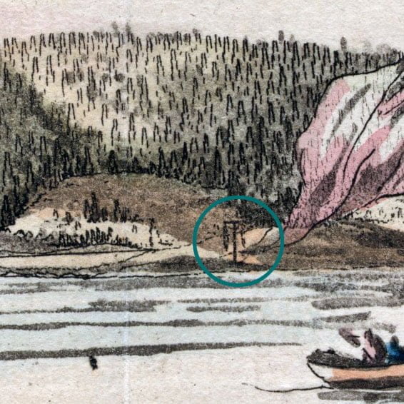
Gibbet seen at what was once “Gibbet Point” in Dartmouth https://cityofdartmouth.ca/dartmouth-shore-in-the-harbour-of-halifax-nova-scotia/

From The Story of Dartmouth, by John P. Martin:

By 1761, the Mi’kmaq raids were at an end. After peace was made with the French in 1763, no more casualties seem to have occurred.

The year 1765 must have brought considerable excitement to Dartmouth, for it was in the month of May that hangings occurred. A search through the Supreme Court files, however, shows that six men were sent to the gallows that spring. Mr. Mullane omitted the name of John Evans. All six gave their occupation as sailors, perhaps merchant seamen.

Driscoll and Lawlor, convicted of murdering a man and a woman at Halifax on April 25, were sentenced to hang on May 20. The charge against Donnelly, Taylor, Smith and Evans was, “that on April 26, 1765, between 11 and 12 in the night, they did by force of arms feloniously break and enter the dwelling-house of Adam Prester at Dartmouth, and steal 20 pounds in gold and silver money and one silver buckle and some linen to the value of 10 shillings”.

Chief Justice Belcher presided. The four accused were convicted and sentenced to hang on May 28. Each man in turn begged the Court to be allowed the benefit of clergy, but was refused.

Adam Prester’s house was on the outskirts of the town-plot. Deed books show that in 1765 he owned lots 1 and 16 in Block “E”. There is no other record of executions in Dartmouth, so far as known, either before or since the above-mentioned.

At least, nothing of that nature befell a party of 30 under the command of Captain William Owen, private secretary to Governor Campbell, who went over the well-known water route from here to the Bay of Fundy in September of 1767. His diary of the trip is most interesting. At Mill Creek, he “impressed a Dutchman with two horses and two trucks to transport their gig and small boats over the portage to the nether Dartmouth Lake”. (This was probably one of the Germans). His descriptions of Lake Banook, and of the islands in Lake MicMac are very accurate. Portobello is also noted.

The number of animals and-of people in Dartmouth about this time is recorded in the census returns for 1767, which give the town a total population of 39. This includes 30 adults, 8 children and 1 [black] man. There are 14 horses, 6 cows and 4 pigs.

1758

From The Story of Dartmouth, by John P. Martin:

The first Nova Scotia election was held in 1758*. In that year, inhabitants of the various settlements went to the polls and named representatives to the first House of Assembly at Halifax. It has met regularly ever since. Previously, the laws had been made by a Governor and his chosen Councils

Most of those early Councillors obtained extensive grants of land in Dartmouth township. This partiality seems to have aroused criticism, especially among Halifax settlers who had come up from New England. One of the latter, writing to a Boston merchant in 1757, made the caustic comment that Cornwallis’ Council had been “composed of military officers and a few dependent on him for the advantageous places he gave them”.

Governor Cornwallis, however, did not appropriate any lands for himself; but before his departure from Halifax in 1752, he granted a large island (McNab’s) to his brothers in England. The comment of the above letter was . . . he gave to his family the very best island in the harbor of Chebucto, called Cornwallis’ Island, which in my opinion should have been given in small farms to the many settlers of Halifax, instead of cooping them up on a small isthmus”.

* The Memorial Tower at North West Arm commemorates this event.

1757

From The Story of Dartmouth, by John P. Martin:

From Volume I of Knox History Journal we learned by a perusal of the diary of Major Robert Rogers that his famous Rogers’ Rangers were quartered at Dartmouth for a time during the 7-Years’ War. According to the record they had been stationed at Fort William Henry, and proceeded from there to the port of New York:

June 1757—. . . sailed with 100 vessels bound to Halifax, where we soon arrived and according to orders, I encamped on the Dartmouth side of the harbour. . . .

The Rangers were here employed in various services. . .

1755

From The Story of Dartmouth, by John P. Martin:

Initially there were about 30 men at the Eastern Battery at Imperoyal, but in the autumn of 1755, military records tell us that a considerable number of soldiers spent the winter on this side of the water. These were none other than the troops of Colonel John Winslow, who had just returned from their job of expelling the Acadians.

Winslow’s diary of November 1755 says that “My 54 non-commissioned officers and privates are at Dartmouth”. In the same records is a memo signed by Henry Dobson stating that Lieut. Billings and Ensign Barrel, one Sergeant, one Corporal and all the [Mi’kmaq] and black people] that belong to Colonel Shirley’s regiment are also here at Dartmouth.

Dr. John Thomas, a surgeon in Winslow’s expedition, has a very complete account of life in Dartmouth that winter. Even the weather is noted. On December 12 he wrote: “Snow last night, we paraded 150 men who went over to Dartmouth under the command of Captain Speakman to take up winter quarters there”.

On December 26, Colonel Winslow came over to Dartmouth to review the men posted there, and on the 28th (probably a Sunday), Mr. Phillips preached in Clapham’s windmill. By the end of that month, the roll of troops in Dartmouth totalled 230.

The reference to the windmill at the Canal suggests that these men were quartered in the buildings near there. If so, Mr. and Mrs. Walter Clarke’s tavern on “Front Street” probably did a thriving business with the soldiers, as Murdoch’s History states that the civilian population is small, consisting only of about five families at that time.

1754

dartmouth map old ferry portland land grants

From The Story of Dartmouth, by John P. Martin:

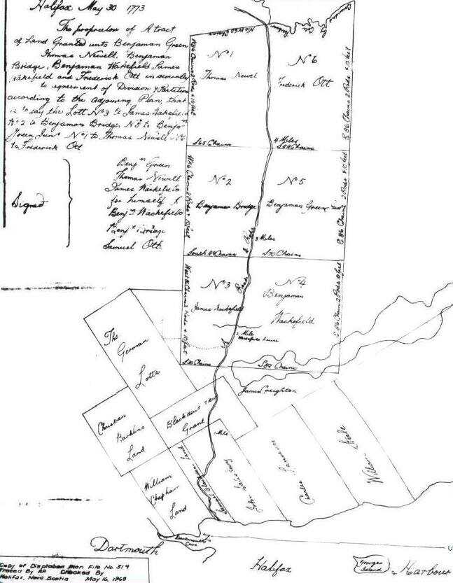
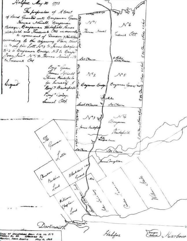
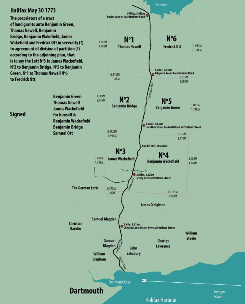
During 1754, gangs of soldiers are busily engaged cutting a road from Dartmouth to the new settlement at Lawrencetown. (This is probably the beginnings of Old Ferry Road from Parker’s wharf over the Cameron Street hill to Cole Harbor, by a route which no doubt avoided the outlet at Maynard’s Lake.)

Of all the fortifications built to protect the harbor of Halifax in early times, one of the first was constructed as the Eastern Battery. Engineer John Brewse was in charge, and he had seven heavy cannon mounted there by October of 1754. Military plans of this period show a road which seems to extend from Black Point to the Battery at Imperoyal.

See also:

1752

From The Story of Dartmouth, by John P. Martin:

Furnished in the minutes of Cornwallis’ Council for February 3, 1752, is when John Connor was given exclusive rights to operate a ferry service. The preamble points out that great inconvenience attends the inhabitants of Halifax and Dartmouth for want of a constant ferryboat.

Henry Wynne of Halifax, and William Manthorne of Block “B”, lot no. 4, took over the service the following December.

There were 53 families with a total population of 193 within the town of Dartmouth, according to statistics of 1752. (This might possibly include the township).

In the same year Captain William Clapham requests the usual bounty for clearing land and erecting stonewalls on his farm, shown on Crown Land plans as being along Saw Mill river near the lower part of Crichton Avenue and Maple Street areas.

1751

From The Story of Dartmouth, by John P. Martin:

According to Harry Piers’ pamphlet on early blockhouses, the timber for the one at Dartmouth was prepared in Halifax. Governor Cornwallis employed French inhabitants squaring logs for that purpose during the winter of 1749-1750. The first mention of ours, is on February 23, 1751, when the Governor orders a “Sergeant and ten or twelve men of the military of Dartmouth, should mount guard at night in the blockhouse, and that they should be visited from time to time by the lieutenant”.

But the blockhouse evidently did not afford much protection when the testing time came. The Alderney settlers had been here about eight months when they suffered a terrifying catastrophe. One night in May of 1751, a ferocious band of [Mi’kmaq] swooped down on the village, and brutally butchered the helpless inhabitants. The frantic screams of the victims could be heard in Halifax. Akins’ History says that Captain Clapham and his Rangers remained inside the blockhouse, firing through the loopholes during the whole affair.

The subsequent report of Governor Cornwallis gives four people killed and six taken prisoners. Private letters written from Halifax, and published in a London paper that summer, increase the number to eight. Another narrative states that the “[Mi’kmaq] massacred several of the soldiery and inhabitants, sparing neither women nor children. A little baby was found lying by its parents, all three scalped. The whole town was a scene of butchery, some having their hands cut off, their bellies ripped open, and others with their brains dashed out.”

Captain Moorsom’s description of Nova Scotia written in 1828, states that almost the whole number of the settlers were destroyed and only one or two escaped. At the time there was an old resident of Halifax who had been a child at the time of the Dartmouth massacre. When the [Mi’kmaq] rushed into his father’s cottage and tomahawked his parents, he escaped their fury by hiding under the bed.

One result of the 1751 massacre was that a wooden wall was soon afterwards erected around the vulnerable sides of the town-plot, the same as had been done in Halifax. Mr. Piers in his writings, explains that these palisades or stockades consisted of stout trees, each six inches in diameter and about ten feet long, of which three feet were firmly embedded in the ground with the lower and upper parts spiked to a stringer. Their tops were sharply pointed in order to add to the difficulty of scaling.

This extensive work was done by German immigrants, who were allotted land outside the pickets. The course of the palisade probably ran from the area close to lot no. 1 of Block “E” which is near the Mayfair Theater and was then a stretch of meadow. It no doubt followed the soft earth around to the northeast corner of Block “I”. Dr. MacMechan’s account says that there was a series of four stockades.

Most likely many inhabitants were scared out of Dartmouth after the massacre, but there is evidence enough in the records to show that the village was not altogether abandoned, as has been repeatedly asserted by various writers.

On St. Paul’s register for May 13th, 14th and 15th, 1751, there is an unusually long list of burials of soldiers and civilians. Among them is the father of John George Pyke who was definitely among the victims of the May massacre at Dartmouth which is thought to have taken place on the night of the 11th.

By 1800 there were many still living who vividly remembered the 1751 massacre. The child described here as having escaped the fury of the [Mi’kmaq] was very likely John George Pyke, who became a member of the House of Assembly and was for many years afterwards a police magistrate of Halifax at the old Court House just up the George Street slope from the ferry landing. His parents had come from England with the first settlers to Dartmouth, and were among the victims of the massacre in 1751. John George Pyke was then about six years of age. Pyke died at Halifax in 1828, where he had been Police Magistrate from the previous century. He was in his 85th year. Mr. Pyke’s figure was a familiar one, clad in drab colored knee breeches with grey yarn stockings and snuff colored coat, sitting in the little police office at the old Court House just up George Street from the Halifax ferry landing.

Many narratives of our early years give one the impression that Dartmouth was a ghost-town from the massacre days until the arrival of the Quakers. But soldiers kept coming and going, and civilians enough remained to create new excitement a few months after the spring [indigenous] raid. In October there occurred a small riot.

The fracas started when Walter Clarke, whose inn stood near the location of the Bowling Academy on Portland Street according to the chart, had an encounter with *John W. Hoffman, a J. P., who had been sent over from Halifax by Commissioner of Peace Ephriam Cook to investigate charges against Clarke; and if necessary take him into custody. So says the Court records.

Clarke was overseer of the German picketers, and perhaps boarded them at his tavern, because the account states that he had them cutting wood and carrying it to the beach on Sundays.

[Clarke] is the man charged with being the chief actor in the Lunenburg riot of 1753 and later imprisoned on George’s Island.

Court records of that time list the complaints of the Germans against the accused of:

1—Struck German people without reason.
2—Obliged the German people to work for him on the Sabbath Day.
3—Employed people to shingle his house on the Sabbath.
4—Employed German carpenters paid by the King, to finish his house, as if the work was done for the King.
5—Sold liquors on the Sabbath.
6—The Constable has found last Sunday his son cutting pickets before his house.

The military ruler of Dartmouth evidently sided with Clarke, for another Court record has a complaint of Mr. Hoffman against Ensign Francis Gilbert of His Excellency Gov. Cornwallis’ Regiment, on October 14, 1751, as follows:

“Hoffman was charged with a letter by Ephriam Cook, Esquire, for Mr. Gilbert—he delivered the letter, then Gilbert called me back saying, Mr. Hoffman, stop, whereupon I stopped, and he asked me what business have you here in Dartmouth. I answered that he had no power to make such a question to me; then he said to me, G- D- you, I will show you another way . . . Then he ordered five soldiers to take me in arrest, carried me as a criminal through *all the town of Dartmouth and I passing in that manner a house, where German people is living in, and Mrs. Clarke, the wife of Walter Clarke standing in the outside of the house, I heard a man’s voice and her loud crying and laughing at me, and I asked her if she did laugh at me, she answered yes, I do, because I see you a prisoner . . . Then I was obliged to go along with the soldiers who kept me in their custody longer than an hour till I was in the boat.”

All the rocky elevation of that vicinity extending over to Christ Church cemetery was known as the “North Range”, because it marked the northerly limits of the town plot as originally laid out in 1750. The highest part of this slate rock ridge is in the rear of 98 King Street, just above the Fire Station. On this strategic spot, commanding a view both towards the lakes and the huts below, was projected a military blockhouse for the protection of our first settlers. That height is known as “Blockhouse Hill”.

Around that section known as “North Range” is woven much of Dartmouth’s recorded history. Shipyard Point seems to have been the front part of the original town plot, because Portland Street in the 1700’s was known as Front Street. The back part was the Blockhouse Hill ridge which extends easterly almost to Pine street. As it was from the lake district that [indigenous] attacks were spared, a barricade of spruce trees had been lined up by the inhabitants to fence off their settlement and to entangle the enemy.

Instead of being an obstacle, however, the brush palisade served as cover for the Mi’kmaq warriors when they made a murderous raid on the town in the month of May 1751. This assault inspired Governor Cornwallis to take further precautions, and as a consequence there was an order issued a few weeks later that some newly arrived German settlers were to be landed in Dartmouth, employed “in picketing the back of said Town”.

No doubt part of this picket protection curved down near the back of Christ Church cemetery. This was our first graveyard, for it was used by the families of the Nantucket Whaling Company as back as the 1780’s, and is often referred to as the “old Quaker burying Ground”. Evidently it was then outside the town plot. The lower part of the present cemetery contained a swamp which was covered with water most of the year, according to records from the Quaker days. A large oval-shaped reservoir which used to fill the hollow opposite 40 Park Avenue, probably formed part the pool. The flow of this sluggish water was easterly, and its run can be traced through the cemetery depression and Pine street to the lower part of Myrtle Street, where it curved down Maple Street to Join Saw Mill river running towards Mill Cove.

Thus it is seen that the first town plot of Dartmouth was a peninsula and triangular in shape, with “North Range” as the base line and Shipyard Point as the apex.

Ponds like the Park reservoir teemed with wiggling pollywogs and greenish frogs that croaked all through a midsummer night. Percy F. Ring got a severe bite from a muskrat that he had trapped there 50-odd years ago. Town authorities had a large puncheon sunk into the center of this pool to keep mud out of the hose of the “Lady Dufferin” whenever a fire occurred in that neighborhood.
Page 148 of 149
1 145 146 147 148 149