Fortifications (in Dartmouth)
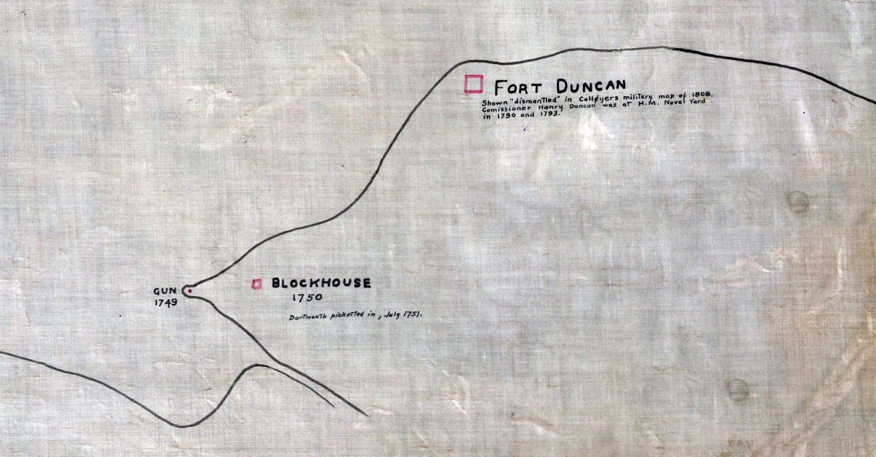
Fort Duncan: Shown “dismantled” in Collyers military map of 1808. Commissioner Henry Duncan was at H.M Naval Yard in 1790 and 1793. Blockhouse: 1750. Dartmouth picketed in, July 1751. Gun:…

Amicitia Crescimus
Fort Duncan: Shown “dismantled” in Collyers military map of 1808. Commissioner Henry Duncan was at H.M Naval Yard in 1790 and 1793. Blockhouse: 1750. Dartmouth picketed in, July 1751. Gun:…
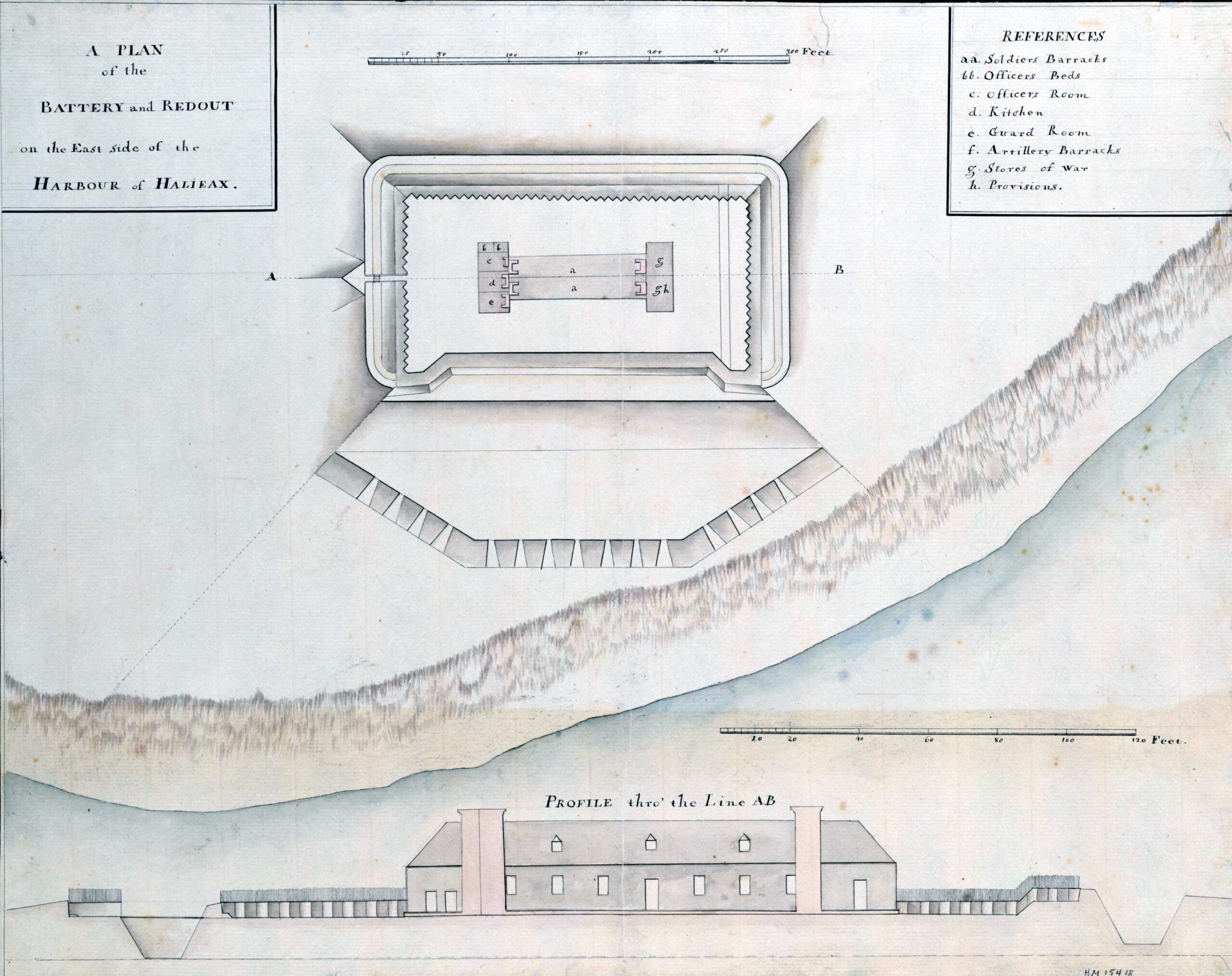
This is likely Fort Clarence, though from the shape of the shoreline and the profile of the fort itself it could also be what was once Fort Duncan, dismantled by…
…all and singular the Territoryes. Lands. Islands. Seas Rivors. Lakes forts and fortresses. whatsoeuer. within the Boundaryes and Lymitts Aforesaid And the Jurisdiccon of our Admiralltie and all other Jurisdiccons…
…with the camp, towers, fortifications, &c. Since the lands and other things in the diet, the charter belonged to Lord William Alexander de Menstrie by inheritance and by resignation they…
…le dit Sieur de la Verdure sortira hors du fort soldats et domestiques, de toutes conditions, servans au d. fort avec leurs armes et tambours battant, enseigne déployée, balles en…

…an investment of four days. The name of the fort was then changed to Cumberland. Fort Gaspereau, on Bay Verte, or Green Bay, was next taken; and the forts on…
…lying between the fortieth and forty-eighth degree of north latitude. Within those limits, too, fishing could be carried on only by permission of the Council for New England, who thus…
…shall be sent forthwith by the City Clerk, by prepaid post, to the person challenged or objected to, if living. (3) If the person whose name is challenged or objected…
…and the many acts of violence committed in and about Fort Lawrence and Fort Cumberland, is it known that a single Yorkshire settler ever swerved in his loyalty. In the…
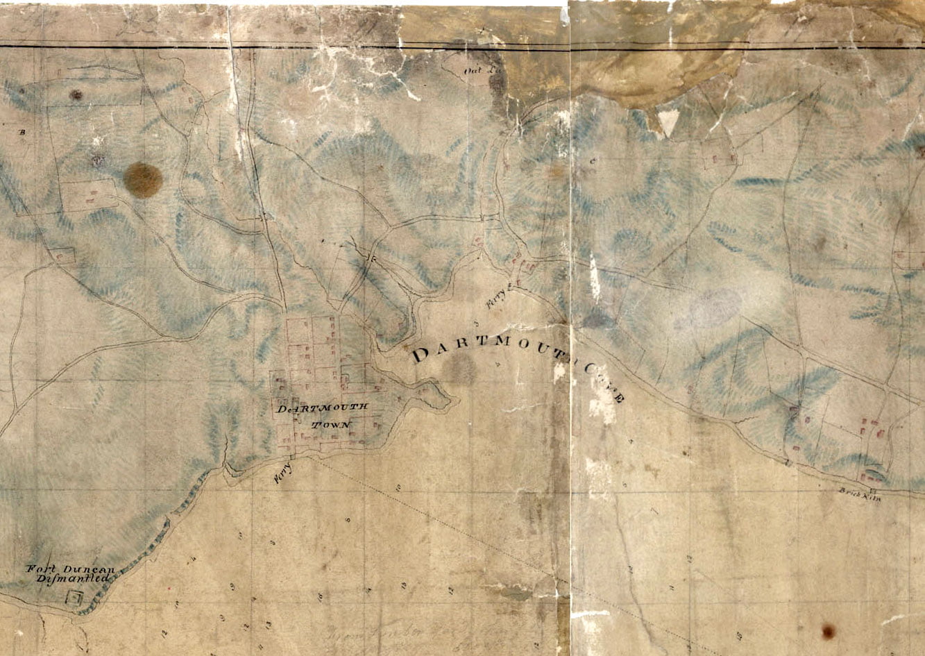
A very detailed rendition of the Dartmouth shore from 1808. Skerry’s ferry at Ochterloney is seen as well as Creighton’s Ferry at the bottom of Old Ferry Road. Fort Duncan…