
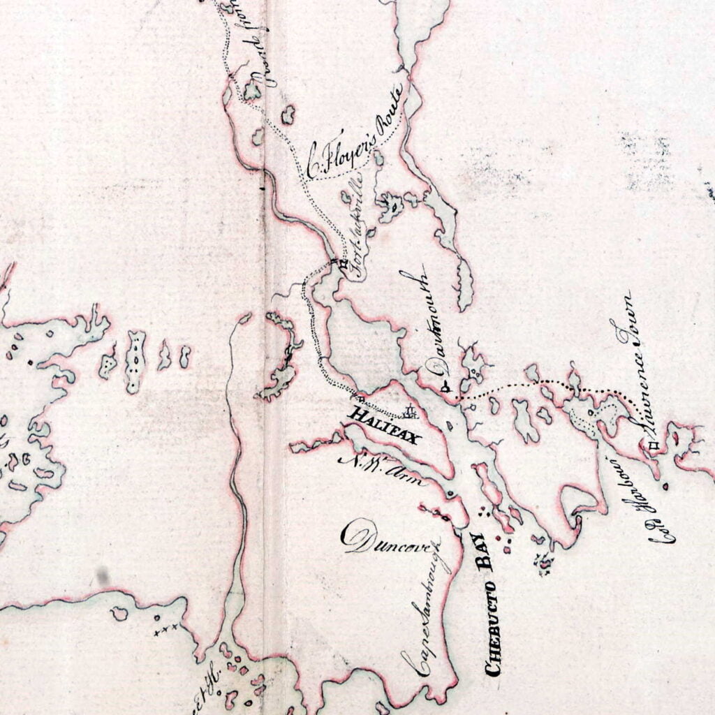
“Harbor of Halifax”, Des Barres, Joseph F. W. [1777-78?] https://www.loc.gov/resource/g3301pm.gan00021/?sp=30&r=0.1,-0.345,0.926,1.292,0

Amicitia Crescimus
“Harbor of Halifax”, Des Barres, Joseph F. W. [1777-78?] https://www.loc.gov/resource/g3301pm.gan00021/?sp=30&r=0.1,-0.345,0.926,1.292,0

“Cape Berton” (Breton) and “Cape Ras (Race) helps to situate this map.
“Geografia tavole moderne di geografia de la maggior parte del mondo di diversi avtori raccolte et messe secondo l’ordine di Tolomeo con i disegni di molte città et fortezze di diverse provintie stampate in rame con stvdio et diligenza.” Antoine Lafréry. Roma. 1575 [?] https://www.loc.gov/resource/g3200m.gct00410/?sp=4&r=0.307,0.07,0.223,0.121,0

“Norumbega”
“Theatrvm orbis terrarvm.” 20 Mai 1570. https://www.loc.gov/resource/g3200m.gct00126/?sp=14&r=0.501,0.026,0.382,0.207,0
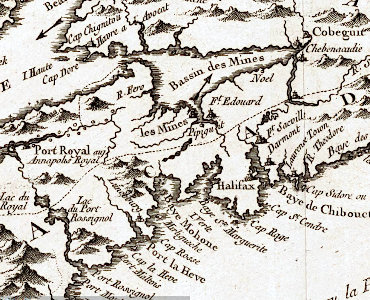
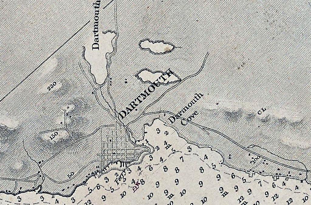
“Darmont”
Interesting interpretation of what is “Part of Canada” and what is Acadie here.
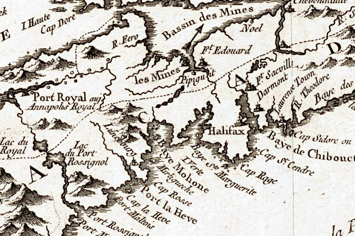
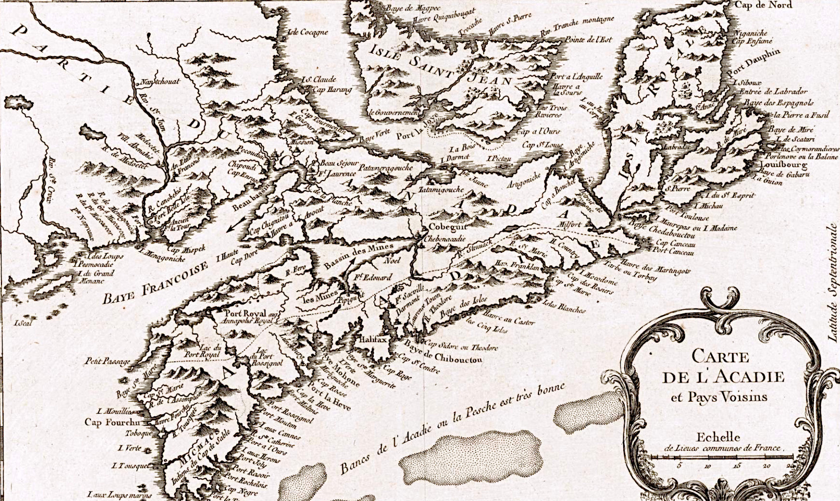
“Carte de l’Acadie et pays voisins.”, Bellin, Jacques Nicolas. [Paris] 1764. https://www.loc.gov/resource/g3420.ct008129/?r=0.34,0.308,0.306,0.166,0
“The Province of New Scotland in Latin Nova Scotia is properly that large Peninsula known formerly by the name of Acady; tho’ in the Charter granted by K. Charles 1st all the seacoast from New England up to the straits of St. John’s Island is included therein. Its extent from Cape Negro to Cape Canso Northeast is about 120 miles [I’m not sure what kind of miles they’re referring to here, utilizing the map’s own “English miles” as a scale would be closer to 240]; the Breadth unequal from 30 to 100 miles. It lies exceedingly well for the Fishery, being surrounded with excellent Bays & Harbors. The land abounds with Wood, such as Beech Fir Pine Elm and many other; & is very fertil in all sorts of Grain. The rivers produce variety & plenty of fish, & the Woods abound with Deer and other valuable Animals; So that the new settlers with His Majesty’s gracious encouragement need not fear supporting themselves & improving the Colony. The climate is good being in the same latitude as the South of France [haha]; and its Vicinity to Boston will procure it any supplies. Such is the state of our New Colony, though an Old Inheritance ever since the reign of Henry 7th. And tho’ Charles 1st did grant a Charter for peopling this Province, and, to give it a sort of dignity, did institute an Order of Baronets of New Scotland, yet there was no effectual Settlement made during the several Reigns of the House of Stuart, for fear of disobliging the French. (Published according to Act of Parliament, April 21, 1749)”
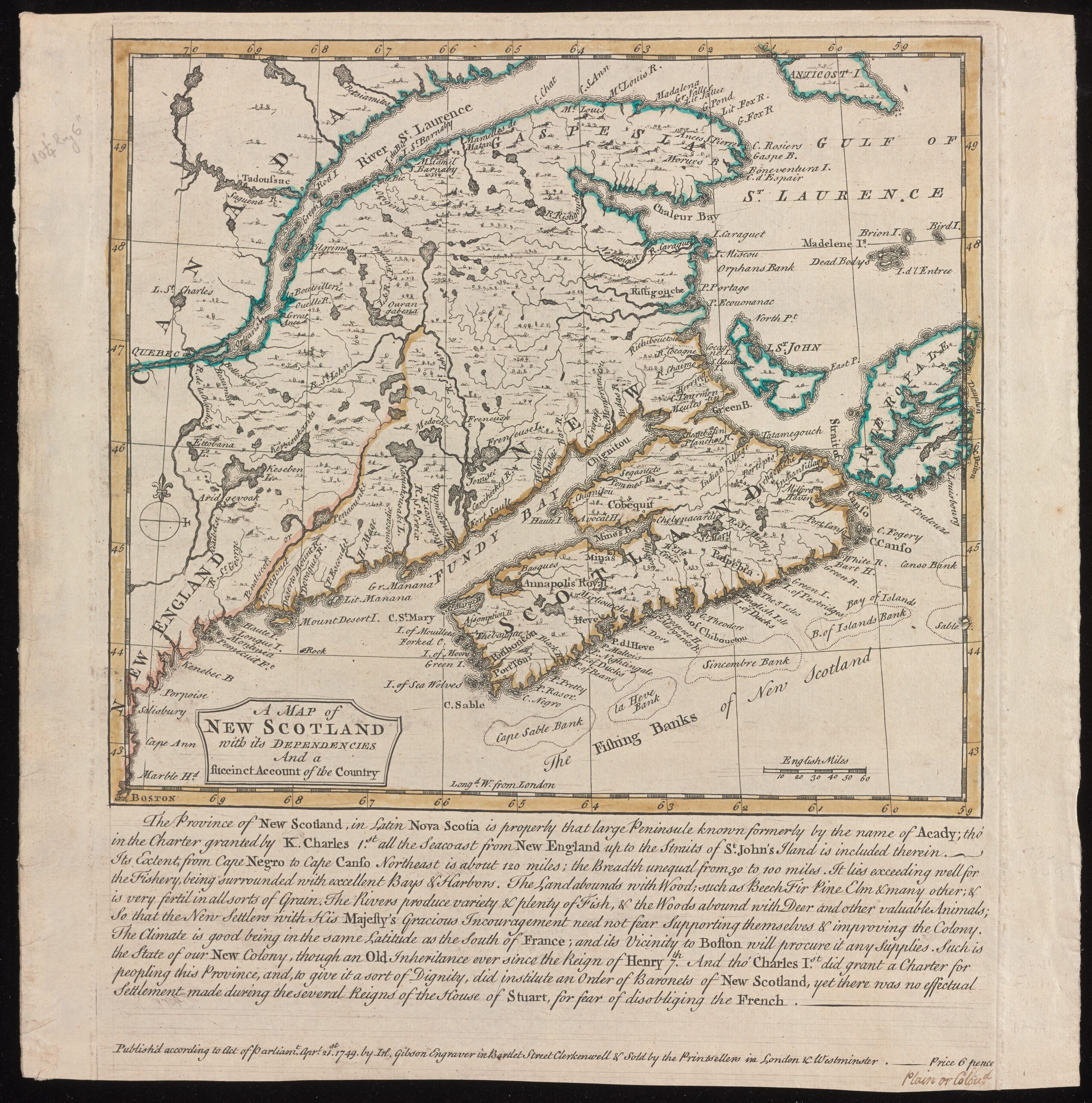
“A map of New Scotland with its dependencies and a succint account of the country.
Publish’d according to Act of Parliament Apr’l 21st, 1749, by Ino. Gibson engraver in Bartlet Street Clerkenwell & sold by the printsellers in London & Westminster.” [1749].
Gibson, J. (John). https://collections.library.yale.edu/catalog/16698407


“A Map of the surueyed parts of Noua Scotia”, [175-?]. https://collections.library.yale.edu/catalog/15826739
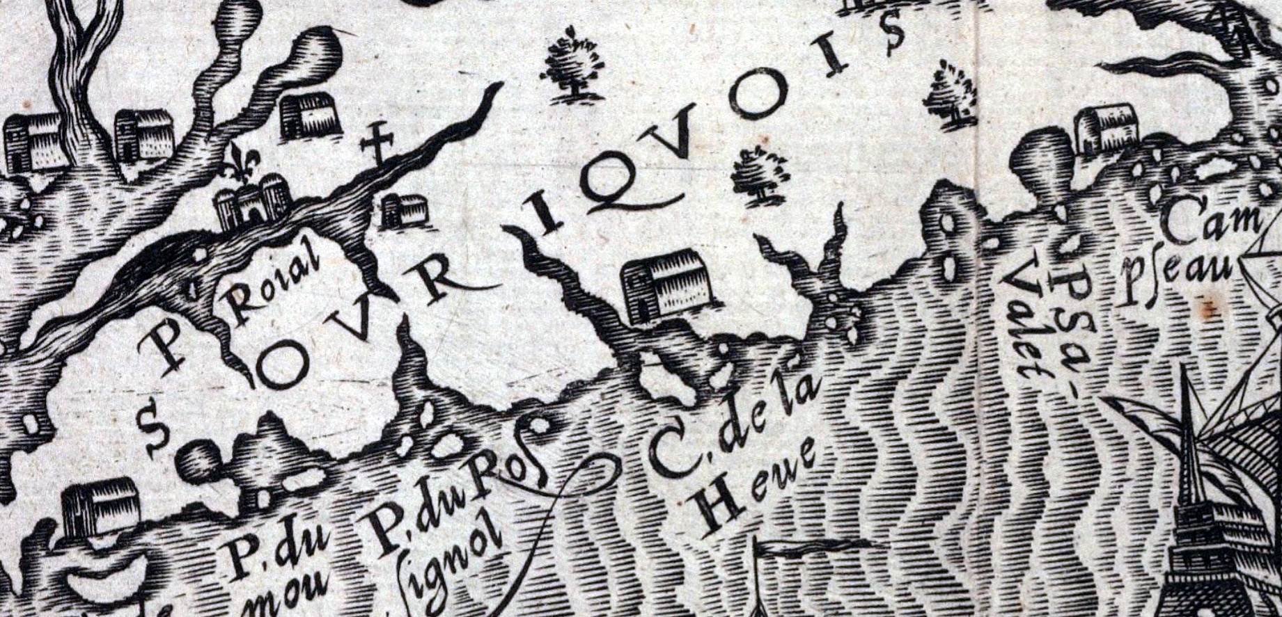

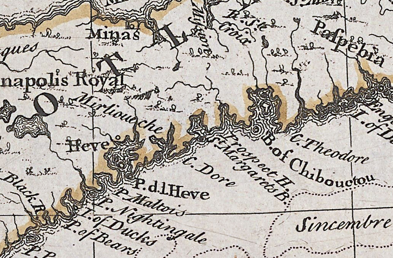
There’s a few settlements shown here on the east coast of Nova Scotia, at Cape Sable, La Heve and at Canso (Campseau). “Souriquois”, the name given to the Mi’kmaq by the French, is also noted here.
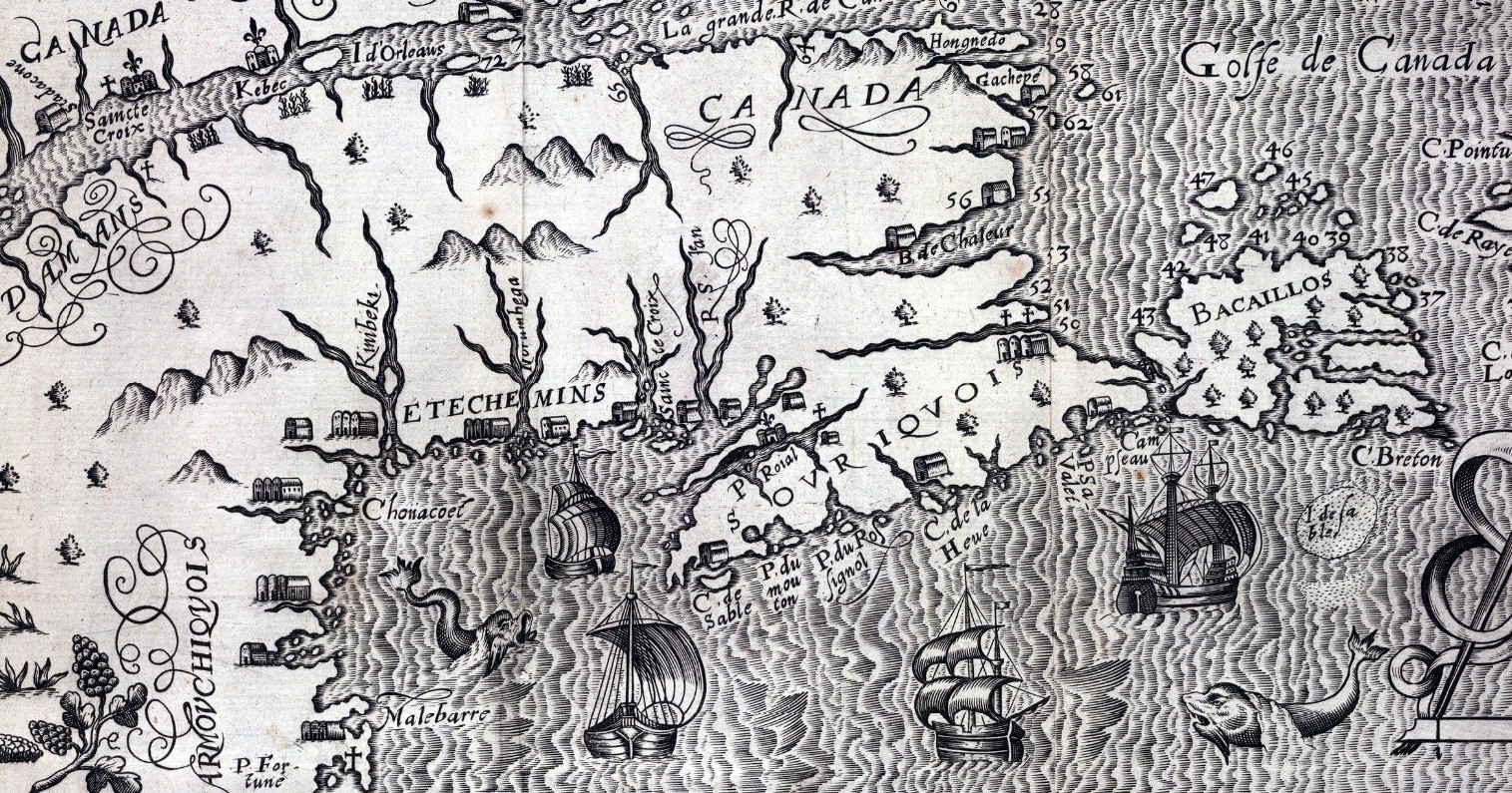
“Figure de la terre neuue, grande riuiere de Canada, et cotes de l’ocean en la Nouuelle France”, Lescarbot, Marc. 1609. https://collections.library.yale.edu/catalog/2000047

“A chart of the peninsula of Nova Scotia by Charles Morris.” Morris, Charles. 1758. https://collections.library.yale.edu/catalog/15826747
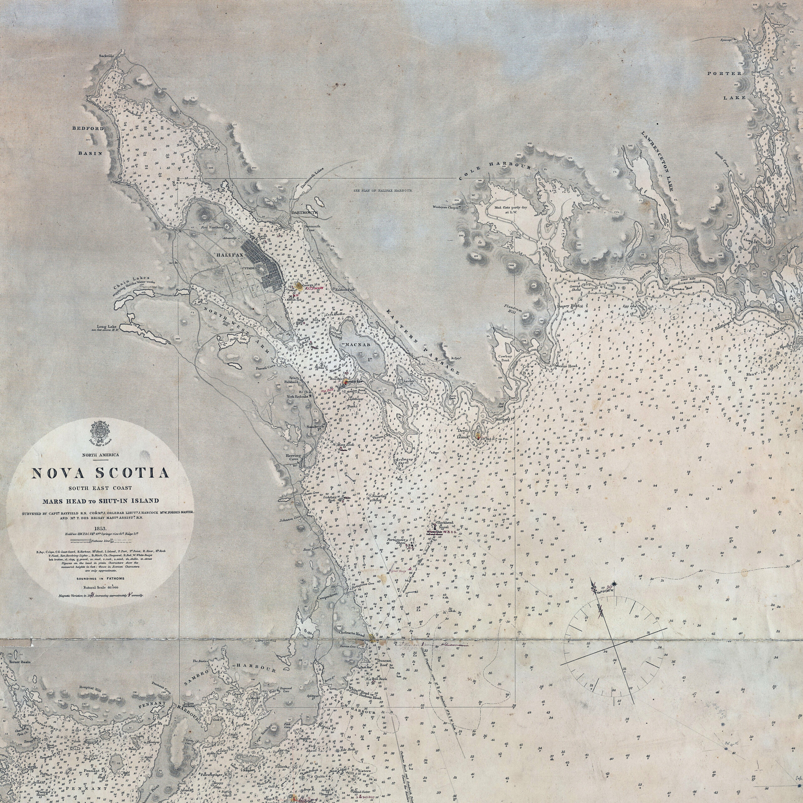
“North America. Nova Scotia: South East Coast. Mars Head to Shut In Island / Surveyed by Captn. Bayfield R.N., Commr. J. Orlebar, Lieut. J. Hancock, , Mr. W. Forbes Master. and Mr. T Des Brisay Mastr. Assist. R.N. 1853”. 1865 [London]. https://collections.library.yale.edu/catalog/15535461

A somewhat detailed representation of Dartmouth by Charles Morris showing what appears to be four blockhouses and what is perhaps the connecting palisade. Mills are also noted along with a windmill just beyond the mill stream, near what would be Maitland Street today.
“A plan of the harbour of Halifax / by Charles Morris, chf. surveyr.”, Morris, Charles. 1751. [Halifax?] https://collections.library.yale.edu/catalog/15826742