
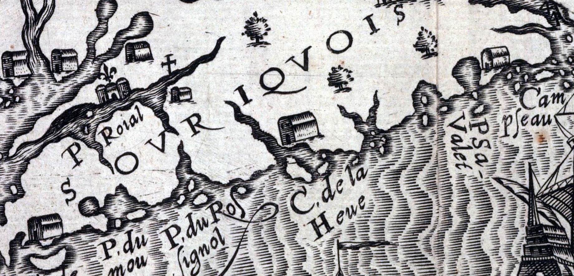

There’s a few settlements shown here on the east coast of Nova Scotia, at Cape Sable, La Heve and at Canso (Campseau). “Souriquois”, the name given to the Mi’kmaq by the French, is also noted here.
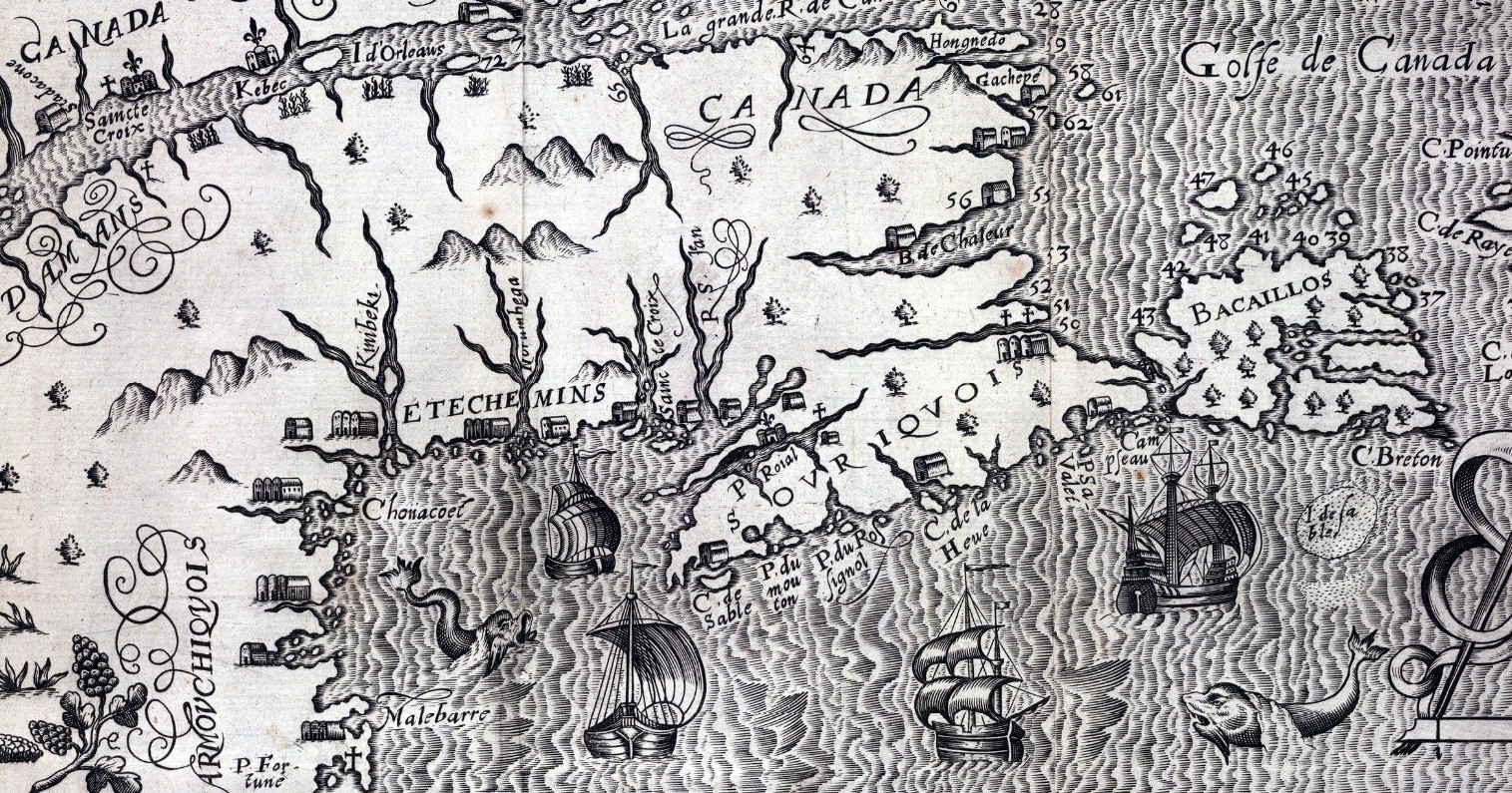
“Figure de la terre neuue, grande riuiere de Canada, et cotes de l’ocean en la Nouuelle France”, Lescarbot, Marc. 1609. https://collections.library.yale.edu/catalog/2000047
Related posts:
- “New Scot Lande” Argals Bay, now the Bay of Fundy, must be a reference to Samuel Argall. Interesting that “The province of Alexandria” as well as “The Province of Caledonia” seem to align with the general jurisdictions of New Brunswick and Nova Scotia...
- The north eastern coast of North America : from New York to Cape Canso, including Sable Island Lionel Pincus and Princess Firyal Map Division, The New York Public Library. “The north eastern coast of North America : from New York to Cape Canso, including Sable Island” The New York Public Library Digital Collections. 1848. https://digitalcollections.nypl.org/items/510d47da-f0b2-a3d9-e040-e00a18064a99...
- “A new map of Nova Scotia, and Cape Britain: With the adjacent parts of New England and Canada” “Bay of Fundy or Argal”, “Gulf of Nova Scotia”, “Cape Britain” “A new map of Nova Scotia, and Cape Britain: With the adjacent parts of New England and Canada, composed from a great number of actual surveys” Jefferys, Thomas. [London]...
- “A chart of the coast of America from New found Land to Cape Cod” “Sesembre” or Sambro, which is at the mouth of Halifax Harbor. I’m not sure if “Baye Senne” then is meant to represent it or another subsequent indentation in a coast that is nothing but indentations and harbors, but it does...
- History of Nova Scotia, Cape Breton, the Sable Islands, New Brunswick, Prince Edward Island, the Bermudas, Newfoundland, &c., &c. “The territorial distribution of the Nova Scotia government is – 1. Eastern division, 2. Middle; 3. Western; 4. Halifax; 5. Cape Breton; there are ten counties, some of which are again subdivided into districts and townships for the more convenient...
- Journals of the Board of Trade and Plantations; relating to the French inhabitants at Nova Scotia Letter from Lord Townshend &c. about the French inhabitants there. Colonel Vetch summon’d. Letter from the Lord Viscount Townshend, of the 15th instant [fo. 346], with a copy of one from Monsieur de Ponchartrain to Monsieur D’Iberville, relating to the...
- “The general cession of Nova Scotia” 220. Mr. Delafaye to the Council of Trade and Plantations. I have laid before the Lords Justices your representation of the proper measures to be taken for the security of Carolina and Nova Scotia. Their Excys. judging that care should...
- America and West Indies Colonial Papers: September 1720, 1-15 The comprises correspondence regarding the security and territorial disputes involving Carolina, Nova Scotia, and the Island of Providence in 1720. Mr. Delafaye conveyed concerns about the security of these regions, prompting inquiries into the state of the Island of Providence...
- Geographical Map of New France There’s a few settlements noted on the Atlantic coast of Nova Scotia here, “sesembre” being Sambro helps orient Halifax harbor. The settlement between “S” and “R” is of interest, S being “River sainte Margrite” and R “baye senne”. Champlain, Samuel...
- Legislative history regarding treaties of commerce with France, Spain relating to New Foundland, Nova Scotia, and Cape Breton Harvard Law School Library. “Description Legislative history regarding treaties of commerce with France, Spain relating to New Foundland, Nova Scotia, and Cape Breton,” ca. 1715? Small Manuscript Collection, Harvard Law School Library. https://nrs.harvard.edu/urn-3:HLS.LIBR:19686447, Accessed 07 June 2021...