“An Act Relating to the Town of Dartmouth”, 1951 c74

Amicitia Crescimus
“An Act Relating to the Town of Dartmouth”, 1951 c74

“An Act to Incorporate the Dartmouth Rink Commission”, 1950 c101
“An Act Relating to the Town of Dartmouth”, 1950 c72
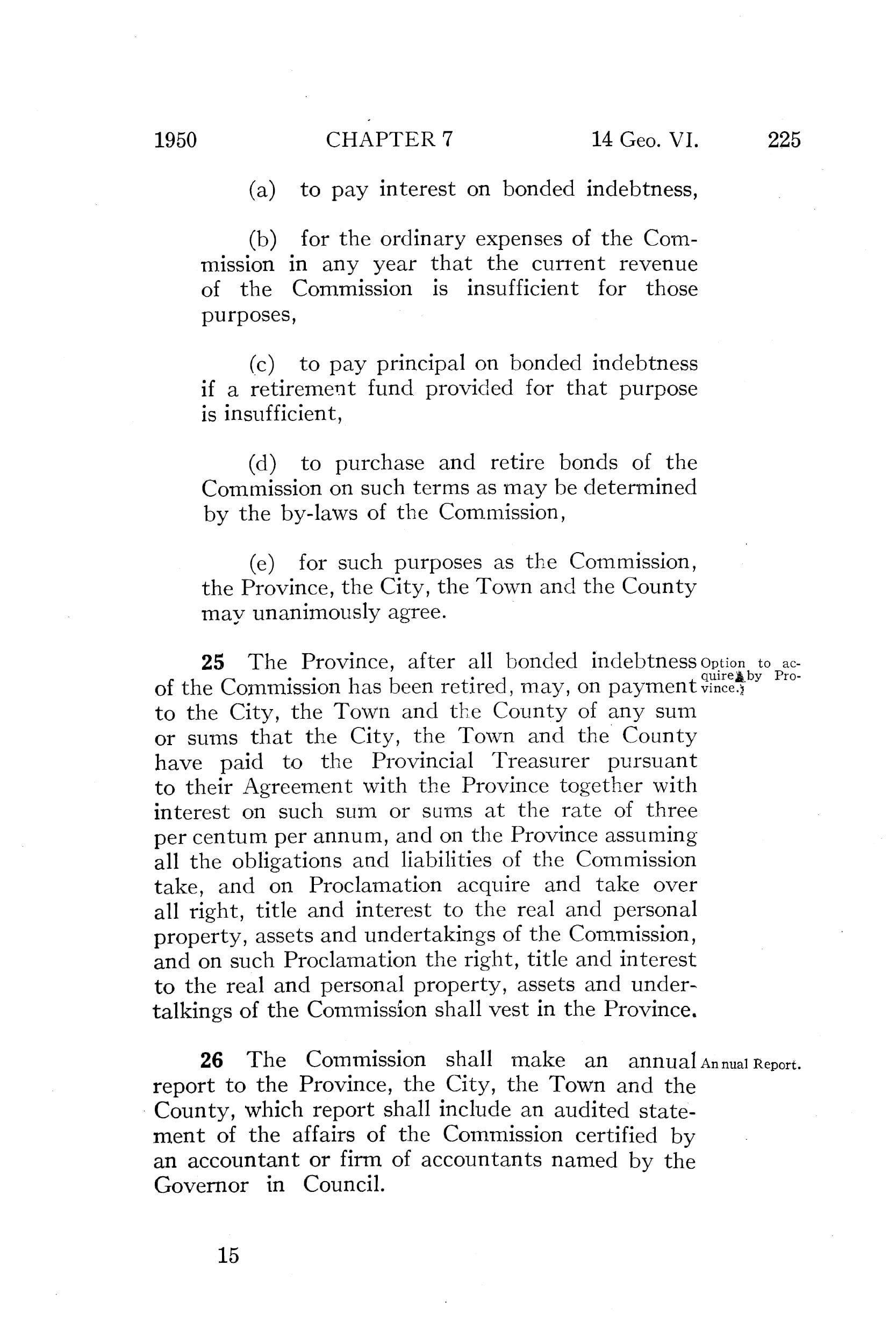
“An Act to Incorporate the Halifax-Dartmouth Bridge Commission”, 1950 c7
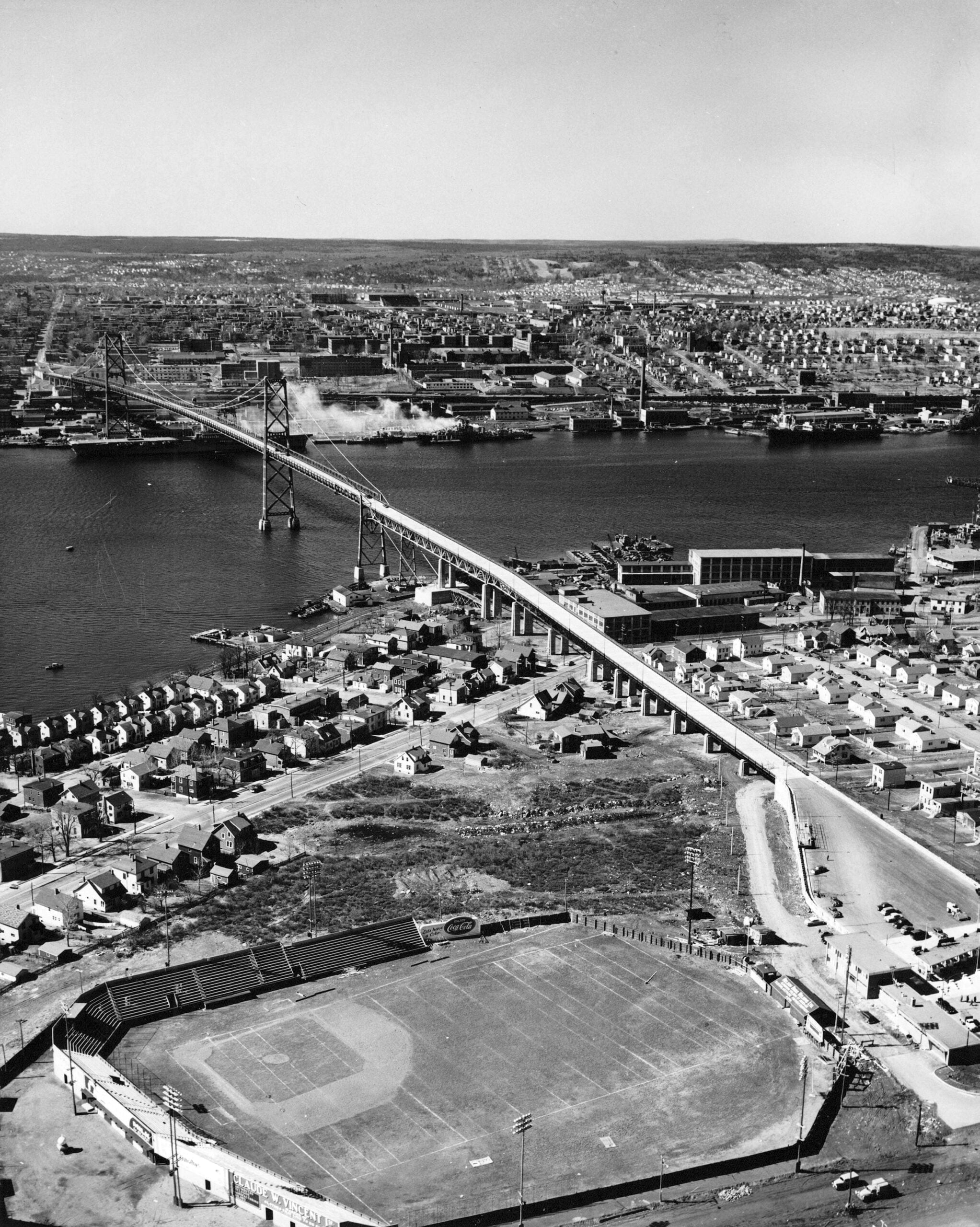

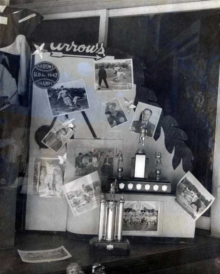
Dartmouth Common ball-field, once home to the Dartmouth Arrows (now the site of the Holiday Inn Dartmouth as well as “Metropolitan Place”).
Halifax District League Champions, Dartmouth Arrows (1947).
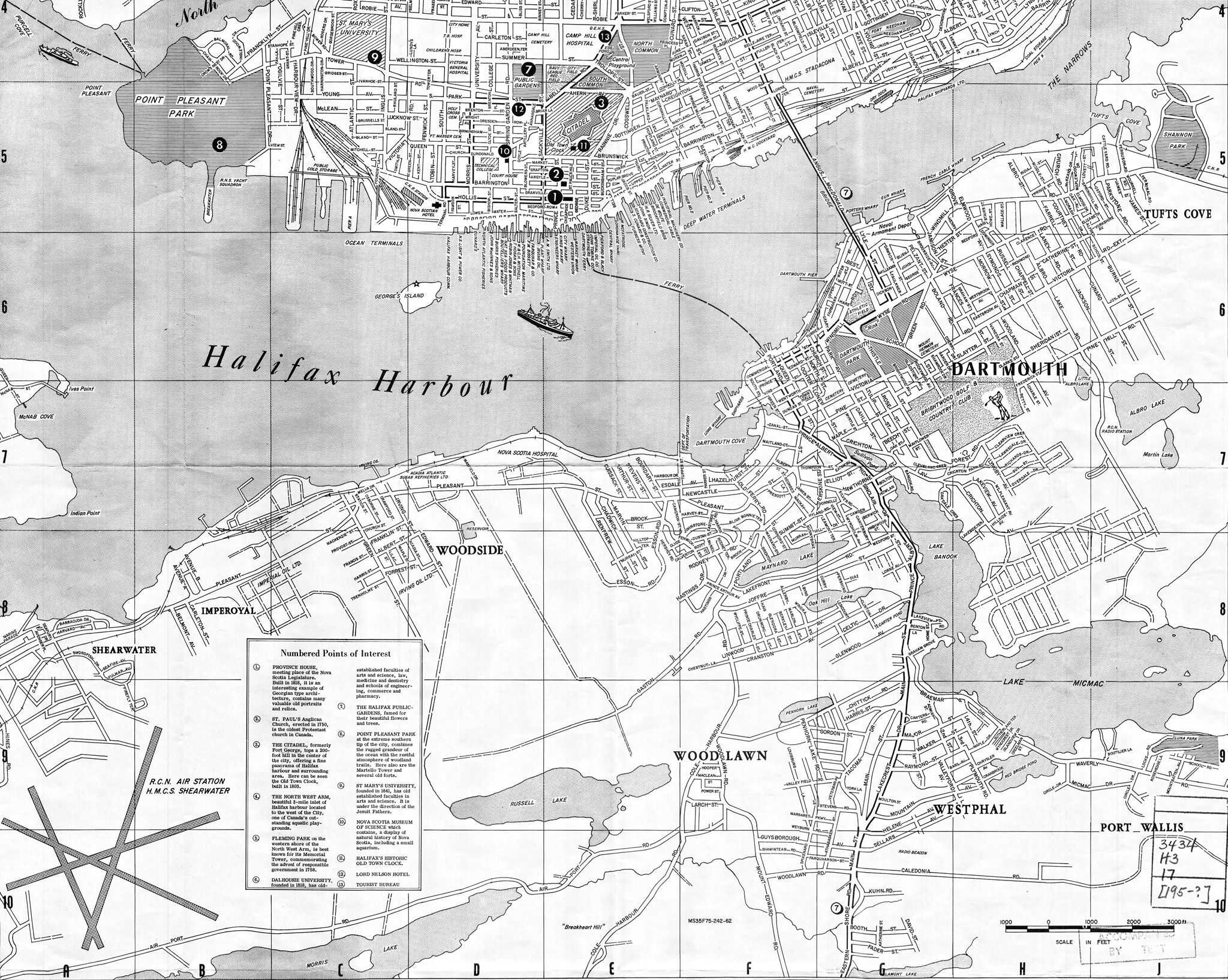
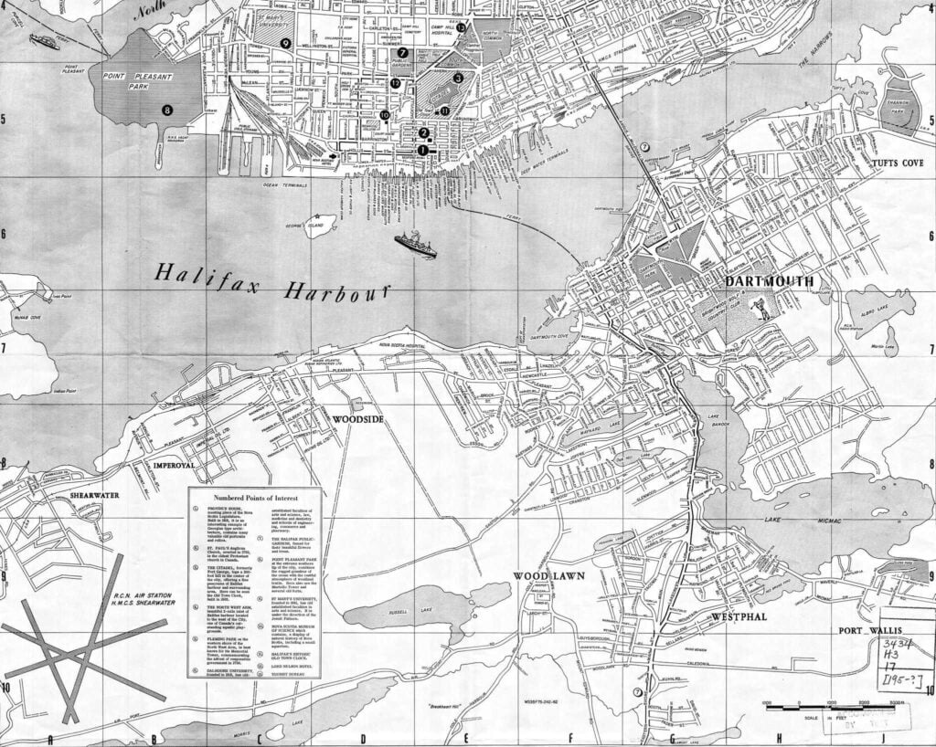
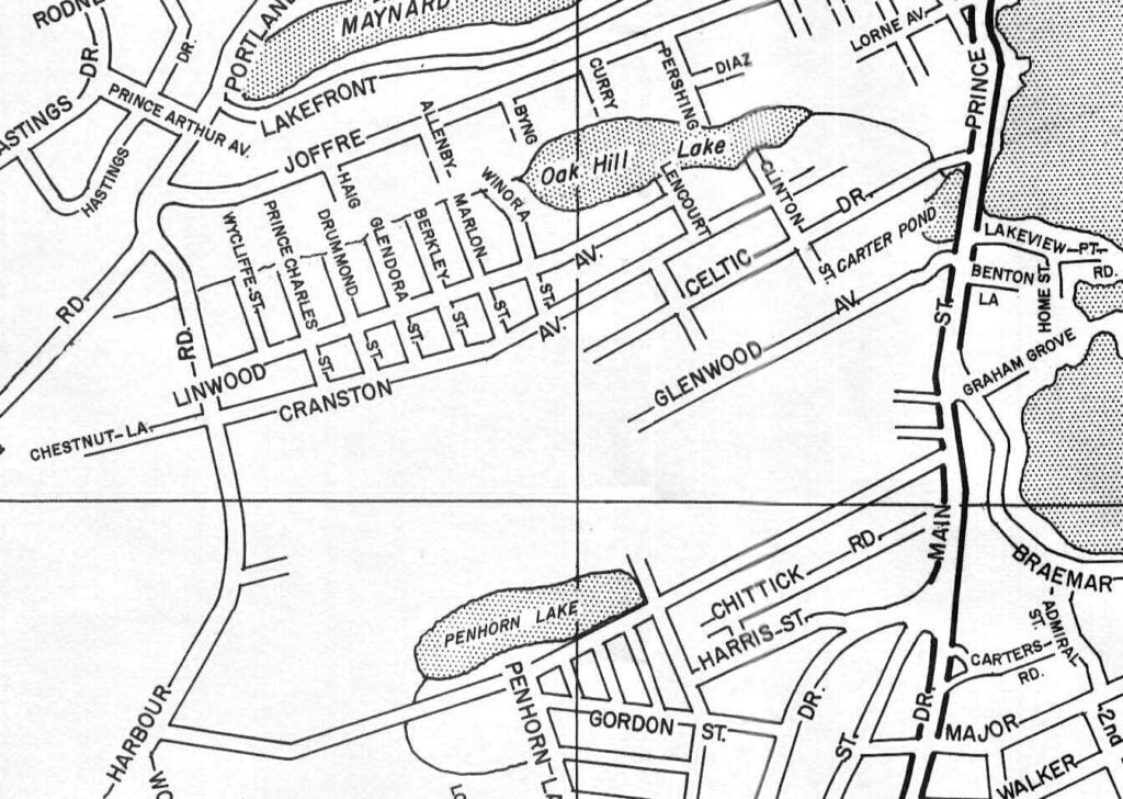
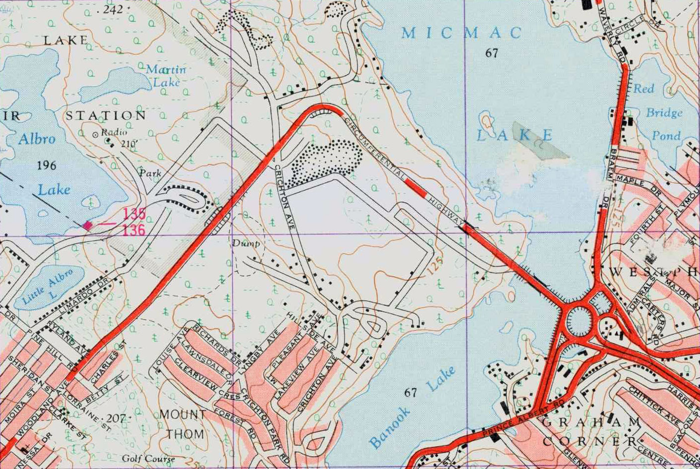
An interesting map of Dartmouth from around 1950. It’s quite detailed – in many cases aspirational.
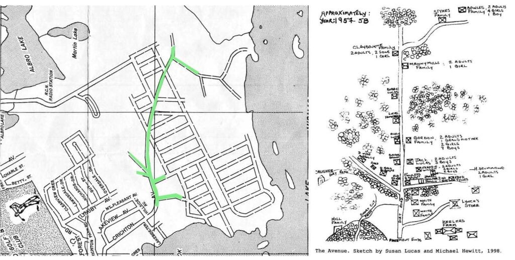
Check out the subdivision plan for what is now Mic Mac Mall – below the modern grid they had once hoped to construct, you can see the makeup of “The Avenue” quite clearly, a rarity for maps of the Dartmouth area. I really appreciate the attention in this plan to preserving pre-existing ROWs.
A whole plan for Manor Park that didn’t come to pass is included too.
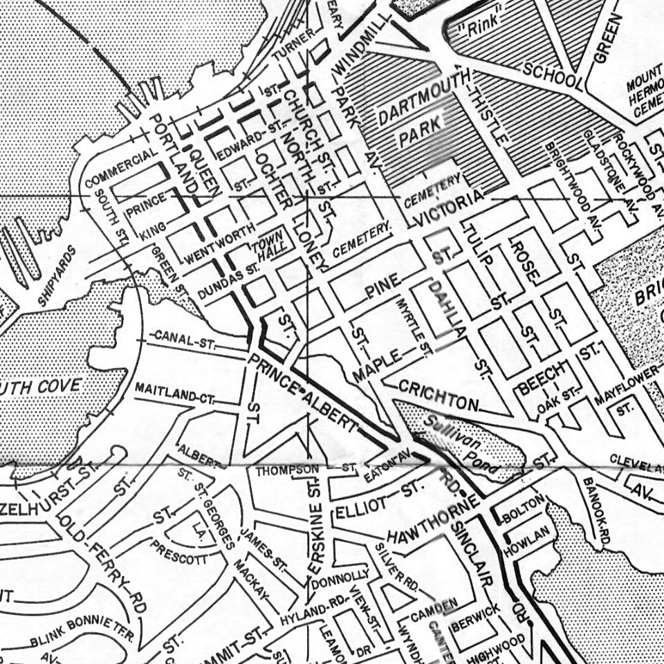
Alderney Drive was yet to be rammed through the downtown, and the original street grid is, for the most part, still present. What would’ve happened if the Province hadn’t strangled Dartmouth’s configuration with the 111 highway? We will never know, but we get an inkling thanks to this map.
“Mapco map and directory of information Halifax and Dartmouth: and vicinity Nova Scotia with indexed streets” Map Corporation of America. 1950. https://mdlcollections.library.utoronto.ca/islandora/object/mdl%3AG3434_H3_17
See also:
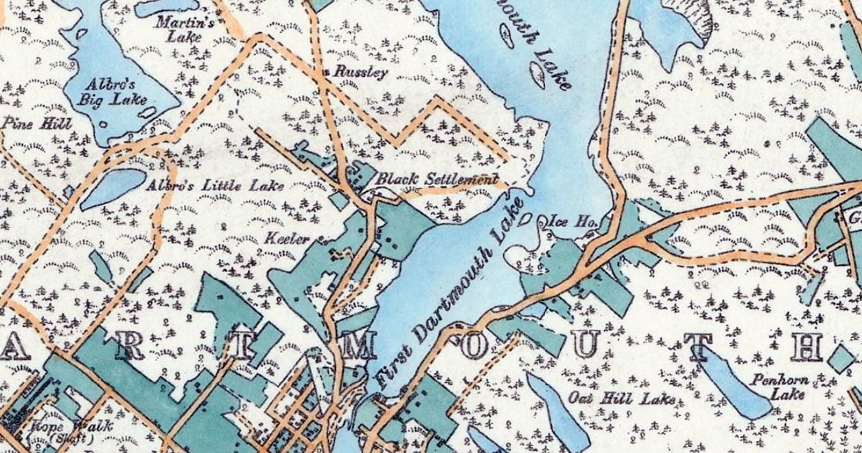
The “Black Settlement”, aka “The Avenue”, as seen on the outskirts of the Town of Dartmouth in 1886
The following excerpts are from “Survival of an African Nova Scotian Community: Up the Avenue, Revisited” by Adrienne Lucas Sehatzadeh, 1998. An incredible resource of some of the Black history of Dartmouth that is certainly worth your time to read.
“The part of Crichton Avenue above Lyngby Avenue is the area where the Black settlement started. Crichton Avenue winds its way north/south from the downtown area, along the western shore of Sullivan’s Pond and Lake Banook.”
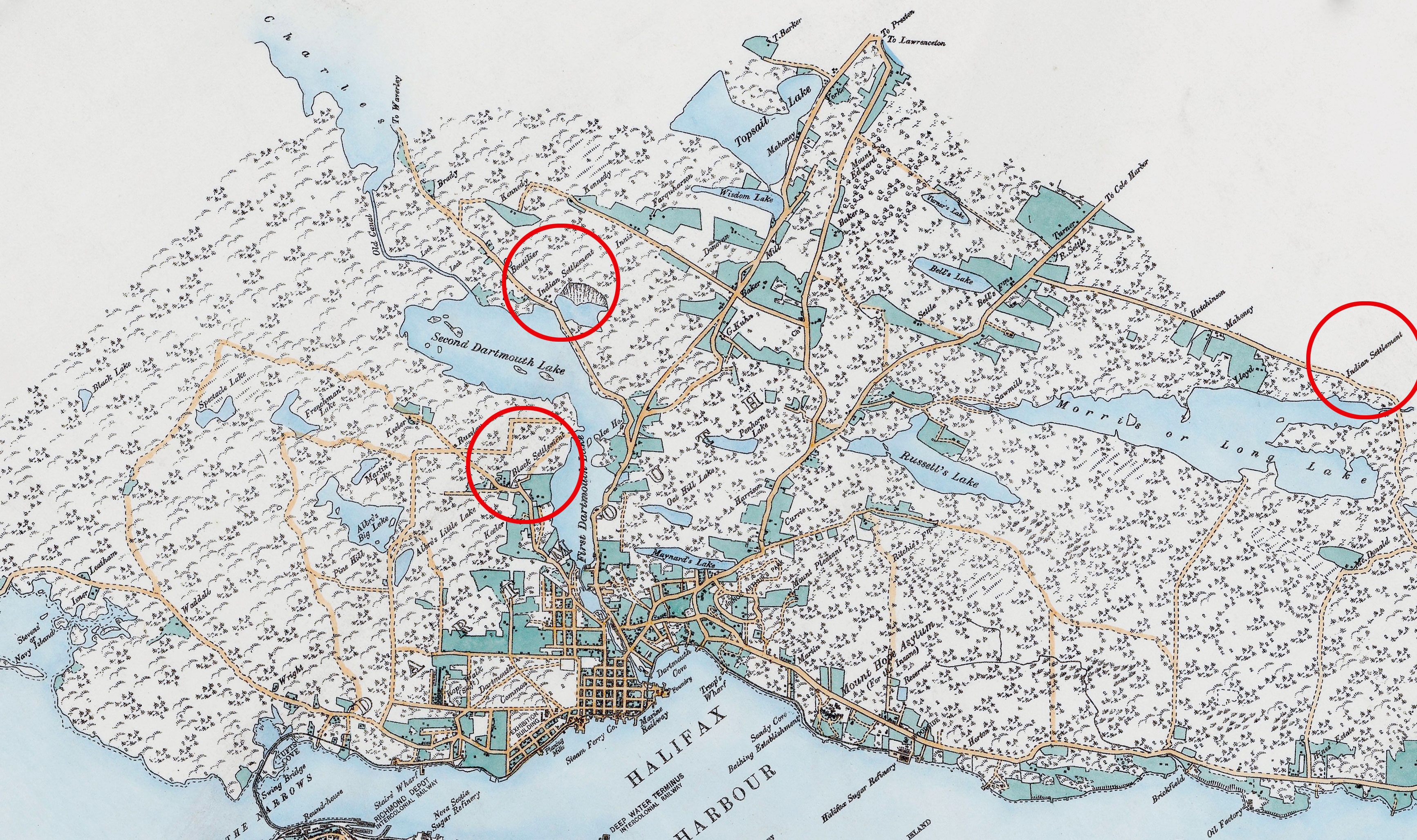
The Avenue as it was in context within the broader Dartmouth area, note also two Mi’kmaq Settlements. There aren’t many maps as excellent as this one by E. Hopkins and Chas S. Akers from the period. Many later maps omitted the Avenue and other peripheral Dartmouth communities entirely. (https://gallica.bnf.fr/ark:/12148/btv1b53029049m)
“Crichton Avenue has been a major roadway in Dartmouth for over 100 years and intersects Ochterloney Street in the downtown area, about one kilometre from Halifax Harbour. The Avenue portion of Crichton Avenue extended across the circumferential highway to The Extension, where the Black community ended.”
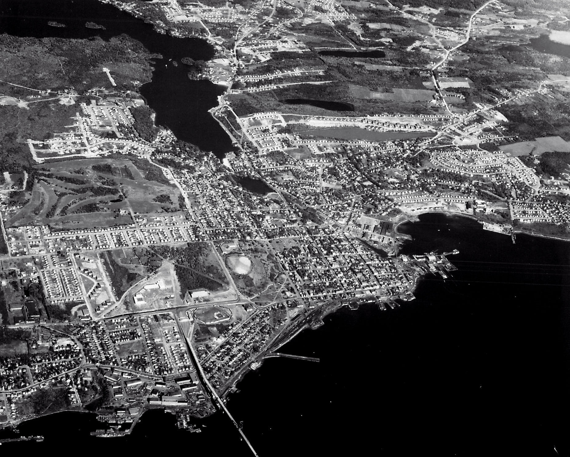
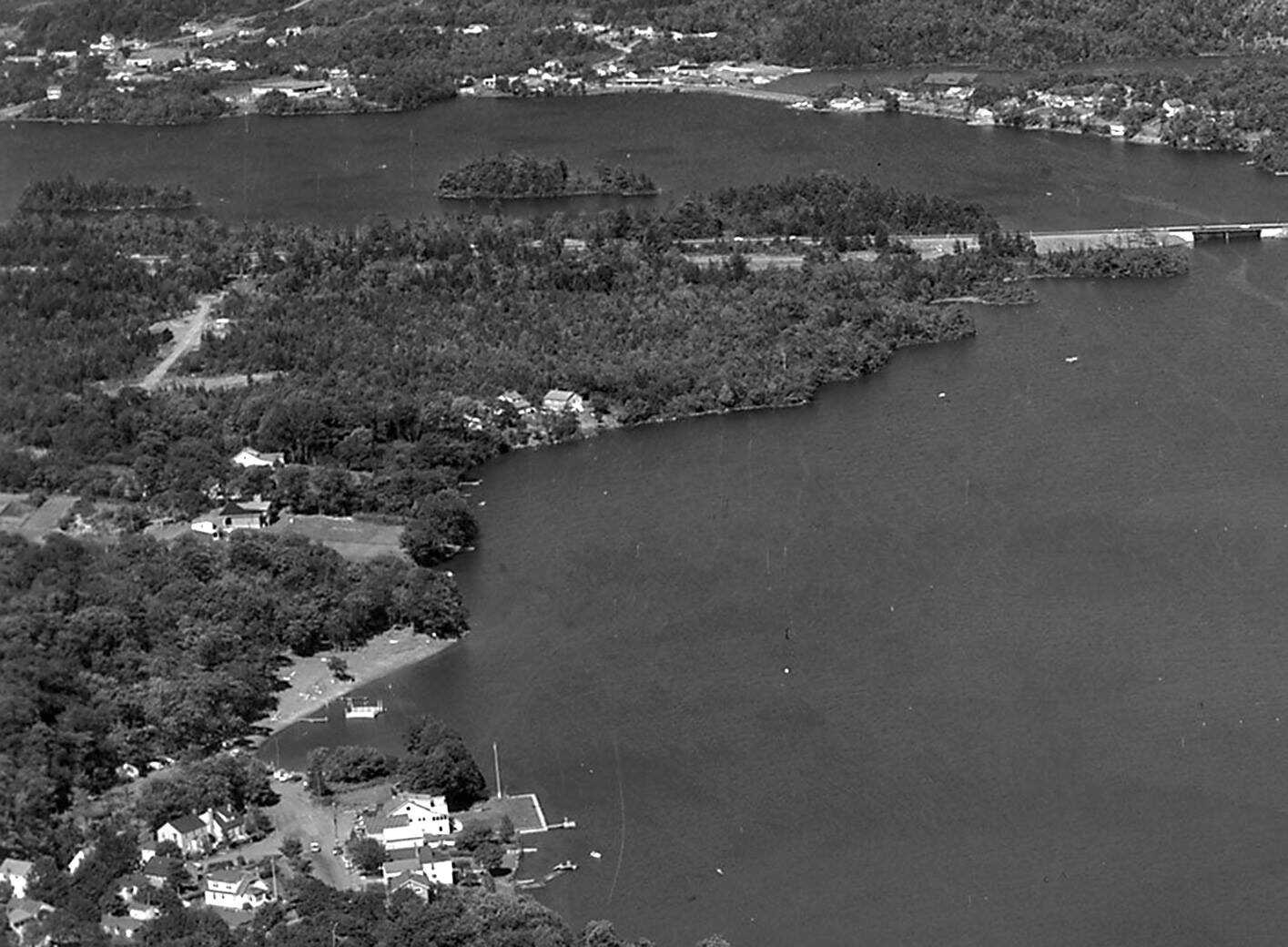
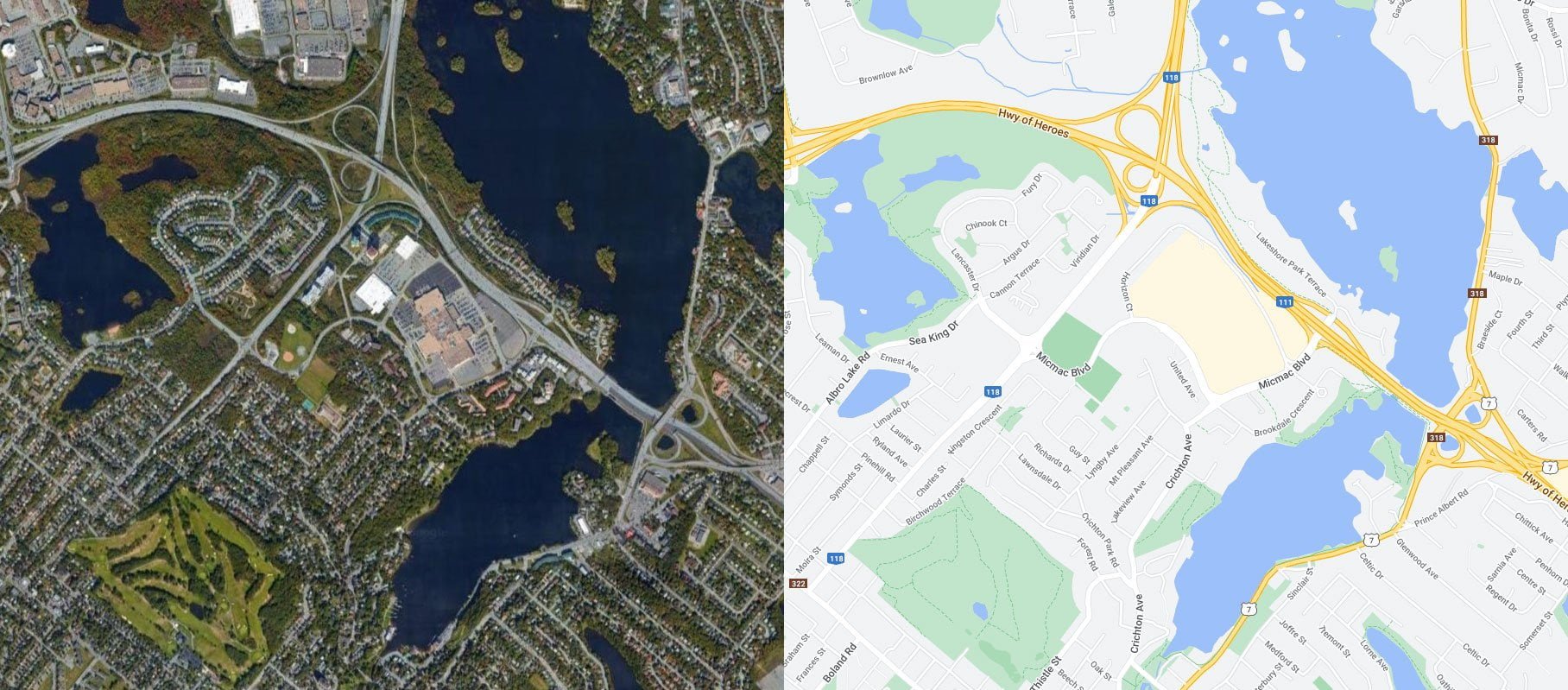
The encroachment of suburbia into “The Avenue” is well underway by the time these aerial shots were taken in the mid-late 1960s.
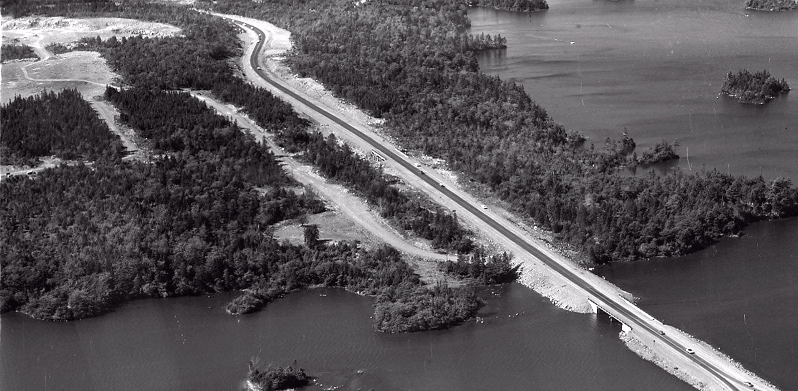
“Crichton Avenue Extension was expropriated in the late 1960s because of the expansion of the circumferential highway. The circumferential highway (not shown on the sketch) runs east less than one-half kilometre north of the last Lucas house on Crichton Avenue.”
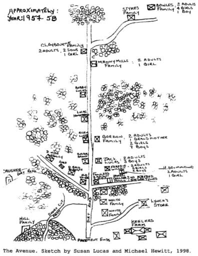
A Sketch of “The Avenue” as seen on Page 164 (153) of “Survival of an African Nova Scotian Community: Up the Avenue Revisited” by Adrienne Lucas Sehatzadeh. (https://www.collectionscanada.gc.ca/obj/s4/f2/dsk2/tape15/PQDD_0012/MQ36526.pdf)
“The Extension was the continuation of Crichton Avenue just north of the highway. The few references to this Black community in the literature refer to the area as ‘Colored Meeting House Road’ until the Legislature passed a bill in 1892 to name the roadway Crichton Avenue. Street signs bearing the name Crichton Avenue were erected in 1894 (Martin, 1957). However, the Black settlement at the top of Crichton Avenue was never officially named.”
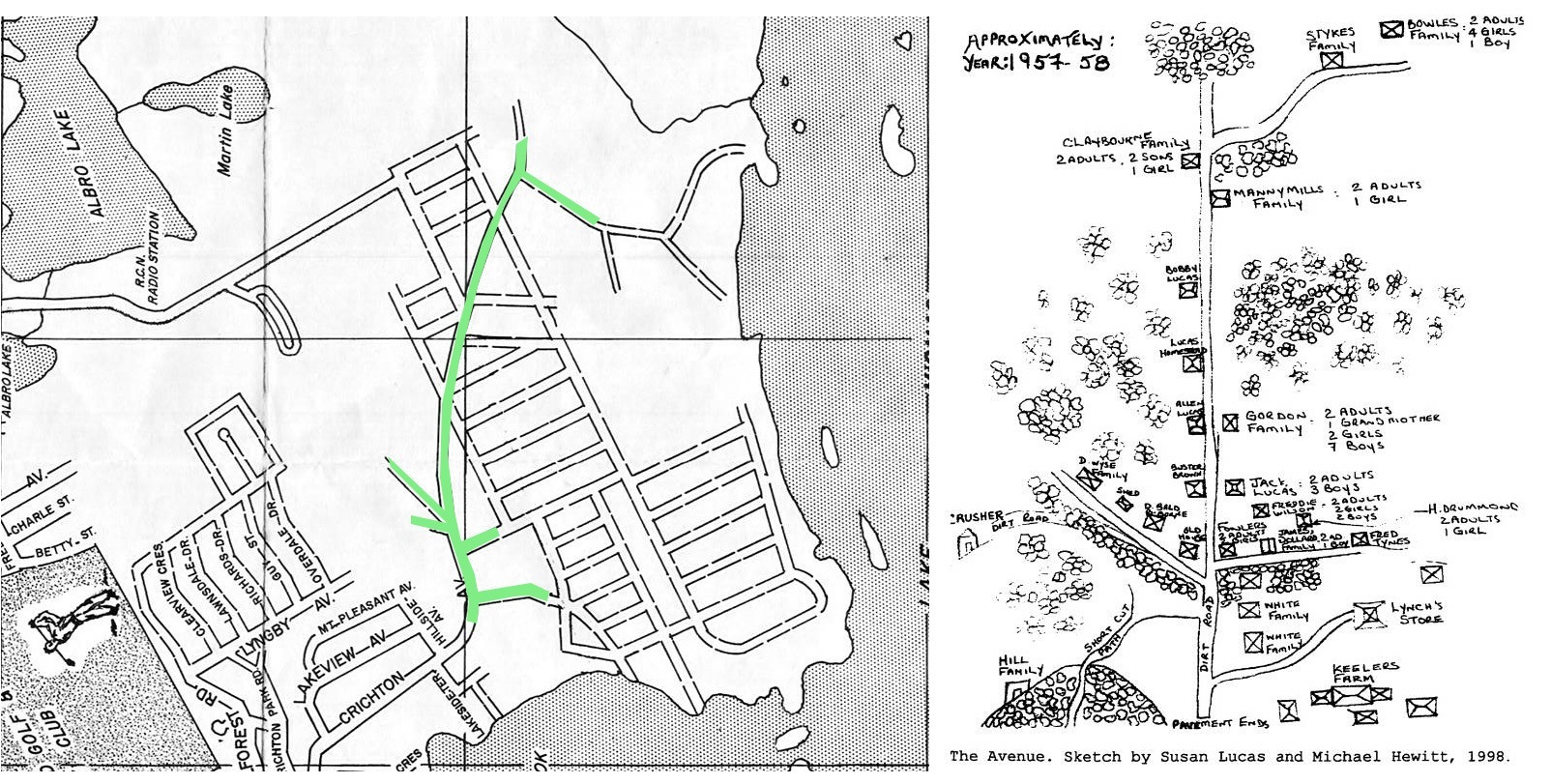
The Avenue seen at left as it intersected with a planned subdivision that never materialized. (https://cityofdartmouth.ca/dartmouth-before-being-strangled-by-a-beltway/)
“Although the Black settlement did not have a formal name, my experience has been that people always talked about going up The Avenue to spend time and socialize. The Avenue is a familiar referent for this community. The phrase evokes powerful imagery for individuals who are familiar with the life and times of the people from this area. I have, therefore, arbitrarily named the area ‘The Avenue’.”
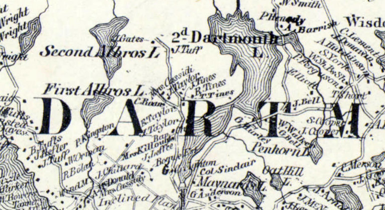
Tines families are seen in this extremely detailed map c.1864 from A.F. Church and Co. (https://collections.lib.uwm.edu/digital/collection/agdm/id/14722/rec/1) along with the Baptist Church, once located near the intersection of what would be Crichton Ave and Glen Manor Drive today.
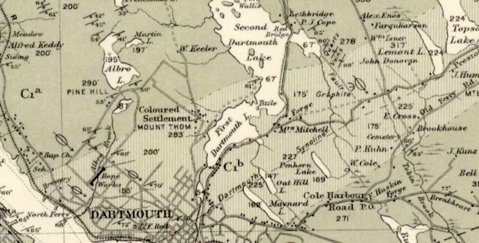
“The avenue”, which by 1908 was referred to as a “Coloured Settlement” on this Geological Survey of Canada Geological Map (https://geoscan.nrcan.gc.ca/starweb/geoscan/servlet.starweb?path=geoscan/fulle.web&search1=R=107885)
“The Avenue” by 1963 (https://digitalarchive.mcmaster.ca/islandora/object/macrepo%3A81109)
“The Avenue” today.
Sehatzadeh, Adrienne Lucas. “Survival of an African Nova Scotian Community, up the Avenue, Revisited.” Thesis / Dissertation, Dalhousie University, 1998. http://www.collectionscanada.gc.ca/obj/s4/f2/dsk2/tape15/PQDD_0012/MQ36526.pdf
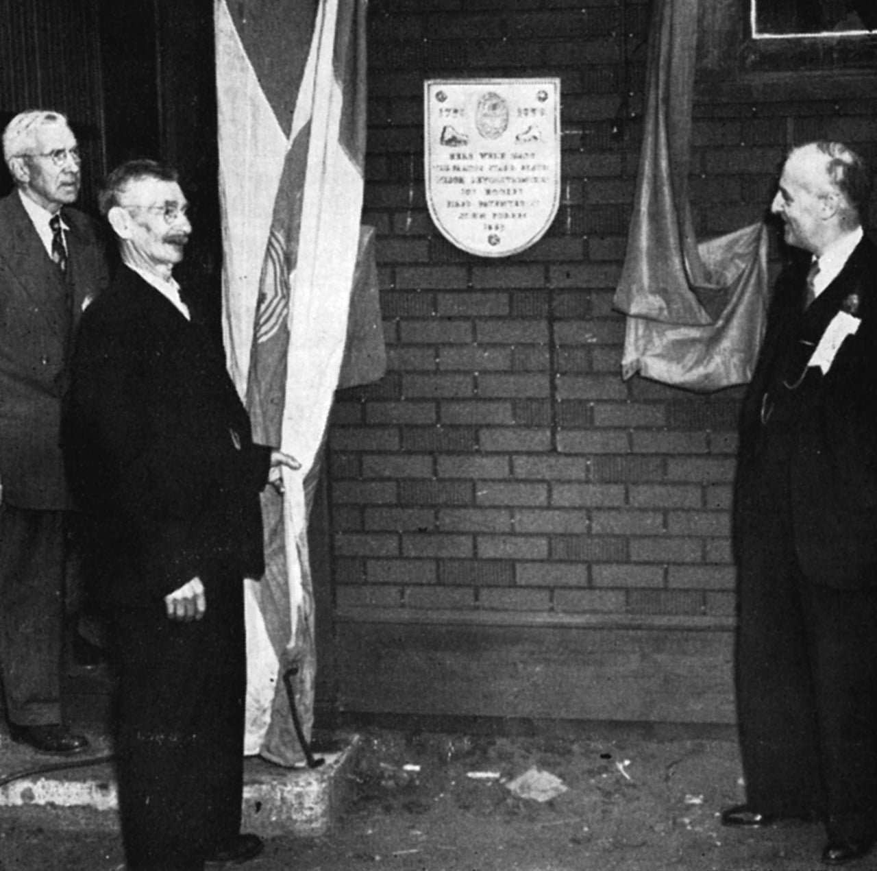

Here we see the historic plaque unveiling at Starr Manufacturing Works during Dartmouth’s Bicentennial in 1950. The man in the middle has Just performed the ceremony. He is Leander F. Stevens who has been employed at the Starr plant, almost without interruption, since 1883. At the right is Arthur C. Pettipas, Bicentennial Chairman, who delivered the address. At left is John P. Martin, Chairman of Plaque Committee. Deputy Mayor Carl Merson presided. Guests included. Rev. E. W. Forbes, nephew of John Forbes, and Alexander Patterson, veteran champion skater. Note spring skate on upper left opposite modern model. (Skate designs by H. B. Douglass, Plaque design by Peter Douglass).
A new Company re-organized in 1939, today is employing about 35 persons. Their products include bolts, nuts, rivets and all kinds of metal fastenings. They are showing steady progress under the Presidency of Gordon D. Stanfield.