Local Government in Nova Scotia

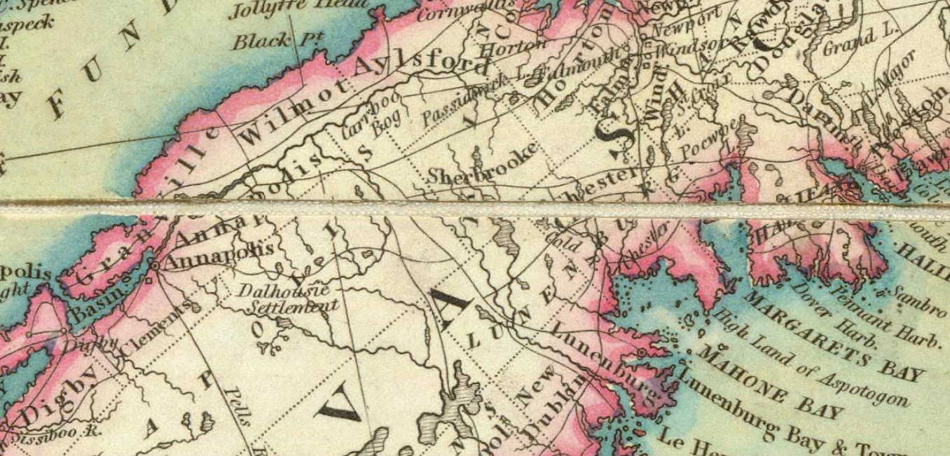
The local government history of Nova Scotia reflects a circuitous progression, from central control to increasing local autonomy and back again to centralized control. From its inception in 1605 with Port Royal, local governance was essentially an extension of central government, lacking elected councils or municipal institutions. Annapolis Royal saw early attempts at local government with the establishment of a civil council in 1720 and a general court in 1721. Halifax’s founding in 1749 marked a shift, with the establishment of Quarter Sessions, allowing for local governance with administrative and judicial functions. The system was influenced by both the Virginia and New England-style systems, with Quarter Sessions and an Inferior Court of Common Pleas.

New England settlers in Halifax demanded greater local self-government, leading to conflicts and eventual incorporation of Halifax in 1841 after a push by figures like Joseph Howe. Despite earlier attempts at incorporation, Halifax faced disallowance due to resistance from the Legislative Council. Meanwhile, outside Halifax, the Quarter Sessions system persisted until 1879 when county incorporation became compulsory, replacing the old system with elected municipal councils. Towns also sought incorporation, Dartmouth being the first in 1873, with eight towns incorporated by 1888.

Towns had to meet population and area requirements for incorporation, with mayors and councillors elected for two-year terms. The councils had broad powers, including taxation and infrastructure development. By 1954, Nova Scotia comprised 18 counties, 24 rural municipalities, 39 incorporated towns, and 2 cities, each with its own local government structure, independent of county or district authority. By 1961 Dartmouth became the third incorporated city.

Functions of local government expanded over time, responding to social and economic changes. Traditional roles included regulation and service provision, such as supporting the poor, maintaining roads, and education. However, more modern demands led to the development of new services like community planning, housing, and recreation.

Financially, municipalities initially relied on property taxes but faced challenges due to increased demands and inflation. Provincial assistance, through grants and shared responsibilities, became essential, especially during times of war and economic downturns. Tax rental agreements and conditional grants help fund services like education and social assistance, reflecting a shift towards greater Provincial and Federal involvement.

Since the 1996 amalgamation, which unilaterally consolidated several local entities into one unit in a number of (what once were) counties, local government in Nova Scotia has again undergone significant restructuring. The dissolution of distinct municipalities has reshaped the landscape, upending established institutions, the concept of local government itself and the constitutional frameworks upon which it relied.


Background:
Although there were no parliamentary institutions of any kind in the area during the French regime, local government of one sort or another has existed in Nova Scotia from the founding of Port Royal in 1605. It began not with elected municipal councils, nor with incorporated towns and cities, not even with the Court of Sessions or the Quarter Sessions. In its beginning it was essentially an extension of the arm of the central government.

…central administration at Annapolis Royal was modified and a measure of local government was provided. At Annapolis Royal a civil council was established in 1720 and a general court in 1721. The Acadians continued to choose their own deputies annually; Acadians acted as collectors of quit rents, notaries, herdsmen and overseers; and one Acadian (notwithstanding the difficulty over oaths of office) was commissioned justice of the peace in 1727. At Canso from 1720 there were justices of the peace, who were also usually captains of the militia there. Moreover, during his visits to Canso, Lieutenant-Governor Armstrong gave at least a semblance of local government to the place, by consulting the justices of the peace and a committee of the people there. “the least appearance of a Civil Government:’ he wrote, “being much more agreeable to Inhabitants than that of a Martial.”

Quarter Sessions:
With the founding of Halifax by more than 2500 people from the Old Country in 1749, the seat of government was transferred to it from Annapolis Royal, and soon a system of local government by Quarter Sessions was established in the new capital. This system had been in operation in England for a long time; it was now transplanted in Nova Scotia. The Court of Quarter Sessions, composed of Justices of the Peace appointed by the Governor and Council, enabled the central government to extend its influence into local affairs. The Quarter Sessions had administrative as well as judicial functions; these included the appointment of local officers; licensing of taverns; control over weights and measures; fixing of certain prices; levying of poor and county rates; and control over roads and bridges, prisons and hospitals, and other public works.

The first Justices of the Peace for the Township of Halifax were commissioned on July 18, 1749. In December of the same year justices of the County Court were appointed, and a commission of the peace for the appointment of justices of the town and county of Halifax was issued. The justices of the County Court took their oath of office on December 27, 1749. and the County Court met for the first time on January 2, 1750. Although the first records of the Quarter Sessions are not now available (few being extant prior to 1766), it is likely that the Quarter Sessions first met on the same day as the County Court. Thus it seems quite clear that the Quarter Sessions were established at Halifax early in 1750. A year later the people were given a direct voice in choosing certain minor town officers. On January 14, 1751 the Governor and Council ordered that the town and suburbs of Halifax were to be divided into eight wards, and that the inhabitants were to be empowered annually to choose eight town overseers, one town clerk, sixteen constables and eight scavengers, for managing such prudential affairs of the town as should be committed to their care by the Governor and Council. For several years the annual election of constables was the only part of local government in which the people directly participated, and this was afterwards taken over by the Quarter Sessions.

If settlers from Old England founded Halifax, people from New England soon constituted the most important element in the new town. They quickly arrived in considerable numbers, in order to take advantage of the opportunities in trade or of the privileges accorded to settlers. Jealousy soon arose between the New World and the Old World settlers. with those from New England insisting upon a greater measure of local self-government and upon the adoption of practices to which they had previously been accustomed. At the outset the government had been modelled after that of Virginia, and accordingly, a County Court, meeting monthly, had been established. By March 2, 1752, however, a change was made in line with New England practice. The County Court became an Inferior Court of Common Pleas, meeting not monthly, but quarterly, on the first Tuesday in March, the first Tuesday in June, the first Tuesday in September, and the first Tuesday in December. As the justices of the Inferior Court of Common Pleas were also Justices of the Peace, the Quarter Sessions opened the same day as the Inferior Court, and the same Jurymen attended both courts.

For a few years, until a House of Assembly was established in 1758, the Governor and the Council of Twelve at Halifax enjoyed a monopoly of power and patronage. At the first session of the Legislature, however, the Assembly (more than half of whose members were of New England origin) initiated legislation to provide a municipal council for Halifax. Rather than agree to this bill, the Council now prepared a bill of its own for erecting Halifax into a parish, with power to provide for its own poor. A conference between the two houses was held, and a compromise seemed to be reached; yet, when the Assembly embodied this agreement in a bill for choosing town officers for the town and suburbs of Halifax and for prescribing their duty, the Council continued to procrastinate. It apparently resented the Assembly’s initiative and early in the following year it rejected the bill on the ground that it was contrary to His Majesty’s instructions. It is clear that when machinery was provided in 1759 for township government in Halifax victory lay with the Council.

Strange to say, this machinery was provided by a bill entitled “An Act for Preventing Trespasses” [extended to Dartmouth in 1818 “An act to extend the provisions of c15 of 1761 relating to Trespasses, to the Town of Pictou and the Town Plot of Dartmouth, 1818 c23“, see also “For regulating the Dartmouth Common, 1841 c52“, “An Act for Preventing Trespasses“] which was introduced in the Legislative Council and afterwards amended by the Assembly and by the Council. It empowered a joint committee of the Council and Assembly to nominate four suitable overseers of the poor, two clerks of the market, two fence viewers, two hog-reeves, and four surveyors of highways for the town of Halifax to serve until the autumn when the Grand Jury should nominate, and their Court of Sessions should appoint their successors. Thereafter annual selections were to be made in this manner. This machinery became the model for township government in Nova Scotia until 1765, when the mode of appointing town officers was modified. At that time the Grand Jury, selected by lot, was empowered to nominate two or more persons for each office, and the Court of Sessions was empowered to choose and appoint the officers from these nominees. Subsequently, in 1811, it was arranged that the number nominated was to be as the justices in sessions might direct, “as the numbers before limited by law were found insufficient.”

The New England Form of Township Government:
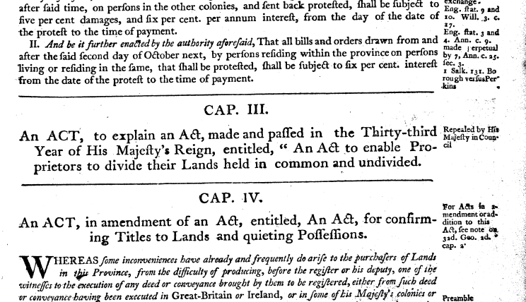
For a brief period the New England form of township government, with the direct democracy of the town meeting, was in operation in part of Nova Scotia. It was introduced at the beginning of a substantial wave of New England migration in 1760. In an attempt to fill up land recently vacated by the Acadians or never previously occupied, the authorities had promised New Englanders central and local institutions similar to their own. Between 1760 and 1765 approximately 8,000 New Englanders migrated to the agricultural townships in the Annapolis Valley, along Minas Basin and across the Isthmus of Chignecto, and to the townships for fishermen and lumbermen along the South Shore. Those who arrived in 1760, accustomed to choosing their own officers and managing their own affairs, immediately inaugurated the same sort of township government in Nova Scotia. A provincial statute was passed to enable proprietors to divide their lands, and they appointed their own committee for this purpose until His Majesty disallowed the Act in 1761. [1760 c3, “An ACT, To Explain An Act, made and passed in the Twenty Third Year of His Majesty’s Reign, entitled, “An Act to enable Proprietors to divide their lands held in common and undivided”]

Screenshot from 2024 03 15 23 23 35
1760 c3, “An ACT, To Explain An Act, made and passed in the Twenty Third Year of His Majesty’s Reign, entitled, “An Act to enable Proprietors to divide their lands held in common and undivided”

The Extension of the Quarter Sessions:
The local autonomy and the direct democracy characteristic of township government in the new settlements were soon replaced by the extension of central authority and by the adoption of the principle of indirect rather than direct election. The British and Virginian way of Quarter Sessions prevailed over the New England style of township government.

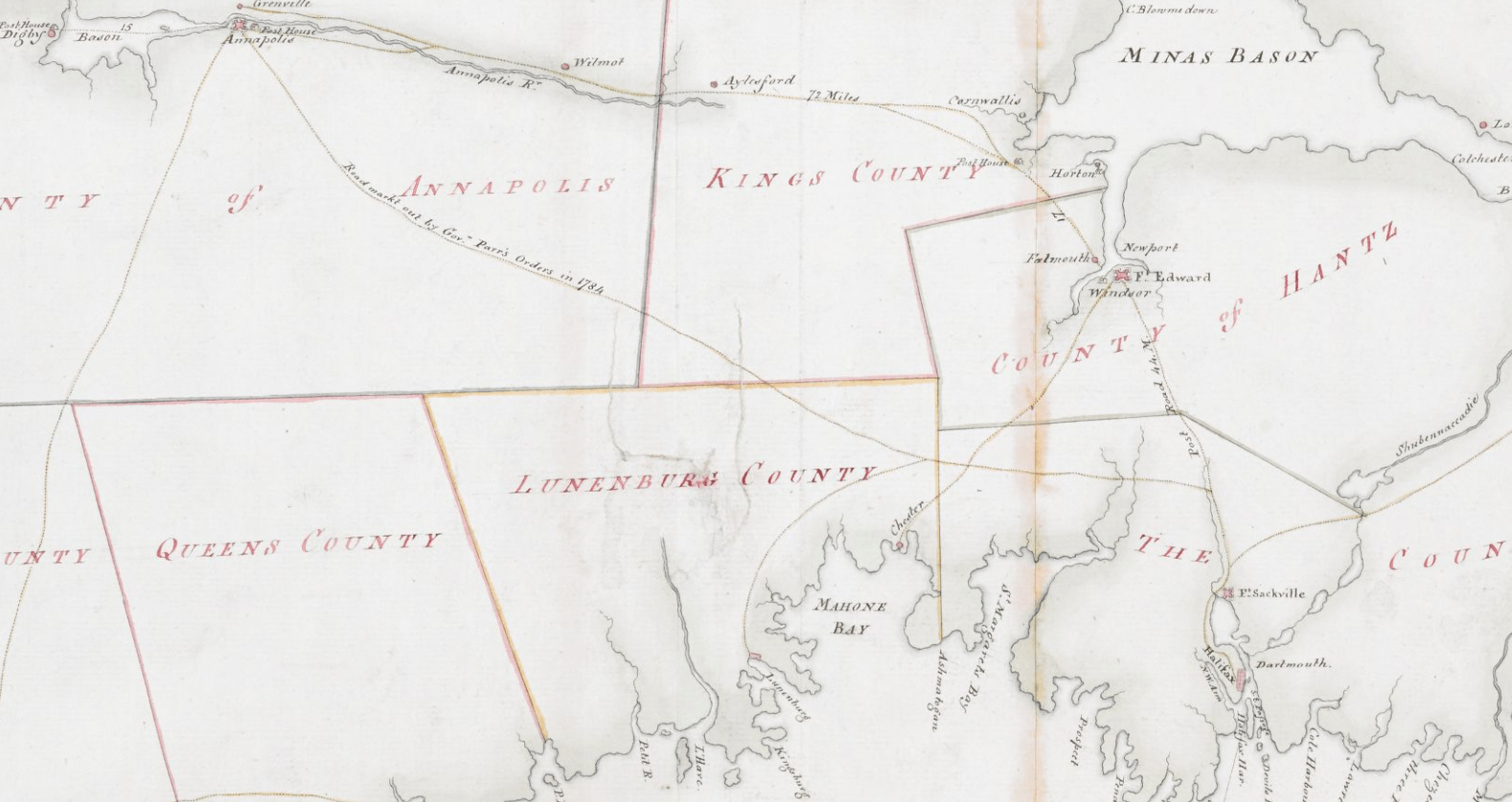
In 1759 the province was divided into the five counties of Halifax, Annapolis, Kings, Lunenburg and Cumberland. Two years later, after His Majesty disallowed the act passed to enable proprietors to divide their lands, committees for that purpose were appointed by the Governor and Council. In the same year the judicial organization of Quarter Sessions and Inferior Court of Common Pleas that already existed in Halifax County was extended to Lunenburg, Kings and Annapolis Counties, and provision was made for the nomination of surveyors of highways by the Grand Jury at the General Sessions of the Peace. This mode of appointment was soon expanded to include all town officers that were chosen prior to the Act of 1765. It left the choice of the officers exclusively to the Grand Jury; but by the Act of 1765 the Grand Jury could only nominate two or more persons for each office, and then the Court of Quarter Sessions those and appointed the officers from those nominees. The central government regained control over the associated proprietors of the township by a statute prescribing that township lands could be apportioned and divided into individual shares, only after a writ had been obtained for that purpose from the Supreme Court. The provost marshal or his deputy, to whom this writ was to be addressed, had to act by inquisition of a jury in the presence of two Justices of the Peace. As new counties and districts were created, the Quarter Sessions extended into them. This system of local government by Quarter Sessions was the general mode in Nova Scotia for more than a century

Personnel In the Quarter Sessions:
In the Court of Quarter Sessions the sheriff, an appointee of the Crown, was the executive officer. Prior to 1778 there had been one provost marshal for the whole province; but thereafter there was a sheriff for each county. Until 1849 the county sheriff was chosen and appointed by the Governor and Council from a list of three names prepared by the Chief Justice or the presiding Justice. An amendment in 1849 provided for the list of three names to be made by the Chief Justice and a puisne judge for, if the Chief Justice were absent, by two puisne judges, acting with two members of the Executive Council. The Justices of the Peace were also appointed by the Crown, and they held office during the pleasure of the Crown. The Grand Jury was a select few who represented the people. It was composed of residents having freehold property of a yearly value of £10 or personal of £100. Each year the sheriff prepared a list of those qualified to serve, and at a stated time the required number of names was drawn from the box.

The Incorporation of Halifax:

[There have been at least three previous attempts to incorporate Halifax: one in 1758, as noted earlier in the Quarter Sessions section, another in 1785, and a third in 1814. However, each of these endeavors faced disallowance, either from the Legislature or the Legislative Council. In later historical accounts of Joseph Howe, one aspect that has notably been removed is his involvement in the push to incorporate Halifax. This involvement primarily revolved around his confrontation with the magistrates, which, within the framework of the existing Quarter Sessions system, represented the closest semblance to a municipal institution we would recognize today.]


Abuses crept into the system, and there were criticisms of its operation in Halifax. Grand Jury after Grand Jury attacked it; there were complaints of unfair assessment, of inefficiency and neglect in the collecting of poor, and county rates, and of other forms of maladministration. The Grand Jury appealed to the Lieutenant-Governor to remedy the situation, and he requested the House of Assembly to do so. Early in 1835 a letter signed “The People”, but written by George Thompson, charging the magistrates of Halifax with misconduct, was published by Joseph Howe in The Nova Scotian. Howe was then prosecuted for criminal libel; he defended himself in a famous trial, the outcome of which was a triumphant acquittal, establishing the freedom of the press and foreshadowing reform in local government. The cry for incorporation grew more insistent. Eventually the old system was swept from Halifax, with the incorporation of the city in 1841. By the charter of that year Halifax was endowed with municipal privileges and securities. This development in local affairs took place seven years before responsible government was won in the wider field of provincial politics in 1848.

An Interlude:
Outside the city of Halifax, the system of local government by Quarter Sessions persisted relatively undisturbed for over thirty more years. In 1850, however, there was an attempt to divide Halifax County into townships and to provide each of its townships with an elected warden and councillors, who were to assume the administrative powers previously exercised by the Justices of the Peace. But a bill to achieve these ends met the disapproval of the Colonial Secretary.

In 1855-56 two provincial statutes provided machinery for the creation of municipal government in counties desiring it by majority vote. The Act of 1855 applied to the Counties of Yarmouth, Annapolis, Kings and Queens; that of 1856 to all the other counties. These acts were permissive not compulsory. They remained on the statute book until 1879, but the fear of heavier county rates prevented any County from adopting the principle of incorporation during those years.

Another Act of 1856 permitted the voluntary incorporation of townships. The municipal council of each township was to consist of five councillors, one of whom was to be the presiding officer, under the name of town reeve. It was to have power similar to that of a county council over roads, poor relief, assessment, and other matters. Only one township-Yarmouth-took advantage of this legislation and ventured upon the experiment of municipal incorporation; and it abandoned it by a majority vote of the electors, after a three years’ trial, in 1858.

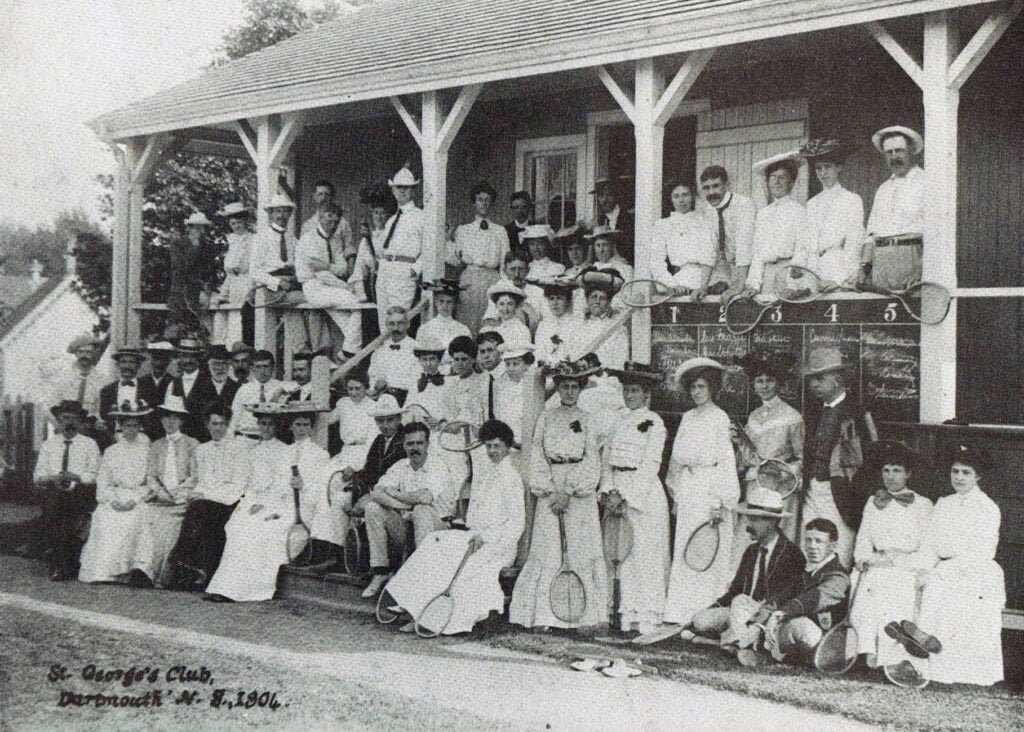
As time passed, however, the larger communities sought more amenities. In order to provide them, they began to request incorporation. Thus the towns seemed more eager than the counties to obtain the privileges of self government, and especially the privileges of assessing for local purposes and of borrowing money. Prior to 1888 eight towns were incorporated. These were Dartmouth, (1873), Pictou (1874), New Glasgow (1875), Windsor (1878), North Sydney (1885), Sydney (1885), and Kentville (1886), each of which was incorporated by special Act.

A New System: Elected Municipal Councils:
By the County Incorporation Act of 1879, the incorporation of counties was made compulsory, and the old system of local government by the Quarter Sessions was at last swept away. Its principal object was to compel the Counties to tax themselves directly to keep up their roads and bridges. It provided for the incorporation of every county and sessional district in the province. Each municipal council was to consist of a warden and councillors, with the warden being chosen by the councillors. From the enactment of this statute to 1892, councillors sat for one year; since 1892, however, their term has been three years. Six of the eighteen counties are divided into two districts, making in all twenty-four rural municipalities. These are divided into polling districts, each of which is entitled according to population to at least one representative in the council. The councils have power to assess for specified purposes, including education, the support of the poor, prevention of disease, administration of justice, court house and jail, protection from fires, and so forth.

The Towns Incorporation Act of Nova Scotia was passed in 1888, revised in 1895, and embodied in the consolidation of 1900 and the revised statutes of 1954. It requires a majority vote of the ratepayers of the town in support of incorporation before it can be granted. It also requires a certain population within a specified area-in 1954 a population of over 1500 within an area of not more than 640 acres was required for any new incorporation. A mayor and not less than six councillors are elected for each town. The mayor and councillors generally hold office for two years; but one-half of the council usually retires each year. The mayor and the councillors are eligible for re-election.

The council has power to assess, collect, and appropriate all sums of money required by the town for erecting, acquiring, improving and furnishing buildings for public schools, fire department, police office, lockups, town hall or other town purpose: streets, sewers, water, town courts, police, support of the poor, salaries, and other town purposes. It appoints town officers, excepting the stipendiary magistrate. Every part of the province is contained within a city, or a town or a rural municipality. The province is divided into eighteen counties. Twelve of the counties constitute separate municipalities; and the remaining six counties are divided into two districts or municipalities each making a total of twenty-four rural municipalities. In addition, there are thirty nine incorporated towns and three cities: Halifax (1841), Sydney (1904), and Dartmouth (1961.)

Each town or city is geographically but not politically part of a county or district, and except for joint expenditures is independent of it.

Local Government in Nova Scotia:
Local government as we know it, has arisen to meet the needs of the people. but it is something more than an agency designed to provide services and to regulate private interests for the public welfare. It has a theoretical foundation as well as a practical responsibility. It is closely linked with the democratic philosophy. Consequently it must be considered not only for its efficiency but also for its place in the democratic process. Local government contributes to the strength of democratic institutions; being close to the people it makes government more responsive to local needs and enables the citizen to participate actively in the affairs of the community. It also serves as a training ground in governmental practices and procedures for those who may later serve the province or the nation.

Structure:
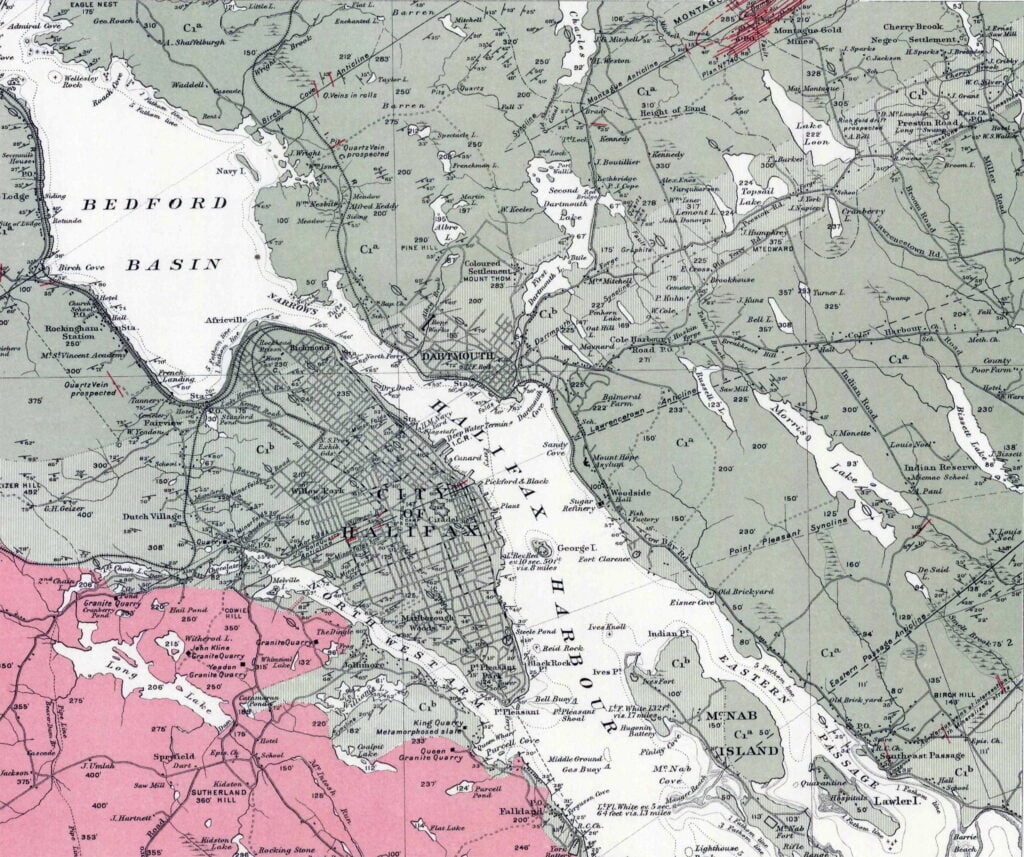
The basic structure of the present system of local government in Nova Scotia must now be outlined. it rests upon the County Incorporation Act of 1879. the Towns Incorporation Act of 1888, and the special Acts by which the three cities were incorporated. It has some relationship to the earlier system of local government by Quarter Sessions, in that the Act of 1879 provided for the compulsory creation of 24 rural Municipalities, based on the boundaries of the Counties and Sessional Districts. Twelve of the eighteen Counties became separate Municipalities, while the remaining six were divided into two Municipalities each. Today there are 66 municipal units: 24 rural municipalities, 39 towns and three cities. These types of municipal units are similar in certain essentials. They are self-governing. Local matters are decided and local services are provided by elected bodies directly representative of the citizens. In addition, they have School Boards, which are chosen partly by the local Council and partly by the Governor-in-Council of the Province. But there are a number of differences. Although for administrative and electoral purposes all rural Municipalities are divided into districts, not all towns are divided into wards. Generally each district in a rural municipality elects one councillor, but some choose two, and a few return three each. In 1959 each of the 24 rural municipalities had from 4 to 24 districts, with from 8 to 26 councillors-a total of 323 districts, with 361 councillors. From late in 1961, however, the Municipality of the County of Halifax has 27 districts and 27 councillors. instead of 22 districts and 26 councillors as heretofore. Municipal councillors are elected for three-year terms.

On the other band, towns may be divided into wards (or electoral purposes, although such divisions are not compulsory. Thus, in 1959, only 11 of the 40 incorporated towns were divided into wards. According to the Towns Incorporation Act, each town must elect at least 6 councillors, each for a two-year term, with half of them retiring each year. If the town is divided into 3 wards, one councillor may be elected (rom each ward per year. Six of the towns are divided into three wards each. New Waterford, North Sydney and Sydney Mines, however, have 8 councillors and 4 wards each, while Glace Bay has 12 councillors and 6 wards. The eleventh 1959 town was Dartmouth, which then had 4 wards and 8 councillors; it has since been incorporated as a city.

Another difference is seen in the way in which Wardens and Mayors are chosen. The Warden of a Municipal Council is chosen by the councillors from among themselves, whereas the Mayor of a Town or a City is elected at large. The Mayor of Halifax, who is elected for a one-year term, may not immediately re-offer after having served for three consecutive years. The Mayor of Sydney is elected at large for a two year term, as is the Mayor of Dartmouth.
The three cities are divided into wards. Halifax now has seven wards; Sydney has six; and Dartmouth has seven. Halifax elects two aldermen for each ward on three-year terms, half being elected each year. Sydney elects a council of 12, half elected each year from six wards for a two-year term. Dartmouth has two aldermen for each of seven wards, half of them elected each year, each elected for a two-year term.

Villages may provide themselves with additional local services, administered by themselves rather than by the Municipal Council. This may be done under the Village Service Act or by special legislation, by incorporating village or service commissions for that purpose. Such villages and service commissions do not constitute separate municipal unit~; only the commissions are incorporated; and the village ratepayers still remain part of the municipality. Under the Village Service Act, the commissioners may provide street lighting, fire protection, sewers, water works. streets, roads, sidewalks, police, garbage disposal, parks, and village buildings. Service commissions incorporated by special legislation may provide fire protection, street lighting, or other services. At the end of 1960 there were 16 village commissions, incorporated under the Village Service Act, in operation, and about 20 service commissions incorporated by special Acts of the Legislature.

Within towns and cities there are a few instances of a similar nature. For example, in the City of Halifax the water utility is operated by an independent body; and in the towns of Bridgewater and Glace Bay water and electric services are provided in the same way.

The school boards of the cities, towns and municipalities are in no case elective, (except (or the. Town of Berwick,) but are appointed partly by the local councils and partly by the Governor-in-Council. Within rural municipalities prior to 1956 school trustees, incorporated, and operating for the provision of school facilities under the Education Act, had power to borrow money and to impose taxation. Since then, however, the dominant control over education in the rural municipalities has passed to the Municipal School Boards. Although school trustees still exist in the rural municipalities, they act generally only as a local agent for the Municipal School Board and they no longer have power to levy taxation or to borrow money. There are no school trustees within any town or city.

Certain joint services required by municipal and urban units-such as court houses, jails, and welfare homes, or offices for the sheriff, registrar of probate, and registrar of deeds are provided by rural municipalities for themselves and for the towns and cities within their limits. They are paid for, under a Joint Expenditure scheme, by which each unit pays a proportion of the cost.

Although each of the three cities in the province has a Mayor and a Council, Halifax has adopted a variation on the basic Mayor-Council theme, a form of the Council-Manager plan. It has not only a Mayor and a Council, but also a manager or executive director of all civic departments who is appointed by the Council.

Functions:
There has been an expansion in the functions of local government. In the old days the dominant idea was that government should only control and regulate the activities of citizens in the common interest. Two things, however, have caused substantial increases in municipal expenditures. One is the fact that social and economic changes in a rapidly moving world have created a demand not only for new services but also Cor higher and more expensive standards for those services that were previously provided by municipalities. The second is the effect of inflation upon all costs, municipal or otherwise.

The day of “the little red school house”, with one teacher for eight or ten grades, is about over. Instead we have large regional schools in central locations, costing sums of money which only a few years ago would have been regarded as astronomical, both to build and to operate, with fleets of buses to convey to school those pupils who live more than a mile or so away from it.

Another instance of the change in circumstances and in attitude is seen in the subject of transportation. The automobile and the motor truck have made paved streets desirable, if not necessary; the car driver and the truck driver of this generation regard them as necessary; the driver of the horse and wagon of the previous generation would have said that they were all very fine, but he couldn’t afford them.

Community planning, now universally regarded as necessary, is a comparatively recent development. Slum clearance and low rental housing provided by the municipality, with the co-operation of other levels of government, are now being undertaken. They were almost unheard of a few years ago.

All of these developments have created financial problems for the municipal governments. There has been an expansion of their work and of their outlay. This has resulted not only in the tax levy of Nova Scotian municipalities having been multiplied by four in less than twenty years, but also in assistance from the provincial government in two ways. One form of assistance is given by cash grants, some amounts being earmarked as direct aid for specific projects, and others being general grants without specified purposes.

The traditional functions of local government included both regulatory activities and certain services provided for citizens. Municipalities have always had a good deal to do with protecting persons and property, and the Municipal Acts all contain long lists of the specific kinds of regulation with which Councils may deal. For municipalities they range from regulating the firing of guns, the management of log booms, and the restraining of domestic fowl from going at large, to controlling brush burning, “abating all public nuisances,” and licensing “hack-men, waggoners and cart-men.” For towns and cities, they include regulating halls “for preventing accidents therein”; making building by-laws; fixing closing hours for shops; licensing restaurants and trades, gasoline pumps and swinging sign-boards; and preventing “unusual noises” and loitering. All of these regulations imply some curbing of freedom in the common interest. and failure to comply with them may involve legal proceedings and penalties. Of the traditional services the most important were the support of the poor, roads, and education.

Recent developments have produced changes even in the field of regulation, as well as in the sphere of services. There are now “truck-men” in addition to “hack-men waggoners and cart-men.” “Automatic machines” have been added to the list of licensed games. Towns and cities have had to be given power to control parking and, in many cases, to install parking meters. In general, however, the lists of kinds of regulation have remained much the same. Certain phases of law enforcement, including court houses, jails, or lock-ups, besides police and other personnel, are also the responsibility of municipalities.

If social and economic changes have affected the regulatory functions of municipal governments, they have greatly increased the demands of people and tremendously expanded the social services. The community is called upon to do many things to improve the health, the welfare and the comfort of its citizens. Local government is therefore concerned with the improvement of the social, cultural and recreational environment in a wide variety of ways. These include adult education, public libraries, traffic police for schools, public concerts and plays, auditoriums, parks and playgrounds, swimming-pools and rinks, health clinics, juvenile courts, housing and slum clearance. There is a growing consciousness of the need for community planning and for zoning. Urbanization and suburbanization, and the emergence of metropolitan areas, have their attendant problems. These raise questions as to whether they are to be dealt with by annexation, by the co-operation of two or more units in matters of mutual concern, or by other means.

Although Nova Scotia passed its first planning Act as early as 1912, municipalities for a variety of reasons proceeded slowly with the work of planning. The Act was completely revised in 1939. Amendments passed in 1956 provided for planning on a regional rather than on a strictly municipal basis. Interest in the field of planning is increasing and a beginning has been made in regional planning with the formation of three Metropolitan Planning Commissions (to August 31,1961). These are (1) the Richmond Inverness Metropolitan Planning Commission, including the Town of Port Hawkesbury and the adjoining southern portion of Richmond and Inverness Counties; (2) the East River Valley Planning Commission, including the Towns of New Glasgow, Stellarton Trenton and Westville, and the adjoining area of the County of Pictou; and (3) the North Side Metropolitan Planning Commission, including the Towns of North Sydney and Sydney Mines and the adjoining area of the County of Cape Breton. Subdivision regulations to enable better control by Planning Boards over subdividing have been enacted for eleven municipal units. The number of municipal units having zoning by-laws is increasing. In the field of housing and urban redevelopment, the City of Halifax began construction of low rental housing about ten years ago, and it has recently completed a survey for slum clearance and embarked upon this project.

Finance:
When municipalities were created, they were obliged to collect money to pay for the services which they provided, including roads and bridges, education and the support of the poor. For those purposes they had to resort to the direct taxation of real and personal property. It was their aversion to this sort of taxation which delayed the establishment of municipal self-government.

For some time there was criticism of the new system in some of the municipalities. But generally they seemed to get along fairly well with the revenue from taxation on real and personal property. The services they provided were neither elaborate nor expensive, though they were reasonably adequate for the demands of the day. By the County Incorporation Act of 1879 the management of the road and bridge service was transferred to the municipal councils instituted by the Act. At that time the Provincial Government reduced its expenditure on this service and left it up to the new municipal councils to maintain the former standards by supplementing that amount out of their own revenues. Eventually this dual control proved impracticable; in 1907 the Province reassumed the expenditure of all provincial moneys for roads. For another ten years the municipal councils continued to look after the statute labour on the highways, and then they lost that control when this was ended. The coming of the automobile had created the need for change. Greatly improved highways were necessary, and the Province began to assume responsibility for this service. At the outset the Province asked the rural municipalities to make a contribution towards the cost of highways based on a fixed rate of taxation on their assessments. This provided about $250,000. In 1961, however, for highways of the standard now in existence the Legislature has appropriated $15,000,000 for maintenance and improvement, to be raised by taxation, and an additional $16,000,000 for construction, to be raised by borrowing.

If the coming of the automobile caused a change, other changes were made by the depression of the thirties and by the second World War. The depression led to a greater measure of planned regulation and to a continuing drive for a more adequate system of social services. During the war municipalities did very little in the way of capital construction or expansion of services. It would have been regarded as unpatriotic to enter the money market to borrow money j that was left for the Dominion in order to ensure necessary financing for the war. It would also have been regarded as unpatriotic to enter the labour market or to purchase material; those also were reserved for war purposes. Consequently, when the war ended municipalities found it necessary to undertake the immediate replacement of some of their capital assets. The attitude of people had also changed. No longer were they satisfied with the type of service previously provided by municipalities; they now wanted better services sometimes much better services, and handsomer buildings, including finer buildings to accommodate a larger school population. They wanted all the streets in the municipality to be paved. With the construction of many new houses, there was also a corresponding increase in the demand for water, sewer and other services which these require.

Along with new demands went higher costs. Inflation had arrived, and seemed to be here to stay. Everything the municipalities bought or built cost a great deal more than it would have cost before the war. But if costs had changed, so had the attitude of the people. All this meant that the municipalities had to provide increasingly large sums of money, and they declared that they were unable to do so from the traditional taxes on real and personal property. If these services were to be provided then the Provincial or the Federal Government would have to help.

Even earlier, as we have seen, the Province had assumed responsibility for highways. There had also been increasing Provincial participation in school administration from 1864-65, when a free school system, supported by compulsory assessment, bad been established in Nova Scotia. Estimates for the fiscal year ending March 31, 1962 require the Province to pay over $23,000,000 towards the cost of education.

The system of unconditional or unspecified grants made by the Province to the municipalities is of quite recent origin. It also arose during and because of the war. Prior to 1942 the municipalities had the right to levy a tax on income, though it had not been used a great deal in Nova Scotia. Then as the Dominion required large sums of money for war purposes, an agreement was made in 1942 between the Province and the Dominion, under which the Province for itself and for the municipalities withdrew from the income tax field so as to leave it to the Dominion alone. This was the first of what are sometimes called “tax rental agreements.” Under that 1942 agreement, the Dominion made certain payments to the Province. In order to compensate the municipalities for their potential loss because the income tax had been taken from them, the Province made cert.1.in grants to them. The major part of the grants now being paid by the Province to its cities, towns and rural municipalities is based on population. The total of these grants for 1961 is approximately $1,000,000.

Grants for specified purposes are also being paid by the Province to the municipalities in a number of fields. Those for education have already been mentioned. Another example is social assistance (formerly called “poor relief”) in which the Province and the Dominion together pay a total of two-thirds of the cost, provided certain standards are met and certain specifications are followed. Similar assistance is made to the county homes, as long as the stipulated standards are maintained. In the operation of county mental hospitals (formerly called “local asylums”), the Province pays one-half the cost, if the required standards are met. The public health scheme under which free hospital care is now provided to the general public has relieved the municipal units of practically their entire expenditure for this purpose.

Notwithstanding the greatly increased participation by the Province in these services, the municipalities have also expended increasingly large sums upon them. Their disbursements on education rose from a little over $3,000,000 in 1943 to a net total of approximately $16,600,000 in 1959. Their total tax levy increased from $8,306,543 in 1942 to $13,620,650 in 1949, and then to $31,626,165 in 1959. Their total general revenue, excluding joint expenditure boards and district or area rates, was $41,560,135 in 1959. Of that amount, about $31,000,000 was raised by taxation, while sums of $2,132,245 and $3,530,607 were received from the Federal and Provincial Governments, respectively.

It is clear, from the increased levy by the municipalities and from the increased participation by the Province and the Dominion, that the cost of providing the public with what were formerly known as municipal services has shown a very great increase indeed.

“Local Government in Nova Scotia”, Fergusson, C. Bruce. 1961. The Institute of Public Affairs, Dalhousie University. https://dalspace.library.dal.ca/handle/10222/11024

Old Annapolis Road

old-annapolis-road2

After piecing together several Crown land grant maps, you can see the path of the Old Annapolis Road much more clearly. Open the image in a new tab, to see it in more detail.

Below you’ll find a few representations of the road as a contiguous route, as opposed to what is left recorded on the Crown Land Grant maps. (You can find find the individual Crown Land Grant maps here: https://novascotia.ca/natr/land/grantmap.asp)

One of the earliest road maps, from 1755, the Bay of Fundy still going by the name of Argal’s Bay. “A New map of Nova Scotia and Cape Britain”, https://gallica.bnf.fr/ark:/12148/btv1b53089581f

“Map of Nova Scotia, or Acadia, with the islands of Cape Breton and St. John’s, from actual surveys” https://gallica.bnf.fr/ark:/12148/btv1b53209890m

Previous to the construction of the more direct route to Annapolis, this map from 1776 shows a road (from Dartmouth, certainly an error, likely from Fort Sackville at the head of the harbor) to Annapolis. “A general Map of the northern British Colonies in America which comprehends the province of Quebec, the government of Newfoundland, Nova Scotia, New England and New-York” https://gallica.bnf.fr/ark:/12148/btv1b8443126p

One of the first representations of the Old Annapolis Road, “Road markt out by Gov. Parr’s orders in 1784”

nova scotia map Annapolis road

“A map of Nova Scotia showing the post roads”, 1787. https://collections.leventhalmap.org/search/commonwealth:hx11z4938

“A Map of the United States and Canada, New Scotland, New Brunswick and New Foundland”, 1806. https://gallica.bnf.fr/ark:/12148/btv1b53100560v

“Map of the Province of Nova Scotia Including Cape Breton, Prince Edwards Island and Part of New Brunswick”, 1819. https://nscc.cairnrepo.org/islandora/object/nscc%3A112, https://collections.leventhalmap.org/search/commonwealth:8049g892q

“Map of the Provinces Of New Brunswick, and Nova Scotia”, 1825. https://nscc.cairnrepo.org/islandora/object/nscc%3A715

annapolis road map 1827

“Map of the United States; and the Provinces of Upper & Lower Canada, New Brunswick, and Nova Scotia”, 1827: https://www.davidrumsey.com/luna/servlet/detail/RUMSEY~8~1~4239~340032:Map-of-the-United-States-

“The Provinces of Lower & Upper Canada, Nova Scotia, New Brunswick, Newfoundland & Prince Edward Island with a large section of the United States”, 1831. https://gallica.bnf.fr/ark:/12148/btv1b530987207

“Maps of the Society for the Diffusion of Useful Knowledge”, 1832: https://www.davidrumsey.com/luna/servlet/detail/RUMSEY~8~1~20966~530058:Nova-Scotia,-N-B-,-Lower-Canada

“North America : sheet I. Nova-Scotia with part of New Brunswick and Lower Canada”, 1832: https://digitalarchive.mcmaster.ca/islandora/object/macrepo%3A26988

“Nouvelle carte des Etats-Unis, du Haut et Bas-Canada : de la Nouv[el]le-Écosse, du Nouv[e]au-Brunswick, de Terre-Neuve”, 1832
https://gallica.bnf.fr/ark:/12148/btv1b530354369

“Map of the United States; and the Provinces of Upper & Lower Canada, New Brunswick, and Nova Scotia”, 1835: https://www.davidrumsey.com/luna/servlet/detail/RUMSEY~8~1~316476~90085094:Composite–Map-of-the-United-States

From: “The London atlas of universal geography”, 1837: https://www.davidrumsey.com/luna/servlet/detail/RUMSEY~8~1~33890~1170042:Lower-Canada

From: “British Possessions in North America, with part of the United States”, 1840: https://hdl.huntington.org/digital/collection/p15150coll4/id/9901

From: “Nelson’s new map of the British provinces in North America”, 1840–1849: https://collections.leventhalmap.org/search/commonwealth:0z709278h

From: “Lower Canada, New Brunswick, Nova Scotia, Prince Edwards Id. Newfoundland, and a large portion of the United States”, 1846. https://digitalarchive.mcmaster.ca/islandora/object/macrepo%3A31427

“Map of the provinces of Canada, New Brunswick, Nova Scotia, Newfoundland and Prince Edward Island”, 1846. https://digitalarchive.mcmaster.ca/islandora/object/macrepo%3A81413

“Lower Canada, New Brunswick, Nova Scotia, Prince Edwards Id. Newfoundland, and a large portion of the United States.”, 1853. https://hdl.huntington.org/digital/collection/p15150coll4/id/100

“Belcher’s map of the Province of Nova Scotia”, 1855: https://www.davidrumsey.com/luna/servlet/detail/RUMSEY~8~1~3016~290077:Belcher-s-map-of-the-Province-of-

“Map of the British Province of New Brunswick”, 1858: https://www.davidrumsey.com/luna/servlet/detail/RUMSEY~8~1~325278~90094243:Map-of-the-British-Province-of-New-

“The royal atlas of modern geography”, 1861: https://www.davidrumsey.com/luna/servlet/workspace/handleMediaPlayer?qvq=&trs=&mi=&lunaMediaId=RUMSEY~8~1~21338~620038

“Mackinlay’s map of the Province of Nova Scotia, including the island of Cape Breton”, 1862: https://www.davidrumsey.com/luna/servlet/detail/RUMSEY~8~1~2372~220044:Mackinlay-s-map-of-the-Province-of-

The portion of the Annapolis road that traverses Halifax County, as seen in the “Topographical township map of Halifax County” from A.F. Church and Co, 1864. https://collections.lib.uwm.edu/digital/collection/agdm/id/14722/rec/1

“Mackinlay’s map of the Province of Nova Scotia”, 1865: https://www.davidrumsey.com/luna/servlet/detail/RUMSEY~8~1~2374~220046:Mackinlay-s-map-of-the-Province-of-

“Colton’s… Nova Scotia”, 1865: https://www.davidrumsey.com/luna/servlet/detail/RUMSEY~8~1~208606~5003402:New-Brunswick,-Nova-Scotia–Prince-

“Colton’s Dominion of Canada”, 1869: https://www.davidrumsey.com/luna/servlet/detail/RUMSEY~8~1~208947~5003938:Dominion-of-Canada–Provinces-of-Ne

Annapolis Road seen here at Stoddards as it made its way through to what is now Dalhousie East. “Annapolis County part of A.F. Church Map”, 1876. https://archives.novascotia.ca/maps/archives/?ID=942

Annapolis Road pieced together from several pages of the “Atlas of the Maritime Provinces of the Dominion of Canada”, Roe Brothers, St. John, NB 1878. https://www.islandimagined.ca/roe_atlas

“Statistical & general map of Canada”, 1883: https://www.davidrumsey.com/luna/servlet/detail/RUMSEY~8~1~31463~1150419:Canada-1-

“Canada : the provinces of Quebec, Nova Scotia, New Brunswick, Prince Edward Island and Newfoundland”, 1886. https://digitalarchive.mcmaster.ca/islandora/object/macrepo%3A27057

“Mackinlay’s map of the Province of Nova Scotia”, 1890: https://www.davidrumsey.com/luna/servlet/detail/RUMSEY~8~1~3012~220131:Mackinlay-s-map-of-the-Province-of-

“Stanford’s London atlas of universal geography”, 1904: https://www.davidrumsey.com/luna/servlet/detail/RUMSEY~8~1~314730~90083550:Quebec,-New-Brunswick,-Nova-Scotia

“Dominion of Canada : E. Quebec, New Brunswick, Nova Scotia, Prince Edward Id. and Newfoundland”, 1910. https://collections.library.yale.edu/catalog/15827305

One of the last representations of the Old Annapolis Road:

Mackinlay’s map of the Province of Nova Scotia Compiled from Actual & Recent Surveys, 1912: https://nscc.cairnrepo.org/islandora/object/nscc%3A534

Fifteen years later, by 1927, the Old Annapolis Road disappears from the maps. Perhaps it wasn’t fit for automobile travel, though it’s hard not to notice the change (back?) to “Annapolis Royal” from “Annapolis” occurred at the same time.

From: “Rand McNally auto road atlas of the United States and Ontario, Quebec, and the Maritime Provinces of Canada”, 1927: https://www.davidrumsey.com/luna/servlet/detail/RUMSEY~8~1~33775~1171491:Maritime-Provinces-

Much of the road is now incorporated into other routes. It’s the #8 from Annapolis through Lequille, it’s the West Dalhousie Road through to Lake La Rose and from West Dalhousie to Albany Cross on to Stoddard’s where it once continued straight at what is now a turn (see above at 1876). It then crossed over the brook that empties into Upper Thirty Lake, from there it continued across another bridge, this time over the LaHave River to connect to what is now Camel Hill Road. The route proceeded to where it now meets Cherryfield Road and becomes Dalhousie Road, and on eastwards from there, through to Franey Corner and on to New Ross. At this point the route seems to have been reclaimed by the woods somewhat but it continued south and east near Sherwood, and then north of Canaan and Timber Lake, to the south of Panuke Lake (once called “Carrying Place”, see above at 1864) near Simms Settlement, through the country between Sandy and Rafter lake then terminating at Pockwock Road, north of Wrights Lake in Upper Hammonds Plains.

From: “Halifax & Dartmouth City & Maritimes map”, 1976. https://archives.novascotia.ca/maps/archives/?ID=948&Page=202012493

See also:

Body politic, Body corporate ⁠— City limits

dartmouth city limits

An examination of the legislated spatial dimensions of Dartmouth – from its initial definition as a township care of the Royal instructions that accompanied Cornwallis in 1749 to its dissolution in one of Nova Scotia’s city county mergers by fiat (aka a “municipal coup”) in 1996.

“And whereas for the better security, regulation and government of our said settlement, it will be necessary that such persons as we shall judge proper to send to our said province should be settled in townships; you are therefore hereby authorized and required to appoint such proper persons as you shall find there fully qualified to carry along with you forthwith to survey and mark out the said townships in such manner and at such places as is herein directed, that is to say, two townships containing 100,000 acres of land each be marked out at or near our harbor of Chebucto, as also one township of the like extent at each of the aforementioned places or such others as you shall judge most proper; and you are to take particular care in laying out such townships that they do include the best and most profitable land and also that they do include the best and most profitable rivers as may be at or near the said settlements and that the said townships do extend as far up into the country as conveniently may be, taking in a necessary part of the seacoast”.

769: Laying out townships in Nova Scotia (I). 1749-1752; (§§ 770, 766).
Labaree, Leonard Woods. “Royal Instructions To British Colonial Governors”, Volume II. New York, Octagon Books, 1967.
https://archive.org/details/royalinstruction028364mbp/page/n93/mode/2up

 “the Town and Suburbs of Dartmouth”

An Act for Establishing and Regulating a Militia, Law by Proclamation, by Command of his Excellency the Governor and his Majesty’s Council, May 10, 1753.

“That the Township of Dartmouth comprehend all the Lands lying on the East Side of the Harbour of Halifax and Bedford Basin, and extending and bounded Easterly by the Grant to the Proprietors of Lawrence-Town, and extending from the North-easterly Head of Bedford Basin into the Country, until One Hundred Thousand Acres be comprehended.”

Proclamation of His Excellency Charles Lawrence, with the Advice and Consent of His Majesty’s Council, January 3rd 1757. Journals of the Board of Trade and Plantations; Townships, Elections, 1757. Proclamation, Governor Charles Lawrence – official announcement and details about the election of representatives to the new General Assembly. The National Archives of the UK (TNA) . Colonial Office and Predecessors: Nova Scotia and Cape Breton Original Correspondence. CO 21/16 ff. 154

“the inhabitants of the town plot of Dartmouth…in said town…the district of Dartmouth”

Chapter 6 of the Acts of 1789, “An act to enable the Inhabitants of the Town Plot of Dartmouth to use and occupy the Common Field, granted them by his excellency the Lieutenant-Governor, in such way as they may think most beneficial to them”
http://0-nsleg–edeposit.gov.ns.ca.legcat.gov.ns.ca/deposit/Statutes/at_large/volume1/1789.pdf

“Common of the town of Dartmouth…the common of the township of Dartmouth; situate on the eastern side of the harbour of Halifax, in special trust, for the use of the inhabitants settled and resident in the town plot, or that might thereafter settle, and actually reside, within the township of Dartmouth… Within the township of Dartmouth”

Chapter 2 of the Acts of 1797, “An act to enable the Governor, Lieutenant Governor, or Commander in chief for the time being, to appoint Trustees, for the Common of the Town of Dartmouth, on the death, or removal, of the Trustees holding the same, and to vacate that part of the grant of the Common aforesaid, which vests trust in the heirs, executors or administrators, of the Trustees, named in the said grant, on the death of such Trustees”
http://0-nsleg–edeposit.gov.ns.ca.legcat.gov.ns.ca/deposit/Statutes/at_large/volume1/1797.pdf

“Town plot of Dartmouth… The said town… The town plot of Dartmouth, bounded on the North by the Common, on the South and West by the Halifax Harbour, and on the east by Mill Brook… Of the said towns respectively, within the said limits.”

Chapter 23 of the Acts of 1818, “An act to extend the provisions of c15 of 1761 relating to Trespasses, to the Town of Pictou and the Town Plot of Dartmouth”
https://0-nsleg–edeposit-gov-ns-ca.legcat.gov.ns.ca/deposit/Statutes/at_large/volume3/1818.pdf

“The town of Dartmouth”

Chapter 32 of the Acts of 1820-21 “To extend the Act for appointing Firewards to the Town of Dartmouth”
https://0-nsleg–edeposit-gov-ns-ca.legcat.gov.ns.ca/deposit/Statutes/at_large/volume3/1820-21.pdf

“the Town of Dartmouth… inhabitants of the said town… the jurisdiction, powers and authority, of the commissioners so to be appointed for the said Town of Dartmouth, shall be confined and restricted to the bounds and limits following, that is to say:⁠— to the direction or space of one Mile, measured in a southwardly, Easterly, and Northerly direction, from the Public Landing, or Steam Boat Company Wharf, in the said Town.”

Chapter 27 of the Acts of 1828 “To extend the Act relating to Commissioners of Highways to the Town of Dartmouth” https://0-nsleg–edeposit-gov-ns-ca.legcat.gov.ns.ca/deposit/Statutes/at_large/volume3/1828.pdf
A rough idea of what a 1 mile radius from the Ferry terminal wharf looks like.

“Inhabitants resident in the Town Plot of Dartmouth, at a meeting to be called for that purpose… Annual Meeting of the said Inhabitants”

Chapter 52 of the Acts of 1841, “An Act for regulating the Dartmouth Common” http://0-nsleg–edeposit.gov.ns.ca.legcat.gov.ns.ca/deposit/Statutes/1841.pdf

“the Town of Dartmouth, in the County of Halifax… the said Town of Dartmouth”

Chapter 48 of the Acts of 1843, “An Act to extend to the Town of Dartmouth the Act to amend the Act to regulate the Assize of Bread” http://0-nsleg–edeposit.gov.ns.ca.legcat.gov.ns.ca/deposit/Statutes/1843.pdf

“Whereas some uncertainty exists as regards the limits of the Township of Dartmouth… Be it therefore enacted by the Lieutenant Governor, Council and Assembly, that the lines of the Township of Dartmouth shall be established and settled as follows, beginning on the Eastern side of Bedford Basin at the head of Pace’s cove at low water mark, and thence to run north seventy four degrees east until it meets the main stream running Into Lake Major, thence southerly through the center of Lake Major and West Salmon River to the waters of Cole Harbor and thence Southwestwardly along the shore the several courses of the shore to Roaring Point, thence northerly following the course of the shore of the Main Land at low water mark to the place of beginning, so as not to include any Islands lying on or near said shore.

Chapter 17 of the Acts of 1846, “An Act to define and establish the Lines of the Township of Dartmouth”
https://0-nsleg–edeposit-gov-ns-ca.legcat.gov.ns.ca/deposit/Statutes/1846.pdf

“…the inhabitants of the said town of Dartmouth …within the space of one mile, measured in a southwardly, easterly and northerly direction from the public landing or Steamboat Company’s wharf in said town”

Chapter 29 of the Acts of 1847, “In relation to Assessment for a Fire Engine at Dartmouth”
https://0-nsleg–edeposit-gov-ns-ca.legcat.gov.ns.ca/deposit/Statutes/1847.pdf

For Dartmouth…one mile, measured in a southwardly, easterly and northerly direction from the public landing or Steamboat Company’s wharf in the said Town”

Chapter 46 of the Acts of 1847, “An act relating to Streets and Highways … in the Town of Dartmouth”
https://0-nsleg–edeposit-gov-ns-ca.legcat.gov.ns.ca/deposit/Statutes/1847.pdf

“After the first Annual Town Meeting in the Township of Dartmouth, Three Trustees of Public Property shall be chosen, in whom shall be vested the legal possession of the several Water Lots that have been reserved for the use of the Public along the shores of the Town Plot of Dartmouth, and of a certain Lot of Land and School House now known and distinguished as the School Lot, lying in the Town Plot, to be recovered, held and preserved by the Trustees for the uses to which the same respectively have been reserved and applied, but the School House and School Lot shall be preserved exclusively to the use of Schools and Education, and nothing herein shall excuse the possession and control of the Trustees to be appointed under the Act passed in the present Session for the support of Schools if the School House and Lot might otherwise come under control of such Trustees. Any other Public Property in the Township of Dartmouth not legally possessed by or under the charge and supervision of any person, shall also be legally vested in the Trustees appointed under this act… three trustees shall be annually thereafter appointed at each Annual Town Meeting of the Township… The Inhabitants, in Town Meeting, at any time may declare the purposes to which the Town Property shall be applied by the Trustees, provided those purposes shall not be inconsistent with the uses to which the property has been granted, reserved or legally appropriated… the next Annual Town Meeting of Dartmouth”

Chapter 53 of the Acts of 1850, “An Act Concerning Town Property in Dartmouth” http://0-nsleg–edeposit.gov.ns.ca.legcat.gov.ns.ca/deposit/Statutes/1850.pdf

“The rateable inhabitants residing within the town plot of the township of Dartmouth, in the county of Halifax, may assess themselves, at any public meeting… for the purpose of obtaining a good and sufficient plan of said town plot… the inhabitants of the said town plot… The Commissioner of Streets for the said township…”

Chapter 56 of the Acts of 1866, “To authorize an assessment on the inhabitants of the Town Plot of Dartmouth”
https://0-nsleg–edeposit-gov-ns-ca.legcat.gov.ns.ca/deposit/Statutes/1866.pdf

“The Trustees of the Dartmouth Common shall be a Body politic and corporate… the Commissioner of Streets for the Town of Dartmouth… A requisition signed by two thirds at least of the rate payers residing within the limits of the town plot of Dartmouth… Which town plot shall be construed to embrace an area within a distance of one mile measured in a southwardly, easterly and northerly direction from the public landing or Steamboat Company’s wharf in said town”

Chapter 31 of the Acts of 1868, “To amend the several Acts relating to the Dartmouth Common”
https://0-nsleg–edeposit-gov-ns-ca.legcat.gov.ns.ca/deposit/Statutes/1868.pdf

‘A municipality shall be erected within the County of Halifax, to be bounded as follows, that is to say: Beginning on the eastern side of the Harbor of Halifax, at a point in such Harbor distant three hundred feet Westerly from the South Western corner of a lot of land formerly owned by Judge Johnston and by him conveyed to John Esdaile; thence to run Eastwardly till it strikes the road leading to the property of the late John Esson; thence by the Southern side of such road and following the course thereof Eastwardly to such Esson property; thence along the Western boundary of such property, Southwardly to the South-Western corner thereof; thence Eastwardly to Gaston’s Road, and crossing such road to a point at right angles with the extension of a new road laid out by J.W. Watt through manor Hill Farm; thence Northwardly to such road and by such road for the length thereof; thence Northwardly to the causeway at Hurley’s on the First Lake; thence Northwardly to the North East boundary of Stair’s Ropewalk property; thence Westwardly to a point three hundred feet into the Harbor of Halifax; and thence Southwardly to then place of beginning; to be called and known as “The Town of Dartmouth”‘.

Chapter 17 of the Acts of 1873, “An Act to Incorporate the Town of Dartmouth” https://0-nsleg–edeposit-gov-ns-ca.legcat.gov.ns.ca/deposit/Statutes/1873.pdf

The inhabitants of the town of Dartmouth are constituted and declared to be a body corporate and politic by the name of the Town of Dartmouth. They shall as a corporation have perpetual succession and a Common Seal, changeable at pleasure, and shall be capable of suing and being sued in all Courts of Justice, and of acquiring, holding and conveying any description of property, real, personal or mixed, and shall have all the other rights usually had and enjoyed by corporations.

The Town of Dartmouth shall be bounded as follows:⁠—

Beginning on the eastern side of the Harbor of Halifax, at a point in such Harbor distant three hundred feet Westerly from the South Western corner of a lot of land formerly owned by Judge Johnston and by him conveyed to John Esdaile; thence to run Eastwardly till it strikes the road leading to the property of the late John Esson; thence by centre of such road and following the course thereof Eastwardly to such Esson property; thence along the Western boundary of such property, Southwardly to the South-Western corner thereof; thence Eastwardly to Gaston’s Road, and crossing such road to a point at right angles with the extension of a new road laid out by J.W. Watt through manor Hill Farm; thence Northwardly to such road and by such road for the length thereof; thence Northwardly to the western extremity of the causeway at Hurley’s on the First Lake; thence Northwestardly through Taylor’s barn on the opposite side of the lake until it strikes the Southern side line of the road which connects with the new road laid out by G. A. S Chichton, thence following the southern line of said road until it reaches the main road leading from Dartmouth to Bedford; and from thence crossing said road in a straight line following the said line of the said new road until it extends three hundred feet into the harbor of Halifax, and thence Southwardly to the place of beginning to be called and known as “The Town of Dartmouth”.

Chapter 40 of the Acts of 1877, “An Act to amend the Act entitled, “An Act to Incorporate the Town of Dartmouth” https://0-nsleg–edeposit-gov-ns-ca.legcat.gov.ns.ca/deposit/Statutes/1873.pdf

“The inhabitants of the town of Dartmouth are constituted and declared to be a body corporate and politic by the name of the Town of Dartmouth, and the boundaries of the town of Dartmouth, the division of the same into wards, and the boundaries of the several wards thereof, shall continue as at the passing of this Act.”

Chapter 86 of the acts of 1886, “An Act to Amend the Acts relating to the Town of Dartmouth”

[Included is a copy of the 1886 Statues from archive.org, since the copy supplied by the Government of Nova Scotia is missing page 253, which just so happens to be paragraph 1-3 of this Act to Amend the Acts relating to the Town of Dartmouth, which contains the above quoted passage, along with an explicit mention of male or female ratepayers, residents and nonresidents as qualified to vote.]

https://archive.org/embed/statutesnovasco01scotgoog
http://0-nsleg–edeposit.gov.ns.ca.legcat.gov.ns.ca/deposit/Statutes/1886.pdf

‘The body so constituted shall be a body corporate, under the name of “The Dartmouth Ferry Commission…”‘

Chapter 83 of the Acts of 1890, “An Act to provide for the establishment and operation of a Public Ferry between Dartmouth and Halifax”
https://0-nsleg–edeposit-gov-ns-ca.legcat.gov.ns.ca/deposit/Statutes/1890.pdf

“The Dartmouth Ferry Commission shall continue to be a body politic and corporate, as constituted under chapter 83 of the Acts of 1890 and amending Acts.”

Chapter 37 of the Acts of 1894, “An Act to Consolidate the Acts relating to the establishment and operation of a Public Ferry between Dartmouth and Halifax”, https://0-nsleg–edeposit-gov-ns-ca.legcat.gov.ns.ca/deposit/Statutes/1894.pdf

“The assessors shall also insert on the roll the names of all yearly tenants in occupation of real property assessed.”

Chapter 65 of the Acts of 1901, “Act to amend Chapter 50 of the Acts 1897, amending Towns’ Incorporation Act so far as relates to Dartmouth”
https://0-nsleg–edeposit-gov-ns-ca.legcat.gov.ns.ca/deposit/Statutes/1901.pdf

The town of Dartmouth is bounded as follows:

Beginning at a point in the harbor of Halifax distant three hundred feet westerly from the southwestern corner of a lot of land formerly owned by the late Judge Johnstone, and by him conveyed to John Esdaile; thence eastwardly to the road leading to the property of the late John Esson; thence by the centre of such road and following the course thereof eastwardly to such Esson property; thence along the Western boundary of such property southwardly to the southwestern corner thereof; thence eastwardly to the eastern side of Gaston’s Road; thence in a straight line to the point of intersection of the eastern side line of a new road laid out by J. W. Watt through Manor Hill farm, and the northern side line of Cole Harbor Road; thence northwardly by the said new road for the length thereof; thence northwardly to the western extremity of the causeway at Hurley’s on the first lake; thence northwestwardly through Taylor’s born on the opposite side of the lake until it strikes the southern line of the road which connects with the new road laid out by G. A. S. Chrichton; thence following the southern side of said road until it reaches the main road leading from Dartmouth to Bedford, and from thence crossing said road in a straight line following the said line of the said new road until it extends three hundred feet into the harbor of Halifax; thence southwardly in a line parallel to the shore of the harbor, and distant three hundred feet therefrom to the place of beginning. (1873, c. 17, s. 1; 1877, c. 40; 1897, c. 50, s. 3)

Chapter 56 of the Acts of 1902, “An Act to Consolidate the Acts Relating to the Town of Dartmouth
https://0-nsleg–edeposit-gov-ns-ca.legcat.gov.ns.ca/deposit/Statutes/1902.pdf

The Town of Dartmouth is bounded as follows:

Beginning at the point of intersection of ordinary high water mark on the eastern shore of Halifax Harbor with the prolongation south-westerly of the centre line of a stone wall defining the south-eastern boundary of a lot of land formerly owned by the late Judge Johnstone and by him conveyed to John Esdaile; thence north-easterly along said prolongation and the centre line of said stone wall 1084 feet to a monument on the eastern line of Pleasant Street; thence 52 degrees 22 minutes right, 880.9 feet to a monument; thence 38 degrees 24 minutes left, 826.8 feet to a monument on the south western boundary of the Esson farm; thence 76 degrees 48 minutes right along the southwestern boundary of said Esson Farm 1097.5 feet to a monument; thence 89 degrees 49 minutes left 1799 feet to a monument on the southeastern boundary of the Dartmouth Rod and Gun club; thence 86 degrees 50 minutes left along the rear line of properties situated on the southern side of Gaston Road, and crossing Gaston Road 1322.4 feet to a monument in rear of Atwood’s house on Gaston Road; thence 10 degrees 22 minutes right crossing Cole Harbor Road and along the eastern side of Watt Street 2411.2 feet to a monument on the southern line of Maynard Street; thence 11 degrees 7 minutes right crossing Oat Hill Lake, 2628 feet to a monument on the southwestern corner of the causeway on the Preston or Lake Road near Robert Carter’s; thence 13 degrees 32 minutes left, crossing Banook Lake 4757 feet to a monument on the southwestern corner of Crichton Avenue and Albro Lake Road; thence 10 degrees 19 minutes left along the southwestern side of Albro Lake Road 1085.8 feet to a monument; thence 88 degrees 25 minutes left along the south-eastern side of Albro Lake Road 2061.6 feet to a monument; thence 42 degrees 40 minutes right along the southern side of Albro Lake Road 400 feet to a monument; thence 19 degrees along the south side of Albro Lake Road 841 feet to a monument; thence 26 degrees 27 minutes left along the southeastern side of Albro Lake Road 1328.5 feet to a monument on the eastern line of Wyse Road at the point of intersection with the prolongation easterly of the northern side of the stone wall on the southern side of Albro Lake Road; thence 19 degrees 50 minutes right along the northern side of the stone wall on the southern side of Albro Lake Road 877.9 feet to a monument on the eastern side of Windmill Road; thence 6 degrees 30 minutes left, 1030 feet more or less to ordinary high water mark; thence in a general southerly direction along the shore of Halifax Harbor, as defined by ordinary high water mark, to the place of beginning, together will all water grants, docks, quays, slips and erections connected with the shores of the town which shall be deemed to be included in the boundaries and form part of the town.

Chapter 97 of the Acts of 1925, “An Act Relating to the Town of Dartmouth”
https://0-nsleg–edeposit-gov-ns-ca.legcat.gov.ns.ca/deposit/Statutes/1925.pdf

The Town of Dartmouth is bounded as follows:

Beginning at the point of intersection of ordinary high water mark on the eastern shore of Halifax Harbor with the prolongation south-westerly of the centre line of a stone wall defining the south-eastern boundary of a lot of land formerly owned by the late Judge Johnstone and by him conveyed to John Esdaile;

Thence north-easterly along said prolongation and the centre line of said stone wall 1084 feet to a monument on the eastern line of Pleasant Street;

Thence southerly along the eastern line of Pleasant Street to the northern line of Johnstone avenue and northern line of Esson Road to the south western boundary of the “Esson farm”;

Thence southeasterly along the southwestern boundary of the “Esson Farm” 100 feet (one hundred) more or less to a monument;

Thence continuing southeasterly along the southwestern boundary of the “Esson Farm” 1097.5 feet to a monument;

Thence 89 degrees 49 minutes left 1799 feet to a monument on the southeastern boundary of the Dartmouth Rod and Gun club;

Thence 86 degrees fifty minutes left along the rear line of properties situated on the southern side of Gaston Road, and crossing Gaston Road 1322.4 feet to a monument in rear of Atwood’s house on Gaston Road;

Thence 10 degrees 22 minutes right crossing Cole Harbor Road and along the eastern side of Watt Street 2411.2 feet to a monument on the southern line of Maynard Street;

Thence 11 degrees 7 minutes right crossing Oat Hill Lake, 2628 feet to a monument on the southwestern corner of the causeway on the Preston or Lake Road near Robert Carter’s;

Thence 13 degrees 32 minutes left, crossing Banook Lake 4757 feet to a monument on the southwestern corner of Crichton Avenue and Albro Lake Road;

Thence 10 degrees 19 minutes left along the southwestern side of Albro Lake Road 1085.8 feet to a monument;

Thence 88 degrees 25 minutes left along the south-eastern side of Albro Lake Road 2061.6 feet to a monument;

Thence 42 degrees 40 minutes right along the southern side of Albro Lake Road 400 feet to a monument;

Thence 19 degrees along the south side of Albro Lake Road 841 feet to a monument;

Thence 26 degrees 27 minutes left along the southeastern side of Albro Lake Road 2700 feet to a monument;

Thence 3 degrees 43 minutes right along the southern side of Albro Lake Road 1328.5 feet to a monument on the eastern line of Wyse Road at the point of intersection with the prolongation easterly of the northern side of the stone wall on the southern side of Albro Lake Road;

Thence 19 degrees 50 minutes right along the northern side of the stone wall on the southern side of Albro Lake Road 877.9 feet to a monument on the eastern side of Windmill Road;

thence 6 degrees 30 minutes left, 1030 feet more or less to ordinary high water mark;

thence in a general southerly direction along the shore of Halifax Harbor, as defined by ordinary high water mark, to the place of beginning, together will all water grants, docks, quays, slips and erections connected with the shores of the town which shall be deemed to be included in the boundaries and form part of the town.

Chapter 60 of the Acts of 1938, “An Act Relating to the Town of Dartmouth”
https://0-nsleg–edeposit-gov-ns-ca.legcat.gov.ns.ca/deposit/Statutes/1938.pdf

The Town of Dartmouth shall continue to be a body corporate under the name “City of Dartmouth” .

The boundaries of the City are as follows:-

Beginning at a point defined by the intersection of the centre line of Wright Brook (at its mouth) with the shoreline of Wright Cove on the north-eastern shore of Bedford Basin;

Thence generally north-easterly along the centre line of Wright Brook to its intersection with the north-western boundary of the Canadian National Railways Right-of-way;

Thence generally north-easterly along the north-western boundary of the said Canadian National Railways Right-of-way to its first intersection with the centre line of McGregor Brook;

Thence generally south-easterly crossing the Canadian National Railways Right-of-way and along the centre line of McGregor Brook to its origin approximately at grid point 52.4 by east 54.7 (Department of Mines and Surveys Map, Bedford Basin, Scale 1 to 25,000) which aforesaid water course flows generally south-easterly into Lake Charles;

Thence generally south-easterly along the centre line of aforesaid Water Course to its mouth on the western shore oof Lake Charles;

Thence easterly along a straight line to the general centre of Lake Charles easterly from the mouth of the aforesaid water course;

Thence northerly along the general centre line of Lake Charles to the northern shore of Lake Charles at its junction with the centre line of the mouth of the northerly water course leading from Lake Charles to Lake William;

Thence generally northerly along the centre line of the aforesaid water course to its intersection with the southern boundary of the Nova Scotia Light and Power Company limited transmission line right-of-way;

Thence easterly along the aforesaid water course to its intersection with the southern boundary of the Nova Scotia Light and Power Company Limited transmission line right-of-way;

Thence easterly along the aforesaid southern boundary of the Nova Scotia Light and Power Company Limited transmission line right-of-way to a point on said southern boundary, which point is at the intersection of this boundary with straight line measured 1,000 feet at right angles from the north-eastern boundary of No. 18 Highway;

Thence generally south-easterly along a line parallel to and distant 1,000 feet easterly from the north-eastern boundary of No. 18 Highway to the centre line of Mitchell Brook;

Thence generally south-easterly along the centre line of said Mitchell Brook to its junction with the shore line of Loon Lake;

Thence south-easterly along the general centre line of Loon Lake to a point northerly from the centre line of the mouth of Cranberry Lake Brook at its mouth on the shore of Loon Lake;

Thence southerly to the centre line of the mouth of said Cranberry Lake Brook at the shore of Loon Lake;

Thence generally south easterly along the centre line of said Cranberry Lake Brook to its junction with the shore line of Cranberry Lake;

Thence south easterly along the general centre line of Cranberry Lake to its southern tip;

Thence south-westerly along a straight line to the northern tip of Settle Lake;

Thence southerly along the general centre line of Settle Lake to its southern shore at tis junction with the centre line of the water course flowing out of the southern tip of Settle Lake;

Thence south-easterly along the centre line of said water course to its intersection with the centre line of the Cole Harbour Road;

Thence south-westerly along a straight line to the north-western tip of Morris Lake;

Thence south-easterly along the general centre line of Morris Lake to a point north easterly from the intersection of the north western boundary of the Department of National Defense property (R.C.N.A.S., H.M.C.S. Shearwater) with the western shore of Morris Lake;

Thence south-westerly along a straight line to the said point of intersection;

Thence south-westerly by the several courses of the aforesaid north-western boundary to the shore of Eastern Passage in Halifax Harbour;

Thence south-westerly across the waters of Eastern Passage of Halifax Harbour to a point 2,000 feet off the general shoreline of the north-eastern shoreline of Halifax Harbour;

Thence north-westerly along a straight line to a point 2,000 feet south-westerly from the most south-western point of lands of the Imperial Oil Refinery property; Thence north-westerly along a straight line to a point on the westerly prolongation of the centre line of Lyle Street 1,300 feet from the intersection of said prolongation with the shoreline of Halifax Harbour;

Thence north-westerly along a straight line to the most northern point of the line marking the headline of Halifax Harbour as laid down on a plan entitled “Plan of the Port of Halifax, Nova Scotia – National Harbours Board, 1931”, said point being on the eastern boundary line of the City of Halifax;

Thence north 60° 44′ west (astronomical bearing) following said eastern boundary line a distance of 6,950 feet to the most northerly angle of the City of Halifax boundary;

Thence northerly along a straight line to a point 1,000 feet due north-west from the most north-western point of Navy Island;

Thence along a straight line in a north-easterly direction to the center of the mouth of the small cove into which Wright Brook empties;

Thence north easterly along the general center line of said cove to the centre line of Wright Brook at its mouth, or to the place of beginning.

Chapter 64 of the Acts of 1961, “The City of Dartmouth Act”
https://0-nsleg–edeposit-gov-ns-ca.legcat.gov.ns.ca/deposit/Statutes/1961.pdf

“The City of Dartmouth shall continue, subject to change in accordance with the provisions thereof to be a body corporate…”

Chapter 67 of the Acts of 1962, “Dartmouth City Charter”
https://0-nsleg–edeposit-gov-ns-ca.legcat.gov.ns.ca/deposit/Statutes/1962-2.pdf

“…all persons of the full age of twenty-one years; whose names appear upon the last revised list of electors; whose names do not appear upon the last revised list of electors but who are Canadian citizens or British subjects and who have continuously resided in the City or in an area annexed to the City since the first day of May immediately preceding the date of election and who continue to reside therein on the date of election and who take the oath or affirmation in Form 14 of the schedule”

Chapter 86 of the Acts of 1966, “An Act to amend Chapter 67 of the Acts of 1962, the Dartmouth City Charter”
https://0-nsleg–edeposit-gov-ns-ca.legcat.gov.ns.ca/deposit/Statutes/1966.pdf

“the City of Dartmouth shall continue… to be a body corporate…”

Chapter 43A of the Acts of 1978, “Dartmouth City Charter”
https://0-nsleg–edeposit-gov-ns-ca.legcat.gov.ns.ca/deposit/Statutes/1978.pdf

And then: by fiat, without a plebiscite, without any measure of support from the body politic as composed of the citizens of any of the municipalities involved:

“On and after April 1, 1996, the inhabitants of the County of Halifax are a body corporate under the name “Halifax Regional Municipality”

“Chapter 3 of the Acts of 1995, An Act to Incorporate the Halifax Regional Municipality”
http://0-nsleg–edeposit-gov-ns-ca.legcat.gov.ns.ca/deposit/Statutes/1995.pdf

Strong Argument Against Confederation

Speaking of the Colonies reminds us that the Montreal Sun of the 28th ultimo editorially refers to the political condition of Canada in rather a striking manner. It states, we observe, that even the Toronto Globe has been forced to admit that Ontario is within the category of Provinces where the “canker of corruption” is eating out the life of the Government, where there exists a premeditated system of thieving from the public purse, an organized system of ballot-stuffing and ballot-switching. “Added to this,” says the Sun, “we have just witnessed the horrifying perjury in connection with the Gamey charges, the partisanship of the judges and the chaos of the Legislature in both parties when the report came up for discussion. This marks the lowest stage ever reached by any province in the history of Canada. God help Ontario! Happy are we who live in the province of Quebec. Our pretensions are fewer, but the obligations of good citizenship are better carried out.” Happier still are we who live here in Newfoundland, outside the Dominion of Canada altogether. The Sun’s remarks, as quoted, furnish us with some of the strongest reasons we have yet seen in print why this colony should not become a part of the Canadian confederacy. Our political life is pure compared with that of the Dominion, and social, and even commercial, conditions here just now are quite as good as, if not a little better than, those of the best province in the big neighboring commonwealth. As a matter of fact, we are doing admirably as we are, and do not want Confederation.

“The (St. John’s Newfoundland) Evening Telegram – Jul 6, 1903” https://news.google.com/newspapers?id=lKkHAAAAIBAJ&sjid=kjoDAAAAIBAJ&pg=6229%2C6776301

The Constitutional Distribution of Taxation Powers in Canada

Nelson v. Dartmouth, perhaps part of the genesis for the Trailer Park Boys.


“After the Act of Union in 1840, British opinion mounted for Canada to become responsible for her own defence. At the same time, American pressure on the western territories became severe. The Northern Pacific Railway, chartered by Americans in 1864, had the object of providing transcontinental service. American settlement was pushing ever northward. Without the protection of British troops, American expansionist claims to the west seemed impossible to resist.

The scheme of Confederation was principally designed to overcome these problems. It was thought that a larger, strongly centralized political unit would be capable of (a) re-establishing the public credit, (b) undertaking the considerable public expenditure on transport which was the condition precedent to development, and (c) offering a sufficient defence posture to resist American pressure.”

Cultural and sectional rivalries proved insuperable obstacles to the legislative union foreseen by Sir John A. Macdonald. A federal state, characterized by strong cultural and regional guarantees, was the compromise. But there was to be no question of economic decentralization. By the British North America Act, 1867 the Dominion government was granted legislative power over:

91(3) The raising of Money by any Mode or System of Taxation.

By section 122 of the Act customs and excise, which accounted for the vast bulk of public revenue immediately prior to Confederation, were brought within the central government’s exclusive competence. Section 118 of the Act, since repealed, 4 made provision for payment of subsidies by the central government to the provinces, with the intent that they be “in full settlement of all future demands on Canada”. In the early years of Confederation such subsidies accounted for some fifty per cent of all provincial revenues.”

“Three mechanisms were tried to ameliorate this unsatisfactory constitutional arrangement. The first was dissolution of the Confederation. This was not conspicuously successful. Nova Scotia was the only government to attempt it. Within two years after union, under the leadership of Joseph Howe, the Imperial Parliament was petitioned to release the province from Confederation. The second alternative involved an increase in the subsidies paid under the B.N.A. Act. Despite some early federal willingness to alter the subsidies stated by the B.N.A. Act to be in full settlement of all claims on the central government, several events intervened to make the Dominion government rely on the full settlement clause and refuse further increase. A global depression, beginning in 1873, placed a severe crimp in the central government’s fiscal capacities. The railroads entailed vast expense, creating further federal monetary restraint. From 1873 until 1906 the subsidy payments stood unaltered. Lastly, resort by the provinces to their own powers of taxation was explored. Some means had to be developed to make these significant. The means found was a judicial stretching of the concept of “direct taxation” to encompass modes of taxation which would have been quite unimaginable to the Fathers of Confederation.”

“In Nelson v. Dartmouth a municipal by-law imposed a license fee of $15 per month on operators of mobile home home situated in the mobile home park. The by-law was attacked as ultra vires in that it overstepped the limits of section 92(9). Counsel argued that the legislation was enacted for the colourable purpose of imposing a personal property tax upon the owners of mobile homes situated in the parks in question. Mr. Justice MacDonald, in considering this submission, held as follows:

In my view, a genuine licensing-tax provision imposed for the primary purpose of revenue or for revenue purposes incidental to valid provincial regulation of such an operation as that of mobile home parks-as is the case here-is not invalidated by the circumstance that the tax may be indirect in its general incidence (See Laskin, Canadian Constitutional Law, 2nd ed., pp. 754-5; and Reference re Farm Products Marketing Act…).

There is no requirement in this case that the indirect taxation by way of license fee be limited to the expenses of the regulatory scheme, nor is there any indication that the fees were so limited. The only limitation referred to by the court is that the license fees must be in relation to the regulation of mobile home parks and not in relation to the raising of revenue by indirect taxation.”

Magnet, Joseph Eliot “The Constitutional Distribution of Taxation Powers in Canada”, Ottawa Law Review, 1978 https://rdo-olr.org/wp-content/uploads/2018/01/olr_10.1_magnet.pdf

Page 2 of 6
1 2 3 4 5 6