“There’s many Whigs (as they are called) in Nova Scotia”

Our couriers between Quebec and Montreal depart from hence twice a week. The letters they carry scarce defray the expense of the riding work; but, seeing that the conveniency of the posts weekly is felt by the mercantile body, and in short by the whole province, and saves the expense of many expresses to Government, I shall continue it as long as it does not bring the office in debt. In all probability we shall be shut out from all communications from any one part of the world after the middle of November until the middle of May, unless letters can be conveyed from the station of the packet-boat (wherever that may be) to Halifax, in Nova Scotia, there to be put under Governor Legge’s care. He could find some trusty [Mi’kmaq] or Acadians to carry a mail across to Quebec, but as (’tis said) there’s many Whigs (as they are called) in Nova Scotia, great caution should be used by the couriers. I cannot see any other method for the Government despatches than the following, laid before General Gage. The couriers will cross over from the River des Loups to the Lake Timisquata on the height of land, then down the River Madawaska to St. John’s River, following its stream to its mouth. This route is practicable in all seasons, though difficult in the fall and early in the spring. Couriers may be despatched from Quebec. A trusty person at the mouth of St. John’s will receive all despatches from Canada or Halifax. The Canadian couriers will leave their packets there, and will take up those for Canada; the expresses from Halifax will carry back the packets from Quebec.

“George III: September 1775.” Calendar of Home Office Papers (George III): 1773-5. Ed. Richard Arthur Roberts. London: Her Majesty’s Stationery Office, 1899. 397-422. British History Online. Web. 2 April 2020. http://www.british-history.ac.uk/home-office-geo3/1773-5/pp397-422.
Francisco de Vitoria and the Nature of Colonial Policy

“The first issue which Vitoria examines (part, then, of his general discussion of the rights of the Spaniards to bring the Indians under their control) concerns the property rights of the Indian. Vitoria immediately proceeds to the heart of the matter, since the question was one of “whether those barbarians in the New World were slaves,” who, on the basis of Justinian’s precepts, could own no property. On the contrary, writes Vitoria, the Indians were at the time of the Spanish conquest “in the peaceful possession of their goods, both in terms of private and of public law,” and hence were at that time not slaves.

Also, it is fallacious to argue that the Indians are not entitled to ownership of their property because they are sinners and infidels or because they appear to be insane. Vitoria writes: “mortal sin does not prevent a person from exercising his property right under civil law.” Quoting from St. Thomas, de Vitoria then says that unbelief or ignorance of the true faith does not interfere with natural or with human law, so that no Christian “may take away the property of a Saracen, a Jew, or another unbeliever solely on the grounds that they do not believe.” On this basis the Spaniards were not entitled to deprive the Indians of their property.

The Indians, furthermore, cannot have their property taken from them on the grounds that they are insane. Insanity, Vitoria admits, again referring to St. Thomas, does, indeed, prevent full exercise of property rights; but the Indians by virtue of their legal and political institutions (the state, marriage, contract, trade regulations, etc.,) clearly exhibit their ability to manage their own affairs, which in turn proves them to be sane. But, Vitoria indicates, man’s greatest possession is his power to reason. The Indians have not employed this power extensively. If they had, they would have used their reasoning capacities to come to an understanding of the true faith as most Europeans have. The Indians’ position can, according to Vitoria, best be compared to that of the ignorant and untutored peasants in Europe, who, likewise, have not had the opportunity to develop their capacities fully. But no one should deny the Indian full ownership of his rights.

…One may say that Vitoria’s theses rest upon a concept of the fundamental rights of each nation under international law, mixed with humanitarianism. Grotius would later popularize these concepts. The right of intervention in modern times seems to stem almost wholly from the philosophy of war as developed by Vitoria. Vitoria gave in his lectures on the Indies something of a patent of nobility to Spanish colonial administration. Although it seems clear that his precepts were often openly flouted, if they were known at all, at least the concept of civilizing the Indian through introduction of the Christian religion, which Vitoria fully subscribed to, lifted the Spanish colonial policy from the level of mere exploitation for its own sake. Other colonizing powers, England, France, and the Nether lands, adhered to this policy.

As one student has written: The enrichment of the mother country, which was one of the motives behind Spanish colonization, was for other colonial powers, with the possible exception of Portugal, the only motive. England and the Netherlands, which later loved to point out the horrors of “popish” Spanish colonial policy, were themselves far less able to step back and view their colonial administration objectively or inveigh against it as a las Casas or a Vitoria could in the sixteenth century. Despite the paradoxes in his writings, Vitoria was certainly the first to try to raise the level of his country’s colonial policy and ground it firmly on the twin bases of international law and Christian humanitarianism.”

van der Kroef, J. M. (1949). Francisco de Vitoria and the Nature of Colonial Policy. The Catholic Historical Review, 35(2), 129–162. http://www.jstor.org/stable/25015004

The First English Court in (The Present) Canada on Its Criminal Side

“It has always seemed to me that a somewhat close parallel could be drawn between the government by the English of Acadia and the government by the Americans of the Philippine Islands”

Riddell, William Renwick. “The First English Court in (The Present) Canada on Its Criminal Side.” Journal of the American Institute of Criminal Law and Criminology, vol. 8, no. 1, 1917, pp. 8–15. JSTOR, www.jstor.org/stable/1133706.

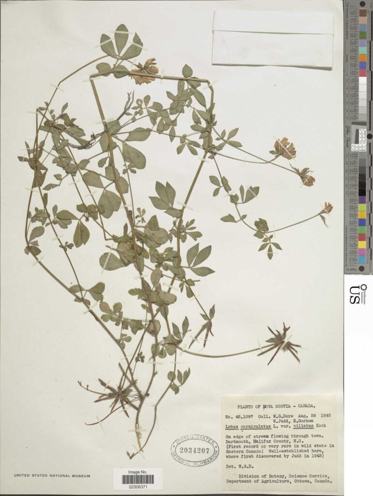
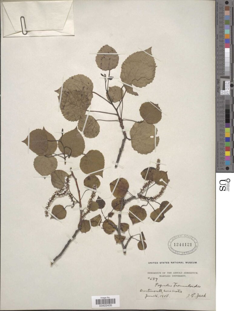
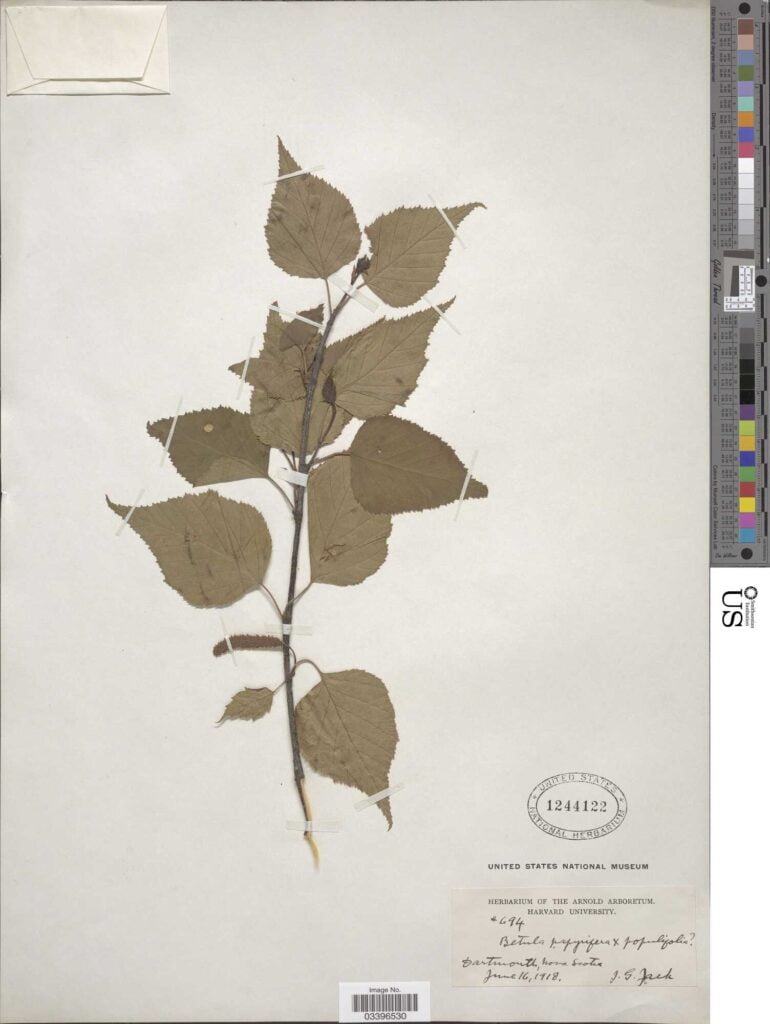
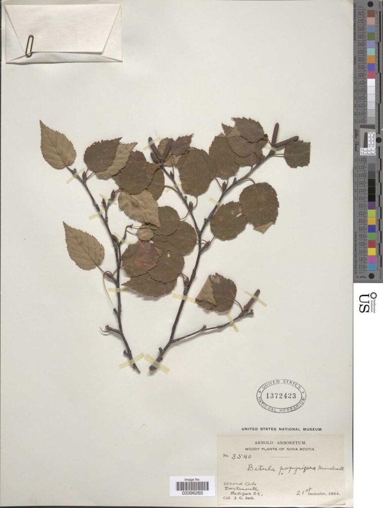
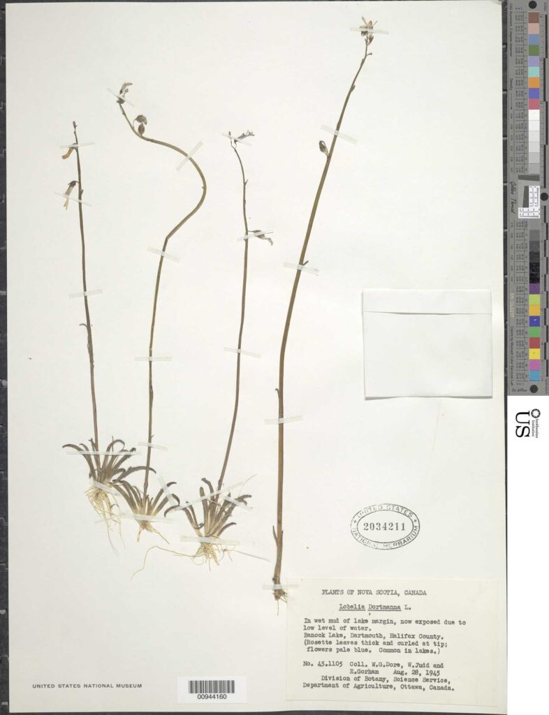
The Time(s) the Smithsonian came to town

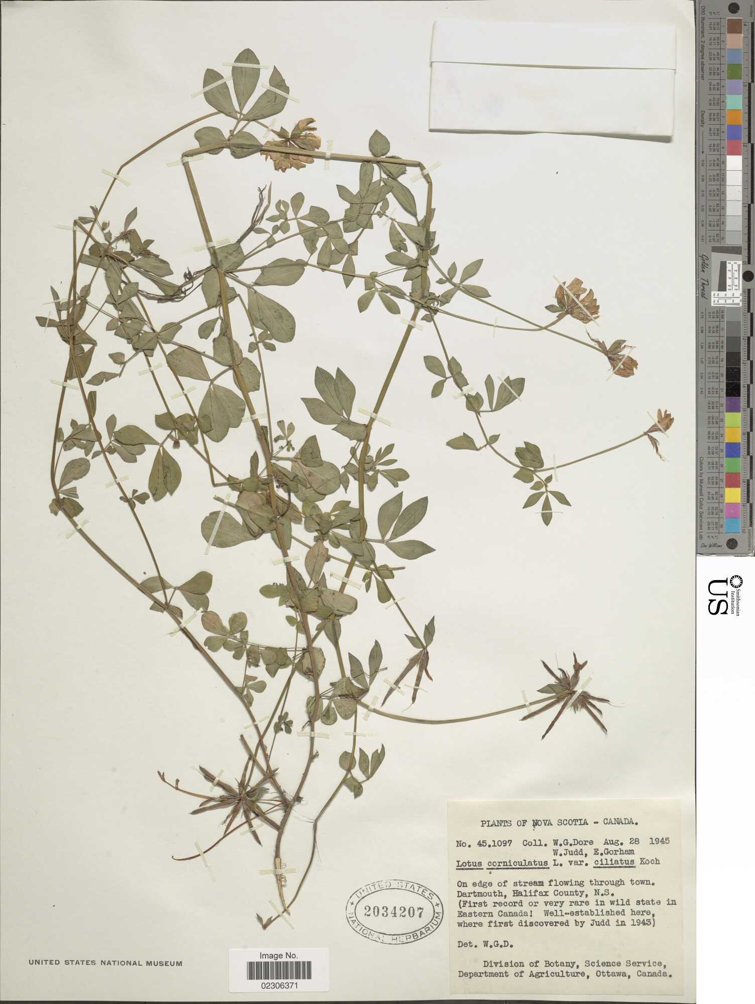
dartmouth plants

https://www.si.edu/search?edan_q=dartmouth%2Bnova%2Bscotia

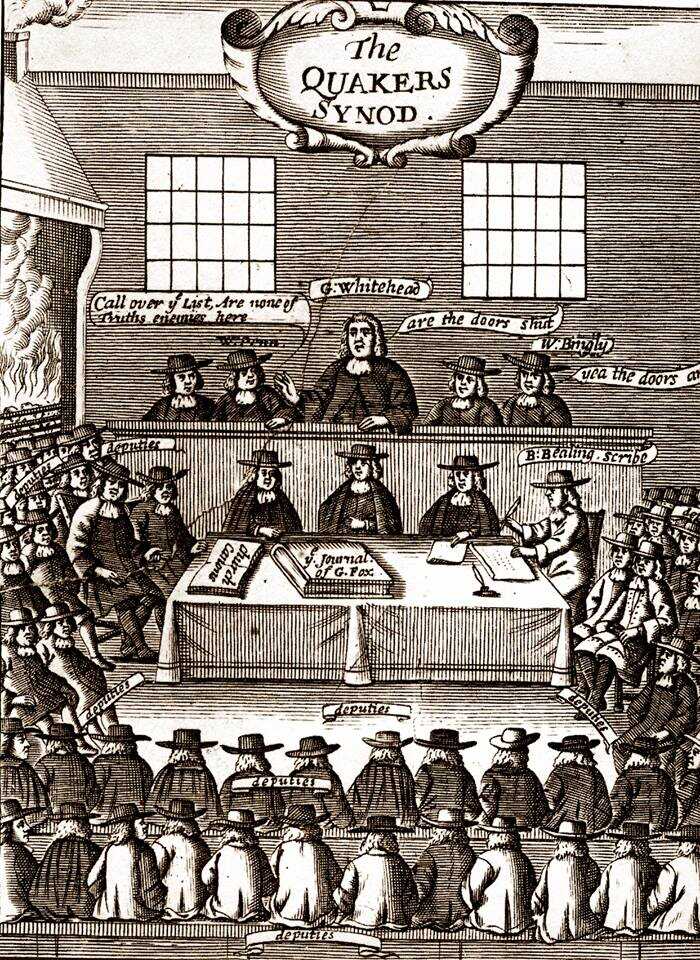
Joshua Evans

quaker

On July 17th 1795 Joshua Evans arrived at Dartmouth. Evans was a Quaker minister and abolitionist born in 1731 in West Jersey, he was a vegetarian, an ardent proponent of the peace testimony along with Quaker plainness and ending slavery. He visited with local Quakers Seth Coleman and Thomas Green, among ten other local families.

“Through a lifetime of increasingly rigorous and peculiar “testimonies”, Joshua Evans bore witness against a spirit of self-indulgence and greed within himself and in his society… his purpose, however, was not primarily negative.. he loved humanity – indeed all living things are creations of his divine master. He was especially fond of blacks and indians, the Acadians, the poor, and the oppressed.”

“Evan’s rejection of “contaminated products” also stemmed from his abhorrance of slave labor. As early as 1761, and perhaps before, Joshua Evans was launched on a journey of “plain dealing” with slaveholders… “to plead for the Liberty of the Black people, and to visit those who held them…” The work went hard, but it was “the Lord’s requiring.””

Evans described Dartmouth as “situated on the east side of Chebucto bay, and contains between fifty and a hundred houses.”

He attended several meetings in Dartmouth “large for the place, and proved to be a heart-tendering, favoured opportunity” including public worship, a meeting of conference and a preparative meeting “in which, those who incline to marry are allowed to declare their intentions…on account of their situation being so remote from any monthly meeting.”

“These friends have had their trials, by reason of others removing away, when they had not freedom to go. Our visit was very acceptable, as coming in a needful time; which some of them expressed.”

On July 27th 1795, the day he departed Dartmouth, Evans described his visit as “Many people, Friends and others, coming together”.

Evans’ visit to Dartmouth was nearly three years before his travels through the southern States (in the spring of 1798) where he continued to labor with friends and others about the evils of slavery. He returned to New Jersey and died in July of that same year.


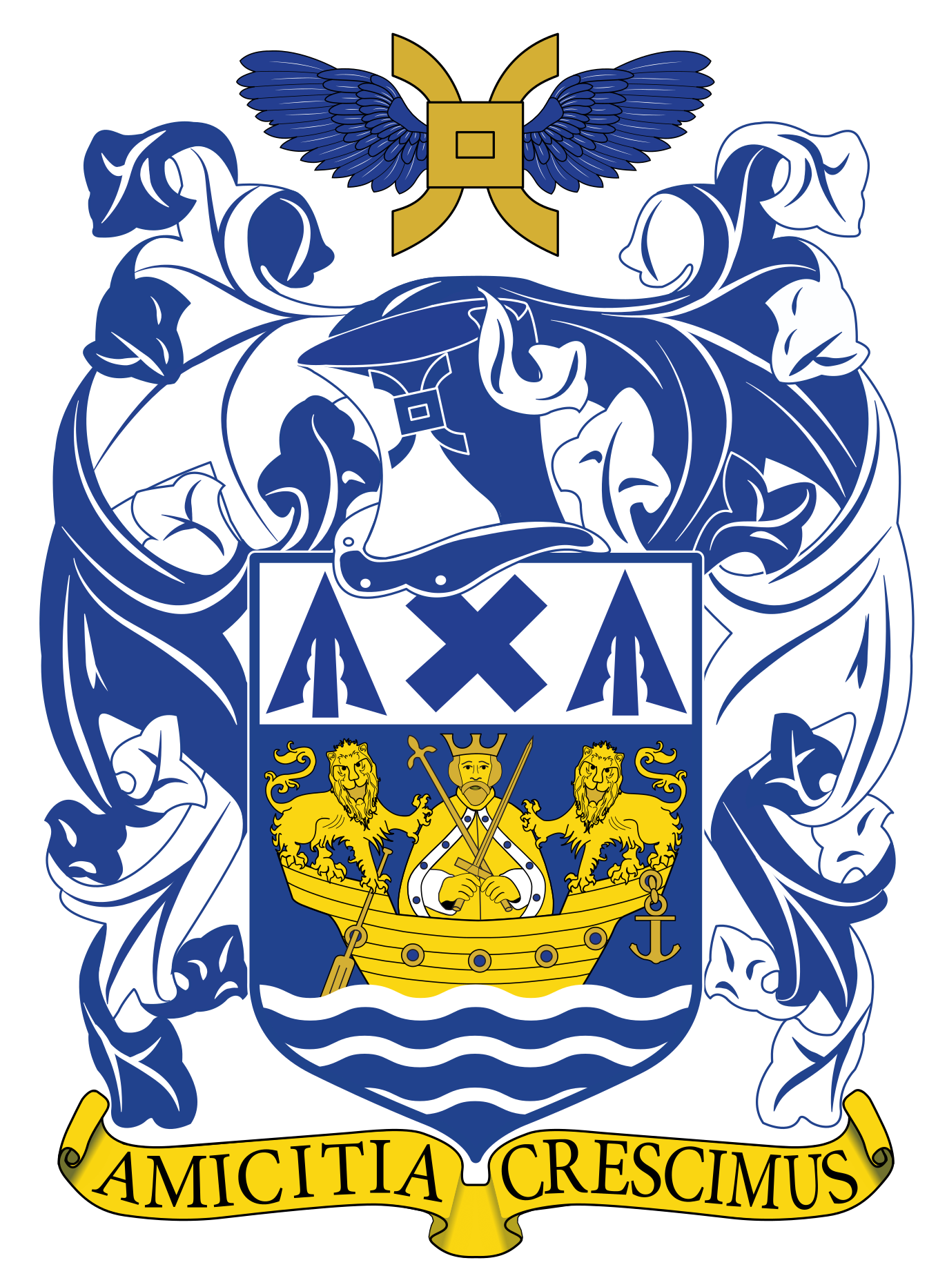
Dartmouth’s motto is “Amicitia Crescimus”, Amicitia meaning “friendship” or “an alliance”, Crescimus being a first-person plural of cresco which has several meanings including to “come in to being”, to “arise”, to “grow”, to “grow up”, “to increase”, to “swell”, to “prosper and thrive”, to “become great”, to “attain honor”.

“We grow in friendship”, “friendship grows”, “through friendship we prosper and thrive” — perhaps Evans’ visit to Dartmouth and his musings served as inspiration.

“Joshua Evans, 1731-1798: A Study in Eighteenth Century Quaker Singularity” Donald Brooks Kelley https://www.jstor.org/stable/41935203

“Joshua Evans Papers”, ca. 1788- ca. 1804
https://archives.tricolib.brynmawr.edu/resources/5190joev

“Journal of the Life, Travels, Religious Exercises and Labours in the Work of the Ministry of Joshua Evans, Late of Newton Township, Gloucester County, New Jersey”, ca. 1834
https://books.google.ca/books?id=Z92QXSO773EC

“Descendants of Benjamin Green Sr.”
https://web.archive.org/web/20120803104226/http://www.jangaard.com/bengreen20%20sep2007.pdf

“The New College Latin & English Dictionary”, Bantam Books, NY, 1969.

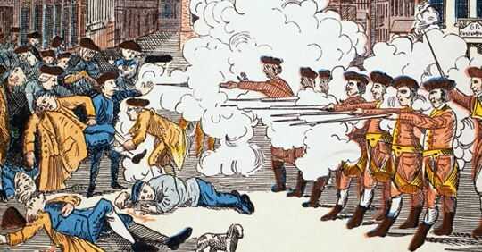
“The spirit of their Boston brethren”

revolution

“Of all the new settlers, the people of Liverpool seem to have been most imbued with the spirit of their Boston brethren. In the minutes of the council of Nova Scotia, under date of July 24, 1762, is a remarkable document drawn up by the inhabitants . . . insisting in no measured terms on their right to local self-government:

“We, your memorialists, proprietors of the township of Liverpool, look upon ourselves to be freemen, and under the same constitution as the rest of His Majesty King George’s other subjects, not only by His Majesty’s Proclamation, but because we were born in a country of Liberty, in a land that belongs to the Crown of England, therefore we conceive we have right and authority invested in ourselves (or at least we pray we may) to nominate and appoint men among us to be our Committee and to do other offices that the Town may want.

His present Excellency . . . and the Council of Halifax have thought proper to disrobe and deprive us of the above privilege, which we first enjoyed.

This we imagine is encroaching on our Freedom and liberty and depriving us of a privilege that belongs to no body of people but ourselves, and whether the alteration and choice of the Men you have chosen to be our Committee is for the best or not we can’t think so, and it has made great uneasiness among the people insomuch that some families have left the place and hindered others from coming, and we know some of the Committee is not hearty for the settlement of this place.””

Weaver, Emily Poynton, 1865- [from old catalog]. “Nova Scotia And New England During the Revolution”. New York, 1904. The American Historical Review, Vol. 10, No. 1 Oct., 1904, pp. 52-71. https://www.jstor.org/stable/pdf/1833814.pdf, https://hdl.handle.net/2027/loc.ark:/13960/t0sq96b2h

The Avenue

tines black history

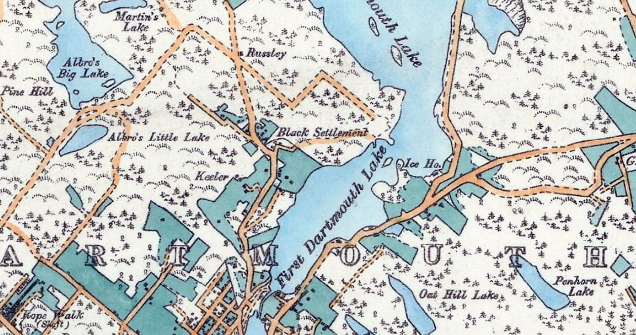
The “Black Settlement”, aka “The Avenue”, as seen on the outskirts of the Town of Dartmouth in 1886

The following excerpts are from “Survival of an African Nova Scotian Community: Up the Avenue, Revisited” by Adrienne Lucas Sehatzadeh, 1998. An incredible resource of some of the Black history of Dartmouth that is certainly worth your time to read.

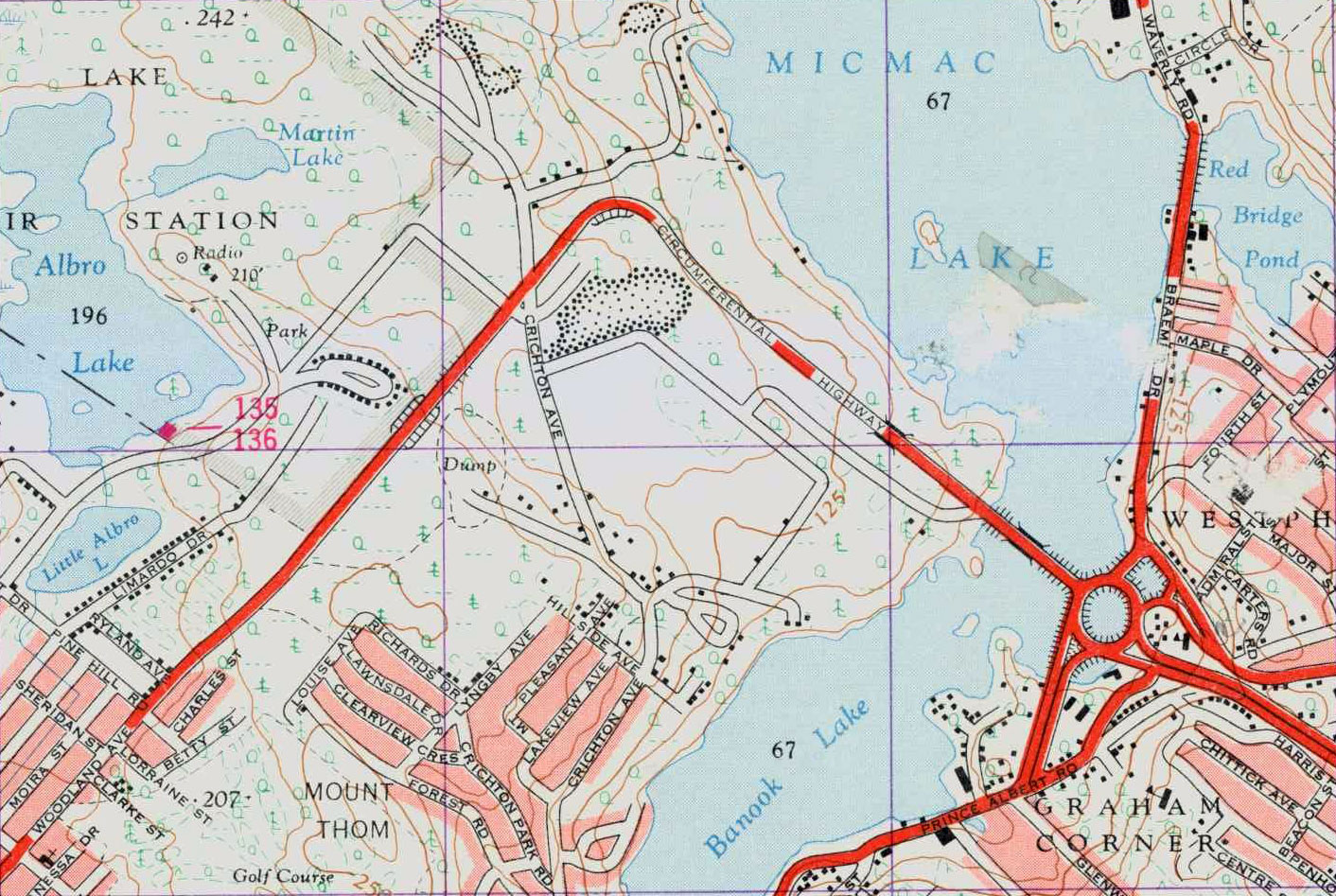
“The part of Crichton Avenue above Lyngby Avenue is the area where the Black settlement started. Crichton Avenue winds its way north/south from the downtown area, along the western shore of Sullivan’s Pond and Lake Banook.”

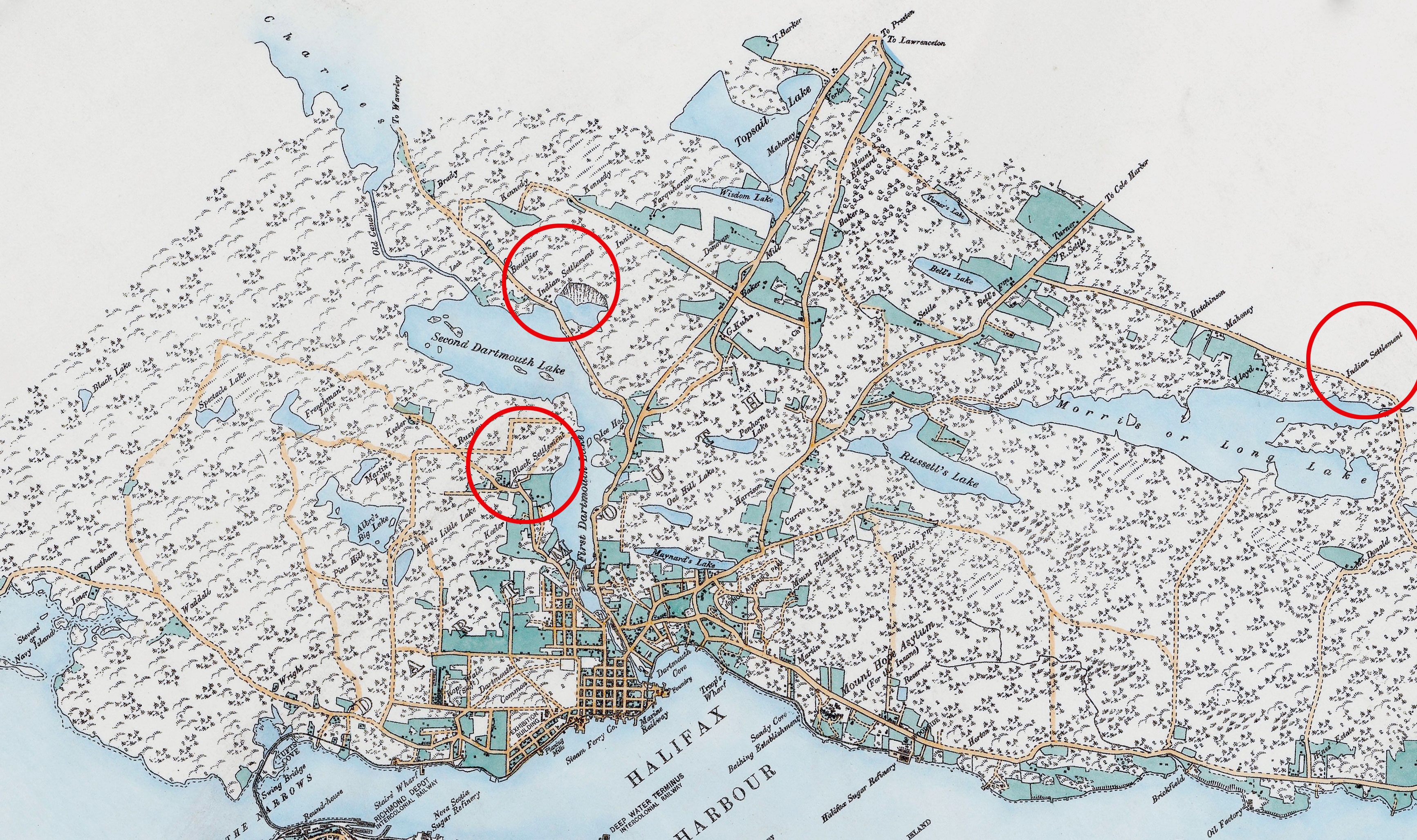
The Avenue as it was in context within the broader Dartmouth area, note also two Mi’kmaq Settlements. There aren’t many maps as excellent as this one by E. Hopkins and Chas S. Akers from the period. Many later maps omitted the Avenue and other peripheral Dartmouth communities entirely. (https://gallica.bnf.fr/ark:/12148/btv1b53029049m)

“Crichton Avenue has been a major roadway in Dartmouth for over 100 years and intersects Ochterloney Street in the downtown area, about one kilometre from Halifax Harbour. The Avenue portion of Crichton Avenue extended across the circumferential highway to The Extension, where the Black community ended.”

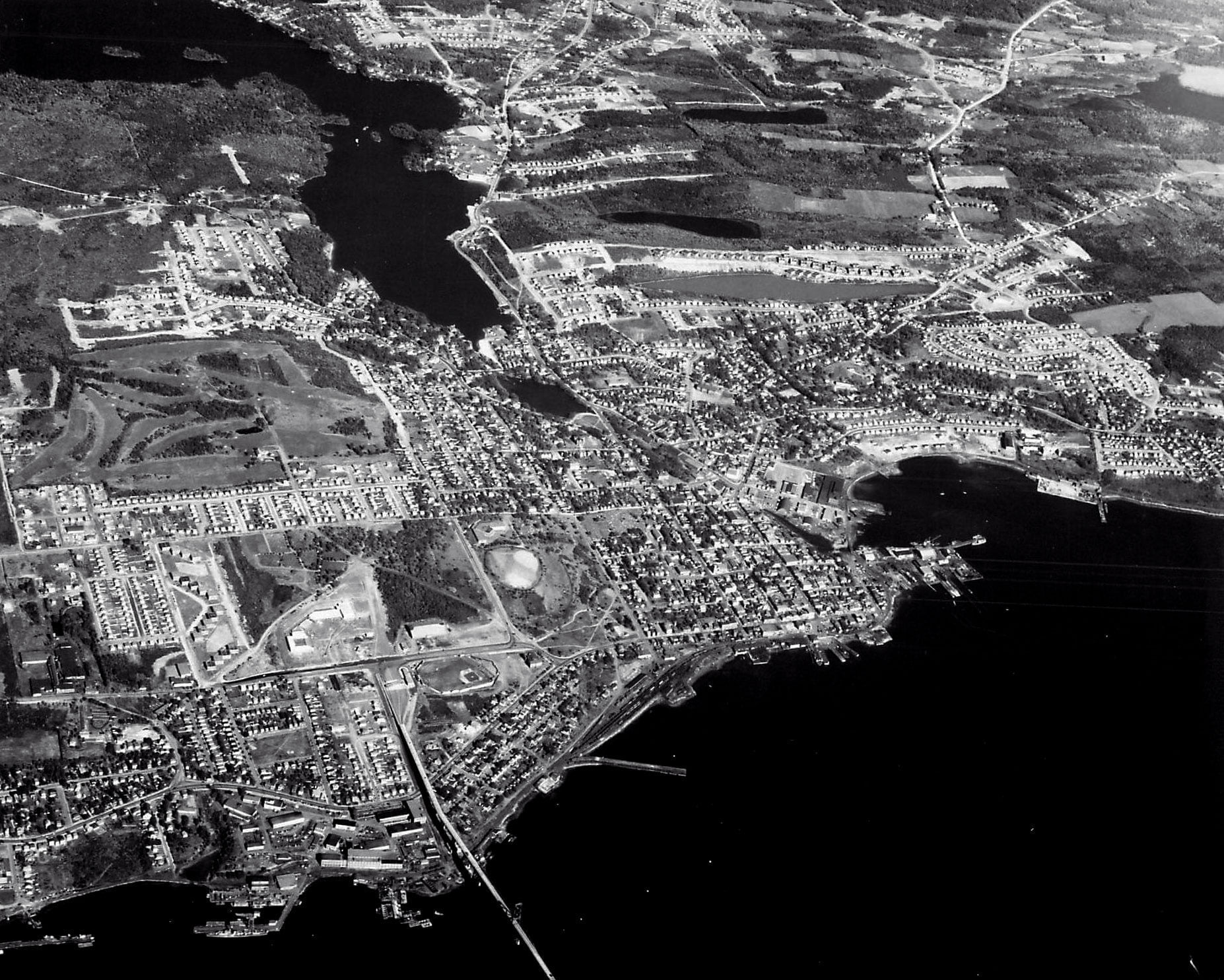
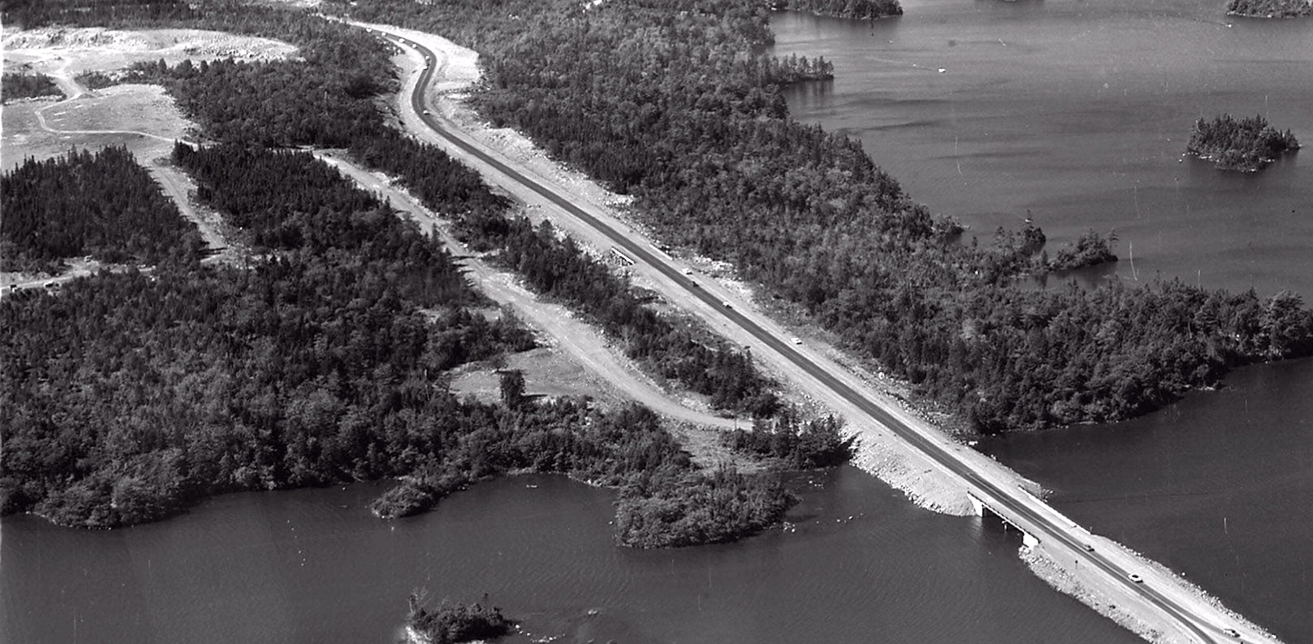
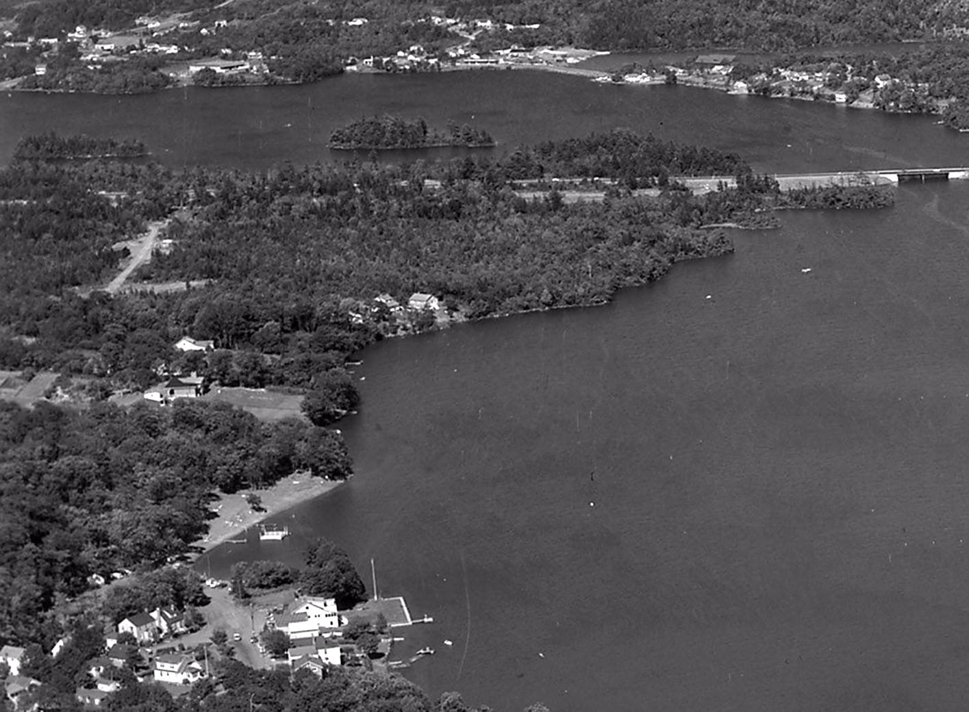
The encroachment of suburbia into “The Avenue” is well underway by the time these aerial shots were taken in the mid-late 1960s.

“Crichton Avenue Extension was expropriated in the late 1960s because of the expansion of the circumferential highway. The circumferential highway (not shown on the sketch) runs east less than one-half kilometre north of the last Lucas house on Crichton Avenue.”

the avenue map black history

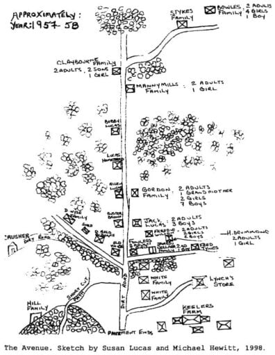
A Sketch of “The Avenue” as seen on Page 164 (153) of “Survival of an African Nova Scotian Community: Up the Avenue Revisited” by Adrienne Lucas Sehatzadeh. (https://www.collectionscanada.gc.ca/obj/s4/f2/dsk2/tape15/PQDD_0012/MQ36526.pdf)

“The Extension was the continuation of Crichton Avenue just north of the highway. The few references to this Black community in the literature refer to the area as ‘Colored Meeting House Road’ until the Legislature passed a bill in 1892 to name the roadway Crichton Avenue. Street signs bearing the name Crichton Avenue were erected in 1894 (Martin, 1957). However, the Black settlement at the top of Crichton Avenue was never officially named.”

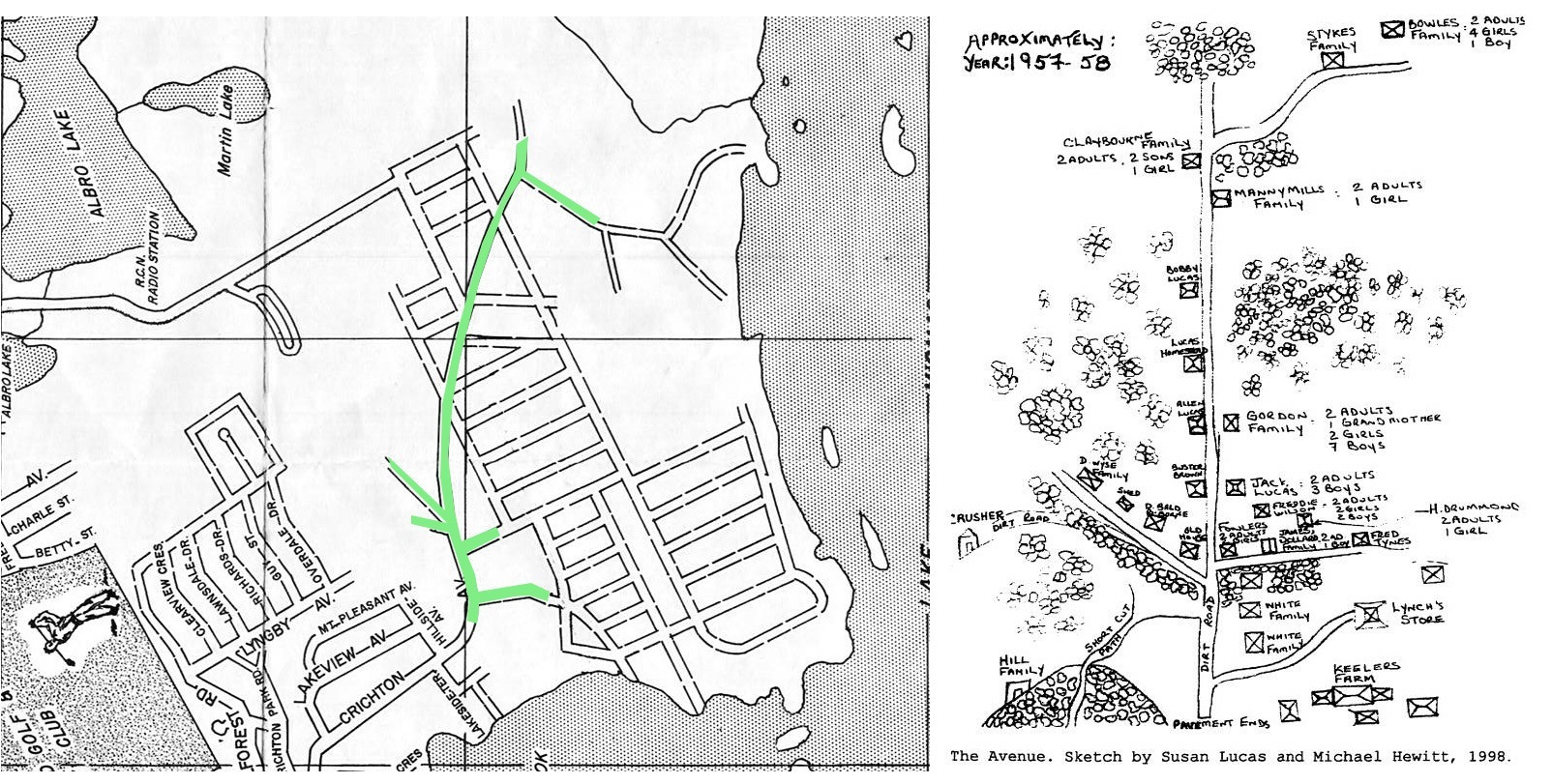
The Avenue seen at left as it intersected with a planned subdivision that never materialized. (https://cityofdartmouth.ca/dartmouth-before-being-strangled-by-a-beltway/)

“Although the Black settlement did not have a formal name, my experience has been that people always talked about going up The Avenue to spend time and socialize. The Avenue is a familiar referent for this community. The phrase evokes powerful imagery for individuals who are familiar with the life and times of the people from this area. I have, therefore, arbitrarily named the area ‘The Avenue’.”

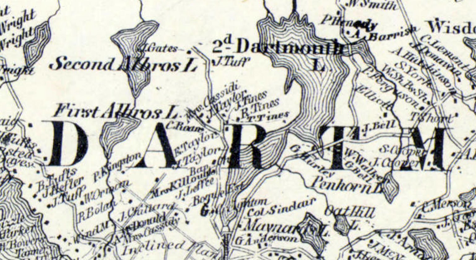
Tines families are seen in this extremely detailed map c.1864 from A.F. Church and Co. (https://collections.lib.uwm.edu/digital/collection/agdm/id/14722/rec/1) along with the Baptist Church, once located near the intersection of what would be Crichton Ave and Glen Manor Drive today.

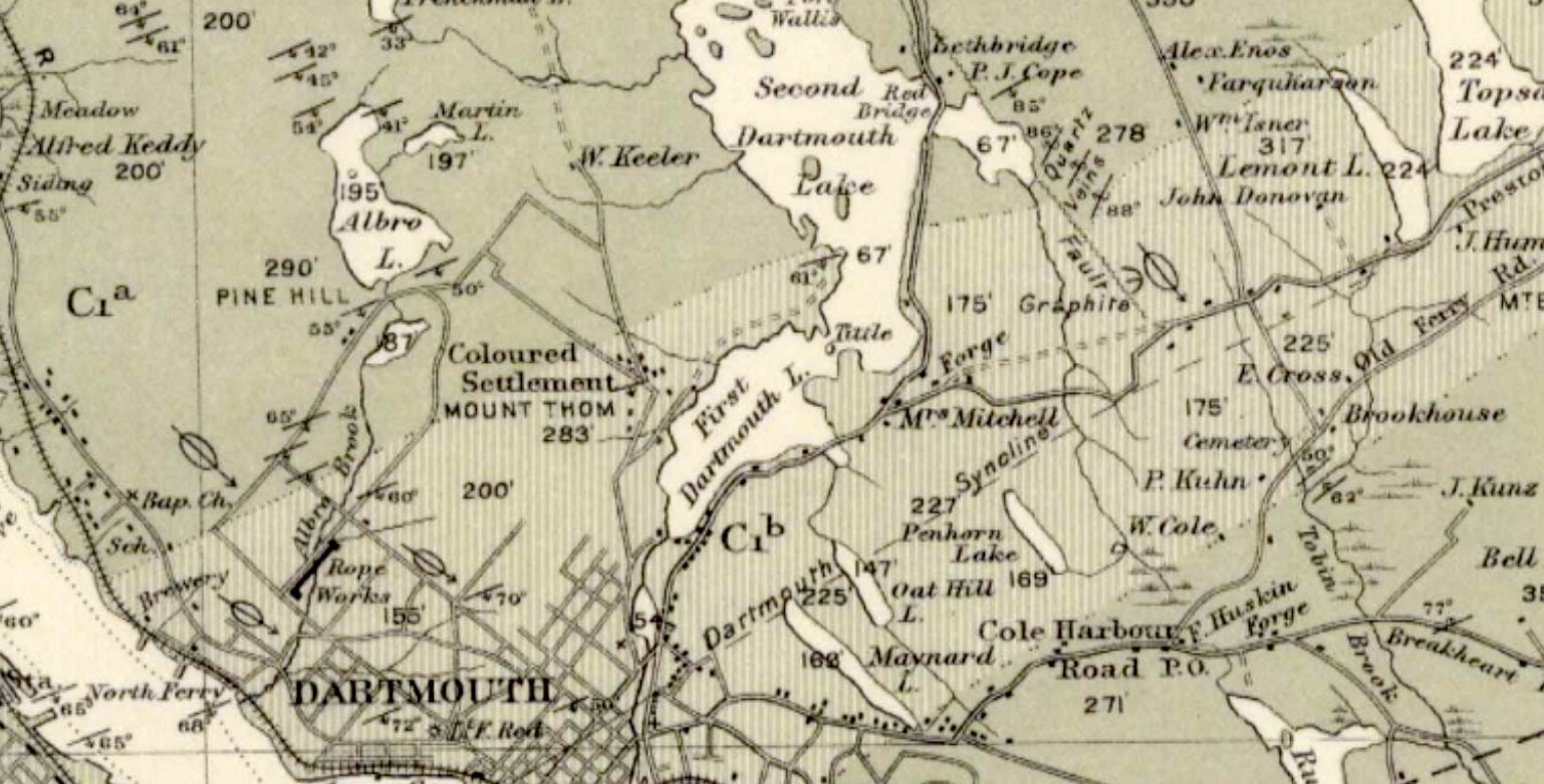
“The avenue”, which by 1908 was referred to as a “Coloured Settlement” on this Geological Survey of Canada Geological Map (https://geoscan.nrcan.gc.ca/starweb/geoscan/servlet.starweb?path=geoscan/fulle.web&search1=R=107885)

“The Avenue” by 1963 (https://digitalarchive.mcmaster.ca/islandora/object/macrepo%3A81109)

“The Avenue” today.

Sehatzadeh, Adrienne Lucas. “Survival of an African Nova Scotian Community, up the Avenue, Revisited.” Thesis / Dissertation, Dalhousie University, 1998. http://www.collectionscanada.gc.ca/obj/s4/f2/dsk2/tape15/PQDD_0012/MQ36526.pdf

Town Meetings under Martial Law

revolution

“Some townships in Nova Scotia had called town meetings to debate and resolve on several questions relating to the laws and government of the province. The governor and council (14th of April 1770) ordered the Attorney General to notify all persons concerned that such meetings were contrary to law, and if persisted in, that he should prosecute them.”

Murdoch, Beamish. “A History of Nova Scotia, Or Acadie”, 1866 https://books.google.ca/books?id=x7cTAAAAYAAJ&pg=PA493#v=onepage&q&f=false

Settlement previous to 1749

census 1688

From The Story of Dartmouth, by John P. Martin:

Dartmouth, long before the European explorers and colonizing forces, had a 7,000 year history of occupation by the [Mi’kmaq]. The [Mi’kmaq] annual cycle of seasonal movement; living in dispersed interior camps during the winter, and larger coastal communities during the summer; meant there were no permanent communities in the Euro-centric sense, but Dartmouth was clearly a place frequented by [Mi’kmaq] for a very long time. Whether it was the Springtime smelt spawning in March; the harvesting of spawning herring, gathering eggs and hunting geese in April; the Summer months when the sea provided cod and shellfish, and coastal breezes that provided relief from irritants like blackflies and mosquitos, or during the autumn and its eel season; Dartmouth with its lakes and rivers, both breadbasket and transport route back and forth to the interior, was a natural place for the [Mi’kmaq] to spend their non-winter months.

A fascinating look into what Nova Scotia and Atlantic Canada could’ve looked like, from the end of the ice age at 19,000 BCE, until present. By 12,000 BCE, this model shows Cape Cod extending much further into the ocean than it does at present, along what is now Brown’s bank, a ridge which more or less stretches all the way to Sable Island along the continental shelf. A sea level 300 feet lower than it is today was enough to create a kind of land bridge to the parts of western and central Nova Scotia no longer under ice, the Bay of Fundy looking like it was an inshore repository for glacial meltwater until sea levels rose. This could’ve allowed for human exploration and settlement in what is now known as Nova Scotia previous to the retreat of the ice sheet in full.

By 10,000 BCE most of the ice had retreated, which squares with the earliest artifacts found in the area, such as at Debert, which date to the same general period, if not previous to that. That sea levels had risen one hundred feet in this two thousand year period might be instructive as to why artifacts are few and far between from this period, many of the settlements, if coastal, would have long ago been lost to the sea. Assuming the artifacts found (at Debert and Belmont) were not from nomadic hunters, and that this model is somewhat accurate, Nova Scotia could have been settled for 10,000 years or more.

Source: https://web.archive.org/web/20210807155606/https://sos.noaa.gov/catalog/datasets/blue-marble-sea-level-ice-and-vegetation-changes-19000bc-10000ad/, https://web.archive.org/web/20130219202242/https://sos.noaa.gov/Docs/bluemarble3000h.kmz

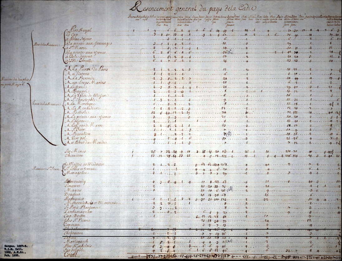
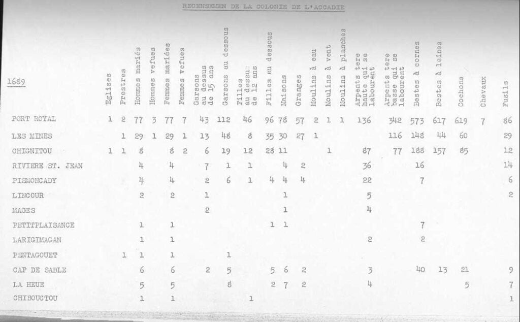
A census of the district of Acadia taken in 1687-1688 attributed to de Gargas shows Chebucto had 1 French family consisting of a man, wife and son; that there were 7 Mi’kmaw men, 7 Mi’kmaw women and 19 Mi’kmaw children, “36 souls” in total. 1 French house, 7 Mi’kmaw homes, 3 guns, 1/2 acre of improved land.

census 1688
Source: https://dalspace.library.dal.ca/bitstream/handle/10222/15754/MS-6-13A1_DeGargas_Census.pdf?sequence=1
carteacadie6 map
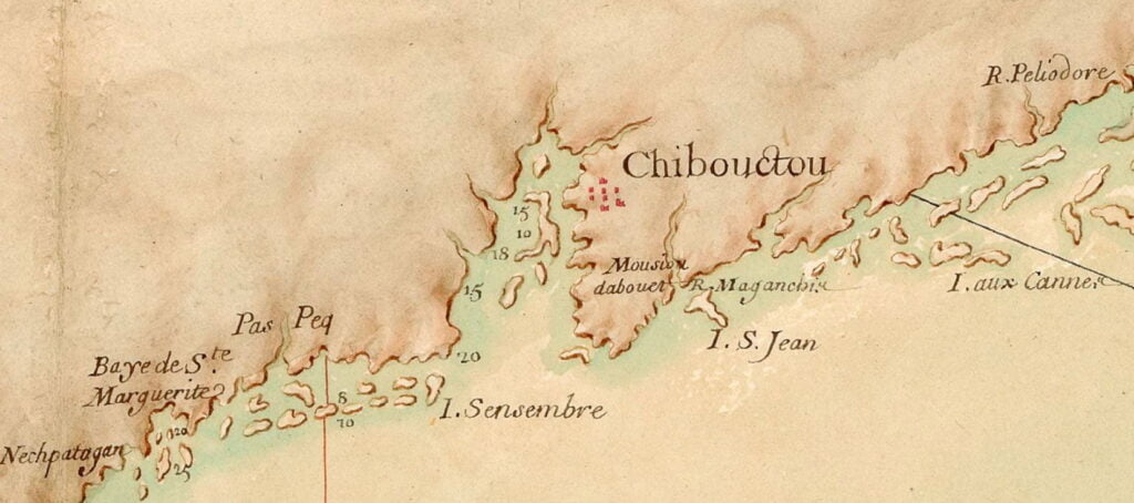
“Chibouctou: https://cityofdartmouth.ca/carte-particuliere-de-la-coste-daccadie/
Source: “Recensements d’Acadie (1671-1752)”, (info), http://139.103.17.56/cea/livres/doc.cfm?livre=recensements, http://139.103.17.56/cea/livres/doc.cfm?retour=R0231&ident=R0040

The St. Malo fishermen who were located at Sambro and at Prospect in the days of French ownership, must often have run to the inner harbor either to dry fish on our long beaches, or to barter furs with the natives who were always their allies. On the Dartmouth side of the harbor, geographical conditions were far more favorable for congregating, with three voluminous streams of never-failing fresh water flowing down to the estuaries of the two little bays, both later known as Mill Cove.

Besides that, there was an abundance of shell fish available at low tide, along with lobsters, crabs, sea-trout, salmon, halibut, codfish, and haddock, with the usual runs of herring and mackerel in warm weather. The woods teemed with wild life. Partridge roosted on trees, moose and deer roamed the forest, and wedges of wild fowl honked high overhead.

The evidence already submitted that the [Mi’kmaq] resorted to the Cove, is borne out by the description of Cobequid (Truro district) by Paul Mascarene about 1721, where he states that “there is communication by a river from Cobequid to Chebucto”. This Implies that the Shubenacadie route had long been in use. Engineer Cowie, after studying several harbor sites for Ocean Terminals a hundred years ago was of the opinion that Chebucto had been used as a trading post over a century before its permanent settlement.

In 1701, when M. Brouillan the newly appointed French Governor, came here from Newfoundland to rule Acadia, he went overland from Chebucto to Port Royal. This is in Murdoch’s History. Dr. Thomas H. Raddall, in his bicentennial story of Halifax, thinks that on this occasion, [Mi’kmaq] transported the Governor by the well-known canoe route of Dartmouth Lakes. (One can’t imagine a viceregal party trudging over a rough black-flied trail from Bedford to Windsor, or portaging through the shallow rivers of that section of country).

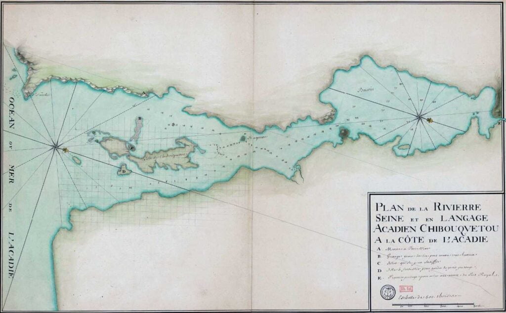
One of the early sketches of Dartmouth side is preserved at the N.S. Archives. It is a detailed drawing of the whole shore and harbor, showing the depth of water from the Eastern Passage to the head of the Basin, done by the French military engineer De Labat in 1711.

The indentations of the various inlets seem quite accurate. The soundings must have occupied a full summer, and the work was no doubt done from small boats; otherwise his large vessel would have butted such shoals as Shipyard Point and the one off shore at Queen Street.

dartmouth map

Not sure whether this is the 1711 map Martin attributes to De Labat but it is detailed, especially as it relates to the Dartmouth Cove, and it contains a number of soundings as he describes. From: “Plan de la rivière de Seine et en langage accadien Chibouquetou” http://gallica.bnf.fr/ark:/12148/btv1b53089940v/f1.item.r=halifax.zoom

Page 32 of 32
1 29 30 31 32