
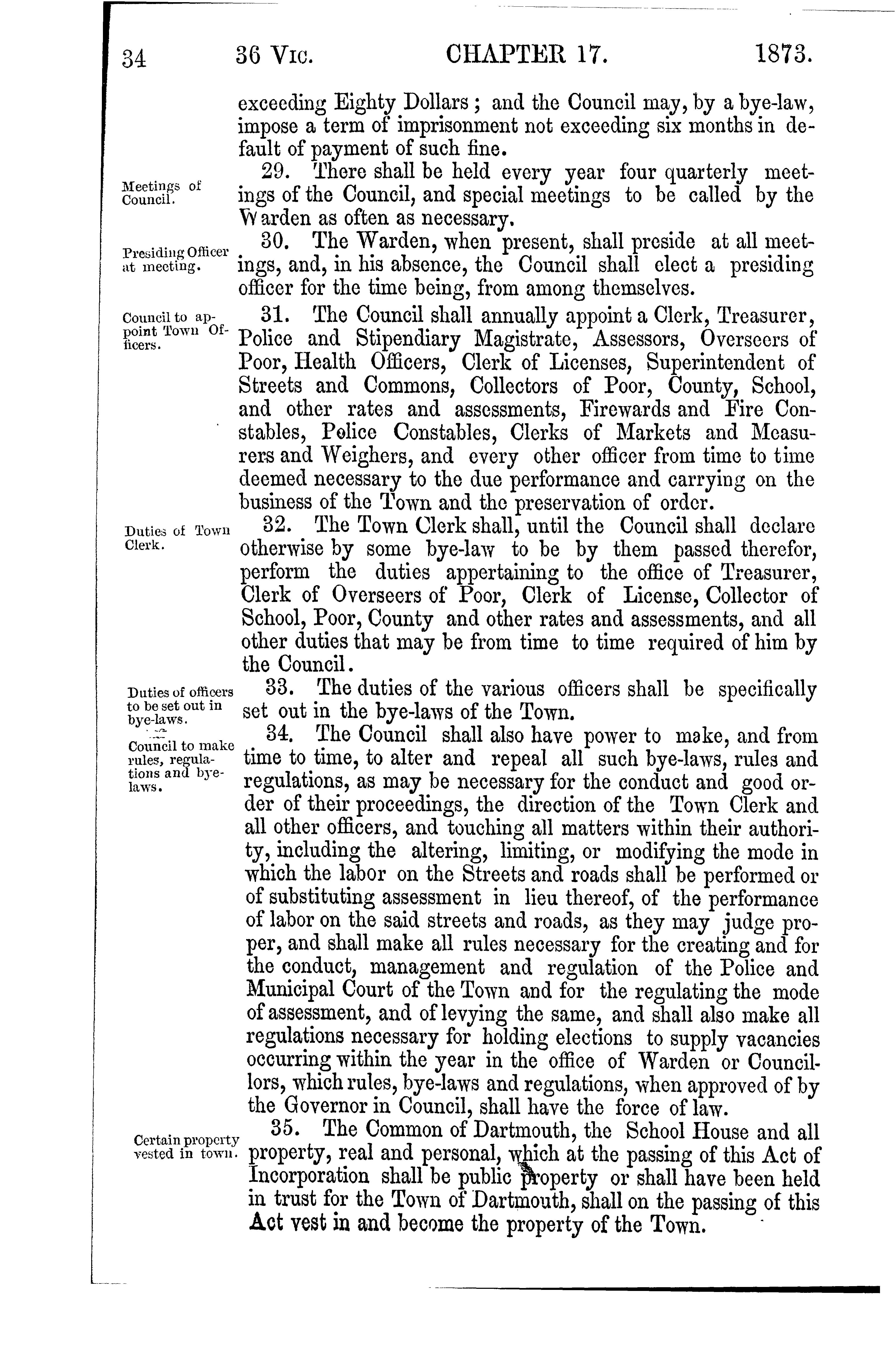
Chapter 17 of the Acts of 1846, “An Act to define and establish the Lines of the Township of Dartmouth” https://0-nsleg–edeposit-gov-ns-ca.legcat.gov.ns.ca/deposit/Statutes/1846.pdf
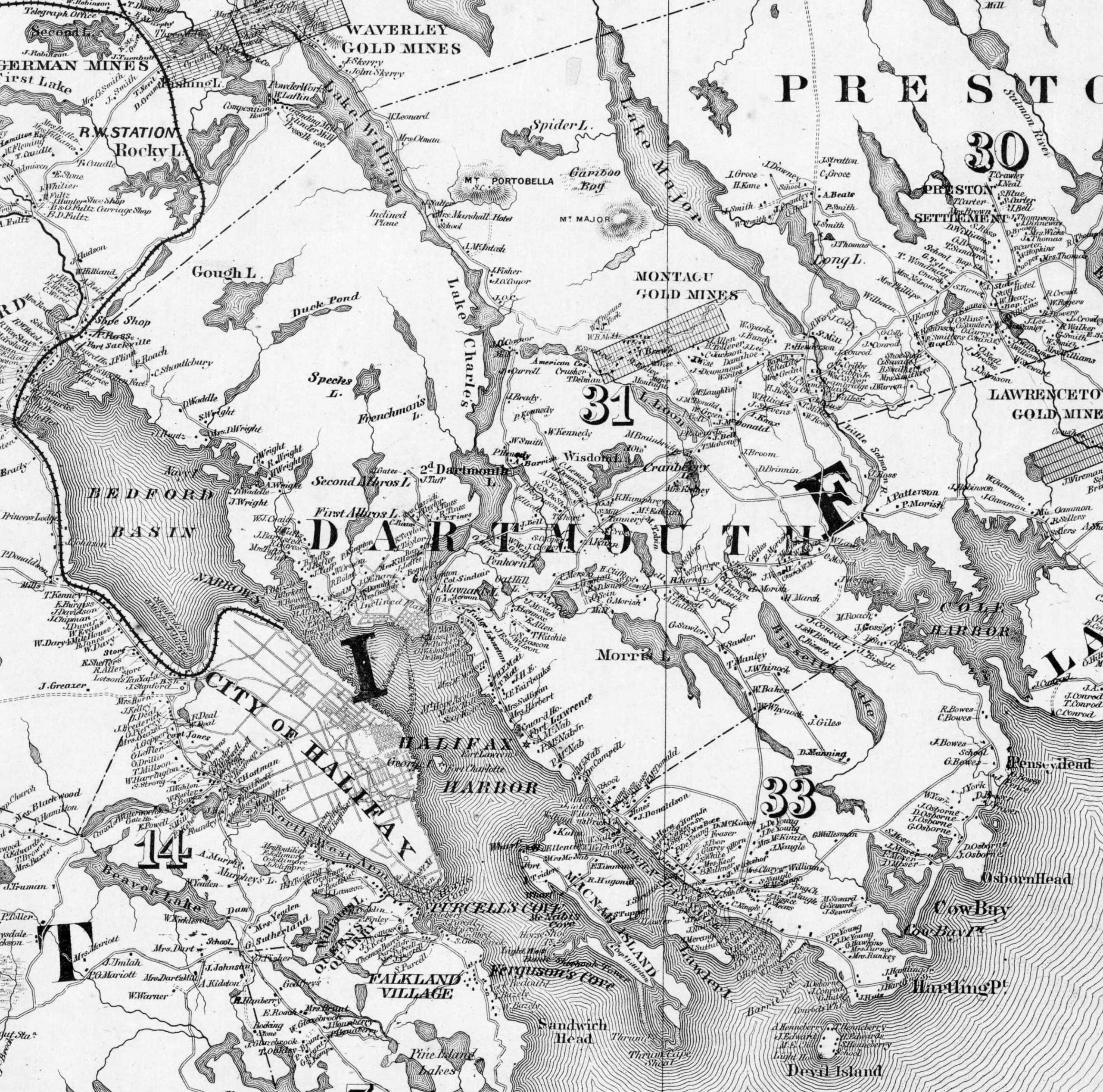
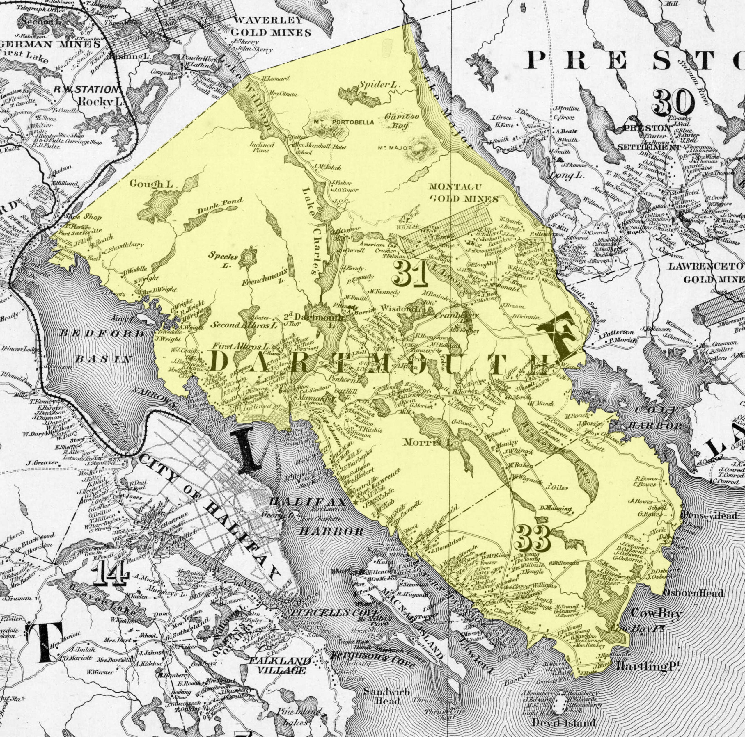
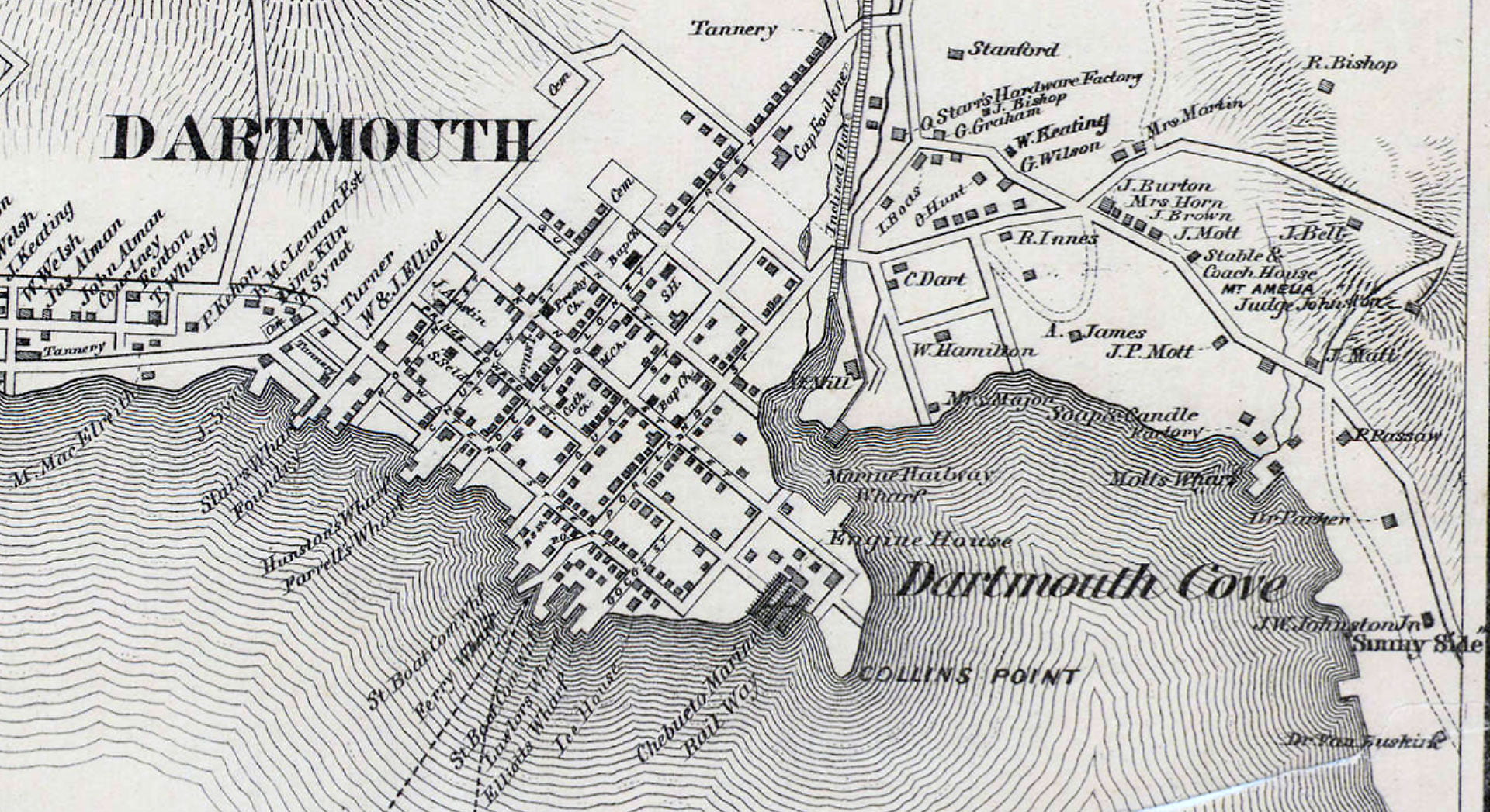
Dartmouth Township above and the Dartmouth Town Plot as seen below as they were in 1865, just before the imposition of the BNA and “confederation”. J.W. Johnston’s estate on Pleasant Street (and/or the immediate vicinity) is referred to as “Sunnyside”, that Dartmouth is now sometimes referred to as “Darkside” seems to align with what has become as much of a calling card of the totalitarian reprobates as any other, an inversion.
The disappearance of the Township along with the accumulated powers of the people that it actuated — the Common, the Grand Jury, the Sessions (Local Courts), the Town meeting and the School meeting — certainly aligns with the disappearance of its progeny, Dartmouth as an incorporated Town and then City, a clear pattern of action as it relates to what’s become of our “governance”.
We’re administered and managed under a never ending constitutional, institutional and ideological year zero, engineered to extract any powers somehow acquired by “the people” in order to centralize them in higher order governments. It’s a process legitimized in a number of ways including through euphemisms like “living tree constitutionalism”, which is as arbitrary as you’d expect under a dominion created without “the people”, in fact in profound opposition to the concept of self government itself.
By decree in 1867 local government became the exclusive jurisdiction of a province created without a written constitution, as close to a “rigged game” as you might find, with nothing to bind it in later years beyond the whims of the uniparty in what’s since degenerated into a unicameral ram-fest legislature. What something is or isn’t is a matter of opinion, shaped by a steady stream of revisionist history and propaganda from those who profit through their proprietary regime not rule of law.
How long until the amalgamated, dynastical, municipalized county otherwise known as the “city” of “HRM” is unilaterally reconfigured in yet another institutional overhaul from above remains to be seen. Even just a cursory look at the past indicates it will happen without the participation or consent of those who supposedly make up the corporation, that of its “citizens”, long ago converted into serfs.
From: “Topographical township map of Halifax County, Nova Scotia“, Walling, Henry Francis, 1864. Publisher: A.F. Church and Co. https://collections.lib.uwm.edu/digital/collection/agdm/id/14725/rec/1
Chapter 27 of the Acts of 1828 “
To extend the Act relating to Commissioners of Highways to the Town of Dartmouth” https://0-nsleg–edeposit-gov-ns-ca.legcat.gov.ns.ca/deposit/Statutes/at_large/volume3/1828.pdf
For more on earlier and later iterations of the legislated spatial dimensions of Dartmouth:
DARTMOUTH, Halifax County: This city is located on the east side of Halifax Harbour. A [Mi'kmaq] name was Boonamoogwaddy, "Tomcod ground". The English name may have been given in honor of William Legge, Earl of Dartmouth, Colonial Secretary 1772-75, but it was probably named for the Devonshire port of Dartmouth.
In August, 1750, the Alderney arrived in Halifax (Chebucto) Harbour with 353 settlers on board. On August 23 the Council resolved to settle them across the Harbour from Halifax. Before the end of 1750, a blockhouse and small military post had been built. In 1751 the settlers suffered from an [indigenous] attack. After the American Revolution an oil factory was set up and operated by a Nantucket Whaling Company about 1785 to 1792. They built a meeting-house about 1787, and their little village near the factory became known as Quaker Town because most of the people were Quakers. Later most of them removed to Wales. In 1809 Dartmouth contained only nineteen dwelling houses but it expanded during the construction of the Shubenacadie Canal. On December 6, 1917, the northern part of Dartmouth was wrecked when the French munition ship Mont Blanc exploded in Halifax Harbour. In April, 1873, Dartmouth was incorporated as a town, and in 1961 it annexed several of its suburban areas and became a city.
An Anglican church was built on Church Hill in 1788. The corner-stone of the Anglican Christ Church was laid July 9, 1817 and the building was consecrated on August 21, 1826. Emmanuel Anglican Church began as a mission hall erected in 1912 and destroyed in the explosion of 1917. The new church building was completed by May, 1920. The Anglican Church of the Holy Spirit was opened on November 23, 1956 near Maynard's Lake. A Baptist meeting-house was built in the Autumn of 1844. A new Baptist church was opened on January 4, 1880, and was destroyed in 1917. A new Baptist church on Victoria Road was dedicated in 1922. South End Baptist Church was begun in January 1955, being dedicated on December 15, 1957. St. Peter's Roman Catholic Church was built in 1830, demolished in 1893. The corner stone of the new St. Peter's Church was laid on July 2, 1891, and the church was dedicated on July 7, 1901, but was burned on December 28, 1966. The corner-stone of St. Paul's Catholic Church, North Dartmouth, was blessed on October 3, 1948. St. Clement's Roman Catholic Church was used by Christmas, 1956. It was blessed on November 25, 1957. A Methodist chapel was dedicated on December 11, 1853. It was destroyed in 1917 and the corner-stone of a new church was laid on October 30, 1919. This church was dedicated on November 14, 1920 as Grace Methodist Church. The foundation of St. James' Presbyterian Church was laid on December 15, 1827. A new St. James' church was opened on January 29, 1871, and a Christian Education centre was built in 1955. St. Andrew's Presbyterian Church was opened on January 22, 1956. Stairs Memorial United Church began in a hall donated by George Stairs. A small church was built in 1922. The new Stairs Memorial Church was dedicated on February 22, 1959. The old chapel was then purchased by the Church of the Nazarine congregation. The Lutheran Church of Our Saviour on Portland Street was under construction in 1954. Wyndholme Christian Church was built in 1958. On June 24, 1958, sod was turned for the first Mormon church in Nova Scotia. It was completed by January, 1959.
A school-house was built in 1827. Central Public School began to operate about 1866. A building known as the Common School was built on the Dartmouth Common in 1876. The four room Greenvale School was built about 1890, opened in May, 1891, and burned on January 28, 1914. Hawthorne School was opened in November, 1885. New Greenvale and Hawthorne schools were opened in 1915. Dartmouth Academy was established about 1857. The corner-stone of a new Dartmouth Academy building was laid on October 22, 1962. Park Street was ready for use by September 1919, replacing the old Park, or Common School which was destroyed in the explosion of 1917. The two room Victoria School was opened in February, 1911. In October, 1950, sod was turned for a new Bicentennial Junior High School: Prince Arthur Junior High School was opened late in 1956. St. Peter's Parochial High School was opened on January 24, 1962. John Martin Junior High School was opened on September 4, 1963.
Postal Way Offices were in operation in Dartmouth in 1847 and 1850. In 1852 the Post Office was established permanently. A Post Office building was built in 1893, and opened on May 1, 1894. A new Post Office building was built in 1915, and opened in August, 1916. In January, 1960, tenders were called for the construction of a new Post Office building. This new building, an addition to the old Post Office, was opened on April 5, 1961.
A Fire Department was organized in September, 1822, and an engine house was built before 1842. A new Fire Station was erected in 1950.The Mechanics Institute building was begun in June, 1846. It was purchased by the town in 1877 and became the Town Hall. The new Town Hall was officially opened on December 28, 1957. The sod was turned for the new City Hall at Ferry Plaza on June 10, 1966, and officially opened in September, 1967. The old City Hall was converted into a library and museum, and the Dartmouth Regional library officially opened in its new headquarters on October 30, 1967. A new Police Station was approved by City Council in December, 1965. It was completed by June, 1966.
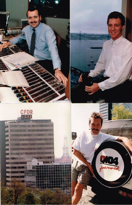
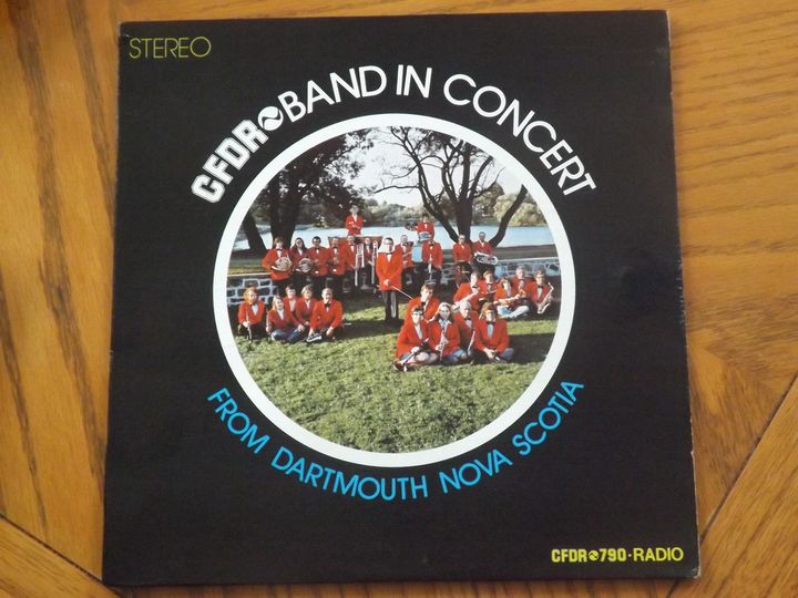
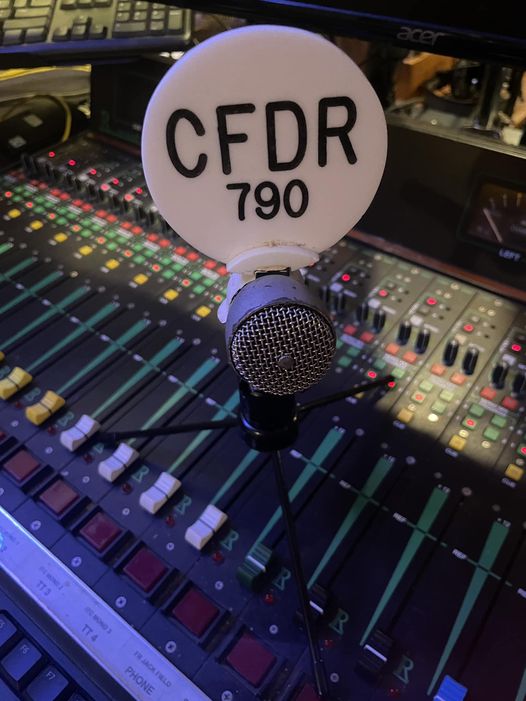
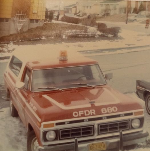
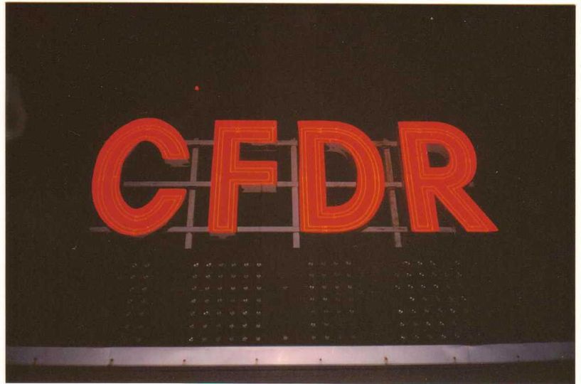
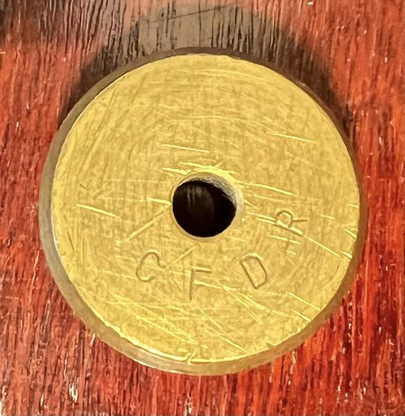
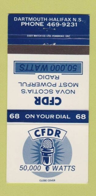
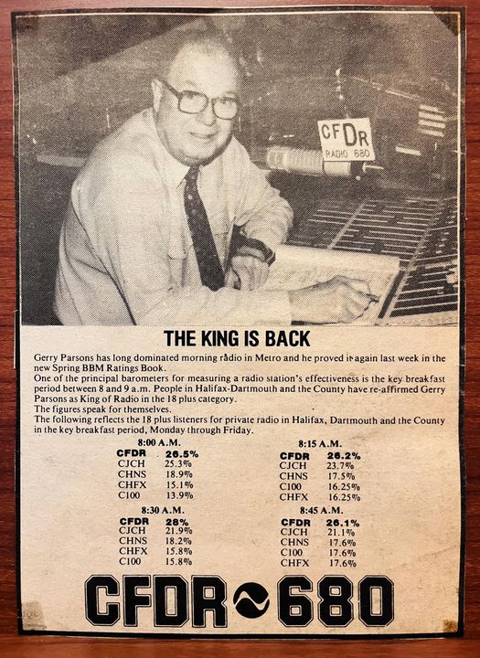
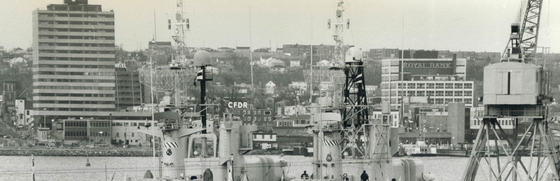
A Railway Station was erected in 1885. and the first passenger service began in January, 1896. A branch railway line to Windsor Junction was completed in June, 1896. The Eastern Shore Railway was begun in October, 1904.Newspapers published in Dartmouth were: The Dartmouth Times, published by James A. Halliday, beginning on August 4, 1883 [through at least to November 1884]; The Tribune, which began in July, 1878. The Atlantic Weekly, was begun on April 1, 1893 by S. Harris Congdon [through to 1900]. About 1901, it was acquired by Joseph M. Weeks, who changed its name to the Dartmouth Patriot [published until 1916, and brought back briefly from October 1992 to December 1993]. The Dartmouth Independent was published by Arthur Johnston about 1920 to 1925. The first issue of the Dartmouth Free Press, edited and published by Ralph S. Morton, came out on July 21, 1954 [published until 1982]. Harbour Views, edited by George Strand, began in November, 1959. [There was also The Mirror, published from at least December 1881 through to April 1882, and more recently, Dartmouth This Week, Published from 1983-1987]. The radio voice of Dartmouth, C.F.D.R. began broadcasting on December 5, 1962 [on the air until July 27, 2009].
DARTMOUTH, Halifax County (continued): The Angus L. Macdonald bridge between Halifax and Dartmouth was opened on April 2 and 3, 1955. Earlier bridges across the Narrows had been built in 1885 floated away in 1891, rebuilt and collapsed in July, 1893. A second bridge was begun in 1967.
Dartmouth Shopping Centre at Bridge Plaza was opened on March 15, 1956. K-Mart Shopping Plaza was opened on August 13, 1964. The first Volvo to be assembled at the Volvo Canada Limited plant rolled off the line on June 11, 1963.
The community has experienced phenomenal growth since the end of World War II as a defence, research and industrial centre. An air-base is maintained at C.F.B. Shearwater, and armed services housing at Shearwater and Shannon Park, while the Naval Research Establishment was officially opened on October 16, 1952. The Bedford Institute of Oceanography was formerly opened on October 25, 1962. Work was started in the summer of 1965 on the provincial research complex for the Nova Scotia Research Foundation. Imperial Oil maintains a large refinery and research centre at Imperoyal, and Texaco also has a refinery at Eastern Passage. Other industries are aluminum products, aviation parts, bakeries, breweries, cars, construction materials, electronic components, electroplating, marine accessories, lumber and wood products, ship repair, and structural steel. Suburban development has accelerated since the opening of the Angus L. Macdonald Bridge in 1955.
The population of Dartmouth in 1966 was 58,754.
[Cole Harbour seems to have originally straddled both Dartmouth and Lawrencetown Townships, at the head of Cole Harbour itself, and has migrated over time to include what was once the eastern portion of Dartmouth Township. Eastern Passage was part of Dartmouth Township but was recognized as a separate electoral district. Both are noted here on that basis, but they were never annexed to the City of Dartmouth in the way the other communities mentioned here were.]
ALBRO LAKE (now Dartmouth), Halifax County: A suburb located on the lake of that name about a mile east of Halifax Harbour, which was probably named after Samuel Albro, a prominent Dartmouth business man who died in 1842. The land was granted to Edward Forster (Foster) and others in July 1783. Edward Foster was a Loyalist who had been banished from Boston because he assisted the British Cavalry. After the end of the World War II the district became occupied by subdivisions until in 1961 it became incorporated into the City of Dartmouth.
A naval radio receiving station was replaced in December 1967 by C.F. Station at Mill Cove.
The population in 1956 was 1,766.
BURNSIDE (now Dartmouth), Halifax County: A suburb on Wright Cove, on the east side of Bedford Basin, thus named because Duncan Waddell had called his home there “Burnside." The Wright family were also early settlers.
An ammunition storage magazine for the three armed services was built in 1927 and enlarged in 1939. On July 18-19, 1945, some of the magazine was destroyed in an explosion caused by a fire breaking out in ammunition unloaded from naval ships which were being de-ammunitioned on cessation of hostilities with Germany. The federal government paid $3,863,959.76 to 7,957 claimants for damages to property caused by the explosion. In April 1952, tenders were called for the construction of 34 new buildings here.
The Bedford Institute of Oceanography was built in 1960-61.
The gypsum loader, built for the National Gypsum Limited was ready for use in February, 1955. The Dominion Structural Steel plant was erected in the summer of 1957. Dartmouth Iron Foundry Limited, founded about 1860-65 completed a new foundry and office building here in November 1962. A new plant for Brookfield Dairy Products Limited was opened in December, 1964. The Maritime Cans Limited plant was opened on November 30. 1964. Moosehead Breweries plant was completed in August, 1964. The Canadian Liquid Air plant was under construction in June, 1966.
The population in 1956 was 317.
COLE HARBOUR, Halifax County: The community is situated at the head of Cole Harbour approximately six miles east of Dartmouth. The [Mi'kmaq] name was Wonpaak, "still water" or "white water". The English name may have been given in honor of an early settler (There is a Joseph Cole, Block Letter “F” building lot 18, listed in the original settlers of Dartmouth), but the name "Coal Harbour" is used on the grant of 3000 acres made to Benjamin Green and others on October 31, 1765. On February 10, 1786 a grant of 600 acres was surveyed for George Bisset and George Harper, south of the present Cole Harbour.
A United church was built before 1825 and was used by many denominations during its history. St. Andrew's Anglican church was built in 1871 being consecrated on November 24, 1972.
James Bennett was schoolmaster in a school established on July 1, 1816. A school-house had been "provided" by January 2, 1818. A new school was built about 1907-1908. A two-room school was built in 1946-47. The five-room Colonel John Stewart School was opened on September 21, 1960. Caldwell Road School was built in 1963-64.
In November, 1959, the first units of Bel Ayr subdivision were completed and occupied. In April, 1965 the contract for a new 16-room elementary school at Bel Ayr Park was awarded.
Formerly fishing and farming were the important means of livelihood, and market gardening for Dartmouth and Halifax residents continued until the end of World War II. Many residents are employed in the metropolitan Dartmouth-Halifax area. A poor farm for Halifax County was established at Cole Harbour in 1890. The Cole Harbour County Hospital is located here.
The population in 1956 was 474.
EASTERN PASSAGE, Halifax County: This place is located on the eastern side of the Eastern Pasage of Halifax Harbour and it takes its name from this water-way. Surveys were made in 1772 for Joseph Chadwick, Benjamin Gerrish, Jacob Hurd at South East Passage. Most of the land in the area was granted about 1785. Land at South Eastern Passage was surveyed for Martn Soward, Lieutenant Joseph Hawkins, and Colonel Hamilton. A combined school-house-meeting hall was erected at South East Passage at 1827.
St. Peter's Anglican Church, Eastern Passage, was built about 1832. It was destroyed by fire on August 19, 1960. The new St. Peter's church was opened and dedicated on November 1, 1965. St. Andrew's Roman Catholic Church was dedicated on June 20, 1850. A school, with Daniel Sutherland as teacher, was established on November 1, 1821, and a building used for school and worship was built in 1827. There was an "unfinished" school at South East Passage in November. 1857. A new 2-room school was built at South East Passage in 1949. In Wellington section, which included all, or part of Imperoyal, and was sometimes called Wellington, Eastern Passage, schools were built in 1919 and in 1945. The new, seven-room Tallahassee school was in operation by December, 1958. Ocean View school was built at Eastern Passage in 1965-66. A Postal Way Office was established at South Eastern Passage in 1866. A Post Office building in Eastern Passage was built in 1965. In the summer of 1918 the Canadian Government built an airbase for the use of American naval aircraft. In 1919 it was turned over to the Canadians and became Shearwater Naval Air Station. In 1955, one hundred new homes for personnel were begun, and an independent post office was established. In 1864 the Confederate raider, Tallahassee, became trapped in Halifax Harbour by Union ships waiting outside the harbour until she finished restocking and refitting. She escaped successfully, however, through the Eastern Passage, under the ex-pert piloting of Jock Fleming. Fairey Aviation Limited began operations in April, 1949 in a building which had been used by the R.C.A.F. and Clark-Ruse Aircraft Company since 1941. The new Texaco Oil Refinery was opened in June, 1964. The new Ocean View Municipal Home was officially opened in January, 1968. The population in 1956 was: Eastern Passage 682, South East Passage, 543.
IMPEROYAL (now Dartmouth), Halifax County: A suburb on the eastern side of Halifax Harbour for which early names were the Eastern Battery and Fort Clarence after fortifications constructed there. “Imperoyal" is a contraction of Imperial Oil Company whose refinery is located there. Settlement began about 1754, when the Eastern Battery was built. In 1789, Alexander, James, and Peter McNab arrived from Perthshire, Scotland and took up land which included all the present Imperoyal area.
Eastern Battery began as an earthworks about 1754, and after being expanded it was renamed in 1798 as Fort Clarence in honour of Prince William Henry, Duke of Clarence. A Martello tower was built in the fort about 1797-98 and served until it was demolished to ground level in 1889. Fort Clarence had lost all its armour by 1913 and was demolished by 1916. Woodside-Imperoyal United Church was opened on March 19, 1922.
Charlotte T. Beckwith was the teacher at Fort Clarence in 1840.
The Imperial Oil Company's refinery was begun in 1916 and went into operation early in 1918. A $30 million expansion was constructed in 1954-56.
The population in 1956 was 490.
LAKE MICMAC (now Dartmouth), Halifax County: A suburb located east of Halifax Harbour, it being named after the original inhabitants of Nova Scotia since the lake was part of the main [indigenous] route between Chebucto Harbour and the Shubenacadie River system. James Quinn and seven others obtained a grant of 800 acres here in 1763, while Christian Barklin received a 200 acres grant in 1772.
The population in 1956 was 63.
PORT WALLACE (now Dartmouth), Halifax County: A suburb located east of Halifax Harbour, named in honour of Michael Wallace the President of the Shubenacadie Canal who acted as master of ceremonies when the sod was turned for the locks at this place on July 25, 1826. In 1767 Captain William Owen named the bay at the head of Lake Micmac “Corner Cove," after one of his men Captain Corner. About 1930, the spelling of the name changed to Port Wallis, in honour of Admiral Sir Provo Wallis, and was officially applied to the new Post Office in 1936. The original spelling, “Port Wallace'' was restored in 1962. John Kennedy built one of the first houses which he called “Mount Pleasant" in the section about 1810 on 300 acres of land rented from Richard Prowse.
An Anglican Mission-Hall was dedicated on May 18, 1936, although St. Andrew's Anglican Church began in June, 1956 was not dedicated until April 1957. The United church congregation held services in the community hall in 1950, and two years later purchased the school for church purposes. The new United Church, in use since November, 1964, was dedicated on April 25, 1965.
Jeremiah Willoughby was schoolmaster in a new school house in 1846. The eight-room Michael Wallace school was built in 1952.
Construction of the Shubenacadie canal was begun at Port Wallace Locks on July 25, 1826, but in 1870 it ceased operations.
The population in 1956 was 1,243.
TUFTS COVE (now Dartmouth), Halifax County: This suburb on the east side of the narrows of Halifax Harbour was probably named for Gersham Tuffs who received a 1000 acre grant in this area on July 23, 1790. He was a carpenter who came to Halifax with Governor Edward Cornwallis in 1749 and was probably one of the first settlers in the area. The spelling of the name later became changed to Tufts.
Holy Trinity Anglican Church began as a basement church on Alfred Street about 1950. In 1951 it was destroyed by fire. The corner-stone of the new Holy Trinity Church was laid on October 13, 1963, but the church was not dedicated until June 24, 1964. St. Anthony's Roman Catholic Church was opened and blessed on October 30, 1950. A Baptist Mission church was built in 1888 and destroyed in the 1917 explosion. Soon after, this church was rebuilt and was used until the new Bethel Baptist Church was built in 1949. The new church was dedicated on October 9, 1949. In 1866 the people of Tufts Cove asked the Assembly of Nova Scotia for financial assistance to erect a school-house for they were mostly "poor fishermen and labourers." A schoolhouse was constructed in 1890. In 1945 a school was set up in a staff house belong to Wartime Housing Limited. A new 12 room school was built in 1946-47. The district expanded after the end of World War II.
Shannon Park naval housing development, taking about two years to complete, opened for occupation in 1952, containing 81 buildings and a school with housing for 521 families of naval personnel. It also included an independent Post Office with D. O. Mattinson as postmaster, and a 10,000 volume adult library. The Shannon Park News, edited and published by Mrs. Franklyn Webb, began at the same time. A new 6-room elementary school was built in 1955. A new 30-room school was built in 1963-64. Our Lady of Fatima Roman Catholic Chapel was begun in April. 1956. The Protestant Chapel, built about the same time, was completed late in 1957.
A Nova Scotia Light and Power Thermal generating plant opened on September 30, 1965. Tufts Cove and Albro Lake were incorporated as a service commission in 1953.
The population in 1956 was 1,579.
WESTPHAL (now Dartmouth), Halifax County: A suburb on the south side of Lake Micmac. east of Halifax Harbour, it was early known as Preston Road until the name “Westphal" was given in 1935 in honour of two Westphal brothers, born near Salmon River, who became Admirals of the Royal Navy. On November 26. 1785, 180 acres in this area were surveyed for John Wisdom and Edward King. The first settlement probably began about that time, but the community remained small until the post World War II population boom.
St. John's Anglican Church in what was then Preston was consecrated in 1791. A second church, consecrated on January 6, 1828, burned in 1849, and a third St. John's church was built about 1850. St. Luke's Anglican wooden church on Westphal Road was begun in 1951, but it became too small, and construction began on a new brick church in 1958. This building was dedicated on June 10, 1959. The dedication and laying of the cornerstone of St. Thomas' More Roman Catholic Church took place in July 1962. It replaced a chapel in use since about 1954. The Westphal Baptist Mission Church was organized in 1955 and a small hall erected a year later. This has become Stevens Road Baptist
Church.
A school-house was erected near St. John's church about 1832. An 8-room Port Wallis-Westphal school was built in 1948. A new school was built in 1954. The new 10-room Mary Lawson Elementary school was completed early in 1959. William Ross School was built in 1961-62. The 20-room Graham Creighton High School was taken over from the contractor on November 22, 1962.
A Postal Way Office was established at Preston Road on July 1, 1872 with J. S. Griffin as Postmaster. A Post Office was opened at Preston Road on August 1, 1895 under W. G. Walker. The K-Mart Shopping Plaza was opened in August 1964.
In January, 1961 most of this suburb was incorporated into the City of Dartmouth.
The population in 1956 was 1,750.
WOODLAWN (now Dartmouth), Halifax County: A suburb south of Lake Micmac on the east side of Halifax Harbour. "Woodlawn” was the name given to Ebe Allen's burial ground which was laid out about 1790. The locality was then known as “the Tanyard” from Stayner and Allen's tanning business. Brook House, where M. Danesville, the Governor of St. Pierre, lived while on parole from 1793 to 1814, was built in 1800, being demolished about 1935.
A Wesleyan chapel was opened and dedicated on the Preston Road, about three miles from Dartmouth in March, 1884. A second church, belonging to the United Church, was opened July 9, 1939. The new Woodlawn United Church was opened on September 20, 1959. The Woodlawn Seventh-Day Adventist Church completed in 1965 was opened on July 4, 1965. The Jehovah Witness' Kingdom Hall on Bruce Street was completed about 1963. A piece of stone from walls of Iona Abbey in the Hebrides was placed in the new Iona Presbyterian Church in 1967. Stevens Road United Baptist Church was organized in 1956 and a church built in 1958.
James Gordon Bennett, later famous as the founder of the “New York Herald” taught school at the Tanyard in 1816. A school-house was built in 1910. A new 12-room elementary school opened for classes in March 1959. Prince Andrew High School was opened on November 2, 1960.
Lawrence Housing development, built near Lake Banook, and consisting of about 250 apartment units, was begun in the Spring of 1963.
Bluenose Woodworkers was begun by Harvey J. Patterson about 1912. Its products include bus bodies.
WOODSIDE (now Dartmouth), Halifax County: A suburb on the east side of Halifax Harbour. “Woodside" was the name given to the estate laid out for the Honourable John E. Fairbanks in 1830. North Woodside was mainly settled at the time of the construction of the Nova Scotia Hospital in 1856. South Woodside began to be settled about 1886 by employees of the Woodside Sugar Refinery. In 1961 the suburb became a part of the City of Dartmouth.
The corner-stone of St. Alban's Anglican Church was laid on September 18, 1921. The church was consecrated on September 26, 1944. The corner-stone of the Immaculate Conception Roman Catholic Church was laid on August 21, 1921 and the church was formally opened on January 29, 1922. A mission hall was opened in the Woodside-Imperoyal area by Presbyterians in 1880. Woodside Imperoyal United Church was opened March 19, 1922.
A two-room school was built near the Dartmouth town boundary line in 1894. A school was built in North Woodside in 1925. A four-room school was built in Woodside in 1937. A new South Woodside school was formally opened on April 26, 1960. A new school staffed by the Sisters of Charity was begun in June, 1957.
The corner-stone of the Nova Scotia Hospital on Mount Hope was laid on June 9, 1856. A new Admission building was officially opened in December 1958. A new nurses' residence was built in 1962-63.
The Woodside Fire Hall and Community Centre was built in 1958-59 being completed by April, 1959.
The Woodside sugar refinery began in 1883. It burned in 1912, and a new plant was built by Acadia Sugar Refinery, which operated until 1942. On October 1, 1958, sod was turned for the new Regent Aluminum Products Plant. On October 9, 1958 construction began on the new Cossar of Canada electronics manufacturing plant. The Dominion Molasses Company packing and storage plant was opened on April 1, 1959. Philips Electric Company opened a new plant in September, 1960. The Zenith Electroplating Plant was built in 1961-62.
The population in 1956 was 2,574.
Fergusson, C. Bruce. "Place-Names and Places of Nova Scotia" Public Archives of Nova Scotia. 1967. https://archives.novascotia.ca/places/