
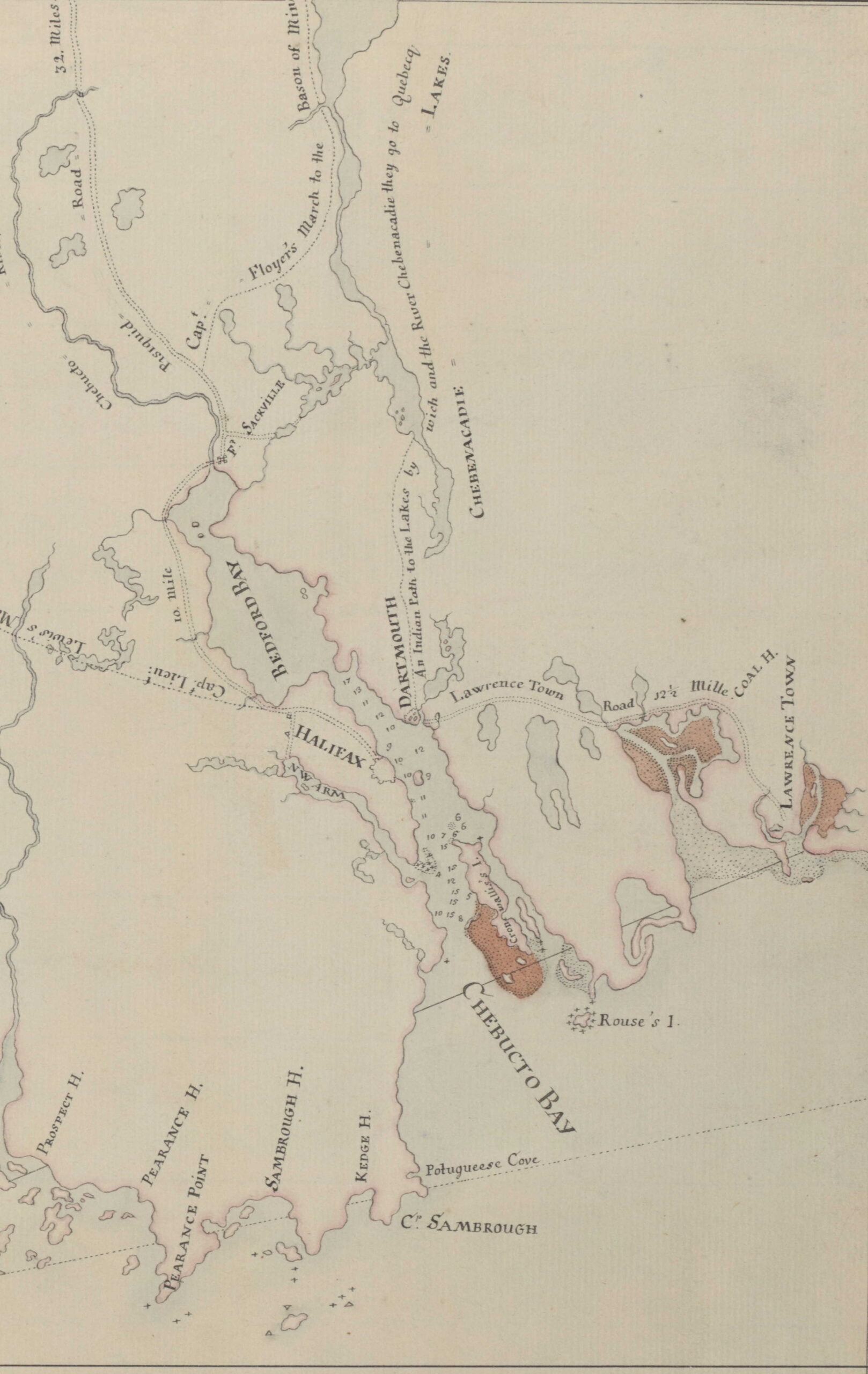
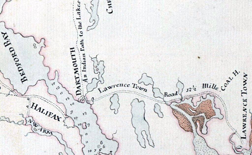
“An Indian path to the lakes by which and the River Chebenacadie they go to Quebecq”, which seems to follow what was the original path of Crichton Avenue, also noted, “Coal Harbor”.
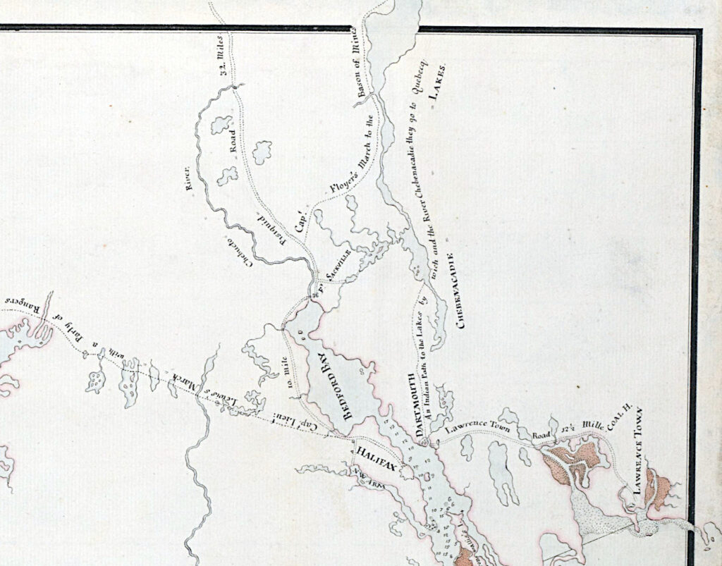
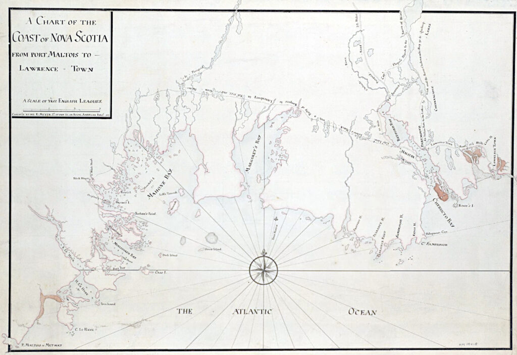
Meyer, Elias. “A chart of the coast of Nova Scotia from Port Maltois to Lawrence town [cartographic material] / Copeye’d by me E. Meyer Lt. of the 60, or Royal American Regt. 1757” https://hdl.huntington.org/digital/collection/p15150coll4/id/16135
Related posts:
- “A chart of the coast of America from New found Land to Cape Cod” “Sesembre” or Sambro, which is at the mouth of Halifax Harbor. I’m not sure if “Baye Senne” then is meant to represent it or another subsequent indentation in a coast that is nothing but indentations and harbors, but it does...
- “A correct map of the coast of New England” “New Scotland”, “Annapolis Royal”. “A large fold-out chart of the New England coast appeared from 1732 to 1760 in “The English Pilot, The Fourth Book”, the standard 18th-century British navigational guide to American waters … Reduced from a chart published...
- A chart of the peninsula of Nova Scotia Morris, Charles. A chart of the peninsula of Nova Scotia. [1761] Map. Retrieved from the Library of Congress, <www.loc.gov/item/74691224/>...
- A chart of the peninsula of Nova Scotia “A chart of the peninsula of Nova Scotia by Charles Morris.” Morris, Charles. 1758. https://collections.library.yale.edu/catalog/15826747...
- A Chart Of The Sea Coasts Of The Peninsula Of Nova Scotia Morris, Charles. “A CHART OF THE SEA COASTS OF THE PENINSULA OF NOVA SCOTIA” 1755. https://collections.leventhalmap.org/search/commonwealth:hx11z491q...
- Southeast Coast of Nova Scotia Des Barres, Joseph F. W. The sea coast of Nova Scotia; exhibiting the diversities of the coast, and the face of the country near it: the banks, rocks, shoals, soundings, &c. Together with remarks and directions for the conveniency of...
- S.e. coast of Nova Scotia: from the most recent British surveys “S.e. coast of Nova Scotia : from the most recent British surveys” 1889. https://collections.leventhalmap.org/search/commonwealth:jh343x78f...
- To his excellency Thomas Jefferson, esqr., President of the Congress, this chart of the United States of America: including Halifax, Havannah [Havana], New Providence, and all the northern parts of the West Indies Dartmouth and Indian Town! 😎 If only there was more detail of the settlements themselves. Fascinating to me that the only inset on this map is Halifax Harbor. To me it represents Jefferson’s viewport to 45°N, reflective of his notes...
- Nova Scotia considered as a field for emigration “There is not a finished canal in Nova Scotia, but there are two now in course of construction. As early as 1825, operations were commenced for connecting the harbour of Halifax with Cobequid Bay, by means of the waters of...
- The Avenue The “Black Settlement”, aka “The Avenue”, as seen on the outskirts of the Town of Dartmouth in 1886 The following excerpts are from “Survival of an African Nova Scotian Community: Up the Avenue, Revisited” by Adrienne Lucas Sehatzadeh, 1998. An...