
1606:
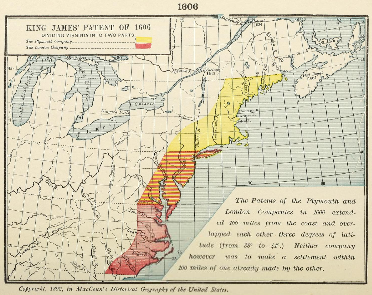
“King James’ Patent of 1606, Dividing Virginia into two parts.
The patents of the Plymouth and London companies in 1606 extended 100 miles from the coast and overlapped each other three degrees of latitude (from 38° to 41°.) Neither company however was to make a settlement within 100 miles of one already made by the other.”
[Norumbega noted on this map].
[Reading the patent itself it states “situate, lying, and being all along the Sea Coasts, between four and thirty (34°) Degrees of Northerly Latitude from the Equinoctial Line, and five and forty (45°) Degrees of the same Latitude, and in the main Land between the same four and thirty and five and forty Degrees, and the Islands thereunto adjacent, or within one hundred Miles of the Coast thereof”.
Hinted on the map, though not shaded along with the rest of the Plymouth Company lands unlike in earlier works, is the fact that 45° latitude also traverses across Nova Scotia, which, despite being a peninsula, is undoubtedly a part of the mainland. Is this revision meant to satiate those to the north, or their proprietors, after their “Confederation”? If this were a one-off I’d more less likely to attribute it to any kind of an arrangement, but there are other sources which confirm this earlier view. Even if Nova Scotia were an island and not connected to the mainland, it would still be within 50 miles of the seacoast of the shaded area, let alone 100 miles.]
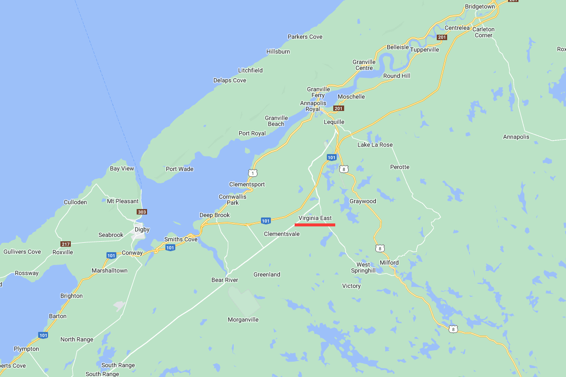
[This might provide insight into the rationale behind naming conventions used for certain communities in Nova Scotia, such as “Virginia East”.]
1609-1620:
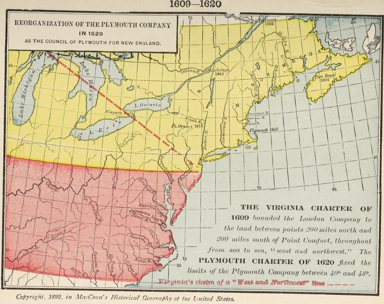
“Reorganization of the Plymouth Company in 1620 as the Council of Plymouth for New England.
The Virginia charter of 1609 bounded the London Company to the land between points 200 miles north and 200 miles south of Point Comfort, throughout from sea to sea, “west and northwest.” The Plymouth charter of 1620 fixed the limits of Plymouth Company between 40° and 48°.”
1640:
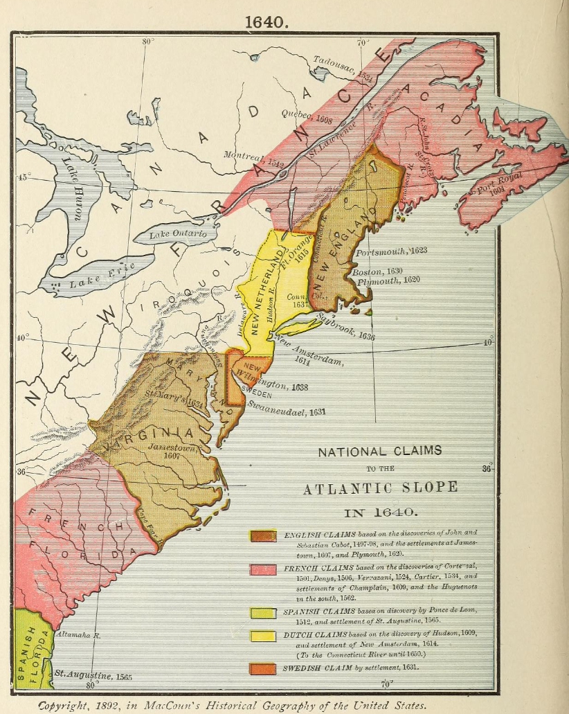
“French claims”
1655:
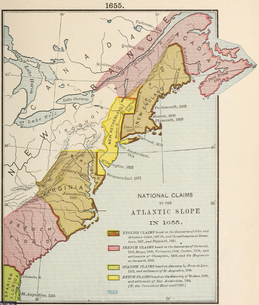
“French claims”
1660:
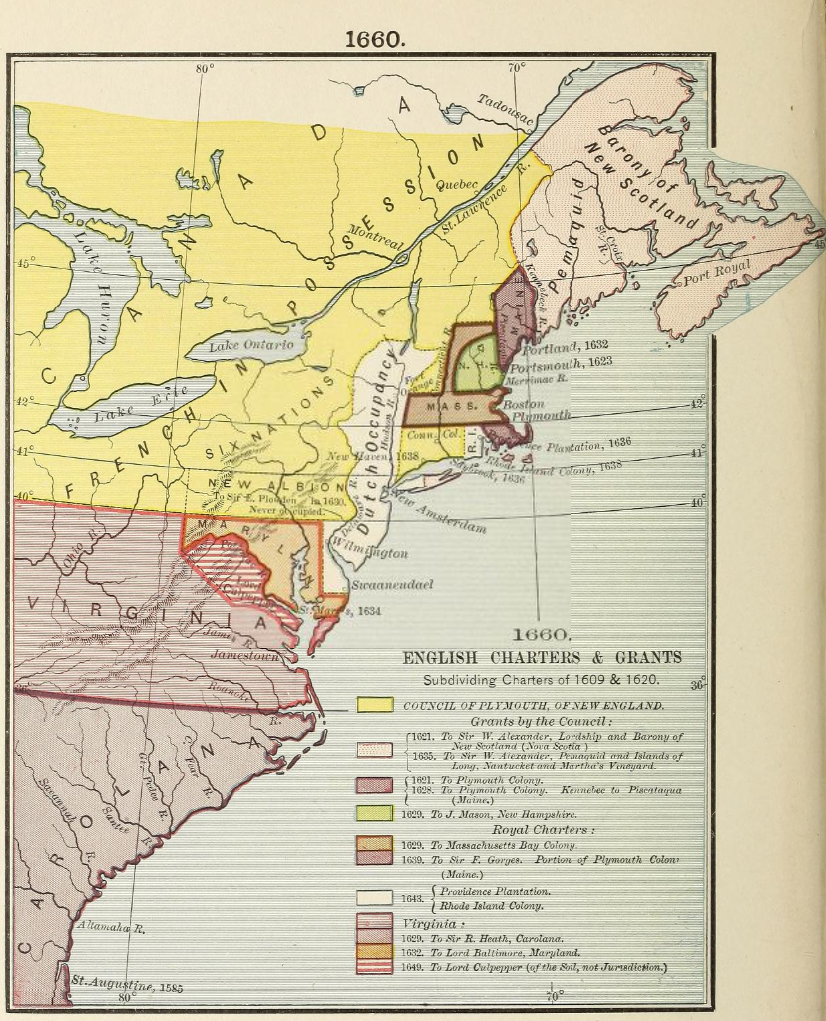
“Barony of New Scotland”
“Council of Plymouth, of New England. Grants by the Council:
1621 To Sir W. Alexander, Lordship and Barony of New Scotland (Nova Scotia)
1635 To Sir W. Alexander, Pemaquid and Islands of Long, Nantucket and Martha’s Vineyard.”
1664:

“Grants to the Duke of York”
1763:
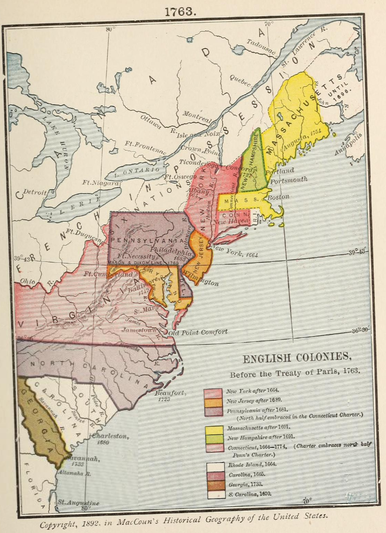
“Massachussetts until 1696”
[There were other English colonies that existed in 1763 not included in this map. While they did not go on to become part of the United States, they were fellow colonies, at least up until ‘the commencement of hostilities’.]
Maccoun, Townsend. An historical geography of the United States. [New York, Boston etc. Silver, Burdett & company, 1911] Map. Retrieved from the Library of Congress, www.loc.gov/item/11031776/