
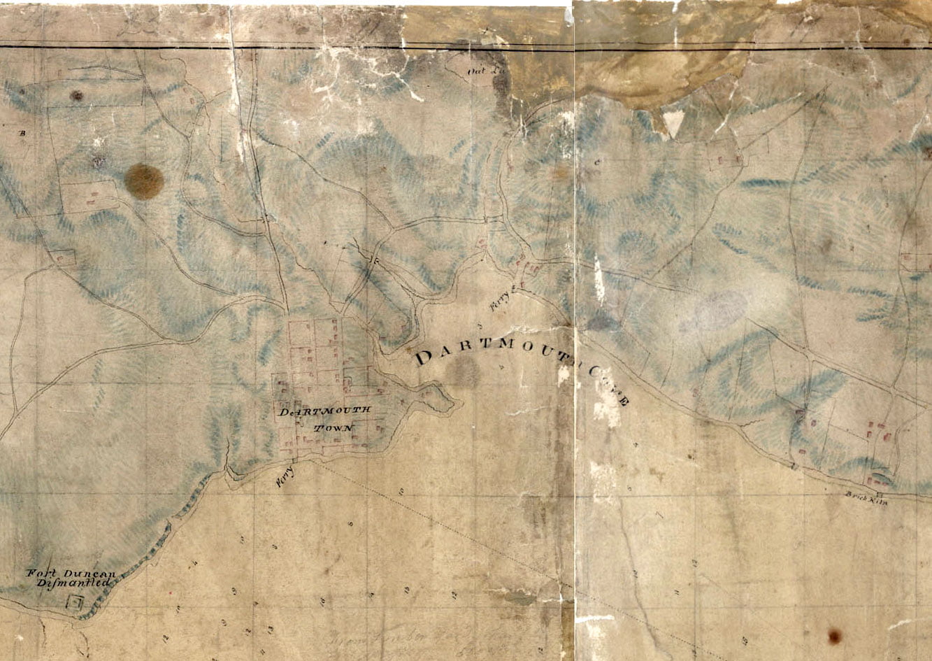
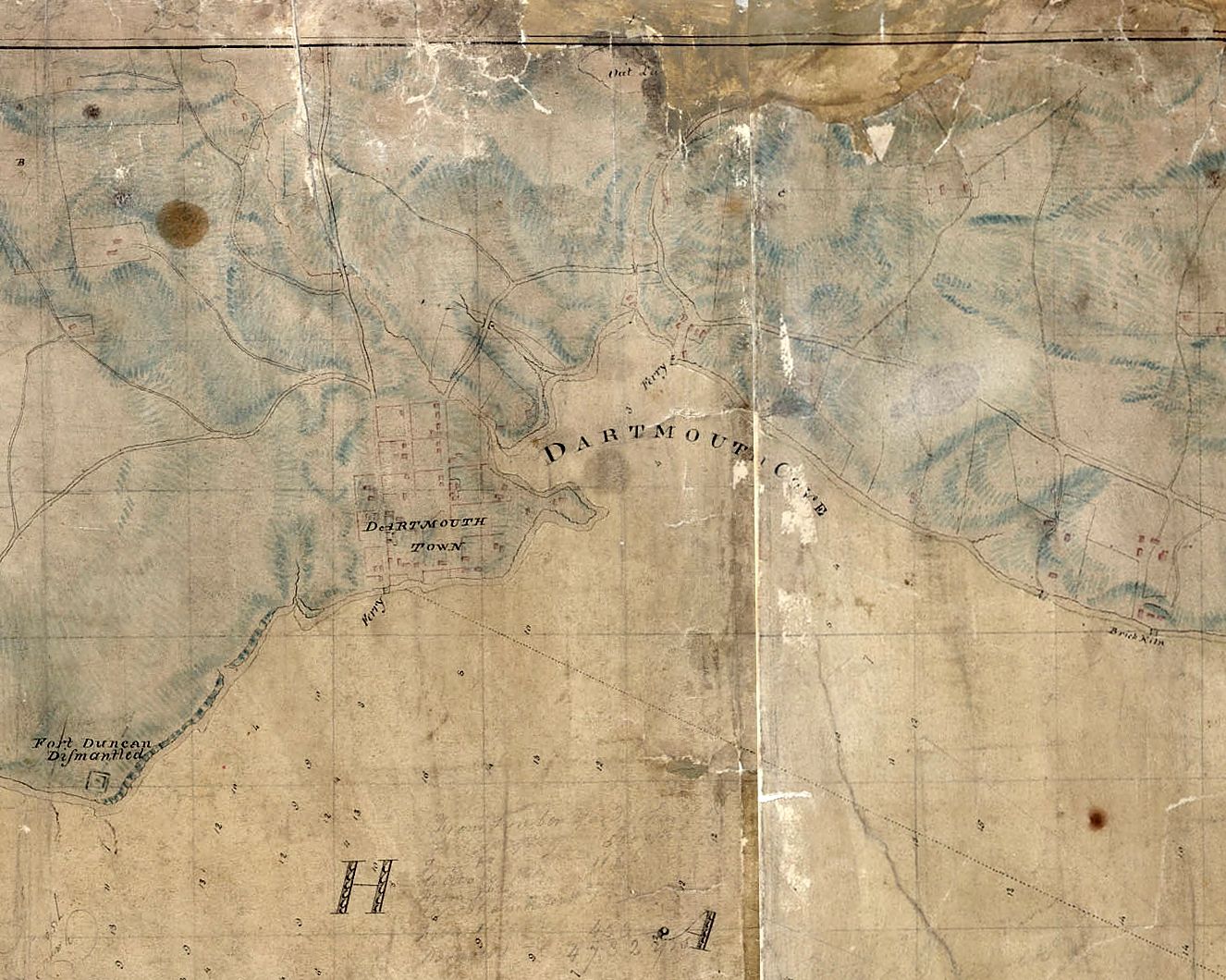
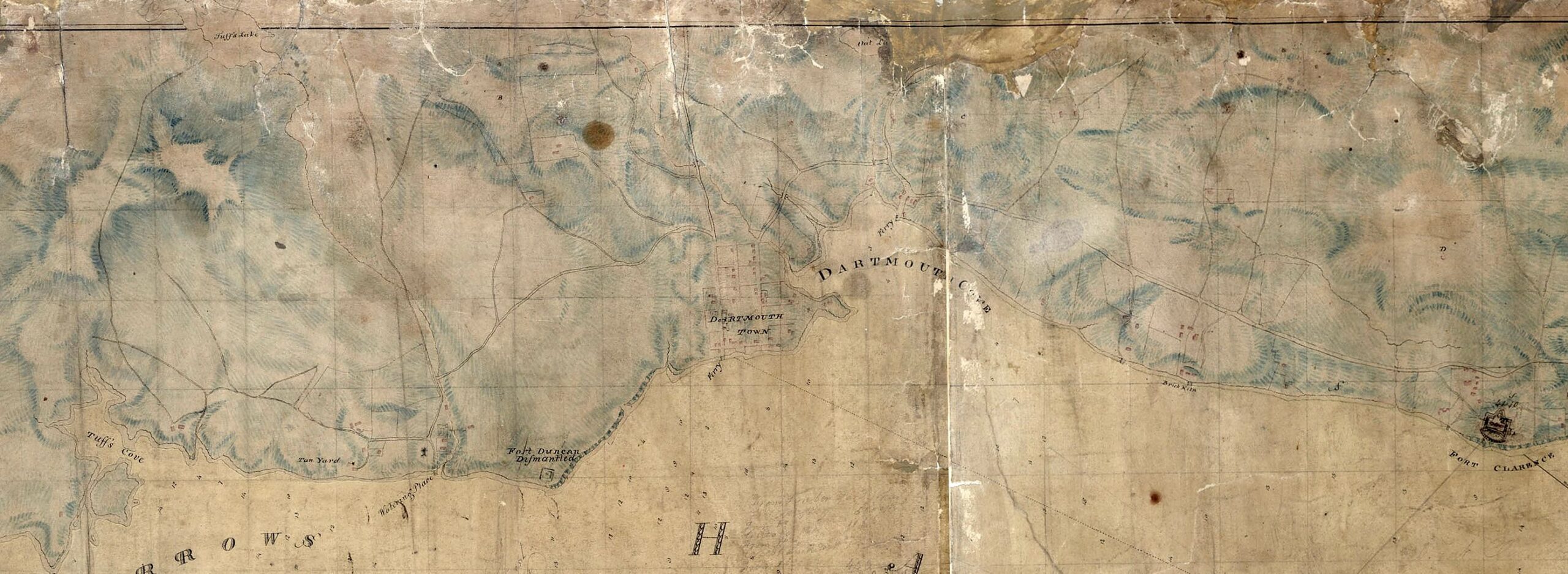
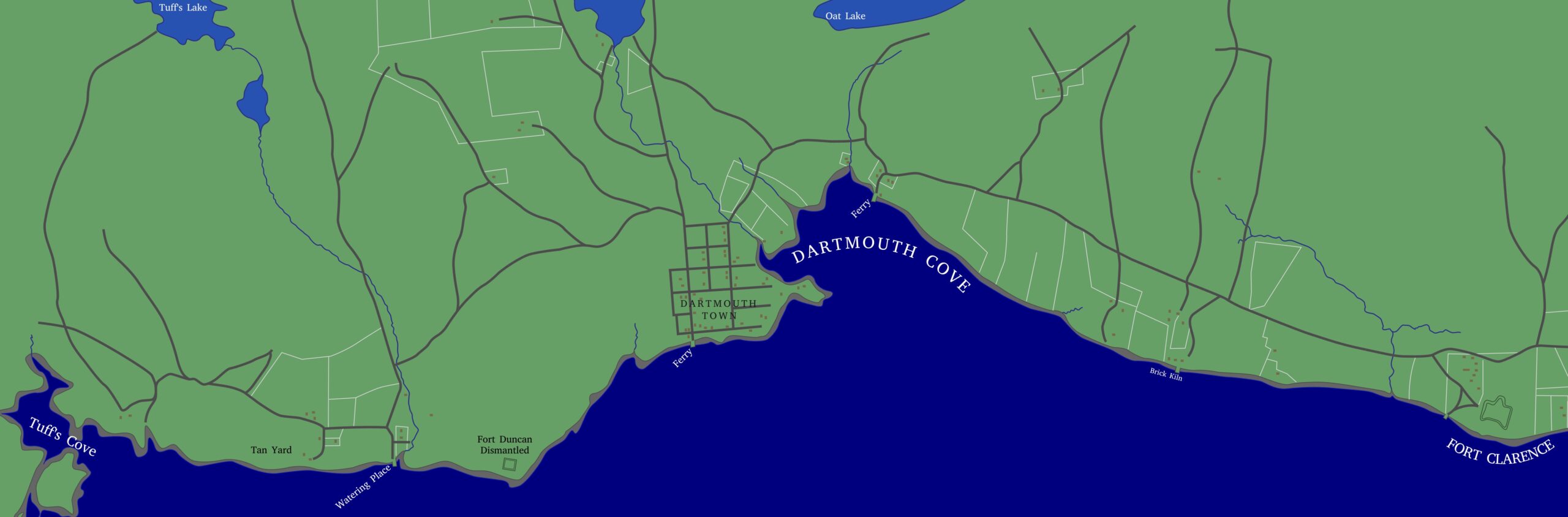
A very detailed rendition of the Dartmouth shore from 1808. Skerry’s ferry at Ochterloney is seen as well as Creighton’s Ferry at the bottom of Old Ferry Road. Fort Duncan can be seen near where Shore Road meets Lyle Street today. Bridges are seen spanning Portland Street at Maitland, and what would be Pleasant Street just before Old Ferry Road as well as Ochterloney Street as it intersects with the Mill stream, now the Shubenacadie River.
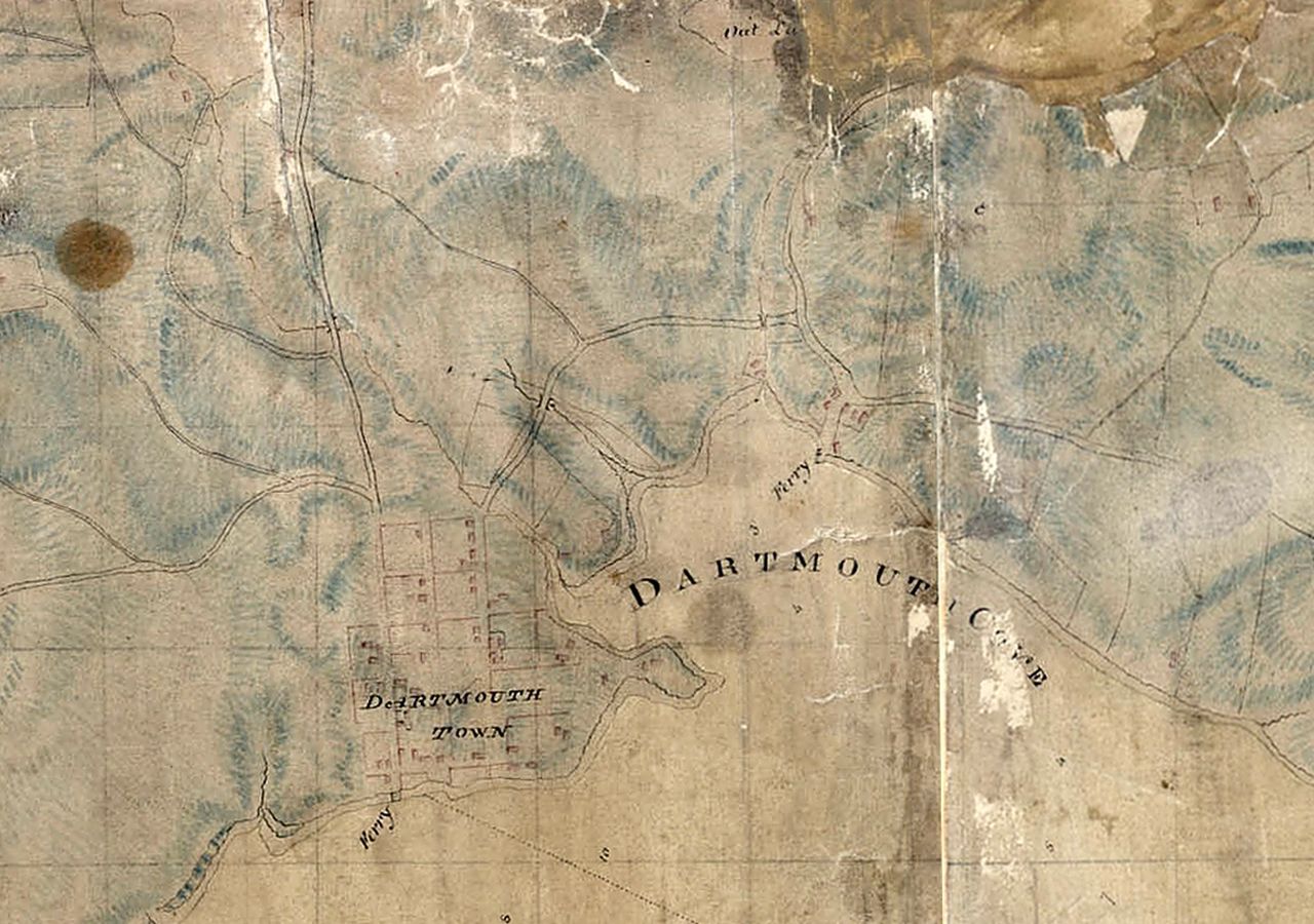
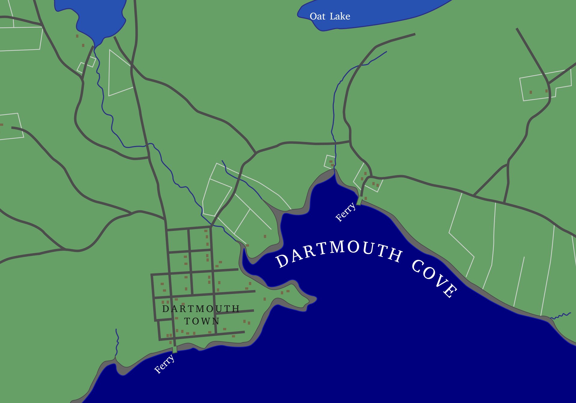
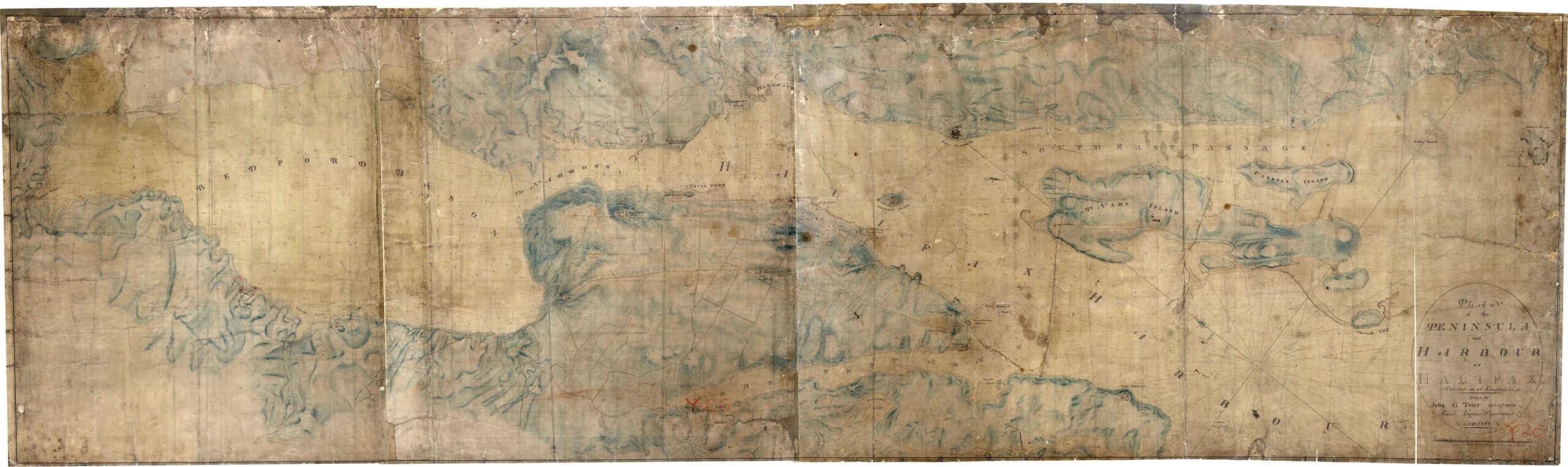
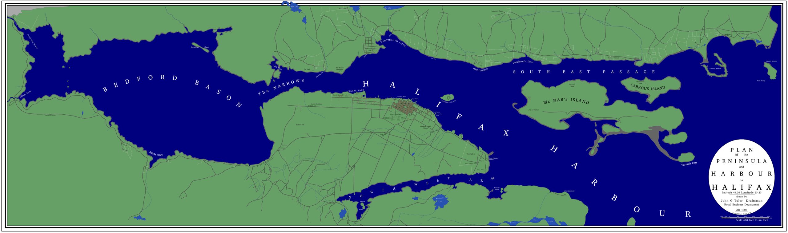
“Peninsula and harbour of Halifax”, John G. Toler, 1808. https://archives.novascotia.ca/maps/archives/?ID=257