
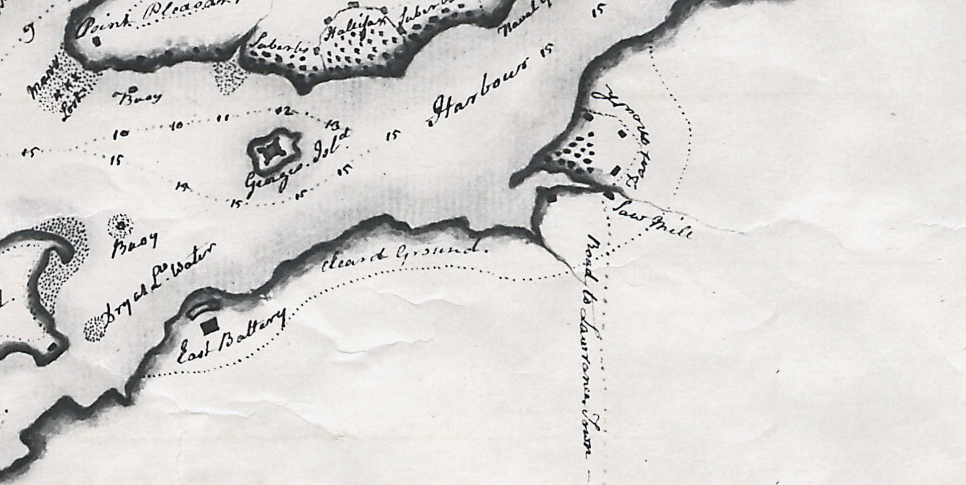

A particularly detailed early map of Dartmouth, showing several blockhouses surrounding the town plot. There’s 16 marks in and around the town plot which would seem to represent buildings, though they might more generally indicate built-up areas nearer to the shore. The Saw Mill can be seen near what would be five corners today along a “Road to Lawrence Town.” A dotted line denotes “cleared ground” which surrounds Dartmouth from The East Battery to the near the bottom of where Jamieson Street would be today (and where the watering place was, then).
“A Chart of Halifax Harbour, N.S.” 1759. https://archives.novascotia.ca/maps/archives/?ID=102&Page=201320528