
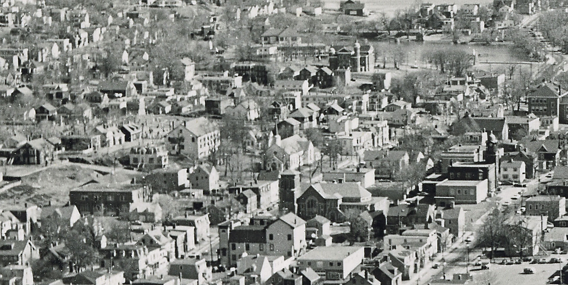
St. Peter’s Church seen at upper middle, First Baptist at Victoria at middle right. Christ Church at middle, Victoria Road Baptist church is seen a block behind between it and its hall, Grace United Church is seen at middle bottom, (what I believe was) another Baptist church a block closer on Ochterloney near where the original St. Peter’s stood, Post Office at middle right.
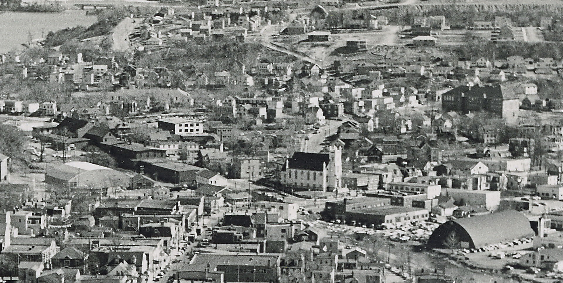
St. James Church at five corners seen here with Dartmouth Medical Center across the street. Starr Manufacturing is the long dark colored building along Prince Albert Road to its left, the old Hawthorne School at the upper right, Silver’s Road directly ahead at top middle.
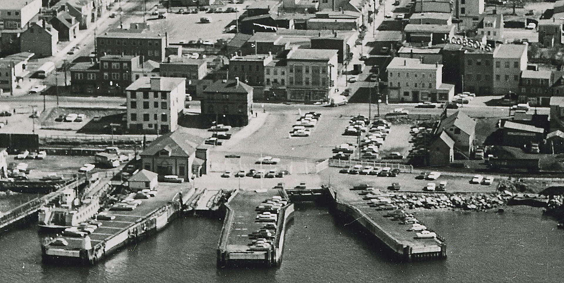
Bus depot at far left, Dartmouth Ferry Terminal at bottom left, the ferry is docked. Nova Scotia Power Dartmouth Division at middle left, Stern’s corner at middle right, Jacobson’s at far right.
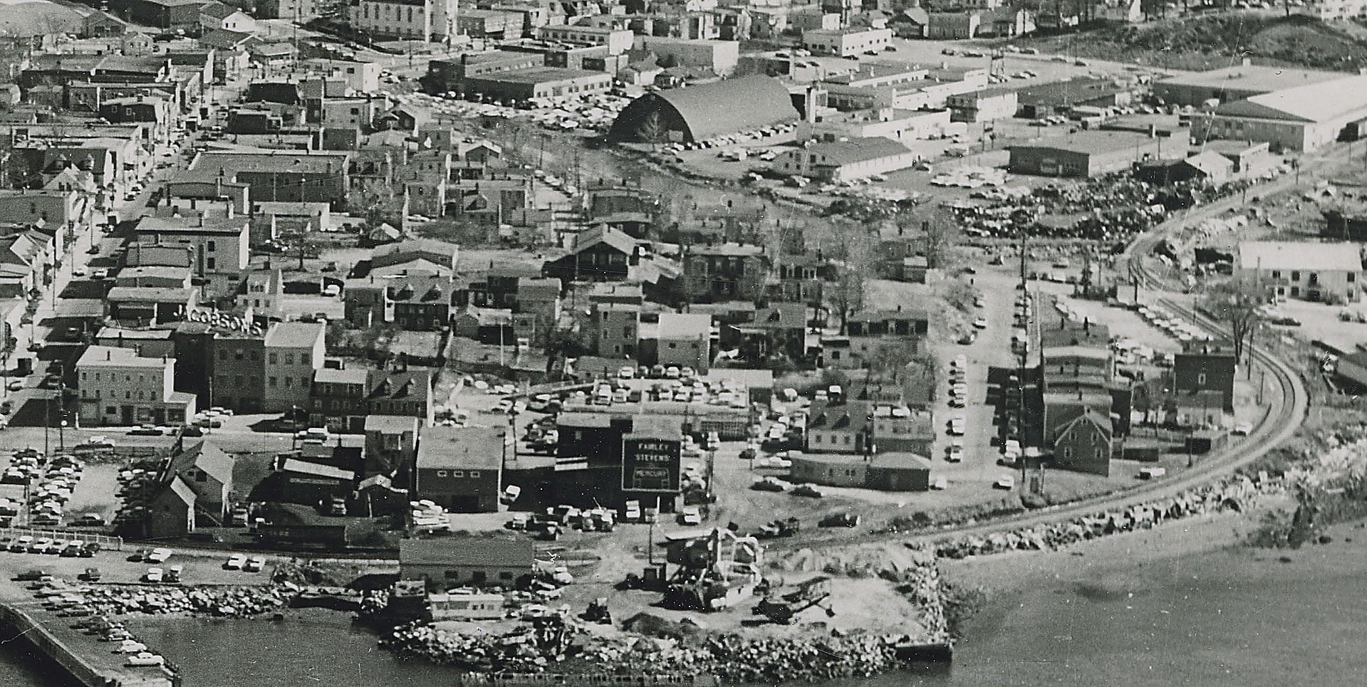
This whole neighborhood was essentially disappeared through “urban renewal”, Boggs Street is now the extent of Alderney Drive and parking lots, Green Street has all but disappeared since, too. So many Quaker homes and other historical relics lost to the wrecking ball. Much of the land has sat vacant for many decades since, as with the land along the waterfront to the north of Downtown, up through the Church Street, Park Avenue and Edward Street lands that lay next to the Common.
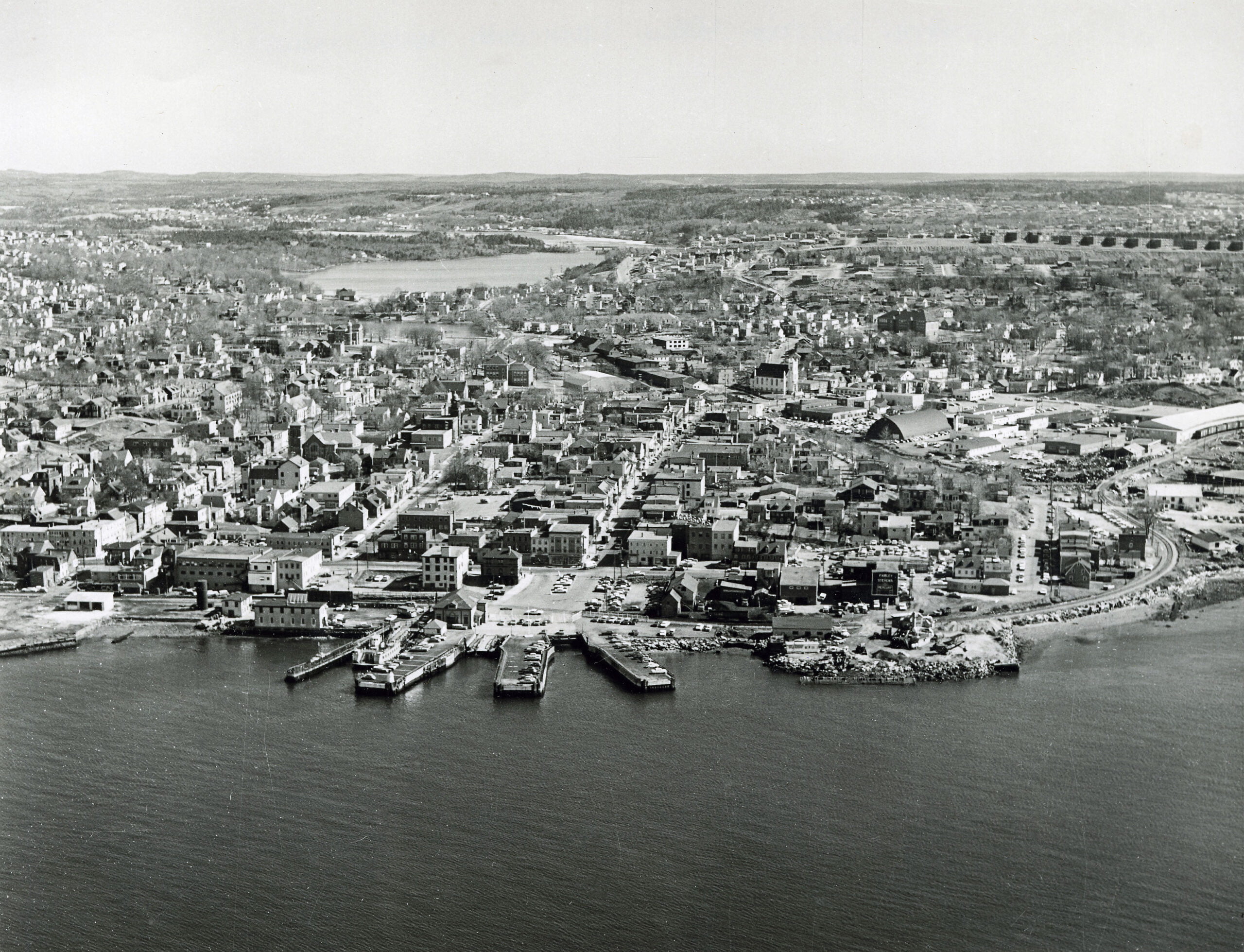
“Dartmouth, Halifax Co.: Aerial View”, 1930 (certainly not 1930, perhaps some time in the late 1950s?). https://archives.novascotia.ca/photocollection/archives/?ID=5276