
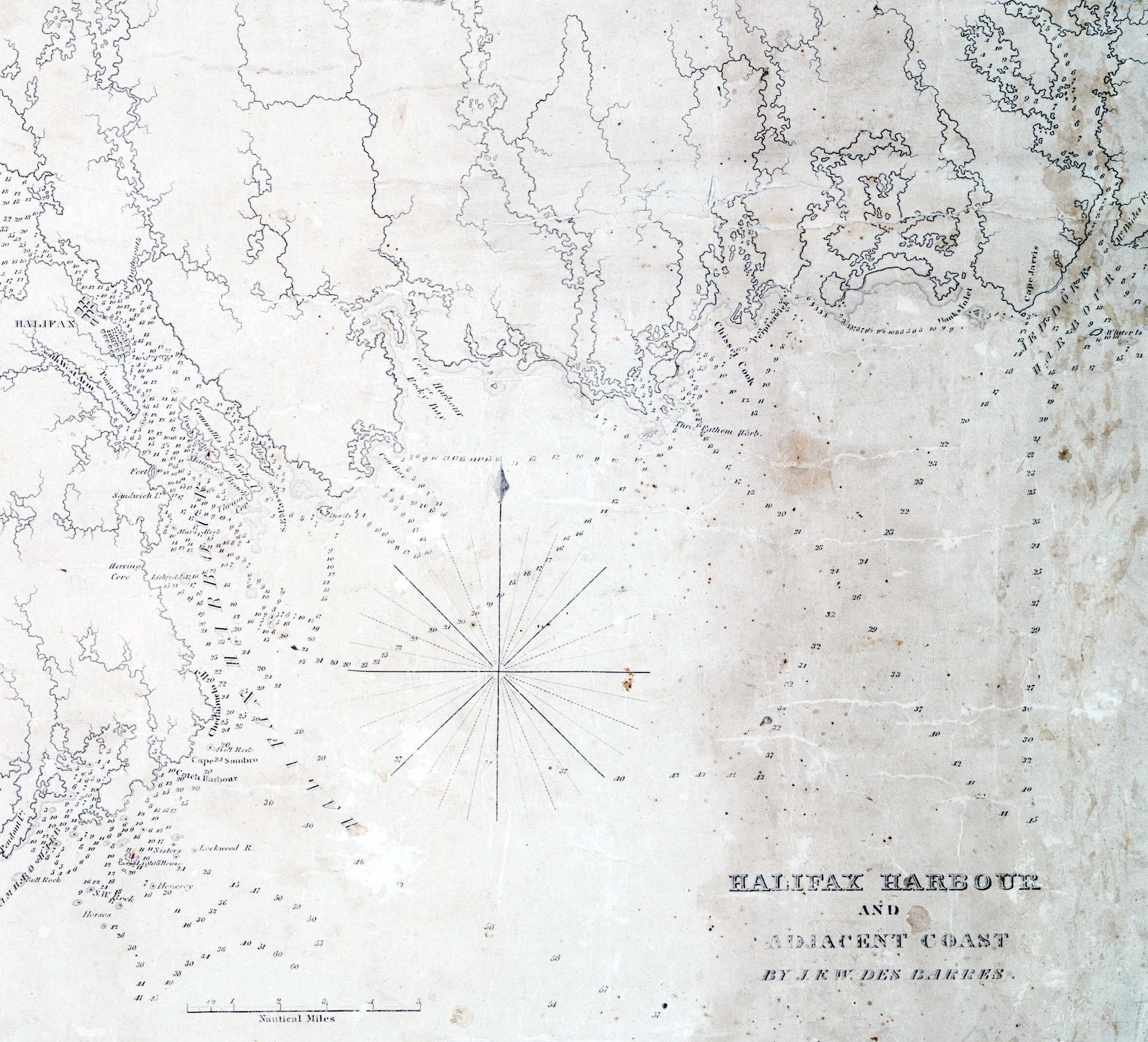
Lionel Pincus and Princess Firyal Map Division, The New York Public Library. “The north eastern coast of North America : from New York to Cape Canso, including Sable Island” The New York Public Library Digital Collections. 1848. https://digitalcollections.nypl.org/items/510d47da-f0b2-a3d9-e040-e00a18064a99
Related posts:
- A map of Cabotia: comprehending the provinces of Upper and Lower Canada, New-Brunswick and Nova-Scotia with Breton Island, Newfoundland & c. and including also the adjacent parts of the United States Lionel Pincus and Princess Firyal Map Division, The New York Public Library. “A map of Cabotia” The New York Public Library Digital Collections. 1814. https://digitalcollections.nypl.org/items/a9d6bc40-2357-0133-af56-58d385a7b928...
- History of Nova Scotia, Cape Breton, the Sable Islands, New Brunswick, Prince Edward Island, the Bermudas, Newfoundland, &c., &c. “The territorial distribution of the Nova Scotia government is – 1. Eastern division, 2. Middle; 3. Western; 4. Halifax; 5. Cape Breton; there are ten counties, some of which are again subdivided into districts and townships for the more convenient...
- “A chart of the coast of America from New found Land to Cape Cod” “Sesembre” or Sambro, which is at the mouth of Halifax Harbor. I’m not sure if “Baye Senne” then is meant to represent it or another subsequent indentation in a coast that is nothing but indentations and harbors, but it does...
- A Chart of ye North part of America “A Chart of ye North part of America, For Hudson’s Bay Comonly called ye North West Passage. By Iohn Thornton Hidrographer at the Platt in the Minories”, London, 1677-1682. https://exhibits.stanford.edu/ruderman/catalog/rt796sf3559, https://collections.library.yale.edu/catalog/2047241...
- “A correct map of the coast of New England” “New Scotland”, “Annapolis Royal”. “A large fold-out chart of the New England coast appeared from 1732 to 1760 in “The English Pilot, The Fourth Book”, the standard 18th-century British navigational guide to American waters … Reduced from a chart published...
- Nova Scotia: South East Coast. Mars Head to Shut In Island “North America. Nova Scotia: South East Coast. Mars Head to Shut In Island / Surveyed by Captn. Bayfield R.N., Commr. J. Orlebar, Lieut. J. Hancock, , Mr. W. Forbes Master. and Mr. T Des Brisay Mastr. Assist. R.N. 1853”. 1865...
- “A new map of Nova Scotia, and Cape Britain: With the adjacent parts of New England and Canada” “Bay of Fundy or Argal”, “Gulf of Nova Scotia”, “Cape Britain” “A new map of Nova Scotia, and Cape Britain: With the adjacent parts of New England and Canada, composed from a great number of actual surveys” Jefferys, Thomas. [London]...
- “Figure de la terre neuue, grande riuiere de Canada, et cotes de l’ocean en la Nouuelle France” There’s a few settlements shown here on the east coast of Nova Scotia, at Cape Sable, La Heve and at Canso (Campseau). “Souriquois”, the name given to the Mi’kmaq by the French, is also noted here. “Figure de la terre...
- “New Scot Lande” Argals Bay, now the Bay of Fundy, must be a reference to Samuel Argall. Interesting that “The province of Alexandria” as well as “The Province of Caledonia” seem to align with the general jurisdictions of New Brunswick and Nova Scotia...
- “as much a part of Nova Scotia, as Cornhill is of England” “The French King has found a way to seperate the following places from Nova Scotia, pretending they do not belong to it, tho they are as much a part of Nova Scotia, as Cornhill is of England. Cleues que, K....