

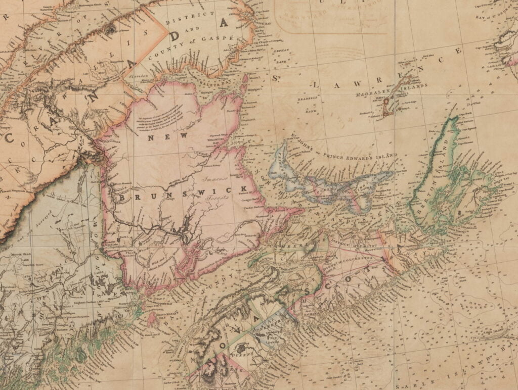
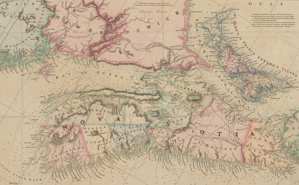
Lionel Pincus and Princess Firyal Map Division, The New York Public Library. “A map of Cabotia” The New York Public Library Digital Collections. 1814. https://digitalcollections.nypl.org/items/a9d6bc40-2357-0133-af56-58d385a7b928
Related posts:
- The north eastern coast of North America : from New York to Cape Canso, including Sable Island Lionel Pincus and Princess Firyal Map Division, The New York Public Library. “The north eastern coast of North America : from New York to Cape Canso, including Sable Island” The New York Public Library Digital Collections. 1848. https://digitalcollections.nypl.org/items/510d47da-f0b2-a3d9-e040-e00a18064a99...
- Memorandum concerning the value of Nova Scotia and a plan for its capture Manuscripts and Archives Division, The New York Public Library. “Memorandum concerning the value of Nova Scotia and a plan for its capture” The New York Public Library Digital Collections. 1777. https://digitalcollections.nypl.org/items/ab000f10-1bbb-0134-5d45-00505686a51c...
- Dartmouth Shore in the Harbour of Halifax, Nova Scotia. There’s a lot going on here. The focus for me is this view, one of the earliest views of Dartmouth, full of detail! This is the only representation I’ve ever seen of the gibbet at what used to be Hangman’s...
- “A new map of Nova Scotia, and Cape Britain: With the adjacent parts of New England and Canada” “Bay of Fundy or Argal”, “Gulf of Nova Scotia”, “Cape Britain” “A new map of Nova Scotia, and Cape Britain: With the adjacent parts of New England and Canada, composed from a great number of actual surveys” Jefferys, Thomas. [London]...
- History of Nova Scotia, Cape Breton, the Sable Islands, New Brunswick, Prince Edward Island, the Bermudas, Newfoundland, &c., &c. “The territorial distribution of the Nova Scotia government is – 1. Eastern division, 2. Middle; 3. Western; 4. Halifax; 5. Cape Breton; there are ten counties, some of which are again subdivided into districts and townships for the more convenient...
- Map of the United States of America and Nova Scotia, &c. &c. “Map of the United States of America and Nova Scotia, &c. &c.” https://quod.lib.umich.edu/c/clark1ic/x-002879918/39015091195050. University of Michigan Library Digital Collections. Accessed: June 02, 2021....
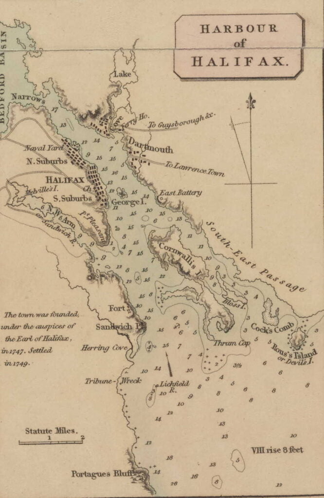
- This Map of the Province of Nova-Scotia and parts adjacent Noticed: “America Point” at the north end of the Halifax peninsula, “Warren’s Point” and “Saw Mill River” on the Dartmouth side. Turner, James. “This Map of the Province of Nova-Scotia and parts adjacent” Sold by Andrew Hook in Philadelphia 2d....
- “A Map of the surveyed parts of Nova Scotia” “A Map of the surueyed parts of Noua Scotia”, [175-?]. https://collections.library.yale.edu/catalog/15826739...
- A chart of the peninsula of Nova Scotia “A chart of the peninsula of Nova Scotia by Charles Morris.” Morris, Charles. 1758. https://collections.library.yale.edu/catalog/15826747...
- “A peep at the western world; being an account of a visit to Nova Scotia, New Brunswick, Canada, and the United States” “Now the “gridiron” is a square box-like structure, situated about midships, in close proximity to the engines, and which being closed in at the top and sides, affords shelter from the wind, and to a great extent, from the heavy...