

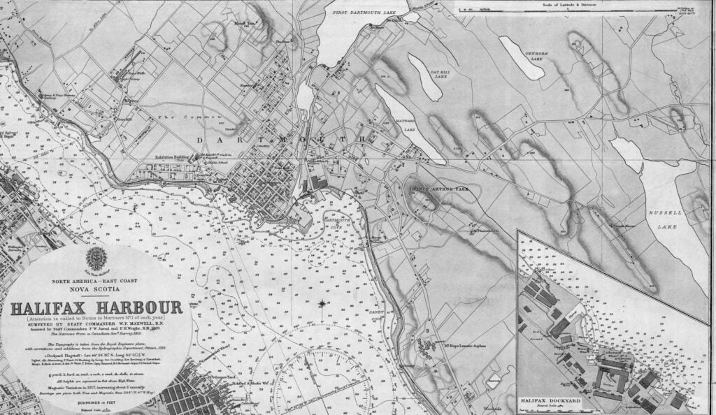
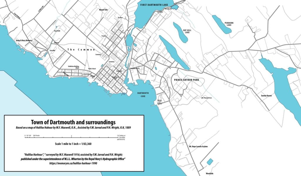
From: Halifax Habour, Surveyed by Staff Commander W.F. Maxwell, R.N., Assisted by Staff Commanders F.W. Jarrad and P.H. Wright, R.N. 1889. The Narrows from a Canadian Government Survey, 1916. The Topography is taken from the Royal Engineers plans, with corrections and additions from the Hydrographic Department, Ottawa, 1916. Soundings in Feet, Natural Scale 1/10,560.
https://memoryns.ca/halifax-harbour-5
Related posts:
- Scale Economies And Police Department Consolidation: Evidence From Los Angeles “Empirical analysis here rejects the hypothesis that police output is produced under increasing returns, which would be an efficiency explanation for the large degree of consolidation found within the county.” This paper tests for scale economies for police departments operating...
- An Act relating to the town of Dartmouth, 1916 c58 (Passed the 17th day of May, A. D. 1916). Section.Preamble.1. Property vested in Company.2. Assessment limited.3. Section 9, Chapter 52, Acts 1915, amended.4. Board authorized to spend $300.00 for medical aid.5. Hawker’s license.6. License to sell from vessel.7. Conflicting legislation...
- A Tourist Map of Dartmouth (1939) Of note at #25, an RCMP detachment within the Town on Prince Albert Road (perhaps at number 159?), as opposed to #24 on the map, the “Civil police”, located at Wentworth and Ochterloney. “Tourist Map of Dartmouth”, 1939. https://memoryns.ca/a-tourist-map-of-dartmouth...
- Thirty-eight years of Liberal government in Nova Scotia “In order to be in a position to extend the advantage of expert advice to every part of the Province, the Government is endeavoring to secure the cooperation of the various municipal, city and town councils in the establishment of...
- A draught of the harbour of Halifax, Sambro Islands, shoals, ledges of rocks, and soundings, also the rivers Shubenauda & Cobequid Bay Morris, Charles. A draught of the harbour of Halifax, Sambro Islands, shoals, ledges of rocks, and soundings, also the rivers Shubenauda & Cobequid Bay. [1761] Map. Retrieved from the Library of Congress, <www.loc.gov/item/74691494/>...
- Halifax County Poor Farm “The first municipal institution built to house the county’s poor and mentally ill was constructed in about 1887 in Cole Harbor.” https://www.memoryns.ca/halifax-n-s-county-halifax-county-home-and-mental-hospital The area in 1864 The same area by 1908...
- 1916 From The Story of Dartmouth, by John P. Martin: In 1916 more local boys enlisted with the 85th Highlanders, the 64th, the 112th and 219th Battalions. One platoon of the last mentioned composed exclusively of Dartmouthians and those of the...
- Map of Halifax & Dartmouth Royal Bank Great period map showing the different communities in the general vicinity — Woodside, Woodlawn, Port Wallace, Tufts Cove. “The Royal Bank was founded in Halifax in 1869 by seven prominent Halifax merchants” isn’t the kind of thing you’d hear from...
- Economies of Scale in Municipal Administration. Empirical Analyses of Municipal Mergers “In an exploratory application for four municipal mergers, we find no evidence for increasing economies of scale. Compared to the level prior to the mergers, average current expenditure for the municipal administration increased more than in a control group of...
- Sullivan’s Pond from Crichton Ave and Hawthorne, Looking South 1916...