
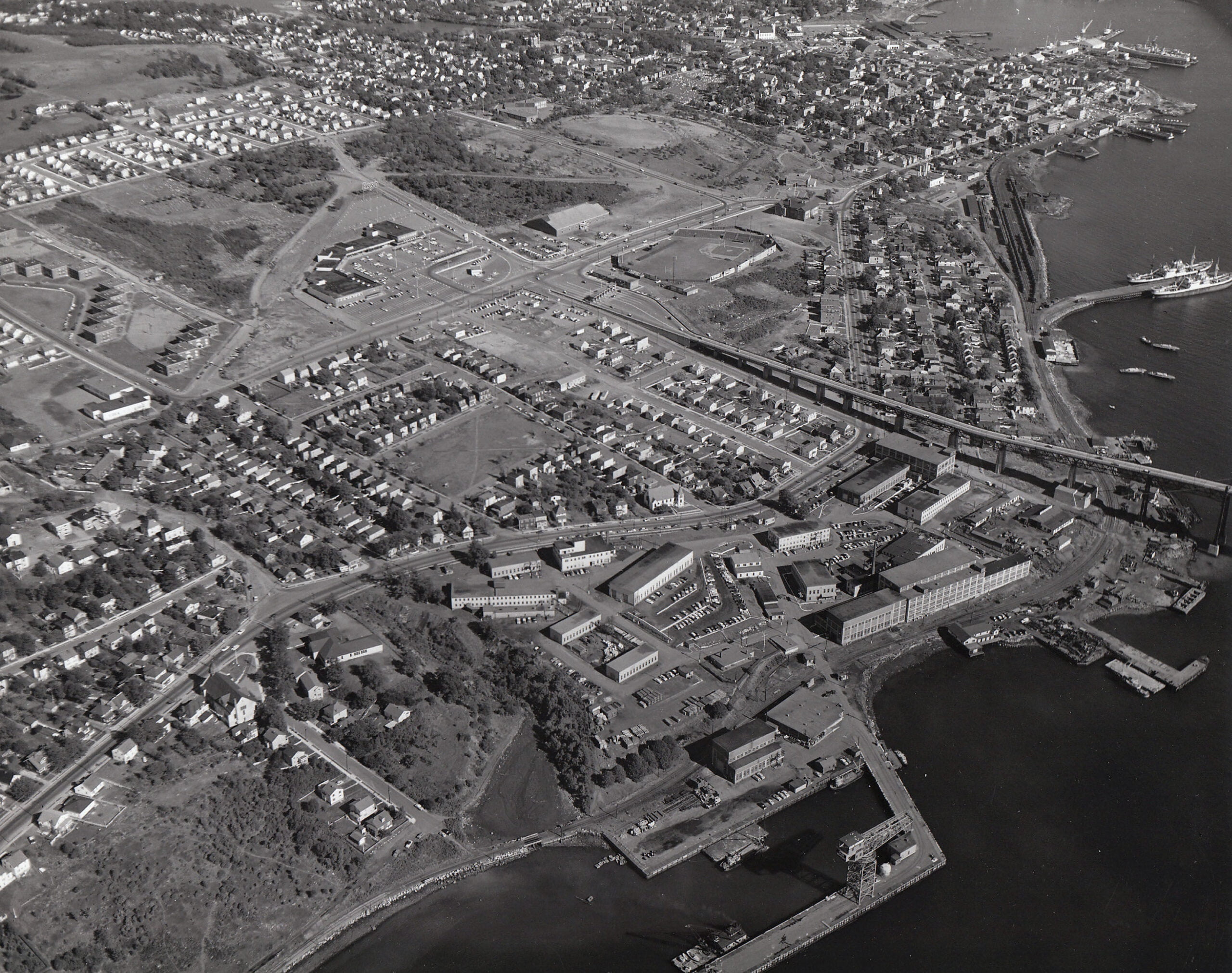
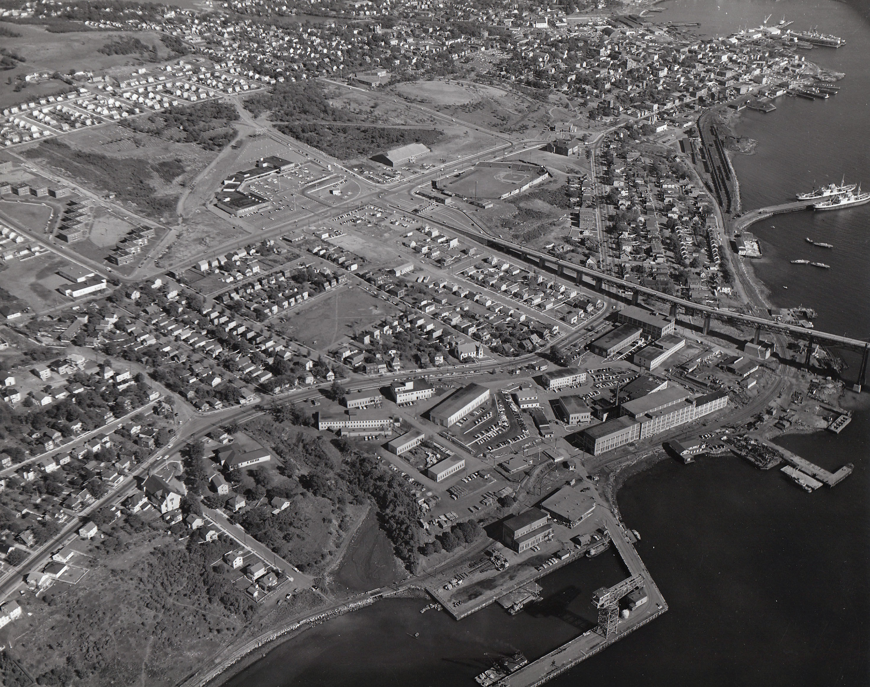
Dartmouth Ball field is seen front and center on Wyse Road at the Bridge Plaza, below you can see the area surrounding City hall previous to its construction on what is now Alderney Dr.
Related posts:
- St. James Church (Canal stream and Portland Street bridge), Dartmouth “St. James Church, Dartmouth”, 1932. https://archives.novascotia.ca/photocollection/archives/?ID=5301...
- Dartmouth Common Ball-field Dartmouth Common ball-field, once home to the Dartmouth Arrows (now the site of the Holiday Inn Dartmouth as well as “Metropolitan Place”). Halifax District League Champions, Dartmouth Arrows (1947)....
- City of Dartmouth City of Dartmouth, date uncertain, late 1960s likely (The sod was turned at City Hall, seen at bottom right, in June 1966 and was officially opened in September 1967). Boggs Street at far right, Canadian Tire on Alderney Drive where...
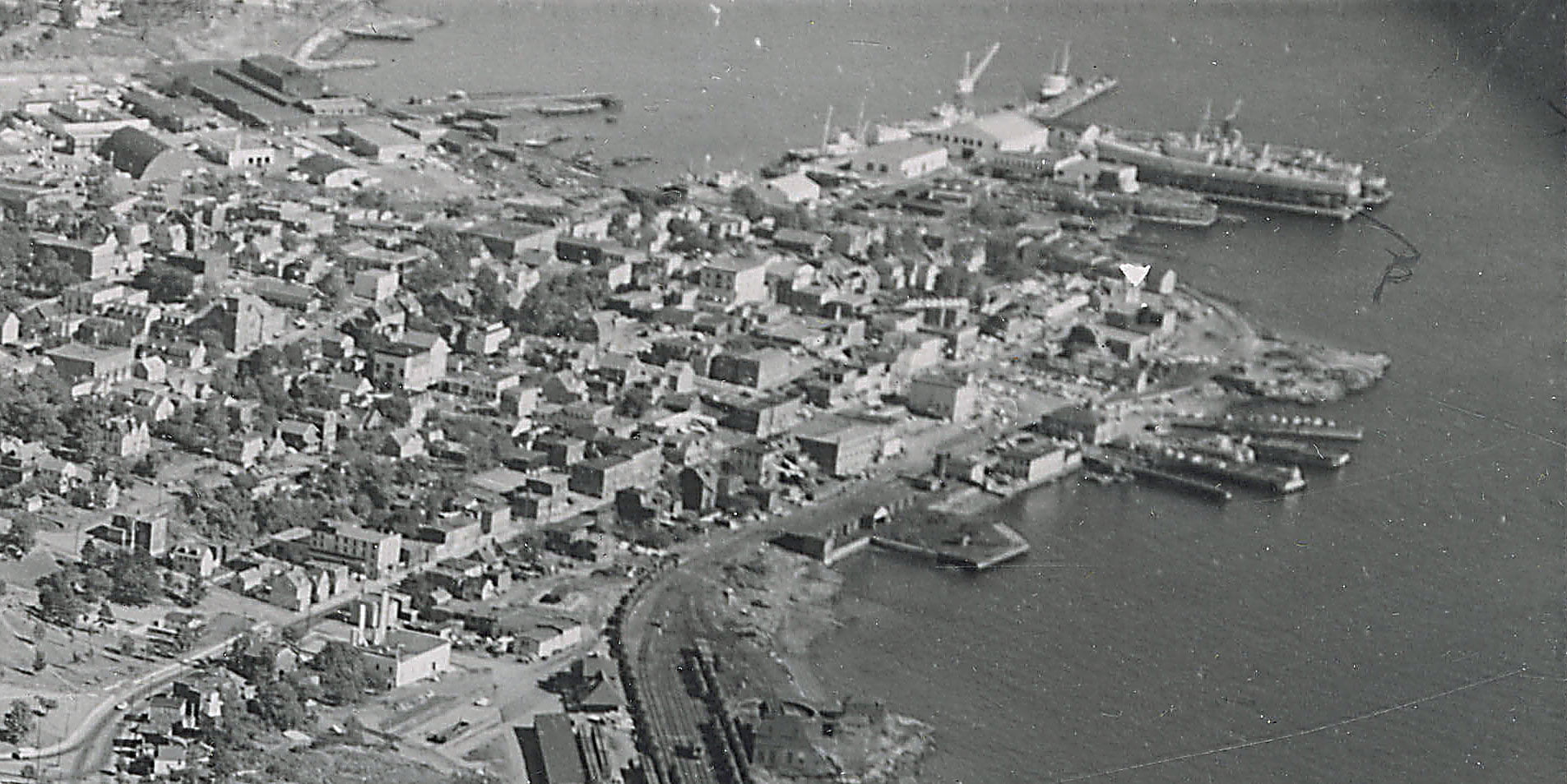
- Halifax Harbour from near the Narrows. Windmill on Dartmouth side the only one in the Province The Windmill seen on what is now Windmill Road, house at right perhaps Fairfield, Howe’s House, at far right is Black Rock Point, now the foot of Lyle Street. “Halifax Harbour from near the Narrows. Windmill on Dartmouth side the...
- Explosion of Munitions at Magazine near Dartmouth “Explosion of munitions at Magazine near Dartmouth, Halifax N.S. July 18-19/45. J. Hayward. 11 Buckingham St. Halifax.” https://archives.novascotia.ca/photocollection/archives/?ID=6324 “Explosion of munitions at Magazine near Dartmouth, Halifax N.S. July 18-19/45. J. Hayward. 11 Buckingham St. Halifax.” https://archives.novascotia.ca/photocollection/archives/?ID=6325...
- Sullivan’s Pond, 1899 The Octagon house seen at left. You’re not likely to find a cow grazing along the shores of Sullivan’s Pond these days! “Sullivan’s Pond”, 1899. https://archives.novascotia.ca/photocollection/archives/?ID=5336 (Date erroneously listed as 1955, likely mixed up with another view of Sullivan’s Pond...
- Sullivan’s Pond, 1955 The Octagon house seen at middle right. “Sullivan’s Pond”, 1955. https://archives.novascotia.ca/photocollection/archives/?ID=5337...
- Dartmouth, Aerial View St. Peter’s Church seen at upper middle, First Baptist at Victoria at middle right. Christ Church at middle, Victoria Road Baptist church is seen a block behind between it and its hall, Grace United Church is seen at middle bottom,...
- Aerial view of part of Dartmouth, 1931 “Aerial View: Halifax Harbour Narrows showing Dartmouth”, 1931. https://archives.novascotia.ca/photocollection/archives/?ID=5573...
- Circular dam foot of Sullivan’s Pond, route of Shubenacadie Canal near Dartmouth “Lakeside”, later ‘‘Beechmount Apartments” and now 84 Crichton Avenue, seen directly ahead behind the circular dam, which, especially in reference to this photo from Findlay’s Pond, helps triangulate the location of this photo to somewhere near the bottom of Maple Street....