
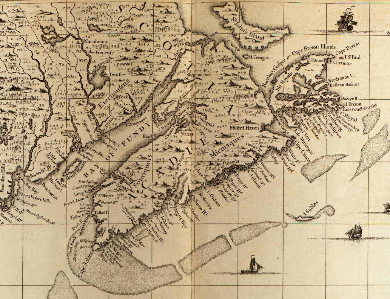
Popple, Henry, -1743, et al. A map of the British Empire in America with the French and Spanish settlements adjacent thereto. [London: s.n, 1733] Map. Retrieved from the Library of Congress, www.loc.gov/item/2009582407/
Related posts:
- A map of the British and French settlements in North America Bowen, Thomas, -1790. A map of the British and French settlements in North America. [London: s.n, 1755] Map. Retrieved from the Library of Congress, www.loc.gov/item/2003623385/...
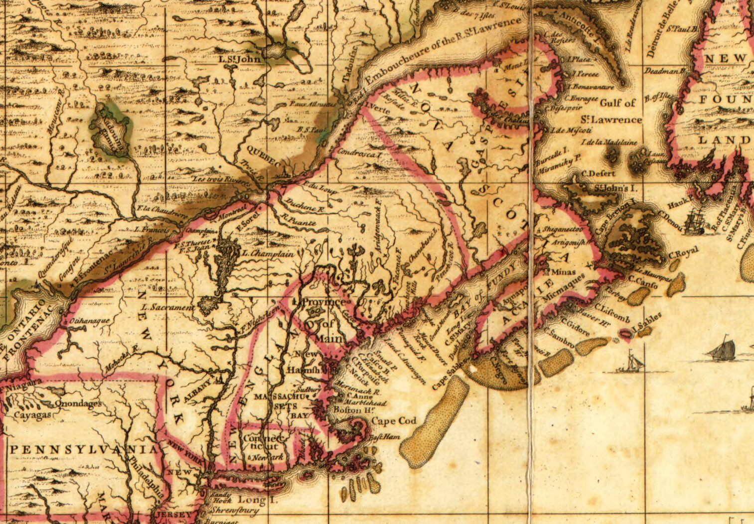
- The British & French dominions in North America: particularly shewing the French encroachments through all the British plantations from Nova Scotia down to the Gulf of Mexico Bowles, Thomas, -1767, and John Bowles & Son. The British & French dominions in North America: particularly shewing the French encroachments through all the British plantations from Nova Scotia down to the Gulf of Mexico. [London: Printed for T. Bowles in...
- A new and accurate map of the English empire in North America Society Of Anti-Gallicans, William Herbert, and Robert Sayer. A new and accurate map of the English empire in North America; Representing their rightful claim as confirmed by charters and the formal surrender of their Indian friends; likewise the encroachments of...
- A new and accurate map of the English empire in North America “The French claim all the country within the Hudson’s Bay Company’s southern limits and the brown line”, an entity just recently privatized. Perhaps this border shown here as the 45° latitude explains the location of the Old Annapolis Road which...
- A new and accurate map of North America Bell, Peter, et al. A new and accurate map of North America. London, Printed for Carington Bowles, 1771. Map. Retrieved from the Library of Congress, www.loc.gov/item/74693987/...
- “A New map of North America from the latest discoveries” A New map of North America from the latest discoveries. [London, 1763] Map. Retrieved from the Library of Congress, www.loc.gov/item/75693984/....
- To his excellency Thomas Jefferson, esqr., President of the Congress, this chart of the United States of America: including Halifax, Havannah [Havana], New Providence, and all the northern parts of the West Indies Dartmouth and Indian Town! 😎 If only there was more detail of the settlements themselves. Fascinating to me that the only inset on this map is Halifax Harbor. To me it represents Jefferson’s viewport to 45°N, reflective of his notes...
- The English and French Settlements in North America A New map of North America from the latest discoveries. [Gibson, John; Bowen, Emanuel, 1758] https://www.davidrumsey.com/luna/servlet/detail/RUMSEY~8~1~239201~5511684:The-English-and-French-Settlements....
- Journal of the Board of trade and Plantations, Agatha Campbell Mrs. Campbell. Their Lordships taking into consideration the draught of a report to the Lords of the Committee of Council, which was ordered the 28th of August last to be prepared, upon the petition of Agatha Campbell of Annapolis Royal...
- America and West Indies Colonial Papers: January 1659 Minute of Articles proposed by Capt. Breedon on the part of Col. Thos. Temple, Lieut. Gen. of Nova Scotia, to Lord Fienes and others, the Company of Adventures, for settling a trade in those parts; the course first designed by...