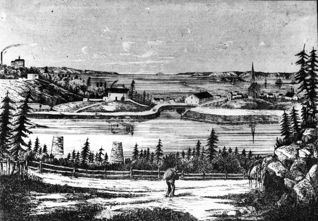
Skip to content
City of Dartmouth
  • Blog
  • Index
  • Categories
    • Academic Avenues
    • Annual Reports
    • Dartmouthians
    • Gallery
    • Map Room
    • Reading Room
  • Digest
    • Dartmouth in the Legislature, Public Acts 1789-1996
    • Post Archive
  • Contact

Sullivan’s Pond lithograph

October 26, 2021January 22, 2021 by City of Dartmouth
sullivans pond
Mount Hope Asylum seen at extreme left, McNabs Island and the harbor seen in the distance

Related posts:

thistle victoriaHalifax Harbour from Dartmouth Common carteacadie5 mapCarte de la côte Sud de l’Acadie Default ThumbnailAcadia And Thereabouts dartmouth mapCarte particulière de la coste d’Acadie Default Thumbnail1858 carteacadie6 mapCarte particulière de la coste d’Accadie
Categories Gallery
Post navigation
The Privy Council and the Constitution
Dartmouth flood

Index   |   Blog   |   Contact

Categories:   Academic Avenues   |   Annual Reports   |   Dartmouthians   |   Gallery   |   Map Room   |   Reading Room  

Digest:   Public Acts 1789-1996  

City of Dartmouth   |   Amicitius Crescium

© 2022 City of Dartmouth • Built with GeneratePress