
Related posts:
- Report on proposed water supply for Dartmouth, N.S. Dear Sir, -Relative to the water supply of the town of Dartmouth I have the honour to report:- After exploring all the Lakes in the vicinity I decide in favour of your obtaining your supply from Lamont and Topsail Lake....
- Plan showing the proposed land to be owned by the [Mi’kmaq] at Tufts Cove, Dartmouth You can see Windmill Road through the middle, its intersection with Albro Lake Road seen at bottom, Albro Lake at Wyse Road bottom middle and Victoria Road at right. In lot “A” above is noted Quarantine ground, “Present Indian Camps”...
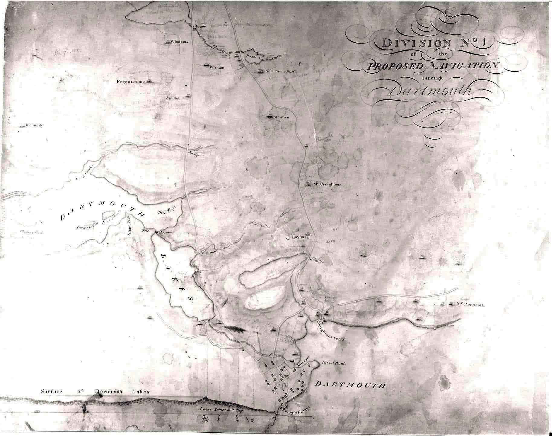
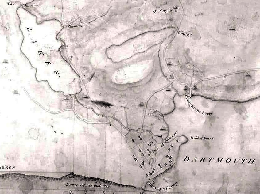
- Dartmouth Property and Owners in Vicinty of Dartmouth Cove Lake and Canal “Dartmouth Property and Owners in Vicinty of Dartmouth Cove Lake and Canal”, November 10, 1804. https://archives.novascotia.ca/maps/archives/?ID=240...
- A Tourist Map of Dartmouth (1939) Of note at #25, an RCMP detachment within the Town on Prince Albert Road (perhaps at number 159?), as opposed to #24 on the map, the “Civil police”, located at Wentworth and Ochterloney. “Tourist Map of Dartmouth”, 1939. https://memoryns.ca/a-tourist-map-of-dartmouth...
- Dartmouth, Property along the 1st Dartmouth Lake “Dartmouth, Property along the 1st Dartmouth Lake”, 1853. https://archives.novascotia.ca/maps/archives/?ID=730...
- Dartmouth Axe & Ladder Co. Float, Dartmouth Fire Department “Dartmouth Axe & Ladder Co. Float, Dartmouth Fire Department”, 1920. https://archives.novascotia.ca/connors/archives/?ID=654...
- Intercolonial Railway lease to Dartmouth Ferry Commission, permission for terra cotta pipe at Dartmouth “Intercolonial Ry. [Railway] lease Dartmouth Ferry Commission, permission terra cotta pipe at Dartmouth – Min. R. and C. [Minister of Railways and Canals], 1909/01/11”, https://recherche-collection-search.bac-lac.gc.ca/eng/home/record?app=OrdInCou&IdNumber=128788...
- Map of halifax and Dartmouth 1887 There’s a few Dartmouth references included here: (187) L. Sterns & Son, dry goods, carpets, floor oil cloths, etc., Water St., Dartmouth, (205) Hospital for Insane, Dartmouth (206) Dartmouth Town Hall, (207) Exhibition building, Dartmouth, (218) Public School, Dartmouth. Wharves...
- Dartmouth, Before Being Strangled by a Beltway An interesting map of Dartmouth from around 1950. It’s quite detailed – in many cases aspirational. Check out the subdivision plan for what is now Mic Mac Mall – below the modern grid they had once hoped to construct, you...
- Map of the Town of Dartmouth “Map of the Town of Dartmouth:, 1937. https://archives.novascotia.ca/maps/archives/?ID=1495...