
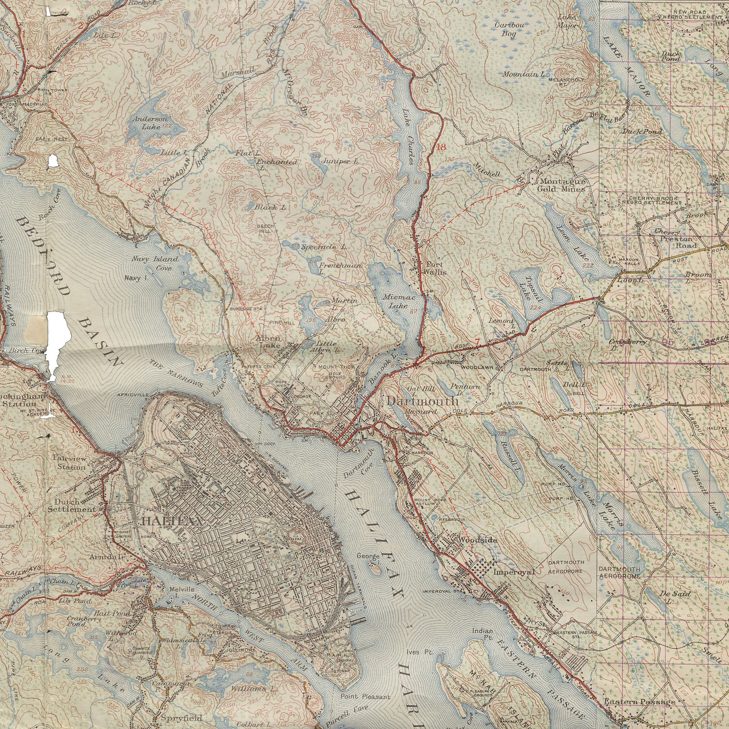
Lots of detail in this topographical map surveyed in 1920 and reprinted in 1946.

The path of the “Old Annapolis Road” can still be seen.
“Topographic Map Nova Scotia – Uniacke Sheet and Chezzetcook Sheet No. 11. Surveyed and Reproduced by the Geographical Section, General Staff, Department of National Defence. Surveyed 1920 reprinted 1946”, https://archives.novascotia.ca/african-heritage/archives/?ID=682