
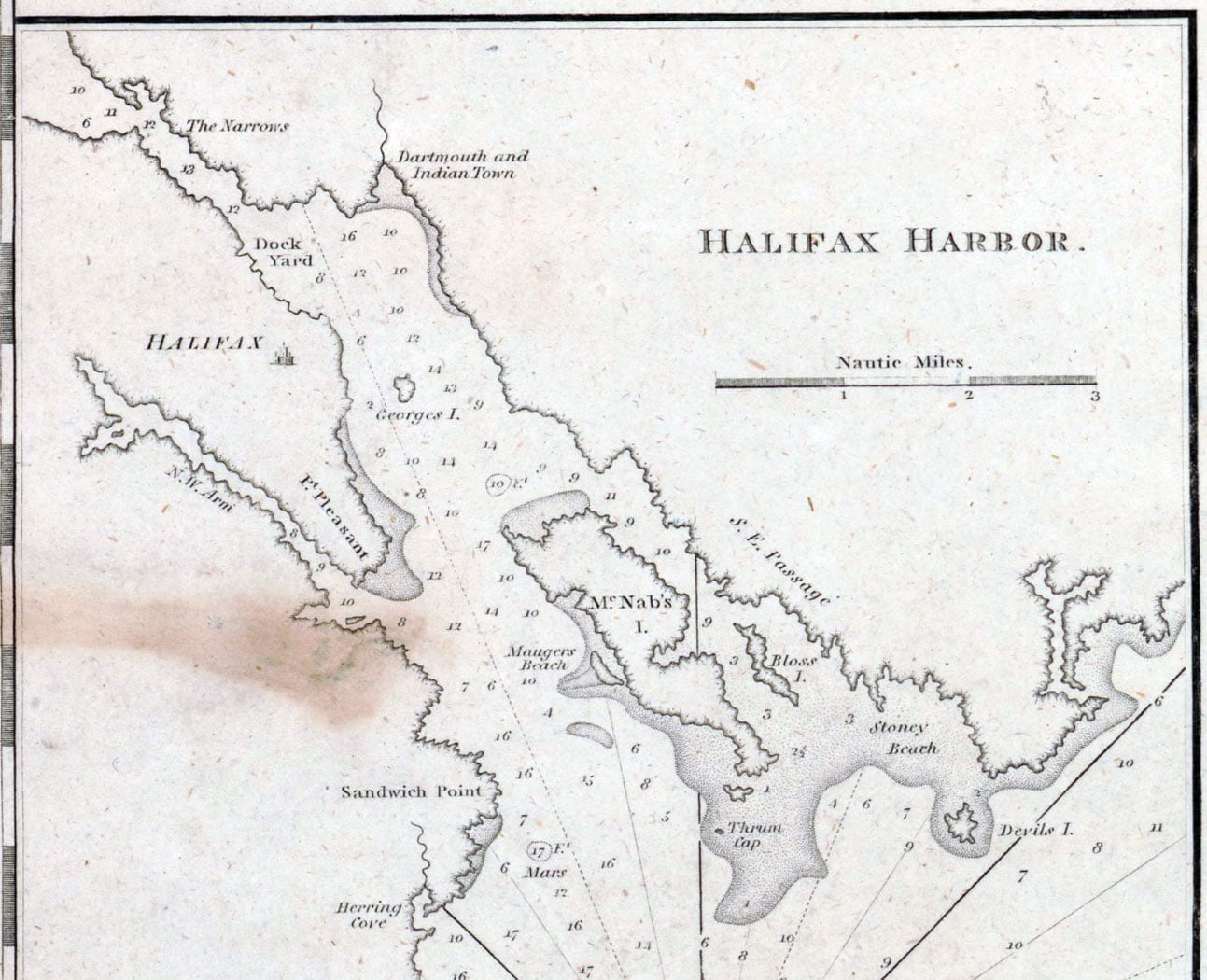
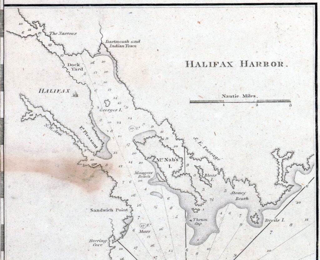
Dartmouth and Indian Town! 😎 If only there was more detail of the settlements themselves. Fascinating to me that the only inset on this map is Halifax Harbor. To me it represents Jefferson’s viewport to 45°N, reflective of his notes on the State of Virginia that traces the constitutional history of Nova Scotia too, from its time as proprietary colony through to various cessions and treaties thereafter, from the earliest instances of European exploration by Cabot and Gilbert to the Treaty of Aix-la-Chapelle and Paris. More on Notes on the State of Virginia as it relates to Nova Scotia here.
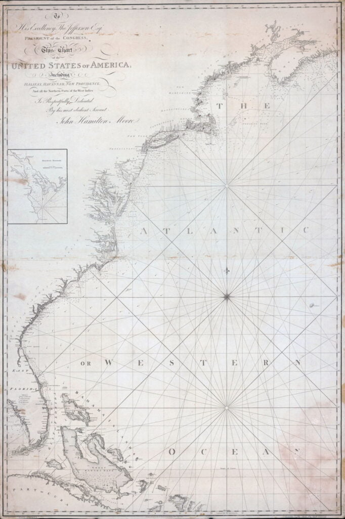
Moore, John Hamilton, -1807, et al. To his excellency Thos. Jefferson, esqr., president of the Congress, this chart of the United States of America: including Halifax, Havannah Havana, New Providence, and all the northern parts of the West Indies. London: R. Penny, sculp, 1805. Map. Retrieved from the Library of Congress, <www.loc.gov/item/2003620053/>