
You can see Windmill Road through the middle, its intersection with Albro Lake Road seen at bottom, Albro Lake at Wyse Road bottom middle and Victoria Road at right.
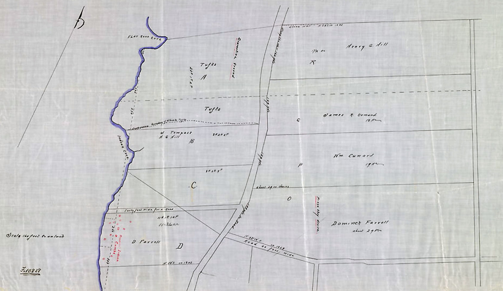
In lot “A” above is noted Quarantine ground, “Present Indian Camps” at the shoreline in block “D”, “Place they desire” seen in the middle of lot “O”, present day Farrell Street Park. A general idea of the neighborhood today:
“Plan showing the proposed land to be owned by the [Mi’kmaq] at Tufts Cove, Dartmouth”, 1912. https://recherche-collection-search.bac-lac.gc.ca/eng/home/record?app=FonAndCol&IdNumber=3672503