
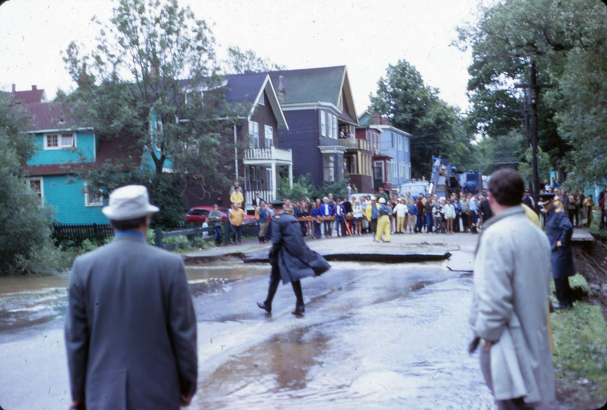
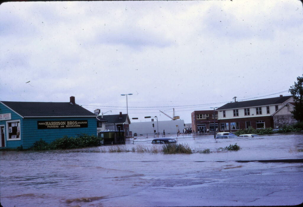
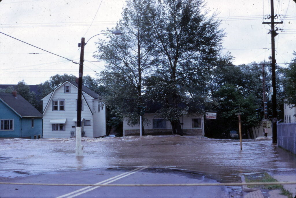
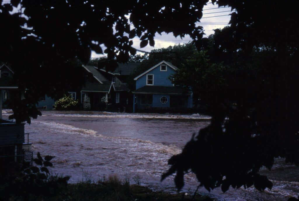
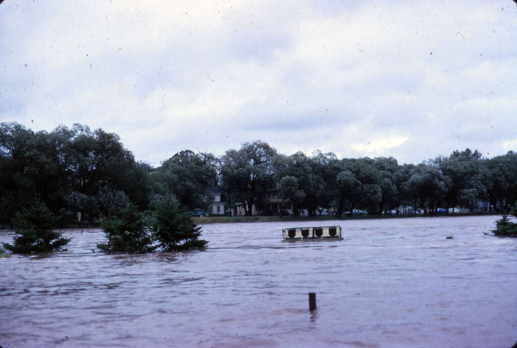
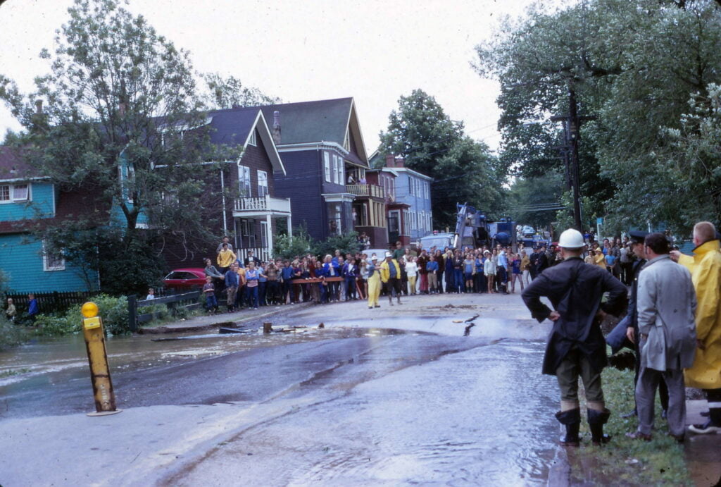
The results of an unwelcome guest, Hurricane Beth, in August of 1971.

Related posts:
- Shubenacadie Canal: Near Sullivan’s Pond, Dartmouth This picture appears to be taken near the inclined plane (the bank seen at right), between Ochterloney at left and Prince Albert Road off screen at right. The circular dam can be seen ahead, so this picture is taken further...
- Halifax (and Dartmouth), Canada Among Dartmouth’s attractions noted: North of Park Avenue: North Ferry, St. Paul’s School, Stairs Memorial Church, Emmanuel Church, Park School and Victoria School, Dartmouth Common as well as Brightwood Golf course further down School Street. In or near Austenville: St....
- Sullivan’s Pond (from the banks of Findlay’s Pond), Dartmouth This photo appears to be looking north, the opposite direction of this other photo of Sullivan’s Pond and Findlay’s Pond, but more than 20 years later on Oct 24th, 1890. The large three story house in the center of the...
- Five Corners Looking East, previous to the construction of the new Hawthorne School (now located in the empty field at middle-left) as well as the apartment building at Pleasant, Portland and Albert Street (in the bottom right). To avoid confusion, this is...
- The Only Authentic Map of the City of Halifax and Town of Dartmouth A noteworthy map since it shows Dartmouth Bus routes, seven of them (#1 Eastern Passage, #2 Imperoyal, #3 Tuft’s Cove, #4 Austenville, #4A Brightwood, #5 Cole Harbour, #6 Port Wallace); operated by Bell Bus Lines at the time. Among the...
- Dartmouth, Looking south towards mouth of harbour “From the old Crichton Manor house called “the Brae” (No. 20 Cleveland Crescent is the site). Looking south towards the mouth of the harbour over part of the 50 acre Crichton estate.” “Gate at middle left is now the corner...
- Sullivan’s Pond lithograph Mount Hope Asylum is visible at extreme left, McNabs Island and the harbor in the distance. “Bridge Street” can be seen directly ahead, across Sullivan’s Pond, which connected Ochterloney Street to the road to Preston. The long building in behind...
- Ochterloney Street, Preston Road, No. 7 Highway From The Story of Dartmouth, by John P. Martin: The names of Ochterloney and Quarrell (now Queen) were commemorated by streets in downtown Dartmouth. The extension of the first named thoroughfare marked the beginnings of the present no. 7 highway....
- September 14th, 1907 From The Story of Dartmouth, by John P. Martin: “This first picture was taken at the intersection of Prince Albert Road and Ochterloney Street on Saturday, September 14, 1907 (Below, as it looks in more modern times). The length of the...
- Circular dam foot of Sullivan’s Pond, route of Shubenacadie Canal near Dartmouth “Lakeside”, later ‘‘Beechmount Apartments” and now 84 Crichton Avenue, seen directly ahead behind the circular dam, which, especially in reference to this photo from Findlay’s Pond, helps triangulate the location of this photo to somewhere near the bottom of Maple Street....