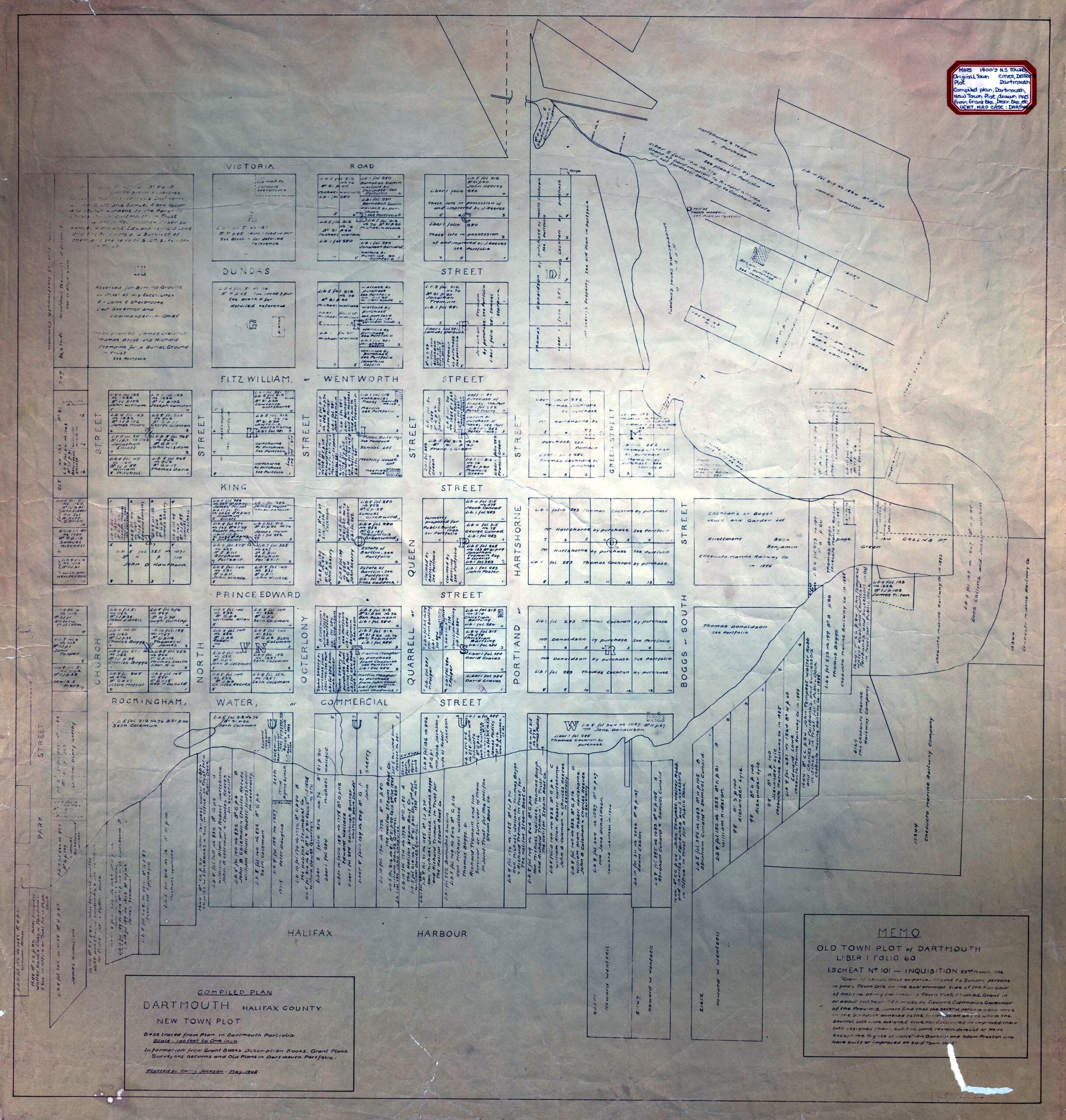
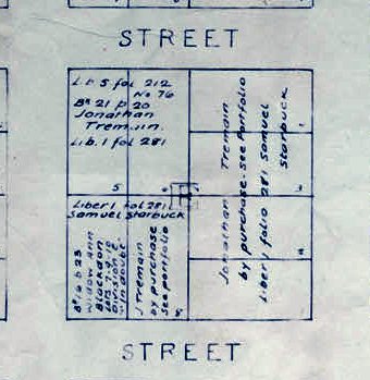
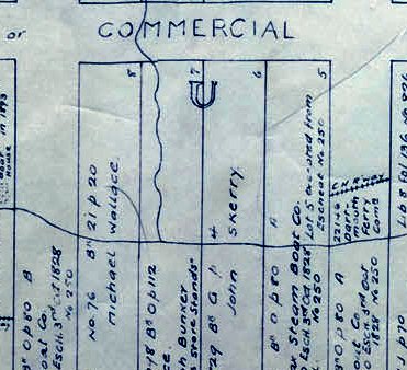
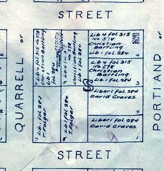
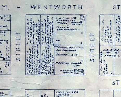
Old Town Plot of Dartmouth. 1784. https://archives.novascotia.ca/maps/archives/?ID=192

Amicitia Crescimus
Old Town Plot of Dartmouth. 1784. https://archives.novascotia.ca/maps/archives/?ID=192
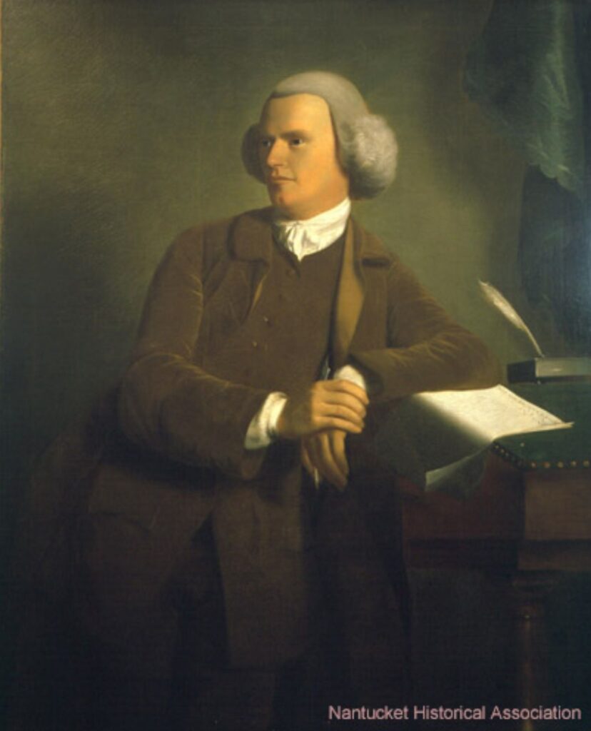
Timothy Folger was born in 1732 to Abishai Folger and Sarah Mayhew. In 1753, he married Abial Coleman, daughter of Barnabas Coleman and Rachael Hussey. The couple had seven children: Syllvanus, Abial, Sally, Lucretia, Margaret “Peggy”, Timothey, and Benjamin Franklin, named after his cousin, the founding father.
As a skilled mariner from Nantucket, Folger was involved in the whaling industry. It was during his time as a Nantucket whaler that he became well-acquainted with the Gulf Stream, a warm and strong ocean current.
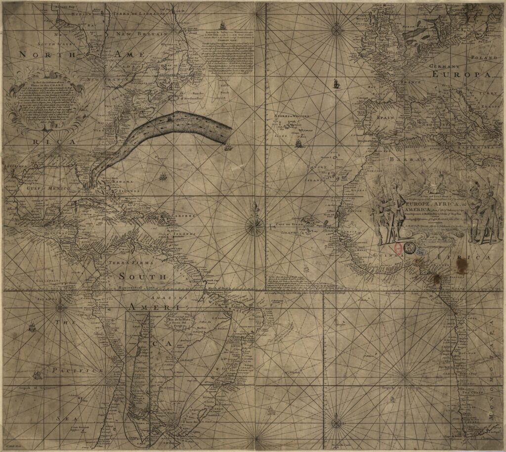
In 1768, Benjamin Franklin, then in London, received a visit from his cousin Timothy Folger, who captained a merchant ship. Folger’s knowledge of the Gulf Stream prompted Franklin to inquire about the prolonged travel time of British mail packet ships compared to regular merchant vessels. Franklin and Folger collaborated to name and map the Gulf Stream for the first time, publishing their findings in the Transactions of the American Philosophical Society in 1769.
In September 1785, Folger, along with Samuel Starbuck and other associates, relocated to Dartmouth, Nova Scotia, intending to continue the whale fishery. They surveyed land in the Township of Dartmouth, acquiring two tracts totaling 2156 acres. The relocation of the Nantucket Whaling Company to Dartmouth marked the town’s first major industry.
However, in 1792, Folger and Starbuck departed for Milford Haven in Great Britain, where they hoped to continue their whale fishery with greater facilities. They were invited by British authorities to establish a whaling center in Milford Haven. Financial assistance, including pensions for Folger and Starbuck, was provided, and the first 15 families arrived in 1792.
Timothy Folger, now settled in Milford Haven, continued his involvement in the whale fishery. He became known as a whalebone cutter in his later years, contributing to the processing of valuable whalebone used in various products. His wife Abiel kept a detailed diary, providing insights into their daily lives and activities.
Timothy Folger died in 1814 in Milford Haven, leaving behind a legacy as a skilled mariner, navigator, and cartographer. His contributions to navigation, alongside his cousin Benjamin Franklin, have had a lasting impact on maritime history. Folger’s involvement in the whaling industry and his role in the settlement of Dartmouth further attest to his significance in shaping both local and maritime communities. He was buried in Milford Haven’s Quaker burial ground, leaving behind a rich legacy of exploration, innovation, and industry.
“Timothy Folger (1732 – 1814)” https://www.wikitree.com/wiki/Folger-296,
“Benjamin Franklin Was the First to Chart the Gulf Stream, Franklin’s cousin, Timothy Folger, knew how the then-unnamed current worked from his days as a whaler” https://www.smithsonianmag.com/smart-news/benjamin-franklin-was-first-chart-gulf-stream-180963066/
“Former home of whale-ship captain Timothy Folger, Milford Haven” https://historypoints.org/index.php?page=former-home-of-whale-ship-captain-timothy-folger-milford-haven
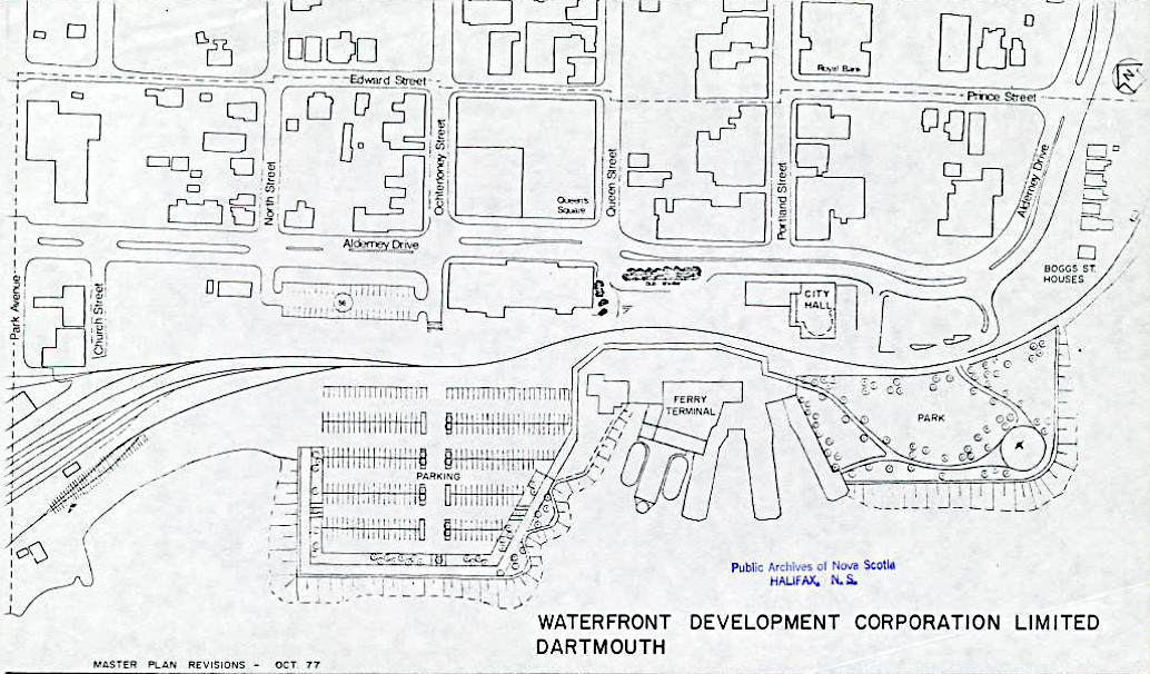
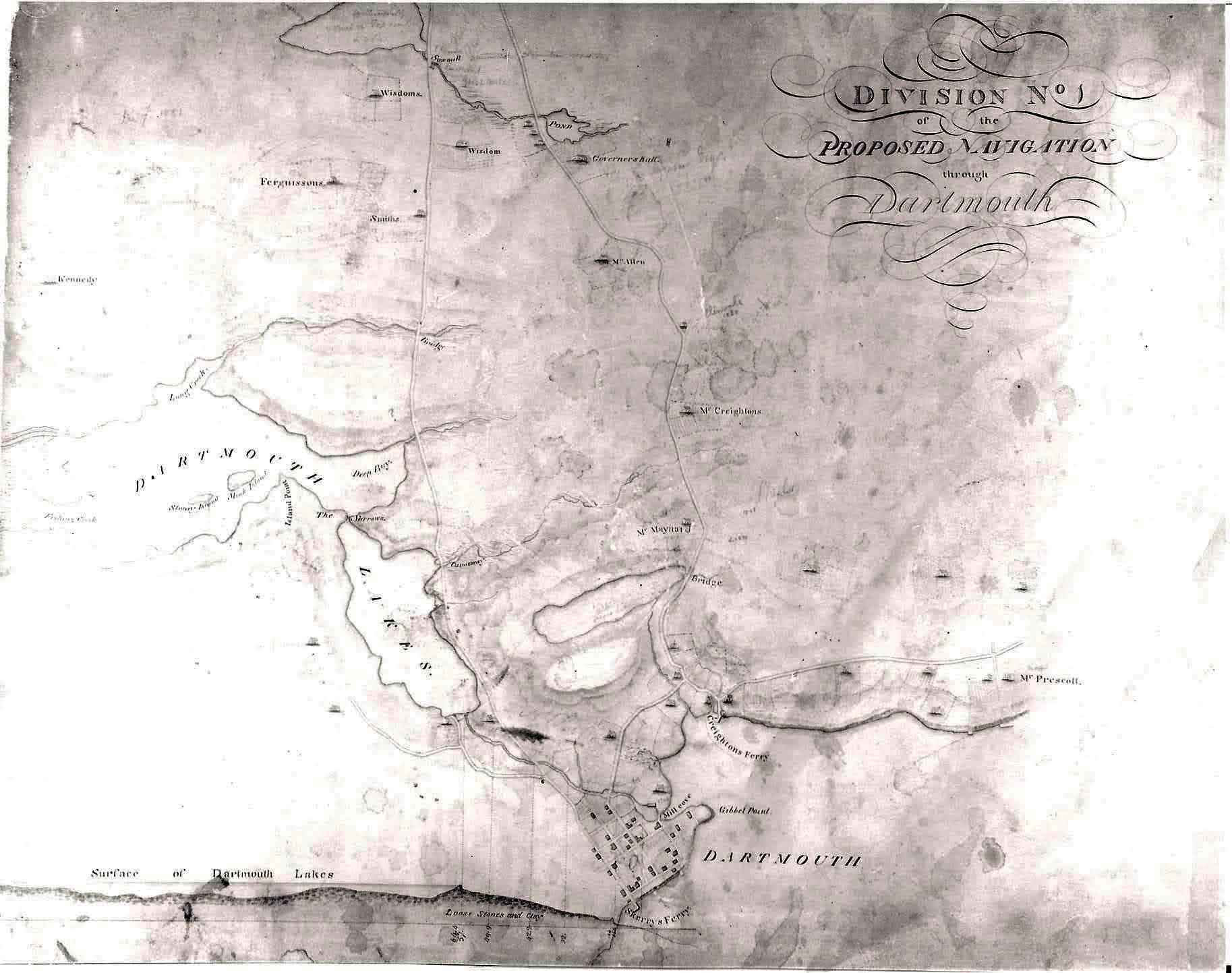
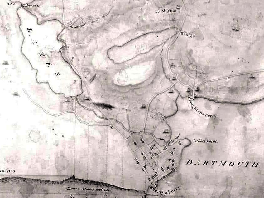
“City of Dartmouth Waterfront Oct 1977”, https://archives.novascotia.ca/maps/archives/?ID=1950
An early road map, showing Dartmouth near the bottom of Old Ferry Road, and the road to Lawrencetown.
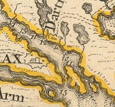
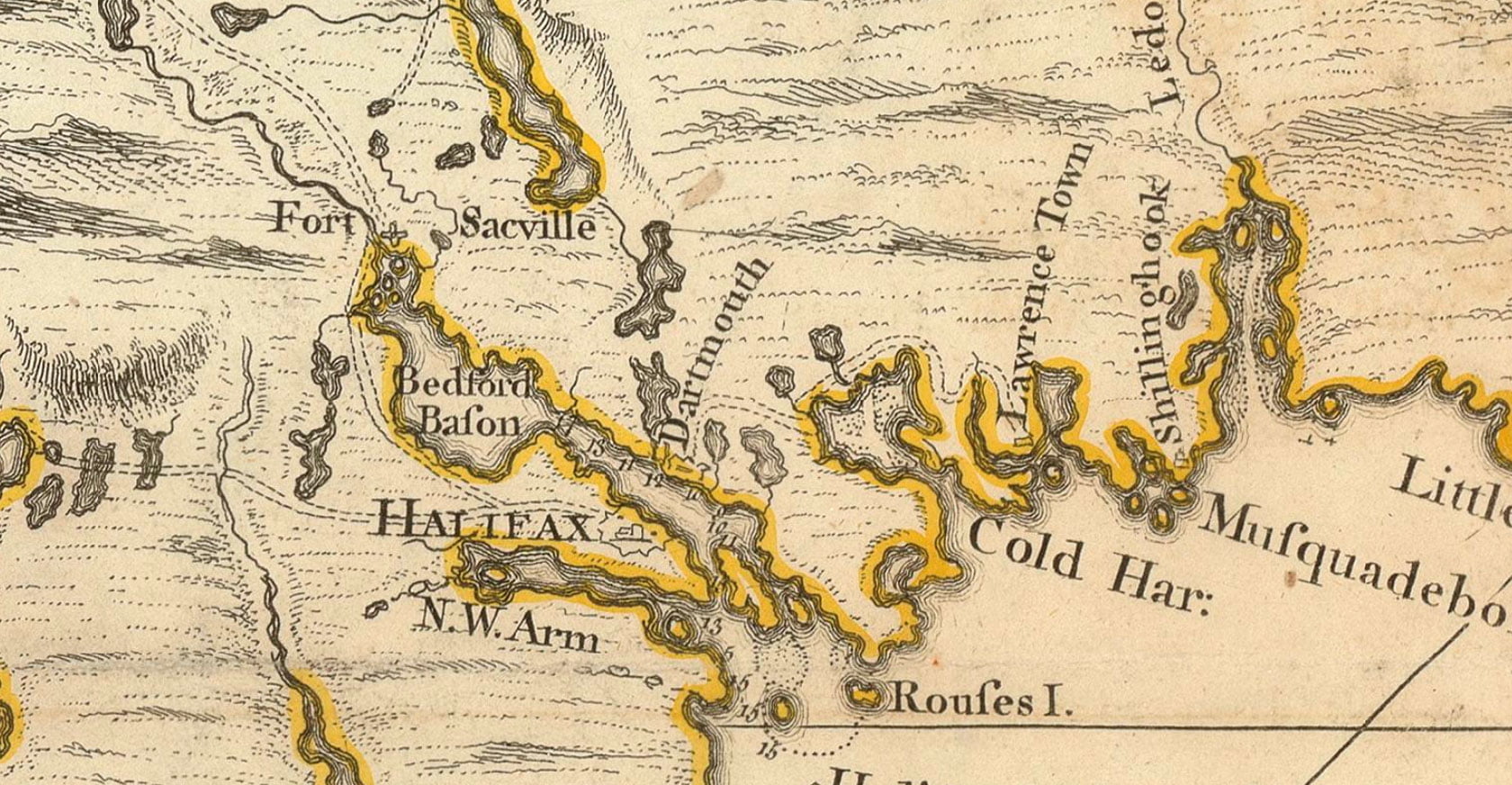
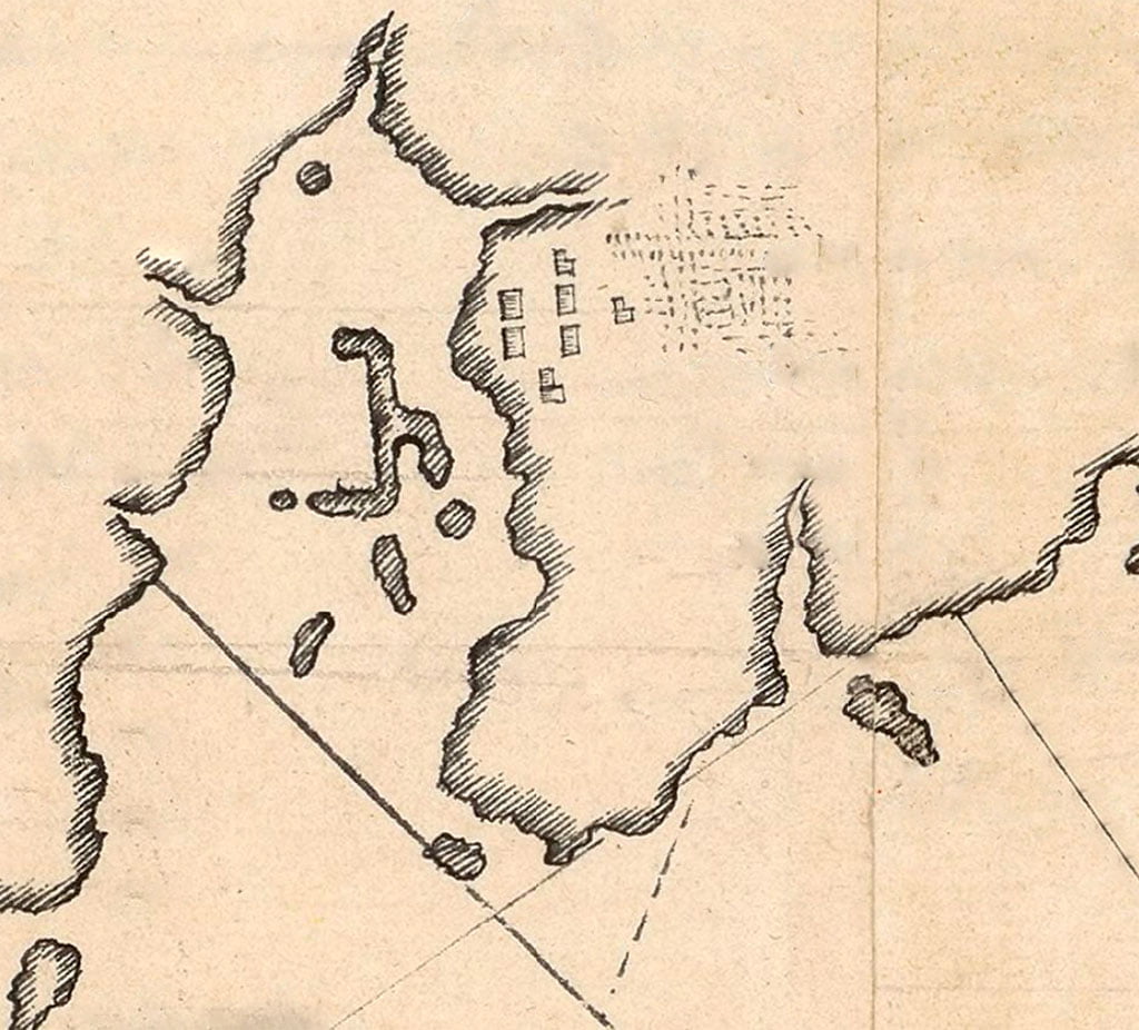
“Map of Nova Scotia, or Acadia, with the islands of Cape Breton and St. John’s”, Caldwall, James. 1768. https://gallica.bnf.fr/ark:/12148/btv1b53209890m
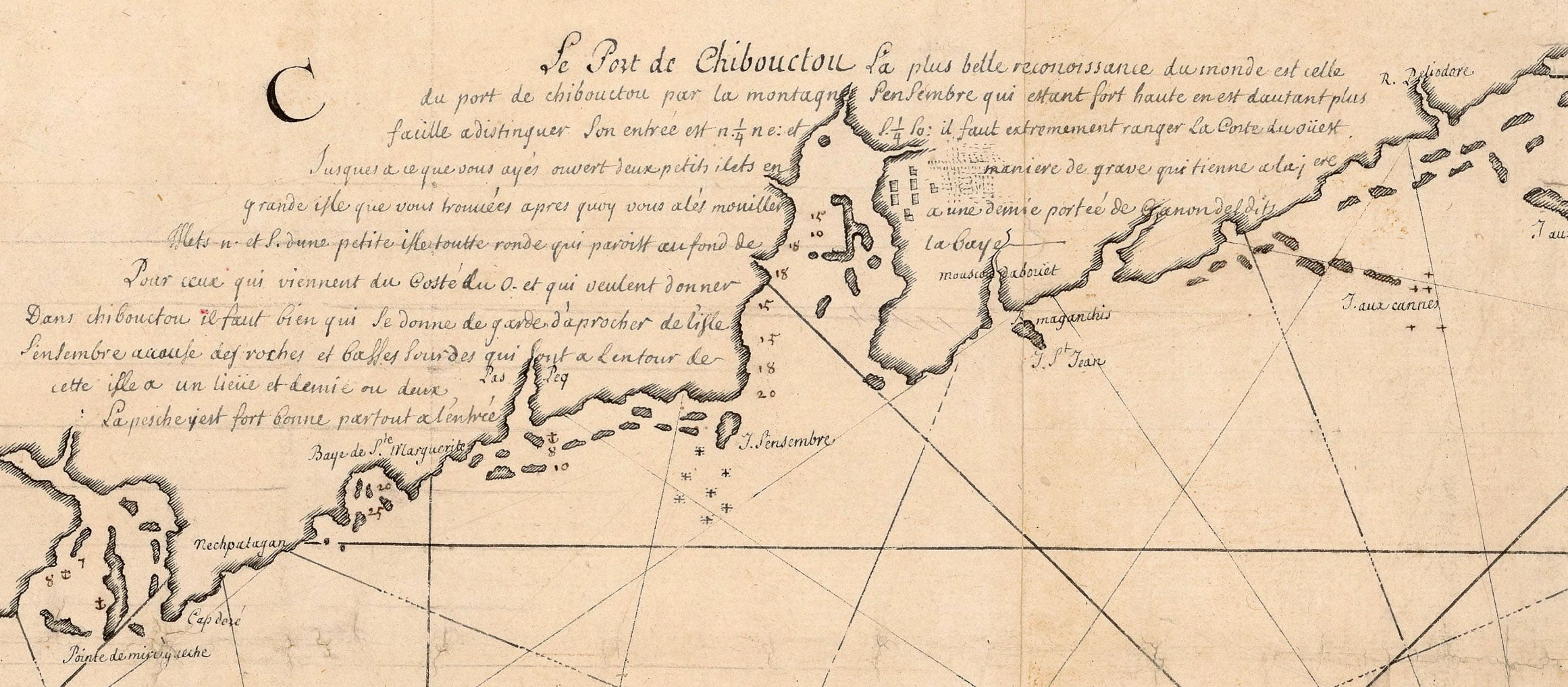
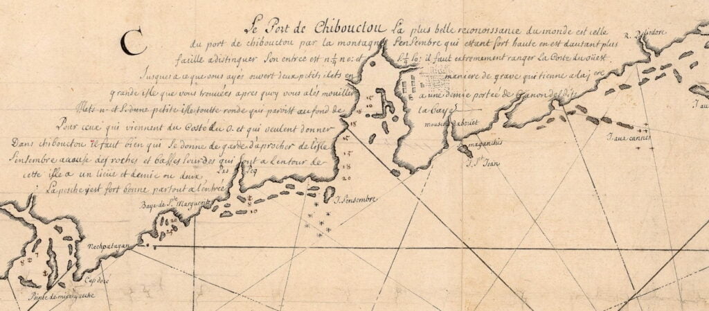
An incredibly detailed map, again showing Chibouctou on the Dartmouth side. Mcnabs Island and George’s are fairly easy to spot for those who’ve seen them on a map before. Perhaps the hatchings next to the seven buildings is meant to represent the “1/2 acre of improved land” that de Gargas notes in his 1687-1688 census of Acadie (including Chibouctou).
I have attempted to transcribe it as best as I can, being mostly unfamiliar with French, certainly the 17th/18th century variety. Following that is my attempt at a translation, thanks to Google Translate along with the ARTFL project at the University of Chicago.
My reading of a word or words I’m not familiar with will be in brackets, with what I think it means in context located previous to the brackets in italics. Example (as seen below): closely to (extremely tidy). I wasn’t sure at first if the text spanned both sides of the harbor but I’m assuming it does since it seems to make more sense. If anyone has a better read of this, please let me know.
“Le Port de Chibouctou la plus belle recoinissance du monde est celle du port de chibouctou par la montagne SenSembre qui estant fort haute en est dautant plus facille adistinquer. Son entree est nord 1/4 nord est et sud 1/4 ouest. Il faut extrement ranger la coste du ouest. Jusques a ce que vous ayes ouvert deux petits islets en maniere de grave qui tienne arajere grand isle que vous howees apres quoy vous ales moniller a une demie portee de canondeldits. Islets nord et sud d’une petite isle toute ronde qui pariott au found de la baye. Pour ceux qui viennent du coste du ouest et qui veulenyt donner. Dans Chibouctou il fait bien qui le donne de garde d’aproacher de l’isle SenSembre accouse des roches et basses soundres qui sont a lentour de cette isle a un lieue et demie ou deux , la pesche est fort bonne partout a l’entree”
“The Port of Chibouctou
The most beautiful view (recognition) in the world is that of the port of Chibouctou from (by) the Sambro (SenSembre) mountain which, being very high, is all the more easy to distinguish.
Its entrance is north 1/4 north east and south 1/4 west.
You must adhere closely to (extremely tidy) the western coast until you see (have opened) two small islets in a grave manner which hold a large isle which you ?? (howees?) after which you go up to them at half a reach of ?? (cannondeldits?) islets north and south of a small isle all round which ?? (pariott?) at the bottom of the bay.
For those who come from the west coast and who want to enter (give in) Chibouctou it is good who gives him the guard to approach from the island Sambro (SenSembre). Watch out for (accommodate) rocks and low soundings (soundres) which are around this island at a league and a half or two. The fishing is very good everywhere at the entrance”
“Carte de la coste de l’Acadie” La Borde, Jean-Benjamin de. 17?? https://gallica.bnf.fr/ark:/12148/btv1b53089980h
See also:

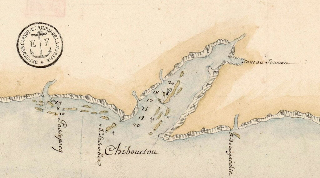
The salmon jump (Santau saumon, at the Shubenacadie River) makes another appearance
“Carte des costes de l’Acadie depuis le passage de Fronsac jusqu’à la rivière St Jeanccadie” 16?? (<1700) https://gallica.bnf.fr/ark:/12148/btv1b53090042j
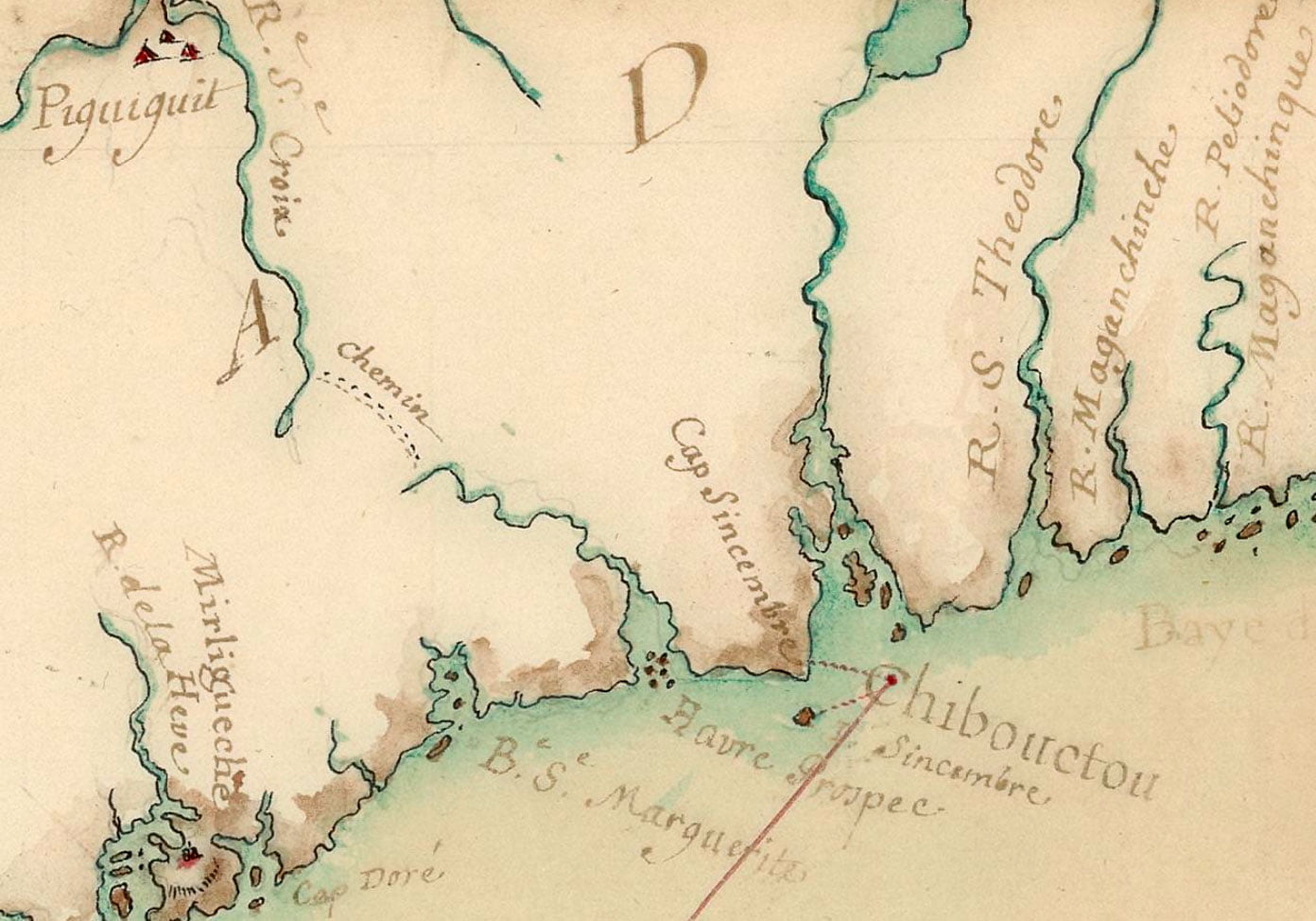

A recognizable Halifax peninsula on this map, McNabs, George’s Lawlors and Devil’s island all properly represented, as well as a portage to Windsor.
“Carte de l’Accadie”, Chabert, Joseph-Bernard de. 1746. https://gallica.bnf.fr/ark:/12148/btv1b53089771s

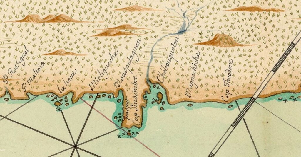
“Chebouquetou”, with McNabs Island relatively easy to pick out.
“Carte de l’Acadie ” 16?? (<1700) https://gallica.bnf.fr/ark:/12148/btv1b53089760x