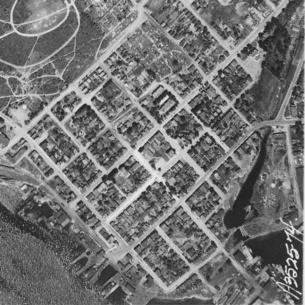
“Aerial View: Halifax Harbour Narrows showing Dartmouth”, 1931. https://archives.novascotia.ca/photocollection/archives/?ID=5573

Amicitia Crescimus
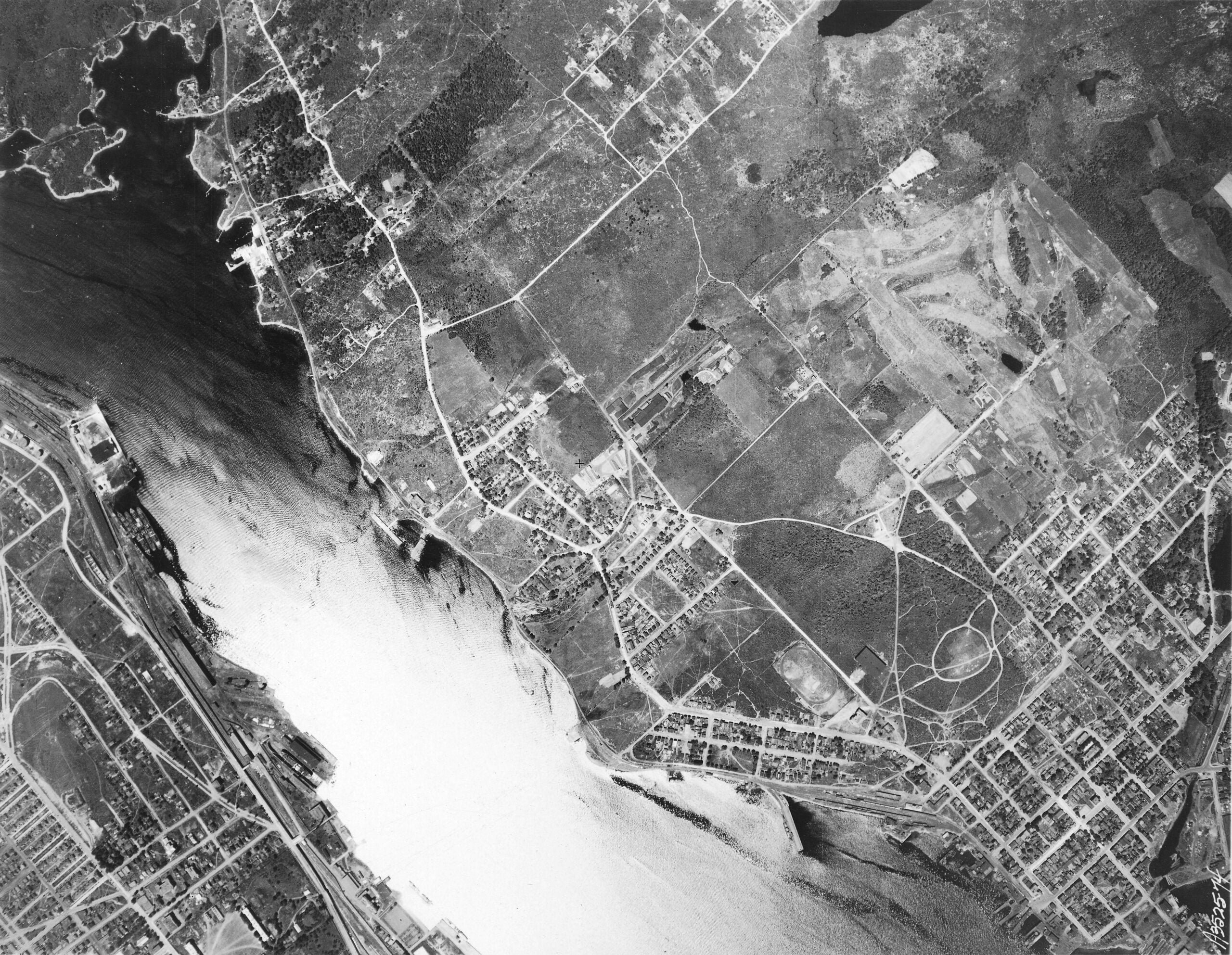
“Aerial View: Halifax Harbour Narrows showing Dartmouth”, 1931. https://archives.novascotia.ca/photocollection/archives/?ID=5573
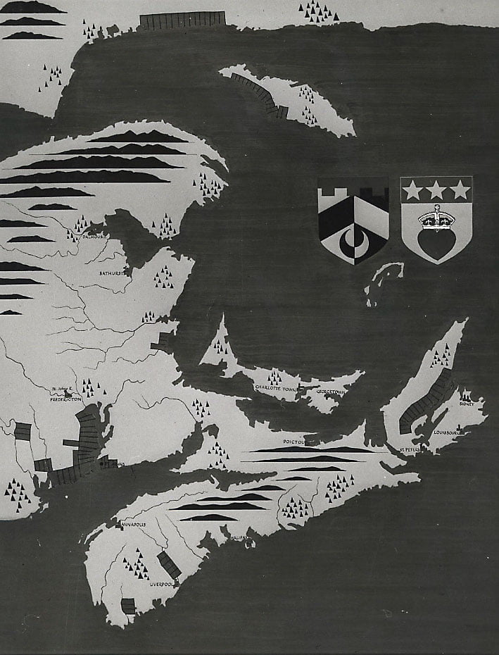
Interesting seeing the crescent here, a similar symbol is seen on the Mi’kmaq Grand Council flag.
“Baronets map”, (Date unknown – listed as 1600, perhaps meant to designate that it’s traced from an earlier map of 17th century origins?) https://archives.novascotia.ca/maps/archives/?ID=7
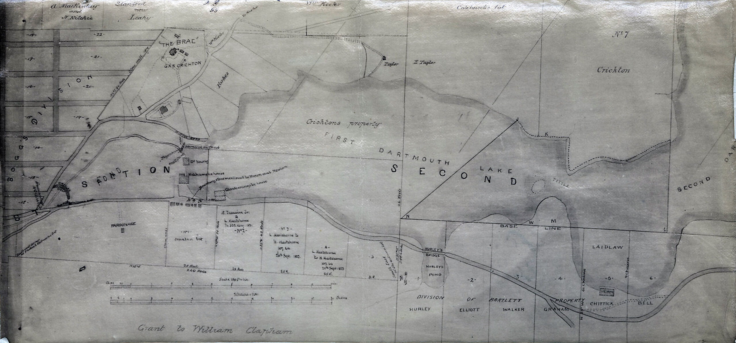
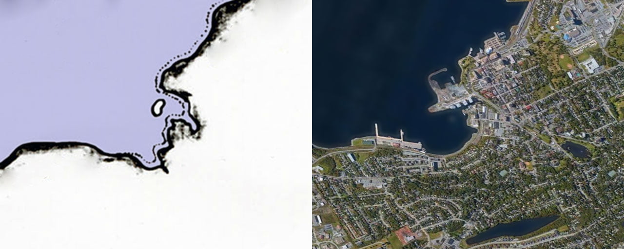
“Dartmouth, Property along the 1st Dartmouth Lake”, 1853. https://archives.novascotia.ca/maps/archives/?ID=730
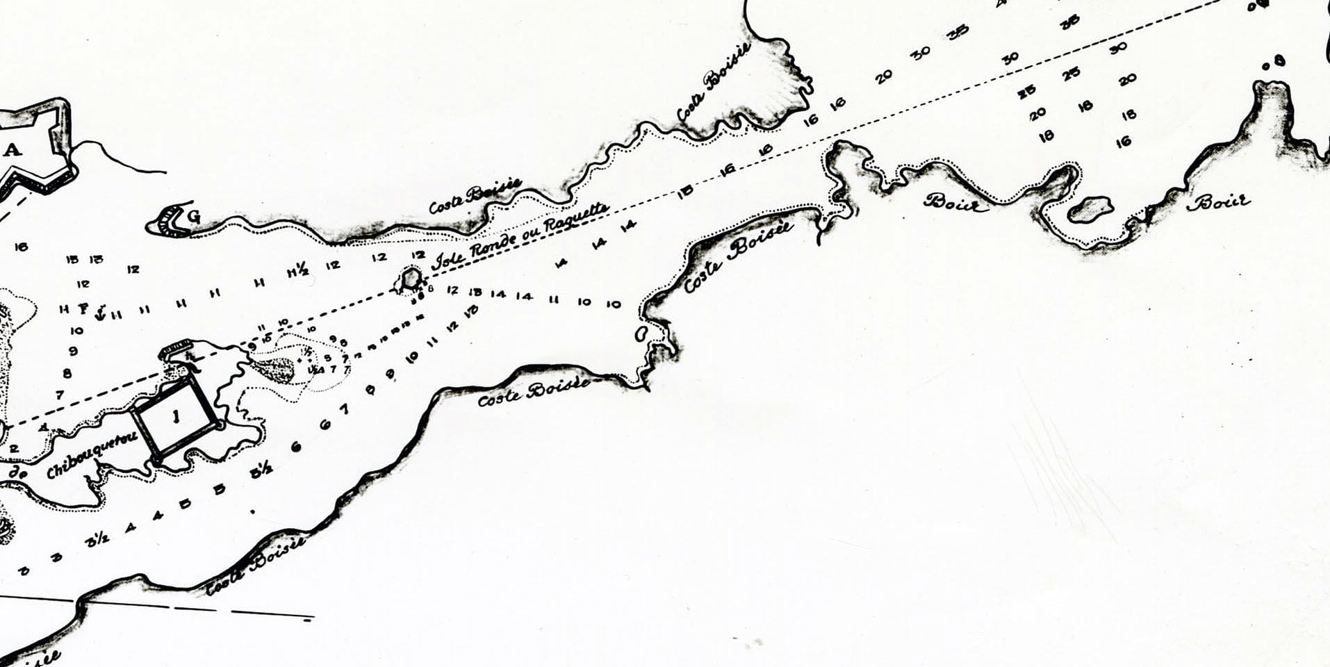
One of only two maps I’m aware of that give a representation of an island that once supposedly existed in Dartmouth Cove, as mentioned by Martin on Page 31 of the Story of Dartmouth. Below, a comparison to the modern day shoreline
“Map of Bay of Chibouquetou”, 1711. https://archives.novascotia.ca/maps/archives/?ID=19
See also:
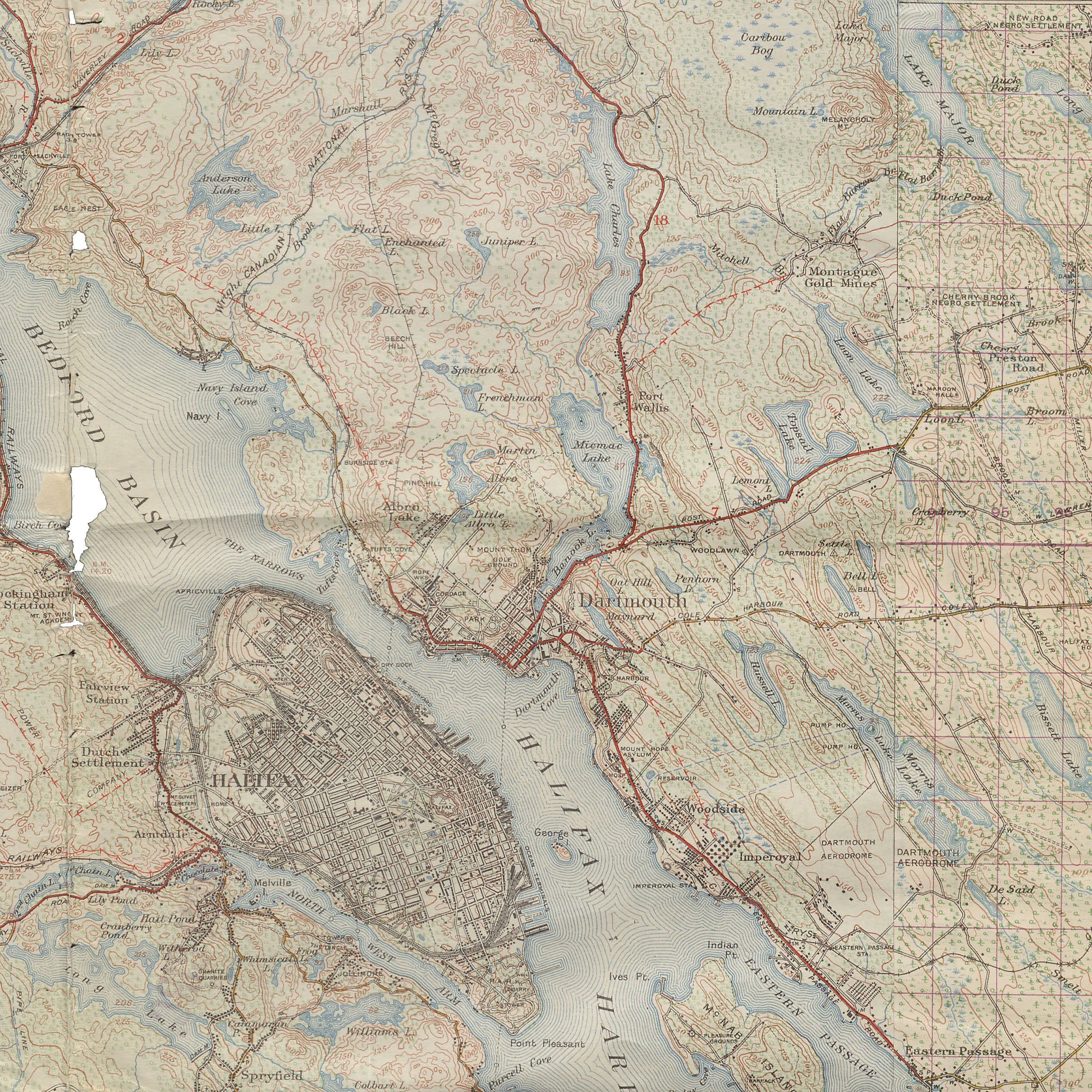
Lots of detail in this topographical map surveyed in 1920 and reprinted in 1946.

The path of the “Old Annapolis Road” can still be seen.
“Topographic Map Nova Scotia – Uniacke Sheet and Chezzetcook Sheet No. 11. Surveyed and Reproduced by the Geographical Section, General Staff, Department of National Defence. Surveyed 1920 reprinted 1946”, https://archives.novascotia.ca/african-heritage/archives/?ID=682
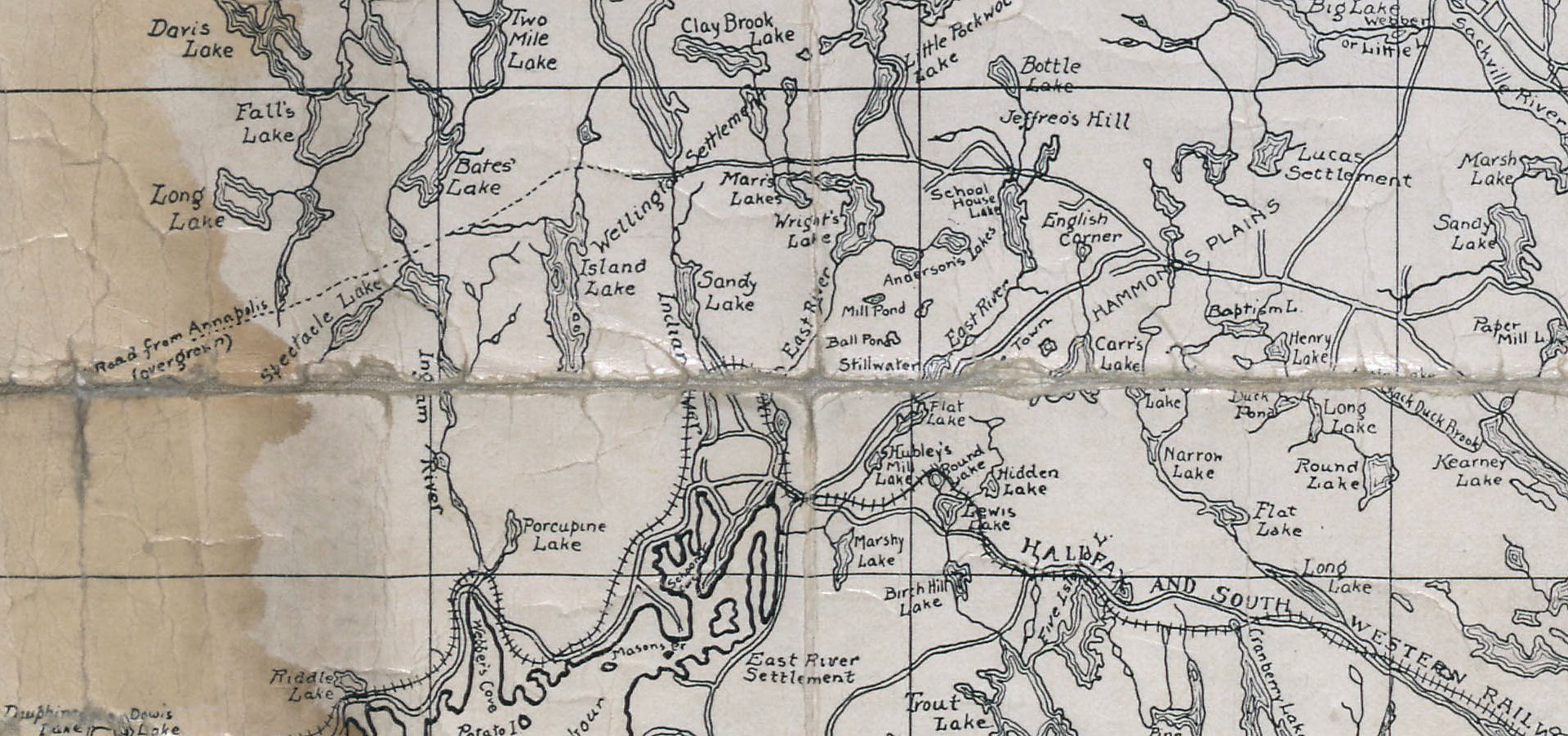
“Road from Annapolis, overgrown”
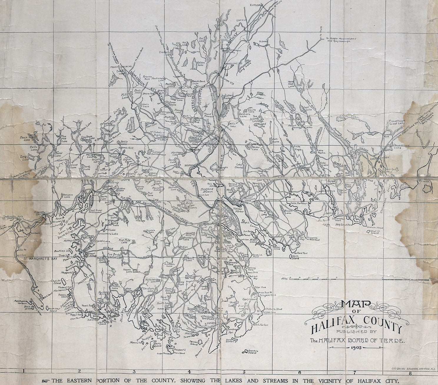
“Map of Halifax County”, 1905. https://archives.novascotia.ca/maps/archives/?ID=1292
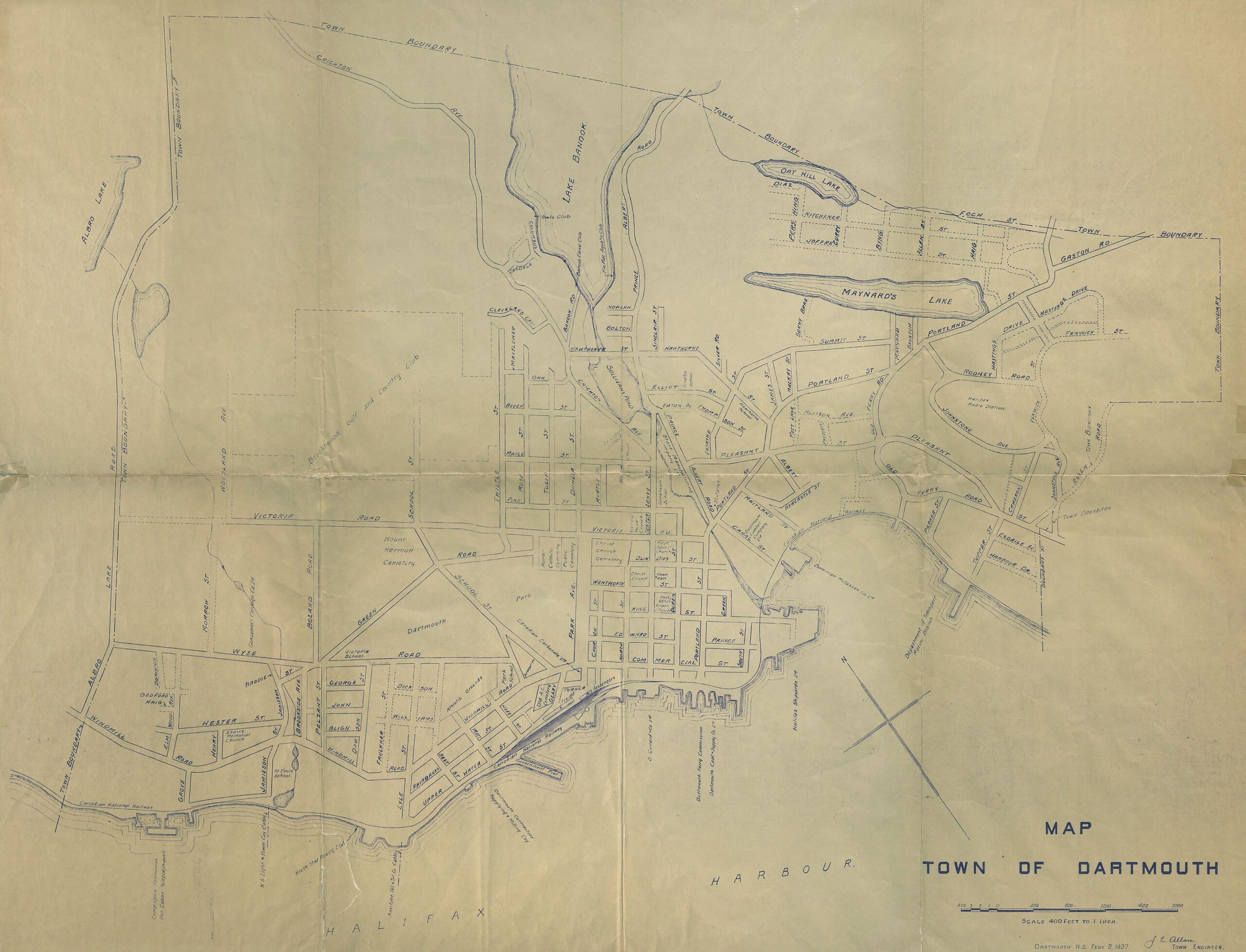
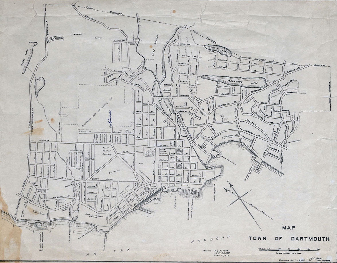
“Map of the Town of Dartmouth:, 1937. https://archives.novascotia.ca/maps/archives/?ID=1495