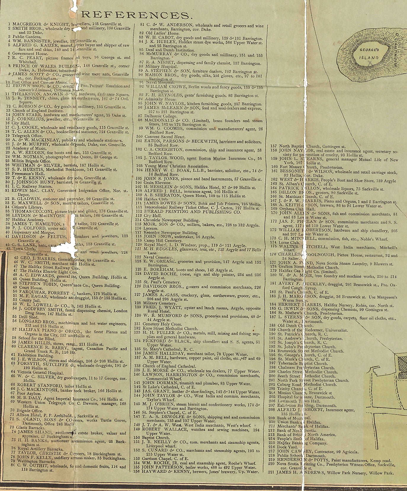
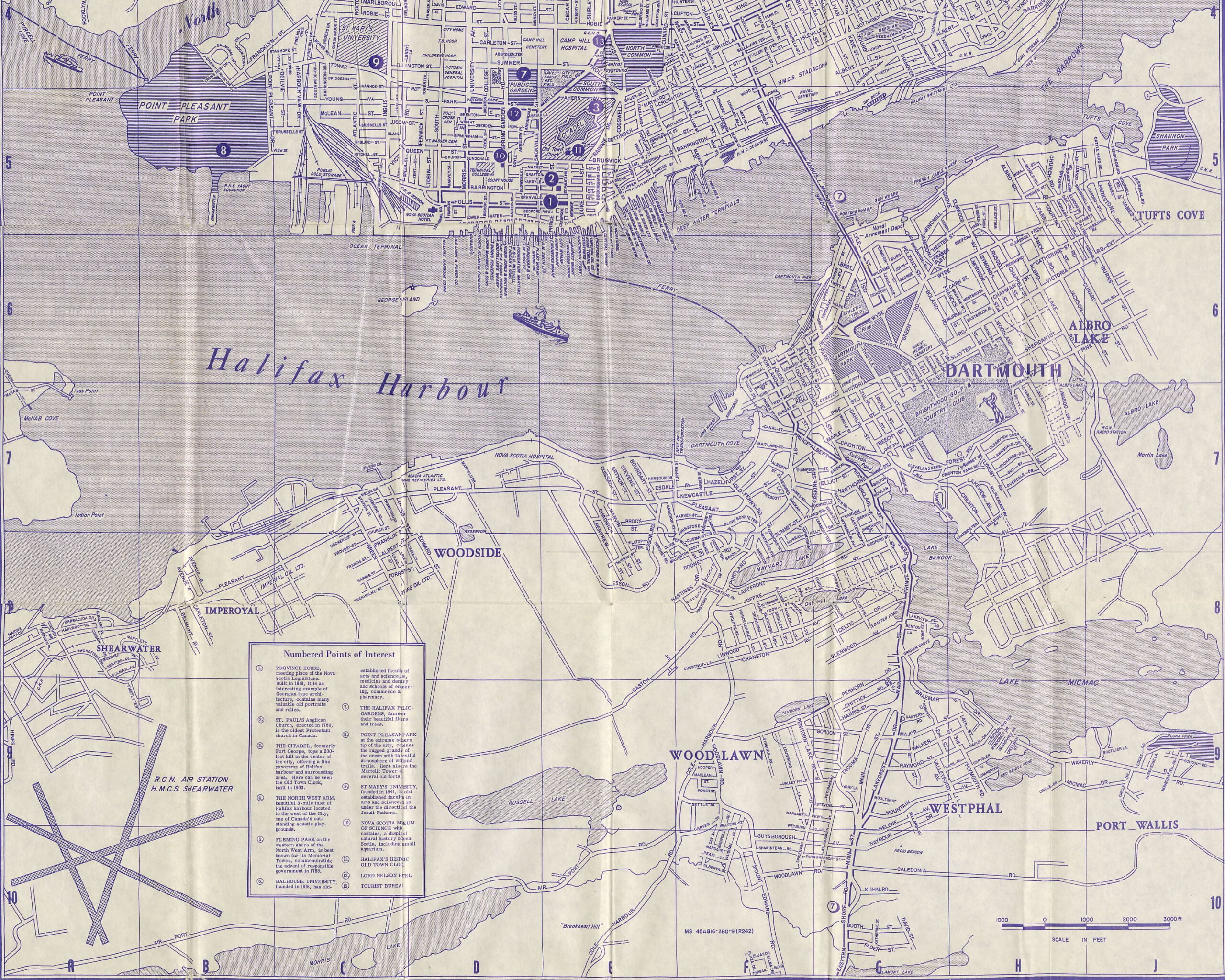
There’s a few Dartmouth references included here: (187) L. Sterns & Son, dry goods, carpets, floor oil cloths, etc., Water St., Dartmouth, (205) Hospital for Insane, Dartmouth (206) Dartmouth Town Hall, (207) Exhibition building, Dartmouth, (218) Public School, Dartmouth.
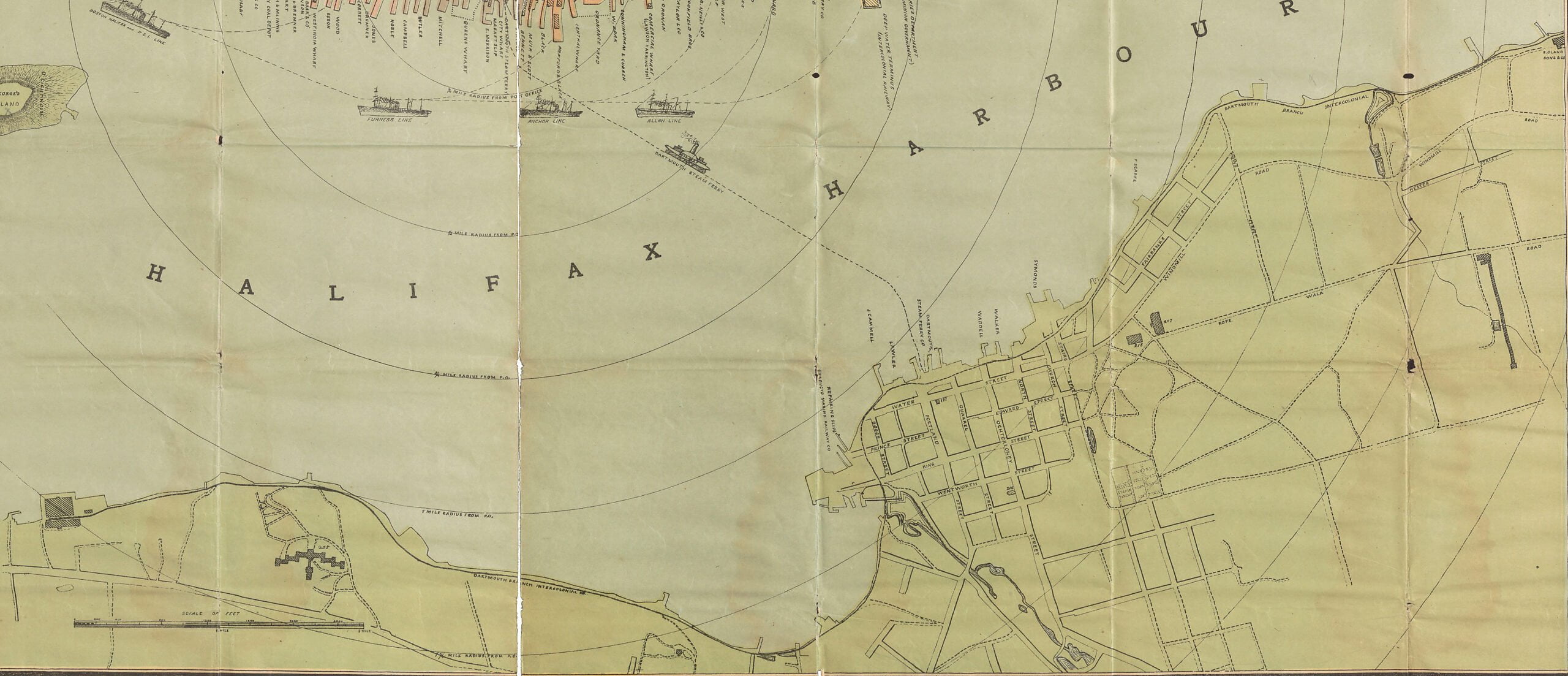
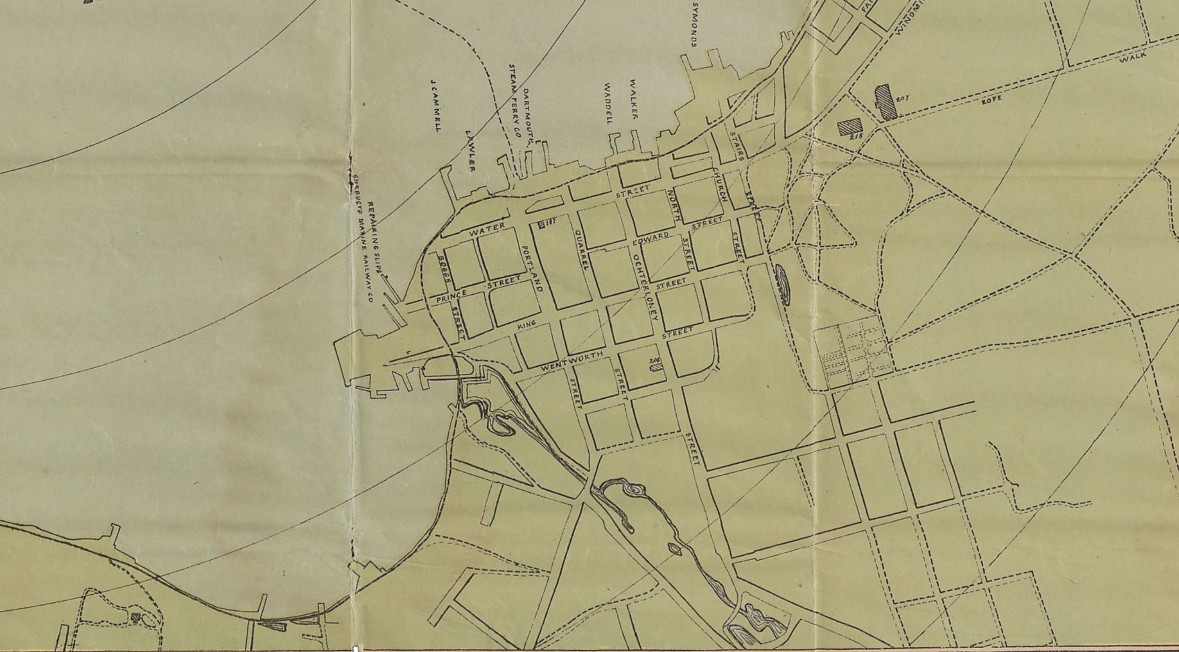
Wharves noted include Chebucto Marine Railway Co with repairing slips south of Boggs Street, J. Cammel and Lawler south of Portland Street at Water Street, Dartmouth Steam Ferry Co at Portland, Waddell and Walker between Ochterloney and North, and Symonds at Church Street.
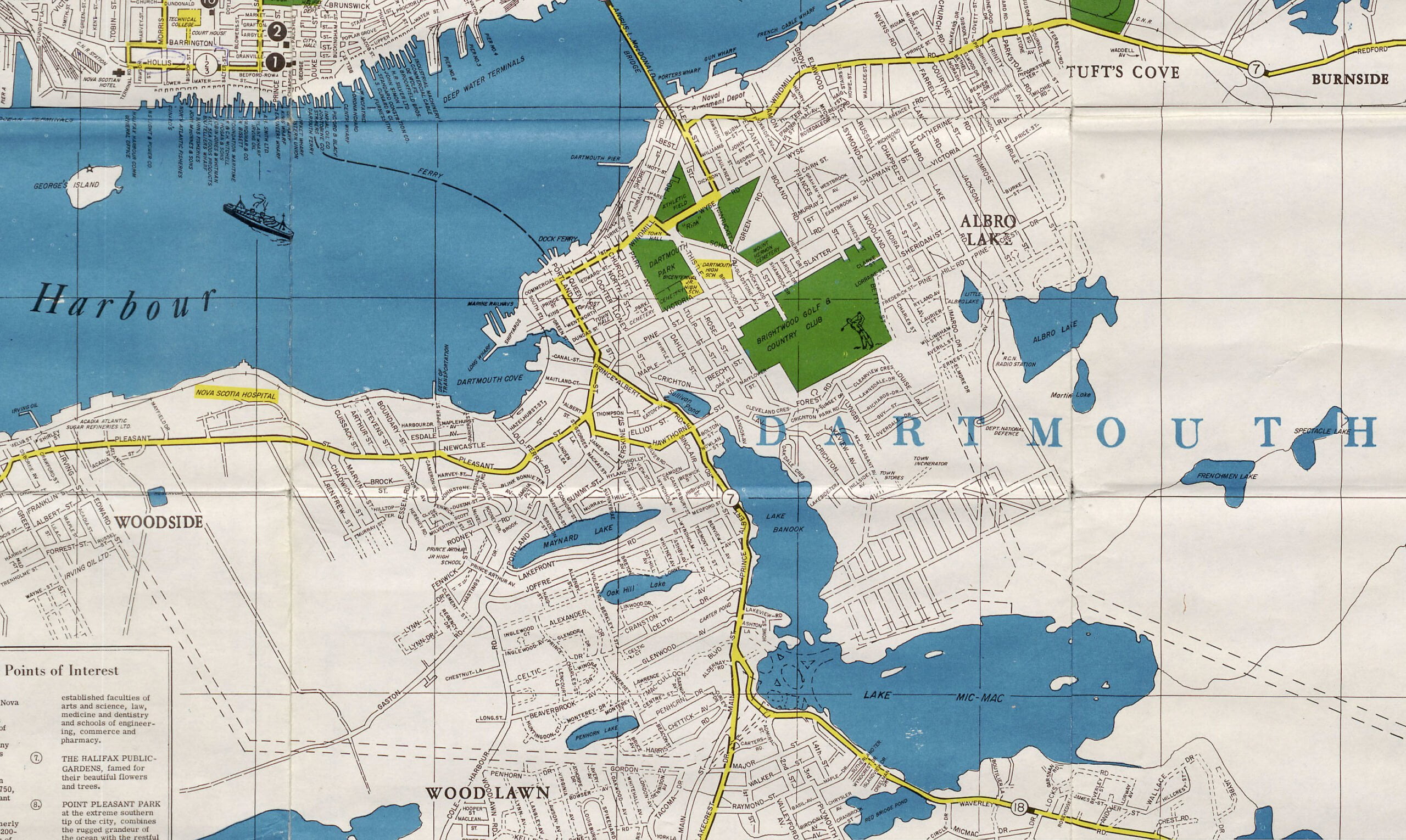
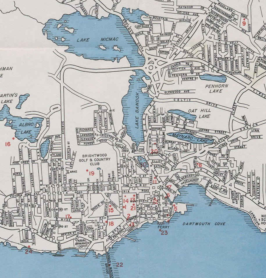
No hint of a beltway or a rotary here, but several subdivision plans for the Woodlawn and Westphal sections, Crichton Park (now Mic Mac Village), as well as Manor Park. Shearwater Airport clearly played a more important role at this point as a “city” airport, connected by Airport Road running along the west side of Morris Lake from Cole Harbor Road. Breakheart hill is noted along with a number of communities including Shearwater, Imperoyal, Woodside, Woodlawn, Westphal, Port Wallis, Albro Lake and Tufts Cove.
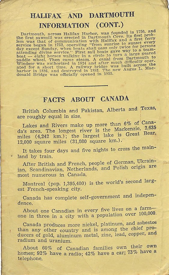
Some bold claims (propaganda), also included with this map, the facts about Canada section asserts “Canada has complete self-government and independence”. 🤔
Great period map showing the different communities in the general vicinity — Woodside, Woodlawn, Port Wallace, Tufts Cove.
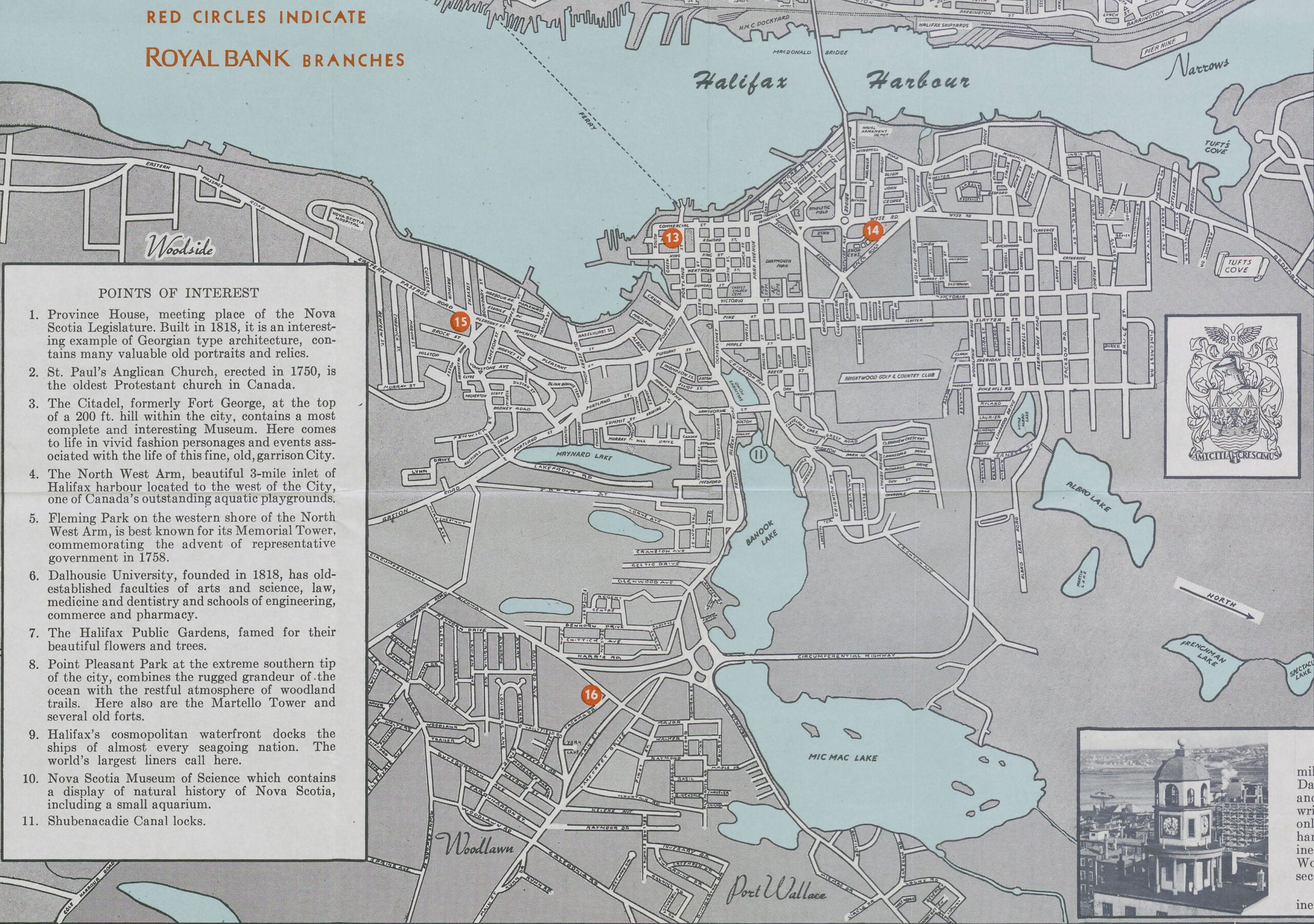
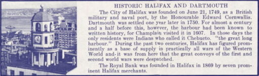
“The Royal Bank was founded in Halifax in 1869 by seven prominent Halifax merchants” isn’t the kind of thing you’d hear from “RBC” these days, that’s for sure, among other things.
Today DARTMOUTH is Canada’s newest city – a community which is noted for its vision and aggressiveness – a sparkplug for Nova Scotia’s resurgence in this decade.
Now wearing its newly won city status like a queen – DARTMOUTH reigns over a population of more than 45,000 – a figure which is growing by the minute.
Covering an area of 15,000 acres, the mushrooming DARTMOUTH is the largest city from a physical point of view anywhere in the Maritimes.
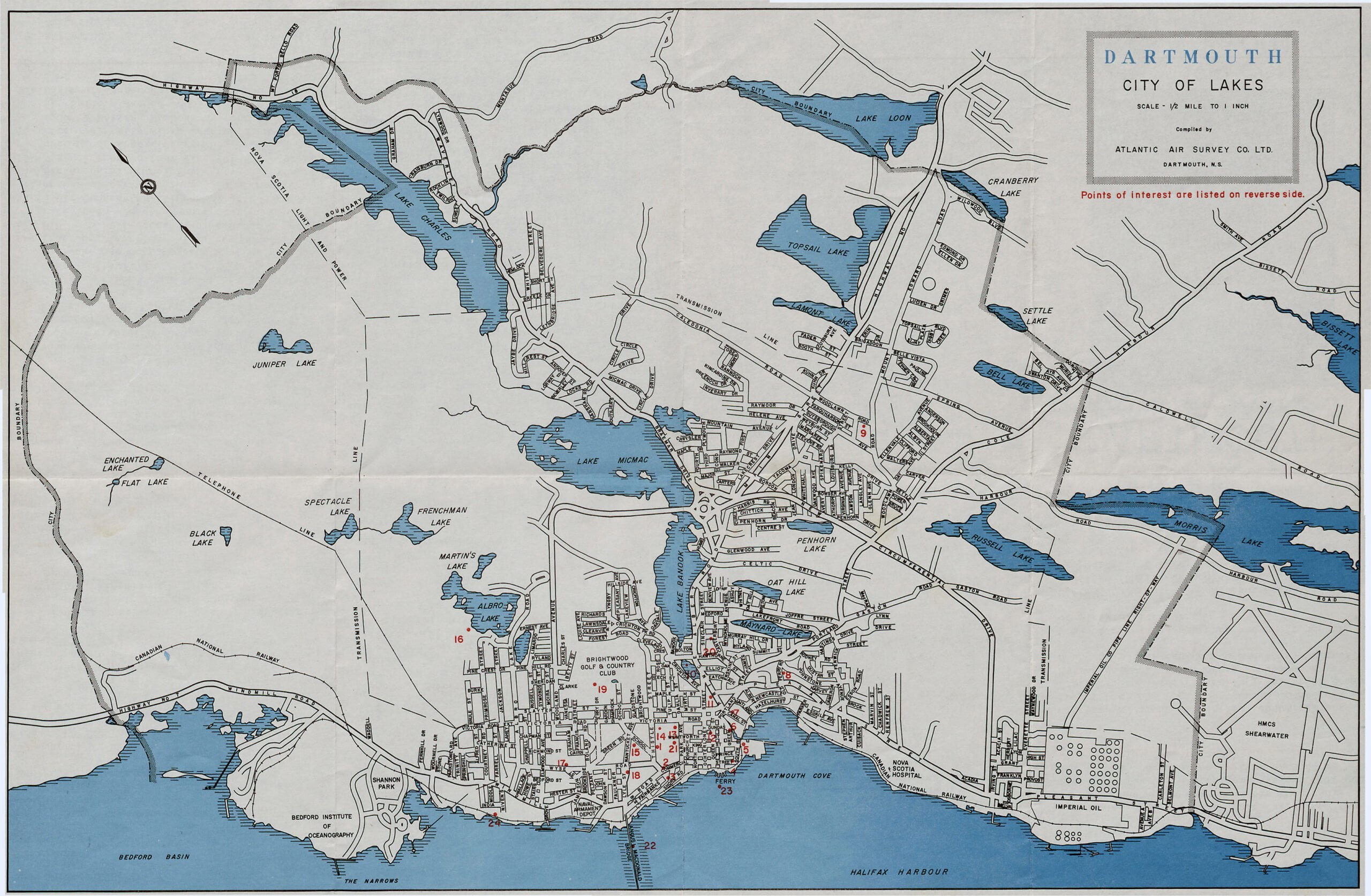
Its inland waters, many of which are protected by public ownership for the enjoyment of future generations, are a source of undying pride and have become Dartmouth’s trademark across Canada.
Accommodations
Our local Tourist Bureau is capable of providing you with detailed information on tourist accommodations in the metropolitan Dartmouth area. Facilities to suit all pocketbooks are available, ranging from the two newly opened motels at Graham’s Corner to our mid-city Belmont Hotel. For the homier atmosphere, the facilities of Hawthorne House, near the lakes, is the answer.
Shopping areas
Two fine shopping areas, providing an inviting place for Dartmouth visitors to seek out unusual gifts and souvenirs, or another aspect of Canada’s newest city which should not be overlooked. Both the downtown business area and the bustling Dartmouth shopping center have a very fine variety of stores, and between the two can satisfy the most discriminating shoppers.
Fishing and hunting
The Eastern shores of Nova Scotia have long been noted for their excellent fishing and hunting areas. For saltwater fishing in the immediate area of Dartmouth, we find Rich catches of pollock and mackerel, while other varieties quite often hooked include haddock, hake, halibut and cod. Deep sea fishing tours for tuna are also available by appointment in the Dartmouth area. More information may be obtained from the local tourist bureau. As for freshwater fishing, we find that the Atlantic salmon, speckled and Brook trout, particularly in the Musquodobit river, which is only about 25 miles from the city limits. Fishing streams extend along the entire East Coast line. The sporty sebago salmon may be fished out of Shubenacadie, Grand Lake – a few miles north of our city. Principal game hunted in Open season within reasonable driving range of Dartmouth – include whitetail or Virginia deer, hair or snowshoe rabbit, black bear, wild or bobcat, red fox and raccoon.
Recreational highlights
There are five supervised public beaches within the city – one at Birch Cove on Lake Banook, and another at the foot of Lake Banook between our two canoe clubs, the Banook and Micmac A.A.C. On Lake Micmac, the 2nd of Dartmouth’s famous chain of lakes – there is sunrise Beach at the Port Wallace walks part of the old Shubenacadie canal, referred to in the history of Dartmouth. On Maynard’s lake, at the top of Portland street, we have the Kinsman Playgrounds, and a public supervised swimming area. In addition to the freshwater swimming areas, lovely silver sands on the Atlantic is but a 20 mile drive from downtown Dartmouth.
For aesthetic recreation, visitors will enjoy the flowers and view at the Dartmouth Civic Park, located directly behind City Hall, and the Tourist Bureau, or a visit to Sullivan’s Pond on Ochterloney Street and Prince Albert Road.
Natal Day
Dartmouth Natal Day, each year falling on the first Wednesday in August, marks the traditional climax to regatta competitions. If you are in the Province during this period, be sure to help us celebrate.
Churches
Represented among the various denominations in our City are Anglicans, Roman Catholics, Presbyterian, Baptist, United, Salvation Army, Mormon, as well as minority groups such as Nazarene, Christian Church, and Jehovah Witness.
Some of our major churches and their pastor or minister include: United (St. James) – Rev. W. Grant MacDonald Anglican (Christ Church) Dr. L.F. Hatfield Baptist (First Dartmouth) Rev. Earl Ward Catholic (St. Peter’s) Msgr. Gerald Murphy
In the narrows off here, occurred the disastrous harbor explosion of 1917, when a munition ship blew to pieces. Honorable Joseph Howeresidence at nearby armament Depot site (–between Jamieson and Dawson Streets on the harbor side of Windmill Road) 1863 to 1869
Scenic drives
Pleasant Street to Eastern Passage and Silver Sands – enjoy a pleasant drive along the eastern shore of Halifax harbor.
The Ocean Highway – enjoy miles of scenic driving along the cool, wide open Waters of the Atlantic Ocean from coal harbor to Chezzetcook, with fishing villages and miles of Sandy saltwater beaches.
Lake-lined Waverly road – in contrast to the saltwater type scenery, this route takes you along the shores of four beautiful, freshwater lakes on a highway lined with trees.
Our Tourist Bureau receptionists will give you additional information.
For Your Guidance
Following is a list of most of our service clubs and community organizations: Junior chamber of commerce, P.O. Box 71, Dartmouth. Ivan Greek, President Chamber of commerce (E.A. House) Lions Club (Elroy Moser) Kinsman Club (Ray Wambolt) Kiwanis Club (Gary Low) Dartmouth Y’s Men (Gerald Eisner) Rotary Club (Donald Robert) Gyro Club (A. McGinnis)
Private Clubs (Membership not restricted) Brightwood Golf and Country Club, Owls Club, Banook Canoe Club, Mic Mac Club.
This guide to places of interest in historic Dartmouth has been prepared for you by the Dartmouth Chamber of Commerce and the Junior Chamber of Commerce.
We hope you have enjoyed your visit to Dartmouth. If there are any features you particularly enjoyed, or criticisms you may have to offer us, we would welcome hearing from you. Please write to the Dartmouth Tourist Bureau, Dartmouth.
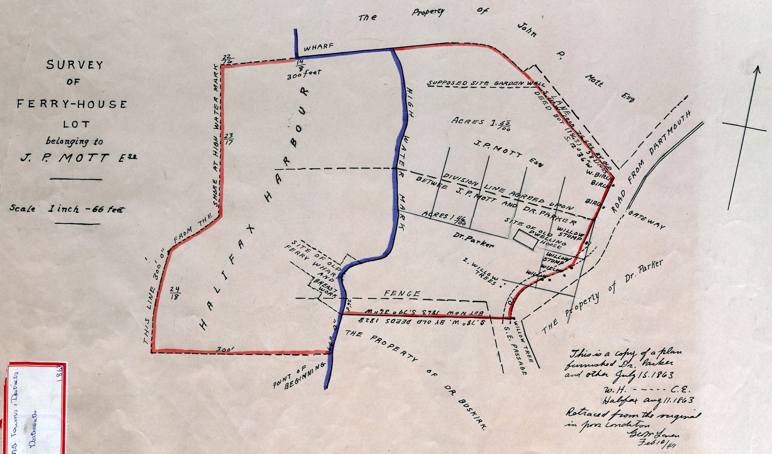
This map encompasses the bottom of Old Ferry Road once known as “Green Lane”, near Newcastle Street and Hazelhurst Street today. The (once massive) willow trees seen here are noted elsewhere.
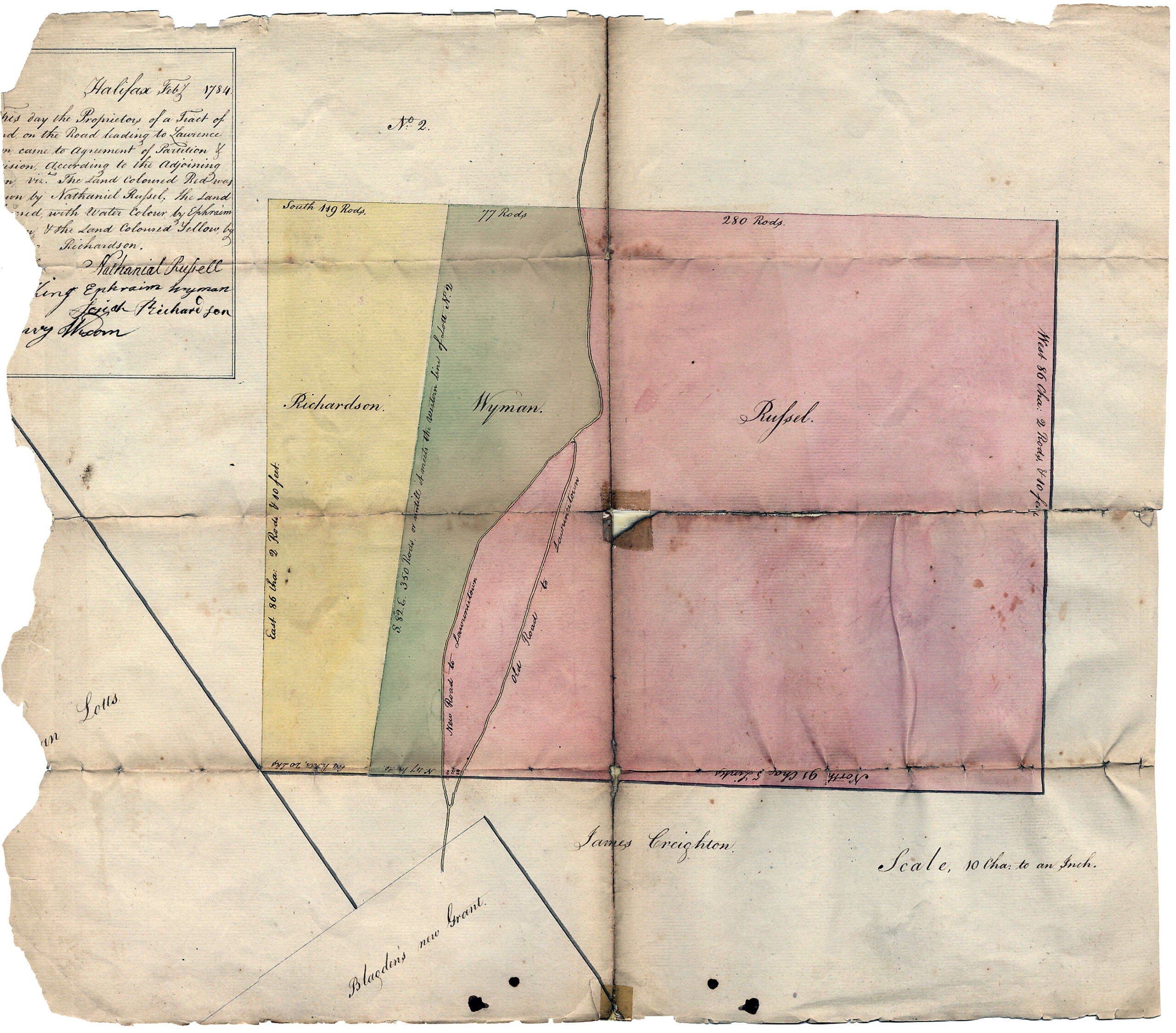
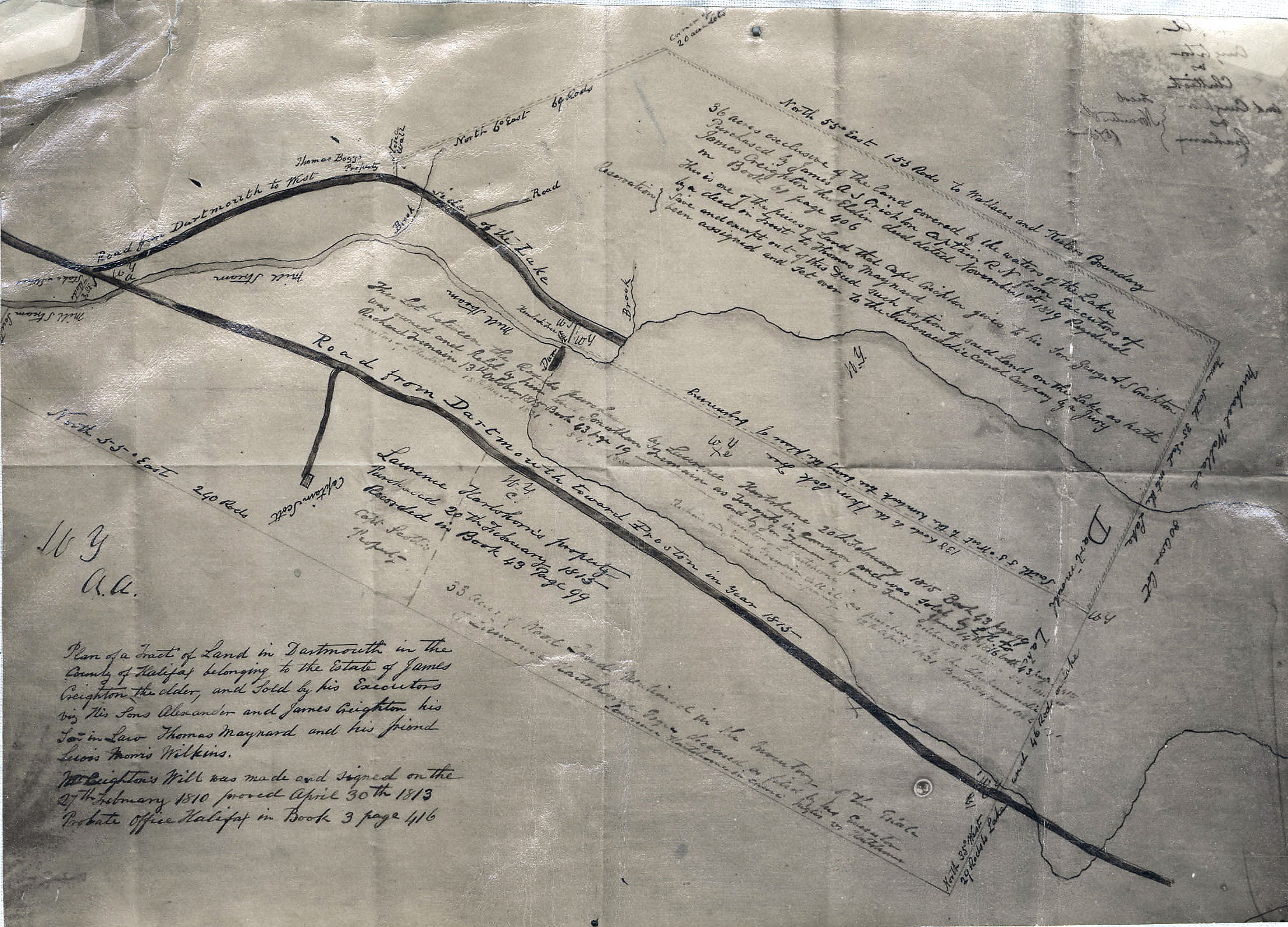
“Halifax, Feb (2?) 1784. This day the proprietors of a tract of land lying on the road to Lawrence Town came to agreement of partition of division according to the adjoining [??], viz. the land colored red was [??] by Nathaniel Russel, the land [??] with water color by Ephraim (Wyman), and the land colored yellow by Richardson.”
“The German Lotts” seen at left, James Creighton’s grant as well as Blagden’s new grant seen at bottom.
No. 2 at top is in reference to the plot granted to Benjamin Bridge as seen here. (No. 5 would be to the right of No. 2, land granted to Benjamin Green, not noted here).
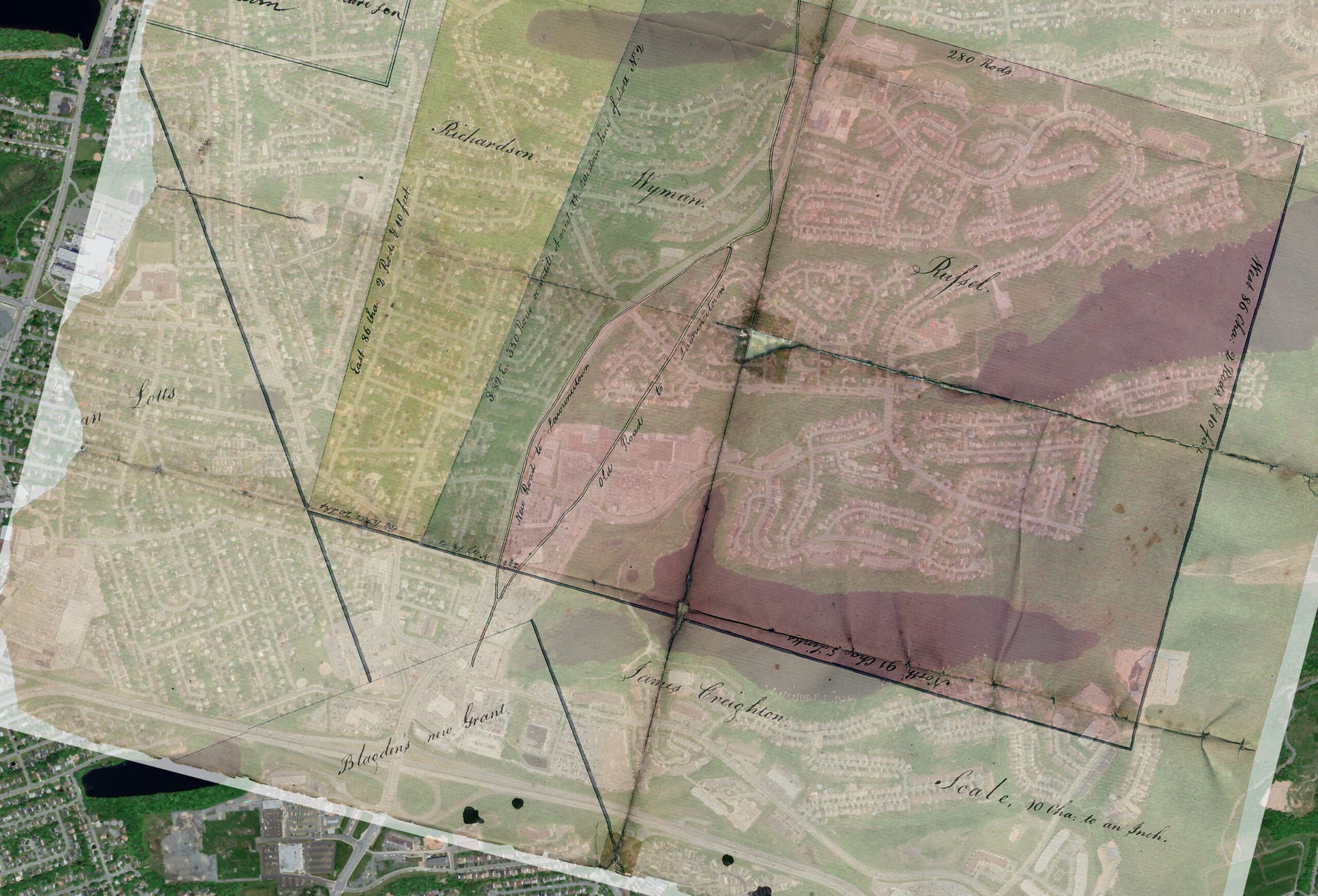
“New Road to Lawrencetown” is now Portland Street, here you can see the approximate location of these tracts today, the 111 highway seen at bottom, Main Street at upper left, Bell Lake at top, Russell Lake at the bottom right.
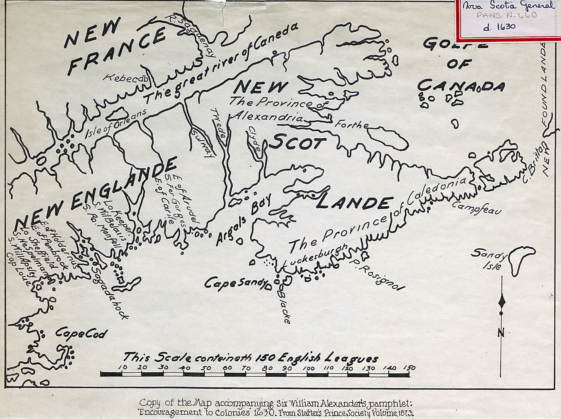
Argals Bay, now the Bay of Fundy, must be a reference to Samuel Argall. Interesting that “The province of Alexandria” as well as “The Province of Caledonia” seem to align with the general jurisdictions of New Brunswick and Nova Scotia today.
Other features include “Cape Brittan” as well as Canso (Campseau), “Blacke” at Nova Scotia’s southern tip, perhaps an earlier derivation and the source of “Cape Negro”, “Cape Sandy” appears to be Cape Sable Island, “Sandy Isle” being Sable Island, “P. Rosignol” perhaps is reference to Western Head, at the mouth of the Mersey River whose source is Lake Rosignol. “Luckesburgh” is also noted, in reference to what, I’m not sure.