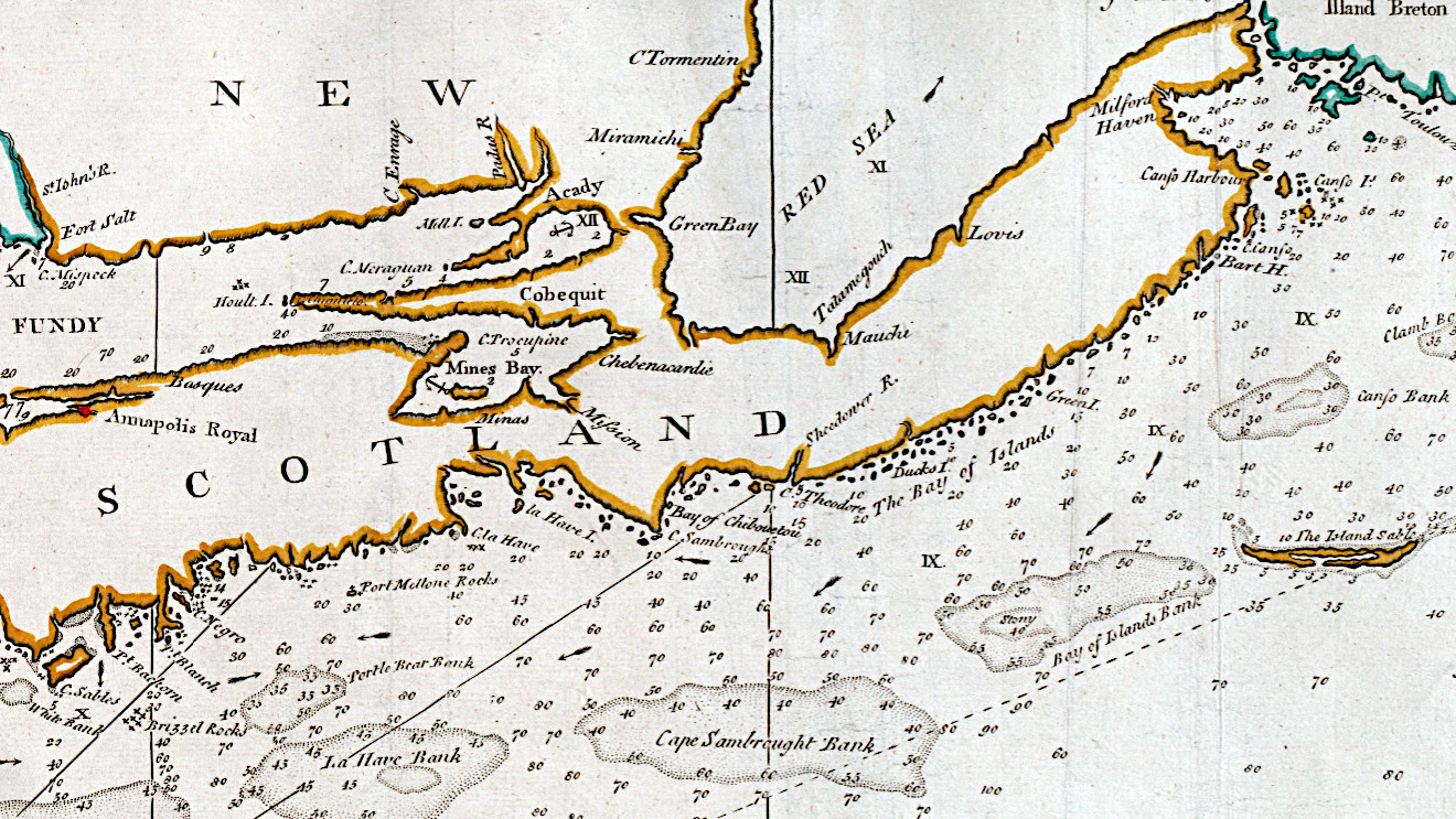
“Sesembre” or Sambro, which is at the mouth of Halifax Harbor. I’m not sure if “Baye Senne” then is meant to represent it or another subsequent indentation in a coast that is nothing but indentations and harbors, but it does serve as a reference point that’s noted on other maps, much like the Bay of Many Islands (Toutes Isles).
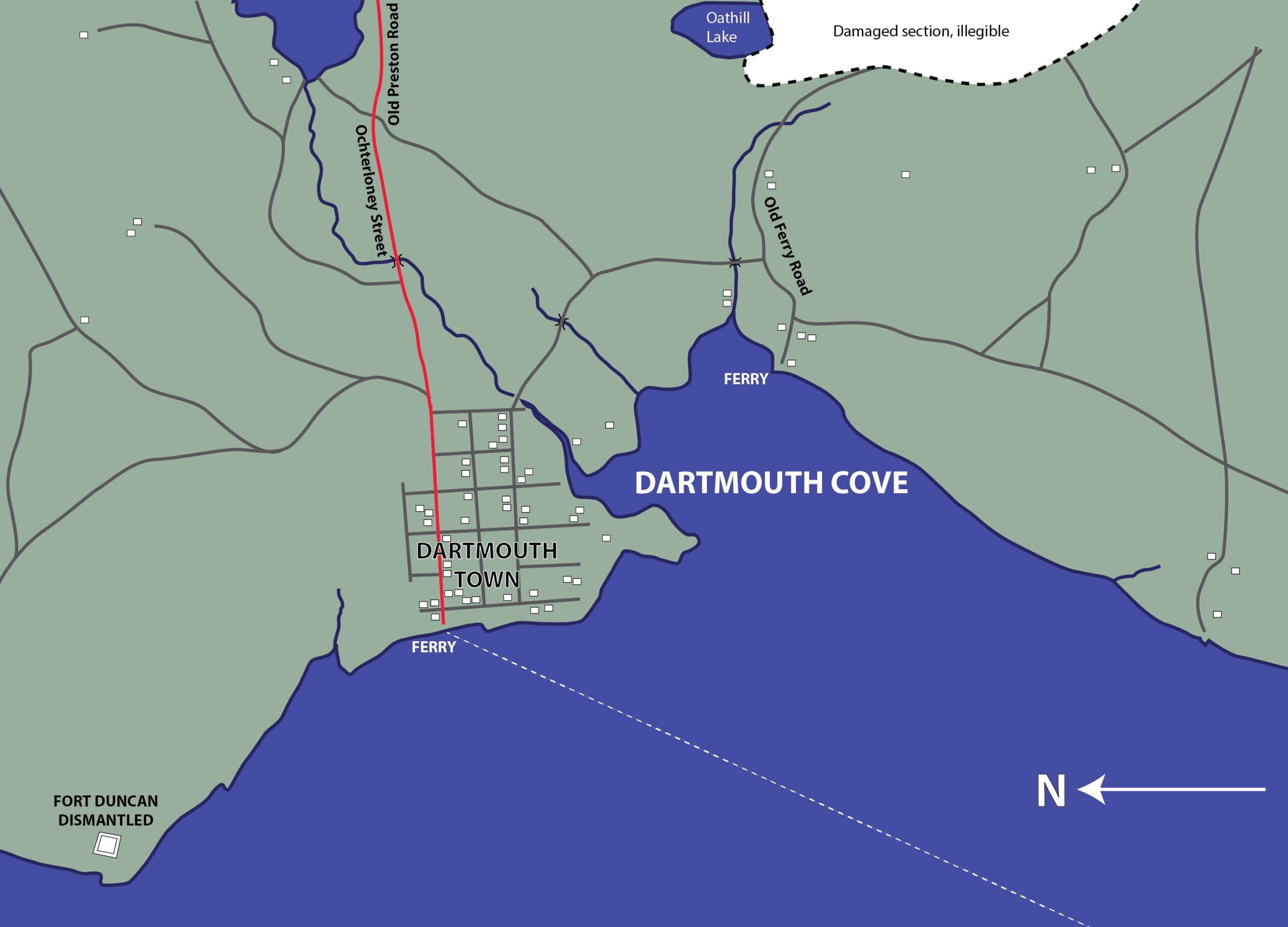
The names of Ochterloney and Quarrell (now Queen) were commemorated by streets in downtown Dartmouth. The extension of the first named thoroughfare marked the beginnings of the present no. 7 highway.
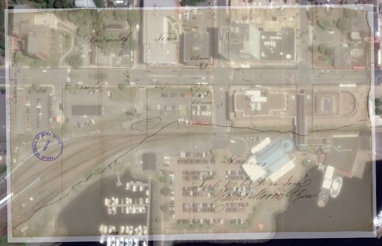
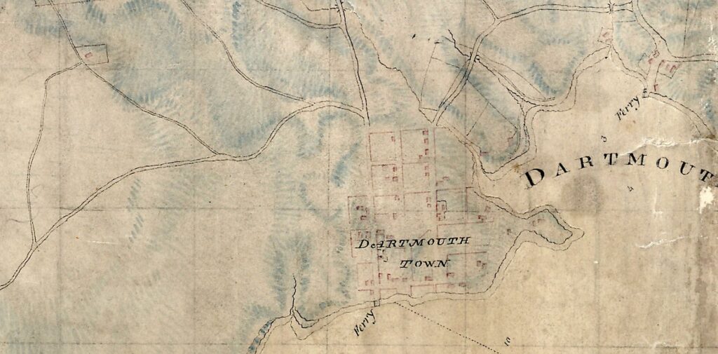
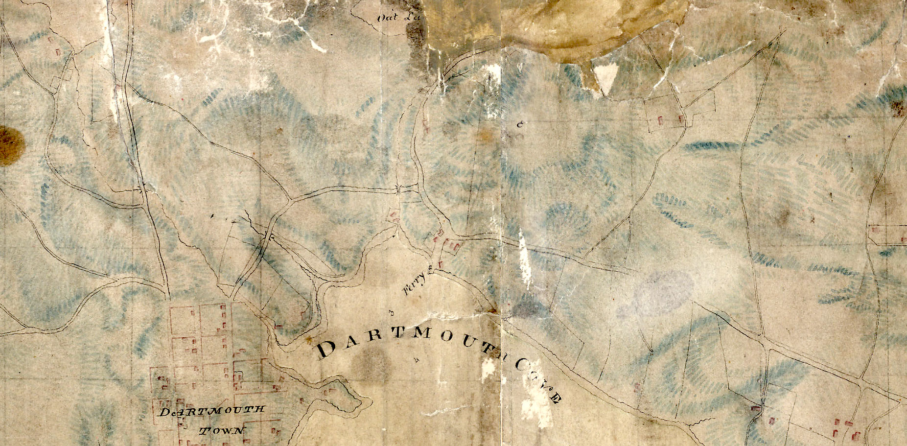
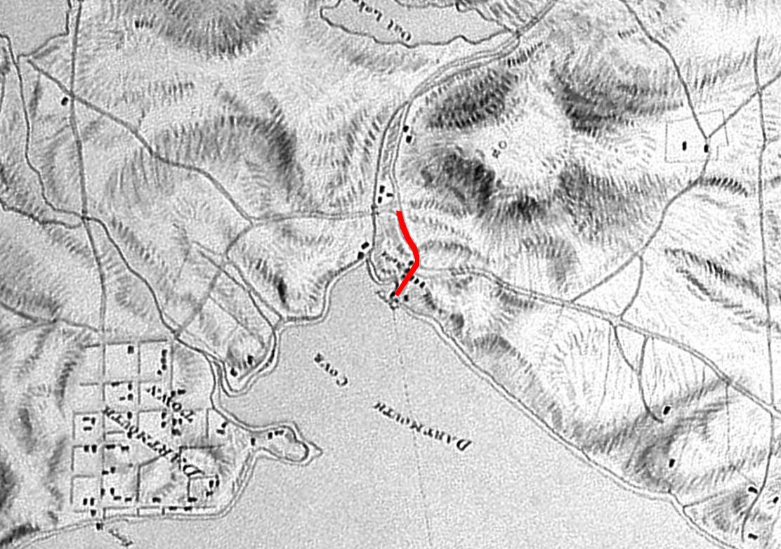
Ochterloney Street at the harbor, second street from right above, what is now Alderney Drive travelling horizontally along the shore. Seth Coleman owned the land to the north side on both sides of Alderney at Ochterloney.
Below, “Ferry” marks the foot of Ochterloney Street where John Skerry was the proprietor, while what is now Victoria Road serves as the northern extent of the town plot.
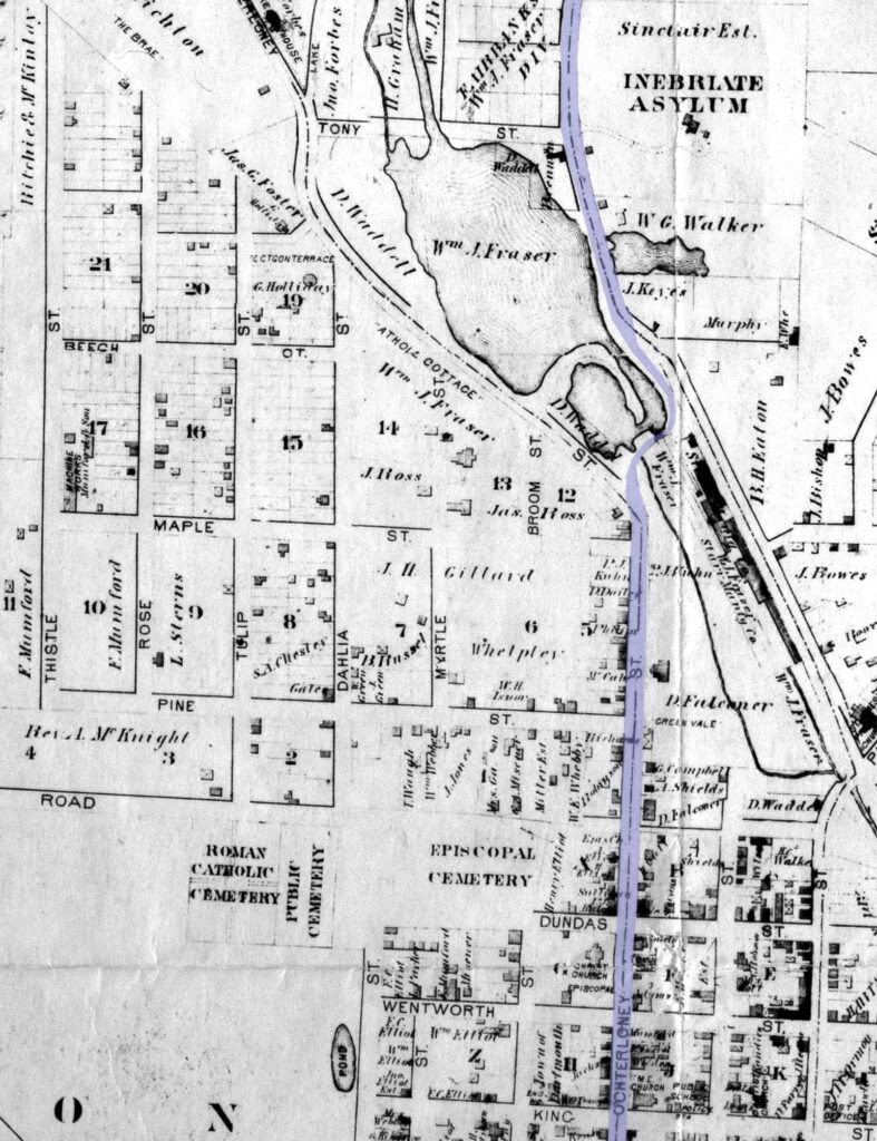
From the old town-plot boundary, (Ochterloney Street) veered to the north beyond Pine Street. Opposite the Greenvale Apartments, the antique stone-house demolished only recently, and apparently built “on the bias”, probably fronted the original line of Ochterloney Street as it continued through the property, now occupied by the Nova Scotia Light and Power plant, and headed for the millstream flowing from the lakes. This road then bridged the stream near the western end of the circular-dam [which then did not exist] and ran diagonally to the rise of Prince Albert Road, just below Hawthorne St. Mounded evidence of this route used to be exposed whenever Sullivan’s Pond was drained.
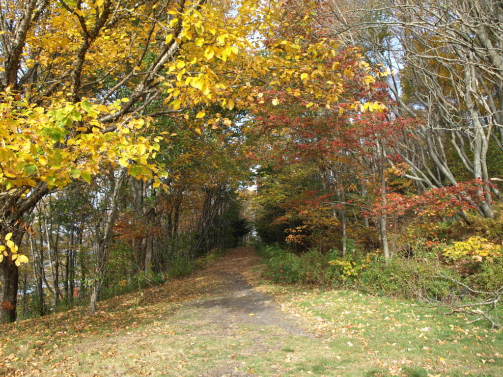
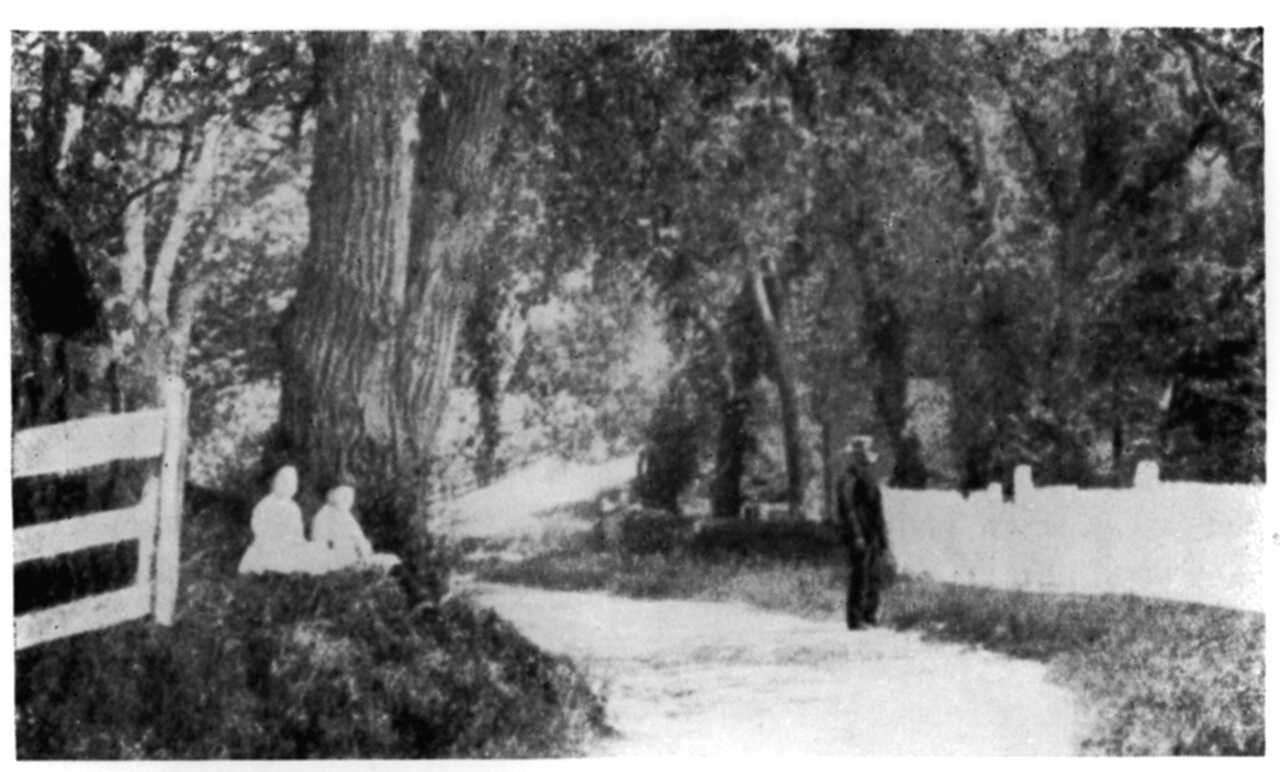
The original road beyond the Sinclair Estate at First Lake is the Preston Road, the path as seen below, located above Prince Albert Road, though the ROW ends abruptly before Cottage Hill Drive.
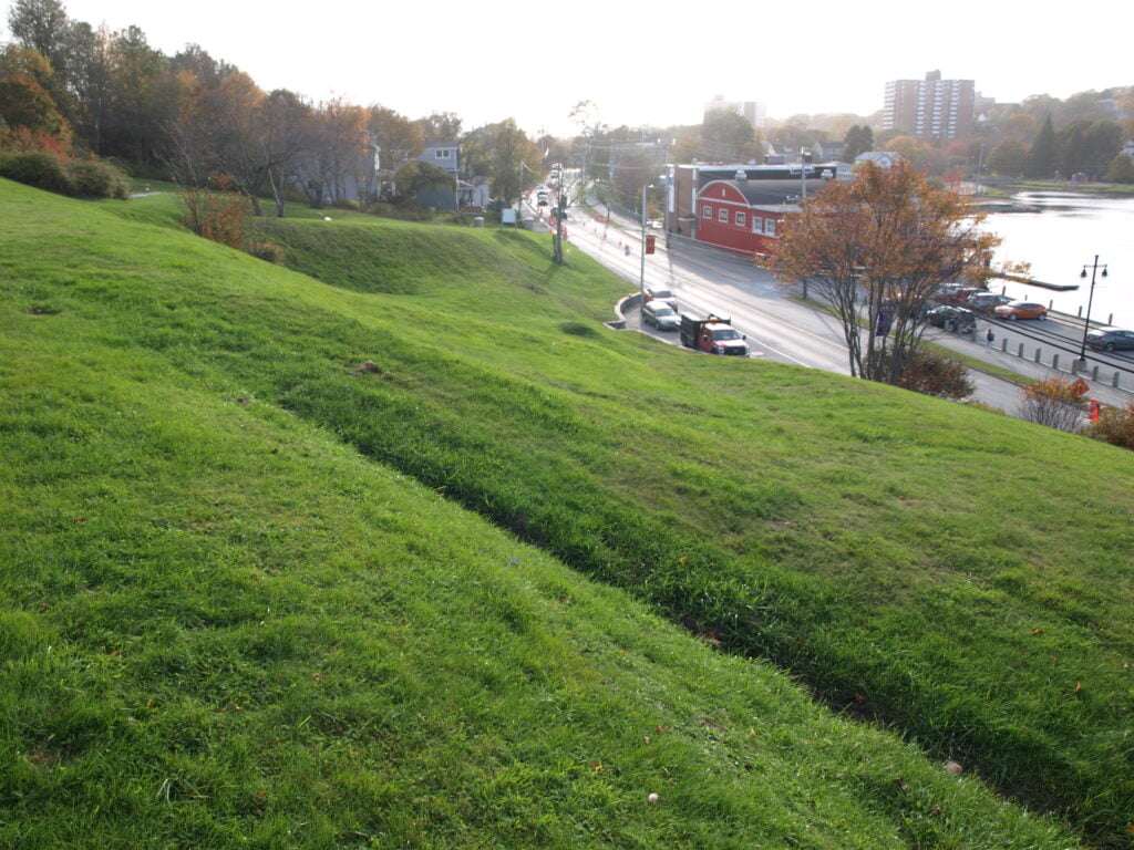
Looking west towards Sullivan’s Pond.
At Silver’s Hill, the slope no doubt originally extended down to the lake shore. Pioneer trails generally avoided lowlands. Hence this “new” road to Preston followed the broad path still seen on the hillside below Sinclair Street, until it emerged around the bend at that bay of the lake called by the Mi’kmaq “Hooganinny Cove”.
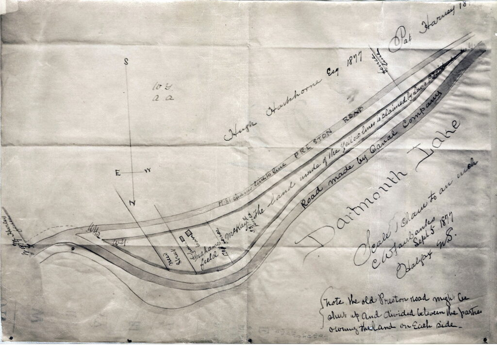
This map shows the (old) Preston Road up above, the lower road or the “Road made by the Canal Company” is the present day Prince Albert Road at Silver’s Hill, the left edge of the map being near where Cranston Avenue is today if it were to continue through Benview to meet with Prince Albert Road. “Hooganinny Cove” would be at bottom left. “Dartmouth”, 5 September 1877. https://archives.novascotia.ca/maps/archives/?ID=963.
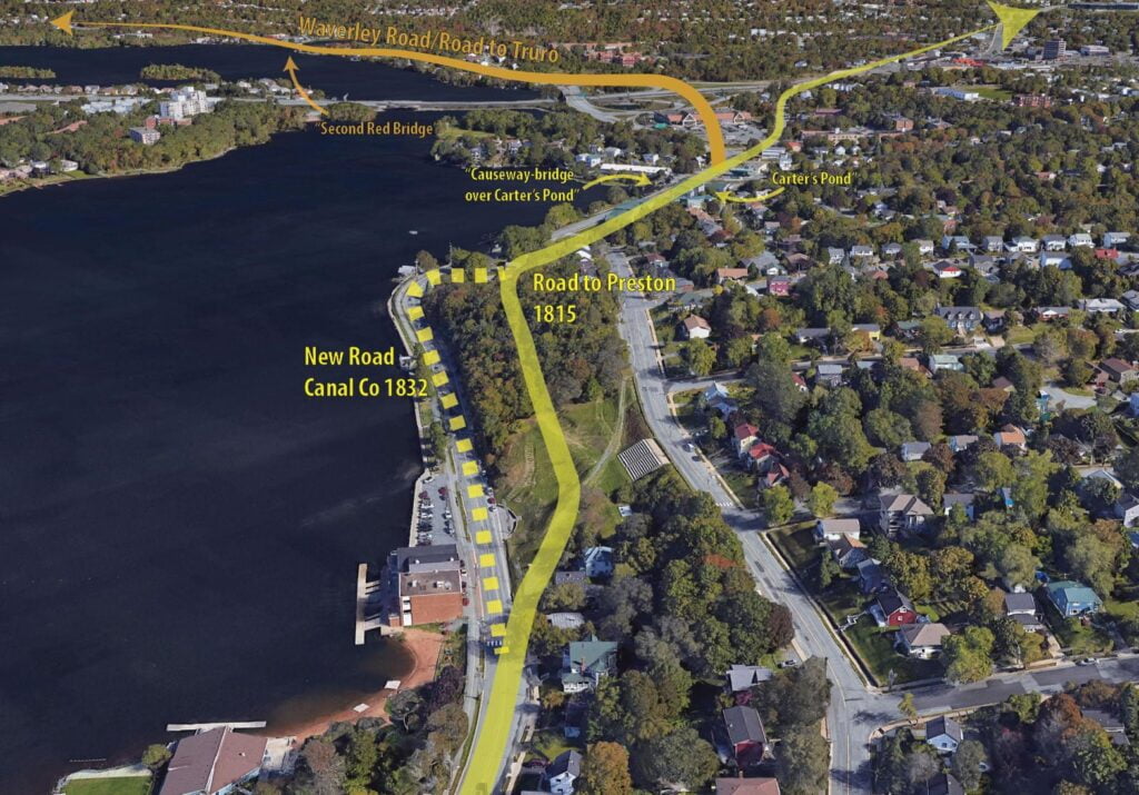
The causeway-bridge over Carter’s Pond at the town limits, was very likely built during the time of the Maroons, for the road is shown on military maps as early as 1808, indicating that this section of highway had been constructed some years previously.
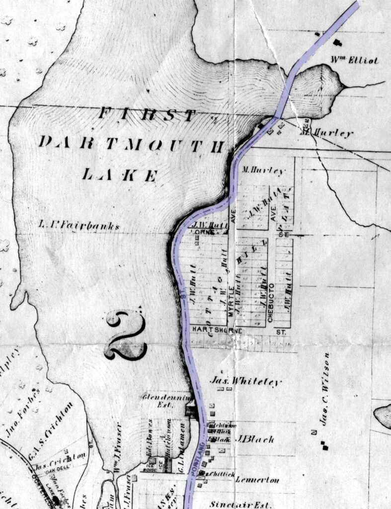
At left Ochterloney Street labelled as Portland Street, First Red Bridge as mentioned below is seen between Hurley and Elliots at (what was once) Carter’s Pond, “Cottage Hill” subdivision at right didn’t come to pass, at least not as originally planned. “Preston Road” is shown with a notation “Canal Co road 1832” while the old “Preston Road”, the high road, is noted and dated 1815. Martin also notes a “Preston Road of 1797” which must have been the original path considering it was 1796 when the Jamaican Maroons settled Preston Township.
From the vermilion color of the protective wooden railing, this crossing was long known as “First Red Bridge” to distinguish it from “Second Red Bridge” with similarly colored railing, built about 1826 across the bay of Lake Mic Mac near Miller’s Mountain.
What is now Prince Albert Road, what was once the Preston Road. Its path continued to the right at Graham’s corner to what is now Main Street and eventually the Number 7 highway. To the left at Graham’s Corner what is now Braemar Drive. The nook in the lake that Graham’s corner once navigated, what was recently the Mic Mac Rotary is examined separately here. More on Main Street here, at the top of the map is the continuance of the “Road to Preston” in the 1820s.
Here is one of, if not the earliest plans available showing Old Ferry Road as far as Cole Harbour (at left), which was originally known as the road to Lawrencetown. Now, Old Ferry Road, Portland Street and Cole Harbour Road. A few modern features added at right to give context. More on this road as it traversed through Woodlawn in the 1780s and 1820s.
Thursday the 16th past, the Settlers of Lawrence Town set out from this Town in order to go by Land for that Place, having a strong Guard of 200 Regular Troops, exclusive of Officers, commanded by Capt. Stone, with a Number of Rangers; which Place they arrived at the Saturday following, having made a Road from Dartmouth Side to the said Town, which is but little more than 11 Miles distance from us…
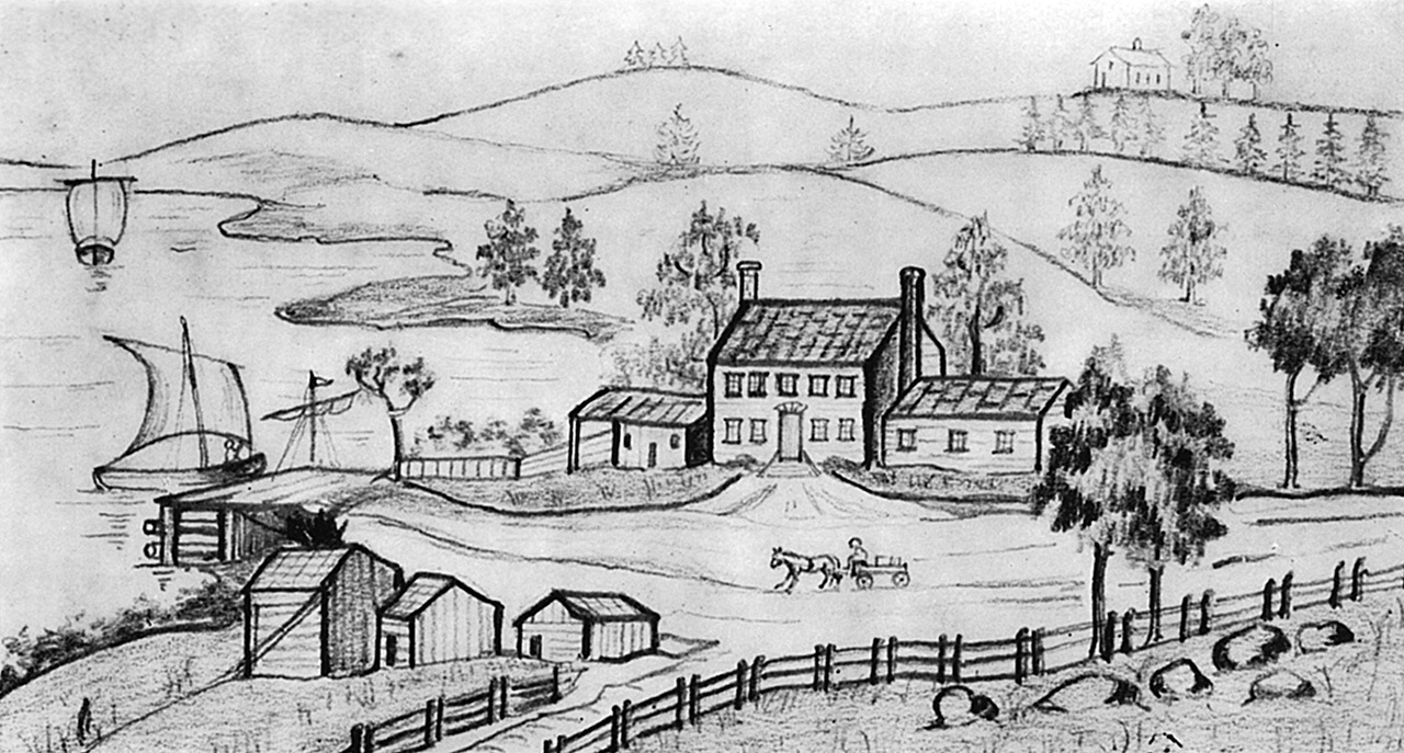
Old Ferry Inn. Farmers stabled horses here, and sailed to Halifax with produce. Road in foreground extended easterly to the Passage. This sketch was made about 1820.
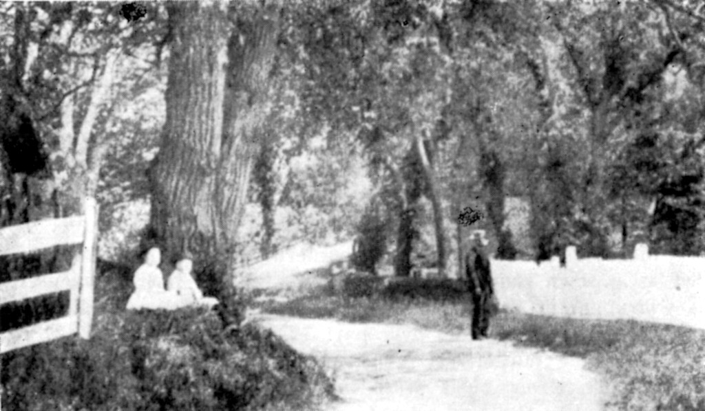
This is the lower part of Old Ferry Road, once known as “Green Lane” The curve in the foreground leads to the Old Ferry Wharf. The fence on the left encloses the South End Lawn Tennis Courts, and from there to the shore stood Regal willow trees. Two of them were named for King George III and Queen Charlotte, and two others for Mr. and Mrs. James Creighton of “Brooklands” who had them planted perhaps in the late 1700’s. When this picture was taken about 1900, they were of an enormous size. The whole road was a beautiful shady walk from the wharf all the way up to the present Portland Street.
The fence on the right borders Dr. Parker’s fields at “Beechwood”, and ran along near the location of the new house at 71 Newcastle Street.
The route of the obliterated road to the shore is identified by manholes of the sewer pipe running to Parker’s Wharf.
The remains of what used to be the Old Ferry Wharf at the foot of Old Ferry Road still remain visible, particularly at a very low tide – seen here the morning after Hurricane Juan:
“A large fold-out chart of the New England coast appeared from 1732 to 1760 in “The English Pilot, The Fourth Book”, the standard 18th-century British navigational guide to American waters … Reduced from a chart published in 1729 by Boston ship captain and America’s earliest chart maker Cyprian Southack, this particular chart shows the northeastern coast from Long Island to New Scotland (Nova Scotia).”
From Labrador to Acadia (present-day southeast Maine) seen here, only Newfoundland is identified by name (Terra Corte Regalis).
“Nautical Atlas of the World, Folio 6 Recto, North Atlantic Ocean” Holanda, António de, approximately 1480-1556 Illustrator. Homem, Lopo, flourished 1517-1565 Cartographer. Manuel I, King of Portugal, 1469-1521 Patron. Reinel, Jorge, active 16th century Cartographer. Reinel, Pedro, born approximately 1464 Cartographer. [publisher not identified], 1519. https://www.loc.gov/resource/gdcwdl.wdl_18557/?r=0.474,0.02,0.309,0.18,0
“Carta d’una parte dell’ America Settentrionale : che serve per ben poter intendere le pretensioni delli Inglesi, esposte ne loro memoriali in occasione della regolazione de limiti con la Francia nell’ America svdetta.” [1755?] [Verona?] https://collections.library.yale.edu/catalog/15823925
“Bay of Fundy or Argal”, “Gulf of Nova Scotia”, “Cape Britain”
“A new map of Nova Scotia, and Cape Britain: With the adjacent parts of New England and Canada, composed from a great number of actual surveys” Jefferys, Thomas. [London] 1755. https://collections.library.yale.edu/catalog/2040299
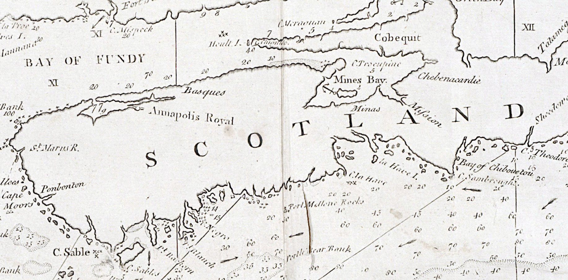
There’s a few settlements noted on the Atlantic coast of Nova Scotia here, “sesembre” being Sambro helps orient Halifax harbor. The settlement between “S” and “R” is of interest, S being “River sainte Margrite” and R “baye senne”.
Watch out for this guy
Champlain, Samuel De, Creator, and David Engraver Pelletier. “Geographical Map of New France Made by Mr. de Champlain of Saintonge, Ordinary Captain for the King’s Navy.” Paris: Jean Berjon, 1612. Map. https://www.loc.gov/item/2021668652/.