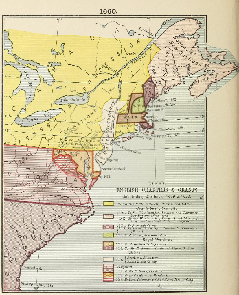
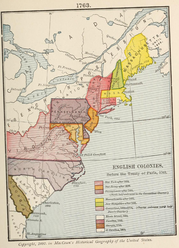
History of the United States, or Republic of America

1620:

1643:

1692:

1776:

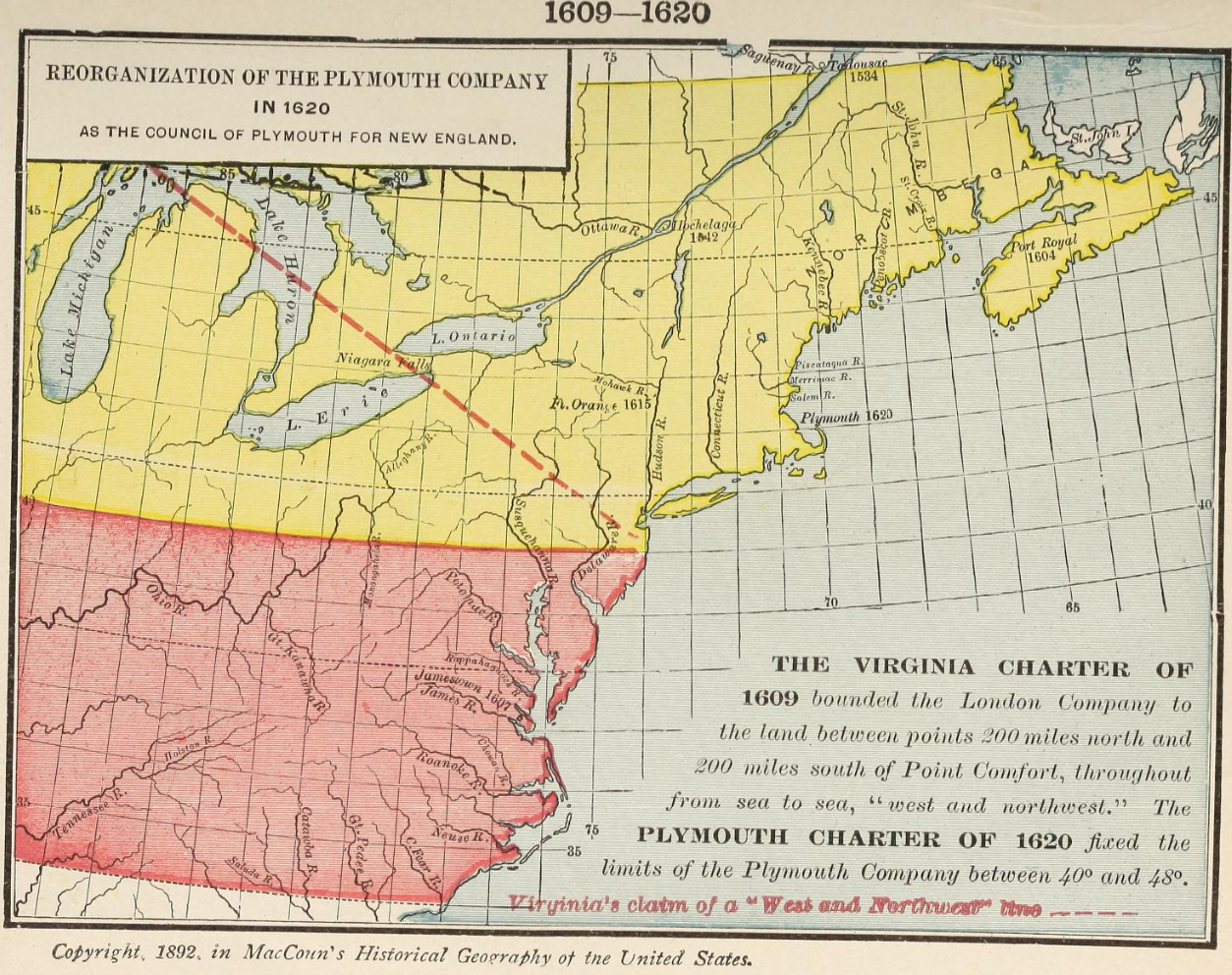
“1524: Smitten by the common passion of the sovereigns of Europe, for American discovery, Francis I. of France turned aside alike from his elegant and his warlike pursuits, and one year before his defeat at Pavia, he found for his service another Italian discoverer. This was John Verrazani, a Florentine, who reached the continent in the latitude of Wilmington, North Carolina. He then sailed fifty leagues south, but finding no convenient harbor, he returned and cast anchor; being the first European who had afforded the astonished natives the spectacle of the white race. They were received with rude, but fearless hospitality. The color of the Indians, the French compared to that of the Saracens. They looked with wonder upon their wild costume, made of the skins of animals, and set off by necklaces of coral and garlands of feathers. As they again sailed northward along the coast, their senses were regaled by the verdure of the forests, and the perfume of the flowers which they scented from the shores.

At a fine harbor, supposed to be that of Newport in Rhode Island, Verrazani remained fifteen days, and there found “the goodliest people he had seen.” From thence he followed the north-eastern shore of New England, finding the inhabitants jealous and hostile. From the peninsula of Nova Scotia, he returned to France, and wrote a narrative of his voyage, which is the earliest original account of the coast of the United States.”

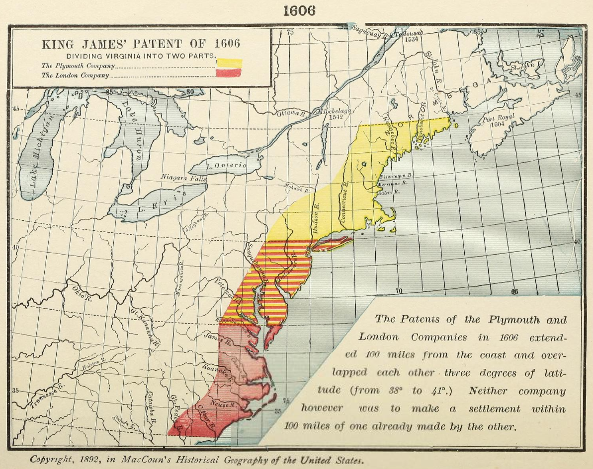
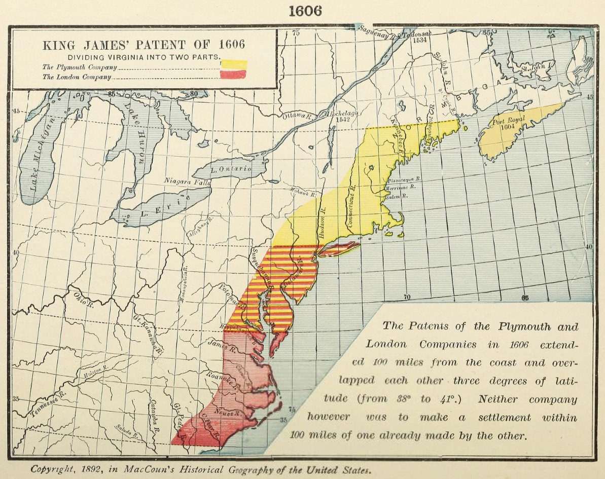
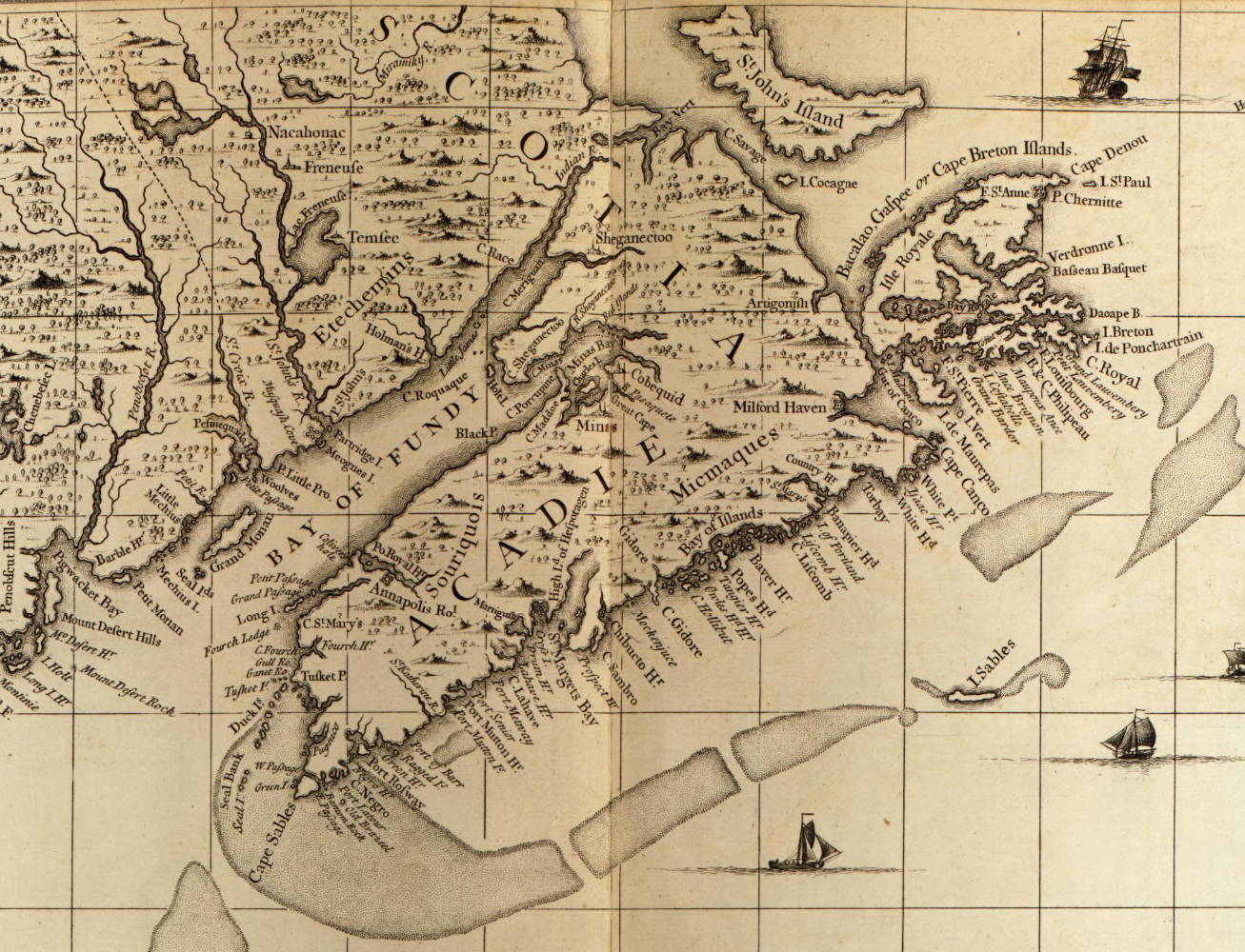
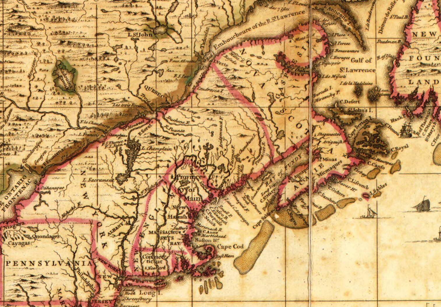
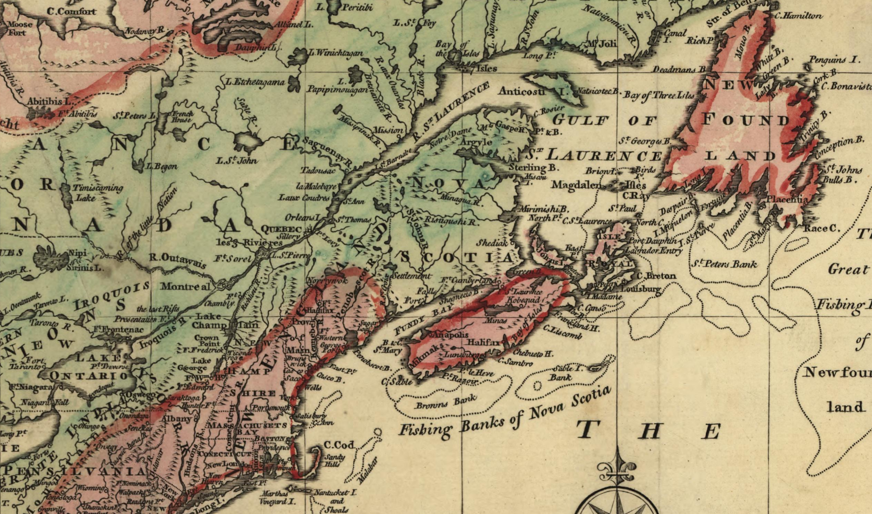
“1692: In none of the colonies did the Revolution in England produce a greater change than in Massachusetts. In 1692, king William, who had refused to restore its former government, granted a new charter, which, extending its limits, but restricting its privileges, commenced a new era in the history of this colony. Massachusetts now embraced, besides the former territory, Plymouth, Maine, and Nova Scotia; extending north to the river St. Lawrence, and west to the South Sea, excepting New Hampshire and New York; and including, also, Nantucket, Martha’s Vineyard, and the Elizabeth islands. Almost the only privilege which the new charter allowed the people, was that of choosing their representatives. The king reserved to himself the right of appointing the governor, lieutenant governor, and secretary; and of repealing all laws within three years after their passage.”

“1755: General Braddock was to attack Fort du Quesne ; Gov. Shirley was to lead the American regulars and Indians against Niagara; the militia of the northern colonies were to be directed against Crown Point; and Nova Scotia was to be invaded.

Early in the spring, the French sent out a powerful fleet, carrying a large body of troops, under the Baron Dieskau, to reinforce the army in Canada.

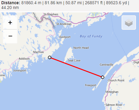
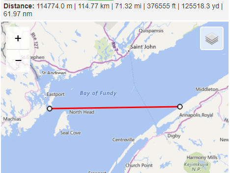
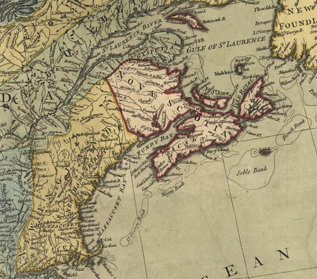
For the expedition against Nova Scotia, three thousand men, under generals Monckton and Winslow, sailed from Boston on the 20th of May. They arrived at Chignecto, on the Bay of Fundy, the first of June. Here they were joined by 300 British troops, and proceeding against BeauSejour, now the principal post of the French in that country, invested and took possession of it, after a bombardment of five days. The fleet appearing in the river St. Johns, the French set fire to their works, and evacuated the country. Thus, with the loss of only three men, the English found themselves in possession of the whole of Nova Scotia.

Col. Washington, on his return from the Great Meadows, had public thanks voted him by the house of burgesses. He rejoined his regiment at Alexandria, and was ordered by the governor to fill up his companies by enlistments — go back immediately — conquer the French, and build a fort beyond the mountains. He wrote to a member of the council, showing the folly and impracticability of the scheme; and it was given up.”

“1756: The campaign of 1756 had been, during the preceding autumn, provided for by the colonists ; but the bad arrangements of the British cabinet palsied their efforts. Although Shirley had been appointed by the crown, commander-in-chief of the forces, yet Winslow, in consequence of his success in Nova Scotia, had the confidence of the people, without which troops could not be raised. The generous Shirley ceded his claim, and the unfinished plans of the preceding campaign were to be again attempted.”

Willard, Emma. History of the United States, or Republic of America. [ New York, Barnes, 1847] Retrieved from the Library of Congress, https://archive.org/details/historyofuniteds00willuoft/

An historical geography of the United States

1606:

King James’ Patent of 1606, Dividing Virginia into two parts.

The patents of the Plymouth and London companies in 1606 extended 100 miles from the coast and overlapped each other three degrees of latitude (from 38° to 41°.) Neither company however was to make a settlement within 100 miles of one already made by the other.”

[Norumbega noted on this map].

[Reading the patent itself it states “situate, lying, and being all along the Sea Coasts, between four and thirty (34°) Degrees of Northerly Latitude from the Equinoctial Line, and five and forty (45°) Degrees of the same Latitude, and in the main Land between the same four and thirty and five and forty Degrees, and the Islands thereunto adjacent, or within one hundred Miles of the Coast thereof”.

Hinted on the map, though not shaded along with the rest of the Plymouth Company lands unlike in earlier works, is the fact that 45° latitude also traverses across Nova Scotia, which, despite being a peninsula, is undoubtedly a part of the mainland. Is this revision meant to satiate those to the north, or their proprietors, after their “Confederation”? If this were a one-off I’d more less likely to attribute it to any kind of an arrangement, but there are other sources which confirm this earlier view. Even if Nova Scotia were an island and not connected to the mainland, it would still be within 50 miles of the seacoast of the shaded area, let alone 100 miles.]

[This might provide insight into the rationale behind naming conventions used for certain communities in Nova Scotia, such as “Virginia East”.]

Virginia East, Nova Scotia

1609-1620:

“Reorganization of the Plymouth Company in 1620 as the Council of Plymouth for New England.

The Virginia charter of 1609 bounded the London Company to the land between points 200 miles north and 200 miles south of Point Comfort, throughout from sea to sea, “west and northwest.” The Plymouth charter of 1620 fixed the limits of Plymouth Company between 40° and 48°.”

1640:

“French claims”

1655:

“French claims”

1660:

“Barony of New Scotland”

“Council of Plymouth, of New England. Grants by the Council:

1621 To Sir W. Alexander, Lordship and Barony of New Scotland (Nova Scotia)

1635 To Sir W. Alexander, Pemaquid and Islands of Long, Nantucket and Martha’s Vineyard.”

1664:

“Grants to the Duke of York”

1763:

“Massachussetts until 1696”

[There were other English colonies that existed in 1763 not included in this map. While they did not go on to become part of the United States, they were fellow colonies, at least up until ‘the commencement of hostilities’.]

Maccoun, Townsend. An historical geography of the United States. [New York, Boston etc. Silver, Burdett & company, 1911] Map. Retrieved from the Library of Congress, www.loc.gov/item/11031776/

A Map exhibiting a view of the English Rights, relative to the Ancient Limits of Acadia

Explanation: Limits proposed by the English commissaries, Sep. 21, 1750, and Jan 11, 1751, exclusive of Cape Breton : with short strokes: ——-

Limits of Acadia, and its banks, by the treaty of Utrecht, marked thus: +++++++

District of Port-Royal by the same treaty, enclosed with a strong line: _______

Limits of Nova Scotia, as granted to Sir William Alexander, September 10, 1621, by dots: …….

(Oliver) Cromwell’s grant to La Tour, Crown and Temple, August 9, 1656: =======

The country restored (to France), by the treaty of Breda, includes all granted by (Oliver) Cromwell, with the country from Mirlegash to Canseau.

The government of La Tour in 1638 shaded: |||||||

The government of Charnesay in 1638 shaded: \\\\\\\

The government of Denys in 1654 shaded: =

Noted: Bay of Fundy or Argal, Gulf of Nova Scotia

“Explanation:

Nova Scotia, or Acadia, as claimed by the English commissaries under the Utrecht treaty in 1713 with short strokes ——

Nova Scotia, as granted to Sir Alexander 1621, as divided by him into two provinces, Alexandria and Caledonia, all to the east of this line -.-.-.-

Acadia, according to Champlain, from 1603, to 1629, the same as Nova Scotia (excepting Cape-Breton) with the country west to Penobskot River and the small pricked line ……

Acadia, as granted by Louis XIII and XIV from 1632, to 1710, the same as claimed by the English. ——

Nova Scotia, as enlarged to the river Kennebek, by father grant to the Earl of Sterling, 1635, the same with Acadia of both Louis’s.

Acadia proper, according to the bipartite division, mentioned by Charlevoix, upright shades, |||||||

Charnesay’s government in 1638, bounded thus =======

La Tour’s government in 1638, marked thus +++++++

Cromwell’s grant to La Tour, Crown, and Temple, in 1656, exclusive of Cape Breton, enclosed with a small line ________

Acadia, as claimed by and ceded to France, at the treaty of Breda, 1667, the same with Cromwell’s grant.

Norembega, according to Dapper’s and Ogilby’s America, between the rivers Penobskot and Kennibek.

The Etchemin’s coast, according to Champlain, p.60 ann Denys, p.31, shaded obliquely \\\\”

Jefferys, Thomas, -1771. A general topography of North America and the West Indies. Being a collection of all the maps, charts, plans, and particular surveys, that have been published of that part of the world, either in Europe or America. London, R. Sayer, 1768. Map. Retrieved from the Library of Congress, www.loc.gov/item/74175046/


Remarks on the French Memorials concerning the Limits of Acadia ; Printed at the Royal Printing-house at Paris, and distributed by the French Ministers at all the Foreign Courts of Europe. With Two Maps, Exhibiting the Limits : One according to the System of the French, as inserted in the said Memorials ; The other conformable to the English Rights, as supported by the Authority of Treaties, continual Grants of the French Kings, and express Passages of the beſt French Authors . To which is added, An Answer to the Summary Discussion, &c. London : Printed for T. Jefferys, at the Corner of St. Martin’s Lane, in the Strand. MDCCLVI. Title ; Explanation for the French and English Maps, 2 pages ; text 110 pages ; 2 folding Maps. Calfextra by Pratt. 80 ( 1l 11s 6d 2973)

This volume surpasses all others for valuable historical, geographical and bibliographical information respecting Nova Scotia or Acadia and part of Canada. The two maps on the same scale show clearly what is claimed by both parties, French and English. They cover the whole territory south of the Gulf of St Lawrence, east of Lake Champlain, and north of Massachusetts, and include all the disputed tracts and grants of the English and French governments. The French map shows the English limits claimed in 1750 and 1751 ; limits of Acadia and Port Royal by the Treaty of Utrecht ; limits of Nova Scotia as granted to Sir Wm. Alexander, 1621 ; Cromwell’s grant to La Tour, Crown and Temple in 1656 ; the country restored to France by the Treaty of Breda ; the government of Denys in 1654, Charnesay’s in 1638, and La Tour’s in 1638. The English map delineates Nova Scotia as claimed by the English by the Treaty of Utrecht, 1713 ; as granted to Sir Wm. Alexander, 1621 ; according to Champlain, 1603-1629 ; with the country west to the Penobscot ; Acadia as granted by Louis XIII and XIV, 1632-1710 ; enlarged to the Kennebeck by further grant to Stirling, 1635 ; Acadia proper according to the tripartite division named by Charlevoix ; Charnesay’s and La Tour’s governments in 1638 ; Cromwell’s grant to La Tour, Crown, and Temple in 1656 ; Acadia claimed by France at theTreaty of Breda, 1667 ; Norembega, between the Penobscot and Kennebeck ; and the Etechemin’s coast according to Champlain and Denys. The text well illustrates and explains these two maps. This copy is quite perfect, but Sheet I (pp. 57-64) is missing in most copies, and is generally supplied by a duplicate of some other sheet. An imperfect copy can be supplied, price 10s 6d. For Memoires’ and ‘ Memorials see Nos 1884, 1891 & 1892.

Stevens, Henry GMB FSA. Stevens, Henry Newton. 1885. “Steven’s Historical Nuggets, Bibliotecha Americana Or A Descriptive Account Of Our Collection of Rare Books Relating to America” https://books.google.com/books/download/Bibliotheca_Americana.pdf

The British & French dominions in North America: particularly shewing the French encroachments through all the British plantations from Nova Scotia down to the Gulf of Mexico

Bowles, Thomas, -1767, and John Bowles & Son. The British & French dominions in North America: particularly shewing the French encroachments through all the British plantations from Nova Scotia down to the Gulf of Mexico. [London: Printed for T. Bowles in St. Pauls Church Yard & John Bowles & Son at the Black Horse in Cornhil, ?, 1758] Map. Retrieved from the Library of Congress, www.loc.gov/item/2004631557/

Page 1 of 17
1 2 3 4 17