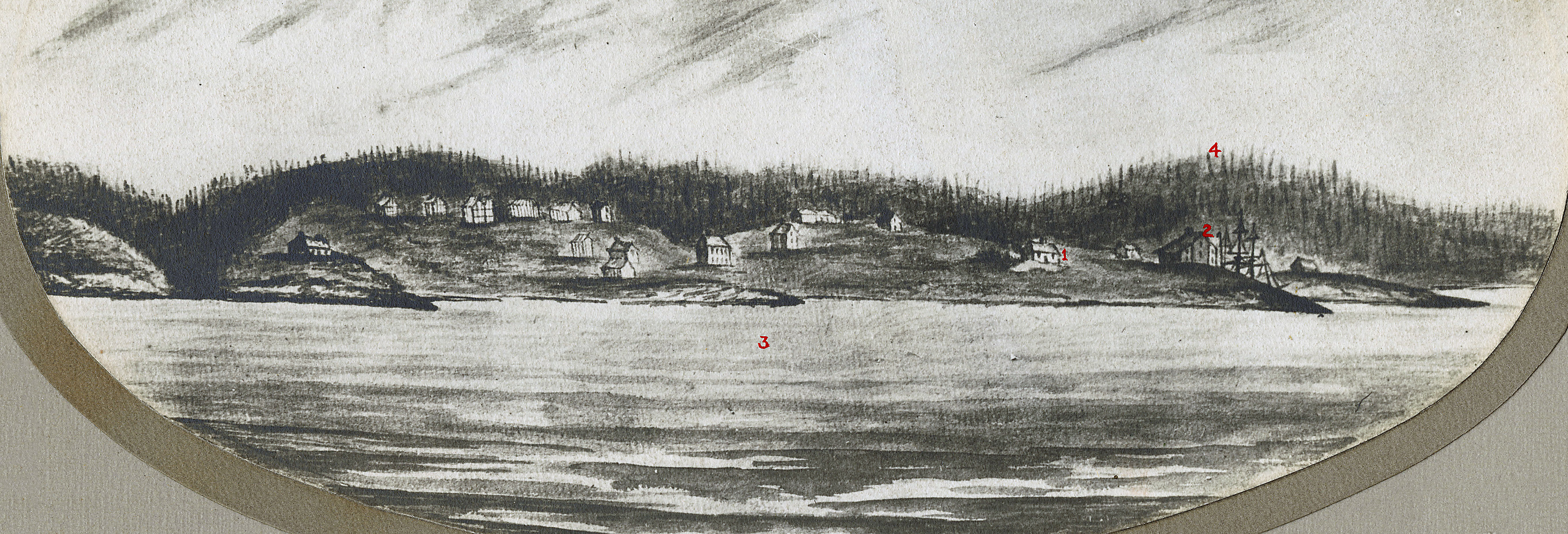
“From the old Crichton Manor house called “the Brae” (No. 20 Cleveland Crescent is the site). Looking south towards the mouth of the harbour over part of the 50 acre Crichton estate.”
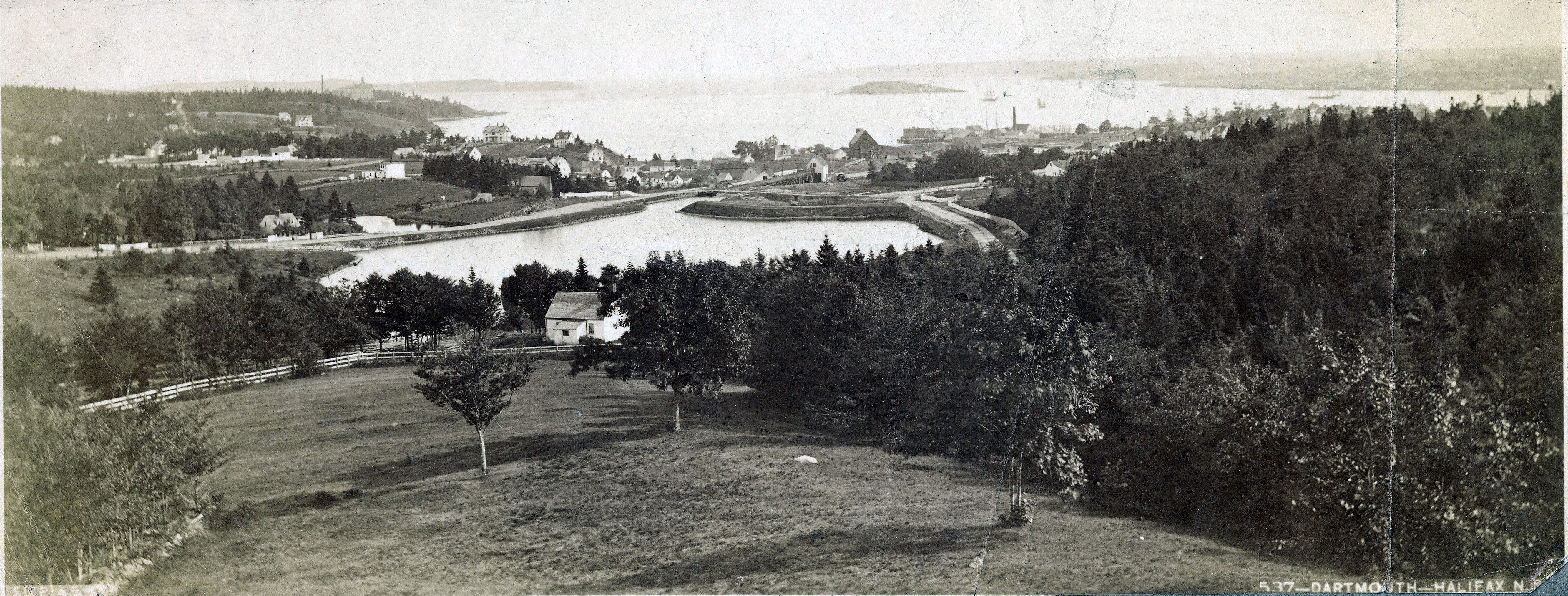
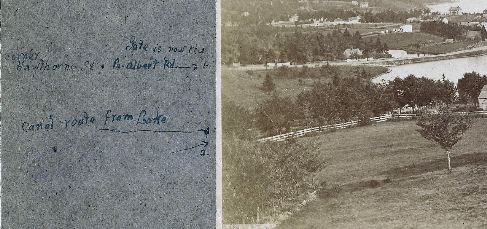
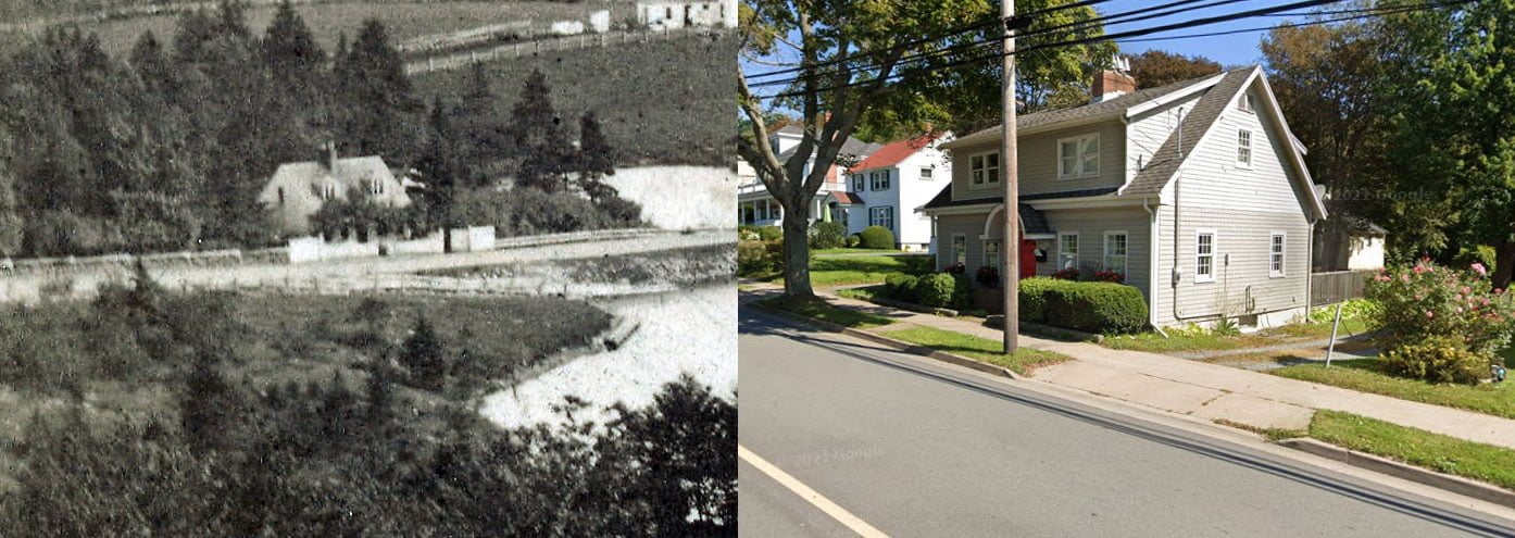
“Gate at middle left is now the corner Hawthorne Street and Prince Albert Road.”
“No. 1 arrow: Road called Lake Road, Canal St, and recently Prince Albert Road. Gate near 1 arrow is entrance to Christ Church rectory. (p. 74 Mrs. Lawson’s History).
[From “History of the townships of Dartmouth, Preston and Lawrencetown, Halifax county, N.S“:
The house is pleasantly situated in a thick grove of native trees. It was retained as a rectory during the incumbency of several clergymen; but being rather far from immediate parish work, it was sold to Col. Sinclair, a retired army officer, who with his family lived there for several years.]
The house was later occupied by L.P. Fairbanks, Esq., according to the editor.
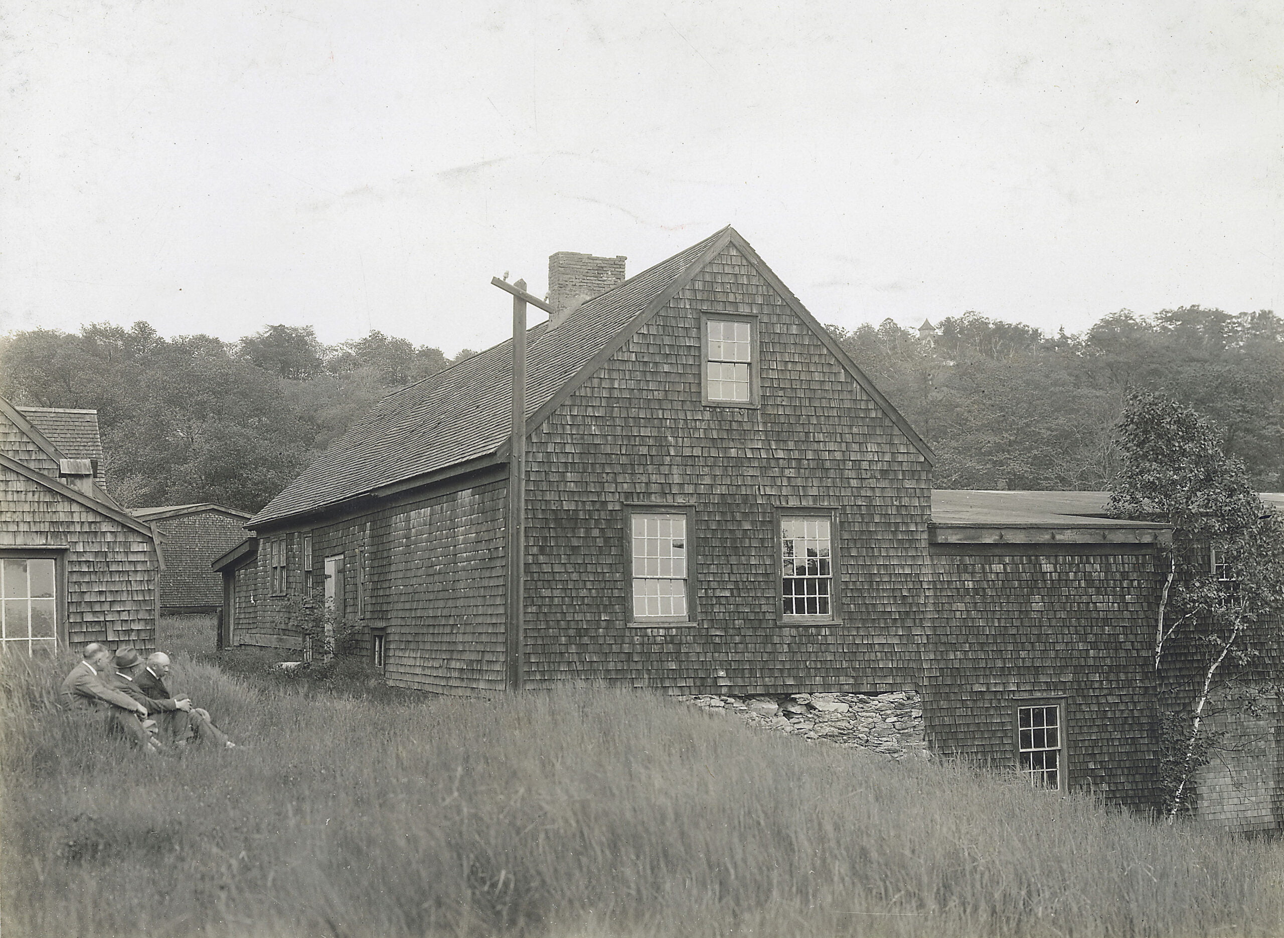
Continue your eye easterly from the gate and you are on the present Hawthorne Street. Now come this way to the cottage and you have Hawthorne Street west. The cottage stood on the west side of Crichton Ave opposite the end of Hawthorne Street and a little to the north. Once occupied by Adam Laidlaw ice merchant (p. 121 Lawson)
[From “History of the townships of Dartmouth, Preston and Lawrencetown, Halifax county, N.S“:
In 1843, Adam Laidlaw, the old and well-known driver of the stage-coach between Windsor and Halifax, commenced the cutting and storing of ice on a much larger scale, and from that time made the industry his only business. As the supply increased, the demand grew more and more. His son, Peter Laidlaw, followed in the same line, and continued the trade until 1870.]
Arrow no. 2 fence borders Crichton Ave. Continue with you eye past Laidlaw’s and follow down west side Sullivan’s Pond to meet Ochterloney Street.”
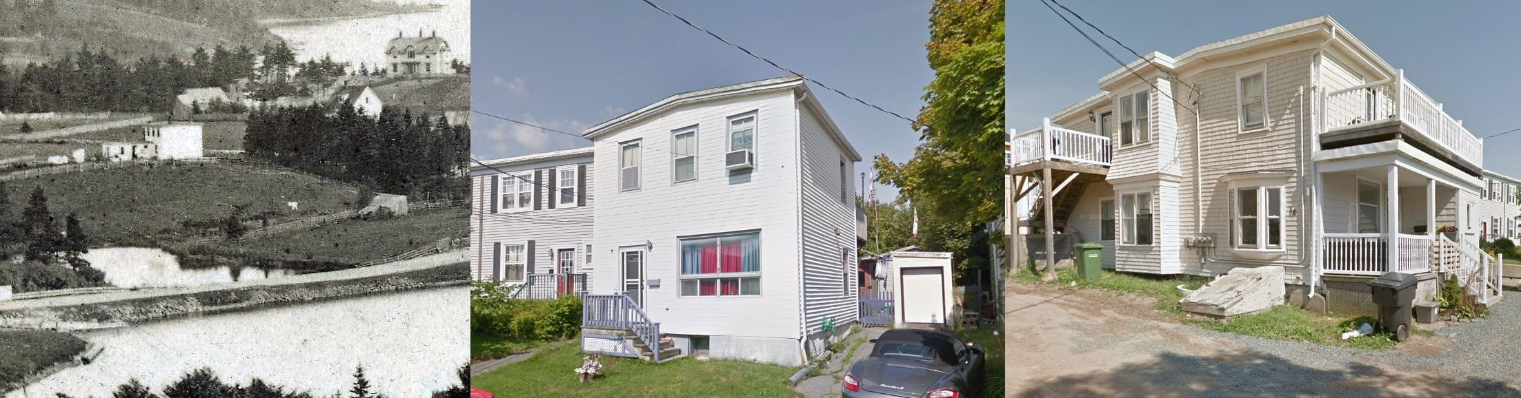
“Arrow no.1 again: Whitish fence a few feet south of gate hides Findlay Cottage. (It still stands at 100 Hawthorne Street). Next house south is old William Walker property once occupied by Misses Herbert; the famous literary family (See the Olive Branch); they taught private school there. Later Capt. Mytius (?), Danish, lived there. Went sealing every winter. He in the 1870s kept a seal in the Findlay’s Pond just south. Col. Montagu died there 1889. (Lawson p. 240)
[From “History of the townships of Dartmouth, Preston and Lawrencetown, Halifax county, N.S“:
(Col. George Montagu) had been in Halifax many years before with his regiment, and he was well known and much liked by all who were acquainted with him. He was connected to the aristocracy of England, his grand-uncle being the Duke of Manchester. He lived at Lake Loon with his family for more than thirty years, improving the property and enjoying its quiet retreat after his years of military service. At last his great age induced him to remove to Dartmouth, where he would be nearer medical help. He died in a house adjoining Findlay’s Pond, near the First Lake, on 10th January, 1889, in the ninety-first year of his age. His youngest son, Gore Montagu, is the present owner of the property at Lake Loon.]
Findlay’s Pond one of first to freeze for December skating. Filled in as a dump about 1911. Elliot Street then constructed.
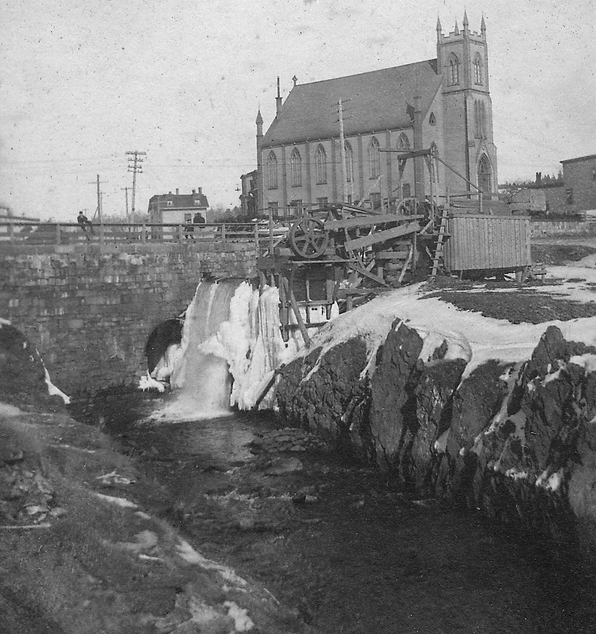
Now imagine Prince Albert Road and the circular dam not yet constructed. Tradition says that Sullivan’s was then a narrow river, part of which flowed westerly in the hollow near Crichton Ave. across Ochterloney and across Portland near Victoria Road base to the sea. The other branch, or division, according to some, swerved to the right at southeast corner Findlay’s Pond crossing Eaton Ave. to the hollow or depression through Pleasant Street forming “Bowes Pond” in rear of no 31 Prince Albert Road, but main stream keeping more to the west crossing Portland Street at the head of Maitland Street as described on reverse side. The other account is that Sullivan’s stream flowed to the left near the present upper Canal bridge. The rafts and scows were hauled up from the harbour over an inclined plane from Lower Canal Bridge (or vice versa on return). Then the paddle steamer towed them through locks. The lock whose gate held back the southern channel, which you see is still there. Logs, lumber, bricks, ice were exported.”
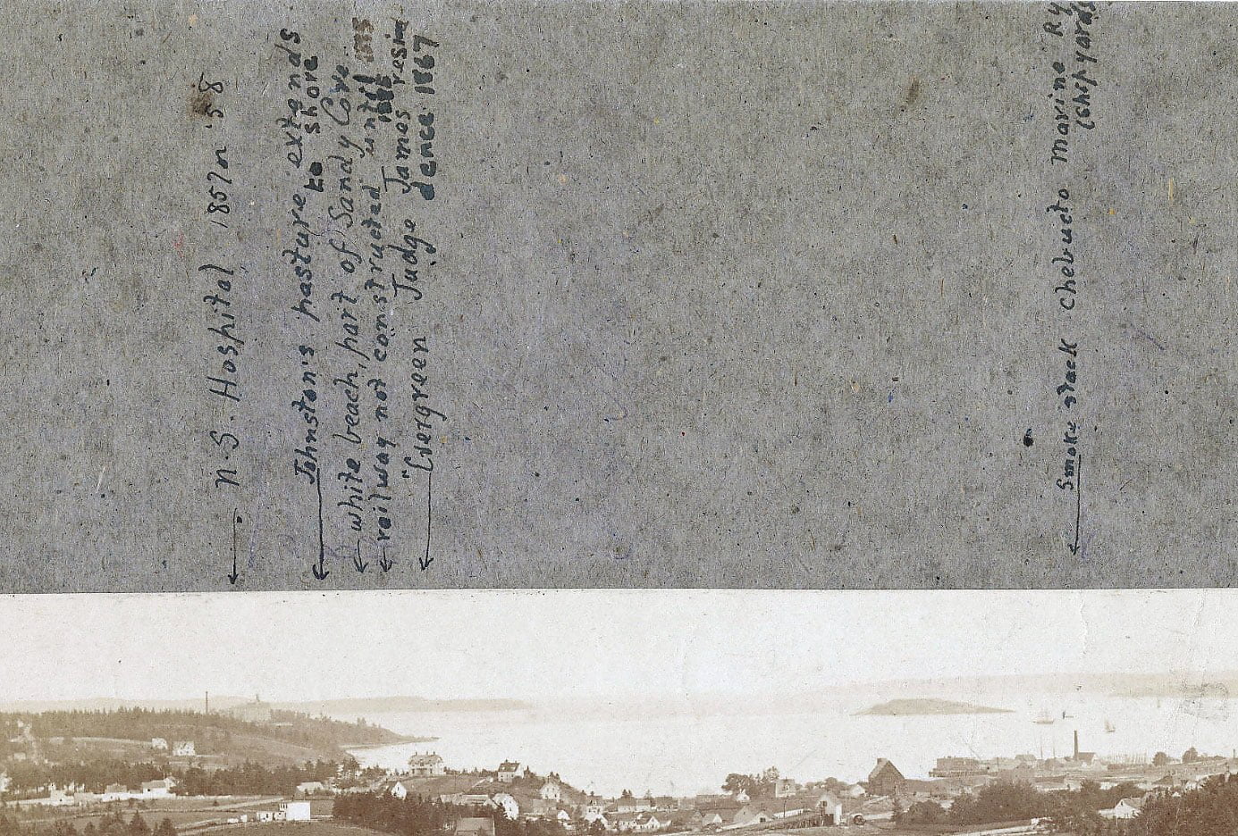
“From left: Nova Scotia hospital, (completed) 1857 or 58. Johnston’s pasture extends to shore. White beach part of Sandy Cove. Railway not constructed until 1885. Evergreen, Judge James residence, 1867. Smokestack, Chebucto Marine Railway (Shipyards).”
Report by John P. Martin, Dartmouth:
“In March 1948 I showed this picture to several old Dartmouth residents and elicited what information is annotated. Note particularly the absence of the Starr Skate Factory. Mrs’ Lawson’s History of Dartmouth says the works were commenced in 1864 by John Starr and John Forbes. William Coates, son of the elder William Coates (grandfather of William Coates Barrett) says that his father came to the Starr factory as a “plater” in the ’60s, and that the first skate factory was a small building near the upper Canal bridge. The small pitch roof structure which you see in this picture may be the one meant. But I think that it is the shed wherein was housed the gear for hauling the scows up over the inclined plane. Note what looks like a large wheel to the right of the building.”
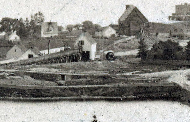
“Note sort of a level ramp leading towards Sullivan’s Pond. If so this picture was taken some time in the 60s. I cannot find as yet, any definite date for the Starr Factory erection. It must have been after 1867.”
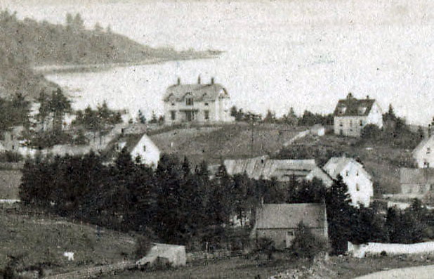
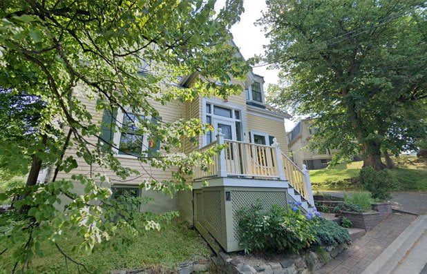
“Mrs. H.D. Creighton states definitely that Judge James residence (now 26 Newcastle Street) was built in 1867. She is a near relative and was born in 1859. So the picture is Dartmouth in 1867 or after.”
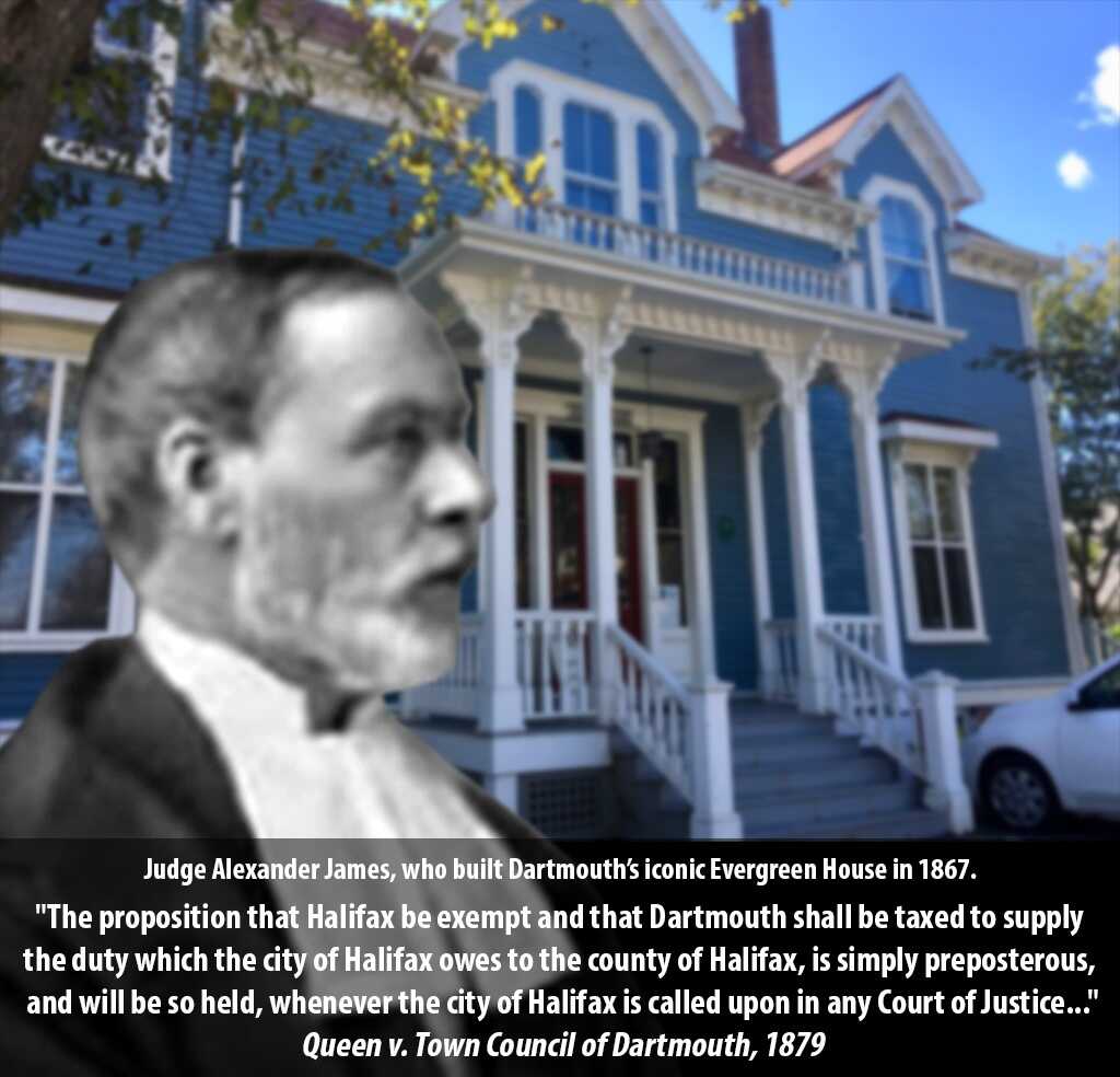
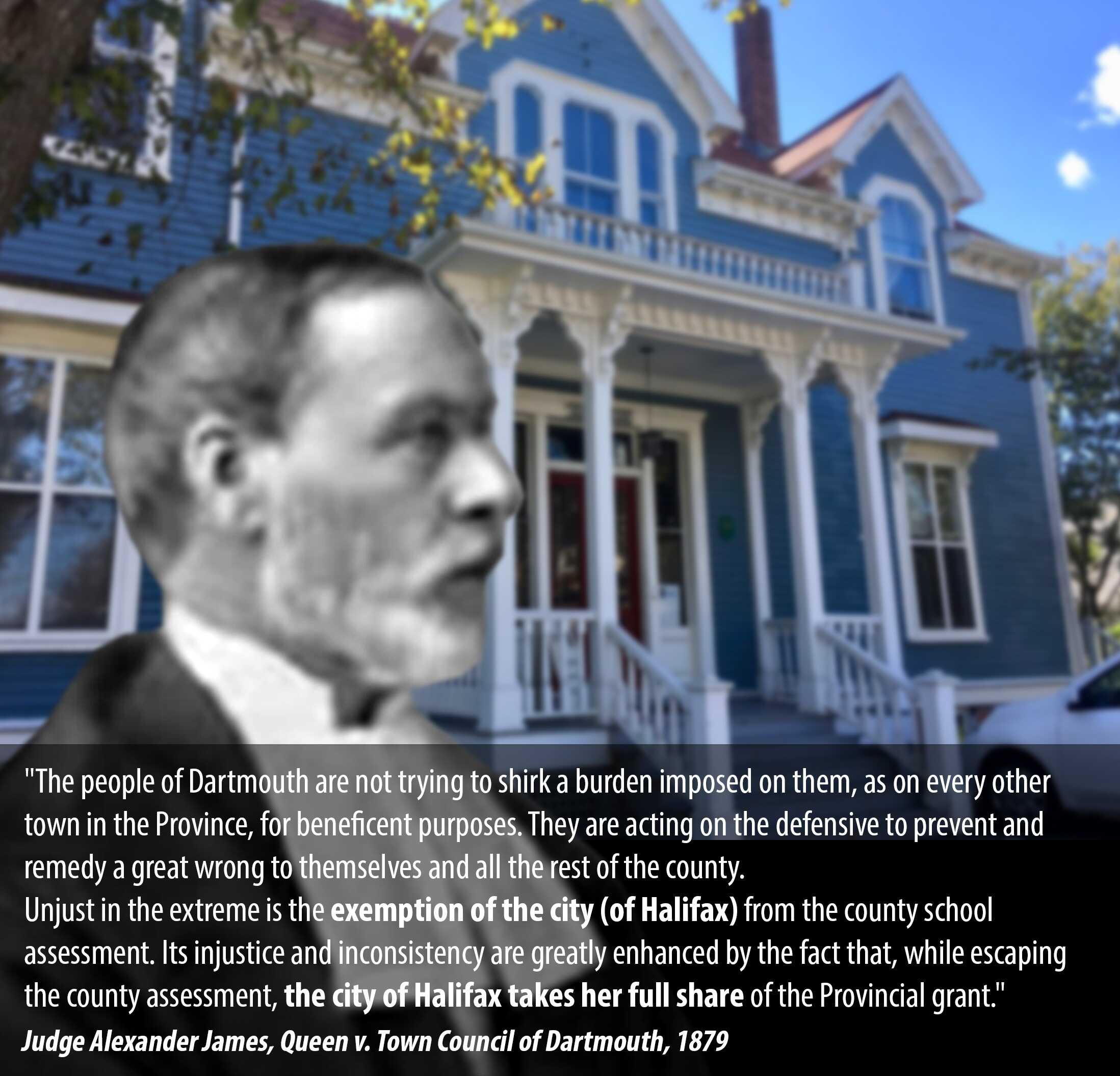
[More from Judge James, his opinion delivered in Queen v. Town Council of Dartmouth: https://cityofdartmouth.ca/queen-v-town-council-of-dartmouth/#JudgeJames]
Ochterloney Street then crossed the stream was about 30 yards south of the present bridge. The level ground on the east side of the present stream marks the old highway. Look now at the picture and trace its route to join the present Ochterloney Street, a little to the east of the foot of Crichton Ave where there was another bridge over the gully. Mr. Walter Elliot (born 1850) often crossed it as did many others.”
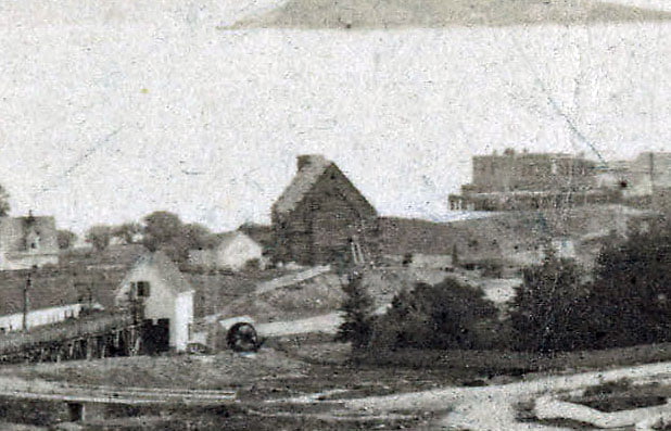
“There is no sign of St. James Church steeple in this picture. As it was erected in 1870 it proves that this was photographed before 1870 and by the Judge James date it was after 1867.
Ronald Findlay 98 Hawthorne Street has a copy of this (So have I) Joseph Findlay, his father, said that the picture was taken by Mr. Emil Vossnack, father of Mrs. J.W. Viditio.
The high building just south of the pitched roof shed which is silhouetted against the Dartmouth Cove is thought to be the Old Grist Mill first erected in 1792 by Hartshorne and Tremaine… see Mrs. Lawson’s history, page 62 foot note).”
[From “History of the townships of Dartmouth, Preston and Lawrencetown, Halifax county, N.S“:
Dr. Akins in an unsigned note…says, that “the village in 1820 contained at least sixty houses, if not more.” Mr. Lawrence Hartshorne and Mr. Johnathon Tremaine were at that time carrying on the manufacture of flour. Their grist-mill – a very large building – was situated in Dartmouth Cove, on the east side of the river flowing from the First Lake. When the canal was being constructed, a long race was built to convenience the mill. About ten or twelve years after this, the mill ceased to be used, and it was subsequently destroyed by fire. The foundation of the building may still be seen, and the old store stands on the shore of the Cove, where the water from the Dartmouth Lakes flows into the sea. At a ball given by the governor and Mrs. Wentworth on December 20th, 1792, the supper was embellished by several ornaments, among which was a representation of Messrs. Hartshorne and Tremaine’s new flour mill.]

“The mill was burned about 18(??). It was to the south or south west of the Woodlawn new dairy, about 20 yards. The smokestack of the Marine Railway (shipyards) is just to the right.”
“Look now at the Judge James house (Evergreen). The high house west of James’ house on your right was then at the corner where Newcastle Street turns at the top. It was occupied then by Mrs. Joplan, a widow. Taught or ran a ladies school in Halifax. Later occupied by William S Stirling, Manager at Union Bank at Halifax. Later the house was moved down the hill where it is now occupied at 7 Newcastle Street by John. L. Harrison.”
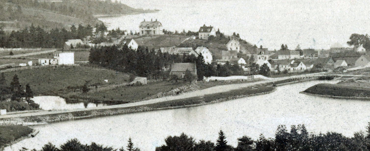
“Down the slope to the west side of Maitland Street where you notice the depression was the route of the water from Findlay’s Pond to the Cove. Look again at Sullivan’s Pond and imagine it before the circular dam was erected and before Prince Albert Road was built as a causeway. Old folks say that it was not a pond then but a narrow river. One branch flowed down the present hollow near Crichton Ave across Ochterloney, down behind Greenvale to the sea. The other swerved to the left, then to the right crossing Eaton Avenue hollow down across Pleasant Street through that hollow area near 211 Portland Street, crossing to form quite a stream entering the Cove at the Molasses factory. Hence the pond there where we skated for years. That swampy area, before it was filled in by the Town dump, was called “the Mussquash”. This was to be the route of the Canal. See old newspapers.”
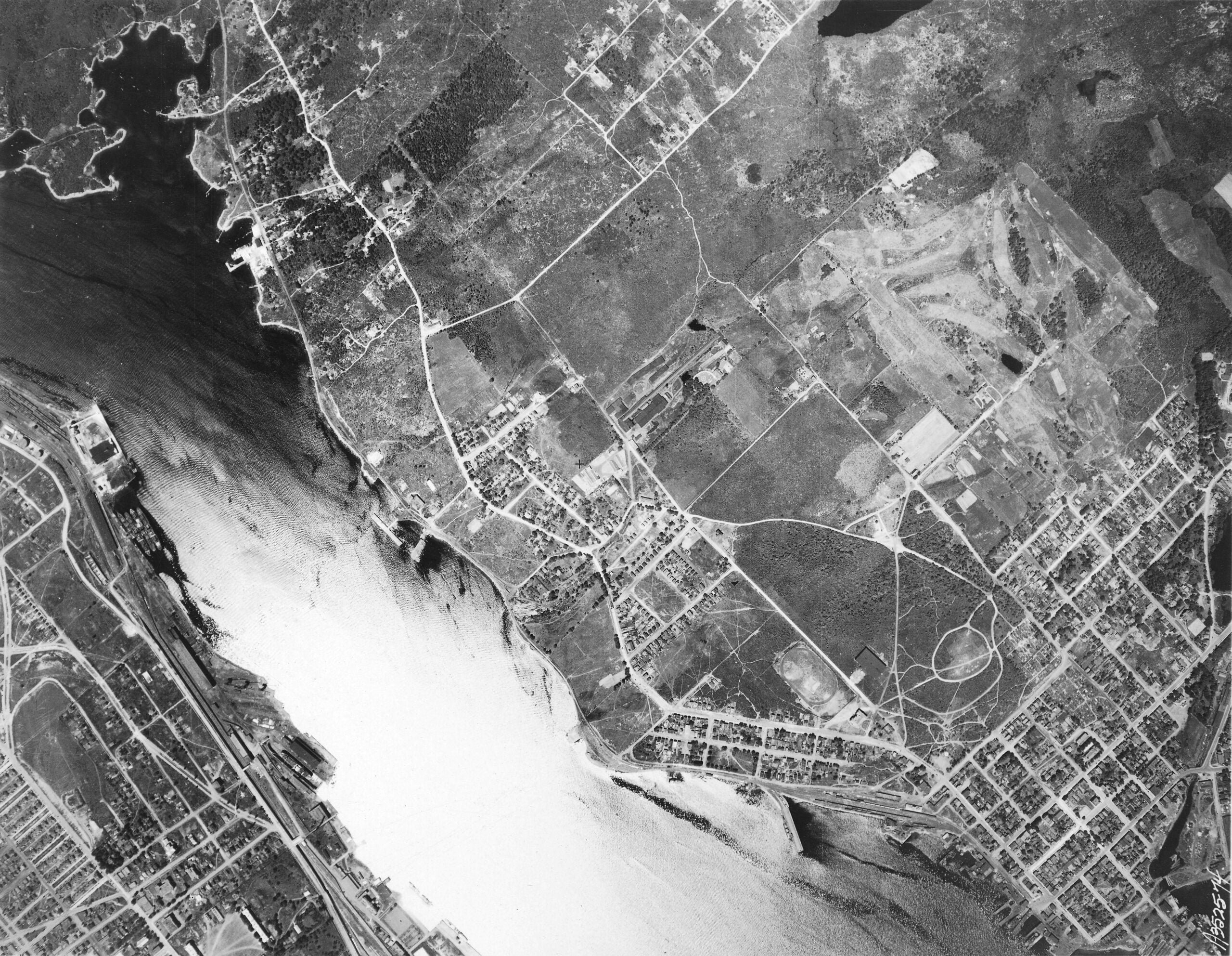
See Also: A photo looking from the other direction from 1890: https://cityofdartmouth.ca/sullivans-pond-findlays-pond-dartmouth/
“Dartmouth, Looking south towards mouth of harbour”, >1867, <1870. https://archives.novascotia.ca/photocollection/archives/?ID=5310&Page=201742606