
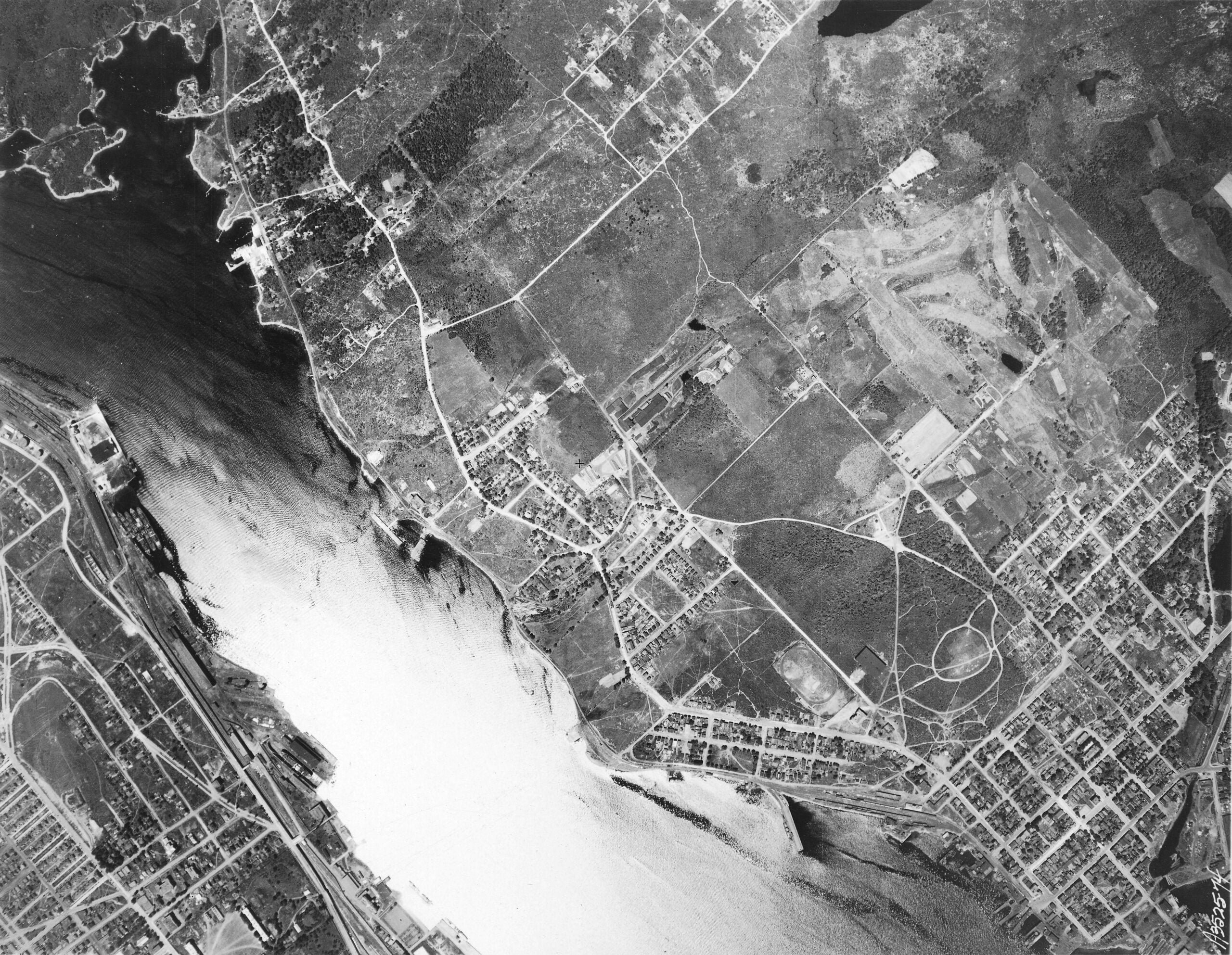

“Aerial View: Halifax Harbour Narrows showing Dartmouth”, 1931. https://archives.novascotia.ca/photocollection/archives/?ID=5573
Related posts:
- Halifax Harbour from near the Narrows. Windmill on Dartmouth side the only one in the Province The Windmill seen on what is now Windmill Road, house at right perhaps Fairfield, Howe’s House, at far right is Black Rock Point, now the foot of Lyle Street. “Halifax Harbour from near the Narrows. Windmill on Dartmouth side the...
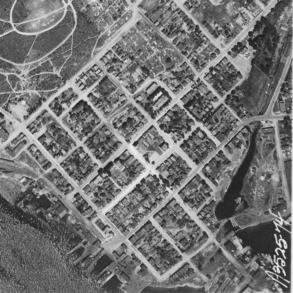
- Dartmouth, Aerial View St. Peter’s Church seen at upper middle, First Baptist at Victoria at middle right. Christ Church at middle, Victoria Road Baptist church is seen a block behind between it and its hall, Grace United Church is seen at middle bottom,...
- View of Halifax from Dartmouth This is a view of Dartmouth Cove, George’s Island and Halifax which looks to be from somewhere on the hilly 200 block of Portland Street behind Linden Lea and St. George’s Lane, whose pond is seen in the foreground. Hazlehurst...
- St. James Church (Canal stream and Portland Street bridge), Dartmouth “St. James Church, Dartmouth”, 1932. https://archives.novascotia.ca/photocollection/archives/?ID=5301...
- View of Halifax (from Dartmouth), 1757 “View of Halifax”, July 1757. https://archives.novascotia.ca/maps/archives/?ID=93...
- Explosion of Munitions at Magazine near Dartmouth “Explosion of munitions at Magazine near Dartmouth, Halifax N.S. July 18-19/45. J. Hayward. 11 Buckingham St. Halifax.” https://archives.novascotia.ca/photocollection/archives/?ID=6324 “Explosion of munitions at Magazine near Dartmouth, Halifax N.S. July 18-19/45. J. Hayward. 11 Buckingham St. Halifax.” https://archives.novascotia.ca/photocollection/archives/?ID=6325...
- View of (Dartmouth, from) His Majesty’s Dockyard, Halifax “View of His Majesty’s Dockyard, Halifax”, 1760. https://archives.novascotia.ca/maps/archives/?ID=107&Page=201320535...
- Sullivan’s Pond, 1899 The Octagon house seen at left. You’re not likely to find a cow grazing along the shores of Sullivan’s Pond these days! “Sullivan’s Pond”, 1899. https://archives.novascotia.ca/photocollection/archives/?ID=5336 (Date erroneously listed as 1955, likely mixed up with another view of Sullivan’s Pond...
- A Chart of Halifax Harbour, N.S. 1759 A particularly detailed early map of Dartmouth, showing several blockhouses surrounding the town plot. There’s 16 marks in and around the town plot which would seem to represent buildings, though they might more generally indicate built-up areas nearer to the...
- Peninsula of Halifax (showing Dartmouth) “Peninsula of Halifax”, 1870. https://archives.novascotia.ca/maps/archives/?ID=897...